Let me tell you something that happens way too often.
A company spends $15,000 on a drone, excited about the flight time and range. They get it in the air and mount their LiDAR sensor—and the drone ba
LiDAR technology, renowned for its precision in distance measurement and 3D mapping, traditionally relied on methods like handheld sensors, airborne sensors on aircraft, and satellite-based systems. Each method had its pros and cons, from flexibility to wide-scale coverage, but also limitations in terms of cost and accuracy.
However, in recent years, LiDAR drones have emerged as a game-changer. The global LiDAR drone market, valued at $114.3 million in 2021, is expected to grow significantly, reaching around $892 million by 2032. LiDAR drones offer versatility and efficiency, making them increasingly popular across various sectors.
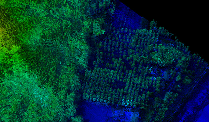
These drones find applications in diverse fields, revolutionizing industrial inspections, surveying and mapping. From topography and cartography to underwater bathymetry, LiDAR drones provide precise solutions. They have also transformed industries like construction, forestry, agriculture, and powerline and oil and gas inspections.
In this article, we'll explore their applications, cost considerations, data processing, and accuracy, while also highlighting the best LiDAR drones on the market.
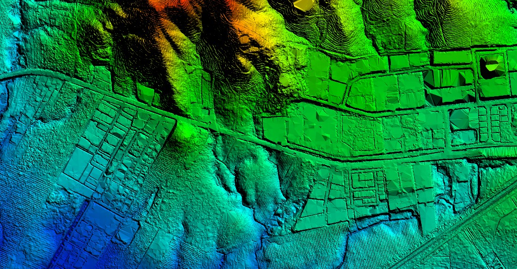
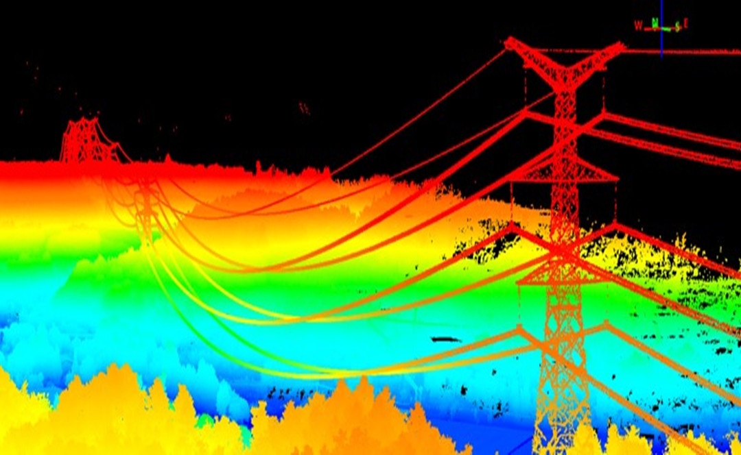
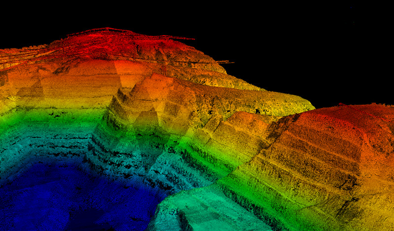
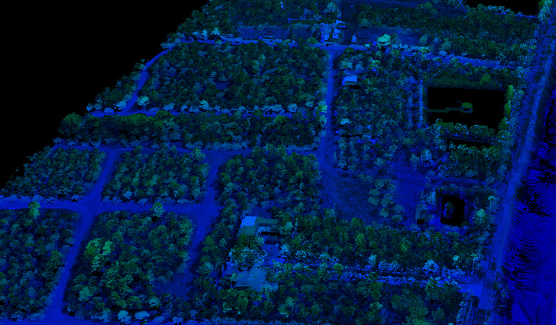
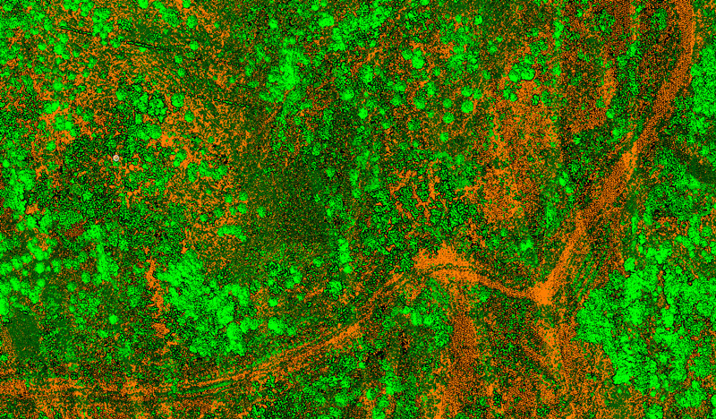
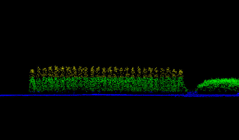
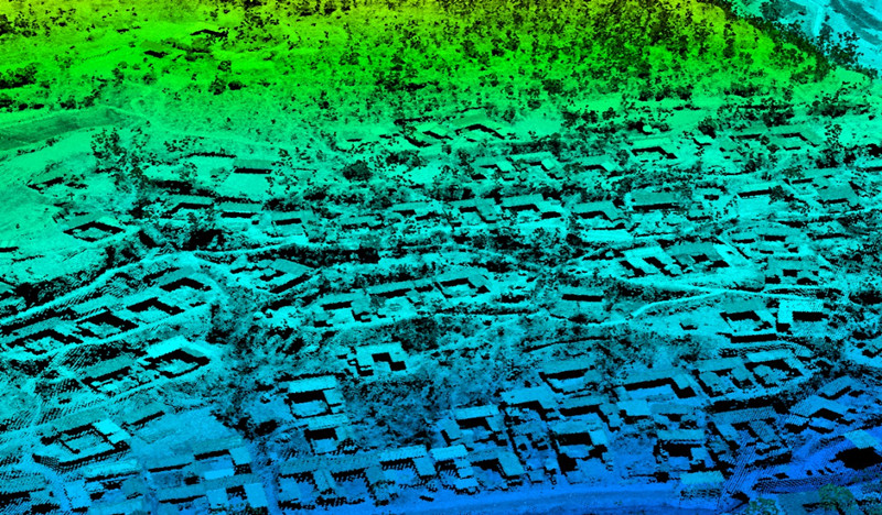
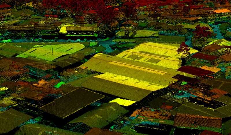
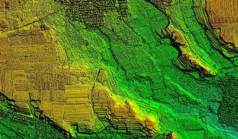
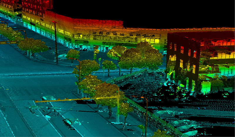
3D LiDAR maps for power line inspection
The primary components of every LiDAR instrument include:
- The Laser: LiDAR payloads are equipped with high-powered lasers that emit focused beams of light. When these laser beams encounter objects such as trees, rocks, buildings, or the Earth's surface, they reflect the laser back to be collected.
- The Scanner: The role of the scanner (also known as a sensor or receiver) is to capture the reflected pulses accurately. The types of lenses and optics used in a LiDAR scanner can vary depending on the specific application.
- Global Positioning System (GPS): For accurate measurement of return signals, almost all LiDAR systems incorporate advanced positioning and navigation systems. These systems help determine the absolute position and orientation of the sensor.
While other hardware considerations like the battery, imaging system, data collector, type of aircraft, and more vary depending on the application of the specific LiDAR instrument, the core principles of LiDAR remain consistent.
A Brief History of LiDAR
The roots of LiDAR trace back to the early 1960s when lasers were first invented. Back then, LiDAR wasn't even an acronym; it was merely a combination of "light" and "radar."
Initially, LiDAR's primary use was mapping small rivers and streams. But in the 1980s, with the advent of GPS technology, it gained prominence as an essential tool for collecting large-scale geospatial data and generating topographical maps.
Early LiDAR sensors in the 1980s were bulky, not very accurate, and typically mounted on manned airplanes. Their operation was manual, expensive, and didn't always offer a satisfactory return on investment.
Today, LiDAR technology is more affordable, compact, and accessible than ever before. It has proliferated across a wide range of industries. In fact, recent iPhones are equipped with LiDAR scanners that can create 3D models from distances of up to 4.5 meters (15 feet).
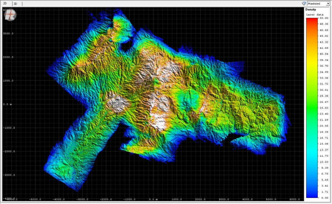
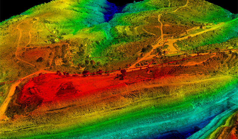
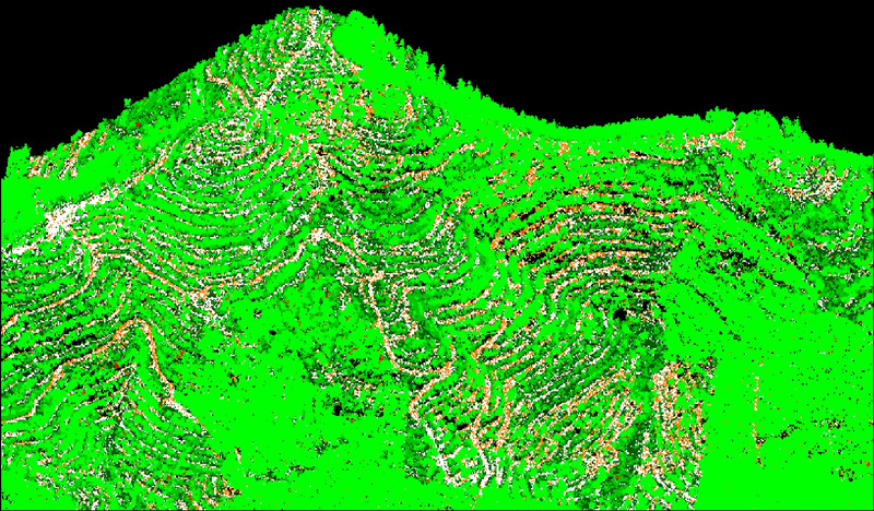
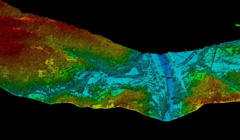
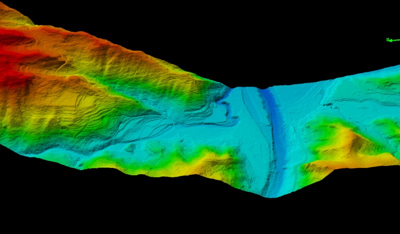
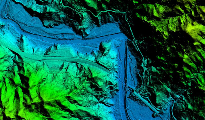
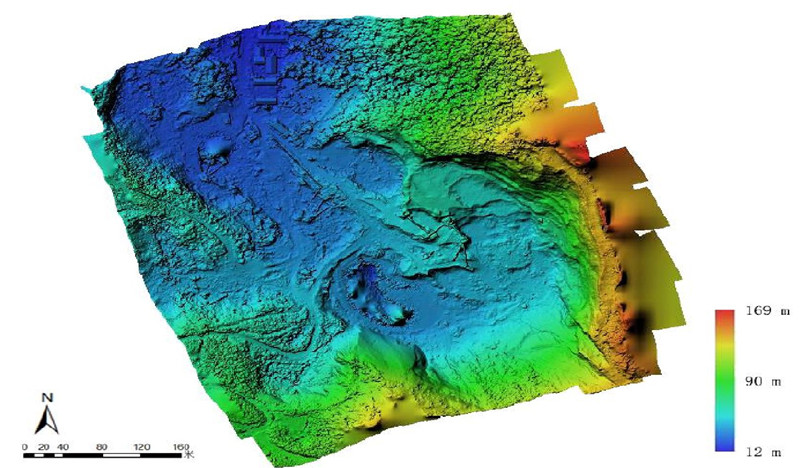
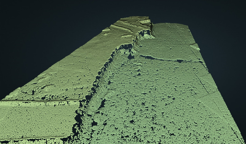
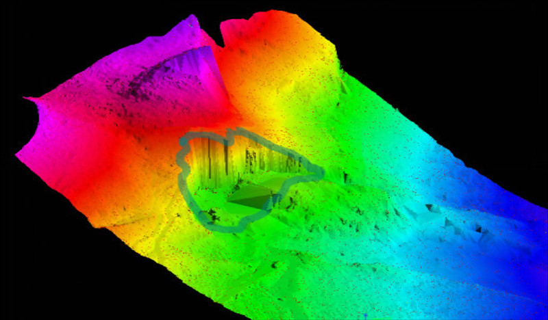
LiDAR bare earth river overlaid with the bare earth digital elevation model colored by elevation.
How Does LiDAR Work?
Whether it's mounted on an aircraft, attached to a drone, or handheld, all LiDAR systems operate by shooting a precise, high-powered laser at a target and accurately measuring the returning pulse. It's a bit like how radar and sonar measure distance, but instead of radio or sound waves, LiDAR systems use light.
- Read more: LiDAR vs. Radar
To derive the precise 3D positions of every point from which the signals bounce back, LiDAR payloads consider factors like the direction of the light, the scanner's position, and the distance between two points.
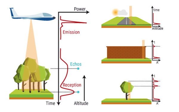
How does LiDAR work? Source from Yellowscan
Here's a step-by-step breakdown of the process:
- Laser Emission: A LiDAR device emits a high-powered laser beam, which is a tightly focused beam of light, typically in the form of near-infrared light.
- Light Bounce: The laser beam travels through the air until it encounters an object or the Earth's surface. When it hits something, it bounces back, or reflects, toward the LiDAR sensor.
- Measurement: LiDAR calculates the distance by measuring the time it takes for the laser beam to travel to the object and return. This measurement is known as the "range." To create a comprehensive 3D understanding of an object, LiDAR sensors measure three key components during this process:
- Time: LiDAR records how long it takes for the laser pulse to return.
- Intensity: It gauges the return strength of the laser pulse.
- The angle of the Reflection: LiDAR assesses how the surface being measured changes by analyzing the angle of reflection.
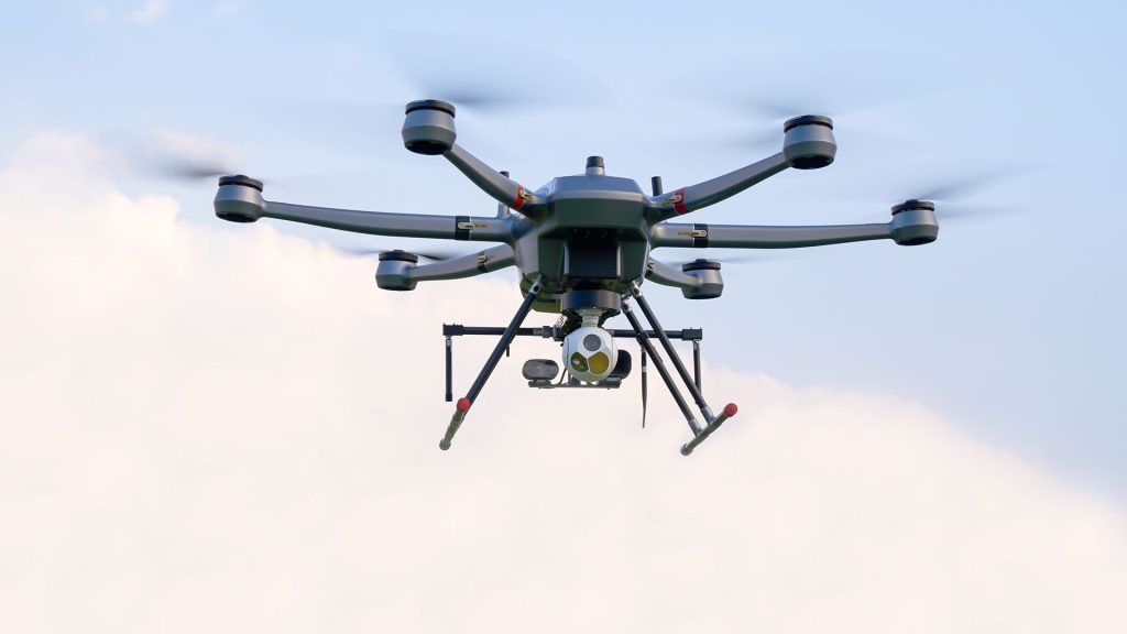
What is a LiDAR Drone?
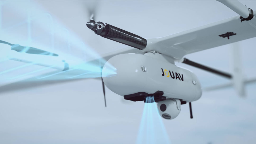
A LiDAR drone is a specialized unmanned aerial vehicle equipped with LiDAR sensors. LiDAR technology uses laser light to measure distances with remarkable accuracy, allowing these drones to create detailed 3D maps of the terrain below. These drones can be used in various environments, including industrial sites, underwater areas, and even indoors, making them incredibly versatile tools for inspection and surveying tasks.
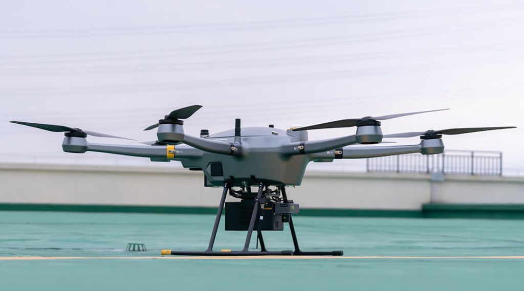
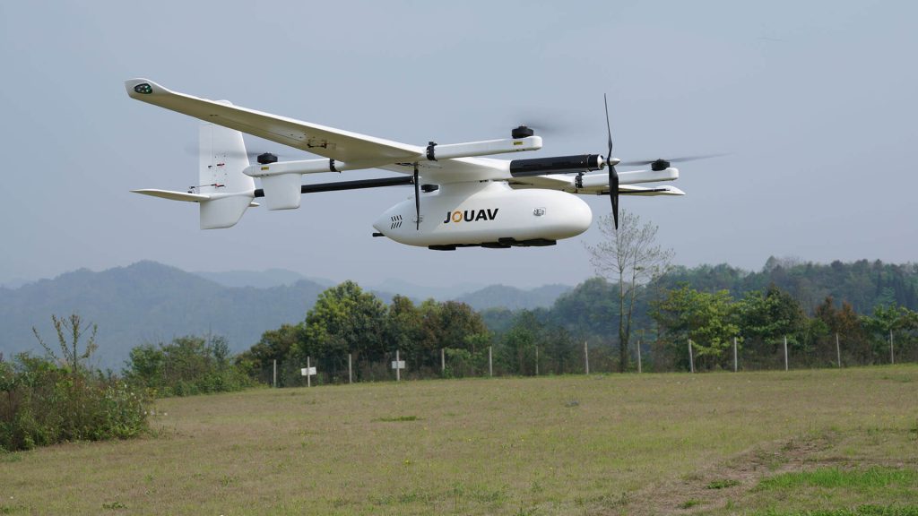
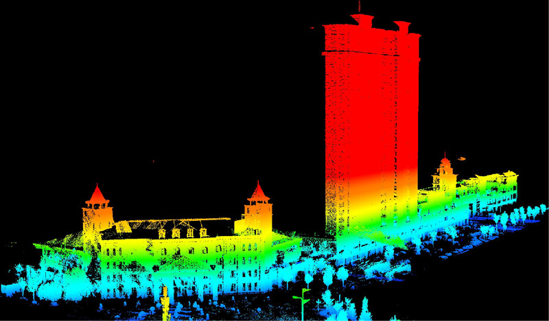
PH-20 multi-rotor UAV with JoLiDAR-1500 sensor
Benefits of LiDAR Drones
LiDAR drones provide several distinct advantages over traditional data collection methods.

Precision and Detail
LiDAR drones offer an unprecedented level of accuracy and detail in 3D mapping, making them ideal for applications requiring high precision, such as land surveying and forestry.

Efficiency and Speed
LiDAR drones can rapidly cover large areas, significantly reducing data collection time and operational costs. Traditional methods are often time-consuming and resource-intensive.

Safety and Accessibility
LiDAR drones can access remote or hazardous areas without risking human lives. They're particularly valuable in tasks such as powerline inspections, disaster response, and environmental monitoring.

Minimal Environmental Impact
Traditional ground-based surveys can disrupt ecosystems. LiDAR drones minimize such disruptions by collecting data from above, which is crucial for ecological and environmental studies.

Versatility and Customization
LiDAR drones can be tailored to specific needs, whether it's mapping forested terrain or surveying underwater landscapes. They offer adaptability in data collection.

More convenient and affordable
Using LiDAR with a drone is convenient, cost-effective, and eliminates the need for a pilot. Despite the initial investment, long-term savings are significant due to reduced labor and surveying costs.
Site Inspection and Topography Analysis
LiDAR drones capture highly detailed 3D models of construction sites, providing engineers with accurate information about the terrain, potential hazards, and unstable ground conditions. Engineers can use this information to optimize site layouts, reduce excavation requirements, and select the most suitable foundation types, ultimately enhancing construction project safety and efficiency.
Infrastructure Inspection
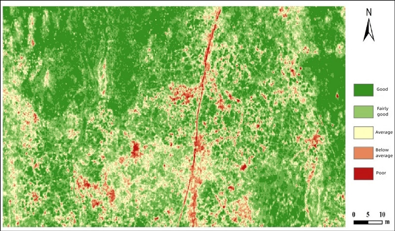
LiDAR drones enhance inspection and maintenance of critical infrastructure like power lines, turbines, and pipelines. They provide detailed assessments, identifying issues remotely, such as cracks and deformations, and minimizing safety risks associated with physical inspections. This data aids in prioritizing maintenance efforts, ensuring long-term durability and safety.
Construction Progress Monitoring
LiDAR drones are deployed throughout construction projects to monitor progress accurately. By capturing multiple scans at different phases of construction, project managers can precisely assess how well the ongoing work aligns with the initial plans. This detailed monitoring capability allows for real-time progress tracking, detection of deviations from project timelines and budgets, and timely corrective actions to maintain project efficiency.
Utility Infrastructure Mapping
LiDAR drones are used to accurately map underground utility lines. This detailed mapping is crucial for utility companies, city planners, and construction projects. Accurate utility mapping minimizes risks during excavation, reducing the potential for damage to critical infrastructure and utility disruptions. It also contributes to more efficient urban planning by ensuring that construction projects avoid conflicts with existing utility lines.
Stockpile Volume Measurement
LiDAR drones are indispensable for accurately measuring the volume of stockpiled materials in mining and quarrying operations. This precise data is essential for inventory management, ensuring that adequate reserves are available and reducing the risk of running out of essential resources. It also supports efficient logistics and resource allocation.
Slope Stability Analysis
In mining areas, LiDAR technology is employed for slope stability analysis. It helps identify unstable slopes and high walls, reducing the risk of collapses. This proactive approach to safety enhances worker safety and minimizes the potential for catastrophic accidents, which can be particularly severe in mining environments.
Environmental Impact Assessment
LiDAR is a powerful tool for monitoring environmental changes resulting from mining and quarrying activities. This technology can detect shifts in soil erosion, habitat disruption, water quality changes, and other environmental factors. Such data is essential for mining companies to meet regulatory requirements and minimize their impact on ecosystems and surrounding communities.
Exploration and Mineral Mapping
LiDAR technology supports mineral exploration and resource mapping. By assisting geologists in identifying potential mineral deposits and mapping existing ones, it provides valuable data for optimizing mining operations and making informed exploration decisions. This data is critical for the sustainable management of mineral resources.
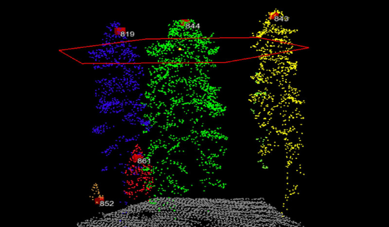
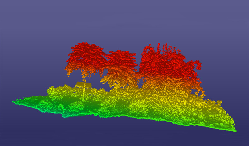
Canopy Height Measurement
LiDAR drones are widely used to measure the height and density of forest canopies. This detailed information offers insights into tree growth and canopy structure, providing data on forest health and timber resources. Forestry professionals can utilize this data to assess forest health, manage tree growth, and make informed decisions about sustainable harvesting.
Forest Structure Mapping
LiDAR drones create comprehensive 3D models of forests, offering information about the forests' structural composition and diversity. This data aids in understanding and preserving ecosystems. It allows foresters to make informed decisions about land use and conservation practices, thereby protecting the natural environment.
Tree Density Analysis
LiDAR data facilitates tree density analysis within forests. This analysis is essential for identifying densely populated areas, and aiding in decisions regarding thinning and harvesting. By optimizing tree density, forestry professionals can improve timber yields while promoting sustainable forest management practices.
Wildfire Risk Assessment
LiDAR is a valuable tool in assessing wildfire risk within forested areas. By identifying fire-prone areas, it aids in planning and implementing firebreaks, fire prevention measures, and wildfire management strategies. This is crucial for reducing the risk of catastrophic wildfires and safeguarding both the forested ecosystem and nearby communities.
Invasive Species Detection
LiDAR technology assists in identifying invasive plant species that threaten forest health. By detecting these invasive species early, foresters can implement management strategies to control their spread and protect native vegetation. This helps maintain the ecological balance within the forest.
Crop Health Analysis
LiDAR drones are essential for monitoring the health of crops in agriculture. They assess canopy density, identify water stress, and detect pests or diseases early in the growing season. This enables farmers to take timely corrective actions, such as adjusting irrigation, applying targeted treatments, and optimizing crop yields.
Soil Mapping and Fertility Assessment
LiDAR technology is used to assess soil quality and fertility, providing precise data on nutrient levels, soil composition, and moisture content. This information guides soil management practices, optimizes fertilization, and ensures that resources are allocated where they are most needed, ultimately promoting crop productivity.
Irrigation Planning
Accurate topographic data from LiDAR supports irrigation system design and water distribution. By identifying areas that require irrigation and those where it can be reduced, farmers can practice water-efficient farming. This reduces resource wastage, conserves water, and promotes sustainability in agriculture.
Precision Planting and Harvesting
LiDAR-guided machinery optimizes planting and harvesting in agriculture. Ensuring proper seed spacing, plant density, and crop yield minimizes resource wastage and crop productivity. Precision planting and harvesting practices improve the efficiency of agricultural operations.
Pest and Disease Detection
LiDAR aids in the early detection of crop issues, including pest infestations and diseases. This early identification allows for targeted treatment, reducing the need for broad-spectrum pesticides. It minimizes the environmental impact while protecting crop yields.
3D Modeling of Construction Sites
LiDAR drones are employed to create highly detailed 3D models of construction sites. These models capture the existing conditions before and during construction, providing architects, engineers, and contractors with the accurate information required for effective design and planning.
Clash Detection
LiDAR data is used to identify conflicts between different systems or components within a construction project, such as plumbing, electrical, and HVAC systems. This detection occurs before construction begins, allowing for the resolution of issues and reducing the need for costly rework.
Site Preparation and Excavation Assessment
LiDAR technology offers precise topographic data that informs decisions regarding site preparation, grading, and excavation. This ensures that construction begins on a solid foundation and reduces the potential for errors and delays, ultimately enhancing the construction process's efficiency.
As-Built Documentation
LiDAR is a crucial tool for capturing the final stage of a construction project through as-built documentation. This documentation is invaluable for facility management, renovations, and future construction projects, serving as a comprehensive record of the construction process.
Discovery of Hidden Archaeological Features
LiDAR drones have become a powerful tool for uncovering hidden archaeological features. They can reveal ancient roadways, foundations, fortifications, and other structures that may not be visible on the surface. This data often leads to significant archaeological discoveries, shedding new light on historical landscapes and civilizations.
Heritage Site Conservation
LiDAR is used to monitor the structural integrity of heritage sites, ensuring that conservation efforts are focused on the areas most in need of preservation. By preventing deterioration and damage to historical structures, conservation experts safeguard cultural heritage for future generations.
Site Preservation Planning
Detailed documentation of cultural heritage sites supports preservation planning efforts. Preservation experts can make informed decisions about restoration, maintenance, and protection strategies to ensure that these sites can be enjoyed by future generations.
Cultural Heritage Documentation
3D modeling of cultural heritage sites aids in documenting these locations for historical and research purposes. These accurate models serve as valuable records and educational tools, providing insights into the architectural and cultural heritage of historical landmarks.
Ecosystem Mapping
LiDAR drones are employed to create comprehensive maps of ecosystems, offering critical data for land use planning, habitat preservation, and environmental protection efforts. These maps provide valuable information about ecosystem structure and dynamics, helping conserve natural environments and biodiversity.
Protected Area Management
LiDAR drones help in managing protected areas by providing accurate data on vegetation, terrain, and wildlife populations. This information is essential for making informed decisions about conservation efforts, monitoring the health of protected ecosystems, and protecting these vital areas for future generations.
Deforestation and Illegal Activity Detection
LiDAR technology is instrumental in detecting deforestation and illegal activities, such as poaching or illegal logging, in remote and challenging environments. The technology enables rapid response by conservation agencies, helping protect valuable forests and wildlife from environmental harm and exploitation.
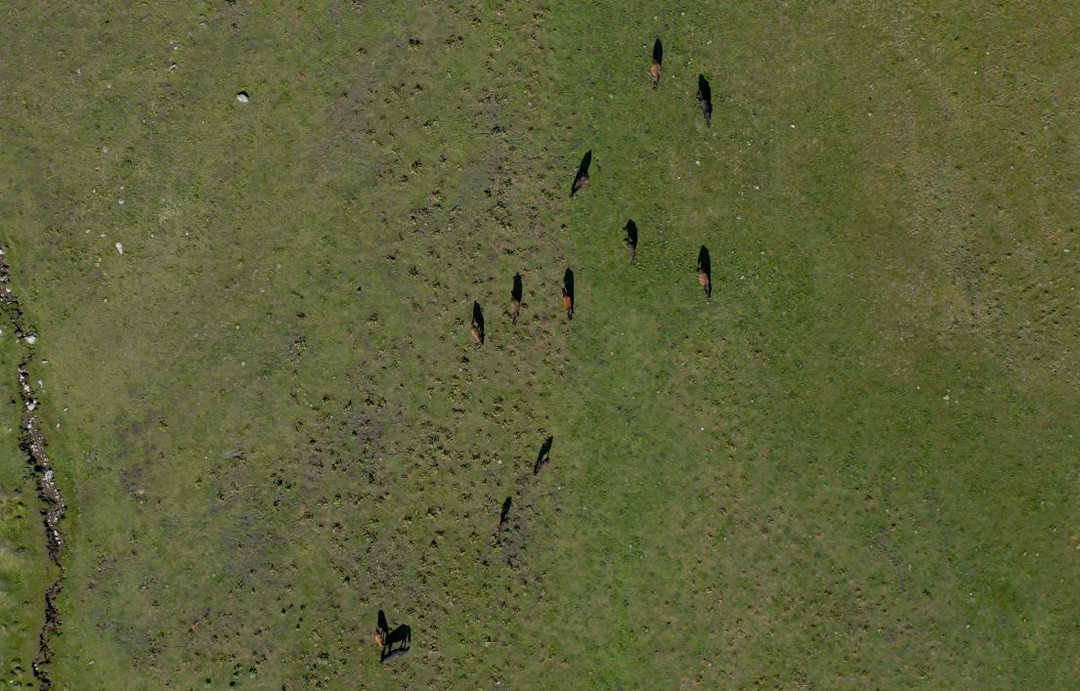
Wildlife Habitat Assessment
LiDAR technology helps conservationists identify and monitor wildlife habitats. This data is essential for the protection of endangered species and the preservation of ecosystems. It aids in the development of conservation strategies that support wildlife populations and biodiversity.
Geological Surveying
LiDAR drones are employed to conduct geological surveys, providing detailed topographic data for assessing the earth's surface and subsurface. This data is crucial for understanding geological features and conditions, making it an essential tool for geological research and exploration.
Fault and Landform Analysis
LiDAR technology assists geologists in analyzing faults, landforms, and geological structures with precision. It aids in identifying seismic activity and potential geological hazards, contributing to hazard assessment and mitigation strategies.
Landslide Risk Assessment
LiDAR technology is instrumental in monitoring unstable slopes and assessing landslide risks. This data is essential for identifying areas vulnerable to landslides and planning mitigation measures to protect communities and infrastructure.
Earthquake Damage Assessment
After an earthquake, LiDAR is used to assess damage to buildings, infrastructure, and the natural environment. This information guides emergency response efforts, informs rebuilding and recovery strategies, and supports post-disaster assessments.
Accident Scene Reconstruction
LiDAR drones provide highly accurate 3D reconstructions of accident scenes. These reconstructions capture details such as vehicle positions, skid marks, and collision dynamics. This data is essential for recreating the events leading up to an accident and providing insights into its causes.
Skid Mark and Debris Analysis
LiDAR technology assists in analyzing skid marks and debris patterns at accident scenes. This analysis aids in understanding the sequence of events and factors leading to the accident. It is crucial for accident reconstruction and legal investigations.

Visualization of Accident Dynamics
LiDAR data can be used to create visualizations that illustrate the dynamics of an accident, including vehicle speeds, collision angles, and the trajectory of objects involved. These visualizations offer invaluable insights to investigators and provide compelling evidence for legal proceedings.
Legal Evidence Collection
LiDAR scans and data are admissible as evidence in court. The accuracy and detail of LiDAR data make it a reliable source for presenting facts related to accidents, contributing to the investigation and legal processes. By providing precise and comprehensive evidence, LiDAR technology supports fair and just legal proceedings.
How to Choose a Drone LiDAR System?
Selecting the ideal drone LiDAR system demands a comprehensive understanding of your project requirements, the available technologies, and regulatory constraints. Here's an in-depth guide to help you make an informed decision:
Define Your Project Requirements
Before you start looking for a drone LiDAR system, you must clearly define your project requirements. This includes:
- Survey Area Size and Coverage: Determine the size and extent of the area you need to survey. Different LiDAR systems are suitable for various scales of projects.
- Project Timeline: Consider your project's timeline. Some LiDAR drones offer faster data acquisition than others, which can be crucial for time-sensitive projects.
- Budget Constraints: Understand your budget limitations. The cost of drone LiDAR systems can vary significantly, so it's essential to find a solution that fits your budget.
- Environmental Conditions: Consider the environmental factors where your project will take place. Weather, terrain, and other conditions may influence your choice of LiDAR drone.
How to Choose a LiDAR Sensor for Your Drone?
Selecting the right LiDAR sensor is a critical step in the process. Some key factors to consider when choosing a LiDAR sensor are:
In addition to the LiDAR sensor, consider the drone's specifications:
- Flight Altitude: The altitude at which you intend to fly your drone plays a vital role in choosing the appropriate LiDAR sensor. Different sensors cater to varying flight heights. Tactical-range sensors excel below 60m AGL, while heights surpassing 60m necessitate long-range or mid-range LiDAR sensors. The flight altitude directly impacts the density of the point cloud, a factor pivotal to your choice.
- Resolution: LiDAR sensor resolution determines the density of the resulting point cloud. Mid-range/tactical LiDAR sensors typically offer 5cm-10cm @ 30m resolution, whereas long-range sensors provide about 2m-3m @ 100m. Consider both altitude and speed meticulously to align your choice with the required resolution.
- 2D vs. 3D: Choosing between 2D and 3D LiDAR sensors is a critical decision. While 2D sensors cast a single beam, 3D sensors employ multiple beams simultaneously, enhancing data collection speed and depth. Your application's needs will dictate which type suits you best.
- Range and Accuracy: Range and accuracy are paramount in LiDAR sensors. Different sensors offer varying ranges and accuracies. It's imperative to compare these features meticulously, ensuring they align with your specific requirements.
- Number of Channels: The number of channels in a LiDAR sensor significantly impacts the detail and density of the point cloud. Sensors with more channels offer a finer level of accuracy. Hence, a higher channel count translates to a more detailed representation of the surveyed area.
- Points Per Second (PPS): Points per second indicate the number of laser measurements made per second. A higher PPS results in a more intricate and accurate point cloud. When evaluating LiDAR sensors, prioritize those with a higher PPS to ensure precision in your data collection.
- Size and Dimensions: For drone applications, the size and weight of the LiDAR sensor are pivotal. Opt for compact and lightweight sensors that can be easily mounted on your drone. The sensor's dimensions directly impact its mounting capability, ensuring a seamless integration with your aerial vehicle.
How to Choose a LiDAR Drone for Surveying?
In addition to the LiDAR sensor, consider the drone's specifications:
- LiDAR Sensor Compatibility: Ensure that the drone is compatible with the LiDAR sensor you intend to Check for payload capacity, mounting options, and power requirements. It is imperative that the drone seamlessly integrates with your chosen LiDAR system to ensure optimal performance and data quality.
- Flight Time: Assess the drone's flight time and range Longer flight times are beneficial for covering extensive areas without the need for frequent battery replacements. Similarly, drones with an extended flight range are essential for efficiently collecting data over vast and remote terrains.
- Flight Altitude and Speed: Evaluate the drone's maximum flight altitude These specifications are critical, particularly if your surveying project involves varying terrain heights or requires rapid data acquisition. The drone should operate at the desired altitude with stability and precision.
- GNSS Integration: Look for drones with an integrated Global Navigation Satellite System (GNSS) GNSS technology enhances the accuracy of georeferencing, ensuring precise mapping. Features like Real-Time Kinematic (RTK) and Post-Processing Kinematic (PPK) are valuable additions for achieving high-precision surveying results.
- Obstacle Avoidance and Safety Features: Prioritize drones equipped with advanced obstacle avoidance systems. These features utilize a combination of sensors and cameras to detect obstacles, ensuring safe flight even in complex environments. Safety mechanisms like return-to-home functions add an extra layer of security to your operations.
- Environmental Suitability: Consider the drone's suitability for diverse environmental conditions. Ensure it can operate in varying temperatures, humidity levels, and weather conditions. Some LiDAR drones are specifically designed for unique environments, such as underwater or extreme weather conditions. Choose a drone that aligns with your project's environmental demands.
- Software and Data Processing Compatibility: Assess the compatibility of the drone's data output with your preferred software for point cloud A seamless integration between the drone's data format and your chosen processing software streamlines your workflow, saving time and effort in data processing and analysis.
- Support and Training Resources: Evaluate the manufacturer's customer support and training A reputable manufacturer provides comprehensive training and support resources, ensuring that you can effectively operate and troubleshoot your LiDAR drone. Access to technical expertise can be invaluable during complex projects.
Types of LiDAR Drones
There are several types of LiDAR drones available, each with its own advantages and disadvantages:
- Fixed Wing Drones: These are suitable for large-area surveys and typically offer longer flight times. They are ideal for mapping expansive landscapes.
- Multirotor Drones: Multirotor drones are more versatile and can take off and land They are great for small to medium-sized projects and offer agility in challenging terrains.
- Hybrid VTOL Drones: Hybrid drones, with their ability to merge the advantages of fixed-wing and multirotor platforms, offer a compelling solution for various surveying tasks, especially in challenging terrains and large mapping projects.
Best LiDAR Drones for Surveying
While you can find drones in the market that come as all-in-one solutions with built-in LiDAR capabilities, it often makes more sense for hobbyists, enthusiasts, and small businesses to consider investing in a top-notch LiDAR Drone.
Choosing the right LiDAR drone involves considering a variety of factors, and there isn't a one-size-fits-all solution. Factors such as load capacity, flight duration, and flight distance are crucial when determining which drone will best suit your needs.
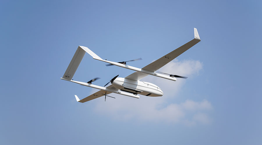
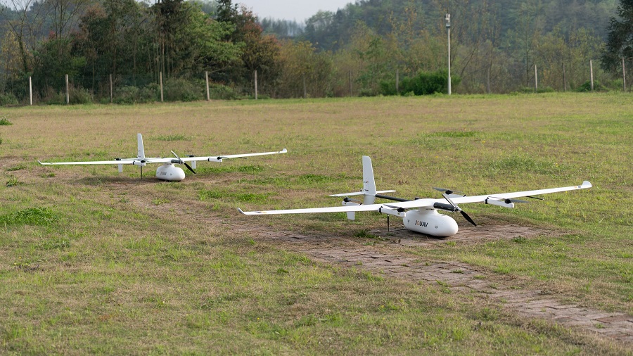
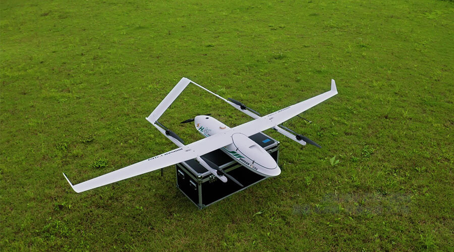
JOUAV offers a diverse range of LiDAR drone solutions with varying specifications. VTOL (Vertical Take-Off and Landing) drones like those in the CW Series are known for their ability to take off and land vertically, making them suitable for various terrains and environments. Multi-rotor UAVs, such as those in the PH Series, are popular for their stability and maneuverability, making them ideal for detailed mapping and surveying tasks.
These drones come in various configurations, with load capacities ranging from 3 to 20 kg. Plus, they offer a wide spectrum of flight durations, spanning from 180 to 480 minutes, and different flight distances that cover a range of 30 to 200 kilometers.
Drone Models |
|
|
|
|
Drone Types | Hexacopter | VTOL | VTOL | VTOL |
Endurance with LiDAR | 75min | 90min | 150min | 480min |
Top Speed | 64.8km/h | 61km/h | 75km/h | 90km/h |
Flight Distance | 30km | 30/50km | 50/100km | 100/200km |
Payload Capacity | 10kg | 3kg | 6kg | 8kg |
Coverage with 3cm Vertical Accuracy | 6km2 | 14km2 | 36km2 | 130km2 |
PPK & RTK | Yes | Yes | Yes | Yes |
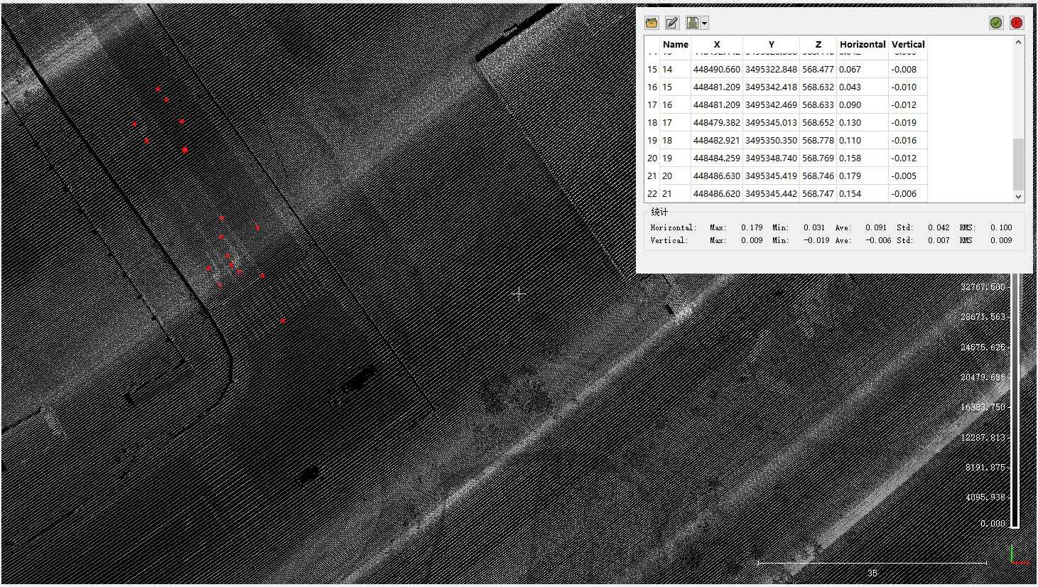
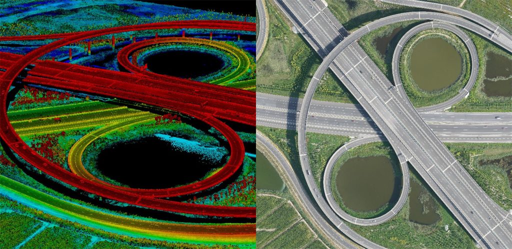
High Accuracy LiDAR Surveying
One standout feature of JOUAV drones is their high-quality LiDAR system, offering a maximum range of 1,845 meters, a 360° field of view, and a data acquisition rate of 2 million points per second. This results in high-density, accurate point clouds with vertical accuracy down to 0.9 cm, all without the need for ground control points (GCPs).
Additionally, JOUAV drones incorporate Real-Time Kinematic (RTK) and Post-Processing Kinematic (PPK) technologies for centimeter-level accuracy in both autonomous flight and surveying operations.
Autonomous and Safe Flight Operations
Surveying tasks demand drones that excel in challenging terrains and obstacles. JOUAV drones offer cutting-edge autonomous flight capabilities. They use high-precision 3D maps for ground-like flight, adapt to various terrains, and maintain consistent ground resolution for precise survey data.
Additionally, JOUAV drones enhance flight safety with forward and downward millimeter-wave radar, intelligent obstacle avoidance, and an ADS-B system that detects and warns of approaching aircraft, ensuring safe operations.
Versatility for Various Environments
JOUAV drones excel in challenging environments and extreme weather conditions. They can vertically take off and land in tight spaces like cliffs, forests, and mountains, expanding survey possibilities.
With heated, drained airspeed tubes and waterproof paint, they ensure safety in adverse conditions. These features conquer high altitudes, humidity, low temperatures, and light rain. Wind resistance of 10.8-17.1m/s and an operating range of -20 to 50 degrees make JOUAV drones dependable for diverse climates.
Large Area Mapping Capabilities
For surveying professionals dealing with large-scale mapping tasks, JOUAV drones offer exceptional endurance. With a maximum flight time of up to 480 minutes, they can cover vast areas with ease. The smart battery and charger system ensures efficient power management, optimizing mission time. The drones cruise at a speed of 61km/h and boast an impressive flight range of up to 200km, further enhancing their suitability for large-scale surveying tasks.
Multiple Payloads for Various Applications
JOUAV drones excel in LiDAR and offer versatile payload options. Their open architecture supports user-defined applications, including RGB, oblique, gimbal, hyperspectral, and multi-spectral cameras, as well as atmospheric sensors and aeromagnetic systems, extending their usability beyond LiDAR for diverse surveying needs.
Whether you're into terrain mapping, urban planning, agriculture monitoring, or environmental studies, JOUAV's LiDAR-equipped UAVs provide precise and efficient data collection solutions.
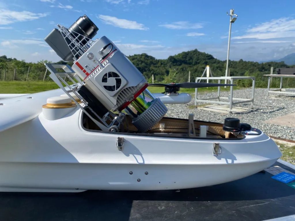
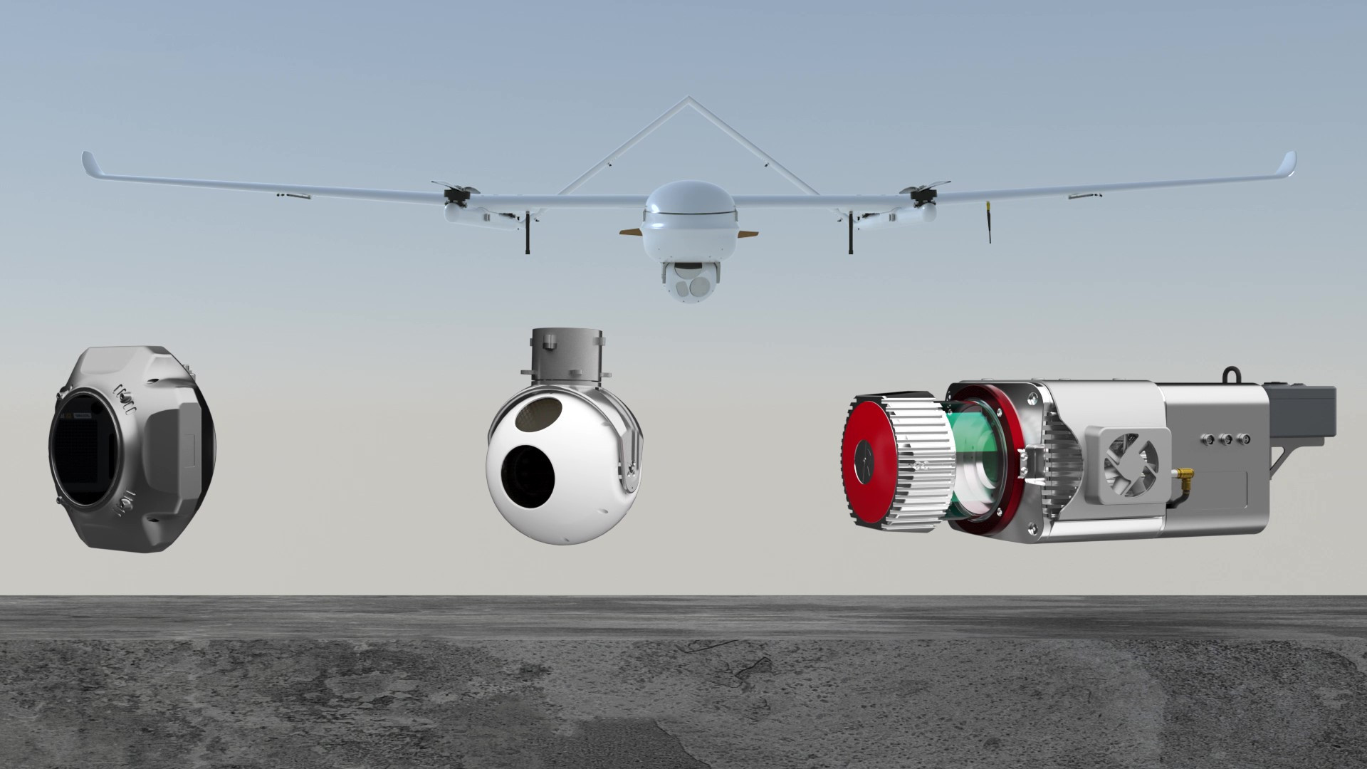
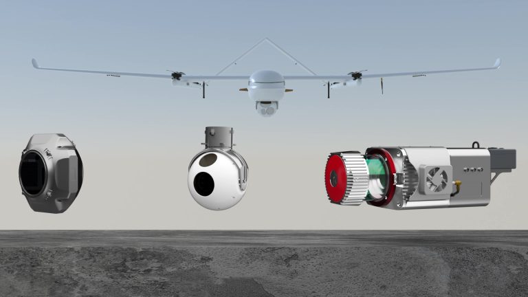
JoLiDAR-120: Small and Lightweight Drone LiDAR Sensor
The JoLiDAR-120 is a marvel of lightweight engineering, weighing only 2.7kg, making it a top choice for those seeking high-performance LiDAR sensors for drones. This advanced UAV LiDAR scanner caters to diverse applications, offering a remarkable 100-degree field of view and an astonishing data acquisition rate of up to 2.4 MHz.
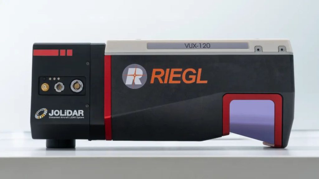
- Impressive 100-degree field of view.
- The data acquisition rate of up to 2.4 MHz.
- Delivers up to 400 scan lines and 2 million effective measurements per second.
- Innovative measuring beam scans vertically, forward oblique, and backward oblique for complete data capture.
- Multi-target capability, targeting up to 32 points per pulse for precise data in dense vegetation.
- 1 terabyte internal data storage.
- Seamless external IMU/GNSS integration for enhanced location accuracy.
- Accommodates up to two external cameras for expanded functionality.
JoLiDAR-1500: Precise LiDAR Solution for Drone Mapping
The JoLiDAR-1500 redefines drone-mounted LiDAR capabilities with its integration of laser scanning, GNSS positioning, inertial navigation, high-speed data acquisition, and a full-frame camera. This compact, highly integrated system boasts full-frequency RTK+IMU fusion technology and LiDAR measurement technology, guaranteeing vertical accuracy within 3 centimeters and horizontal accuracy within 5 centimeters.
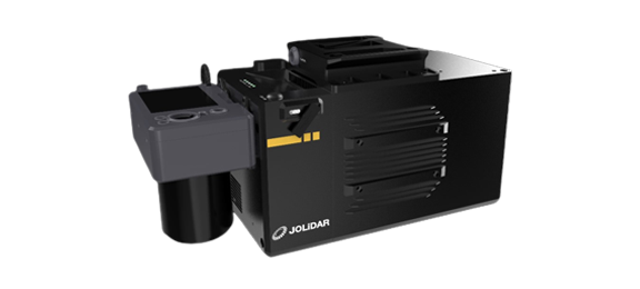
- Simultaneously captures centimeter-level precision LiDAR and photogrammetry.
- Detects objects up to 1500m or more.
- 2000 kHz laser emission frequency and 2 million point/second measurement frequency.
- 7 echoes penetrate dense vegetation for detailed terrain data.
- 75° field of view for focused laser pulses and maximum data utilization.
- Deep integration with JOUAV's drone flight planning software - FlightSurv for seamless control and monitoring.
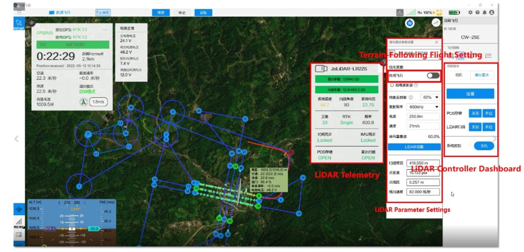
JoLiDAR-LR22S: Long-Range LiDAR Scanning System
The JoLiDAR-LR22S is a multi-functional and long-range LiDAR scanning system renowned for its endurance, high measurement accuracy, and swift data processing. This all-in-one solution integrates a laser scanner, GNSS high-precision positioning system, Lrg guidance system, high-speed data acquisition, and storage system, along with a full-frame camera.
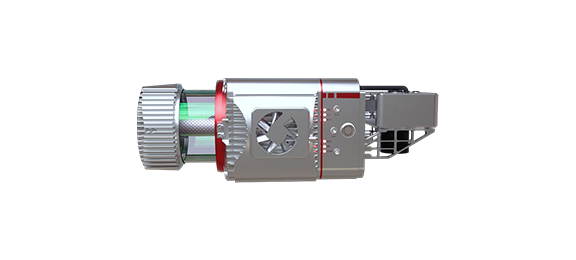
- Simultaneously captures centimeter-level precision LiDAR and photogrammetry.
- Detects objects at a distance of 1845m or further.
- 1500 kHz laser emission frequency and 1.5 million points/second measurement frequency.
- 15 echoes penetrate dense vegetation for precise topographic data.
- Vertical accuracy is better than 3cm and horizontal accuracy is better than 5cm.
- The angular resolution of less than 0.001° for finer 3D point cloud models.
- A full 360° field of view eliminates the need for multiple products.
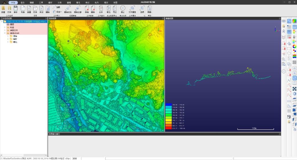
Best LiDAR Processing Software
JoLiDAR is a powerful LiDAR processing software available in three versatile versions: Field, Surveying, and Electric Power.
Our Field version equips you with a range of advanced tools, from diverse point cloud rendering modes to precise measurements and accuracy verification. It also allows for data customization through resampling, chunking, and alignment, giving you full control of your point cloud data.
In the Surveying version, JoLiDAR streamlines your data processing with segmentation, tape matching, and tape leveling, ensuring impeccable accuracy. You can classify point clouds and solve trajectory cloud issues effortlessly.
The Electric Power version of JoLiDAR is tailored to meet the specific demands of the electric power industry. It lets you add markers to towers, cut point clouds between towers, and patch missing power lines efficiently.
This version also offers fine classification, vectorization, tree barrier analysis, cross-over analysis, arc sag analysis, and fine inspection features to optimize power line management.
Choose the JoLiDAR version that matches your needs and embark on a journey of precision and efficiency in LiDAR data processing.
JoLiDAR sets itself apart through its cutting-edge point cloud processing capabilities. Automatic point cloud matching, airstrip segmentation, airstrip matching, and airstrip leveling are just a few of its pioneering features. These methods not only streamline the processing workflow but also significantly enhance the accuracy of point cloud data, ensuring reliable and detailed results.
How to Collect LiDAR with a Drone?
Collecting LiDAR data with a drone involves a series of steps and the use of specialized equipment. Here is a general overview of the process:
Step 1: Drone Setup
LiDAR Sensor Integration: Ensure that the LiDAR sensor is securely and precisely mounted on the drone. Proper alignment is essential for accurate data collection. Follow the manufacturer's guidelines for installation.
Onboard Computer and Software: Install the required LiDAR sensor control and data recording software on the drone's onboard computer. Ensure that the software is properly configured to communicate with the sensor.
Calibration: Perform rigorous calibration of the LiDAR sensor to account for factors such as sensor alignment and timing offsets. Calibration is crucial for maintaining data accuracy.
Step 2: Flight Planning
Detailed Mission Planning: Utilize advanced drone flight planning software to create a mission plan that maximizes LiDAR data collection efficiency. Consider factors such as the project's size, complexity, and the desired level of data density.
Optimal Parameters: Fine-tune the flight parameters, including flight altitude, overlap percentage, and ground speed, to match the specific needs of your project. These settings play a vital role in the quality of LiDAR data collected.
Georeferencing Accuracy: Ensure that the drone supports real-time kinematic (RTK) or post-processing kinematic (PPK) technology for precise georeferencing. This is critical for achieving accurate spatial positioning of LiDAR data.
Step 3: Data Collection
Pre-Flight Checks: Before each flight, verify that all equipment is in working order, including batteries, avionics, and the LiDAR sensor.
Real-Time Monitoring: Continuously monitor the drone's status throughout the flight mission, ensuring it follows the planned trajectory and maintains optimal performance.
Data Logging: Set up the LiDAR sensor control software to record LiDAR data during the flight. Verify that the data is securely stored on the drone's onboard computer and is not subject to interference or data loss.
Step 4: Data Processing
Data Transfer: After the flight, transfer the LiDAR data from the drone's onboard computer to a dedicated processing workstation for post-processing.
Specialized Software: Utilize professional LiDAR data processing software, like JoLiDAR, to filter, classify, and georeference the point cloud data.
Georeferencing Fusion: Combine the LiDAR data with GNSS/RTK data for accurate georeferencing. This step ensures that the point cloud is accurately positioned in the correct geographic coordinates.
Data Export: Export the processed LiDAR data in a format compatible with your downstream applications, such as LAS, LAZ, or E57. These formats are widely used in GIS and other software.
Step 5: Data Analysis
Tailored Analysis: Conduct a detailed analysis of the LiDAR data, tailoring it to your project's specific requirements. This may include generating digital terrain models, 3D models, or conducting vegetation or infrastructure assessments.
Advanced Metrics: Utilize advanced LiDAR analysis tools to extract complex insights from the data, such as volumetric calculations, object recognition, or change detection.
Step 6: Reporting and Visualization
Generate comprehensive reports and visual representations of the LiDAR data findings to effectively communicate results, insights, and recommendations to stakeholders or clients.
Step 7: Post-Processing and Quality Control
Quality Assurance: Implement rigorous quality control checks to ensure data accuracy, identify errors, and remove artifacts or anomalies in the LiDAR data.
Data Refinement: Address any issues or discrepancies discovered during quality control, which may involve reprocessing data or conducting additional flights if necessary.
Step 8: Data Storage and Archiving
Establish a well-organized and secure data storage system for archiving both the raw LiDAR data and the associated project files. Effective archiving is critical for future reference, analysis, and potential audits.
Step 9: Documentation and Record Keeping
Maintain comprehensive records and documentation of every aspect of the LiDAR data collection process. This documentation should cover equipment configurations, flight plans, processing steps, and quality control measures. Such records are invaluable for project replication, troubleshooting, and adherence to industry standards and regulations.
Drone LiDAR vs. Photogrammetry: What's the Difference
With the recent developments in drone surveying, many myths and misconceptions have emerged around drone photogrammetry and LiDAR. There are as many differences as similarities between the two technologies.
What Are the Advantages of Using LiDAR Drones?
- LiDAR technology does not require good light conditions to collect points. The sensor emits its energy so it can capture points both day and night.
- LiDAR systems are capable of offering a very high point density. For example, mid-range commercial devices are capable of generating between 300 and 1,000 points per square meter.
- Related to the above, it is capable of rebuilding fine elements such as cables and power lines.
- They are teams with very high productivity since they require less overlapping of flight lines (20%-30%). In addition, each "pass" of the drone usually covers a greater width than with the most common cameras. An easy rule of thumb is to consider the width to be twice the flight height.
- In general, each measured point generates a more precise coordinate than the equivalent with photogrammetric methods.
- Very important: The laser has a certain penetration capacity, with which it is possible to obtain digital models that can, for example, ignore the vegetation. In this case, the “number of pulses” that the sensor emits determines how many bounces it can detect in a particular direction.
- The cost of the sensors is much higher in the case of LIDAR. The most basic start at tens of thousands of euros.
- The processing of the data obtained is lighter, although it is equally specialized.
- Not all LiDAR is capable of reconstructing the visible appearance of objects, so in some cases only the uncolored point cloud is available.
Understood, But Drone LiDAR Also Has Some Disadvantages...
The most obvious challenge that comes with working with LiDAR is its cost. Due to greater operational complexity (and the need for more sophisticated components and sensors), you can easily spend hundreds of thousands of dollars on a complete survey solution.
This complexity also widens your margin for error and increases the reliance on an experienced professional. With multiple sensors and information not readily available without a fair amount of processing, extracting the data you need isn't straightforward.
It is also important to keep in mind that traditional LiDAR sensors are larger than simple cameras. With the growing popularity of drone surveying, the need for a larger drone to handle a heavier payload can add to an already significant expense.
With photogrammetry, RGB reconstructions are obtained in which each pixel is assigned the color that corresponds to reality, while with LiDAR the points are monochrome (without RGB). This limitation can be removed by adopting an RGB camera to the device.
Can LiDAR Technology Replace Photogrammetry?
It depends on the case. Drone photogrammetry remains one of the cheapest and most effective methods for aerial data collection. In any case, you should ask yourself several fundamental questions when deciding on one or another method. Let's go to clear cases:
Need to model terrain in densely forested areas? If so, LIDAR is the winner. If these wooded areas appear as patches between which there is visible ground, photogrammetry is still a viable option.
Do you need to capture a large area (thousands of hectares) and time/cost is a critical factor? A laser scanner will be more productive per day, but also more expensive to move. In our experience, it is possible to capture areas of 2000-3000 hectares with a fixed-wing drone in half a week with resolutions of 3-4 cm/pixel.
Is investment a limiting factor? If so, photogrammetry is a more competitive technology.
Do you need each point to be located with a very low margin of error or do the clouds have to be extremely dense? LIDAR is your preference. Be careful, the precision of terrestrial LIDAR is greater than that achieved by similar sensors on board a moving drone.
How Much Does a LiDAR Drone Cost?
The LiDAR drone price is a big concern for many customers. While the integration of LiDAR sensors into commercial drones makes LiDAR mapping more affordable, the cost is still difficult to estimate. Because the price of LiDAR drones and sensors can vary greatly depending on the type and features.
Users can choose to either rent or buy a LiDAR UAV. People who choose to rent a LiDAR drone will need to pay about $1,400 per month. This option also allows users to avoid maintenance costs.
You can also choose to purchase a new drone with LiDAR. An entry-level LiDAR system costs about $23,000. The accompanying UAV ranges from $10,000-$16,000. Additional costs include accessories for the drone, batteries, base stations, and GPS rovers, which can add up to $10,000 in total.
What is often forgotten is the insurance. For a $23,000 LiDAR system, expect to spend at least $2,000 per year on equipment insurance. The cost for basic drone insurance typically is around $500-$750 per year.
Read More

Have you ever watched a drone hover effortlessly over a construction site, inspect a wind turbine blade, or deliver medical supplies to a remote village?
That drone was almost certainly a multirotor.

Every drone needs a brain.
Without it, you’re holding an expensive paperweight with spinning blades.
That brain is called a flight controller—but most people have no idea what it actually does.

JOUAV Product News and Use Cases
Fixed-Wing VTOL Drones Insights and Industry Trends
Invitations to online demo events