At 2:27 PM on a storm-lashed afternoon in July 2025, a small fishing boat capsized off the coast of Gulei, Zhangzhou.
Two men were thrown into violent waters. Winds howled at gale force. Waves surged
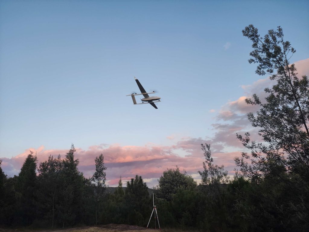
The Yunnan Bureau of Nonferrous Geology used CW-25E to collect laser point cloud and orthophoto data of 950km² of forest in Yunnan Province, China, in just 8 hours. The captured 3D point cloud data help forestry workers gain insight into the health of the forest and prevent forest fires. So far, the CW-25E lidar has accumulated 53 sorties and 116 hours of flight time.
The Yunnan Provincial Bureau of Non-Ferrous Geology, a government organization that manages 424 million acres of forest in the province, started going back in 2020 to find out what drones could do. They noticed that drones had already been used successfully in China for environmental monitoring missions, and even some of their counterparts were already using them for forestry management.
This new technology sparked their interest because they had to update maps of their forests every year. But the sheer size of the natural woodlands made the project very labor-intensive, resulting in time-consuming, tedious, and error-prone manual estimates for staff.
Understand the needs of the Yunnan Nonferrous Geology Bureau
"We hope that using drones will improve the efficiency of forestry surveys, lower the cost of forestry surveys, and reduce the work intensity and risk of manual surveys. At the same time, we also hope that by using drones we can improve the information level of our forest management. Obviously, this is a very complex system project and it's not as simple as buying a few drones to fly and photograph," said Li Wei, the project manager of Yunnan Nonferrous Geology Bureau.
When Yunnan Nonferrous Geology Bureau initially conducted market research, they already knew that JOUAV's CW-25E was known for its quality and reliability. But they wanted to make sure that JOUAV's solution would meet their actual needs, and in the process, they also evaluated the technical capability and responsiveness of the vendor's support and services. For them, drone surveying for forest management is a complex, long-term, and continuous improvement effort, and if the supplier is simply trying to sell equipment, it won't meet their requirements.
"During the process, we actually recognized the CW-25E's long-established reputation in the industry for product reliability, and that it is a drone that can truly be used to work continuously for long periods of time. At the same time, we were impressed by JOUAV's motivation and enthusiasm to provide support and service to our customers. We were impressed by JOUAV's enthusiasm to provide support and service to our customers. During the field test, JOUAV's technical support staff was always on-site working with our forest workers, understanding the work of our forestry survey, discussing and trying out reasonable flight methods with us, and training our forestry staff on operation", said Li Wei.
Learn how Yunnan Nonferrous Geology Bureau used CW-25E
In September this year, Yunnan Nonferrous Geology Bureau used JOUAV CW-25E with JoLiDAR-LR22S LiDAR system to collect 950km² of forest area in Yunnan Province in only 480 minutes, saving a lot of time, and money and reducing the risk of the manual survey. Let's move on to see how they use benefits from CW-25E.
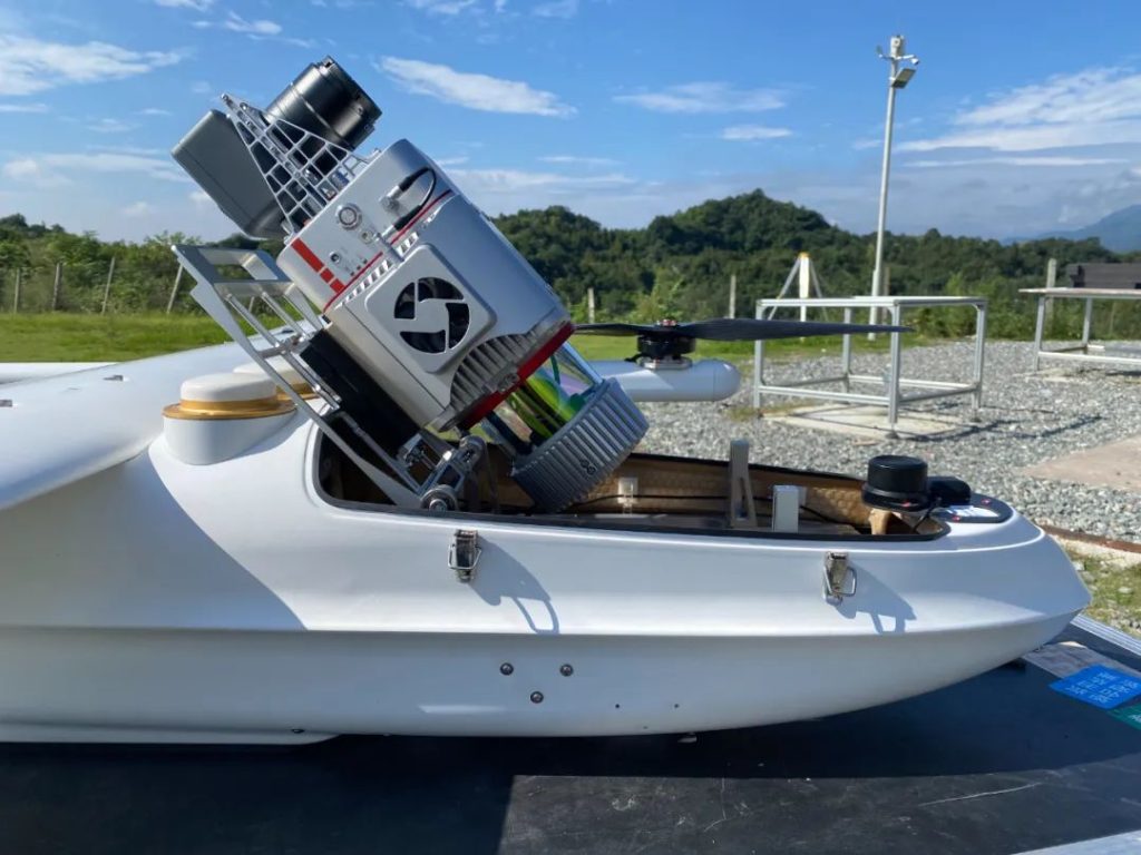
Because of the complicated terrain with many mountains, high voltage pylons, and woods along the way, Yunnan Nonferrous Geology Bureau used the CW-23E in a combination of terrain-following flight and level flight mode to ensure flight efficiency and data accuracy. In the face of the 950km² forest area, CW-25E used the relay flight mode to carry out 4 sorties, with a maximum flight time of 135 minutes per sortie, covering an area of 25km². The CW-25E was equipped with a JoLiDAR-LR22S LiDAR scanner, which collected 3D coordinates of the ground and its vegetation along with orthophoto data.
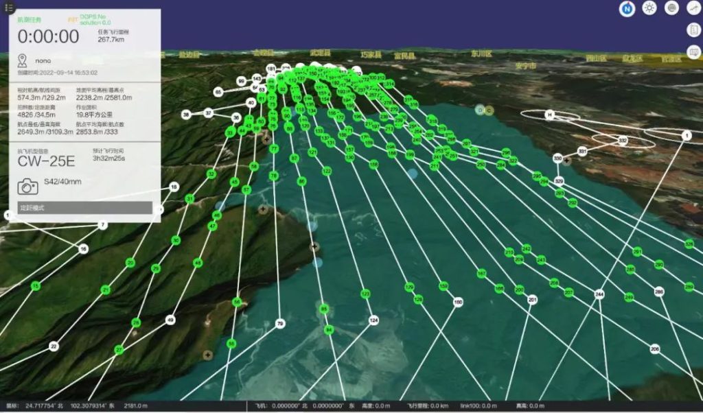
The flight route planning
After the flight, a 3D model is generated through post-processing software, which accurately reproduces the forestry environment. With these 3D models, our foresters can quickly extract accurate indicators of tree height, diameter, volume, and number, which can be used to analyze the health of vegetation, monitor soil contamination, and prevent forest fires. They also generate Digital Line Graphs (DLG) at a scale of 1:2000 based on the acquired 3D point cloud data.
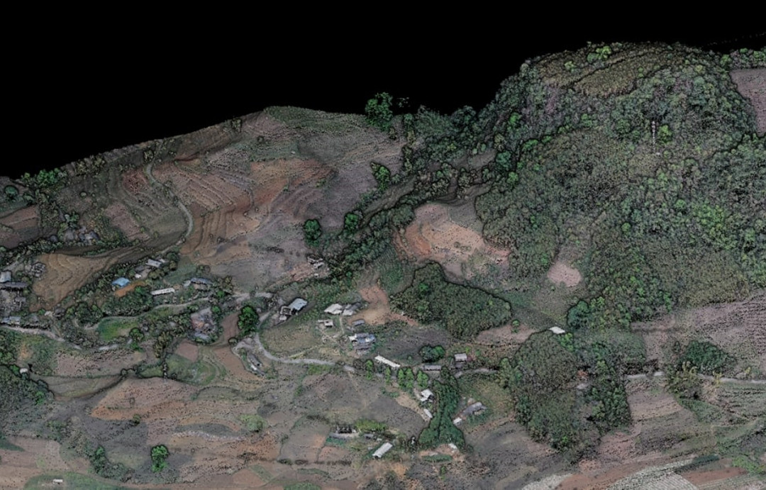
3D point cloud
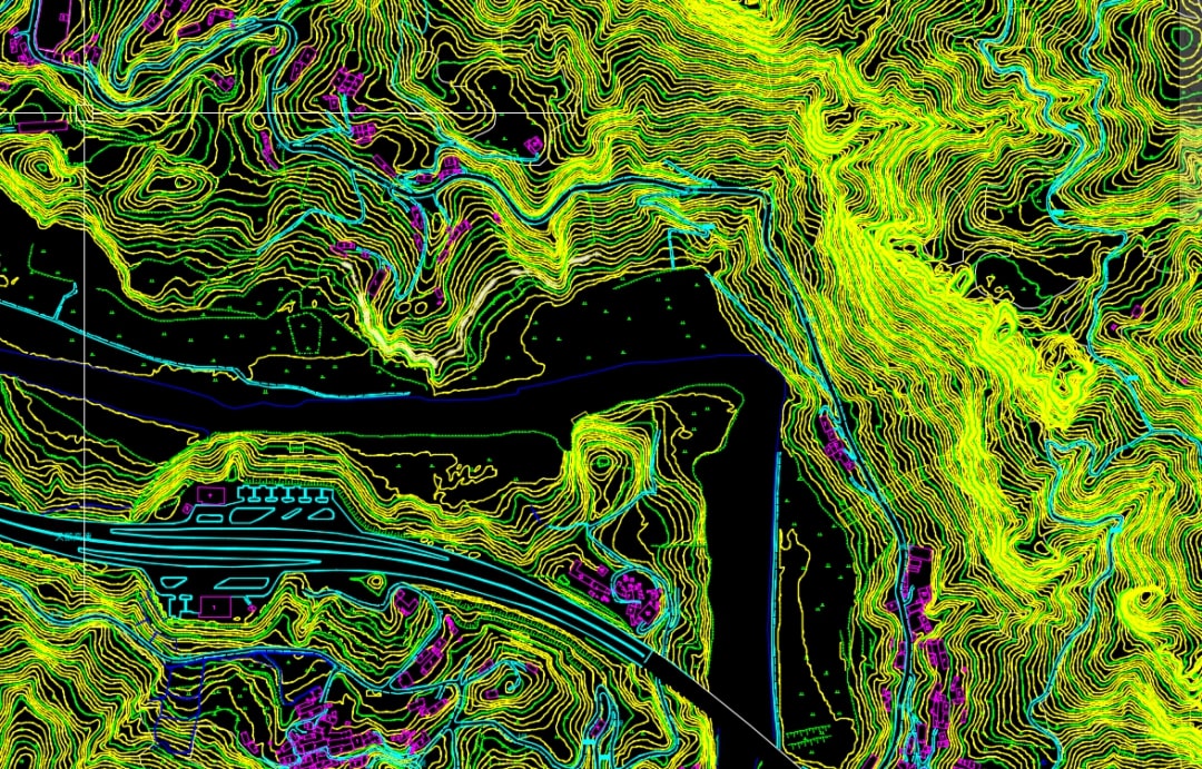
DLG
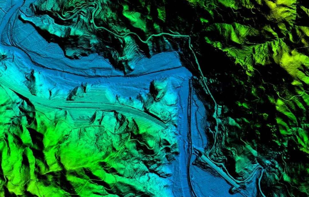
DEM
More Use Cases


Chongqing’s Qinba Mountains are basically a giant green wall protecting the region. But there’s a problem – pine wood nematodes are eating through it. Fast.
The forestry department n

When TotalEnergies set out to build one of Southeast Asia’s largest solar and battery storage projects—spanning 12,000 hectares across the dense acacia forests of Riau, Indonesia—they faced a problem

JOUAV Product News and Use Cases
Fixed-Wing VTOL Drones Insights and Industry Trends
Invitations to online demo events