Benefits and Features
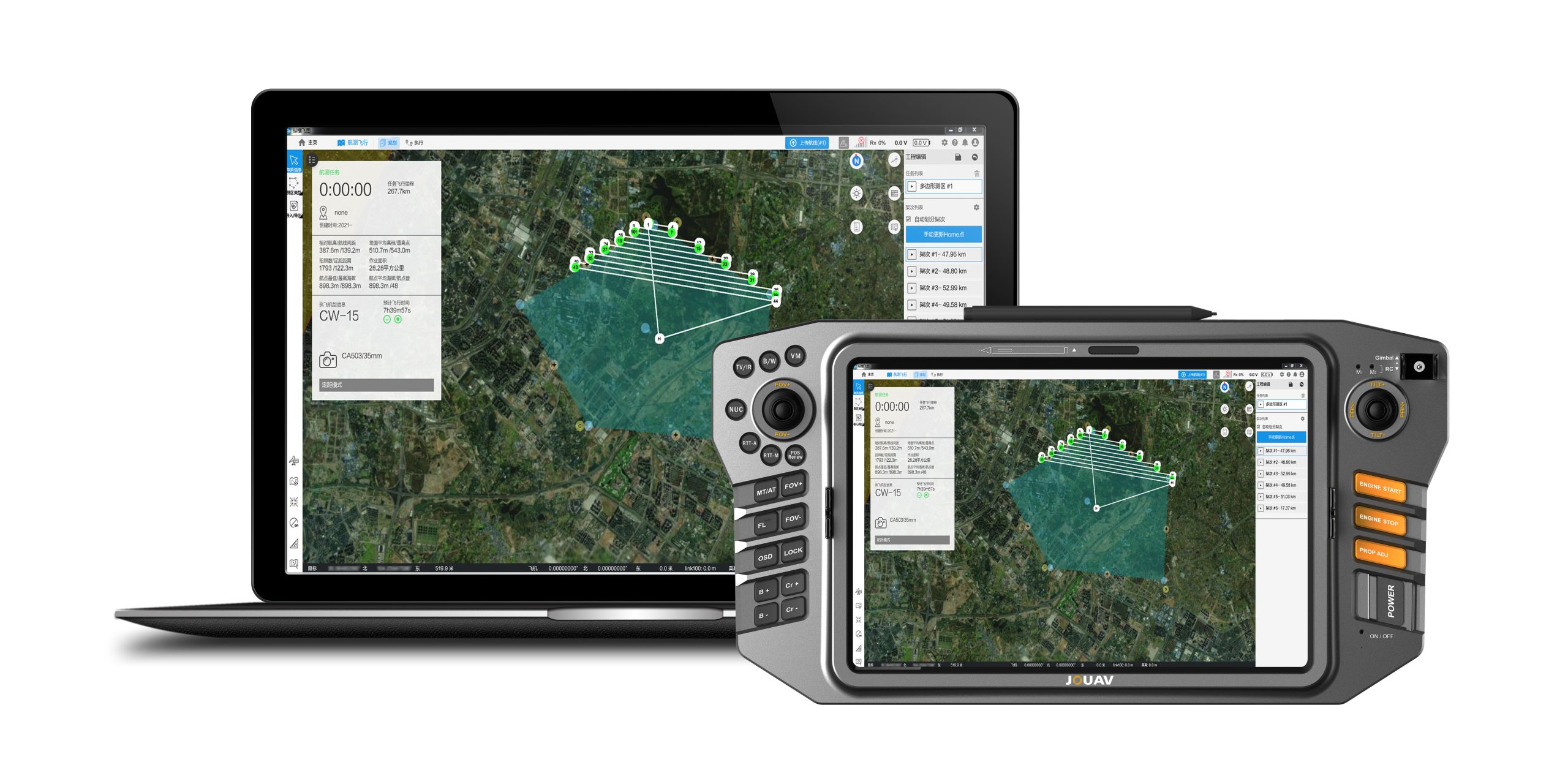
If you’re just starting out with drone mapping, look no further than FlightSurv! This easy-to-use drone mapping software helps you get your drone in the air quickly and output data results efficiently. The software offers unparalleled efficiency and user experience by allowing you to plan a mission consisting of multiple flight plans from the ground.

Support Drone Data Collection, Processing, Asset Inspection
Besides drone flight planning, FlightSurv can also capture images, inspect your assets, analyze collected data.

Full of Cloud-based Operations
It’s easy to manage even if you have many team members or clients who need your drone data on their own mobile devices.

Simple and Intuitive Interface Design
Users can quickly complete the entire flight mission while navigating the intuitively designed interface effortlessly.

High-speed Data Processing
To process 1000 photos, the software only takes only 2 hours to generate high precision TDOM and DSM.

Fly Multiple Plans at Once
You don't need to land the drone between flight plans, which maximizes its efficiency in the air.

Import and Create Routes from KML Data
Your flight plan will automatically be generated once import a KML file that will save you 50% time.

More information about JOUAV and our drones
Provide the suitable solution for your needs
Help for your project promotion
Get a product quote