What is a drone mining survey?
Mining drone inspection means that a drone equipped with a downward RGB camera, LiDAR, or other measurement sensors captures images from different points of the open-pit mine or quarry. These images or LiDAR point cloud data are then processed by comprehensive and professional photogrammetry software to form geotagged 3D maps, Digital Elevation Models (DEM), Digital Terrain Models (DTM), Digital Surface Models (DSM), etc. for detailed analysis by operators.
Benefits of using drone in mining
Drone surveying is being used in more and more mining operations. They enable more efficient and accurate data collection compared to traditional methods. Let's check the benefits of using drone in mining in detail:
Improve safety
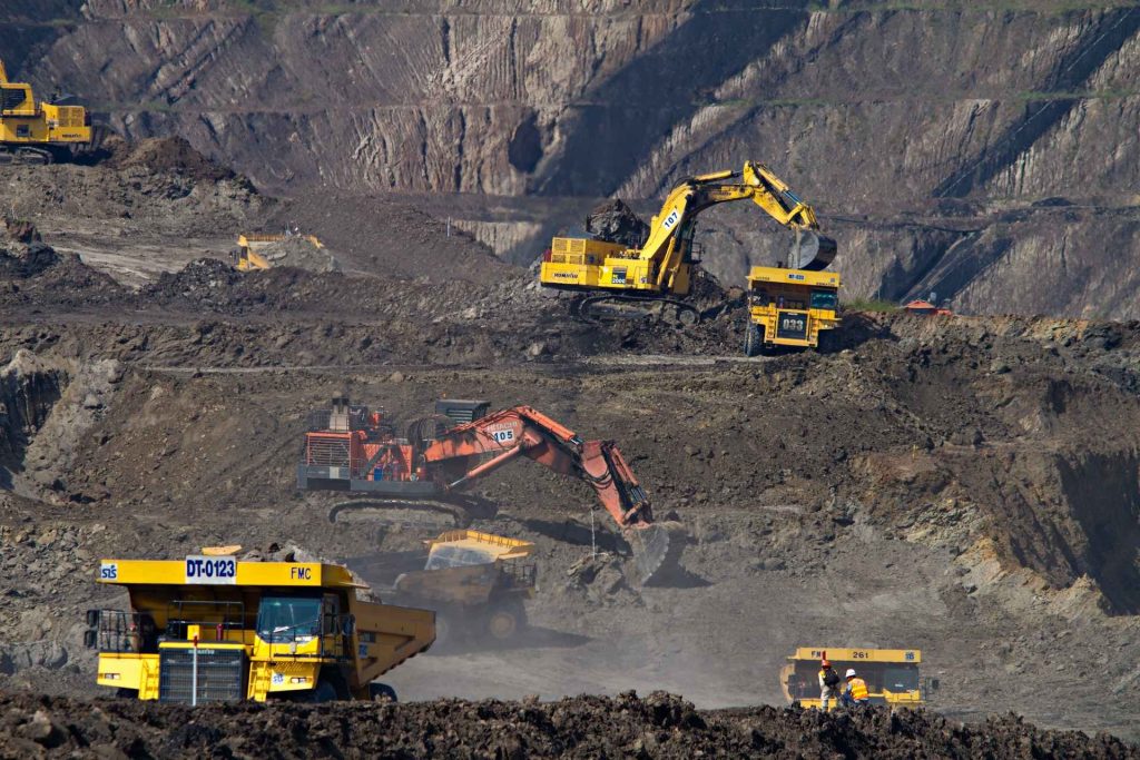
It's very dangerous that surveyors to collect visual data on the state of potentially unstable areas of the mine, such as high walls, crests, slugs, and blast points. Using drones means fewer people are exposed to these hazards.
High accuracy
Drones give a complete rendering of greater precision. A LiDAR drone can fly lower than the planes generally used for the acquisition of this data, which makes it possible to optimize the number of reference points and to offer more high accuracy in the data.
Low operating costs
The operating costs associated with drones are lower than the costs of traditional survey methods. The drone applications are unlimited and exploitable throughout the process (exploration, development, and operations), not to mention, not to mention, the rapid assessment of dangers.
Increase worker efficiency
Mining companies can use high-resolution images captured by drones to analyze current routes and see how they can be optimized for better efficiency. And then share the status of an ongoing operation with stakeholders.
What kinds of maps can you expect from mining drones?
Orthomosaic maps
They allow detailed visual monitoring of the state of the quarry, measurements of surfaces and distances, etc.
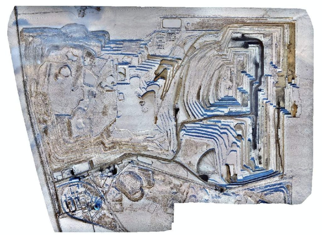
The CW-25E with JoLiDAR-LR22S produced an accurate digital orthophoto model for the Baorixile open-pit mine.
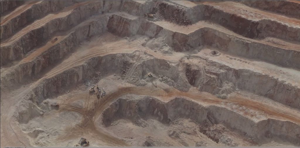
3D model
A 3D reconstruction, in addition to containing high-detail three-dimensional information, is a very powerful way of explaining the project to people with fewer skills.
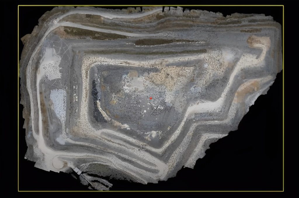
3D point cloud
Point clouds are collections of three-dimensional coordinates. They have very high detail (millions of points) compared to traditional measurement methods, and they are useful in volume estimation and simulation programs.
Aeromagnetic map
By measuring the strength of the Earth's natural magnetic field, the drone magnetic surveying constructs a map representing the changing properties of magnetic rocks and a 2D or 3D model of the geology of the Earth's crust. These models are aeromagnetic maps, which can be used for mining exploration.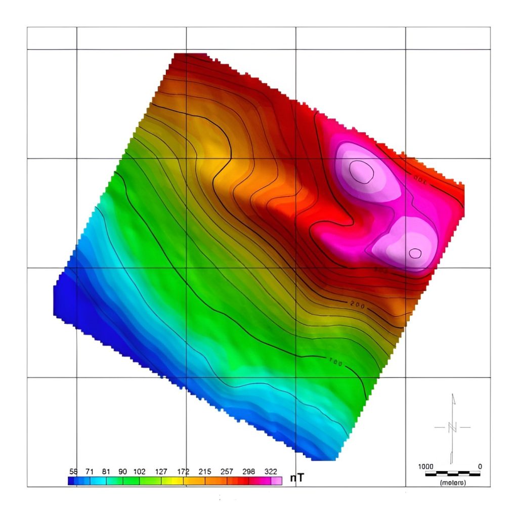
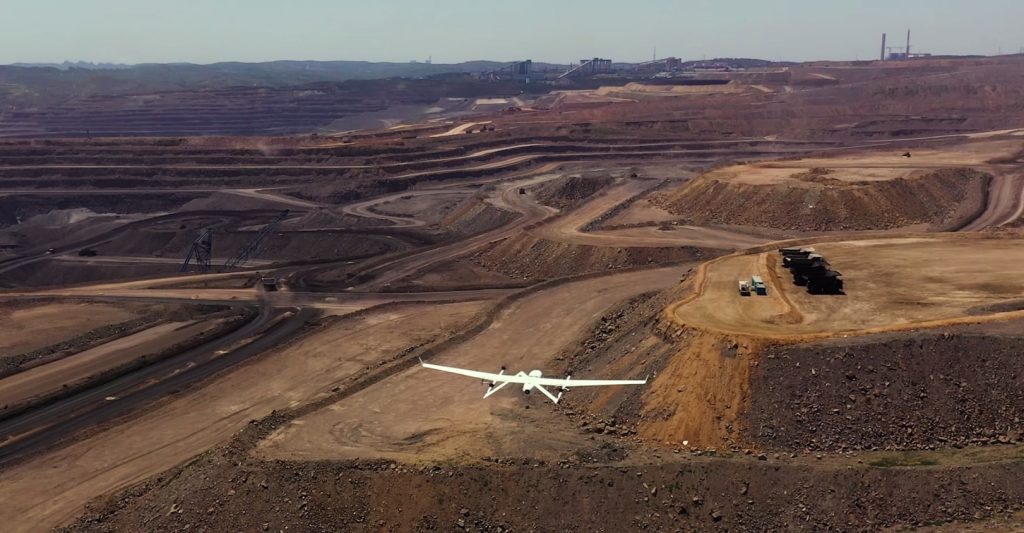
What are the best drones for the mining industry?
JOUAV drones are the best drones created especially for mapping and surveying services in the mining industry. It is a fixed-wing drone with vertical take-off and landing capabilities and a number of impressive features.
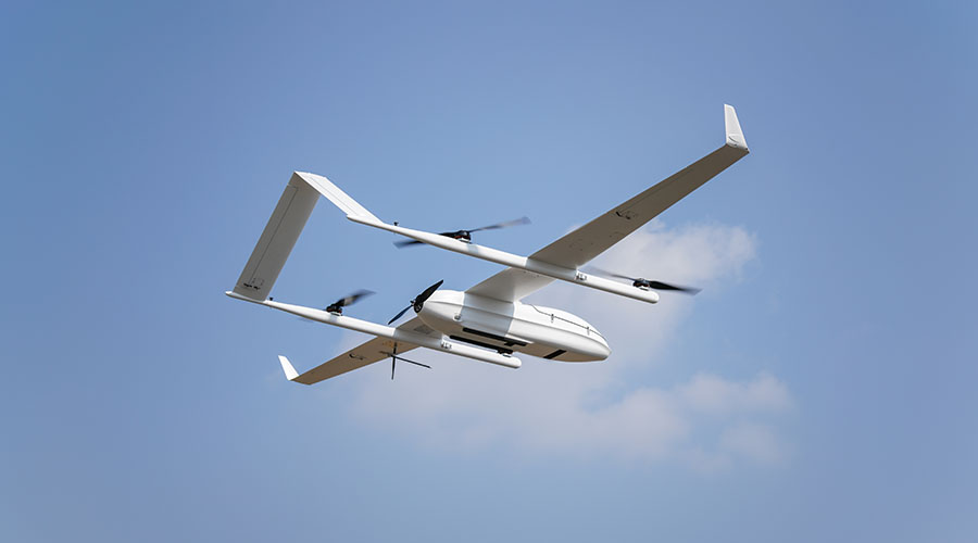
Take off and land vertically (VTOL)
JOUAV drones combine the advantages of a fixed drone and a multi-rotor drone. Unlike other fixed-wing drones that need to land over wide areas and soft terrain, JOUAV drones can take off from confined areas and land smoothly in gravel and open pits. In addition, different from other multi-rotor aircraft, the JOUAV VTOL drone can fly faster and has a longer flight time.
61.0 megapixels/down to 1cm (1.2")
With a 61.0 megapixels full-frame camera, JOUAV drones can fly at a high altitude over a deep pit and still deliver low GSD images. The drones have a built-in multi-frequency PPK GNSS receiver that provides best-in-class absolute horizontal accuracy of up to 1 cm (0.4") and vertical accuracy of up to 3cm (1.18").
Fully autonomous flight
After planning the route, JOUAV drones can now fly autonomously at remarkably high speeds, while navigating unpredictable obstacles using their onboard sensors. In our test, JOUAV drones can keep speeds of up to 60~100km/s without crashing into trees, walls, or obstacles.
Best payload solutions for mining
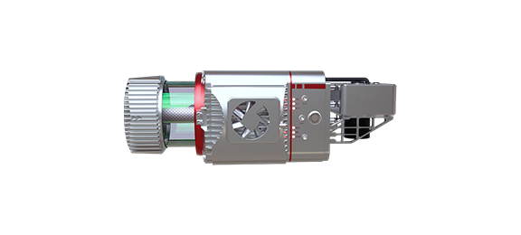
LiDAR: mining mapping and surveying
JoLiDAR-LR22S is the best long-range and high-precision UAV LiDAR solution for mining. With a built-in high-precision GNSS INS board and laser scanner, the sensor achieves elevation accuracy of less than 5cm, plane accuracy of less than 8cm, and distance of up to 1854m, meeting the needs of engineering measurement. JoLiDAR can sort data quickly, which greatly increases the speed of data processing and enables you to complete projects in the shortest possible time with little interruption.
Oblique camera: mining mapping and surveying
Integrating 120 megapixels half-frame five lenses, the CA500R Series Oblique Camera collects oblique imagery, which can not only truly reflect the ground conditions and obtain multi-directional texture information with high precision, but also generate real-world 3D models through advanced positioning, fusion, modeling, and other technologies.
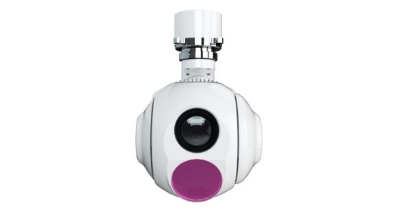
Gimbal Camera: Real-time mine monitoring
The MG-120E Gimbal Camera is the best surveillance drone camera that combines an optical zoom camera with a high-precision thermal image sensor. Its 30x optical zoom camera identifies details of equipment, buildings, and structures within 2km. 640*512 resolution thermal sensor allows monitoring of coal mines at night or in low visibility and also identifies potential problems that are invisible to the naked eye.