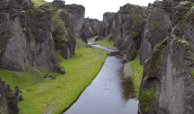
River and Lake Monitoring and Supervision
Unmanned aerial vehicles can be used for auxiliary supervision of suspected illegal construction, illegal planting and development and utilization, illegal sand mining and other incidents within the jurisdiction of the water resources project jurisdiction, extracting information on the location and scope of illegal acts, and providing technical support for law enforcement and management. Violations of laws and regulations shall be detected early, stopped early and dealt with early.
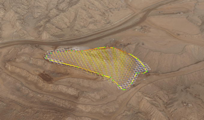
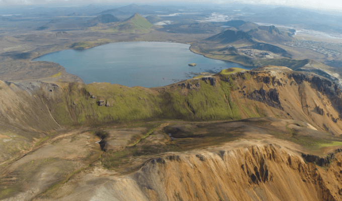
Soil and Water Conservation Investigation
Traditional water and soil conservation monitoring techniques cannot meet the requirements of accuracy, timeliness, and completeness in production and construction projects. UAV's low-altitude remote sensing has the characteristics of high precision, high timeliness, and a high degree of visualization. It can be used for quantitative detection and evaluation of soil erosion, monitoring and evaluation of soil and water conservation treatment measures, and soil and water conservation monitoring of production and construction projects. Drone surveillance has become a new technical means to comprehensively monitor the state of soil and water conservation.
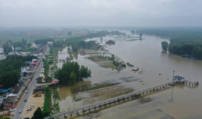
Flood Control & Drought Relief
UAV systems play an important role in the field of flood control, drought relief, and disaster relief, and can be used for emergency monitoring of landslides, mountain floods, urban floods, and dam failures. The maneuverability and flexibility of the UAV system are especially suitable for emergency response, which greatly reduces the risk of emergency responders, and improves the efficiency of handling early warning and disasters. Quickly and accurately carry out aerial photography and damage assessment of the disaster-affected area, and provide rescuers with valuable first-hand information.
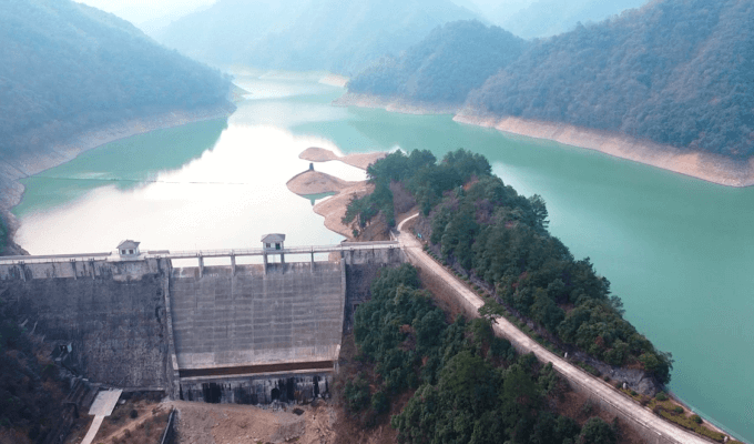
Water Resources Projects Inspection
UAV can quickly monitor the water resources projects that need to be inspected in real time, and through real-time inspections of upstream and downstream rivers, they can grasp the relevant hydrological conditions such as land inundation caused by the construction of hydraulic structures ASAP. The analysis results of monitoring data obtained by UAV can effectively monitor temporary buildings such as cofferdams, check the safety status of surrounding slopes, and investigate the type and amount of flooded land. Discover relevant signs in time to prevent accidents and ensure the smooth progress of hydraulic structures. At the same time, it provides information for controlling the quality of construction, reducing the impact on the surrounding environment, and improving construction methods.
Emergency Monitoring of Barrier Lake
Barrier lakes are formed by blocking river valleys or riverbeds and storing water after landslides and landslides caused by mudslides or earthquakes. The scale and environment of barrier lake formation are complex, and the blockage is vulnerable to erosion. Once it is destroyed, it is easy to cause secondary disasters with serious consequences. Due to its technical characteristics such as small size and flexibility, rapid maneuverability, and simple maintenance and operation, the UAV can provide efficient on-site investigation and evaluation and dynamic early warning for the distribution and dynamic changes of the barrier lake. It provides the basis for experts’ first-hand information and scientific decision-making on the nature and risk assessment of dammed lakes, and the preliminary investigation and scale estimation for the barrier lake failure plan and the immediate disaster plan for the resettlement of downstream dangerous areas. Make timely monitoring and early warning for risk elimination and failure.
Emergency Monitoring of Ice Flood
The traditional manual method of visually estimating the ice flood situation relies on the experience. Although simple and reliable, the observation range is small and lacks the grasp of the ice flood information of the entire river channel. Satellite or aerial remote sensing detection method has a large observation range and wide coverage. However, due to the long revisit period of satellites, the remote sensing resolution is low, and it is susceptible to atmospheric interference, the ability to grasp the local details of the river is not strong, and the real-time performance does not meet the demand. Drones for environmental monitoring and disaster assessment have mature applications and practices in many fields. UAVs are equipped with high-performance sensors of various types, which can remotely monitor river openings, ice jams, ice piles, ice dam distribution, etc., provide a scientific basis for judging the scale and disaster situation of ice floods.
June 2017 Lanxi City Rainstorm Rescue
In June 2017, the highest water level in Lanxi City, Jinhua, Zhejiang exceeded the second highest water level in 2011, which was 31.86 meters. Zhejiang Hehai Surveying and Mapping Institute used CW-20 to take off in the rain. In more than one hour, a total of 659 photos were obtained. It is a 0.1-meter high-definition image, and the drone surveying area is about 15 square kilometers. In the evening, through the overnight processing of the team, combined with historical data, on the morning of the 27th, provided high-definition images before and after the disaster in Xiangxi Town, Lanxi City, and the storage capacity curve map of the inundated area in a timely manner to provide disaster research and assessment and subsequent risk management Geographic information data support.

Huai River Flood Control Real-time Monitoring
Affected by heavy rainfall since July 10, 2020, the water level at Wangjiaba Hydro Station on the mainstream of the Huai River reached the warning water level of 27.5 meters at 22:48 on July 17, which is the first time in 2020 to reach the warning water level. According to the "Regulations on Flood Numbering of Major Rivers in the Country" , The flood number is "Huai River No. 1 Flood in 2020". At 8:32 on July 20, the Wangjiaba Sluice on the mainstream of the Huai River was opened for flood release. The CW-30D VTOL UAV flew from Caotai Gate to Wangjiaba, which is more than 30 kilometers away, to monitor the flood discharge situation of Wangjiaba Gate in real time, and the flood discharge area of 180 square kilometers from Caotai Gate to Wangjiaba in real time.
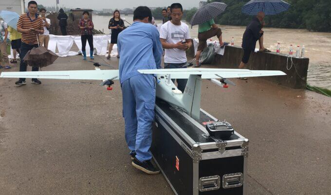
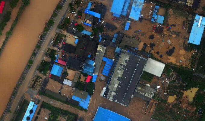
Zhengzhou "July 20" Extraordinary Heavy Rain
Since July 17, 2021, there have been torrential rains and heavy rains in some parts of Henan, and extremely heavy rains have occurred in Zhengzhou, Jiaozuo, Jiyuan and other places. The Weihe, Jialu, Shaying, Hongru, Baihe, and Shuangji rivers have experienced flooding processes. Gongyi , Dengfeng, Xinmi and other places were severely affected. In order to grasp the disaster situation in flood-stricken areas and the risks of secondary geological disasters, the National Disaster Reduction Center of the Ministry of Emergency Management launched the emergency monitoring response of major disasters by UAV, and JOUAV urgently established an emergency team. Provided the first batch of post-disaster digital orthophotos and 3D real-life data in the disaster area at the earliest time.

More information about JOUAV and our drones
Provide the suitable solution for your needs
Help for your project promotion
Get a product quote