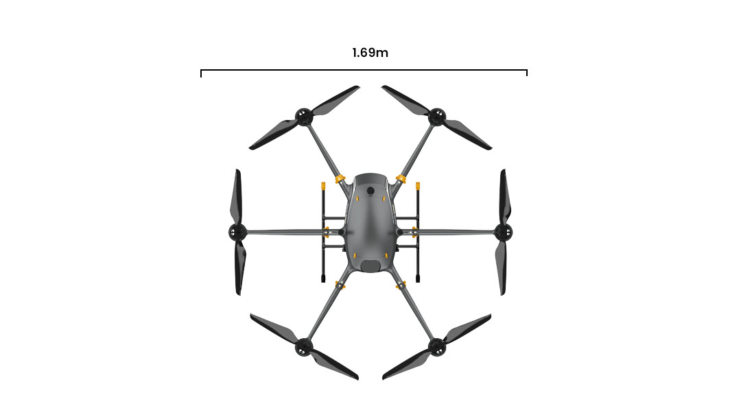
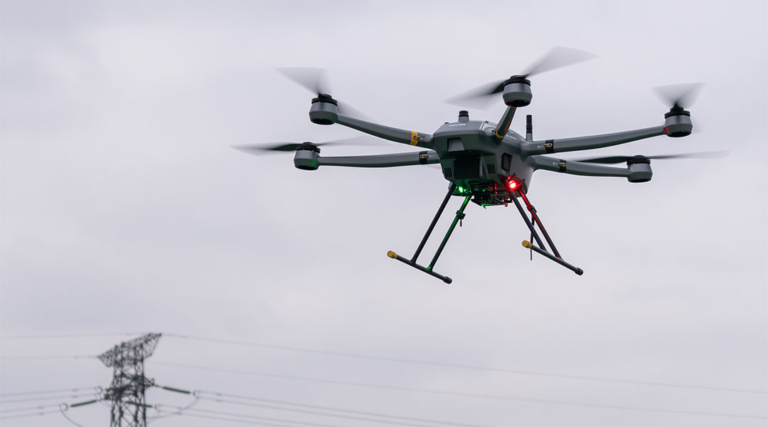
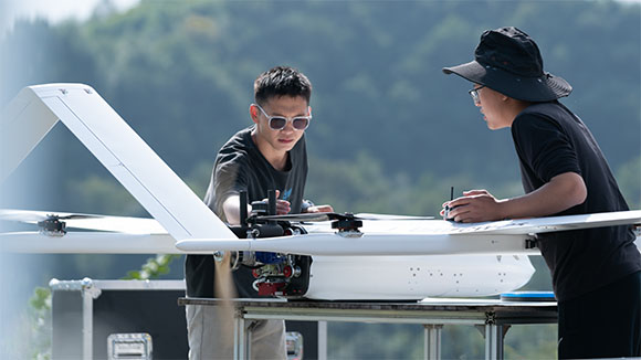
PH-20 Overview
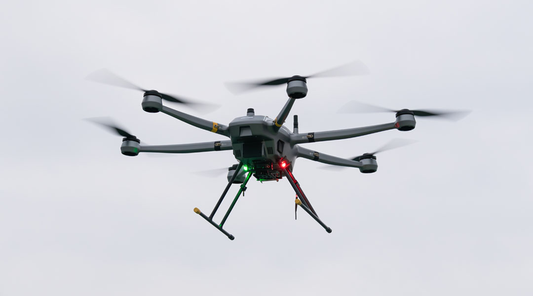
The JOUAV PH-20 boasts a six-rotor setup for heavy payloads, long endurance, seamless integration, and top-notch reliability. Crafted from lightweight yet sturdy carbon fiber composites, its modular design ensures easy use and maintenance. The rotor system's inward tilt enhances stability, wind resistance, and interference tolerance.

Equipped with an intelligent flight controller utilizing CAN bus communication and sensor redundancy, the PH-20 excels in thwarting interference and offers impressive expandability. Its autopilot features advanced adaptive control algorithms and robust emergency protection, ensuring reliable and safe flights.
Trusted by
Benefits and Features
With the continuous technical updates , our drones bring many actual benefits to our customers, including saving time and cost, getting more comprehensive data, keeping personnel safe.

Long Endurance
The upgraded PH-20 has a longer flight time. 70 minutes with gimbal camera, 75 minutes with LiDAR.

Heavy Payload
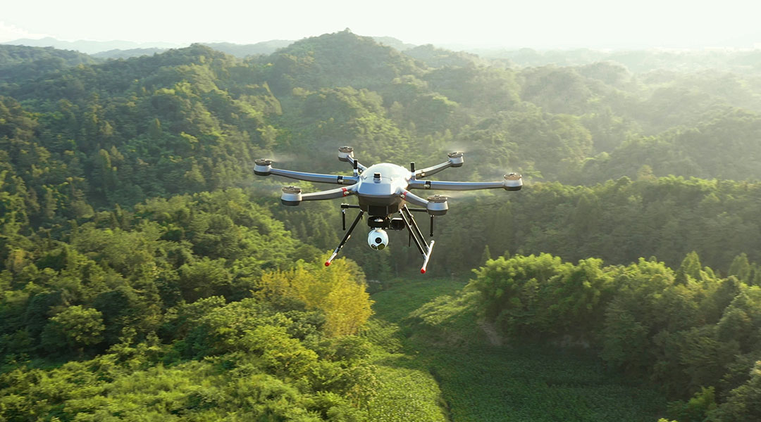
Maximum load 10kg, all common payloads can be equipped, such as LIDAR, camera, spectral imager, aeromagnetic, miniSAR, etc.

Smarter
Multi-sensor redundancy technology, control distribution reconfiguration technology, all-digital bus avionics technology, fully closed-loop health monitoring, and management technology.

More Convenient
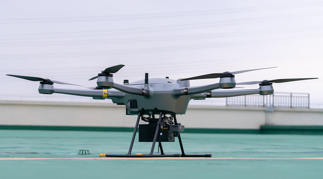
The arm is pluggable, easy to use and maintain; unified load electrical interface, one key installation.

More Reliable
The whole machine is made of high-performance carbon fiber composites, lightweight, rigid and high strength. The rotor system's inward tilt enhances stability, wind resistance, and interference tolerance.

Safer
Equipped with millimeter wave radar for four-way obstacle avoidance.
After high and low temperature, plateau, high wind, rain, and another harsh environmental testing, higher safety.
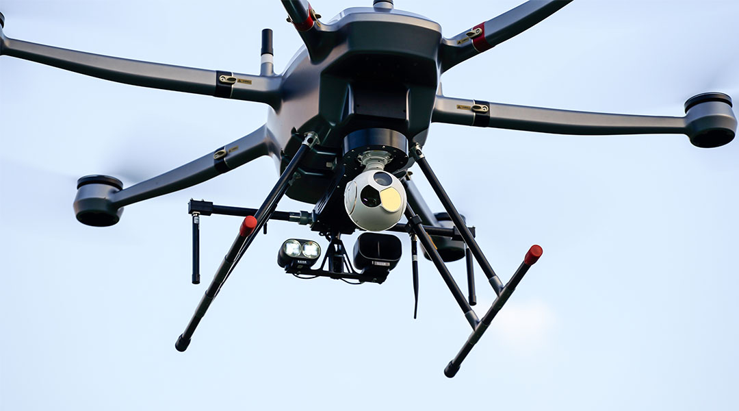
Optional Payloads
The JOUAV PH-20 UAV can carry many types of mission payloads. You can choose different cameras according to the actual mission needs, including LiDAR system, industrial aerial camera, oblique camera system, gimbal system and SAR. Simple and flexible, multi-purpose.
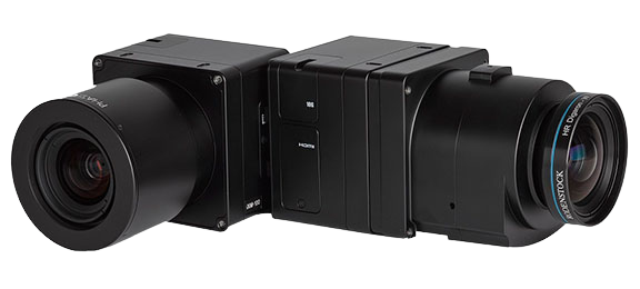
PhaseOne iXM Series Camera
High-resolution medium format cameras for mapping and surveying
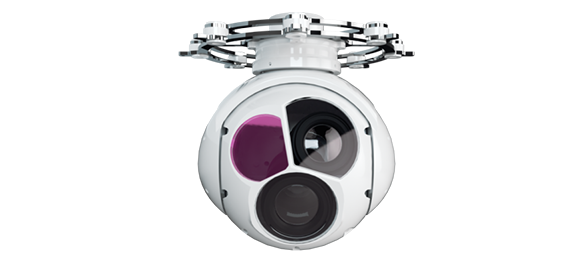
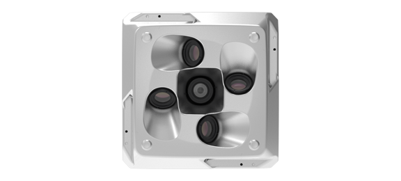
MG-150E EO/IR/LR Gimbal Camera
30x optical zoom and thermal imaging drone gimbal camera with 3km laser rangefinder
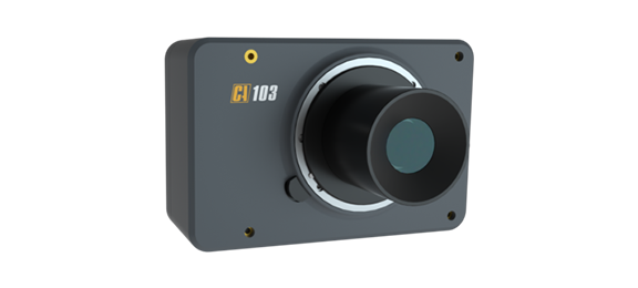
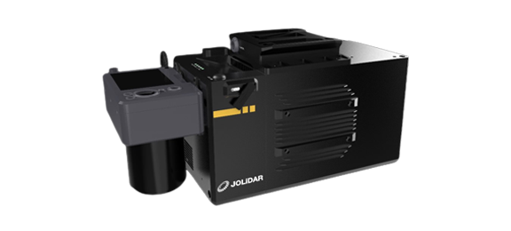
JoLiDAR-LR22
JoLiDAR-LR22 is a lightweight and long-range laser scanner for UAV surveying.
CA50XR Series Oblique Camera
High-precision half-frame/full-frame oblique cameras for 3D city modeling and urban planning
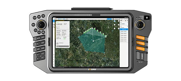
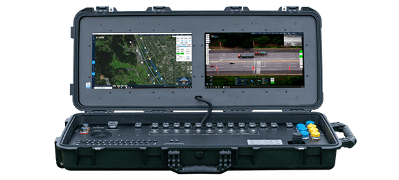
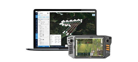
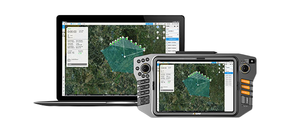
Ground Control Stations
JOUAV offers handheld, portable and modular vehicle ground control station. You can choose different control devices according to the different environment and task.
Supporting Software
JOUAV provides one-stop UAV products, including the supporting software needed for the task. You can use these software to plan a flight path, control and manage the drone, track and identify targets, and see video and geo-data information from the drone in real time.
Eagle Map Drone Surveillance Software
An intuitive software solution to deploy drones' security and surveillance operations.
FlightSurv Drone Mapping software
Cloud-based drone mapping software for flight planning, data collection, processing, and analysis.
Professional Technical Support
We are committed to ensuring that every customer can get timely and professional technical support. Engineers can provide customers with remote product installation guidance, software updates, and UAV flight technical support; they can also arrive at the scene to provide services.

Complete drones flight training
Professional after-sales engineer team, online or on-site support
Well documented support and videos
Local distributor support
Worry-free package and professional insurance
Warranty and return to factory repair
More information about JOUAV and our drones
Provide the suitable solution for your needs
Help for your project promotion
Get a product quote