Benefits and Features
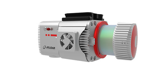
The JoLiDAR-1500 is a game-changer for aerial data acquisition. This innovative LiDAR system seamlessly integrates a high-precision laser scanner, an advanced navigation system, and a high-resolution camera, empowering professionals to capture the world in stunning detail. Its versatility allows it to be mounted on various drones, making it ideal for diverse applications like topographic mapping, powerline inspection, mining surveying, and much more.

High Precision
Capture intricate details with 5mm measurement accuracy and 1.5cm relative accuracy.
High Efficiency
Map up to 53km² on CW-25E in a single flight (50% overlap, 500m relative height).

Extended Range
Capture detailed data from up to 1500 meters away at 80% reflectivity.

75° Field of View
Capture more data points per scan for detailed results.

7 Returns
Penetrate dense vegetation and complex environments

61MP Full-Frame Camera
Seamlessly synchronize high-resolution imagery with LiDAR data for comprehensive analysis

No Base Station or GCP Required
Operates freely over large areas without compromising accuracy.
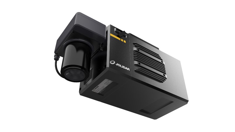
The JoLiDAR-1500 goes beyond just LiDAR data collection. It's equipped with a powerful Full-frame RGB Camera featuring a high resolution of 61MP and a large sensor size (35.7mm × 23.8mm). This camera captures detailed color images (9504 × 6336 pixels) with a 21mm focal length, providing valuable visual context alongside the rich LiDAR data.
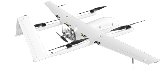
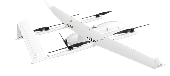
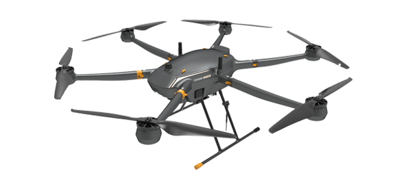
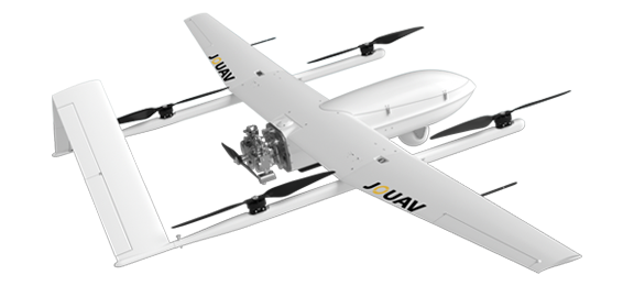
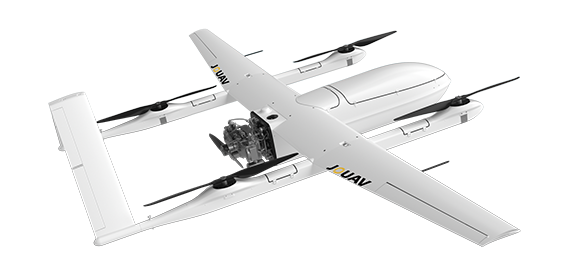
Compatible Drones
Pairing the JoLiDAR—1500 scanner with a drone makes LiDAR more accessible, and allows surveyors and other professionals to collect precise data quickly and easily. Let's see the compatible drones of JoLiDAR—1500.
Other Payloads
JOUAV is constantly updating its cameras and enriching its product lineups to provide a better data results and to meet customers' needs.
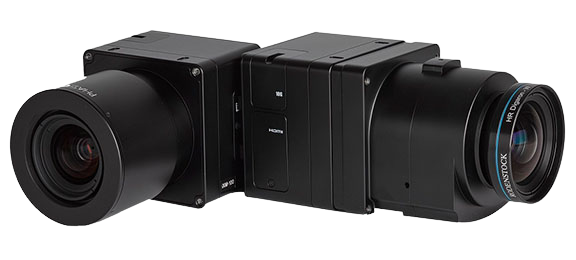
PhaseOne iXM Series Camera
High-resolution medium format cameras for mapping and surveying
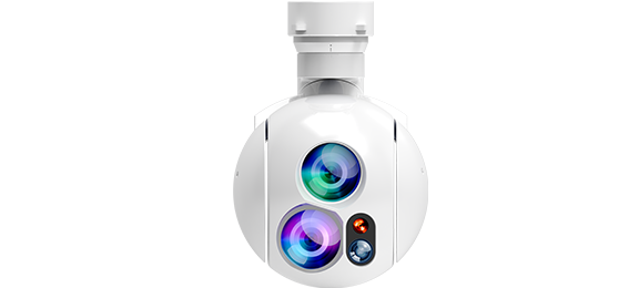
MG-120E EO/IR/LR Gimbal Camera
Lightweight 3-axis 30X optical zoom and thermal imaging with laser rangefinder
JoLiDAR-LR22
JoLiDAR-LR22 is a lightweight and long-range laser scanner for UAV surveying.

More information about JOUAV and our drones
Provide the suitable solution for your needs
Help for your project promotion
Get a product quote