Have you ever watched a drone hover effortlessly over a construction site, inspect a wind turbine blade, or deliver medical supplies to a remote village?
That drone was almost certainly a multirotor.
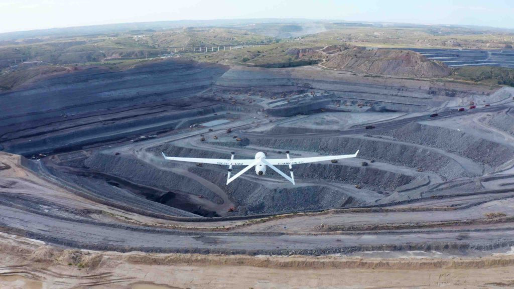
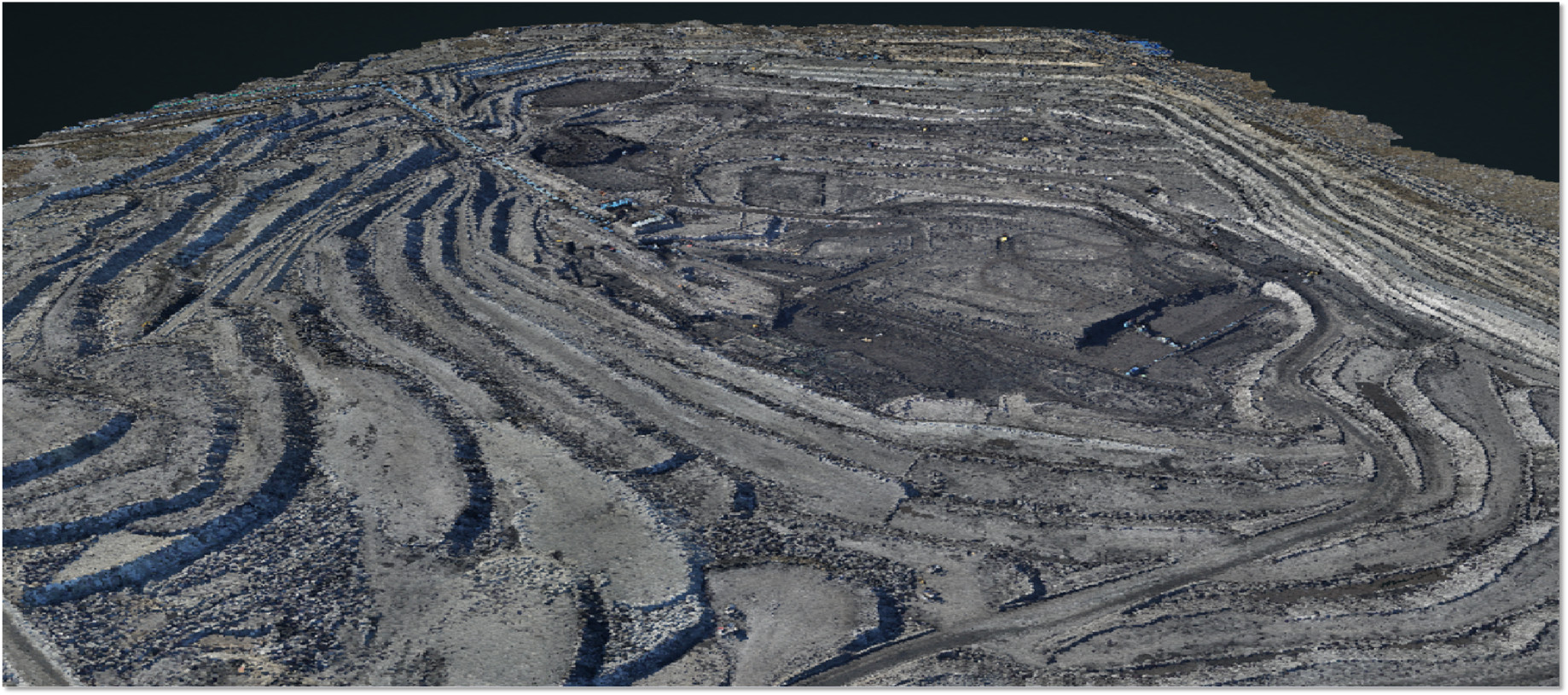
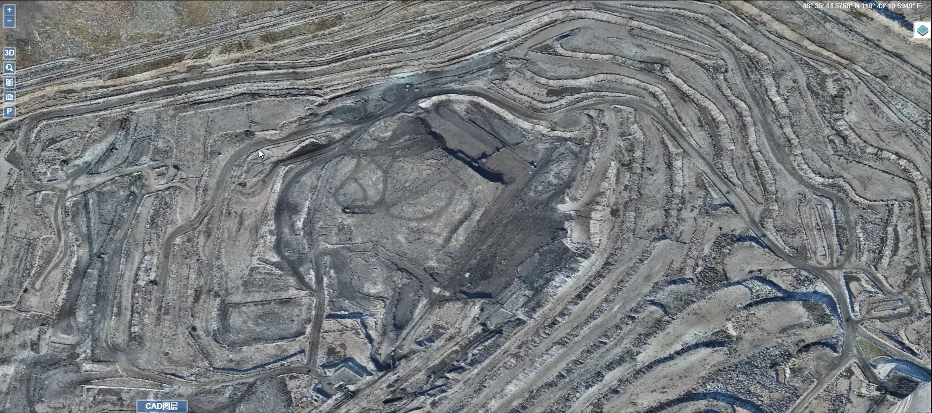
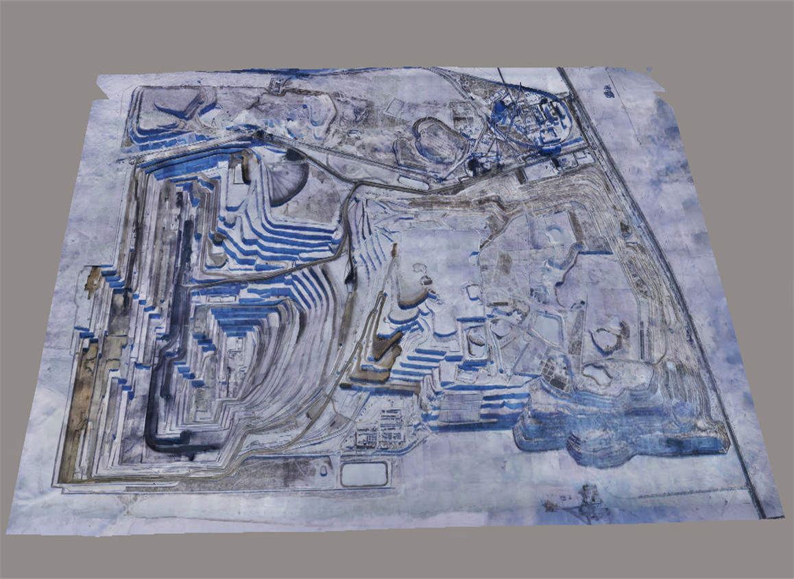
After relying on traditional ground surveys for three decades, Baorixile Open Pit Mine embraced the CW-25E UAV LiDAR technology.
This innovation not only facilitated a 6.5-fold increase in data collection efficiency but also brought about a substantial enhancement in overall in-house operations, boasting an impressive surge of nearly 180%!
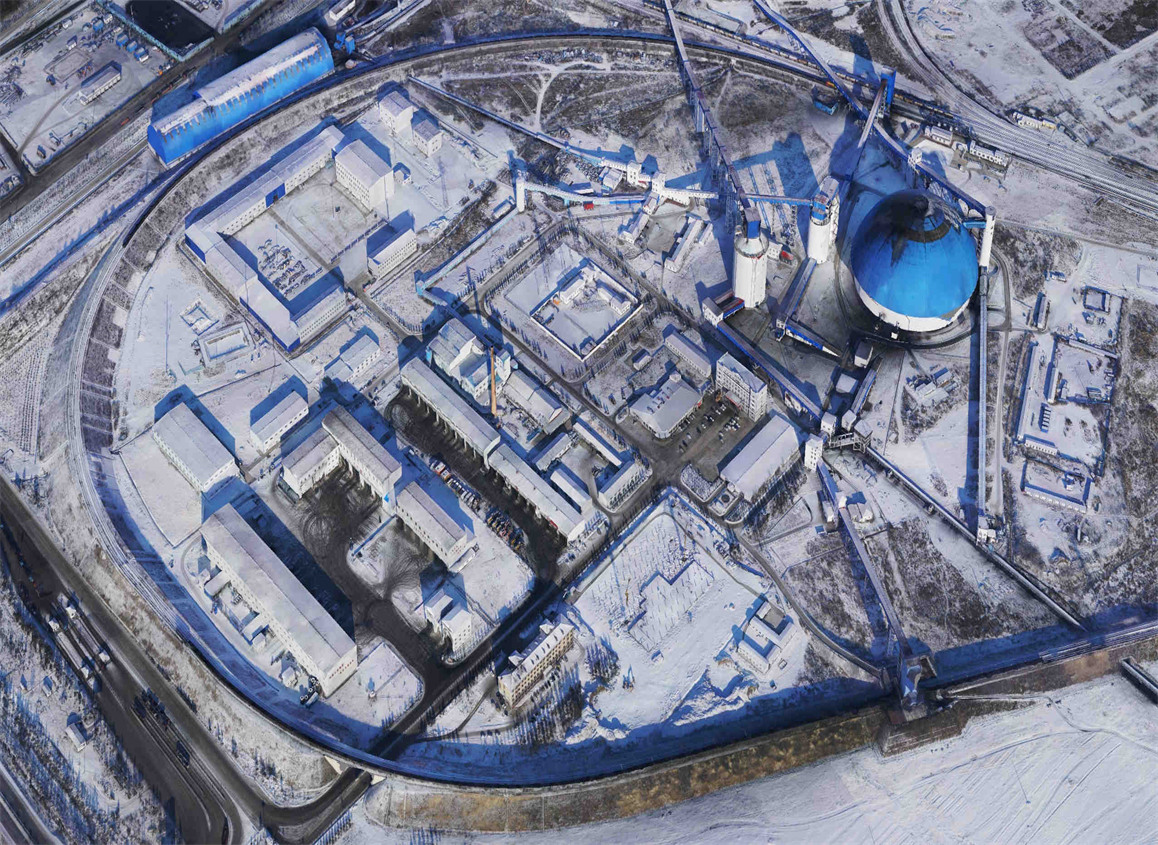
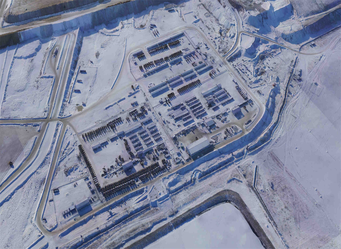
Nestled in Hulunbeier City, Inner Mongolia Autonomous Region, Baorixile Open Pit Mine is a key entity under the umbrella of China Shenhua Energy Co., Ltd.
As a sizable mine with an annual production capacity of 7 million tons, a mining license area spanning 50 square kilometers, and a coal resource reserve reaching a staggering 640 million tons, it plays a pivotal role in supporting China's coal mining industry.
However, the mine's geographical intricacies, coupled with the challenging climatic conditions unique to the frigid Inner Mongolia region, have made traditional measurement methods exceedingly complex.
Stuck in the Snow: Traditional Surveying Challenges
In the past, engineers used heavy equipment such as GNSS, total stations, and GPS to carry out measurements.
Still, in cold conditions, this equipment may face problems such as shortened battery life and frozen mechanical parts, which greatly increase the difficulty of the mapping task.
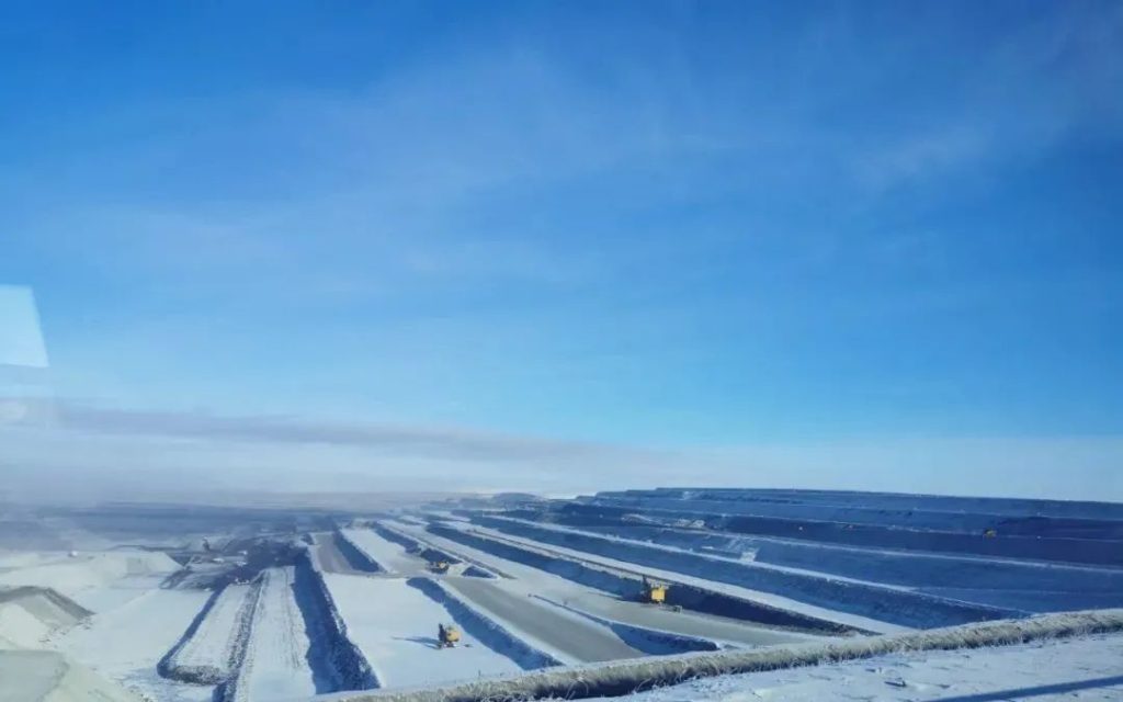
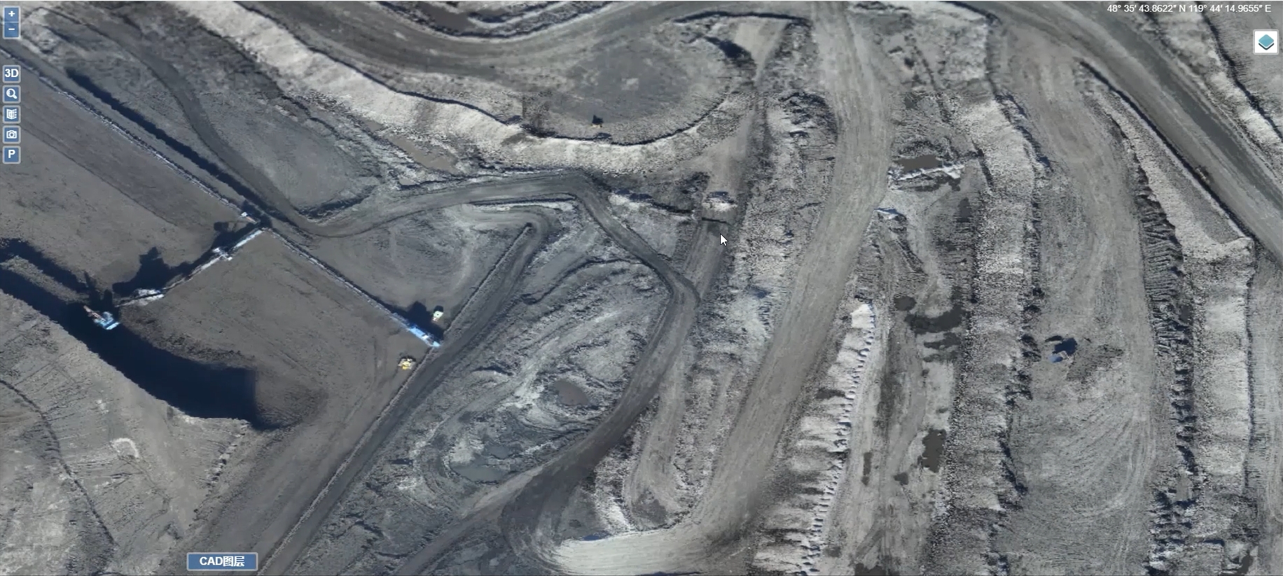
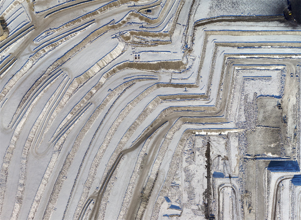
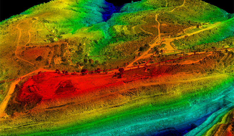
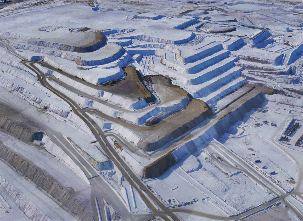
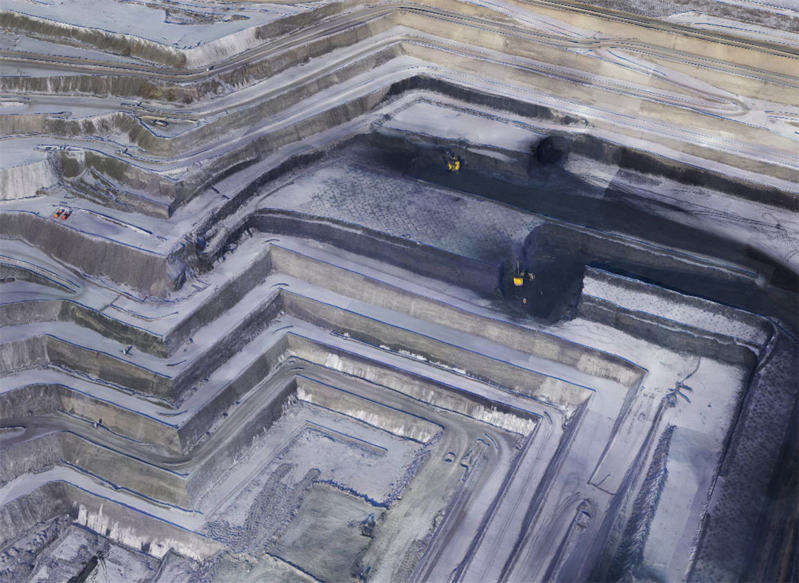
The snow-covered Baorixile open-pit mine not only captivates with its breathtaking aesthetics but also presents a unique challenge to mining operations.
Especially when measuring the stockpile volume, engineers need to move the ruler meter by meter and record the height change of each ore pile by observing the markers with optical equipment, which is monotonous and takes a long time to complete due to the freezing temperature.
Zhang Hao, a mining surveyor in the Production Technology Department of the Baorixile Open Pit Mine, points out: "Moving through the piles is a very dangerous task for the engineers. The complexity of the work is compounded by the large amount of water that accumulates when the snow melts. Considering that the stacks can be up to 12 meters high, this makes the work extremely dangerous, as sometimes bulldozers may be operated on top of the coal piles during the measurement process."
Therefore, to address these issues, Baorixile decided to adopt drone surveying technology to gain detailed information and insights about the mine more frequently, more accurately, and more safely.
After evaluating several drone mapping solutions, the company ultimately chose the CW-25E LiDAR drone mapping solution, equipped with RTK, PPK, and long-range JoLiDAR-LR22S LiDAR.
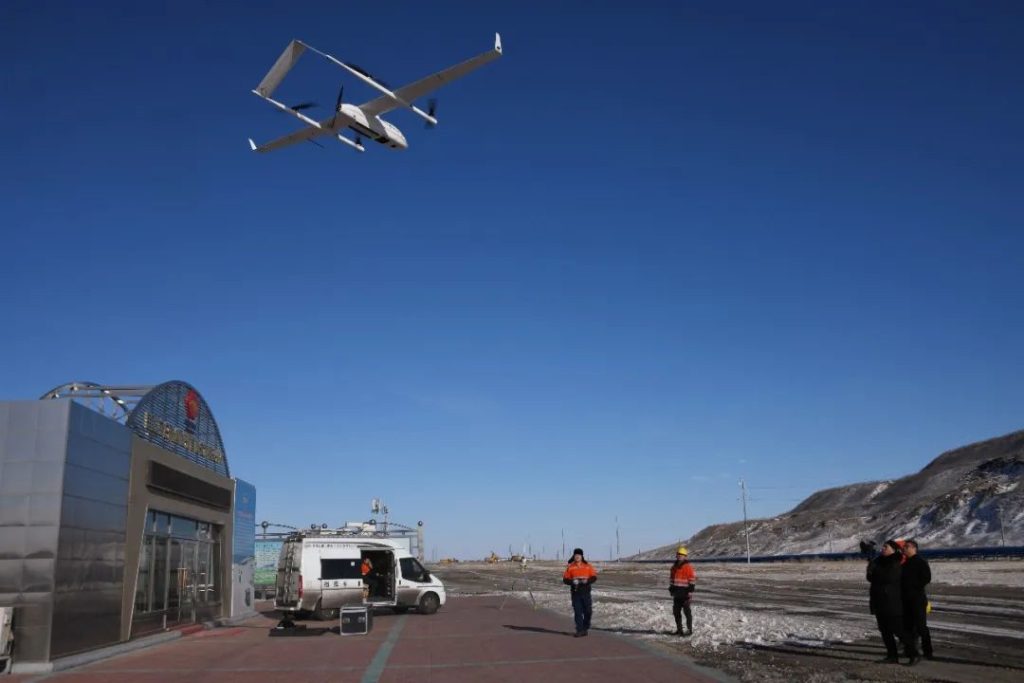
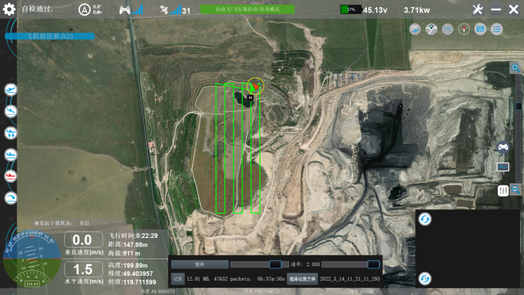
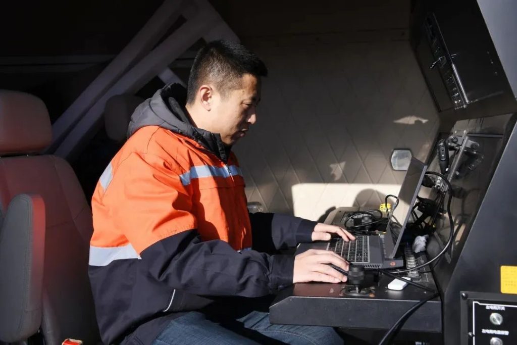
Zhang Hao effortlessly guides the CW-25E into takeoff, a UAV so user-friendly that 2 operators are all it takes. Meanwhile, other team members keep a close eye on crucial flight parameters from JOUAV's mobile UAV command and control vehicle.
China's First UAV LiDAR Survey System in an Extremely Cold Environment (Below -35 °C)
Plateau Adaptability
The CW-25E stands out with its exceptional plateau adaptability, boasting the ability to take off from elevations as high as 4,000 meters and effortlessly cruise at 6,000 meters.
This capability is made possible by advanced heated and drained airspeed tube technology, ensuring safe flight in challenging environments, including plateaus, high humidity, low temperatures, and light rain.
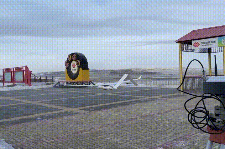
The CW-25E VTOL drone gracefully ascends into the sky, lifting off from the ice-covered expanse of the Baorixile open-pit mine.
Extended Flight Time and Range
The CW-25E boasts an impressive 240 minutes of flight time, coupled with a cruising speed of 72km/h and a range of 200km.
This extended capability allows for efficient data acquisition during large-scale mining missions, significantly improving productivity.
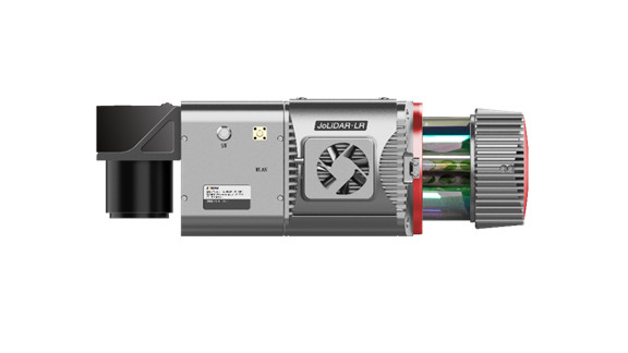
JoLiDAR-LR22S LiDAR System
The integrated JoLiDAR-LR22S is a game-changer, combining LiDAR, GNSS, inertial guidance, and a camera multi-sensor system.
With a 1,845-meter-long-range laser scanner, it achieves a remarkable measurement rate of 1.5 million points/second.
This high-density point cloud data acquisition enables precise mapping in a short period, essential for detailed mining site analysis.
Mobile Drone Command & Control Vehicle
To adapt to the harsh operating environment in mining areas, the JOUAV Mobile Drone Command & Control Vehicle adopts a high-performance chassis with unlimited driving capability, ensuring convenient deployment at any time.
Designed to withstand perennial extreme cold weather, the command and control vehicle provides a humanized indoor operating space for field operators.
Multiple redundancies in data links, ground charging, and power supply guarantee enhanced safety and reliability during drone operations, significantly increasing their utility.
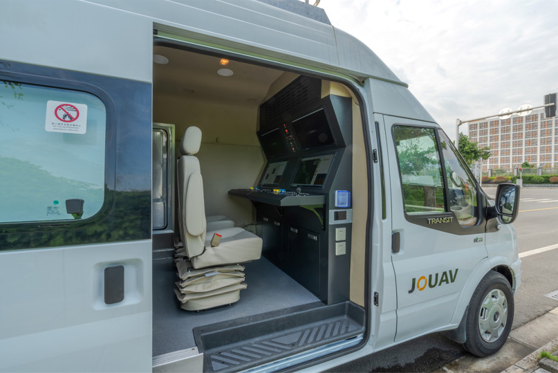
With a high-performance chassis, the JOUAV Mobile Drone Command navigates the challenging terrain effortlessly, providing unlimited driving capability for convenient deployment.
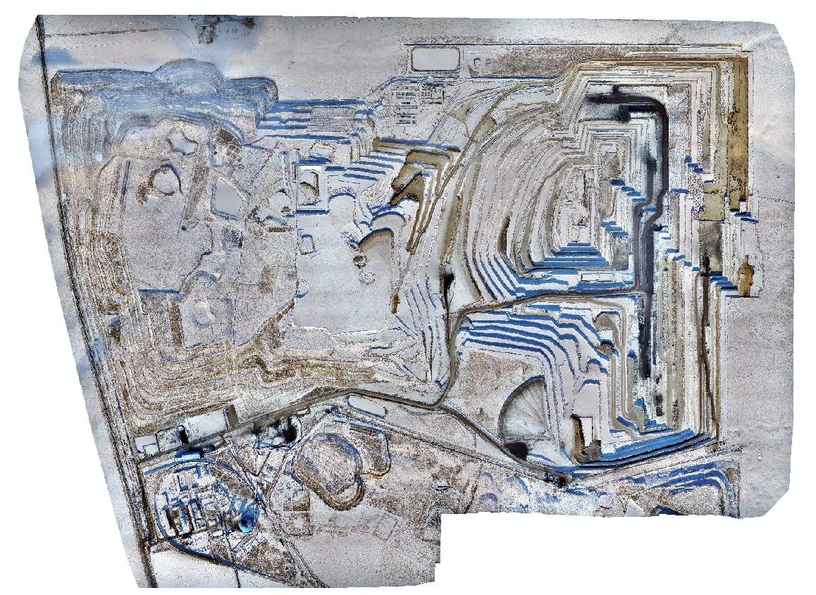
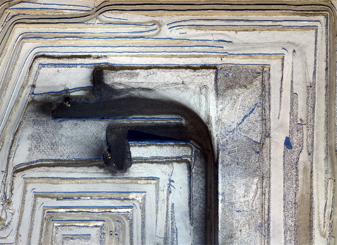
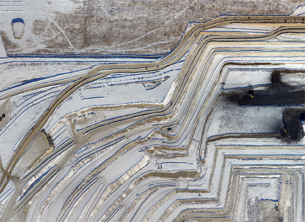
Open Pit Mine Digital Surveying System
Complementing the hardware, JOUAV offers an open pit mine digital surveying system tailored to Baorixile's needs.
This system facilitates automatic DEM extraction, slope top/bottom line extraction, earthwork quantity calculations, and early detection of geologic hazards.
This comprehensive digital solution empowers Baorixile to manage the mine efficiently, boost productivity, and ensure the safety of both the environment and personnel.
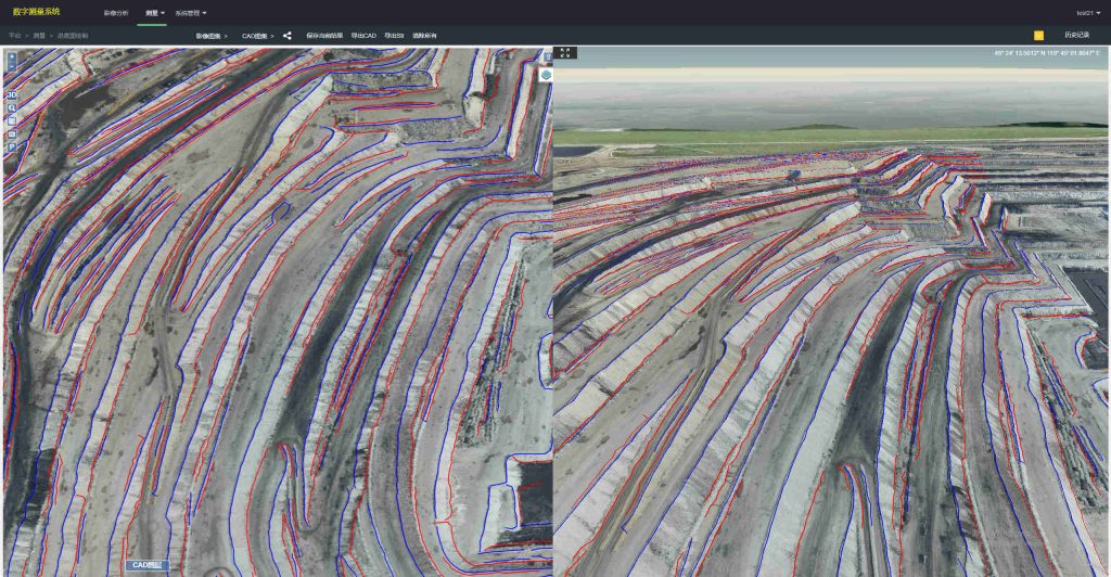
The JOUAV Open-Pit Mine Digital Measurement System's automatic extraction feature minimizes manual intervention, reducing the risk of human error and significantly speeding up the surveying process.
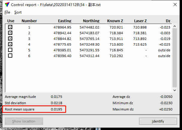
Point Cloud Accuracy Down to 1cm
Zhang Hao's team recently shared insightful data reports derived from two successful flight missions employing the CW-25E drone lidar system.
The practical applications of high-density point clouds in mine exploration and environmental monitoring were exemplified through these missions.
Mine Exploration Flight
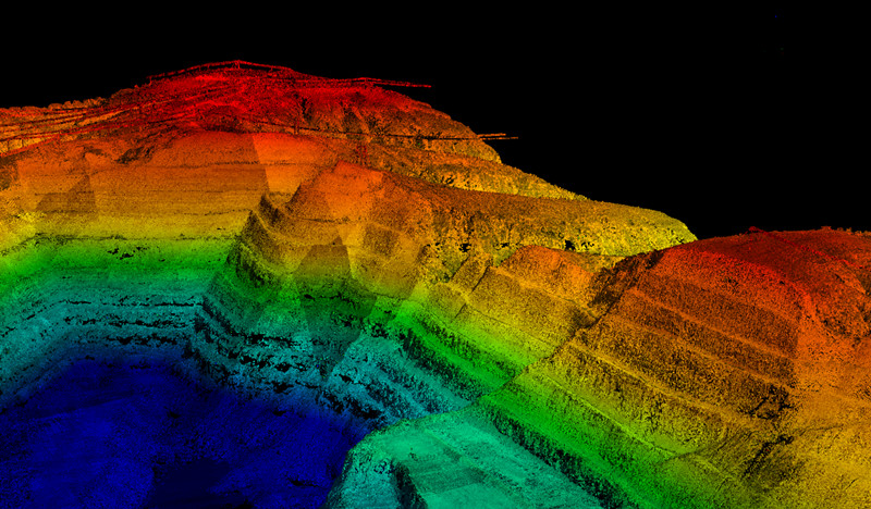
In the first data collection mission, the team utilized the CW-25E VTOL UAV equipped with JoLiDAR-LR22S LiDAR to cover the entire mine area.
The drone, maintaining a stable flight attitude, collected high-density point cloud data, crucial for effective mine exploration.
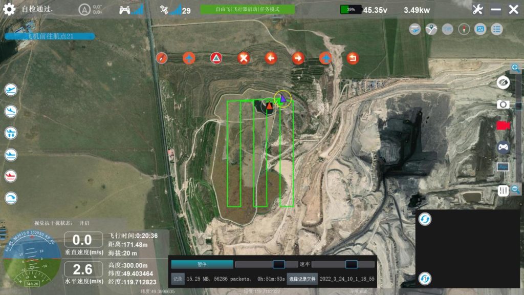
Key Parameters:
Cruise Speed: 22m/s
- Flight Altitude: 300m
- Route Length: 120km
- Flight Duration: 120min
- LiDAR Scanning Frequency: 800kHz
- Point Cloud Density: ~80 points/m²
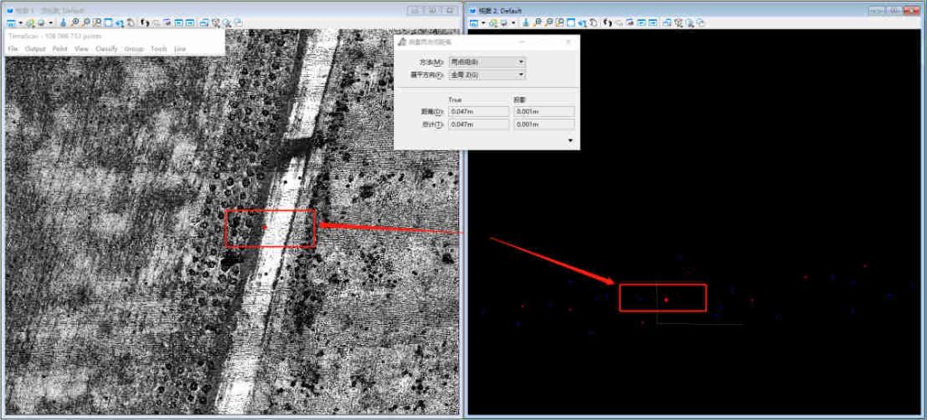
The point cloud data, processed using JOUAV's JoLiDAR post-processing software, revealed a seamless outcome with no stratification, a point cloud thickness of 4-7cm, and an elevation accuracy of 1.8cm.
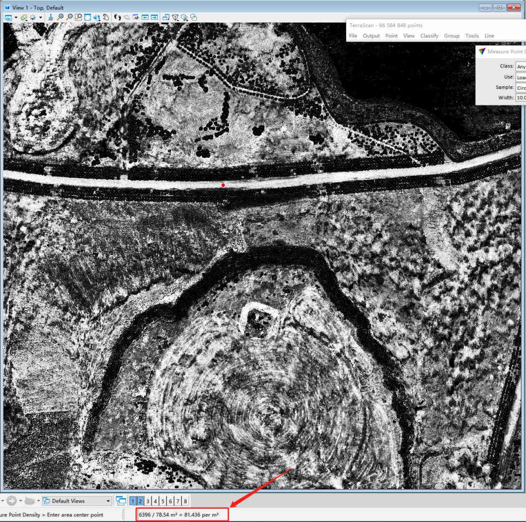
The point cloud density is 80 points/m².
The elevation accuracy is down to 1.8cm.
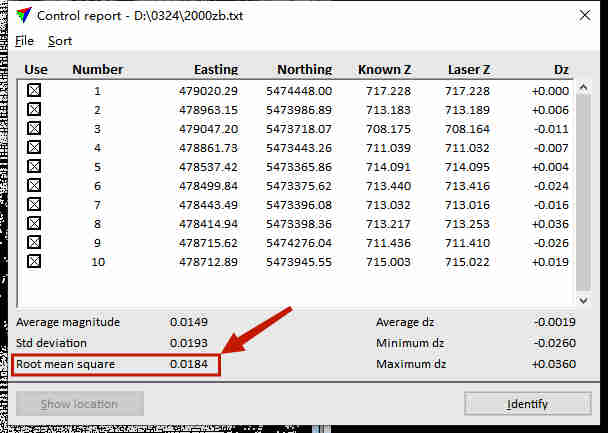
Environmental Monitoring Flight
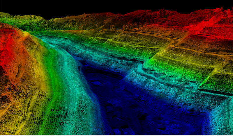
For the second data collection, the team took off from the west side of the mine, navigating the mine shaft with precision.
The VTOL UAV successfully avoided obstacles, including chimneys, providing comprehensive data on the mine's surroundings.
Key Parameters:
- Flight Speed: 9m/s
- Flight Altitude: 200m
- Route Length: 100km
- Flight Duration: 100min
- Laser Scanning Frequency: 800kHz
- Point Cloud Density: ~120 points/m²
Results indicated no layering, a point cloud thickness of 4-7 centimeters, and an impressive comparison between checkpoints and point cloud data, with an absolute error of 1-2 centimeters.
The point cloud thickness is 4-7 centimeters.
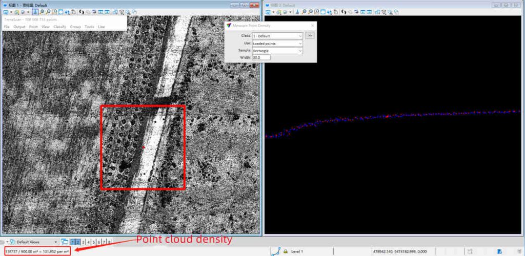
The point cloud density is 120 points/m².
The absolute error is down to 1-2 centimeters.
CW-25E Improve Overall LiDAR Mapping Efficiency by 6.5 Times
Zhang Hao's team enthusiastically commends the exceptional performance of the CW-25E LiDAR drone, heralding it as a game-changer in their data acquisition endeavors.
Over the past year, this cutting-edge technology has seamlessly integrated into their workflow, emerging as a powerful ally in the realm of data collection.
Notably, the frequency of site surveys, previously conducted twice a month, now showcases an impressive average duration of just 4 hours - an accomplishment that signifies significant time savings compared to previous methodologies.
Here is a detailed table comparing the efficiency and outcomes of measuring a 30 km² area using Traditional RTK Surveying and the CW-25E LiDAR System:
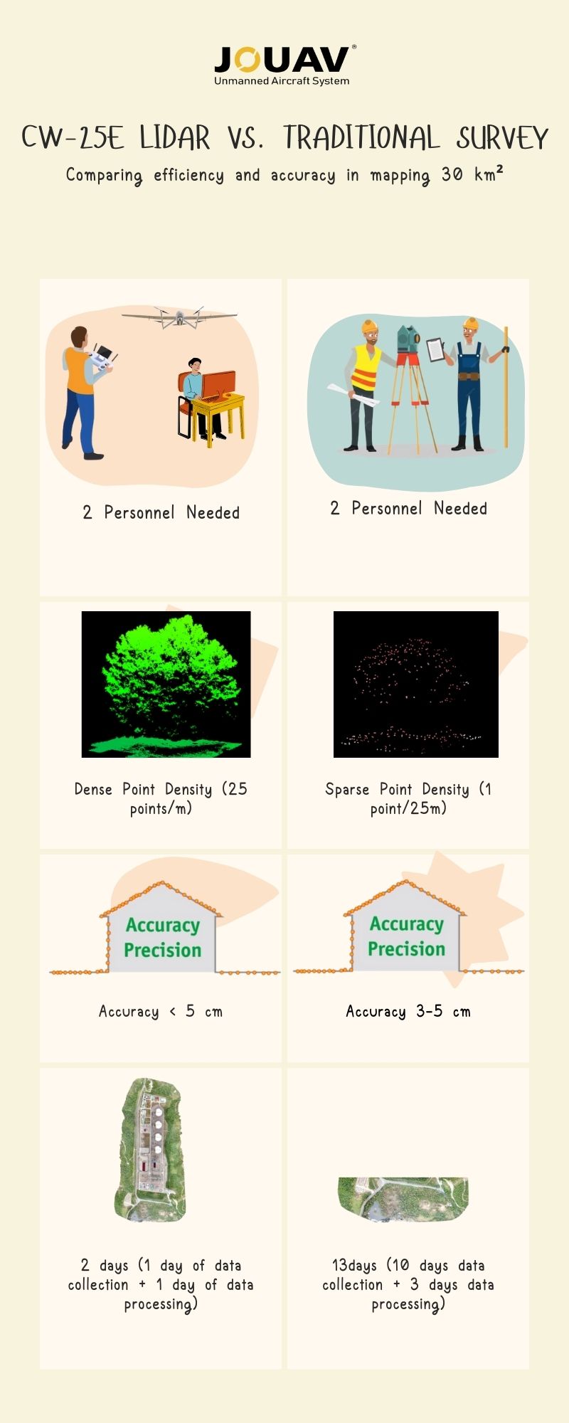
The CW-25E LiDAR System achieves a remarkable 125 times higher point density (25 points/m) compared to traditional RTK Surveying (1 point/25m), maintaining less than 5 cm coordinate accuracy. Data acquisition and processing time were slashed from 13 days to 2 days, making the overall LiDAR survey 6.5 times more efficient.
Beyond the compelling numerical gains, it's crucial to appreciate the profound impact on decision-making.
The expedited data collection not only optimizes operational efficiency but also empowers Zhang Hao's team with more timely and accurate information, significantly enhancing their ability to make well-informed decisions.
In Zhang Hao's words, "The speed and accuracy of the CW-25E have given us a real edge. We now have the data we need at our fingertips, allowing us to make critical decisions faster and with utmost confidence."
Oblique Photography: Seeing Every Detail
Baorixile recently acquired the cutting-edge CA-502 oblique camera from JOUAV, boasting a full frame of 210 million pixels for high-resolution and precise image capture.
This state-of-the-art camera delivers five essential POS parameters – longitude, latitude, elevation, heading, and pitch - facilitating seamless post-processing data analysis.
Even when operating at the challenging altitude of 800 meters, the CW-25E UAV demonstrates remarkable performance by achieving an impressive ground resolution of 7 cm, with horizontal and vertical errors down to 6 and 1 cm.
In Zhang Hao's words, "Our demand for varied UAV data sources, covering oblique photography, video surveillance, and multi-spectral imagery, is escalating. Looking ahead, we are exploring the acquisition of gimbal cameras from JOUAV to meet evolving requirements."
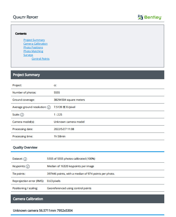
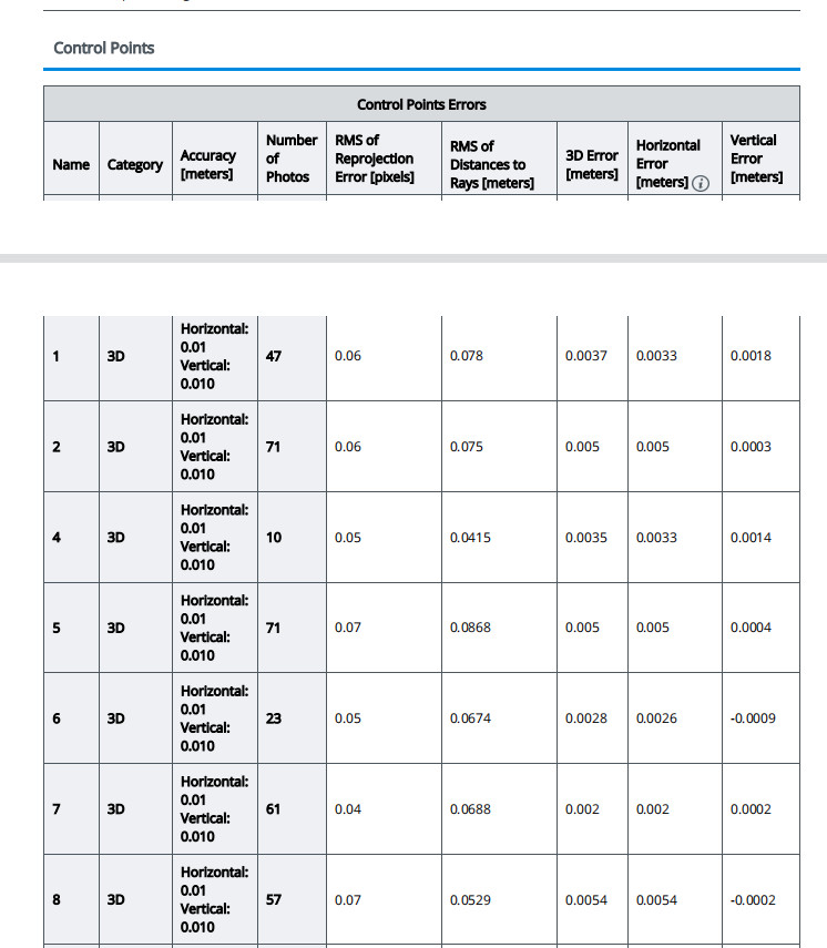
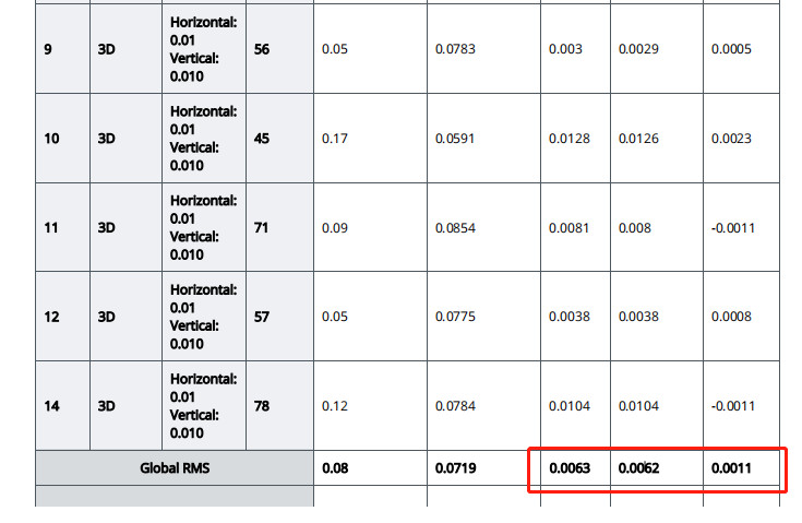
Zhang Hao's team has generously shared a comprehensive data report highlighting the impressive outcomes of their oblique photography endeavors.
The report showcases the acquisition of 5,555 images processed swiftly in just 1 hour and 58 minutes.
Remarkably, even at a challenging flight altitude of 800 meters, the ground resolution achieved an impressive 7 cm, with horizontal and vertical errors down to 6 cm and 1 cm, respectively.
These compelling statistics underscore the team's remarkable success in leveraging oblique photography to achieve unparalleled precision and efficiency in their surveying efforts.
Read More


Every drone needs a brain.
Without it, you’re holding an expensive paperweight with spinning blades.
That brain is called a flight controller—but most people have no idea what it actually does.

Let’s be honest: the drone world loves its acronyms. UAV, UAS, drone, RPAS, UCAV, FPV–it’s an alphabet soup. And most people use them like they’re the same thing.
They’re not.
And here’s why that matt

JOUAV Product News and Use Cases
Fixed-Wing VTOL Drones Insights and Industry Trends
Invitations to online demo events