Have you ever watched a drone hover effortlessly over a construction site, inspect a wind turbine blade, or deliver medical supplies to a remote village?
That drone was almost certainly a multirotor.
What is BVLOS in Drones?
BVLOS, or Beyond Visual Line of Sight, refers to drone operations conducted outside the direct visual range of the remote pilot. In simpler terms, it means flying a drone so far away that the operator can no longer see it with their naked eye or without the help of any visual aids like binoculars.
In contrast to standard drone operations, where the pilot must maintain Visual Line of Sight (VLOS), BVLOS enables drones to cover greater distances, automate tasks, and conduct long-range missions without the need for human spotters along the route.
How Do BVLOS Drones Work?
BVLOS drones operate using a combination of autonomous flight systems, real-time data links, advanced GPS, and sense-and-avoid technologies that enable them to fly safely without direct human visual oversight. These systems work together to ensure that the drone can not only execute its mission efficiently but also avoid collisions and comply with airspace regulations.
Let’s break down the key components that make beyond visual line of sight drone operations possible.
1. Autonomous Flight Systems
At the heart of BVLOS operations is the drone’s autonomous navigation system. Unlike traditional VLOS drones that rely heavily on manual input from the pilot, BVLOS UAVs are equipped with onboard computers that can execute pre-programmed flight plans, adjust to real-time conditions, and make decisions without pilot intervention.
These systems allow drones to:
- Fly extended routes without real-time control
- Automatically return to home or a safe landing site if communication is lost
- Adapt to GPS drift or wind changes mid-flight
For complex missions, this autonomy is often paired with cloud-based fleet management platforms, enabling multiple BVLOS drones to be monitored and controlled remotely.
2. BVLOS GPS and Real-Time Navigation
Precise Global Positioning System (GPS) and GNSS (Global Navigation Satellite System) technologies are crucial for BVLOS operations. They allow the drone to:
- Accurately follow flight paths even over long distances
- Geotag images and data with high positional accuracy
- Maintain stable flight in areas where no pilot can visually verify their position
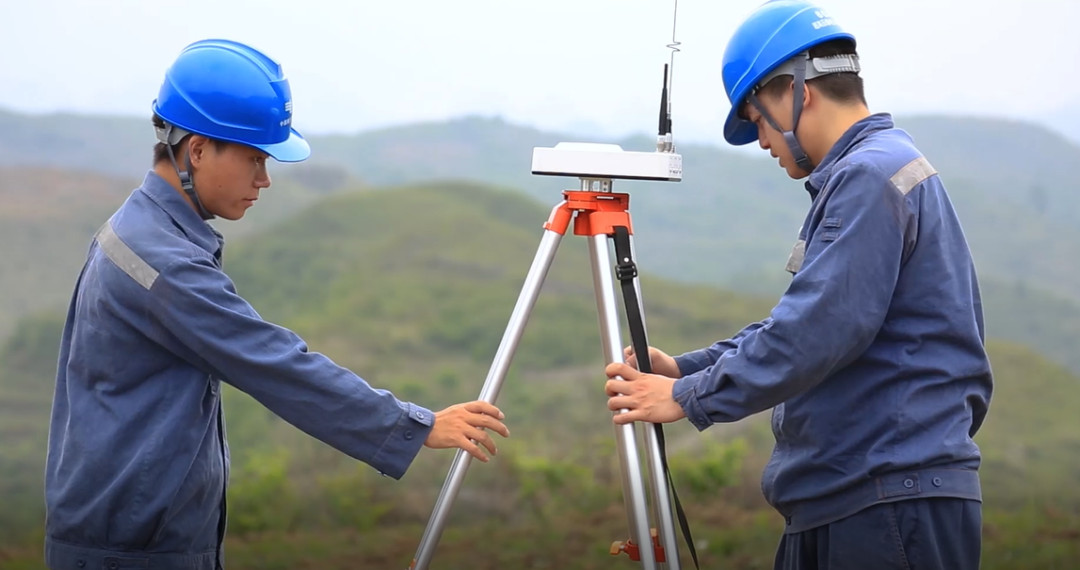
Many BVLOS drones also incorporate RTK (Real-Time Kinematic) or PPK (Post-Processed Kinematic) GPS systems for centimeter-level accuracy, which is especially important in BVLOS drone surveying, mapping, and inspections.
3. Command and Control (C2) Links
To operate safely beyond the operator’s view, BVLOS drones use robust Command and Control (C2) data links, which maintain constant communication between the UAV and the Ground Control Station (GCS). These links can be supported by:
- Cellular 4G/5G networks
- Satellite communications (SATCOM)
- Radio frequency (RF) systems on licensed frequencies
These channels transmit live telemetry, location, and health status data, ensuring that the drone can be tracked in real time and manually overridden if necessary.
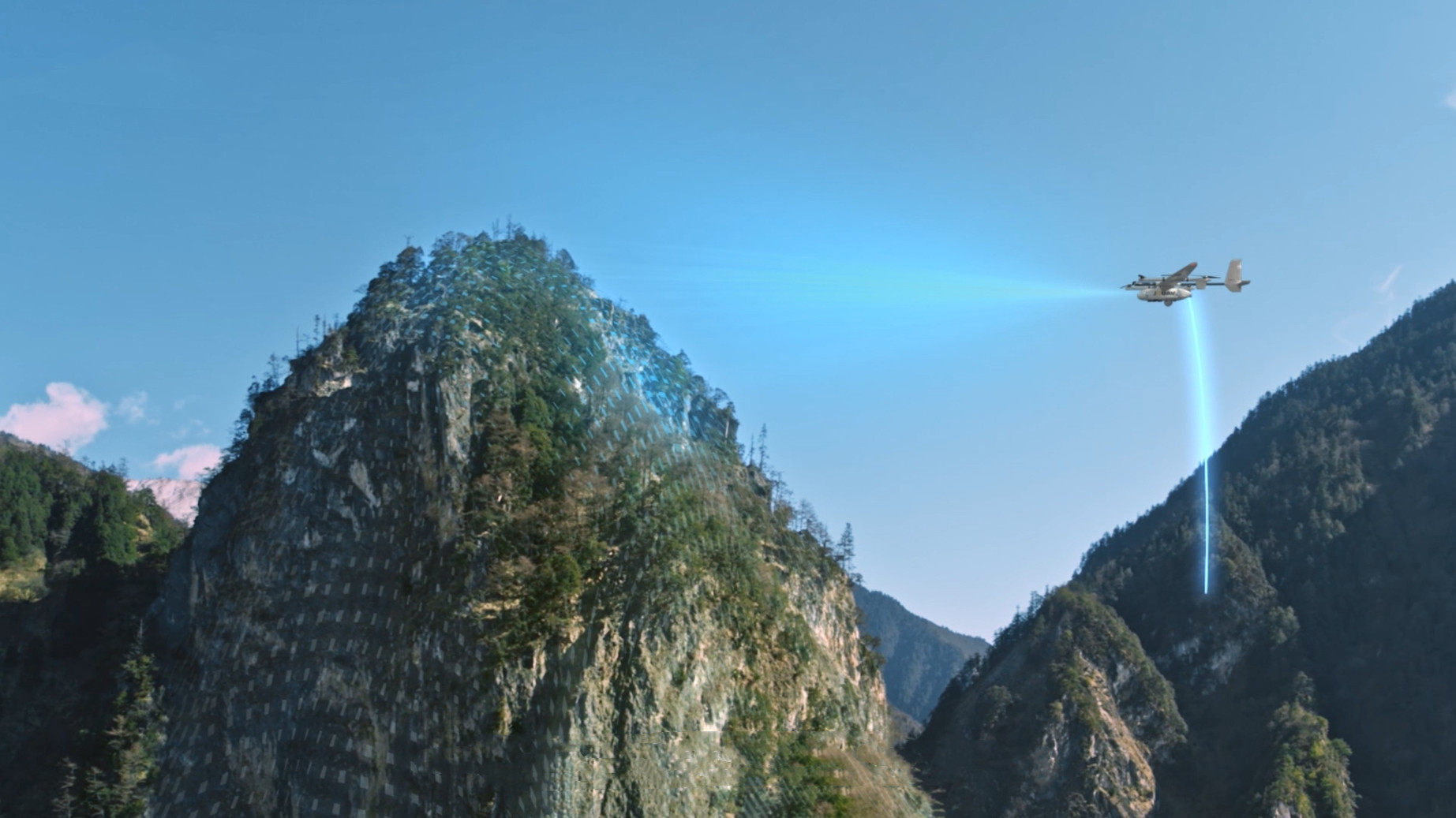
4. Detect-and-Avoid (DAA) Systems
Since BVLOS drones do not rely on human visual awareness to avoid collisions, they must be equipped with Detect-and-Avoid (DAA) or Sense-and-Avoid systems. These technologies allow drones to identify and maneuver around obstacles such as:
- Manned aircraft
- Birds
- Power lines or structures
- Other UAVs
- DAA systems may include:
- Radar sensors
- Optical and infrared cameras
- ADS-B (Automatic Dependent Surveillance–Broadcast)
- LiDAR-based collision avoidance
Without effective DAA systems, FAA BVLOS approval is unlikely, especially in shared or uncontrolled airspace.
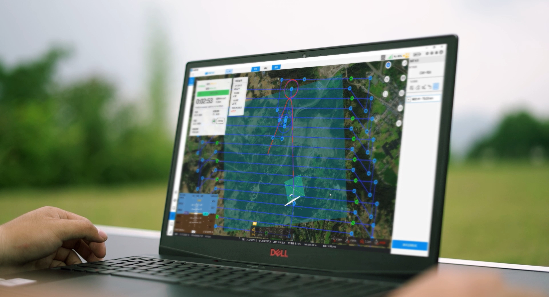
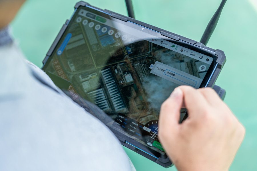
5. Ground Control Station and Remote Monitoring
A Ground Control Station (GCS) or remote operations center monitors every aspect of the flight. Operators can receive:
- Live video feeds
- System alerts
- Navigation data
- Emergency override options
Modern BVLOS drone companies offer cloud-connected platforms that allow multi-drone coordination, centralized fleet management, and fail-safe protocols in the event of link loss or flight anomalies.
6. Airspace Integration and Remote ID
To legally fly BVLOS, the drone must be integrated into the broader civil airspace. This often includes:
- Remote ID broadcasts, allowing authorities and nearby aircraft to track the drone’s position
- Real-time airspace awareness tools to avoid no-fly zones or conflicts
- Compliance with BVLOS FAA regulations, including pre-flight airspace authorization and active communication with air traffic control (in some scenarios)
Best Drones for BVLOS on the Market
Drones used in BVLOS operations must combine long-range communication, extended endurance, reliable navigation, and robust safety features.
JOUAV CW-30E - 200km (124 miles)
This hybrid VTOL drone is built for maximal coverage. Its long-wing design and fuel/battery mix give it up to 480 minutes of endurance, while an 8 kg payload bay supports cameras, LiDAR, or other sensors. Crucially, the CW-30E uses a 1.4 GHz radio link (strong penetration and low interference) to maintain comms for >100 km without dropout.
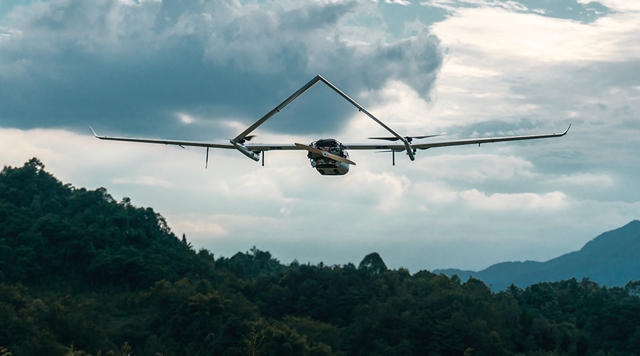
Advanced features like onboard RTK/PPK GNSS correction, an autonomous flight planner, and real-time obstacle avoidance (multi-direction radar and ADS-B) make it safe and precise.
In practice, users have demonstrated stable live video and control at >100 km, even in challenging RF environments. In short, the CW-30E’s advantage is extreme range and endurance with enterprise-grade reliability, though it comes at a premium cost.
Quantum Trinity F90+ - 100km (62 miles)
A VTOL fixed-wing optimized for surveying and mapping. It offers dual interchangeable payloads (42 MP high-resolution RGB plus an NDVI multispectral camera) for simultaneous imaging or vegetation analysis.

With a 100 km flight range and ~90 min endurance, the Trinity F90+ covers large areas on a single sortie. It includes precision PPK/GNSS support via Quantum-System’s iBase ground station, enabling sub-decimeter geotagging.
Live air-traffic awareness (ADS-B in) and advanced mission software (QBase 3D planning/monitoring) simplify BVLOS missions. The fixed-wing hull provides inherent efficiency and a smooth camera platform (with damped gimbals), while its VTOL capability avoids awkward belly landings.
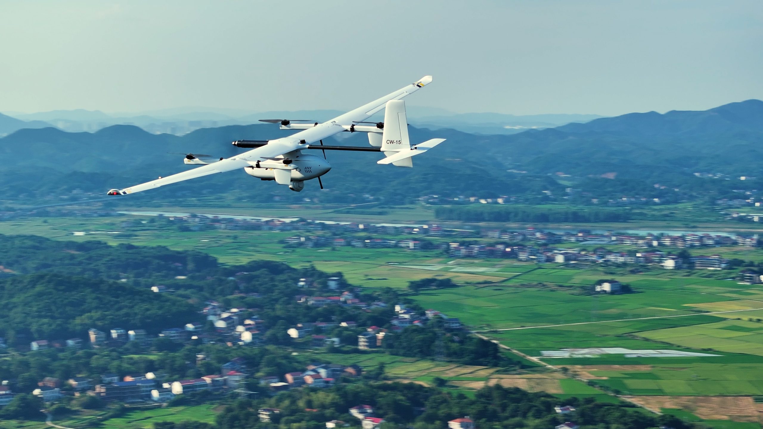
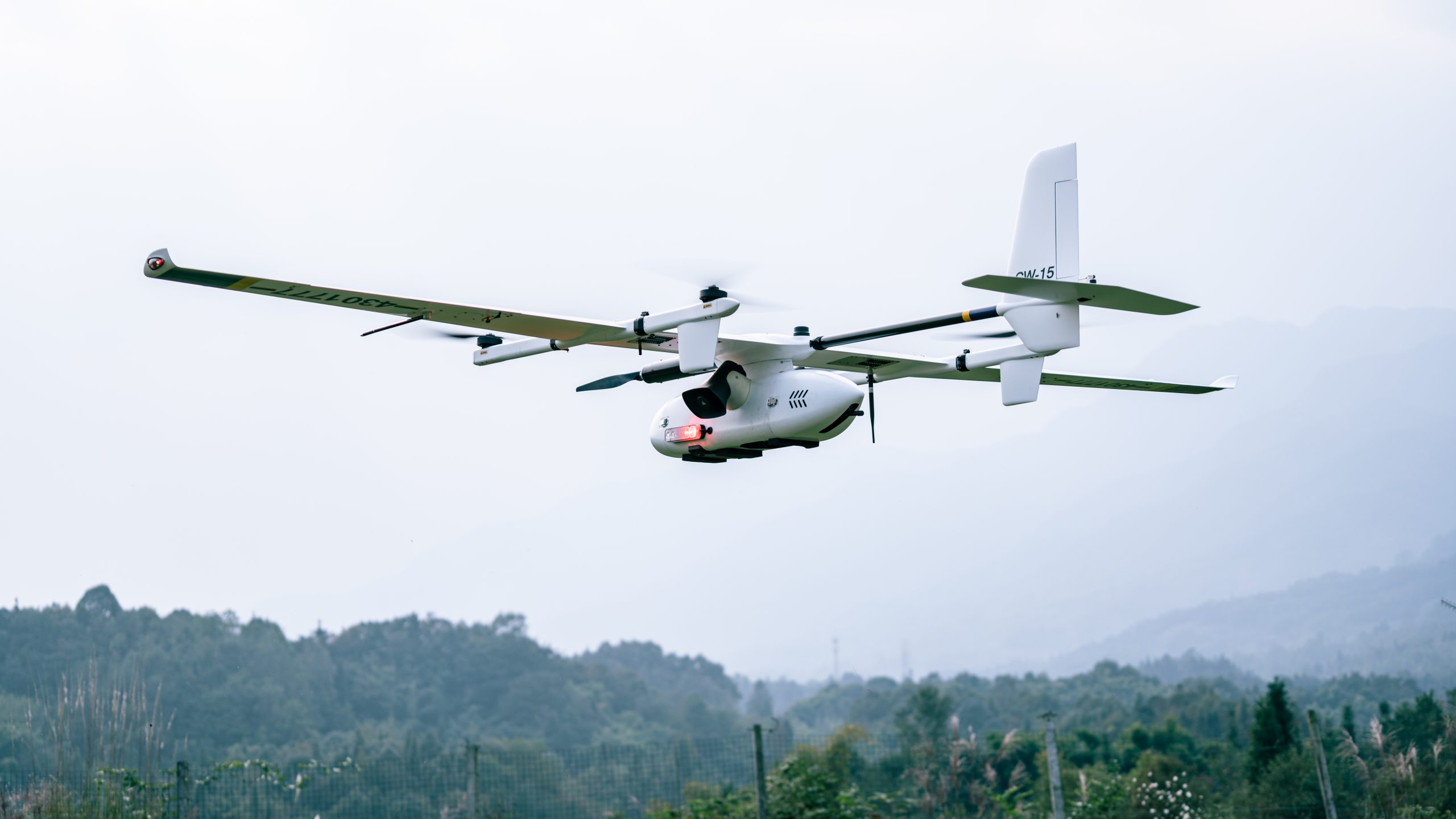
JOUAV CW-15 - 50km (31 miles)
A smaller VTOL fixed-wing designed for rapid response and medium-range BVLOS. With ~180 min flight time and a 3 kg payload, it’s tailored for tasks like public safety, pipeline patrol, and wildfire monitoring.
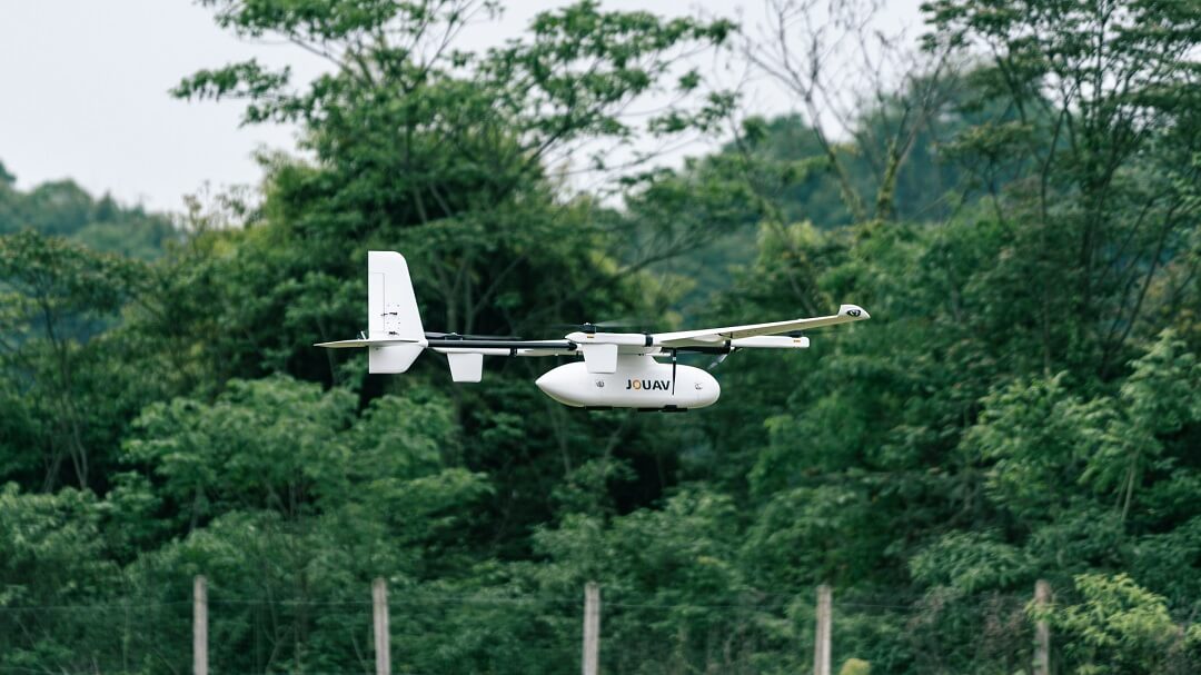
It supports dual-link communication (configurable 30 km or 50 km range) and uses the same 1.4 GHz modem for robust links. One notable feature is its MG-120E AI-integrated gimbal (thermal + EO) for automated fire/smoke detection.
As with the CW-30E, the CW-15 includes RTK/PPK GNSS, a modular SDK for custom software, and autonomous flight modes (waypoint, terrain-following). Safety is also built-in: it has multi-direction obstacle sensors, ADS-B, auto-return on signal loss, and a quick-deploy VTOL platform for rapid launch. Users report solid control and clear imaging at 50 km distance.
DJI Matrice 350 RTK - 20km (12 miles)
A modern quadcopter aimed at industrial inspection and mapping. The M350 RTK builds on the Matrice 300’s pedigree with better link range (up to 20 km), lighter weight, and 2.7 kg payload capacity.
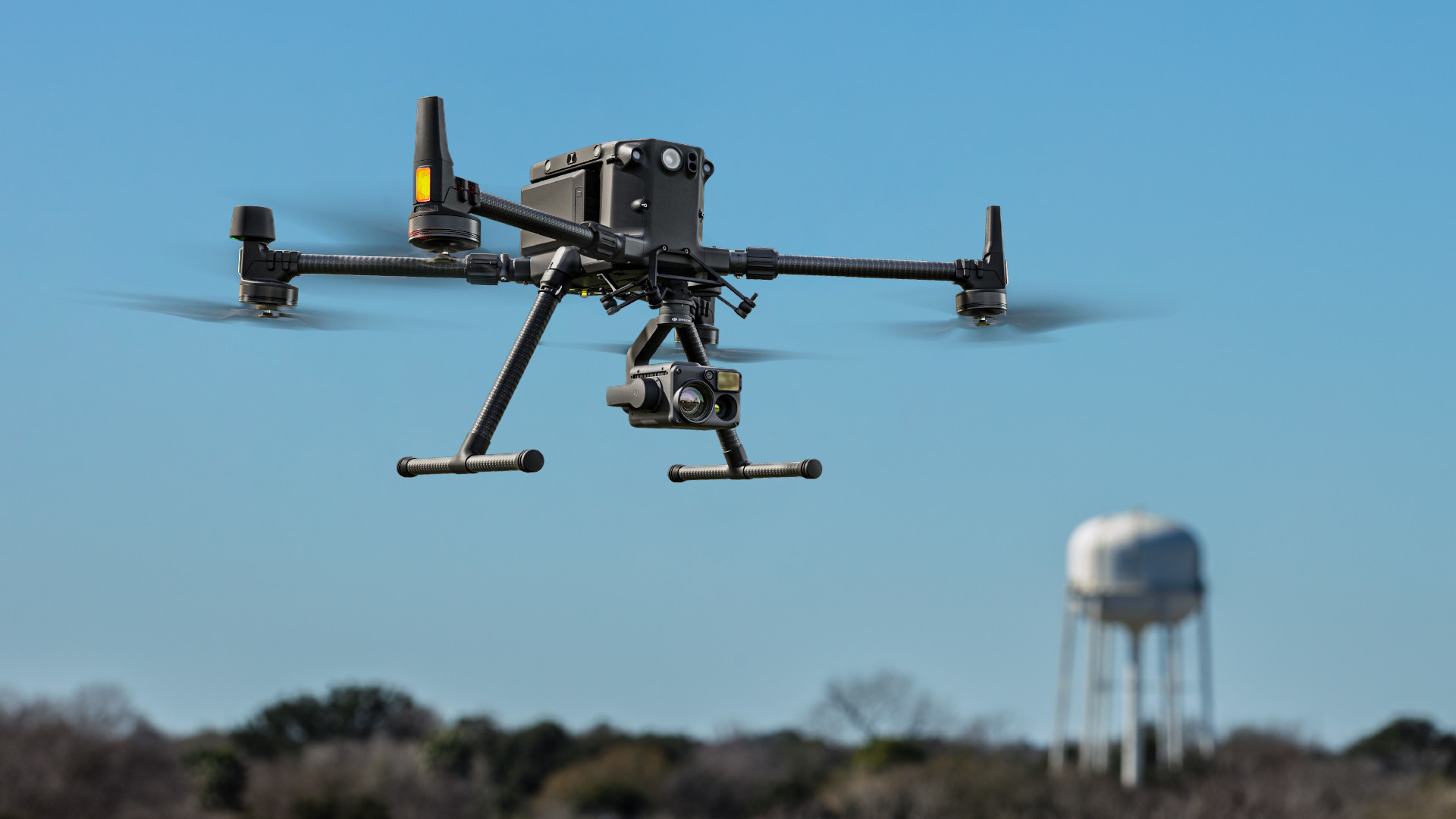
It features multi-band GNSS plus onboard RTK for centimeter accuracy and improved video transmission (DJI’s O3+ 1080p/60fps system with quad-antenna design) to maintain crisp live feed up to its range.
With compatibility for high-end dual-sensor gimbals (e.g., 20 MP zoom + 12 MP wide + LRF), obstacle sensing on six sides, and swappable batteries (43+ minutes of flight), the Matrice 350 RTK is highly capable. Its advantages are precision and versatility: enterprise-grade positioning, strong anti-interference comms, and support for two cameras or thermal+RGB setups.
DJI Matrice 3 Pro - 15km (9.3 miles)
A new high-end prosumer/enterprise quadcopter. It sports a triple-camera array (24 mm wide Hasselblad, 70 mm medium tele [3x], and a long tele 166 mm). This configuration delivers cinematic 4/3″ imaging plus two telephoto views in one flight. It can record up to 5.1K video (30 fps) and 4K at 120 fps for slow motion.
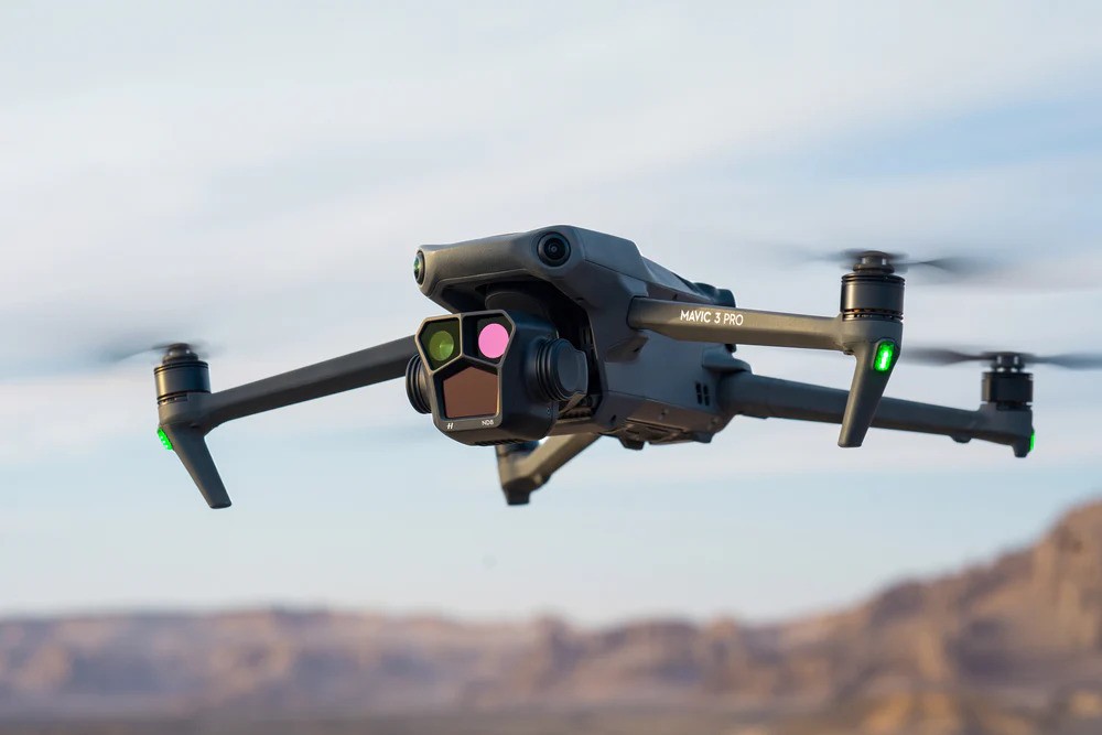
The M3 Pro also includes omnidirectional obstacle sensing and RTK/GNSS support. Its 15 km O3+ transmission allows extended-range control, though in practice operators typically fly it tens of kilometers BVLOS.
The main advantage is superior imaging flexibility: multi-lens capability and high-resolution video (including DJI’s ProRes in Cine models), all in a compact, relatively lightweight platform. It appeals to agencies needing both visual and thermal/zoom imagery in one UAV (with the optional payload).
How to Choose a BVLOS Drone?
Selecting the right BVLOS drone is a strategic decision that impacts the success, safety, and legality of your operations.
1. Standard Remote ID Compliance
A BVLOS drone must comply with your country’s aviation authority requirements for identification and tracking—often referred to as Remote ID. In many regions, compliance means more than just attaching an external broadcast module; your drone must be certified or listed in the national drone compliance database.
Always confirm that the drone’s model and serial number are registered where required. This step is critical when applying for BVLOS permissions or operating in controlled airspace.
2. Airspace Awareness: ADS-B In
While not mandatory for every BVLOS mission, many authorities (like the FAA) strongly prefer drones equipped with ADS-B In technology, which allows the drone operator to detect nearby manned aircraft.
The JOUAV FlightSurv system, for example, displays real-time manned aircraft positions on the controller. Other drone manufacturers also integrate this to enhance situational awareness.
3. Visibility: Anti-Collision Lights
For safety and visibility, your drone should include anti-collision lighting visible from at least 1 statute mile during daylight hours. While some drones offer this built-in, others may require aftermarket lights.
For drone-in-a-box systems, built-in lighting is usually required unless your deployment system can attach lights autonomously.
4. Telemetry and Situational Data
The ground control station (GCS) must show real-time telemetry for position, altitude, direction of flight, and flight mode. This data is essential for remote pilots and supporting crew to maintain full awareness during BVLOS flights.
Systems lacking these capabilities may struggle to pass waiver evaluations or pose a safety risk in complex operations.
5. System Warnings and Alerts
A reliable BVLOS drone should provide both visual and audible alerts for three critical failure types:
- Degraded system performance
- UAS malfunctions
- Loss of command and control (C2) link
Many platforms claim to offer alerts, but few provide comprehensive notification coverage in all three categories—make sure yours does.
6. Communication Reliability and Antenna Elevation
Maintaining a solid control and telemetry link is essential for BVLOS flights. Some handheld units may have limited range unless the operator is elevated, such as in a vehicle or bucket truck.
Consider drones that allow for external, elevated antennas or support long-range data radios and 4G/5G modules to improve connection stability, especially near trees or structures.
7. Latency and Communication Quality
BVLOS operations rely on near-real-time data, especially for detect-and-avoid functions. A drone system with high latency—especially when using satellite or cellular links—can compromise safety.
As a benchmark, command latency should ideally be under 500 milliseconds. JOUAV drones, for example, transmit 1080p HD video with just 300 ms latency, offering reliable performance for time-sensitive operations.
8. Operations Over People (OOP) Approval
If your mission involves flying over people or roads, you’ll need an FAA Declaration of Compliance for Operations Over People, not just Remote ID. If your drone lacks this, alternatives like parachute recovery systems may be necessary.
These must deploy reliably and be operable even if the main C2 link is lost, so double-check transmitter range and redundancy.
9. Total System Cost
Don’t just look at the upfront drone price—consider the total cost of ownership, including:
- Software subscriptions
- Regulatory and waiver consulting fees
- Detect-and-avoid sensor systems (e.g., radar, optical, Casia G)
- Battery costs and charging infrastructure
- Export compliance (for foreign-manufactured drones)
- Parachutes and emergency systems
High-end BVLOS systems may cost upwards of $100,000 once fully equipped and certified.
10. Field-Tested Communication Range
Lab specs don’t always translate into field performance. In areas with dense vegetation, hills, or buildings, radio signal degradation is a major concern.
Before committing, test your drone’s actual range under realistic conditions—especially if you're planning shielded or low-altitude missions in environments like forests or industrial zones.
Application and Use Cases of BVLOS Drones
Below are key sectors where BVLOS drones are delivering exceptional value:
1. Public Safety and Emergency Response
Government agencies and first responders increasingly rely on BVLOS drones to cover vast areas rapidly and safely during emergencies.
Use Cases:
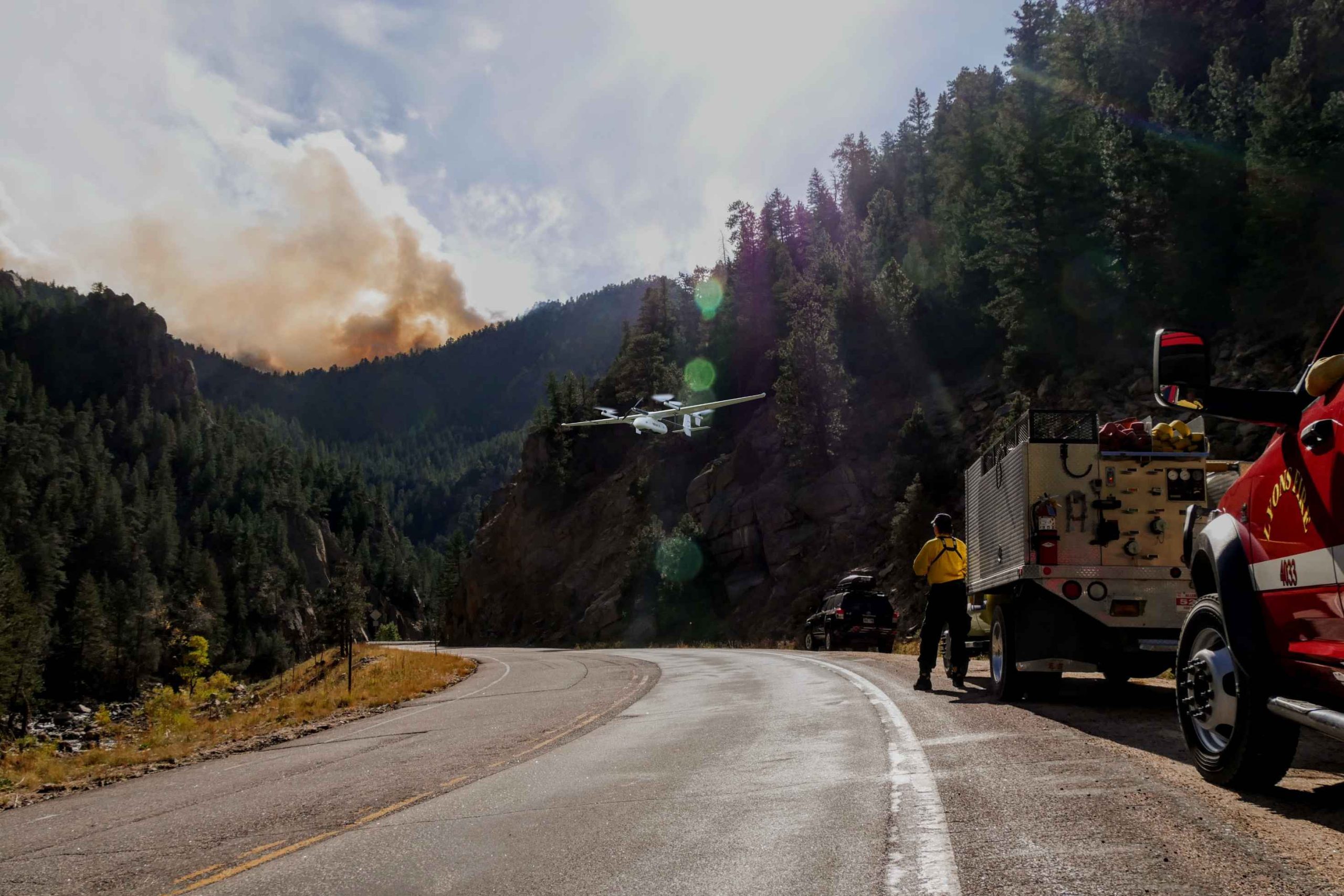
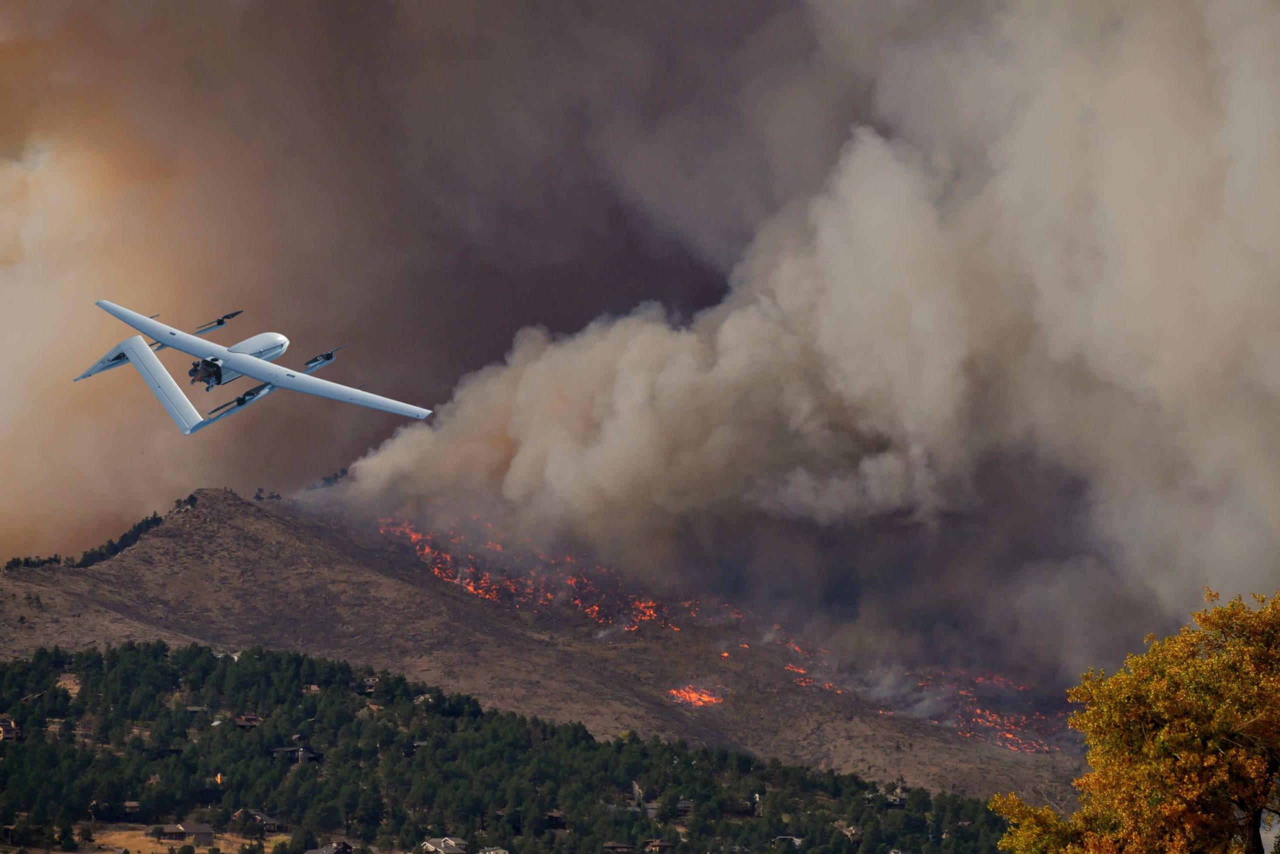
- Disaster Response: During wildfires, floods, earthquakes, or industrial accidents, BVLOS drones like the JOUAV CW-15 can be rapidly deployed to assess damage, locate survivors, and provide real-time situational awareness from a safe distance.
- Search and Rescue: In mountainous terrain or dense forests, BVLOS drones with thermal and optical sensors can scan large zones for missing persons—day or night—without putting rescue teams at risk.
- Fire Detection and Monitoring: Equipped with AI-enabled cameras (e.g., MG-120E on the CW-15), drones detect fire outbreaks early, track fire spread in real time, and relay actionable data to ground teams.
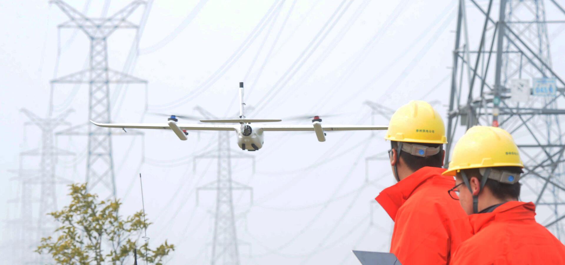
2. Infrastructure and Utility Inspection
Traditional methods of inspecting pipelines, power lines, railways, and highways are often time-consuming, costly, and dangerous. BVLOS drones now streamline these operations.
Use Cases:
- Transmission Line Patrol: Long-endurance drones like the JOUAV CW-30E can inspect hundreds of kilometers of power lines in a single flight. Onboard LiDAR and EO/IR payloads help detect sagging wires, vegetation encroachment, and damaged insulators.
- Pipeline Monitoring: Oil and gas companies use BVLOS drones for leak detection, corrosion analysis, and intrusion monitoring along remote pipeline routes.
- Railway and Roadway Surveys: BVLOS operations reduce downtime and allow for routine, automated inspections of transportation corridors without interrupting traffic or operations.
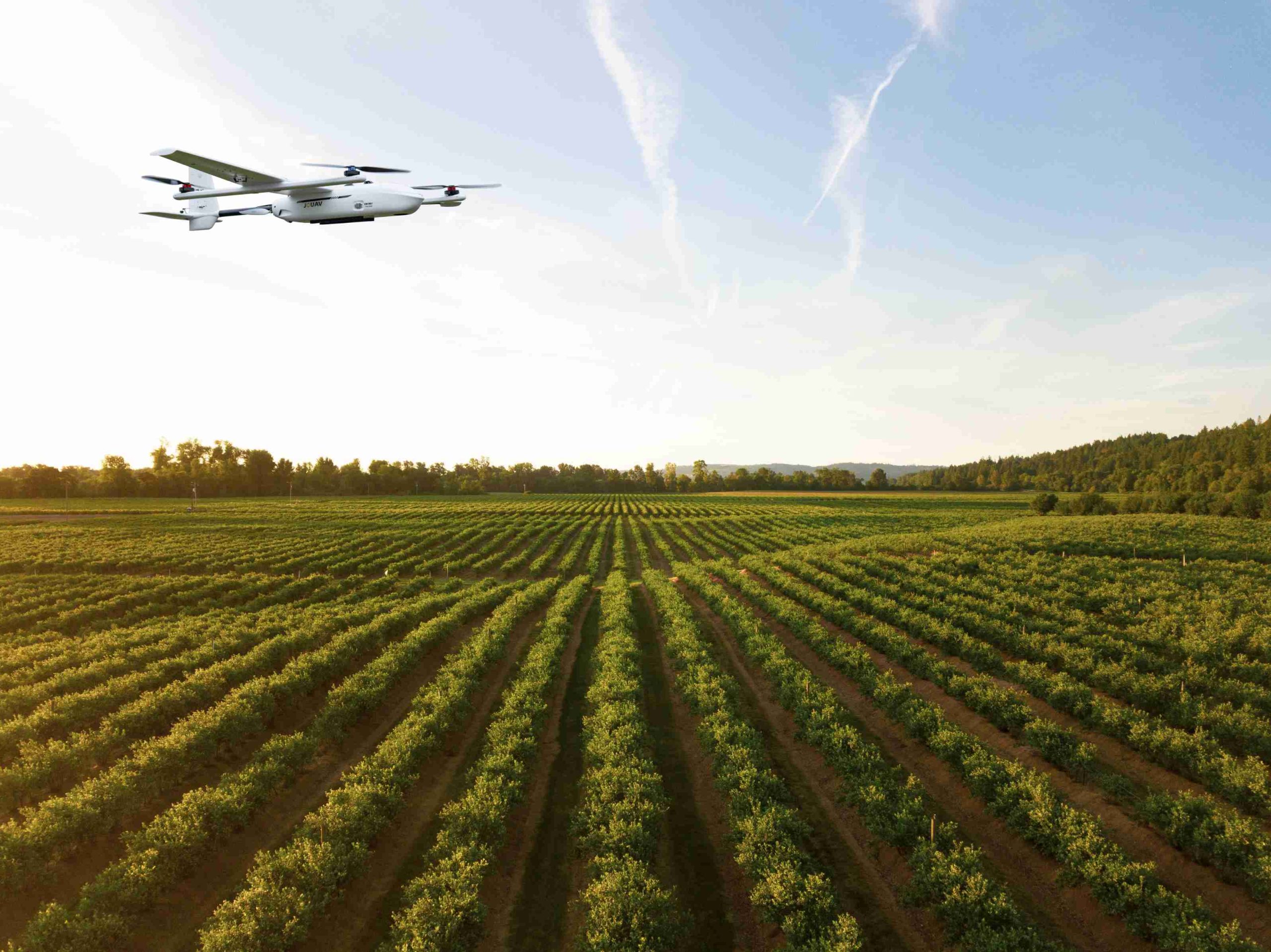
3. Agriculture and Environmental Monitoring
In precision agriculture and ecological monitoring, BVLOS drones provide essential data for informed decision-making.
Use Cases:
- Crop Health Analysis: With multispectral sensors, drones like the JOUAV CW-15 can cover large farms to detect irrigation issues, pest infestations, and nutrient deficiencies.
- Forest and Wildlife Management: Government conservation agencies use BVLOS drones to monitor deforestation, illegal logging, wildlife populations, and ecosystem health over remote and protected lands.
- Climate and Pollution Studies: Drones can carry environmental sensors to monitor air quality, emissions, and atmospheric changes over wide areas, supporting research and regulatory compliance.
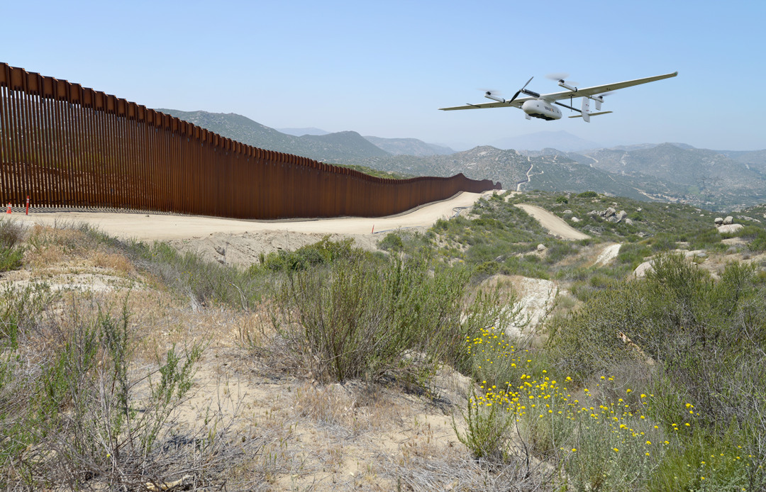
4. Security, Border Patrol, and Surveillance
For national security, perimeter defense, and maritime monitoring, BVLOS drones offer unmatched real-time intelligence and persistent coverage.
Use Cases:
- Border Surveillance: Long-range UAVs like the CW-30E are used to patrol national borders, detect illegal crossings, and monitor smuggling routes, especially in harsh or inaccessible terrains.
- Maritime Patrol: BVLOS drones can monitor shipping lanes, detect unauthorized fishing or smuggling activities, and respond quickly to emergencies offshore.
- Facility Perimeter Security: Critical infrastructure facilities (power plants, oil refineries, military bases) use BVLOS drones for continuous perimeter monitoring and threat detection.
5. Mapping, Surveying, and Land Management
BVLOS drones bring high efficiency to land surveying, cadastral mapping, and construction planning—tasks that typically require long hours and high labor costs.
Use Cases:
- Topographic Mapping: RTK/PPK-enabled drones like the CW-30E and CW-15 create centimeter-accurate 3D maps over large land parcels, reducing field time and post-processing efforts.
- Construction Progress Monitoring: Engineering firms use BVLOS UAVs to monitor infrastructure project development over time, compare progress to design plans, and ensure safety compliance.
- Resource and Mine Surveying: In open-pit mining and resource exploration, drones provide volumetric analysis, terrain modeling, and environmental impact assessments.
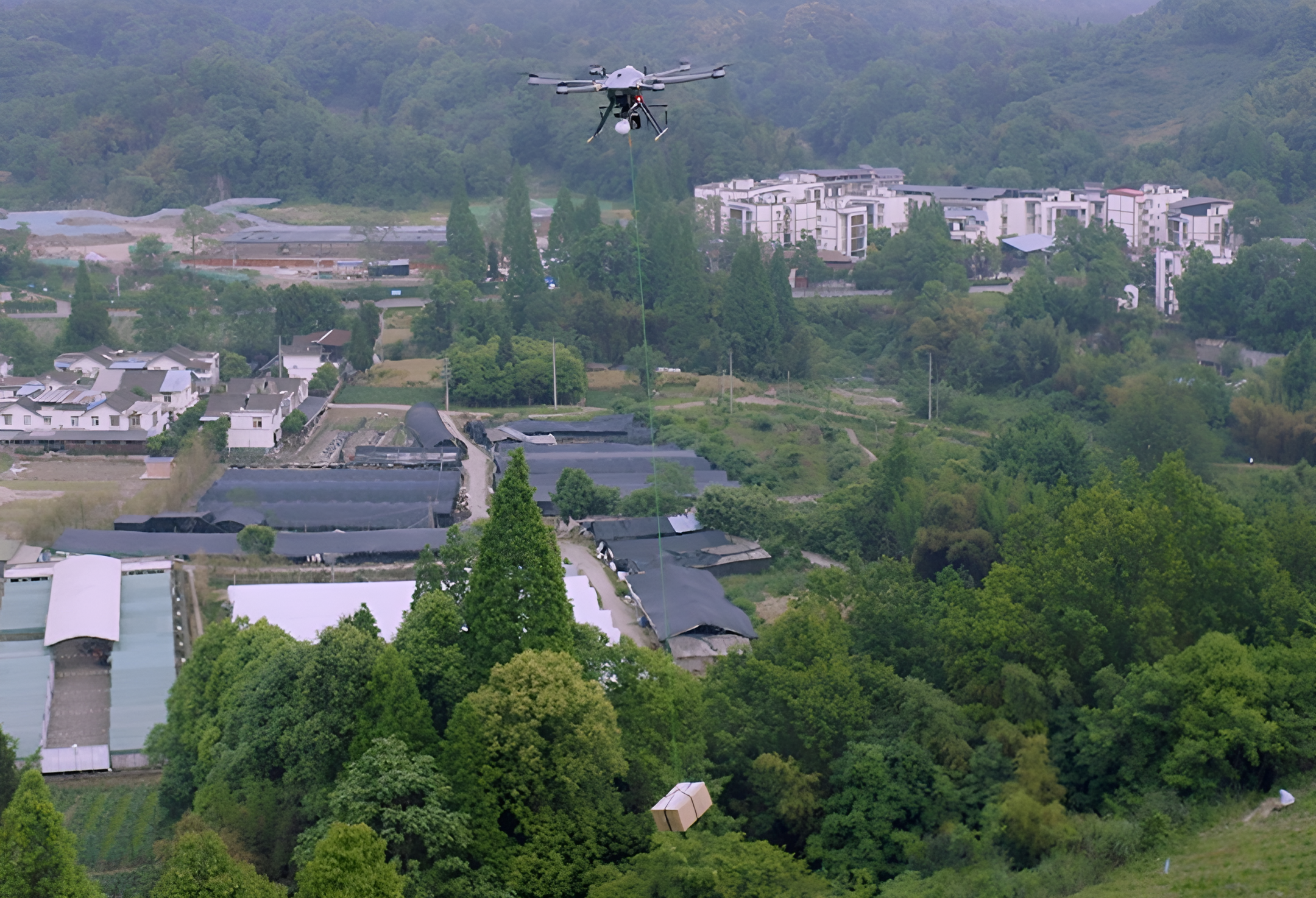
6. Logistics and Long-Distance Cargo Delivery
Although still developing, cargo delivery by BVLOS drones is gaining traction, especially in rural, island, or disaster-affected regions where traditional transport is limited.
Use Cases:
- Medical Supply Delivery: Transport of vaccines, blood, and essential medicines to clinics in remote areas during emergencies.
- Last-Mile Delivery: Lightweight packages can be delivered directly to homes or depots in remote or hard-to-reach locations.
- Industrial Spare Parts Transport: Internal logistics across large industrial sites or between manufacturing plants.
7. Oil & Gas, Mining, and Energy Exploration
BVLOS drones are revolutionizing site monitoring, hazard detection, and data collection in the world’s most remote and dangerous industries.
Use Cases:
- Surveying Exploration Sites: Perform initial site surveys and generate high-resolution terrain models quickly and safely.
- Asset Monitoring: Continuously monitor remote facilities such as offshore platforms or desert pipelines for leaks, damage, or intrusions.
- Safety Audits: Real-time video and sensor data help identify potential risks before they become operational failures.

8. Smart City and Urban Planning
Urban environments benefit from large-scale data capture and infrastructure monitoring that only BVLOS-capable drones can efficiently deliver.
Use Cases:
- City-Wide 3D Mapping: Generate detailed models of urban layouts for planning utilities, transportation, and zoning projects.
- Traffic Flow Monitoring: Observe and analyze traffic patterns during peak hours to improve urban mobility and reduce congestion.
- Disaster Risk Reduction: Identify flood-prone zones, evaluate building vulnerabilities, and simulate emergency scenarios using drone-collected geospatial data.
Types of BVLOS Waivers
Although the FAA doesn't publish formal BVLOS "types," industry practices and FAA documents reveal common scenarios:
1. Shielded Operations (Shielded BVLOS)
Shielded BVLOS operations leverage physical structures or terrain features (e.g., buildings, cliffs, dense forests) as barriers to mitigate collision risks with manned aircraft.
The drone must operate within 100 feet laterally and below the top of the shielding object. This concept is formally recognized under FAA § 107.110 and integrated into risk assessments like EASA’s SORA.
Its primary application is infrastructure inspection (power lines, pipelines, bridges), where the shield reduces airspace conflict risks.
Critical considerations include strict adherence to lateral boundaries, residual helicopter risks requiring mitigations (DAA or visual observers), and challenges in populated areas where "over people" waivers add complexity.
The shielding principle transforms high-risk BVLOS into manageable operations by exploiting geography.
2. Drone-in-a-Box (DIB) Operations
DIB systems enable fully automated BVLOS missions: drones launch from weatherproof docking stations, execute pre-programmed tasks (e.g., patrols or inspections), and return autonomously for charging. This model inherently combines BVLOS with high automation, demanding waivers covering multiple facets:
- Robust Detect-and-Avoid (DAA) for autonomous collision prevention.
- Secure Command-and-Control (C2) links resistant to jamming.
- Automated emergency protocols for lost links or system failures.
- Cybersecurity for drones, docking stations, and networks.
DIB is ideal for repetitive tasks like security patrols or utility inspections. Regulators scrutinize docking reliability, remote health monitoring, and the system’s ability to handle environmental variables without on-site personnel.
3. Extended Visual Line of Sight (EVLOS)
EVLOS extends situational awareness beyond the remote pilot’s vision using networked Visual Observers (VOs). Strategically positioned VOs maintain direct sight of the drone and relay hazards to the pilot via real-time communication (e.g., radios). While EASA explicitly authorizes EVLOS, the FAA treats it as BVLOS, requiring a waiver. Key requirements include:
- Redundant communication systems between the pilot and VOs.
- Predefined VO protocols for sector coverage and handoffs.
- Crew Resource Management (CRM) training to ensure coordination.
EVLOS suits linear operations (power line inspections, agricultural surveys) where terrain allows VO placement. Its range is limited by human vision and communication reliability (typically <5 km).
4. Tactical BVLOS (TBVLOS) / First Responder Waivers
TBVLOS waivers expedite BVLOS authorization for public safety agencies during emergencies (e.g., search-and-rescue, wildfire response). These prioritize speed through:
- Pre-approved mission templates with standardized risk mitigations.
- Direct regulatory hotlines for rapid activation.
- Acceptance of elevated risk-benefit ratios in life-threatening scenarios.
For example, firefighters may receive near-immediate authorization for wildfire mapping. Success hinges on pre-coordination with aviation authorities, airspace deconfliction plans, and rigorous post-mission reviews. TBVLOS acknowledges that procedural agility saves lives but requires mature agency protocols.
5. Special Governmental Interest (SGI) Waivers (FAA-Specific)
The FAA’s SGI process accelerates approvals for BVLOS operations serving urgent public interests (e.g., disaster response, critical infrastructure restoration). Unlike TBVLOS (focused on first responders), SGI applies broadly to governmental and qualifying private entities (e.g., utilities post-storm). Approval requires:
- Demonstration of compelling public necessity (e.g., imminent safety threats).
- Robust safety plans despite expedited review.
- Pre-established FAA contacts for swift processing.
SGI waivers resolve in hours/days instead of months, balancing regulatory rigor with societal urgency. They are not for routine operations.
Read More


Every drone needs a brain.
Without it, you’re holding an expensive paperweight with spinning blades.
That brain is called a flight controller—but most people have no idea what it actually does.

Let’s be honest: the drone world loves its acronyms. UAV, UAS, drone, RPAS, UCAV, FPV–it’s an alphabet soup. And most people use them like they’re the same thing.
They’re not.
And here’s why that matt

JOUAV Product News and Use Cases
Fixed-Wing VTOL Drones Insights and Industry Trends
Invitations to online demo events