The Yunnan Bureau of Nonferrous Geology used CW-25E to collect laser point cloud and orthophoto data of 950km² of forest in Yunnan Province, China, in just 8 hours. The captured 3D point cloud data he
Benefits of Using Drones in Agriculture
First, let's delve into the advantages of agricultural drones. In this section, we'll uncover the numerous benefits these unmanned aerial vehicles bring to farming, ranging from precise farming practices to cost-effectiveness.

Improved Efficiency and Productivity
Agriculture drones have revolutionized farming efficiency and productivity. They cover up to 500 acres of farmland in a single day, a task taking traditional methods weeks. This 90% time-saving allows farmers to focus on critical tasks.

Data-Driven Decision Making
Equipped with high-resolution cameras and advanced sensors, drones capture detailed data. Analyzing this information identifies issues like crop diseases, irrigation irregularities, or nutrient deficiencies. Farmers make informed choices, reducing resource wastage.

Cost-Effectiveness
Agriculture drones save costs by optimizing resource use. Data analytics can reduce fertilizer and pesticide use by up to 30%, cutting operational expenses and environmental impact. Less reliance on manual labor results in significant labor cost savings.

Enhanced Crop Management
Drones enhance crop management by providing real-time insights into crop health and growth patterns. Early disease detection through drone-based imaging can boost crop yields by 25%. Timely intervention based on drone data ensures healthier, higher-quality crops.

Environmental Benefits
Agriculture drones reduce chemical usage by 35% by precisely targeting treatment areas, conserving natural resources and reducing pollution. Moreover, decreased fuel consumption from fewer field visits contributes to lower greenhouse gas emissions.
Precision Mapping and Surveying
Agriculture drones are outfitted with cutting-edge sensors and high-resolution cameras, facilitating precision mapping and surveying of agricultural landscapes. These technological marvels empower farmers with intricate insights into topographical variations, soil composition, and drainage patterns across their fields. The resulting data serves as the foundation for optimized planting strategies, resource allocation, and land management.
Vigilant Plant Health Monitoring
Agricultural drones, equipped with advanced multispectral and infrared cameras, excel in plant health assessment. By discerning subtle variations indicating stress, nutrient deficiencies, or diseases, professionals can implement precise remedial actions. Proactive measures translate into higher-quality crops and sustainable agricultural ecosystems.
Comprehensive Soil Health Analysis
Soil health forms the bedrock of productive agriculture. Drones facilitate the collection of diverse soil samples across fields. Through meticulous analysis, agricultural professionals gain insights into soil fertility, pH levels, and moisture content. Informed decisions regarding nutrient management, waterlogging, and soil conditioning enhance agricultural productivity and longevity.
Real-Time Aerial Surveillance and Field Monitoring
Drones provide an unparalleled vantage point, facilitating real-time aerial surveillance of agricultural landscapes. Through continuous monitoring, professionals can promptly identify challenges such as water stagnation, pest infestations, or crop diseases. Timely intervention, based on these observations, mitigates risks and ensures optimal crop health, thereby safeguarding yields and farm profitability.
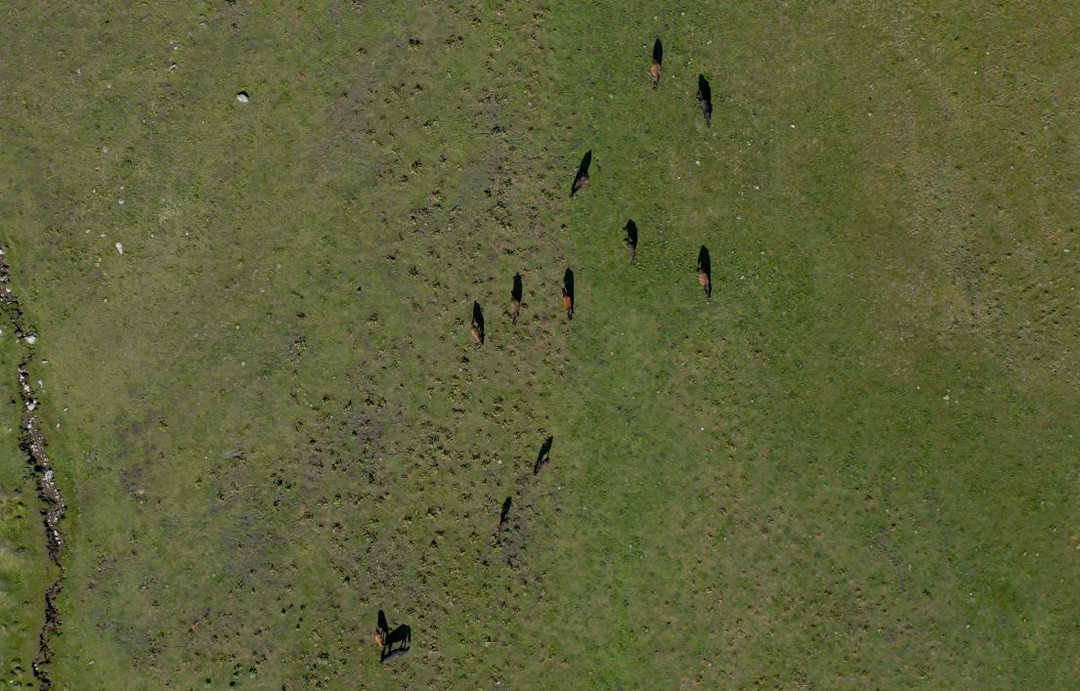
Livestock Management and Health Assessment
Beyond crop-centric applications, drones play a pivotal role in livestock management. Professionals utilize drones to monitor livestock health, track animal movements, and assess pasture conditions. This holistic approach to agriculture ensures the well-being of both crops and livestock, fostering integrated farming practices.
Best Drones for Agriculture
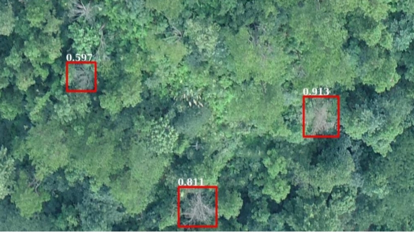
Using high-resolution RGB cameras and professional multispectral sensors on drones like JOUAV drones can indeed provide valuable insights into crop health and help in early detection and quantification of crop health problems.
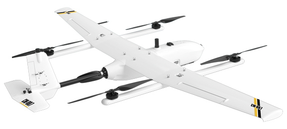
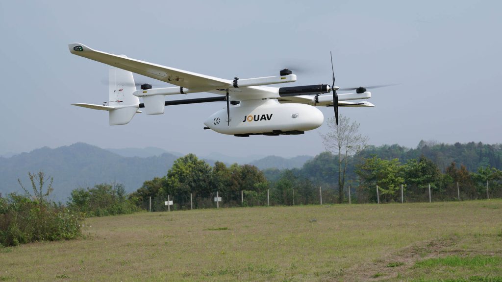
CW-007
A portable, integrated UAV platform that delivers exceptional reliability to our customers.
VTOL Capability for Terrain Challenges
JOUAV drones are equipped with Vertical Takeoff and Landing (VTOL) capability, overcoming challenges posed by large fields, difficult terrains, and steep landscapes. Unlike conventional drones, JOUAV drones do not require smooth surfaces for take-off and landing, ensuring adaptability to diverse agricultural environments.
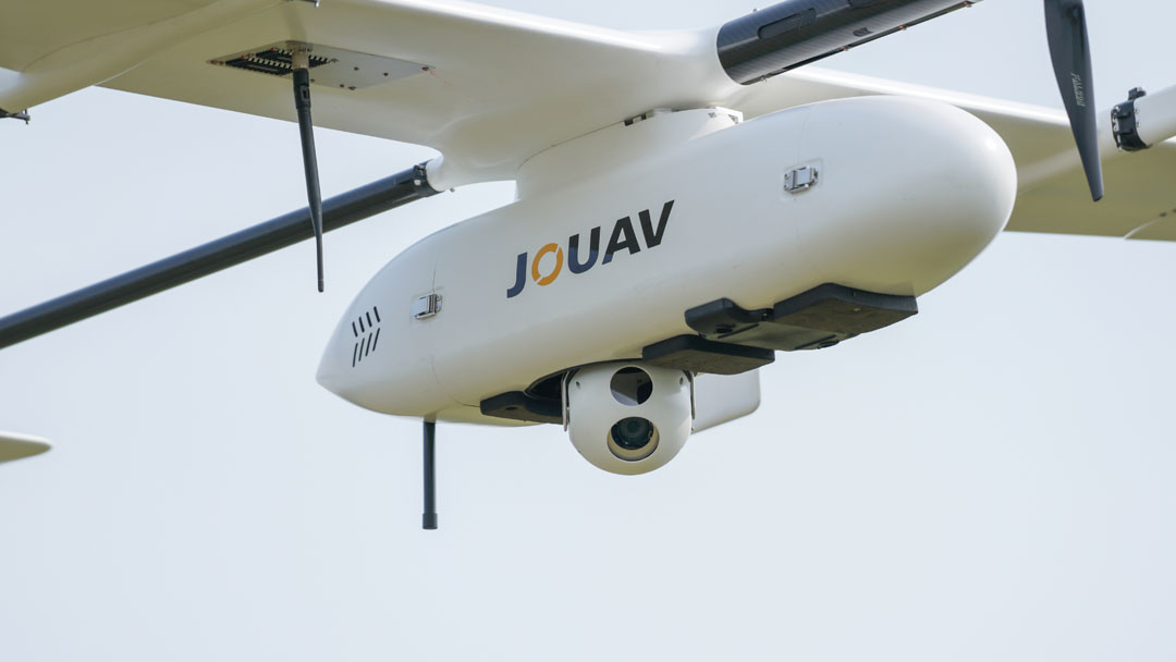
Versatile Payloads for Varied Applications
With an impressive 8kg payload capacity, JOUAV drones offer versatility in applications. They can be equipped with a range of sensors including a 1845m long-range LiDAR sensor, a 61MP RGB camera, and a multispectral camera featuring 6 multispectral sensors with 1.2MP. This flexibility enables precise data collection tailored to different agricultural needs.
High-Resolution Data for Advanced Research
For agricultural researchers and agronomists focused on cutting-edge vegetation research, JOUAV drones furnish high-resolution data. These drones can achieve a staggering 1.2cm (0.47in) full-color sharpened ground resolution at an altitude of 60m (200ft). This extraordinary level of detail empowers precise data collection, facilitating meticulous vegetation analysis and research pursuits.
Exceptional Efficiency in Flight
JOUAV drones excel in efficiency, offering long flight times of up to 480 minutes and a cruising speed of 90km/h, with an impressive 200km long-range capability. The efficiency of these drones is particularly notable when compared to multi-rotor drones. A single flight of the JOUAV CW-15 can cover the same area as 14 flights of a multi-rotor drone. This efficiency translates to significant time and resource savings for farmers.
Autonomous Flight Capabilities
JOUAV drones elevate the standards of safety and ease of operation with their autonomous flight capabilities. These drones possess the intrinsic capacity to autonomously circumvent obstacles during flight and return independently in the event of operational anomalies, thus reducing the risk of accidents and simplifying operational control.
Superior Performance in Extreme Weather
JOUAV drones excel in extreme weather, ensuring reliable operation in high altitudes, humidity, low temperatures, and light rain. They feature power optimization and innovations like heated airspeed tubes and waterproofing, making them ideal for farms in diverse weather conditions.
Case Studies of Successful Agriculture Drone Project
Sometimes, seeing is believing. Let's dive into real-world stories of farmers who've harnessed the power of JOUAV drones to revolutionize their crops.
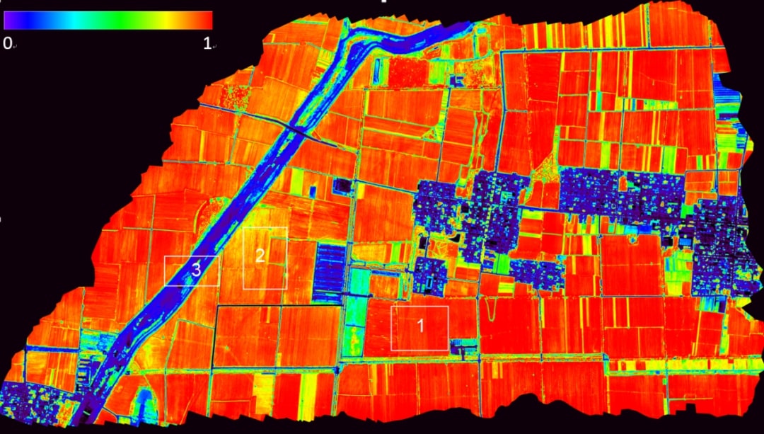
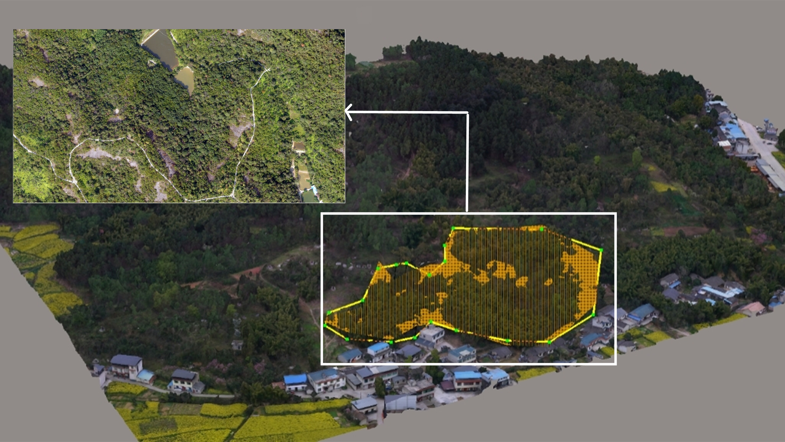
On May 16, 2023, Beijing Anzhou Technology Co., Ltd. conducted a flight test in an agricultural demonstration area in Yanzhou District, Jining City, Shandong Province. The goal of the flight test was
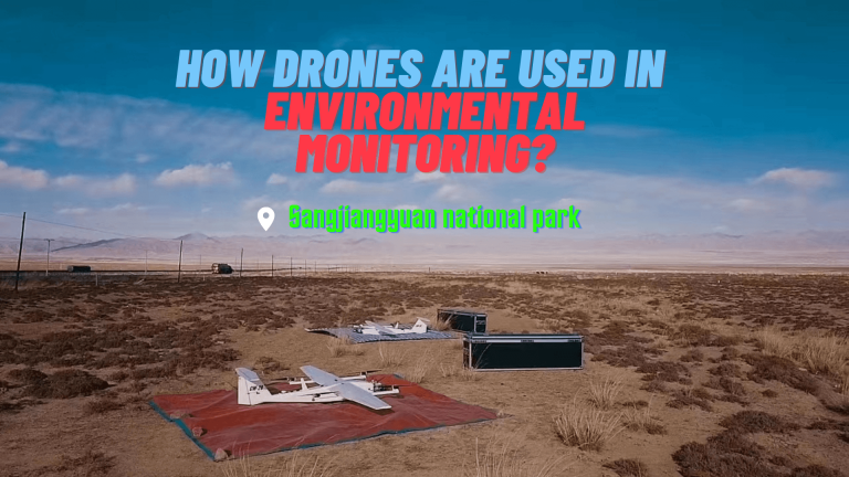
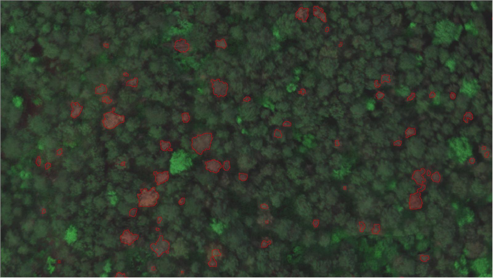
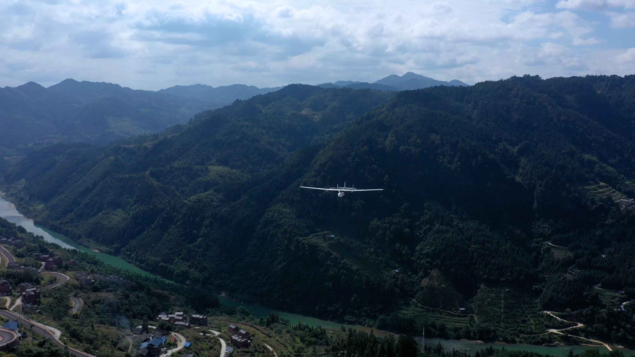
This case study examines how drones were used to monitor the Sanjiangyuan lakes and wetlands, snowy mountains, and grassland desertification, as well as the benefits and challenges of this approach.
What Are the Different Types of Agricultural Drones?
Agriculture drones come in various forms, each tailored to specific agricultural applications. Understanding the advantages and disadvantages of these drone types is crucial for optimizing their utility in farming practices.
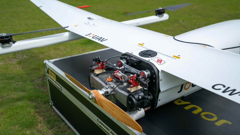
Fixed-Wing Drones
Fixed-wing drones are well-suited for large-scale farming operations. They efficiently cover extensive areas in a single flight, making them ideal for surveying vast farmlands. Their longer flight times compared to multirotor drones enable them to complete more comprehensive mapping and surveying tasks before needing to recharge or replace batteries. Moreover, due to their aerodynamic design, fixed-wing drones tend to handle windy conditions better, ensuring consistent data collection even in adverse weather.
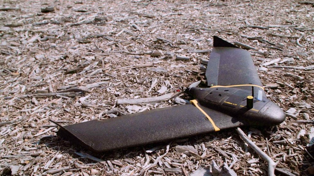
However, fixed-wing drones have limited maneuverability compared to multirotor drones. They cannot hover or make quick changes in direction, which may be a drawback when precise positioning is required. Additionally, takeoff and landing can be more challenging, as they require a runway-like space. The higher initial cost of fixed-wing drones might also be a consideration for smaller farms or operations with budget constraints.
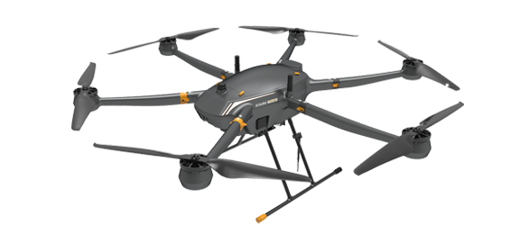
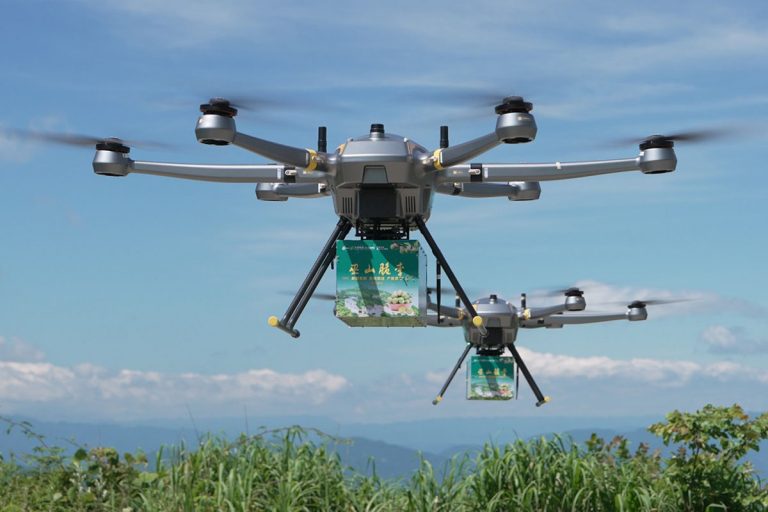
Multirotor Drones
Multirotor drones, such as quadcopters and hexacopters, excel in maneuverability. They can hover, change direction rapidly, and fly at low altitudes, making them ideal for close inspection of crops and precise applications. These drones are typically easier to operate and require less training than fixed-wing drones, allowing farmers to quickly integrate them into their daily operations. Their vertical takeoff and landing capability eliminates the need for a runway or open space.

Multirotor drones generally have shorter flight times compared to fixed-wing and VTOL drones, which may necessitate frequent battery changes or recharging during longer tasks. Additionally, due to their shorter flight times and lower speed, multirotor drones are better suited for smaller to medium-sized fields, as covering extensive areas may require multiple flights and battery swaps.
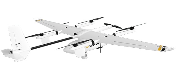
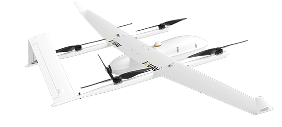
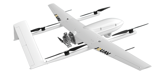
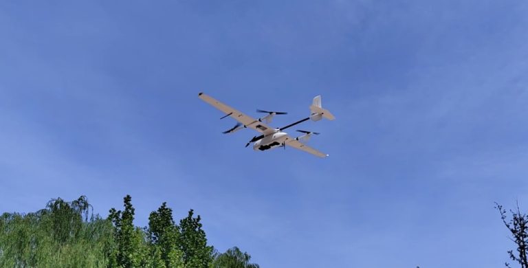
VTOL (Vertical Takeoff and Landing) Drones
VTOL drones combine the advantages of both fixed-wing and multirotor drones. They can take off and land vertically like multi-rotors and transition to fixed-wing flight for efficient long-distance coverage. This versatility makes them suitable for farms with varied topography, as they can navigate rugged terrain and conduct aerial surveys over large areas. They also offer extended flight times compared to pure multirotor drones.
VTOL drones can be more complex to operate and maintain compared to standard multirotors, requiring proper training and expertise. Additionally, they tend to be more expensive due to their hybrid design and advanced capabilities, which may be a consideration for budget-conscious farmers.
What Are the Components of Agriculture Drone?
To comprehend the capabilities of agriculture drones, it's essential to understand their core components. This section breaks down the key elements that make these drones effective tools for modern farming.
Frame
The frame of an agriculture drone serves as its structural backbone. It is typically made from lightweight materials such as carbon fiber or aluminum to keep the drone agile and aerodynamic while ensuring durability. The frame houses all the other components and provides the necessary structure for mounting the motors, propellers, and other hardware.
Motors
Motors are the powerhouse of agriculture drones. These electric motors generate the necessary thrust to lift the drone off the ground and keep it airborne. Agriculture drones typically use brushless DC motors for their efficiency and reliability. The number and size of motors may vary depending on the drone's design and payload capacity.
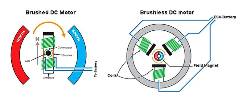
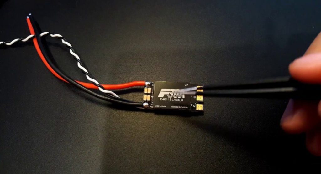
Electronic Speed Control (ESC)
Electronic Speed Control (ESC) for drones is a crucial electronic device that manages the speed and direction of each motor in the drone. It interprets signals from the flight controller, adjusting the power supplied to the motors to control their revolutions per minute (RPM) and, consequently, the drone's movement and stability during flight. In essence, it acts as a bridge between the flight controller and the motors, ensuring precise control and maneuverability of the drone.
Flight Control Board
The flight control board, often referred to as the "brain" of the drone, is responsible for processing data from various sensors and sending commands to the motors and ESCs. It plays a crucial role in stabilizing the drone, ensuring it stays level and responds to pilot inputs accurately. Flight control boards are equipped with advanced algorithms and sensors like accelerometers and gyroscopes to provide stability and precise control.
Radio Receiver
The radio receiver receives signals from the drone operator's transmitter, translating them into commands that the flight control board can execute. This component enables remote control of the drone, including functions such as throttle, pitch, roll, and yaw, allowing the pilot to navigate and control the drone's movements.
Propellers
Propellers are responsible for generating the thrust required to lift and propel the drone. Agriculture drones often use specially designed propellers optimized for efficiency and stability during aerial operations. Propeller size, pitch, and rotation direction are carefully selected to match the drone's design and intended use.
Battery
The battery is the primary source of power for the agriculture drone. Lithium-polymer (LiPo) batteries are commonly used due to their high energy density and lightweight properties. The capacity and voltage of the battery directly influence the drone's flight time and payload capacity. Advanced battery management systems ensure safe and efficient power delivery.
Gimbal
Agriculture drones are often equipped with gimbals to stabilize cameras and sensors mounted on board. A gimbal allows the camera or sensor to maintain a steady orientation, even when the drone experiences turbulence or changes in direction. This stability is crucial for capturing accurate and usable data during agricultural surveys and inspections.
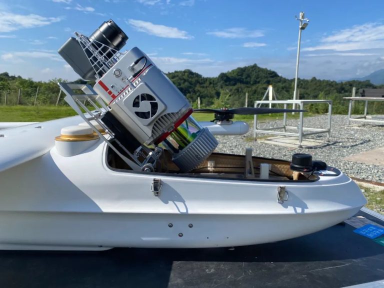
Sensors
Sensors constitute the sensory array of agriculture drones, each tailored to specific functions:
- Cameras: Agriculture drones often have cameras capable of capturing high-resolution images and These cameras may include RGB (visible light), multispectral, or thermal imaging sensors.
- LiDAR(Light Detection and Ranging): LiDAR sensors use laser beams to create detailed 3D maps of the terrain, making them useful for terrain mapping and elevation
- InfraredSensors: Infrared sensors are used for monitoring crop health, identifying stress in plants, and detecting temperature
- UltrasonicSensors: Ultrasonic sensors help drones maintain a consistent altitude above the ground, especially during low-altitude
Read More

Every drone needs a brain.
Without it, you’re holding an expensive paperweight with spinning blades.
That brain is called a flight controller—but most people have no idea what it actually does.

Let’s be honest: the drone world loves its acronyms. UAV, UAS, drone, RPAS, UCAV, FPV–it’s an alphabet soup. And most people use them like they’re the same thing.
They’re not.
And here’s why that matt
An airborne cargo drone is exactly what it sounds like: an unmanned aircraft built to carry stuff. Not tiny packages for a suburban backyard – real cargo. From medical supplies to industrial parts.
An

JOUAV Product News and Use Cases
Fixed-Wing VTOL Drones Insights and Industry Trends
Invitations to online demo events