At 2:27 PM on a storm-lashed afternoon in July 2025, a small fishing boat capsized off the coast of Gulei, Zhangzhou.
Two men were thrown into violent waters. Winds howled at gale force. Waves surged
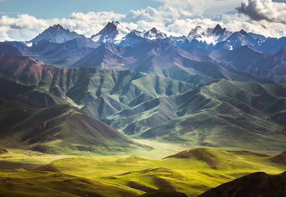
Sanjiangyuan, which means "the source of three rivers," is a high-altitude plateau located on the eastern edge of the Tibetan Plateau. The area spans 363,000 square kilometers and is home to the headwaters of the Yangtze, Yellow, and Mekong rivers. Sanjiangyuan is considered one of the most important areas for biodiversity in China, supporting over 5,000 species of plants and animals, including many endangered species such as the snow leopard, Tibetan antelope, and black-necked crane.
The Sanjiangyuan National Park Administration is responsible for the management, protection, and conservation of the park and its resources. This includes patrolling, monitoring, and surveying wildlife populations when necessary, and controlling illegal activities such as poaching.
Check out the full video of this case study here:
The challenge
Located in the Qinghai-Tibet Plateau region with an altitude from 3335 to 6564 meters, the Sanjiangyuan region is challenging to monitor due to its remote location, harsh climate, and difficult terrain.
Traditional monitoring methods, such as ground-based surveys, are time-consuming, costly, and can disturb the natural habitats of the wildlife being studied. Surveillance drone provides a broader perspective, and compared to helicopters or airplanes, this tool is inexpensive and silent which does not scare away the animals being monitored.
However, adverse weather conditions and rugged terrain also can affect the flight stability and maneuverability of drones, making it difficult for them to fly safely and complete their missions.
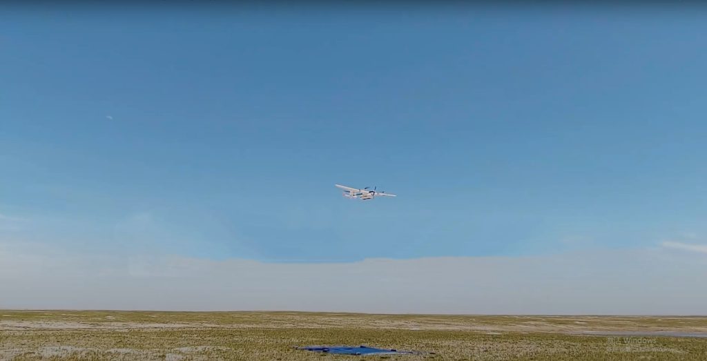
The Sanjiangyuan National Park Administration compared many commercial drones and finally chose JOUAV CW-15 and CW-25E vertical take-off and landing (VTOL) fixed-wing drones which are specially designed to handle extreme weather conditions and harsh environments.
These drones are equipped with powerful motors, high-capacity batteries, and advanced flight controllers that allow them to fly in strong wind, heavy rain, cold temperature, low visibility, and high altitudes.
The solution
John Shee, a drone pilot, and researcher at the Sanjiangyuan National Park Administration, along with 7 other team members, used CW-15 and CW-25E drones with MG-120E gimbal cameras. They also integrated a ground control vehicle to ensure real-time control and video transmission between the drones and the command center.
Here are the important parameters of the equipment used in this environmental monitoring and management mission:
| UAV platform | CW-15 | |
| Max. payload | 3kg | |
| Max. Ceiling | 7000m | |
| Max. flight time | 180min | |
| Max. takeoff altitude | 5000m | |
| CW-25E | ||
| Max. payload | 6kg | |
| Max. Ceiling | 6500m | |
| Max. flight time | 240 | |
| Max. takeoff altitude | 4500m | |
| Payload | MG-120E gimbal camera | |
| Head configuration | 3 axis | |
| Optical resolution | 1080P | |
| Infrared resolution | 640x512 | |
| Optical zoom | 30x | |
| Ground control system | UAV ground control vehicle | |
| Loading capacity | CW-25E*2 | |
| Power supply capacity | 5Kw | |
| Control range | 100km | |
| Endurance | 20h | |
"Using the CW-15 and CW-25E VTOL drones in our environmental monitoring work has been incredibly effective. Its long flight time, long range, and fast cruising speed allowed me to cover a large area of environmental monitoring, making our job more efficient and effective”, John Shee said. “But what really impressed me was its highland performance - it navigated through the tough terrain with ease and accuracy. I highly recommend this drone to anyone who needs to collect data in challenging environments."
Equipped with the MG-120E gimbal camera, these two drones can automatically track poachers and environmental destructors. With a 30x optical zoom camera and a 640*512 infrared sensor, John's team captured remarkable details even from a distance and in low-light conditions. The gimbal camera features AI tracking and identification technology that guides the JOUAV drones to automatically follow and keep the object centered on the screen. Additionally, the 3-axis design of the MG-120E ensures stable pictures, even under shaky conditions.
The JOUAV ground control vehicle was an essential component for the success of the mission. It not only provided the CW-15 and CW-25E drones with real-time data and navigation information but also monitored their performance and made the necessary adjustments to ensure the drones fly within the expected parameters.
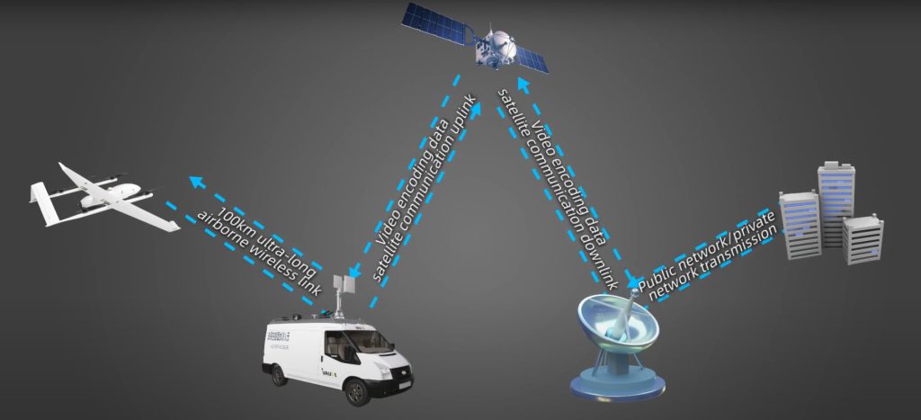
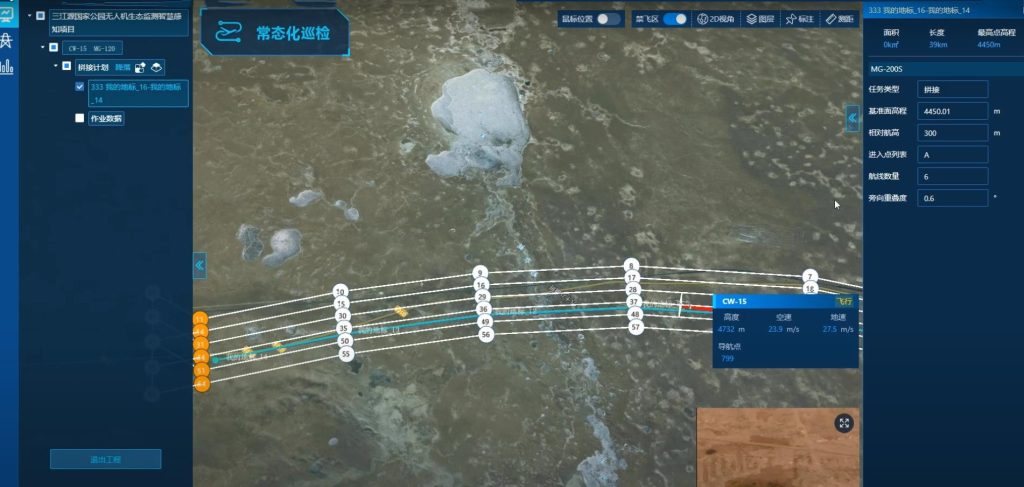
The Sanjiangyuan National Park Administration uses the JOUAV Cloud platform to guide flights located on drones, which is a cloud-based platform that allows for the collection, storage, and analysis of environmental data from a variety of sources in real-time with a centralized and secure repository accessible through a web-based interface.
"The JOUAV Cloud allows for input from sensors, weather stations, and remote monitoring systems, and provides real-time updates and alerts on key environmental indicators. The web-based interface and data visualization tools make it easy for me to remotely monitor and understand environmental conditions. Plus, the platform's ability to store historical data enables long-term analysis of environmental trends, helping me identify areas of concern and potential risks. It's the perfect solution for monitoring and protecting the environment," said John.
The result
These two drones flew from Golmud to the Cocosili hinterland via the Qinghai-Tibet route, completing two sorties. The first flight took 30 minutes, during which the satellite communication vehicle captured real-time images of takeoff and landing. During the second 90-minute flight, the ground control vehicle sent critical takeoff commands to the UAV, and the console obtained real-time video of the gimbal camera in action. The drones flew at a cruising altitude of 4,730 meters and a telemetry distance of 40-50 KM, covering a large area for environmental monitoring purposes.
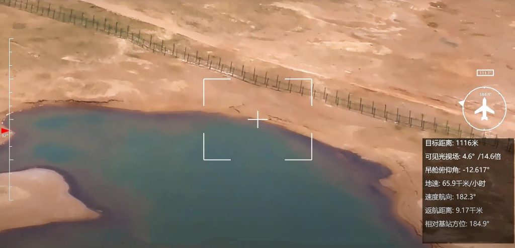
Mapping wetlands and lakes
The Sanjiangyuan National Park Administration used the CW-15 and CW-25E drones to gather valuable data on the wetlands and lakes, including information on water levels, plant, and animal populations, and any signs of environmental degradation.
"I was impressed with the JOUAV drone patrol for wetlands and lakes. With advanced technology and sensors, the drone was able to gather data and images of the area with ease. The regular patrols ensured that the data collected was always up-to-date and accurate, and the analysis by experts helped identify any potential issues affecting the ecosystem," commented John.
Monitoring snowy mountains
The JOUAV drones flew at high altitudes and captured images of glaciers, snow cover, and ice formations, providing researchers of the Sanjiangyuan National Park Administration with a bird's eye view of the area. These images and data were used to track changes in snow cover and ice formation over time, allowing researchers to better understand the effects of climate change in Sanjiangyuan.
"The JOUAV drones have been an essential tool in monitoring the snowy mountains in Sanjiangyuan and keeping us informed on the stability and potential hazards. The data gathered by JOUAV drones provided valuable insights into snow cover, glacial melt, and changes in the landscape. By analyzing the high-resolution images, we can easily analyze their stability, avalanches, and snow and ice movement," said John.
Tracking wildlife
The CW-15 and CW-25E drones have also been used for wildlife management in Sanjiangyuan, offering valuable data on their movements, habitat use, and population dynamics. These drones captured images and video of the animals, allowing researchers to identify individuals and track their movements over time.
"With the JOUAV drone, tracking wildlife has never been easier! The advanced technology allows me to get close-up shots without disturbing the animals and the ability to track their movements in real-time is just amazing," described John.
![]()
Detecting grassland desertification
JOUAV drones were also used to detect grassland desertification, a major problem in Sanjiangyuan. The drones captured images of the grasslands, allowing researchers to identify areas that are undergoing desertification and develop strategies to combat this problem.
Conclusion
The use of drones for the environmental monitoring of Sanjiangyuan has proven to be successful.
Real-time data on environmental changes such as deforestation, land use changes, and pollution levels collected by the CW-15 and CW-25E VTOL drones can help the Sanjiangyuan National Park Administration develop effective policies and management strategies to protect the region.
Eventually, the Sanjiangyuan National Park Administration was pleased with the results and plans to use JOUAV VTOL drones for future environmental monitoring missions.
More Use Cases


Chongqing’s Qinba Mountains are basically a giant green wall protecting the region. But there’s a problem – pine wood nematodes are eating through it. Fast.
The forestry department n

When TotalEnergies set out to build one of Southeast Asia’s largest solar and battery storage projects—spanning 12,000 hectares across the dense acacia forests of Riau, Indonesia—they faced a problem

JOUAV Product News and Use Cases
Fixed-Wing VTOL Drones Insights and Industry Trends
Invitations to online demo events