At 2:27 PM on a storm-lashed afternoon in July 2025, a small fishing boat capsized off the coast of Gulei, Zhangzhou.
Two men were thrown into violent waters. Winds howled at gale force. Waves surged
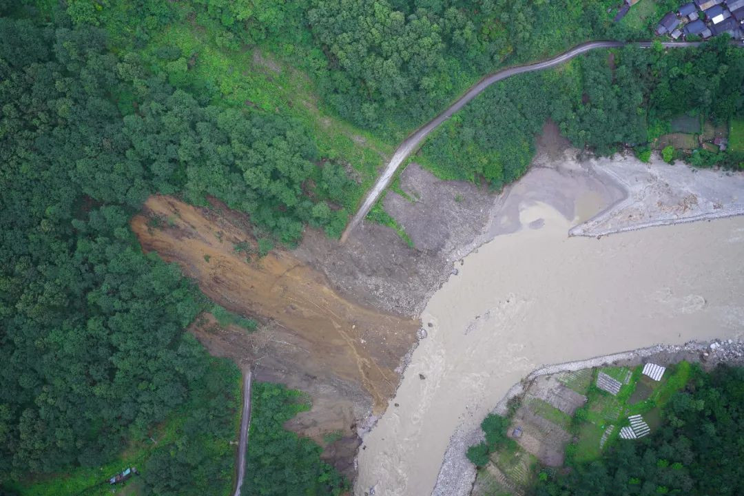
In late May 2025, Dukendong Township in Gongshan County, Nujiang Prefecture, Yunnan, faced a severe natural disaster. Continuous heavy rainfall triggered flash floods and massive debris flows, severely damaging roadbeds, power lines, and communication infrastructure.
To support rapid disaster response, China Southern Power Grid Co., Ltd (CSG) deployed the JOUAV CW-15 drone, a VTOL fixed-wing drone designed for emergency mapping and aerial reconnaissance. Acting on urgent instructions from local authorities, the drone was tasked with surveying damaged power transmission lines and roadways in the affected mountainous area.

Fast, Accurate Disaster Area Mapping
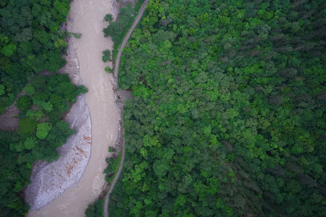
Emergency response teams required high-resolution 2D orthophotos of the disaster zone to guide road repairs, power restoration, and resource allocation. However, Dukendong Township’s steep, canyon-like terrain and persistent rainfall made manned inspections nearly impossible and challenged conventional UAV operations.
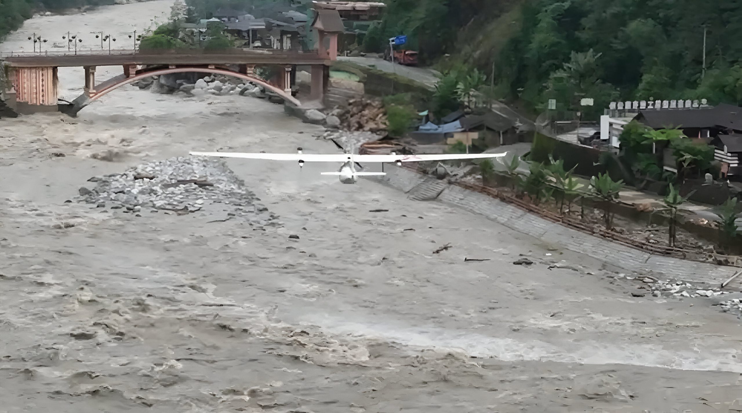
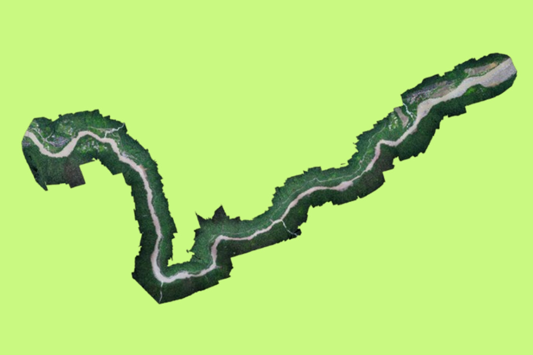
Undeterred by the harsh weather and complex topography, the CW-15 drone took off with its onboard CA-103 orthophoto camera system and covered a 77-kilometer stretch of damaged infrastructure. In just two flights, it captured over 2,300 aerial images, generating a 1:500 scale orthomosaic that provided precise geospatial data for responders on the ground.
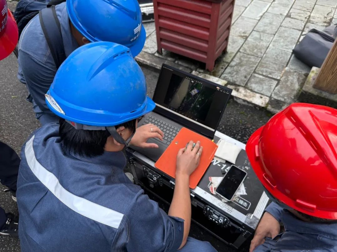
Seamless Air-to-Ground Coordination
The operation demonstrated the efficiency of multi-source drone deployment and real-time data interpretation. While multiple UAVs performed specialized aerial surveys, the ground team rapidly processed and interpreted data on-site, closing the loop between field collection and emergency planning.
This streamlined workflow enabled the fast production of accurate disaster assessment visuals, pinpointing:
- Power line damage segments
- Road interruption points
- Terrain hazards affecting rescue logistics
Empowering Smarter Emergency Decisions
“With accurate data from the CW-15 drone, we were able to create more targeted rescue plans, allocate resources wisely, and gain crucial time to restore power and access,” said a field engineer involved in the operation.
In just a few hours, the CW-15 provided a clear, comprehensive overview of the disaster impact, helping guide power grid restoration, road clearance, and emergency relief logistics. Its long-endurance performance, all-weather capabilities, and precise imaging system proved invaluable in delivering full-cycle technical support from damage identification to action planning.
More Use Cases


Chongqing’s Qinba Mountains are basically a giant green wall protecting the region. But there’s a problem – pine wood nematodes are eating through it. Fast.
The forestry department n

When TotalEnergies set out to build one of Southeast Asia’s largest solar and battery storage projects—spanning 12,000 hectares across the dense acacia forests of Riau, Indonesia—they faced a problem

JOUAV Product News and Use Cases
Fixed-Wing VTOL Drones Insights and Industry Trends
Invitations to online demo events