Best Long Range Drones 2026 (15-200km): Expert Tested & Review
Need to cover the serious ground? Like, miles and miles of it?
If you're tasked with inspecting far-off infrastructure, searching vast landscapes, or surveying huge swaths of land, a long-range drone might be your new best friend.
Professionals in fields like agriculture, construction, and energy are already seeing the benefits.
These high-flying machines can monitor massive areas, check out remote spots, and even help with large-scale search and rescue missions.
But with so many long-range drones out there, picking the right one can feel like finding a needle in a haystack.
That's why our team has put in the hours, testing countless models to bring you the absolute best.
We'll break down what makes a long-range drone great, share some tips on choosing the perfect one, and unveil our top picks for both fixed-wing and multi-rotor drones built for business.
Ready to take your business further? Let's find the perfect long range drone solution.
If you are in a hurry, here is the list. A roundup of the best long range drones - comparison table:
| Model | Range | Flight Time |
| JOUAV CW-30E | 200km (124 miles) | 480min |
| Trinity F90+ | 100km (62 miles) | 90min |
| JOUAV CW-15 | 50km (31 miles) | 180min |
| Autel Dragonfish Pro | 30km (19 miles) | 158min |
| Parrot Anafi AI | 22.5km (14 miles) | 32min |
| DJI Matrice 350 | 20km (12 miles) | 55min |
| DJI Air 3 | 20km (12 miles) | 46min |
| DJI Mavic 3 Pro | 15km (9 miles) | 43min |
| Autel Evo 2 Pro | 15km (9 miles) | 40min |
Top Fixed Wing Long Range Drones
When it comes to long-range capabilities, fixed-wing drones often lead the pack due to their aerodynamic design and efficient flight mechanics. Here are our top five picks for fixed-wing long-range drones:
JOUAV CW-30E: 200km (124 Miles)
| Pros | Cons |
|
|
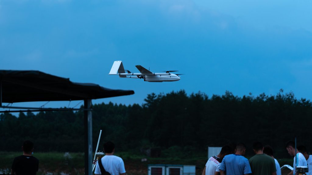
Let's face it, the JOUAV CW-30E is a pricey piece of kit. But if you're in the market for a drone that can truly go the distance, this might be your best bet. It's a tank of a drone, built like a champ.
I've been lucky enough to get my hands on the standard version for a spin, and I have to say, the 100km range is no joke. The company claims it, and I've seen it with my own eyes. Flying at a decent clip of about 25m/s, I managed to push it to almost exactly 100km before turning back. The video feed was rock solid the entire time, even at over half a kilometer up.
I haven't tested the upgraded 200km version yet, but given the performance of the standard model, I have high hopes for it.
One thing that really impressed me is how well this drone handles interference. It uses a 1.4GHz band, which is less crowded than the usual 2.4GHz or 5.8GHz. This means fewer dropouts when flying in urban areas or places with lots of other wireless devices. I've flown it in some pretty hectic environments, and it’s handled it like a pro.
The camera setup on this thing is a game-changer. The dual-optical gimbal with its 30x zoom is incredible for spotting details, and the infrared camera is perfect for those early morning or late night missions. I've used it for everything from wildlife spotting to inspecting power lines, and it's never let me down. The AI-powered object tracking is a nice bonus, although it's not perfect, and sometimes it gets a little confused.
Another thing I love about the CW-30E is its versatility. It can take off and land pretty much anywhere, which is a huge plus. I've launched it from the back of a truck, a small field, and even a moving boat without any issues. And with a payload of 8kg, you can load it up with all sorts of gear to suit your needs.
The flight time is impressive too. I managed to squeeze out about 7 hours on a single tank while carrying a decent payload. That’s plenty of time to cover a lot of ground.
The JOUAV CW-30E is a seriously capable drone that can handle just about anything you throw at it. If you need long range, reliability, and versatility, this is definitely worth considering. But be prepared to dig deep, because it doesn’t come cheap.
Quantum Trinity Pro: 100km (62 Miles)
| Pros | Cons |
|
|
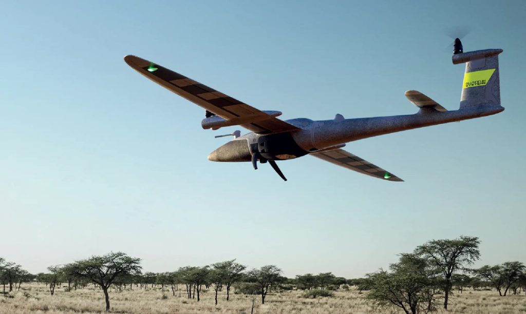
I recently got my hands on the standard Trinity Pro, and while it's not perfect, it's definitely a capable drone. The advertised 50km range is a bit optimistic, but I managed to squeeze out about 36km in decent conditions.
The connection was strong throughout the flight, which is a big plus. I haven’t tested the upgraded range, but I’d be surprised if it hit 70km consistently.
One thing that stood out was the drone’s ability to handle itself. The terrain tracking with the downward-facing LiDAR is a game-changer. It makes flying in uneven terrain a breeze and the automatic obstacle avoidance is a great safety feature. The flight planning software, QBase 3D, is pretty slick too. It’s nice to be able to set up a flight plan and let the drone do its thing.
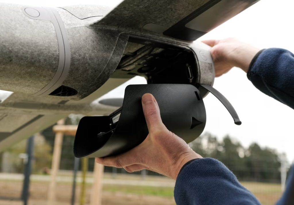
The camera system is decent, and I like the quick-swappable payload bay. However, I did notice some vibration in the footage, even with the dampening. It’s not a deal-breaker, but it’s something to be aware of.
While the Trinity Pro is impressive in many ways, it’s not without its flaws. The 2.4GHz frequency can be a bit of a pain in crowded areas. I experienced some interference when flying near a busy Wi-Fi network.
Overall, the Trinity Pro is a solid choice for those who need a drone that can handle itself. It's not the most budget-friendly option, but the advanced features and reliable performance make it a worthwhile investment for many users.
JOUAV CW-15: 50km (31 miles)
| Pros | Cons |
|
|
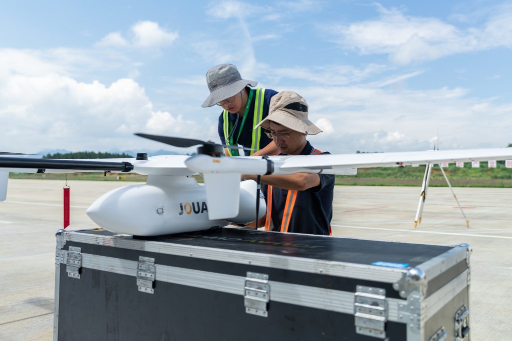
I've had the opportunity to really put the JOUAV CW-15 through its paces, and I'm impressed. We managed to push it to its limits on a calm day, flying it for over 41 minutes at a decent clip. What's crazy is we got clear video and solid control at over 47km (29 miles) away. I've even managed to stretch it a bit further, topping out at over 50km (31 miles). That's an insane range!
The secret sauce seems to be the 1.4GHz data link. It's rock solid, and I didn't experience any dropouts or interference, even when flying in areas with lots of other wireless devices.
The CW-15 is built for serious work. With a 3kg payload, you can load it up with all sorts of gear. I've tested it with the MG-120E gimbal camera for inspections and the CA-103 for mapping, and both worked great. The ability to customize it with LiDAR or other sensors is a huge plus.
Battery life is another strong point. I’ve managed to get close to the advertised 180 minutes on a few flights. That's a massive advantage for long missions.
One thing I really appreciate is how easy it is to get this drone in the air. The pre-flight checks and auto-calibration are quick and efficient. Plus, the safety features are top-notch. Obstacle avoidance and terrain following are essential for any serious drone pilot, and the CW-15 delivers.
The only downside I've found so far is that it's a pretty hefty investment. But if you need a drone with serious range and payload capacity, the CW-15 is definitely worth considering.
Autel Dragonfish Pro: 30km (19 miles)
| Pros | Cons |
|
|
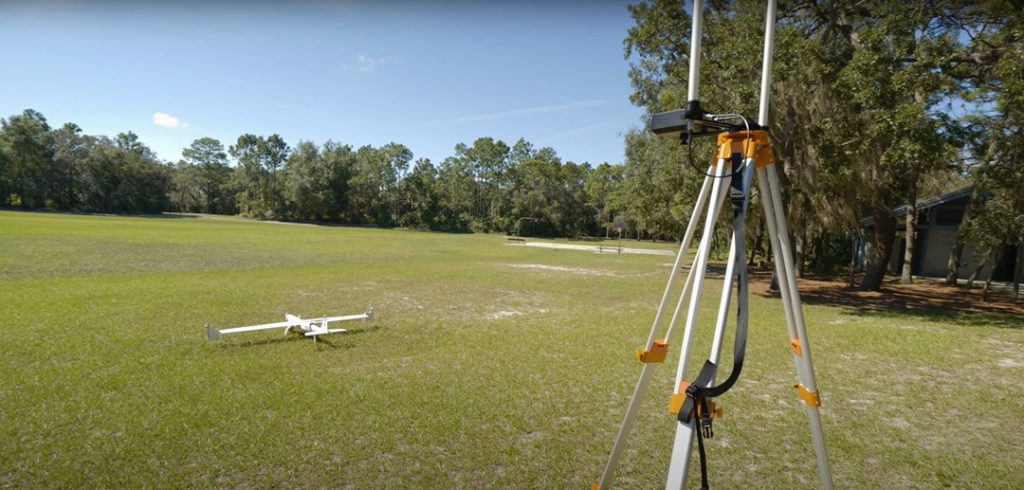
The Autel Dragonfish Pro is a serious contender in the long-range drone market. Advertised with a 30km range, I was eager to see how it would perform in real-world conditions.
During my tests, I managed to push the Dragonfish Pro to about 11km before hitting some noticeable signal degradation. However, I was pleasantly surprised by how well it held up at around 16km. Even with obstacles like buildings and trees in the way, the connection remained strong. Autel’s dual-frequency system (2.4GHz and 5.8GHz) ensures a stable video feed throughout the flight by intelligently switching between frequencies.
The Dragonfish Pro excels in image quality. Equipped with the L50T payload, the drone provides 50x optical zoom and 240x hybrid zoom, capturing clear details from as far as 2 kilometers. Its 158-minute flight time is a game-changer for extended missions, offering ample opportunity to cover vast areas.
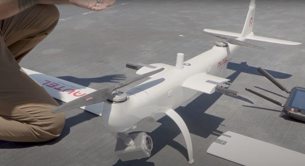
The drone handles directional changes with ease, maintaining a stable and clear video feed, which is essential for precise aerial footage. Its dual RTK modules deliver centimeter-level accuracy, precise heading, and strong resistance to magnetic interference, all while improving the quality of photogrammetric data.
Autel has prioritized safety and reliability in the Dragonfish Pro. Redundant systems, including dual RTK modules and the ability to switch to multi-rotor mode in emergencies, inspire confidence. The inclusion of ADS-B for air traffic awareness is a significant safety enhancement.
While the Dragonfish Pro is undoubtedly a high-performance drone, it comes with a premium price tag. It's a tool for professionals who demand long range, high image quality, and robust performance.
Top Multirotor Long Range Drones
With advancements in technology, multirotor drones are now capable of covering impressive distances, opening up new possibilities for photography, videography, and exploration.
Parrot Anafi AI: 23km (14 miles)
| Pros | Cons |
|
|
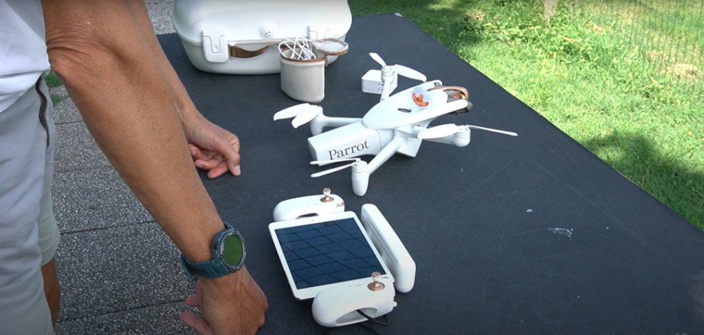
The Parrot Anafi AI is a groundbreaking drone that utilizes 4G as its primary data link, promising a maximum range of 23km. While this technology offers the potential for expanded flight distances, real-world conditions can impact performance.
During my tests in a light urban area with mild winds, the video quality began to decline around 11 miles, and the connection was completely lost at 15.3 miles. Reconnecting required restarting the app, highlighting some limitations in the drone's range.
Despite these challenges, the Anafi AI’s 4G connectivity allows for reliable control beyond typical range limits. The camera system stands out with its 48MP resolution, 4K HDR video, and a versatile gimbal that can tilt from -90° to +90°, making it ideal for capturing unique angles like the underside of bridges.
The drone also features a 6-axis hybrid image stabilization system, combining mechanical and electronic stabilization to ensure clear photos even in winds up to 12.7 m/s. This makes it a solid choice for professional use in varying weather conditions.
Security is another key feature of the Anafi AI. For the first time, a drone and its Skycontroller 4 include an encrypted 4G link, protecting both software integrity and data privacy, making it a secure option for sensitive operations.
Additionally, the Anafi AI’s embedded artificial intelligence automates flight plans for photogrammetry, saving time and increasing productivity. Its bionic design, with a rotating head and omnidirectional camera, ensures precise obstacle avoidance, automatically choosing the best path to complete tasks safely.
DJI Matrice 350: 20km (12 miles)
| Pros | Cons |
|
|
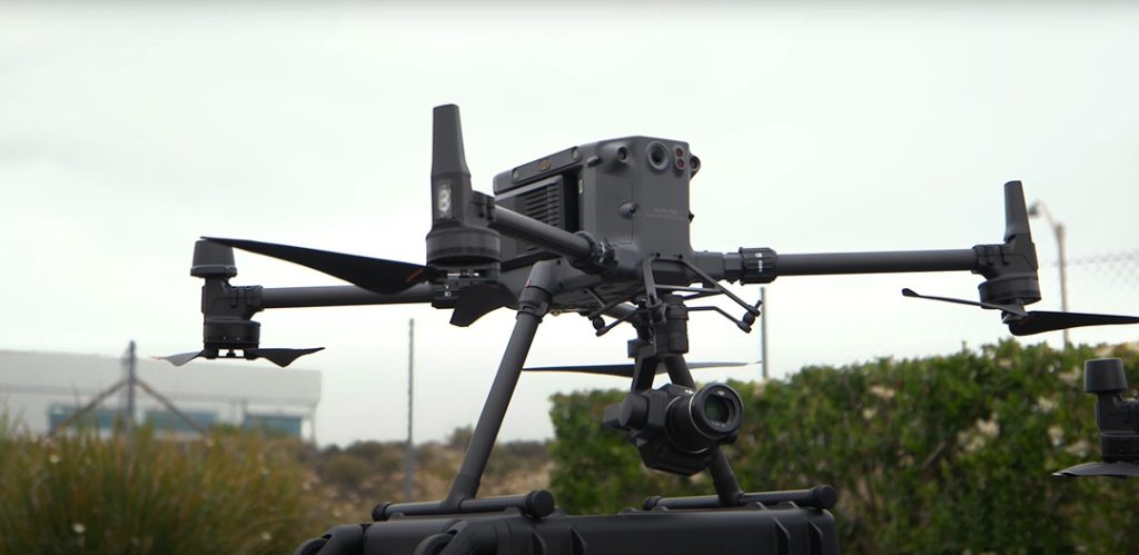
The DJI Matrice 350 RTK represents a significant advancement over its predecessor, the Matrice 300 RTK. With an advertised range of up to 20km, we subjected the M350 RTK to rigorous testing in open field conditions under strong wind gusts. Despite the challenging environment and the drone’s high cost, we prioritized safety and returned the drone before reaching the maximum range of 15km.
Impressively, the drone maintained a strong signal throughout the test, even in the face of persistent wind. However, the aircraft struggled to counteract the strong gusts, requiring constant pilot input to maintain stability. The drone's tilt was significant, and frequent wind speed warnings further emphasized the challenging conditions.
The drone’s extended range is thanks to the DJI O3 Enterprise transmission system, which supports three-channel 1080p HD live streaming. The quad-antenna transceiver system on both the drone and remote control intelligently selects the best antennas for signal transmission, enhancing anti-interference and stability.
The Matrice 350 RTK can be fitted with the Zenmuse H20 camera system, which includes a 20 MP zoom camera, a 12 MP wide-angle camera, and a laser rangefinder with a 1200-meter range. This setup allows for high-quality photos and videos from a safe distance.
The new TB65 dual battery system provides approximately 43 minutes of flight time and supports hot-swapping, enabling multiple flights without shutdown. The TB65 battery is rated for up to 400 cycles, compared to the TB60’s 200 cycles, and features real-time monitoring and an integrated self-heating system for operation in temperatures as low as -20°C.
The Matrice 350 RTK features a six-way binocular vision system with sensors on the front, back, down, up, and infrared sensors on the sides. This system ensures real-time obstacle detection and avoidance, making it well-suited for complex environments. Additionally, the drone uses GPS, GLONASS, BeiDou, and DJI’s Real-Time Kinematic (RTK) system for accurate positioning in challenging conditions.
DJI Air 3: 20km (12 miles)
| Pros | Cons |
|
|
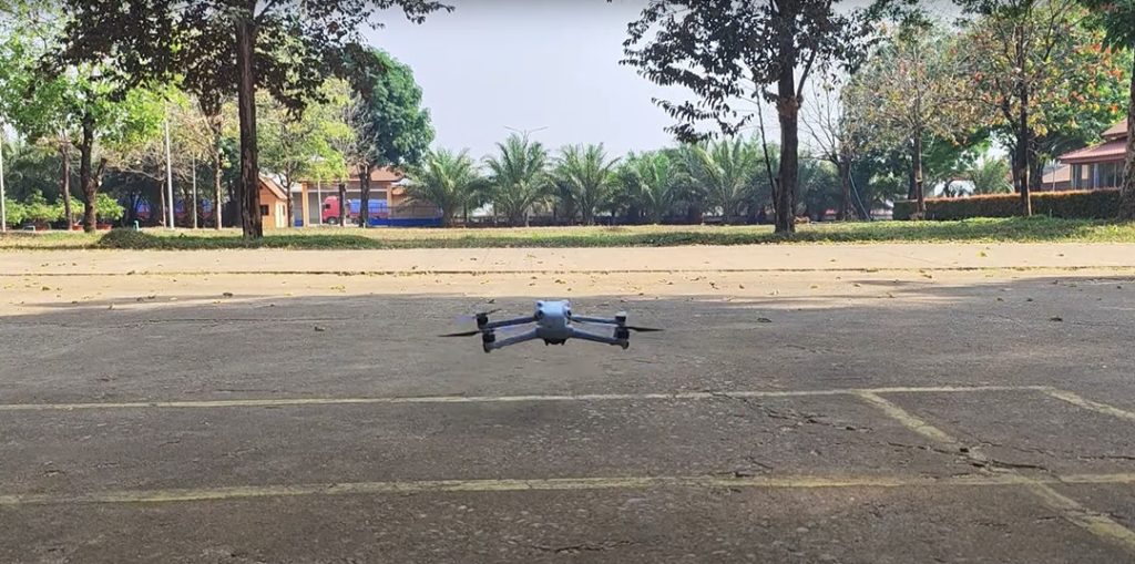
Released in 2023, the DJI Air 3 offers a robust flight time of up to 43 minutes and can reach a maximum range of 19 kilometers.
We tested the Air 3 in a mountainous area with clear visibility to evaluate its performance. To focus on its range, we temporarily disabled features like obstacle avoidance sensors. The main goal was to see how far it could fly while maintaining a stable signal.
Flying at 26 mph in gusty winds of 5-10 mph, the Air 3 took off smoothly and stayed low to avoid disturbing people nearby. After about 20 minutes, it managed an impressive range of around 7 miles. Even at this distance, the signal remained strong with smooth video transmission, thanks to its OcuSync O4 technology, which supports up to 20 kilometers of range and delivers 1080p video with low latency.
The battery life also exceeded our expectations. Despite the long flight and varying speeds, the battery held up well and activated the automatic return home mode when it reached 55% charge. In typical use, the battery lasts up to 35 minutes.
Want to see the DJI Air 3 in action? Check out Dustin's video testing its maximum flight time and range:
The Air 3 comes equipped with two cameras that deliver excellent aerial imagery. The 12-megapixel mode combines four pixels into one for better performance in low light, while the 48-megapixel mode uses each pixel individually for higher resolution, though it’s less effective in low light.
The cameras have a 70mm equivalent focal length for detailed close-up shots, and both sensors are 1/1.3 inches in size, with the wide-angle lens set at f/1.7 and the zoom lens at f/2.8.
In addition to its impressive cameras, the Air 3 offers improved wind resistance, omnidirectional obstacle avoidance, and long battery life. It also supports features like waypoint navigation and pre-programmed flight paths, making it versatile and easy to use.
DJI Mavic 3 Pro: 15km (9 miles)
| Pros | Cons |
|
|
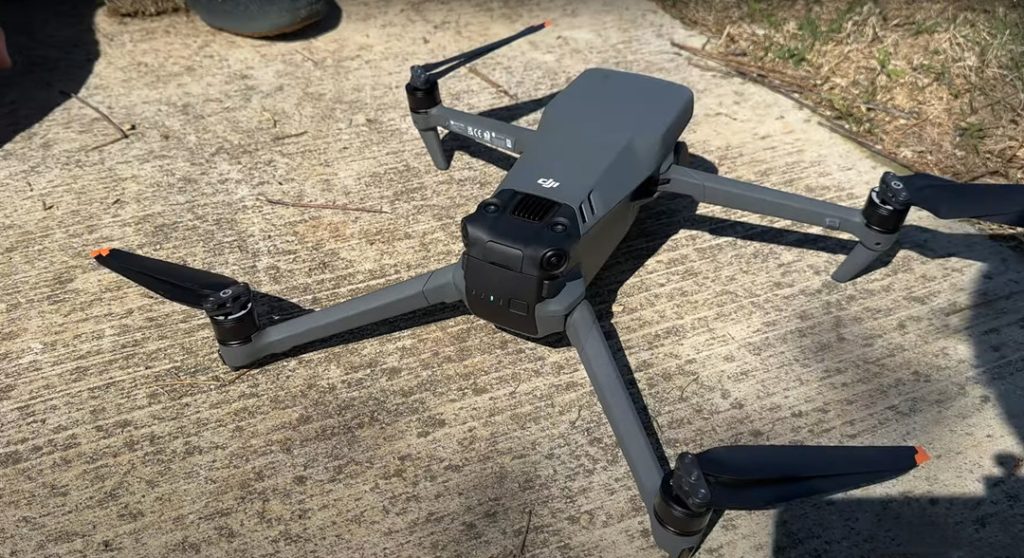
The DJI Mavic 3 Pro boasts an impressive range, easily surpassing its advertised 15km limit in ideal conditions.
For this range test, I launched the drone from an open field and flew it steadily while monitoring the battery. When the battery level dropped to 58%, the drone had traveled a remarkable 4.6 miles. We still had full control and a clear video feed, though the screen did show a weak signal alert.
Other users have reported similarly impressive results. One test had the Mavic 3 Pro covering a 10km round trip over open water with no issues. DJI's OcuSync 3.0 technology undoubtedly contributes to this exceptional performance.
Of course, real-world conditions can affect range due to obstacles, interference, and regulations. But even conservatively, the Mavic 3 Pro’s range is impressive and well beyond line-of-sight.
With a 45-minute flight time, you can make the most of the Mavic 3 Pro’s long range, exploring vast areas on a single charge. It handles flying over forests, rivers, and fields with ease.
See how far the DJI Air 3 can really go. Youtube Guy's video shows the results.
The Mavic 3 Pro also features an upgraded camera system. It includes a 20MP Hasselblad camera, a 48MP mid-range camera, and a 12MP zoom lens. Despite these upgrades, it’s priced similarly to the original Mavic 3, offering great value for the enhanced features.
Whether for landscape photography, search and rescue, or industrial inspections, the Mavic 3 Pro delivers exceptional long-range performance and advanced camera capabilities. DJI has made significant strides in drone technology with this model.
Autel Evo II Pro V3: 15km (9 miles)
| Pros | Cons |
|
|
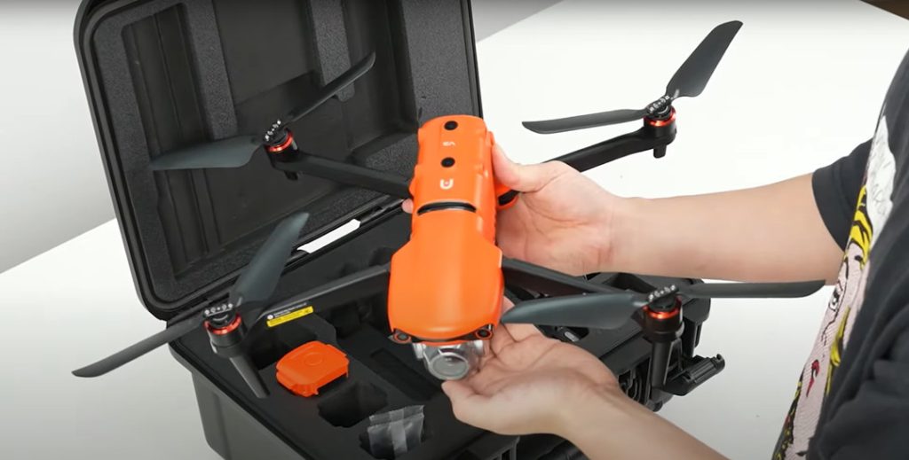
The Autel EVO II Pro V3 has captured our attention as a top performer among long-range drones, with a maximum transmission range of 9 kilometers (5.5 miles) under optimal conditions.
In real-world testing, the EVO Pro V3 managed to fly up to 4,000 meters (2.5 miles). Although there were occasional weak signal warnings, the telemetry data remained reliable, showing that the drone was within its range. Adjustments to the antenna angle and altitude helped regain a stronger connection when needed.
Pushing its limits further, the drone reached nearly 5,000 meters (3.1 miles), setting new range records. Its dual-frequency transmission system automatically switches between frequencies to maintain a strong connection, keeping the video feed stable throughout the flight.
Battery life was the main limitation. During its return flight, the drone lost connection and landed in a cornfield. Thankfully, after an hour of searching, we recovered it intact.
In addition to its long-range capability, the EVO Pro V3 offers up to 6K video resolution, the highest in its class. While we observed some sharpening and occasional flashes in detailed footage, overall image quality was impressive.
The drone performs exceptionally well in low-light conditions, capturing clear nighttime cityscapes and retaining shadow details, making it an excellent choice for challenging lighting situations.
How Far Can A Drone Fly?
The flight range of a drone varies widely depending on its type, purpose, and design. Here’s a breakdown of how far different types of drones can fly:
Military Drones
Military drones are designed for various missions, from tactical operations to long-range surveillance.
- Small Tactical Drones: These drones, like the FULMAR, typically have a range of about 90 kilometers and can stay airborne for up to 12 hours on a single mission.
- Medium Altitude Long Endurance (MALE) Drones: Drones like the MQ-9 Reaper can cover much larger distances, with an endurance of around 27 hours, allowing them to fly over vast areas.
- High Altitude Long Endurance (HALE) Drones: The RQ-4 Global Hawk is an example of a HALE drone, capable of flying at altitudes up to 60,000 feet with a range exceeding 12,000 miles. These drones can remain in the air for up to 34 hours, enabling missions that span entire continents.
Commercial Drones
Commercial drones vary significantly in range based on their design and technology.
- Multi-Rotor Drones: Typical commercial multi-rotor drones have a flight range of 10 to 15 kilometers, making them suitable for tasks that require proximity and shorter durations.
- Fixed-Wing Drones: For long-range applications like large-area mapping and surveying, fixed-wing drones are ideal. They can cover distances up to 100 kilometers, offering efficient coverage of vast territories.
Police Drones
Police drones are used for a variety of law enforcement tasks, from surveillance to crowd management.
- Long-Range Police Drones: Advanced police drones can fly up to 200 kilometers on a single mission, making them ideal for extensive surveillance and long-duration operations.
- Standard Police Drones: More commonly, police drones are used within a range of up to 15 kilometers, which is sufficient for tasks like traffic monitoring, crowd management, and tactical deployments. These drones allow law enforcement to quickly cover large areas, improving response times and public safety management.
What You Should Consider Before Buying the Best Long Range Drone?
When it comes to long-distance flying, the type of drone that is best depends on the specific needs of the operator. However, there are several factors to consider when choosing the best one:
Stable and low-latency transmission: It's essential to choose a transmission system that offers a clear and uninterrupted live feed. Those that support both 2.4 GHz and 5.8 GHz frequencies are more reliable, especially with automatic switching in real-time, ensuring a stable transmission in areas with high levels of interference.
Transmission live feed quality: High-resolution transmission feeds provide precise adjustments for the drone's flight, capturing footage with exceptional detail. For long-range drone flights, a 1080p live stream feed is a good choice as it offers a high-quality live view.
Anti-jamming technology: Anti-jamming technology is used to prevent interference from other electronic signals that can disrupt the drone's communication systems. Both anti-jamming GPS technology, frequency hopping spread spectrum (FHSS) and direct-sequence spread spectrum (DSSS) can help prevent interference
Secure video transmission: It's important to secure the transmission of data between the drone and the receiver, especially if the drone is being used for sensitive applications such as surveillance applications. AES 256-bit is an example of a strong encryption algorithm.
Excellent flight performance: A drone's speed and flight time are important factors in its performance. Faster drones can quickly reach their destination, while longer flight times allow for more efficient and productive work. It is recommended to choose a drone that can fly for at least 20 minutes per battery to ensure maximum flight time.
Camera quality: If you plan to use the drone for aerial photography or videography, you'll want to select a drone with a high-quality camera and imaging capabilities. Consider sensor size, resolution, lens quality, stabilization, field of view, low-light capabilities, and dynamic range. Also, think about brand reputation, compatibility, ease of use, and cost.
Obstacle avoidance: Obstacle avoidance technology can help prevent collisions and ensure safe flights, especially when flying in challenging environments. Consider whether the drone has advanced obstacle avoidance features such as sensors and intelligent flight modes.
Portability: If you plan on traveling with your drone or need to transport it to different locations, consider the portability of the drone. Look for features such as foldable arms and lightweight design.
What Factors Affect a Drone's Range?
When considering a drone's range, several critical factors come into play that determine how far your drone can fly and how effectively it can perform during a flight.
Battery Life
Measured in milliampere-hours (mAh), a larger capacity generally equates to longer flight times. For example, the DJI Mini 4 Pro's 2,590 mAh battery offers around 34 minutes of flight time, while the DJI Matrice 350 RTK's 4,920 mAh battery provides up to 55 minutes.
Advancements in battery technology, such as the use of higher energy density materials and efficient battery management systems (BMS), can significantly extend flight range.
Drone Weight
A drone's weight significantly impacts its range. Heavier drones consume more power to stay aloft, reducing flight time. Additional payloads like cameras, sensors, or gimbals further increase weight, affecting range.
Drone Design and Technology
A drone's design, including factors like aerodynamic efficiency, motor power, and propulsion system, impacts range. Advanced features like GPS, obstacle avoidance, and camera stabilization can increase power consumption, affecting flight time.
Weather Conditions
Weather conditions significantly impact drone performance. Headwinds increase power consumption, reducing range. Extreme temperatures affect battery efficiency and drone components. High humidity can reduce battery performance and impact electronic components.
Signal Strength and Interference
Maintaining a strong signal between the drone and controller is crucial for long-range flights. Factors like transmission frequency, antenna design, and environmental obstacles (buildings, trees, electronic devices) influence signal strength. Flying in open areas generally provides better signal strength and extended range.
Terrain and Obstacles
Terrain and obstacles can influence flight paths and range. Dense urban areas and mountainous terrain can create challenges. Planning routes that avoid these obstacles and flying at higher altitudes can help maximize range.
How to Extend Your Drone Range with Relay Communication?
If you're looking to push the boundaries of your drone's capabilities and achieve greater range, it's time to delve into the finer details that can make a substantial difference.
UAV Relay Communication System
Drones are not only aerial marvels but also vital communication platforms. Learn about innovative relay communication systems that transform drones into dynamic bridges, connecting people even in emergencies and challenging terrains.
1. Airborne Platform Relay Communication: When we need to communicate in emergencies or tricky terrains, airborne platforms carrying communication devices can help. These platforms can rise up and solve the problem of weak communication signals in complicated places. Think of them as flying cell towers that provide temporary Wi-Fi in the air. These flying platforms have been crucial for rescue missions during emergencies like earthquakes and floods.
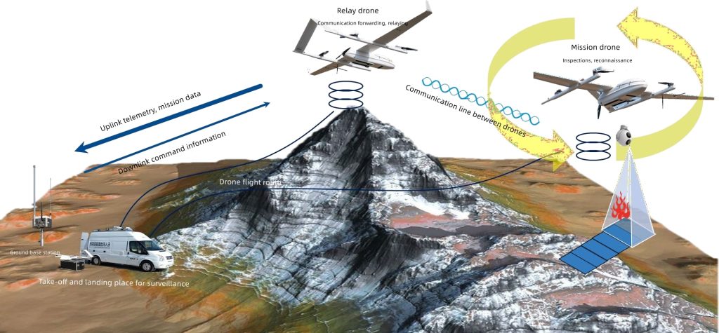
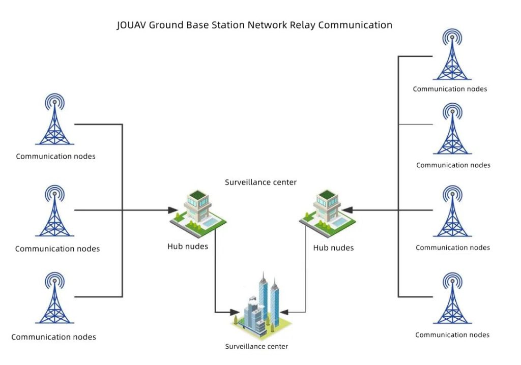
2. Ground Base Station Network Relay Communication: Imagine setting up ground stations that talk to flying drones. These stations connect to each other to form a network, allowing a drone to talk to multiple stations. This network approach, combined with smart flying techniques, lets drones cover larger areas.
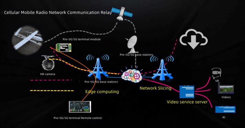
3. Cellular Mobile Radio Grouping Network Relay Communication: Think of this like turning drones into flying Wi-Fi hotspots. Drones have equipment that connects to cell towers on the ground. This creates a mini-network in the sky, useful for various situations. As our regular mobile networks improve, drones working with these networks can do more tasks together, moving around a lot and helping in different places.
For example, the JOUAV CW-15 drone uses the power of 5G internet to talk to a central system in real-time. This helps with controlling the drone and sending back pictures or data it collects during its flight.
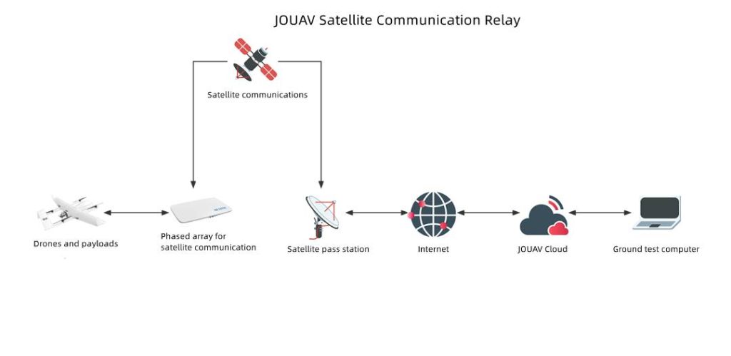
4. Satellite Communication: When you want to talk over really long distances, satellites can help. They're like signal boosters in space. You can send signals from anywhere on Earth to these satellites, and they'll bounce the signal back down to a station on the ground. This is useful for things like the internet in remote areas or when normal signals can't reach due to Earth's curves or obstacles.
For instance, the JOUAV CW-80E drone is versatile when it comes to communication. It can connect with different systems like satellite terminals, wireless networks, and even 5G systems. This means it can help people communicate in tough situations, like disasters or tricky environments.
Enhancing Hardware
1. Vertical Antenna Orientation: Contrary to common belief, the best signal transmission results from vertical antenna orientation, rather than pointing directly at the drone. This setup optimizes signal reception and transmission angles.
2. Signal Strength Enhancement: Enhance signal strength with extender devices and directional antennas. These accessories concentrate signal power, ensuring reliable communication even in challenging environments.
3. Obstruction Avoidance: Proper placement of internal components, such as antennas, is critical to prevent obstruction and maintain signal quality. A clear path for signal transmission contributes to an extended communication range.
4. Transmitter Upgrade: Experienced drone pilots aiming to expand their capabilities can consider technical modifications. Positioning the drone's internal antenna beneath it, away from potential obstructions like batteries, can enhance signal transmission. Upgrading to a more powerful transmitter directly amplifies signal output, extending the drone's communication range. It's important, however, to approach these modifications with expertise and adherence to safety guidelines.
Optimizing Environmental Conditions
1. Fly at Higher Altitudes: To counter interference from objects and low sources, flying drones at higher altitudes is a strategic move. This maneuver distances drones from potential signal disruptors, leading to a more robust connection. However, adhering to local aviation regulations and altitude limits is crucial to ensure safety and compliance.
2. Choose Open Areas: For optimal communication range, selecting open spaces free from obstructions is essential. Avoiding buildings, trees, and other barriers allows for seamless signal transmission. Analyzing the surroundings before takeoff ensures a clear flight path and effective communication.
3. Weather Considerations: Weather conditions significantly influence drone communication capabilities. Thick fog, rain, and high humidity can weaken signals. Checking weather forecasts and avoiding adverse conditions is essential. Drones perform optimally on sunny days with clear skies, providing ideal conditions for strong signal transmission and extended range.
Legal Limitations for Flying Long Range Drones
Flying long-range drones requires strict adherence to legal limitations to ensure safety and compliance. In the U.S., drones under 55 pounds are regulated by 14 CFR Part 107, which requires pilots to keep drones within visual line of sight (VLOS), stay below 400 feet in altitude, and avoid restricted airspace.
Beyond Visual Line of Sight (BVLOS) Operations
BVLOS operations represent a significant advancement for commercial drone applications, enabling tasks like delivery services, infrastructure inspections, and large-scale mapping. However, the risks involved necessitate stringent regulations.
To ensure safety, countries are developing specific regulations for BVLOS operations. These often involve rigorous safety assessments, advanced drone technologies, and robust communication systems.
BVLOS drones typically require advanced features like sense-and-avoid systems, reliable communication links, and high-precision GPS for safe and autonomous operation.
Extending Range with Visual Observers
To maximize the operational range while adhering to these regulations, drone pilots can utilize visual observers. By strategically placing observers along the flight path, each maintaining direct visual contact with the drone, the pilot can extend the drone’s range while remaining within legal limits.
Typically, observers are spaced between 500 feet and 0.5 miles apart. Effective communication between the pilot and observers, whether through hand signals or radios, ensures that the drone remains within sight at all times and that tracking duties are smoothly passed along the flight path.
However, even with visual observers, safety must remain the top priority. Pilots should avoid flying near people, manned aircraft, or in situations where visibility might be compromised. Attempting complex maneuvers or operating beyond the range of visual observers can lead to violations of FAA regulations and increased risks.
Compliance with Additional FAA Requirements
In addition to operational guidelines, recreational drone pilots in the U.S. are required to take The Recreational UAS Safety Test (TRUST) and carry proof of registration for their drones. These requirements are part of the FAA’s broader efforts to promote responsible drone use.
Similar regulations apply in other countries like Canada and Australia. In these regions, drones must also be flown within the operator's visual line of sight and adhere to specific altitude restrictions. Additionally, Canada and Australia enforce strict rules against flying over bystanders, public events, and near sensitive areas such as airports and heliports.
Types of Long Range Drones
The world of long-range drones is as diverse as the applications they serve. These high-performance aerial vehicles come in various types, each tailored to specific operational demands. Let's delve into the distinct categories of long-range drones:
Long Range Fixed-Wing Drones
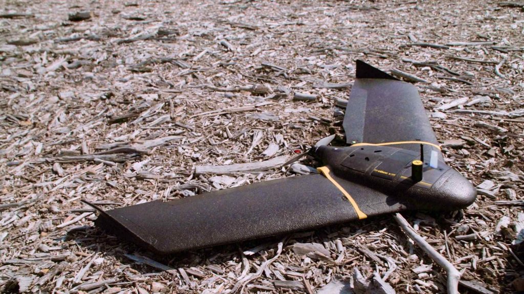
Long-range fixed-wing drones are synonymous with endurance and extensive coverage. These aircraft, resembling miniature airplanes, excel in traversing large distances efficiently. Their aerodynamic design allows them to glide through the air with minimal power consumption, resulting in extended flight times.
Often used for surveying vast areas, mapping, and surveillance, fixed-wing drones can cover expansive territories in a single flight, making them invaluable for environmental monitoring, agriculture, and infrastructure inspection.
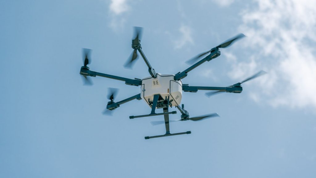
Long Range Quadcopters and Multirotors
In contrast to their fixed-wing counterparts, long-range quadcopters and multi-rotors are characterized by their agility and adaptability. These drones utilize multiple rotors for enhanced stability and maneuverability.
While their flight times may be shorter compared to fixed-wing drones, their ability to hover and navigate intricate spaces makes them ideal for tasks like aerial photography, cinematography, and inspection of structures or equipment in challenging environments.
Long Range VTOL (Vertical Takeoff and Landing) Drones
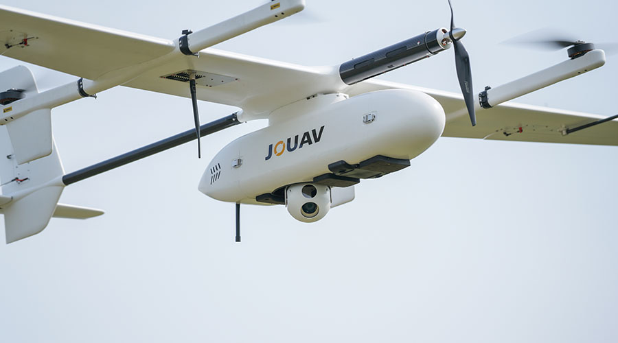
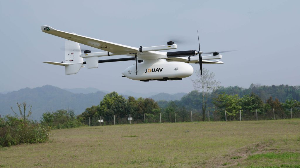
Long-range VTOL drones, like JOUAV CW Series drones, combine the benefits of both fixed-wing and multirotor designs. They possess the ability to take off and land vertically like quadcopters, while also enjoying the efficiency and extended flight times associated with fixed-wing aircraft.
VTOL drones are suitable for scenarios requiring versatile deployment, such as search and rescue operations in rugged terrains or quick reconnaissance missions. Their ability to adapt to various environments makes them a go-to choice for missions demanding both reach and flexibility.
Long Range Helicopter Drones
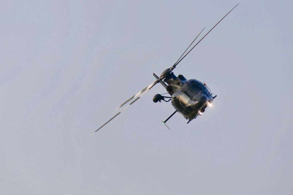
Helicopter drones, often equipped with a single rotor, offer stability and precise hovering capabilities. These drones excel in tasks that demand steady observation, such as wildlife monitoring, border patrol, and powerline inspections. Their ability to maintain a fixed position in the air provides a stable platform for capturing detailed imagery or conducting accurate surveys.
Long Range Mini Drones
For specific applications requiring compactness and precision, long-range mini drones step in. These diminutive marvels are designed for specialized tasks such as monitoring confined spaces, inspecting intricate machinery, or conducting scientific research in challenging locations.
Their small size allows them to access areas that larger drones cannot, making them valuable tools for industries like mining, construction, and scientific exploration.
Applications of Long Range Drones
Long range drones have emerged as transformative tools across a spectrum of industries, revolutionizing the way tasks are executed. Let's explore the expansive horizons of long range drone applications, shedding light on their impact and significance.
Surveillance and Security
The integration of long range drones in surveillance and security domains has redefined vigilance. Outfitted with cutting-edge cameras and sensors, these drones offer unprecedented coverage over expansive areas.
From safeguarding critical infrastructure to curbing wildlife poaching and fortifying border security, long range drones provide real-time insights and unparalleled situational awareness. Their ability to cover vast terrains with precision makes them essential tools for enhancing security measures and proactive threat detection.
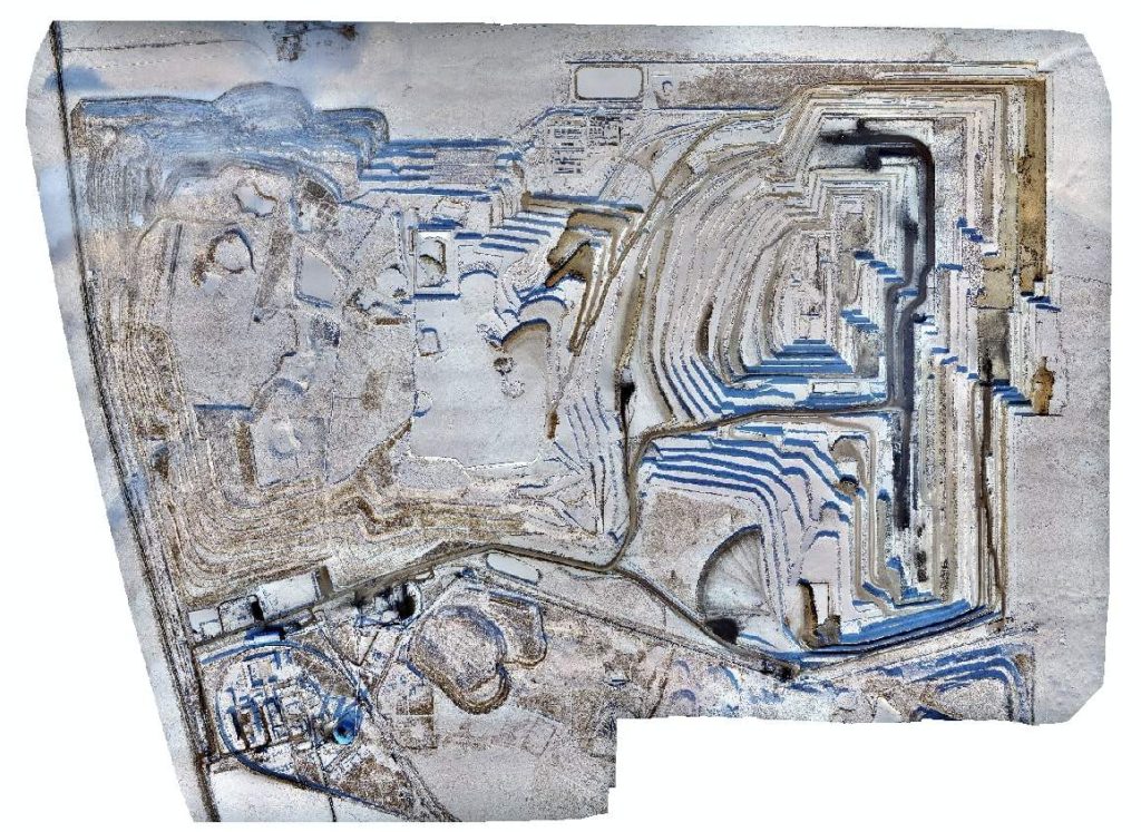
Surveying and Mapping
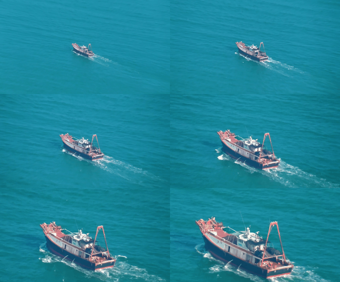
Mapping expansive areas has always been a challenge. Long range drones are rewriting the rules of surveying and mapping, making the once complex process efficient and accurate. They fly over vast terrains, capturing detailed images that are then stitched together to create intricate maps.
These maps are more than visuals; they’re the blueprints that guide urban planning, infrastructure development, and disaster management. With long range drones in the sky, the uncharted becomes mapped, and the impossible becomes reality.
Precision Agriculture
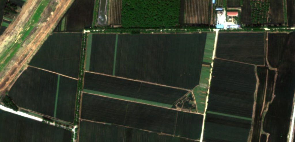
In the realm of agriculture and land surveying, long range drones are catalysts for precision and efficiency. Aerial scans of crops and fields enable early detection of issues like pest infestations or irrigation inefficiencies.
Beyond that, their ability to swiftly cover expansive areas aids in land mapping and soil analysis. Farmers and land planners leverage these insights to optimize productivity, implement targeted interventions, and make informed decisions that ultimately enhance yields and resource management.
Environmental Monitoring
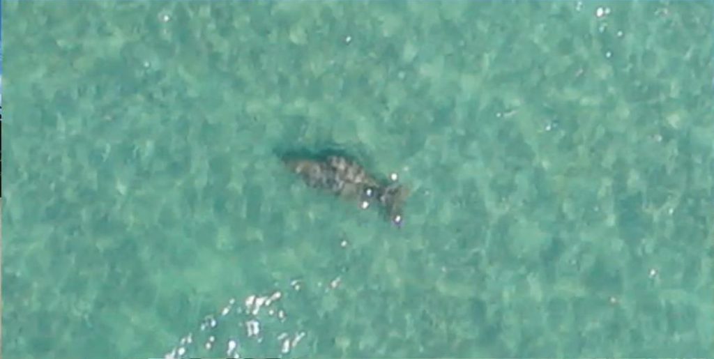
Long range drones have emerged as essential allies in environmental conservation. They facilitate tracking wildlife movements, monitoring ecosystem changes, and surveying deforestation. These drones navigate remote and challenging terrains, providing researchers and conservationists with vital data to preserve biodiversity.
By accessing hard-to-reach areas and delivering real-time insights, they contribute significantly to understanding and addressing environmental concerns.
Search and Rescue Missions
In critical situations, long range drones play a pivotal role in search and rescue missions. Rapid deployment and aerial reconnaissance capabilities aid teams in locating missing individuals or assessing disaster-affected areas.
These drones swiftly cover vast expanses and navigate challenging terrains, providing invaluable assistance to emergency responders. Their contributions significantly improve search efficiency and enhance the chances of successful rescue operations.
Infrastructure Inpsection
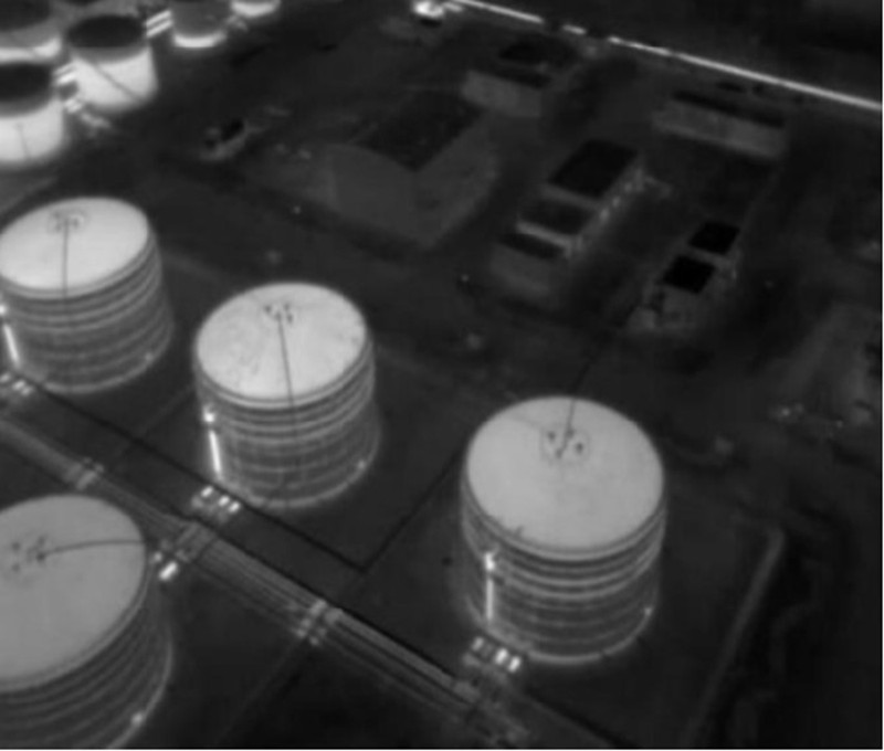
Long range drones have found a crucial role in infrastructure inspection. From bridges to power lines, these drones can thoroughly assess structures for signs of wear, damage, or maintenance needs.
Their ability to access hard-to-reach or dangerous areas reduces human risk and ensures thorough assessments, contributing to safer and more efficient infrastructure management.
Photography and Videography
The union of long range drones with photography and videography has unveiled novel avenues of creativity. Offering breathtaking aerial perspectives, these drones enable the capture of stunning landscapes, architectural wonders, and cinematic shots from previously unattainable angles.
Their high-quality imagery and smooth video footage have reshaped industries such as filmmaking, advertising, and tourism promotion. Long range drones empower visual storytellers to craft narratives that captivate and immerse audiences like never before.
How are Long Range Drones Controlled?
The control of long-range drones, pivotal to their performance, encompasses diverse methods and technologies. From remote control to computer interfaces, each approach carries distinct strengths and intricacies. Let's delve into the heart of long-range drone control.
Remote Control
The most prevalent method is remote control, where a handheld device guides the drone's flight from a distance. Small drones with limited ranges typically utilize this approach.
Remote controls comprise three essential components: the transmitter sends signals, the receiver interprets them, and the controller instructs the drone. This controller, ranging from simple joysticks to sophisticated consoles, dictates movement based on signals received.
Computer Interface
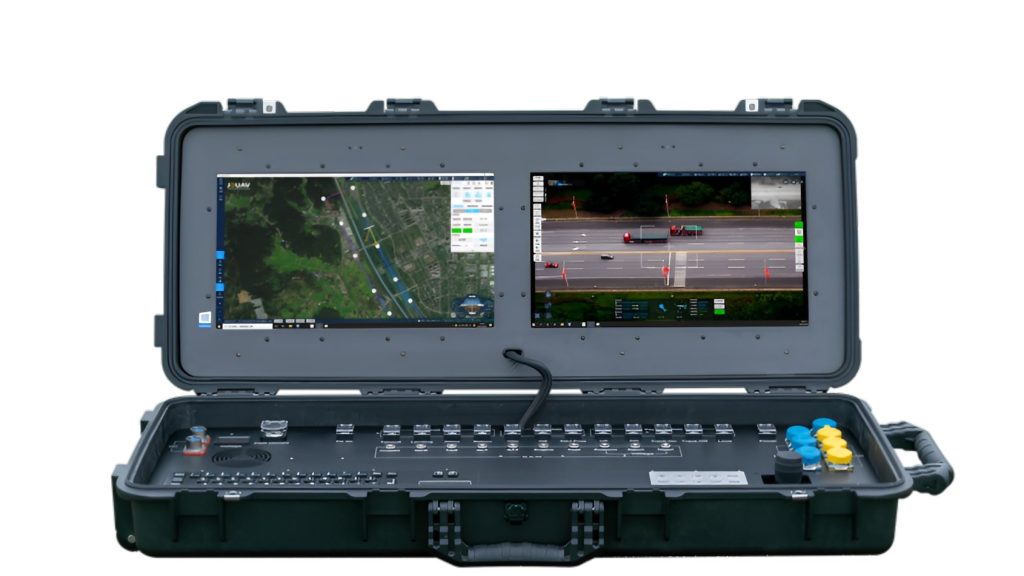
For larger drones covering substantial distances, computer interfaces take the lead. These interfaces connect drones to computers, enabling intricate control via dedicated software. Ranging from basic joysticks to feature-rich consoles, they grant comprehensive navigation.
Additionally, software often includes flight path mapping, valuable for extended missions or complex scenarios like search and rescue.
Ground Control Technologies
Long-range drone control relies on radio transmitters and receivers. The transmitter conveys instructions, while the receiver translates them for the drone. Alternative technologies like Wi-Fi and Bluetooth provide direct links, although they suit shorter ranges due to potential signal disruptions.
The overarching goal is stability amid changing conditions, attained through sensor-driven adjustments and algorithms that maintain steady flight trajectories.
What Happens When a Drone Goes Out of Range?
When a drone loses connection with its controller, it generally follows specific programmed responses to handle the situation.
Return to Home (RTH)
Most modern drones are equipped with an automatic Return to Home (RTH) function. When the signal is lost, the drone uses GPS to navigate back to its takeoff point. This process involves ascending to a predetermined altitude and then flying directly to the launch location. For example, if a JOUAV drone loses connection, it will automatically engage RTH, providing a high likelihood of safe recovery if the GPS signal is strong and unobstructed.
Hovering in Place
If the drone's RTH function is not active or if the environment is unsuitable for RTH (e.g., if GPS signals are weak), many drones will hover in place. This behavior allows the drone to remain stationary and wait for the signal to be restored. Hovering is typically implemented when the drone is in a safe area, such as an open field, where it can maintain altitude without immediate risk.
Emergency Landing
In scenarios where RTH and hovering are not feasible, the drone may initiate an emergency landing. This feature is activated if the battery level drops critically low or if the drone cannot safely navigate back to the takeoff point. The landing could be a controlled descent to a safe spot or, in more extreme cases, a rapid drop if no better option is available.
Loss of Control
In the absence of RTH, GPS, or hovering capabilities, the drone may lose control entirely. This situation often results in the drone crashing or becoming lost, especially if it is out of range in an area with obstacles or dense structures. Drones without advanced safety features are more susceptible to uncontrollable situations when they lose connection.
FAQ
Why Video Transmission is Important for Long Range Drones?
Video transmission is crucial for long-range drones because it allows operators to maintain situational awareness, monitor the drone's surroundings, and gather real-time data from a distance. This ensures safe navigation, obstacle avoidance, and effective mission execution.
What is the Range of a Fixed Wing Drone?
The exact range of a fixed-wing drone can vary significantly based on its design, specifications, and operational conditions. However, to provide you with a rough estimate:
- Entry-level fixed-wing drones might have ranges of around 5 to 10 kilometers (3 to 6 miles).
- Mid-range fixed-wing drones can achieve distances of 10 to 50 kilometers (6 to 31 miles).
- Advanced fixed-wing drones, especially those designed for long-range missions like mapping or surveillance, can cover distances of 50 kilometers (31 miles) or more in a single flight.
Can a Drone Fly 200 Miles?
Yes, certain long-range drones, especially those used for specialized purposes like surveying or remote sensing, can cover 200 miles or more in a single flight.
Can a Drone Fly for 5 Hours?
Some high-end drones like JOUAV CW-30E equipped with efficient propulsion systems and large battery capacities can achieve flight times of around 8 hours.
What Makes Long-Range Drones Possible?
A successful long-range drone setup involves optimizing battery capacity, selecting efficient propulsion systems, using lightweight yet durable materials, incorporating advanced navigation and communication systems, and adhering to local regulations.
Can You Control a Drone from Far Away?
Yes, you can control a drone from far away using a remote controller or a mobile device linked to the drone's control system. However, you must stay within the drone's communication range to maintain control.
How Far Can You Fly a Drone from an Airport?
The distance you can fly a drone from an airport is subject to aviation regulations. Generally, drones are not allowed to operate within certain distances (typically several miles) from airports due to safety concerns.
How Do Long Range Drones Communicate?
Long-range drones communicate using various technologies, including radio frequencies, satellite links, and cellular networks. These communication channels allow remote pilots to control the drone and receive telemetry data over extended distances.
What Frequency Do Long Range Drones Use?
Long-range drones typically use radio frequencies within the 2.4 GHz and 5.8 GHz bands for control and telemetry. Some advanced long-range drones might also employ satellite communication systems for extended coverage.
Do Drone Range Extenders Really Work?
Yes, it works. When using a drone signal extender, you can typically expect a range boost of around 15% or more. This improvement is achieved by optimizing the way your remote controller's signals are transmitted to your drone. By focusing the communication signals directly towards the drone, signal loss is minimized, and potential interference is reduced.
How Much Does a Long Range Drone Cost?
The cost of a long-range drone plane can vary depending on various factors such as its capabilities, range, payload capacity, and other features. Generally, long-range drones can range from a few hundred to tens of thousands of dollars.
The most basic long-range drones, such as those used for hobby or personal use, typically cost between $500 to $2,000. However, if you're looking for a more advanced long-range drone with specialized features, you can expect to pay upwards of $10,000 to $50,000 or more.
It's important to note that the cost of a long-range drone is not the only expense you'll incur. You'll also need to consider additional costs such as licensing fees, training, maintenance, and insurance.
- Read more: How Much Does A Drone Cost in 2023? Here’s a Price Breakdown
How to Prevent the Drone from Flying Out of Range?
Preventing a drone from flying out of range is crucial to ensure a safe and successful flight. Here are some ways to prevent your drone from flying out of range:
- Know your drone's range: Make sure you know your drone's maximum range before flying. Check the manufacturer's specifications and ensure that your drone is within range of your controller at all times.
- Keep your drone in line of sight: Keeping your drone in line of sight is critical to prevent it from flying out of range. Avoid flying behind obstacles, trees, or buildings that can obstruct your view of the drone.
- Monitor the battery level: Keep an eye on your drone's battery level and ensure that it has enough power to return to the controller. Most drones have a low battery warning feature that alerts you when the battery is getting low.
- Use a GPS-enabled drone: A GPS-enabled drone can help prevent it from flying out of range by allowing you to track its position and location. Some drones have a return-to-home feature that automatically brings the drone back to the controller when it reaches a certain distance.
- Set a safe distance: Set a safe distance between your drone and the controller to prevent it from flying out of range. It's recommended to keep a buffer of at least 500 meters between your drone and controller.
- Observe weather conditions: Flying in adverse weather conditions can affect the range of your drone. Avoid flying in high winds, extreme temperatures, or rain, as these conditions can cause your drone to fly out of range.
By following these tips, you can help prevent your drone from flying out of range and ensure a safe and successful flight.
Will the Drone Return Home on a Low Battery?
High-end drones can decide to land or return to flight automatically (common with drones such as the JOUAV CW-30E). Some poor-quality customer drones may simply fall out of the air because it does not have enough battery power to keep the motor running.
What to Do If My Drone Loses Connection?
In the event you lose connection to the drone, you need to check the camera feed and the responsiveness of the joystick. If there is a button to return to the home, press it. You can also use the controller to move in the general direction of its last flight to try to find it. Sometimes you may be able to reconnect the controller to the drone while it is still in the air. Try adjusting the antenna or moving yourself to a better vantage point to make sure there are no obstructions between you and the drone.
How High Can a Drone Fly?
How high can a drone fly depends on the regulations in the country where it is being operated and the capabilities of the drone itself. In general, most consumer drones have a maximum altitude limit of 120 meters (400 feet) above ground level, which is the limit set by the Federal Aviation Administration (FAA) in the United States and other regulatory bodies around the world.
However, some professional-grade drones can fly higher than 120 meters, depending on the capabilities of the drone and the permits required by the regulatory bodies. For example, some drones used for aerial photography, surveying, or mapping may be allowed to fly up to 400 feet or higher with the appropriate permissions and permits.


