At 2:27 PM on a storm-lashed afternoon in July 2025, a small fishing boat capsized off the coast of Gulei, Zhangzhou.
Two men were thrown into violent waters. Winds howled at gale force. Waves surged
The Department of Marine and Coastal Resources (DMCR), a Thai marine conservation officer, faced a challenge in tracking marine mammal populations because they spend most of their time underwater and have a broad geographic distribution.
To address this issue, DMCR made use of the JOUAV CW-15II VTOL drone and conducted a Proof of Concept (POC) test, where they achieved outstanding results. This case study will outline the solution and the outcomes that DMCR achieved.
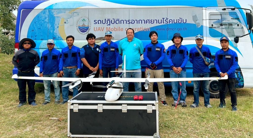
Members of the Department of Marine and Coastal Resources (DMCR) with CW-15II
The Challenges:
The DMCR was facing difficulties in exploring, tracking, and assessing marine mammals. Marine mammal populations are often spread over wide areas and individuals are often submerged when they cannot be sighted.
Marine mammal researchers have long relied on boats, planes, and helicopters to study these animals in their natural habitats. However, from the boat-based horizontal perspective, cetacean behavioral observations only allow for viewing when the animal is at the surface. Population counts and health evaluations are based on photographs captured from this restricted perspective. While observing from helicopters or airplanes may provide more comprehensive observations, it is expensive, loud, and hazardous.
So, DMCR was looking for an effective method for marine mammal research and conservation.
The Solution:
In mid-2021, DMCR learned about the JOUAV CW-15II VTOL drone from JOUAV's Thai distributor, Systronics. To test the effectiveness of the drone, on December 13-17, 2021, DMCR hosted a proof of concept (POC) in Koh Libong and Koh Lanta to test the feasibility of using UAS to perform coastal surveys.
Drone Model | JOUAV CW-15II |
Number of Flights: | 6 |
Time | 9hrs (within 3 days) |
Flight Height | 233m |
Camera Resolution | 42MP (Full-frame) |
Flight Mileage | 965.75km |
Survey Area | 67 km (41,875 ha) |
The DMCR team divided the target area into three flight areas with a total distance of 965.75 km. The CW-15II flew 6 sorties with the CA-103 42 MP full-frame industrial camera at an altitude of 233 meters on a defined route.
"The CW-15II is amazing that we can launch and retrieve the drone from small or remote locations like research vessels or rocky coastlines without needing a runway or launch pad. This makes it so much more convenient and versatile for our needs," said Benton, General Manager of DMCR.
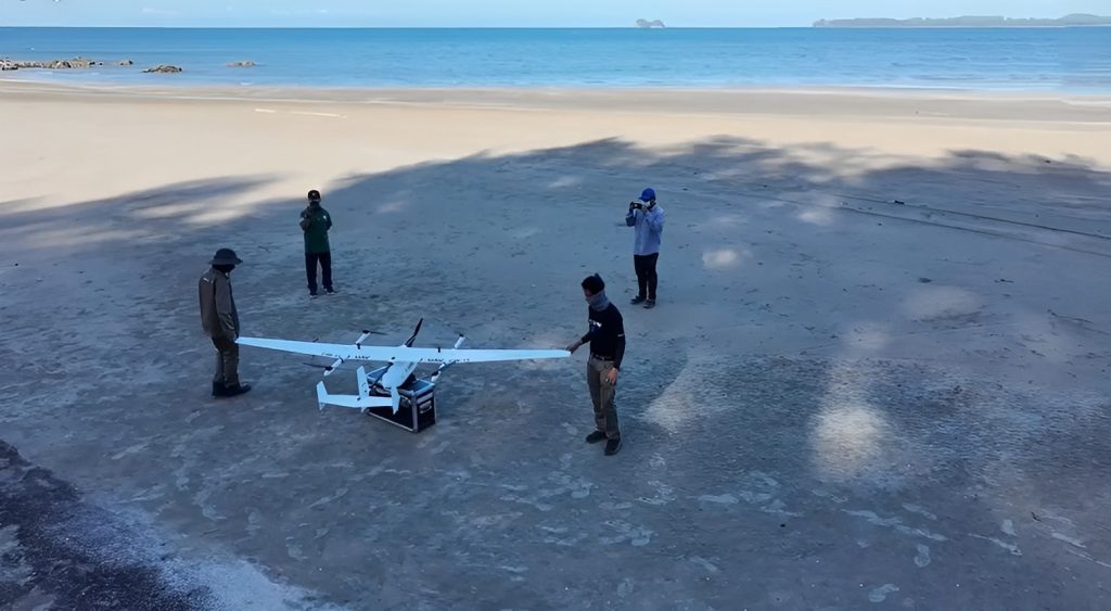
DMCR members were doing the pre-flight check
With 180min of Max flight time and 61km/h of cruising time, the conservation drone covered a total of 67 km (41,875 ha) in 9 hours, without the need for expensive research vessels or other equipment. "The CW-15II is a perfect tool for conducting large-scale surveys of marine mammal populations, or for tracking individual animals over time," said Benton.
The sea breeze was tested at a speed of 12.3 meters per second, but the CW-15II marine drone continued to fly smoothly and capture steady images, thanks to its advanced sensors and stabilization systems.
"It's amazing how it can handle challenging weather conditions," commented Benton. "What's even better is that it's environmentally friendly - the silent electric motor ensures that marine mammal populations are not disturbed during research activities. Overall, I highly recommend the CW-15II VTOL drone as a sustainable and efficient tool for environmental monitoring."
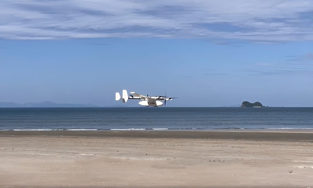
CW-15II took off on a windy sea stand
The Results:
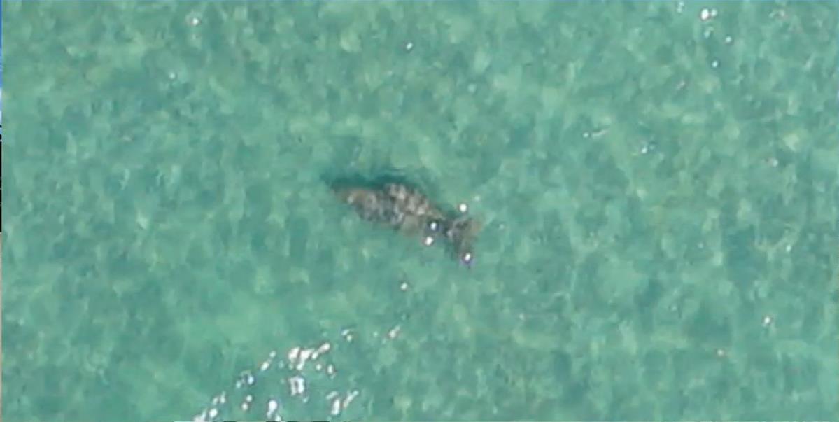
With these sharp and detailed images, DMCR found a total of 50 dugongs, 2 dolphins, and many sea turtles.
Number of images captured | 6870 |
Dugong | 50 Found |
Dolphin | 2 Found |
Sea Turtles | Many Found (Awaiting proof of quantity) |
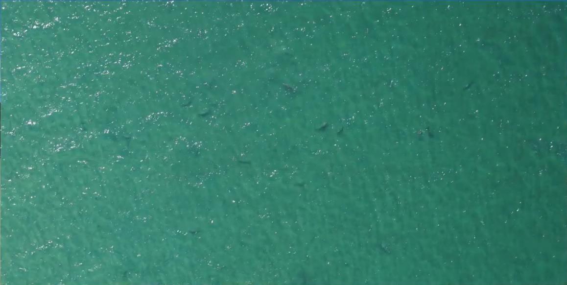
CW-15II found and took pictures of a group of 50 Dugongs
CW-15II found and took pictures of 2 dolphins
DMCR summarized and digitized the drone findings for researchers to use for historical and current population comparisons. This information helped DMCR understand the health and sustainability of marine ecosystems as well as inform conservation and management decisions. "The drone data helped our researchers understand marine mammal social dynamics, migration patterns, and habitat preferences for conservation," described Benton.
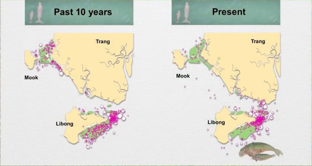
Comparing the previous and current populations of marine mammals
The images captured by the drone were also uploaded to their online system, and users could scan QR codes to access pictures and location coordinates of these animals.
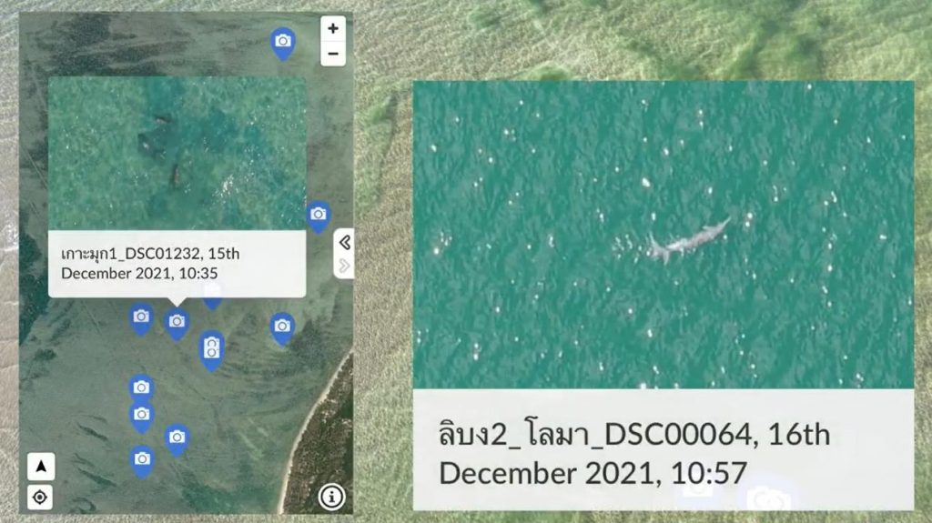
By scanning the QR code, you can see the location distribution and detailed photos of marine mammals.
The drone's efficiency and results were impressive, leading DMCR to immediately contract Systronics to order a fleet of drones for marine mammal surveys. This decision has helped DMCR to save time and resources while obtaining more accurate information about marine mammal populations.
"In the future, the CW-15II can also aid in marine mammal rescue efforts, providing real-time information to rescuers on the ground," said Benton. "We also consider buying JOUAV's AI-powered gimbal cameras for automatic recognition and tracking of individual marine animals".
Conclusion
The JOUAV CW-15II VTOL drone proved to be the solution they were looking for. Its ability to fly at a low altitude, hover for extended periods, and capture high-quality images of cryptic marine species without disturbing them has allowed DMCR to save time, and resources, and ultimately lead to better conservation efforts. This success story serves as an excellent example of how using advanced technology can lead to better conservation outcomes.
Read more case studies of JOUAV drones used for environmental monitoring:
More Use Cases


Chongqing’s Qinba Mountains are basically a giant green wall protecting the region. But there’s a problem – pine wood nematodes are eating through it. Fast.
The forestry department n

When TotalEnergies set out to build one of Southeast Asia’s largest solar and battery storage projects—spanning 12,000 hectares across the dense acacia forests of Riau, Indonesia—they faced a problem

JOUAV Product News and Use Cases
Fixed-Wing VTOL Drones Insights and Industry Trends
Invitations to online demo events