At 2:27 PM on a storm-lashed afternoon in July 2025, a small fishing boat capsized off the coast of Gulei, Zhangzhou.
Two men were thrown into violent waters. Winds howled at gale force. Waves surged
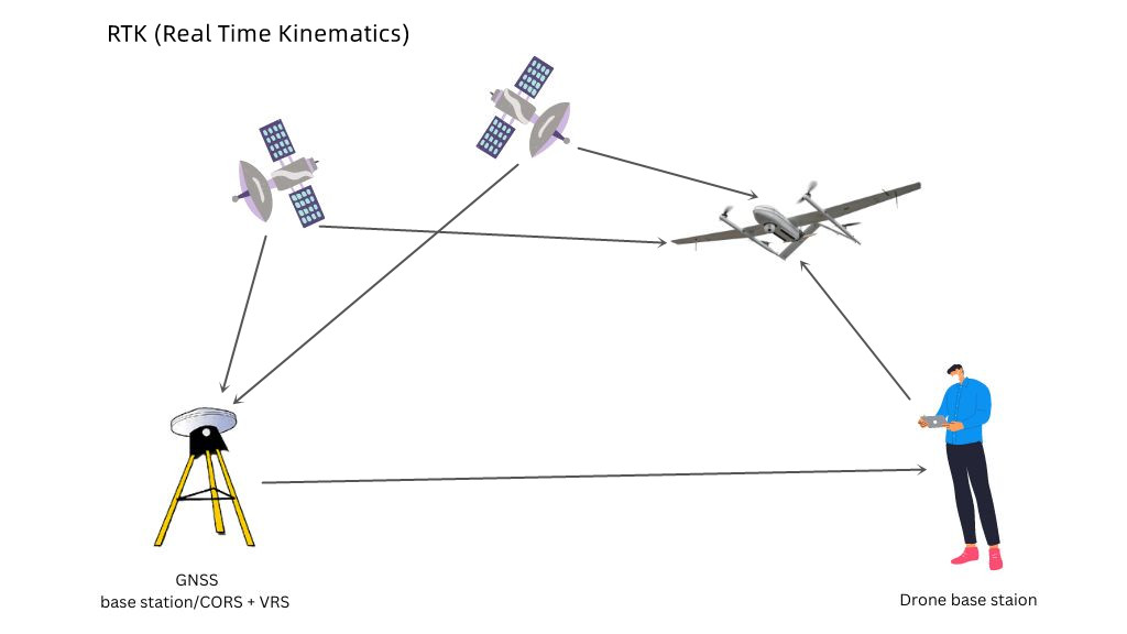
Did you know that there are positioning methods that can help GPS systems be more accurate in drone surveys? This is RTK (Real Time Kinematics) and PPK (Post-Processing Kinematics) technology.
Commercial drones use GPS units and compasses. However, the accuracy provided by these devices may vary widely depending on weather conditions, terrain, the quality of the device itself, or other conditions. Even under the best of conditions, GPS drone systems provide positioning accuracy in meters.
Therefore, more in-depth technologies such as RTK and PPK are needed, which can correct common errors of satellite navigation (GNSS) systems to improve the accuracy of surveyed and mapped data.
Are you curious to know what this RTK drone is and how it works? Want to know what the difference is between RTK and PPK? Check out how it can work in your project in the following content.
How does an RTK drone work?
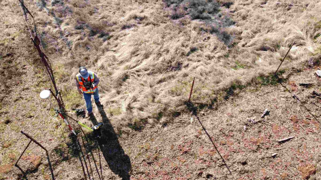
RTK GPS drones have an onboard GNSS RTK receiver that collects data from satellites while flying and taking photos. The field GNSS base station located at a known point or connected to a CORS network needs to accurately mark the location of the image in real time.
During the RTK workflow, seamless communication between the drone and the GNSS base station is required.
When the drone lands, absolute accuracy data is available for processing in your mapping software if all signals are constant.
The RTK method is suitable for flat terrain where trees or mountains do not obstruct the communication signal. It is ideal for RTK drones to fly over open terrain within 2 to 3 kilometers of a field base station or within 30 kilometers of a CORS station. If you already have access to your own base station, this can be used with an RTK drone as long as your base station has the ability to generate NTRIP data.
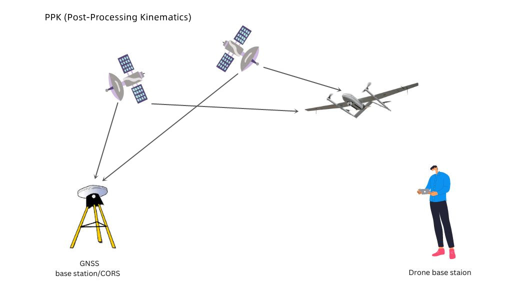
What is PPK in drones and how does it work?
PPK (Post-Processing Kinematics) precise positioning technology does not perform GPS position correction in real time during the drone flight, but at the end of the flight.
In the PPK workflow, the base station and rover units record GNSS raw data without any calculations. The collected data are stored in the measurement controller or receiver until the end of the fieldwork. These data are then processed with software and the corrections are applied to the data.
What can you do with RTK drones?
RTK GPS drones are used in a variety of applications to make things easier and more efficient. Here are 4 common applications of RTK drones:
Public safety
Drones with RTK are becoming critical tools for public safety agencies and law enforcement. These public safety drones can help identify and track fugitives or missing persons by providing highly accurate location data in real time like the operator. Fire departments can use drones in large-scale disasters to understand the situation and reduce the risk of firefighters being put at unnecessary risk.

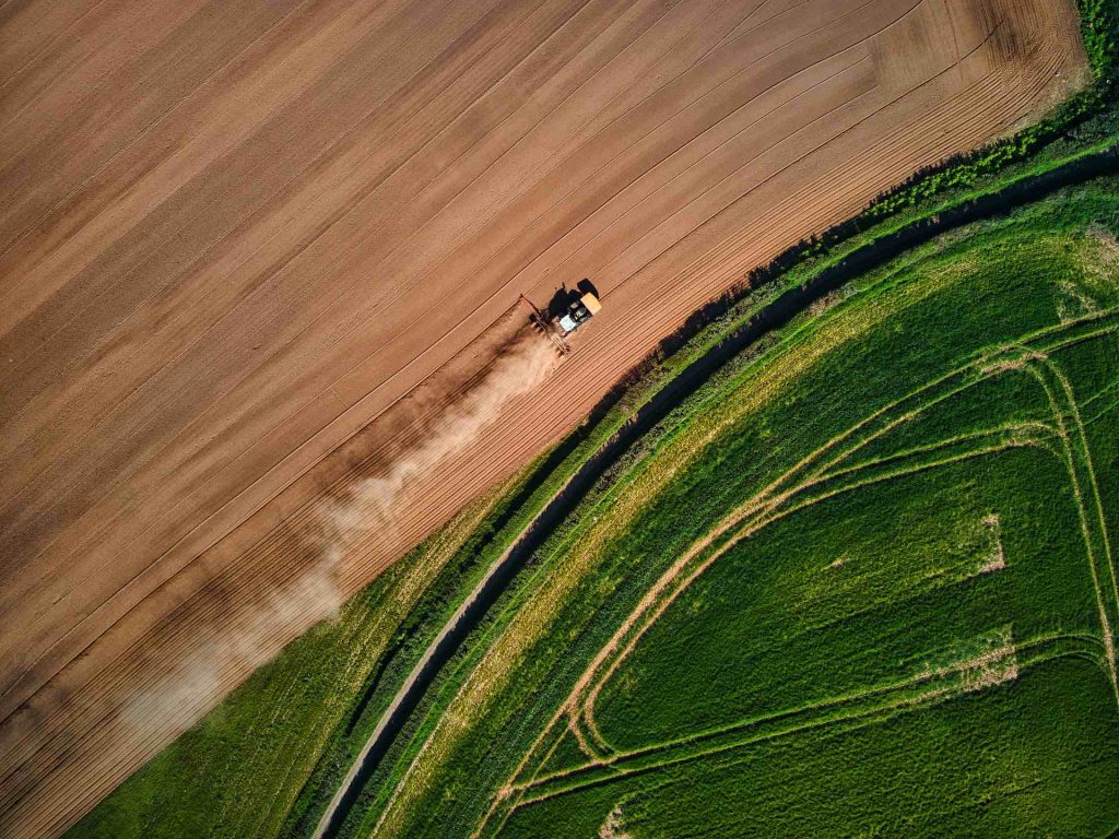
Agriculture
RTK drones play an inaccessible role in vegetation mapping, geological surveys, and agricultural inspections. RTK drones provide accurate location data to enable farmers to determine where to most effectively sow crops and determine the best location for drainage and irrigation systems. RTK can also help self-driving tractors and other precision farming systems operate in the field without requiring farmers to be in the cab.
Surveying/mapping
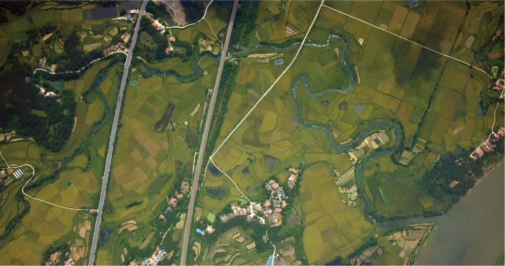
RTK drones have become an essential tool for land mapping, as they record GPS information and geotag images during flight. Even in bad weather and treacherous alpine areas, RTK drones can accurately measure and map the world's most remote locations without placing surveyors in danger.
Inspection
Adding RTK technology to drone inspections helps make remote operations inspections safer and easier. RTK drones can provide remote inspectors with real-time, precise location data, enabling them to quickly and accurately locate possible defects in facility equipment. This helps maintenance work proceed efficiently and prevents potentially catastrophic failures from occurring.
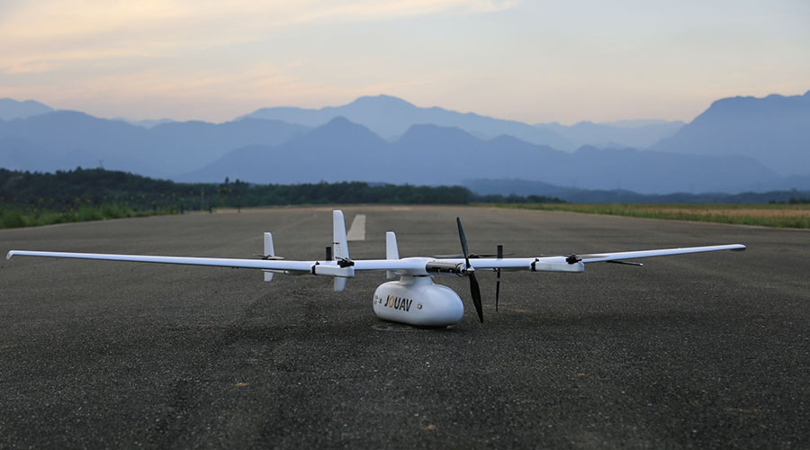
Best RTK drones for sale
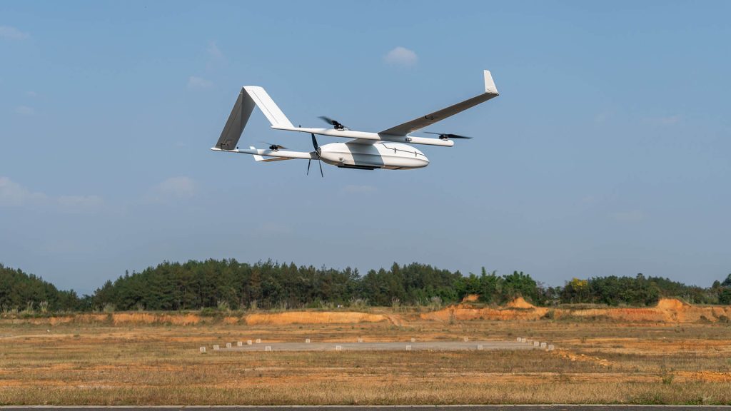
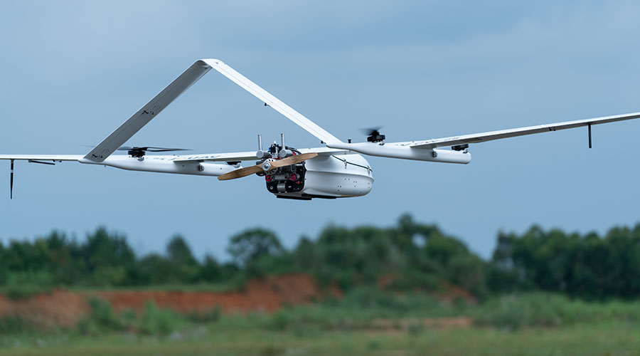
The JOUAV CW Series VTOL drones deserve the best survey drones that combine RTK with PPK. The RTK technology is used for precise takeoff and landing while the PPK module allows them to efficiently gather centimeter-level accurate data results. Therefore, these drones achieve the best-in-class absolute down to 1 cm and a GSD of down to 5-8mm per pixel.
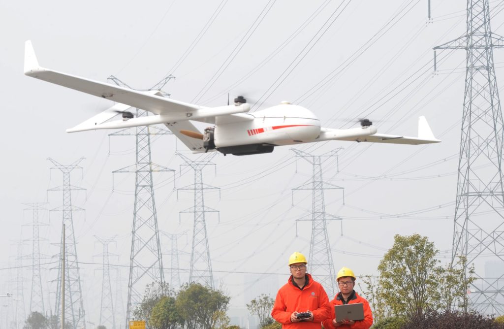
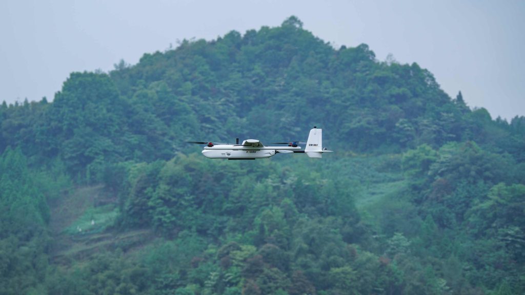
The JOUAV CW Series drones is a vertical takeoff and landing fixed-wing drones. Same as multirotor, they can take off in confined areas and land smoothly on gravel, between tree stands, or in mountainous areas. They also provide a long flight time of up to 600min and a payload capacity of up to 10kg like a fixed wing drone.
JOUAV CW-007
Portable and lightweight, JOUAV CW-007 can be carried and operated by one person. With its modular design, you can assemble and disassemble the drone in two minutes without any tools. This drone has a flight time of up to 55min and a cruising speed of 61.2km/h. In one flight, the CW-007 can cover 6 km2 with 5 cm/px GSD, making it ideal for middle-area mapping.
JOUAV CW-15
Designed for aerial surveying and 3D mapping, the CW-15 gives you an impressive flight time of up to 180min and 61km/h cruising speed. With a 3kg payload capability, it supports multiple payload configuration options to meet different mapping applications. Build specifically with surveyors in mind, this drone incorporates the 61MP full-frame camera to give you centimeter-level absolute accuracy on image metadata.
JOUAV CW-25E
JOUAV CW-25E is a gas-powered drone specially designed for large-area missions. This drone has a flight time of 240min, a cruising speed of 72km/h, and a payload of 6kg. This RTK mapping drone can be equipped with the JoLiDAR-LR22S LiDAR sensor, offering incredibly high-resolution dense point clouds. The CW-25E has been used for powerline inspection, land mapping, highway construction surveying, etc.
JOUAV CW-30E
Available in gasoline and heavy fuel-powered models, the JOUAV CW-30E is specifically designed for land or sea operations with high precision and large-area aerial applications. Equipped with the RIEGL VUX-240 LiDAR sensor, this drone can achieve 1.2cm (0.47in) full-color sharpened ground resolution at 60m (200ft). This resolution makes it possible to create more precise 3D models and mesh that help benefit a variety of industries, such as vegetation research, livestock management, and forest conservation.
More Use Cases


Chongqing’s Qinba Mountains are basically a giant green wall protecting the region. But there’s a problem – pine wood nematodes are eating through it. Fast.
The forestry department n

When TotalEnergies set out to build one of Southeast Asia’s largest solar and battery storage projects—spanning 12,000 hectares across the dense acacia forests of Riau, Indonesia—they faced a problem

JOUAV Product News and Use Cases
Fixed-Wing VTOL Drones Insights and Industry Trends
Invitations to online demo events