Yeah, you’ve probably seen those LiDAR maps—the ones that strip away trees to reveal ancient ruins or show cityscapes in stunning 3D detail. They’re impressive.
But here’s a question
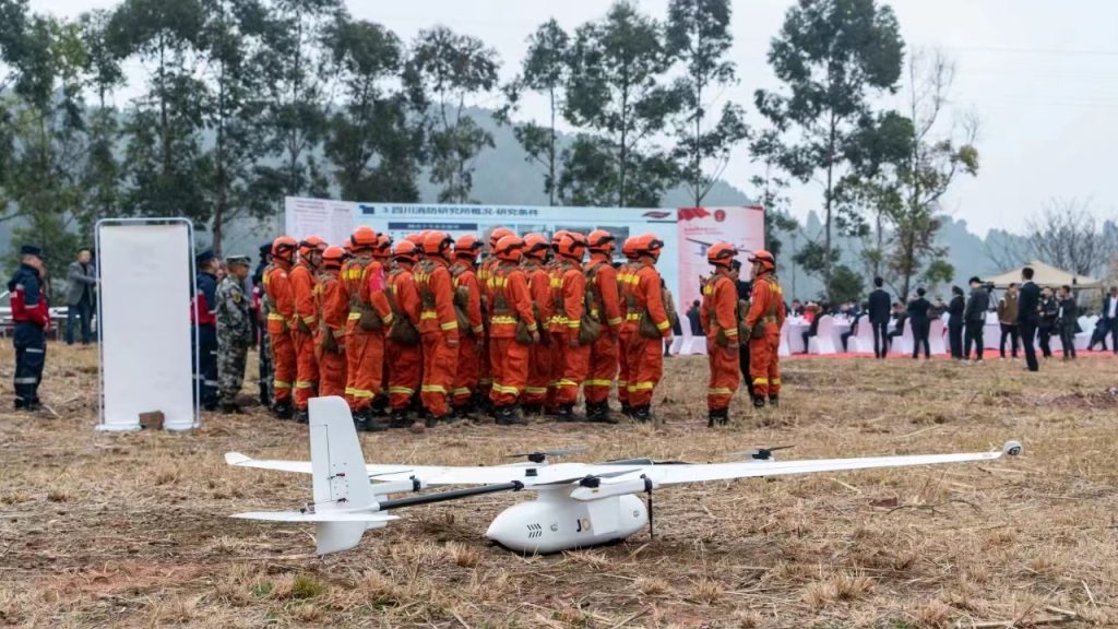
Drones have revolutionized global public safety operations, serving as invaluable force multipliers that save time, resources, and lives. Public safety agencies, including police, firefighters, and search and rescue teams, rely on drones for smarter, safer, and more efficient operations.
The future of the public safety drone market looks promising. In 2023, it boasts a valuation of $1.1 billion, and projections suggest a nearly twofold increase in value by 2028, reaching approximately $2.6 billion by 2030. This translates to an impressive compound annual growth rate (CAGR) of 12.6%.
The safety and security drone market is also poised for remarkable growth, with a projected CAGR of 18.1% between 2023 and 2030.
The need for drones in public safety has never been more evident. They play a vital role, from data collection for informed decisions to direct life and property-saving missions. However, choosing the right drone remains critical.
In this article, we explore key use cases for public safety drones and provide insights into the top options available in the market today.
Benefits of Public Safety Drones
After exploring the various roles of public safety drones, let's delve into how these incredible devices enhance overall public safety:
Enhanced Situational Awareness
Public safety drones act as our aerial eyes in the sky. They offer real-time visual data, which is like having an extra pair of eyes during critical situations. Whether it's overseeing a large public event, assessing a disaster-stricken area, or handling a security issue, these drones provide invaluable insights to make informed decisions swiftly. They are the best drones for public safety, ensuring our teams are well-equipped.
Rapid Response Times
When we talk about drones for public safety, think of them as our rapid first responders in the air. They can reach emergency scenes much faster than traditional methods, especially during search and rescue missions or law enforcement operations. These drones are like our trusty companions, helping us react promptly and potentially saving lives in the process.
Cost-Efficiency
Public safety agencies often have limited budgets. Public safety drones are like budget-friendly superheroes, especially when compared to traditional aircraft. They don't require expensive pilots or consume hefty amounts of fuel. This cost-effectiveness allows us to allocate our resources wisely and invest in other crucial aspects of public safety programs.
Enhanced Safety
Ensuring the safety of your public safety personnel is paramount. Drones act as your eyes and ears in high-risk situations without exposing your teams to potential dangers. They can assess hazardous areas, monitor fire incidents, and even deliver essential supplies to remote locations. This means your teams can work more safely and efficiently, making these drones the best options for security and safety.
How Do Drones Help Public Safety?
Now that we've explored the various domains where public safety drones make a significant impact, let's dive deeper into how these remarkable aerial assets enhance overall public safety:
Law Enforcement
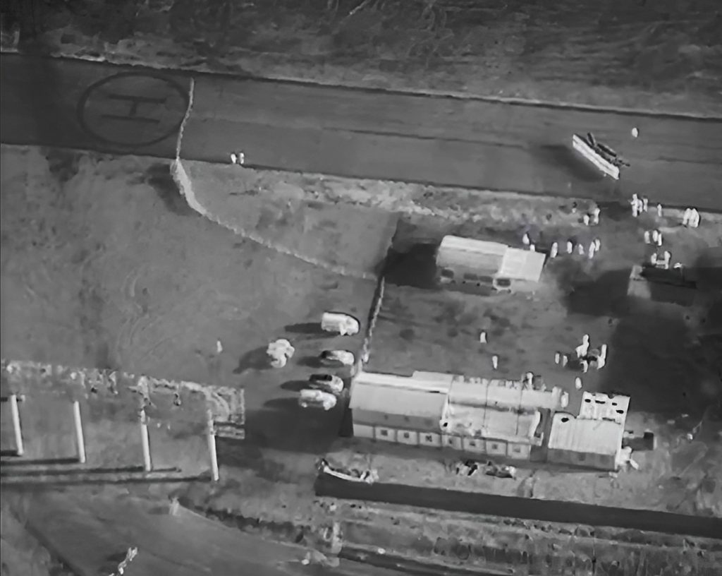
Public safety drones equipped with advanced imaging technology, such as thermal and high-resolution cameras, offer law enforcement valuable aerial surveillance capabilities. These drones, often referred to as "eyes in the sky," excel at monitoring large areas, tracking suspects, and providing rapid responses, all while maintaining a safe distance.
In crime investigations, these drones are instrumental. Their high-definition cameras capture detailed aerial shots, supplying crucial evidence that aids investigators in reconstructing events and building strong cases for legal proceedings.
Furthermore, security drones play a pivotal role in search and arrest operations, offering essential intelligence that helps locate suspects in challenging environments like dense forests or urban areas. This not only enhances officer safety but also boosts operational efficiency significantly.
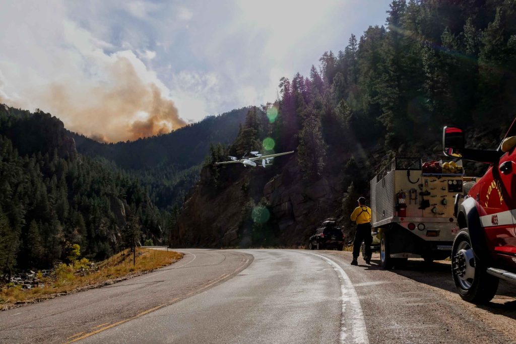
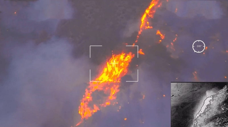
Firefighting
Public safety drones, equipped with thermal and smoke-penetrating tech, are gold for wildfire monitoring. They deliver real-time data on fire behavior, hotspots, and potential threats, helping firefighting teams strategize effectively and safeguard lives and property.
Situational awareness is key during firefighting. Drones provide an aerial view, letting firefighters assess the situation, spot hazards, and adjust tactics on the fly. This data-driven approach ramps up safety and effectiveness.
Mapping fire perimeters and monitoring fire lines are drone-strong suits. They assist in coordinating firefighting resources, ensuring personnel are where they're needed most. This proactive approach cuts risks and optimizes resource use.
Emergency Response
After natural disasters or emergencies, public safety drones play a critical role by quickly assessing affected areas. They capture high-resolution images and videos that guide decision-makers in prioritizing response efforts and deploying resources effectively. Equipped with thermal imaging technology, these drones can locate individuals in disaster zones, even in low-visibility conditions, significantly enhancing search and rescue operations and improving the chances of saving lives.
Additionally, during emergency response, drones provide essential data on road conditions, infrastructure damage, and accessible routes. This valuable information enables response teams to streamline their efforts and deliver aid promptly to those in need.
Search and Rescue
In search and rescue missions, drones shine in scouting remote, hard-to-reach spots. Real-time video feeds help rescuers assess terrain and plan their approach, reducing risks and speeding up operations. With rescue gear like ropes or flotation devices, they can swiftly retrieve victims from dangerous spots, like water or cliffs. This slashes response times and enhances safety for both rescuers and victims.
In challenging environments like collapsed buildings or unstable terrain, public safety drones with sensors and cameras explore risky areas without risking human lives. They gather vital info that guides rescue efforts.
DJI Matrice 300 RTK
DJI Matrice 300 RTK is a powerful drone designed for public safety operations. It features a range of advanced capabilities such as a 15 km transmission range, a 55-min maximum flight time, and a service ceiling of 7000m. With a maximum payload capacity of 2.7 kg and 6 directional sensing & positioning, it offers versatility and precise navigation.

The drone is equipped with a primary flight display and 1080p triple-channel video for enhanced situational awareness. It also supports real-time auto-switching between 2.4 GHz and 5.8 GHz frequencies for reliable flight in high-interference environments.
The DJI Matrice 300 RTK is designed for durability and functionality in various operating conditions. It has an IP45 rating, allowing it to withstand dust and water exposure. The operating temperature range of -20°C to 50°C ensures reliable performance in extreme climates. The drone features a hot-swappable battery system, enabling continuous operation without interruptions. Additionally, the M300 RTK offers an integrated UAV Health Management System (UHMS) to optimize fleet maintenance.
Cons:
- Long transmission range and flight time for extended coverage
- High payload capacity and precise navigation capabilities
- Primary flight display and triple-channel video for enhanced situational awareness
- Secure data transmission with AES-256 encryption
- Durability with IP45 rating and wide operating temperature range
- Hot-swappable battery system for continuous operation
- UAV Health Management System for real-time diagnostics and maintenance recommendations
Cons:
- Large batteries that require frequent changes
- Performance may be affected by excessive water exposure
- Restricted operations in locked zones may waste time in the field
Parrot ANAFI USA
The Parrot ANAFI USA is a compact and lightweight drone designed for public safety operations. It features two 21MP cameras with wide and telephoto lenses, allowing for 32x zoom and 4K video recording. The drone also includes a FLIR Boson 320x256 IR camera for thermal imaging capabilities. With 5-axis hybrid stabilization, the ANAFI USA ensures smooth footage even in challenging flight conditions.
With dimensions of 228x101x76 mm and a weight of only 501 grams, the ANAFI USA is highly portable. Its foldable design allows for easy storage in its waterproof transport case, making it convenient to carry and set up. The drone boasts a flight time of 32 minutes and a speed of 14.7 m/s, providing efficient coverage of areas of interest. It also has a weather rating of IP53, making it resistant to dust and water.
Pros:
- Lightweight and portable
- Compact and lightweight design
- Advanced camera capabilities, including zoom and thermal imaging
- 5-axis hybrid stabilization for steady footage
- Weather resistant for operation in challenging environments
Cons:
- Shorter battery life
- Image quality at extreme zoom levels may be poorer compared to other drones
- Lack of obstacle avoidance capabilities
- Moderate Wi-Fi connection may affect signal stability
- Thermal camera has a lower resolution compared to dedicated thermal imaging drones
- Charging the flight battery takes more than 3 hours
DJI Mavic 2 Enterprise Dual
The DJI Mavic 2 Enterprise Dual is a versatile drone designed to excel in public safety applications. Its standout feature lies in its dual-camera setup, combining a Thermal FLIR® camera with a 4K HDR camera featuring a high-resolution 21MP Sony sensor. This dual-sensor capability allows the drone to capture both thermal and high-resolution visual data simultaneously, making it invaluable for detailed inspections and data collection. Notably, the drone's exceptional 32x zoom capability ensures meticulous scrutiny of structures and environments with remarkable precision.
A key strength of the DJI Mavic 2 Enterprise Dual is its exceptional stability. With three-axis stabilization, the cameras remain steady and crystal clear, even when tilted at angles of +/-90°. This stability proves crucial when inspecting structures from various viewpoints or capturing clear perspectives from directly beneath.
The drone's maximum transmission distance of 4km enables extensive coverage over expansive areas in a single flight, while its impressive 26-minute flight duration ensures prolonged inspection sessions for uninterrupted data collection and analysis.
Pros:
- Dual sensor capabilities - infrared and 4K imaging.
- FLIR thermal sensor with MSX for enhanced image context.
- Ample onboard storage (24GB) for data capture.
- GPS timestamping for accurate location data on captured media.
- Omnidirectional obstacle avoidance and DJI AirSense for safe operation.
Cons:
- Short flight time is limited to 26 minutes
- Limited transmission range compared to some competitors.
Autel Evo II 640T
The Autel Evo II Dual drone is equipped with a dual-camera system, featuring a FLIR Boson thermal sensor and a 48MP visual camera. This combination allows for both thermal imaging and high-resolution photography, making it an ideal choice for public safety applications such as search and rescue missions or surveillance operations.
One notable feature of the Autel Evo II Dual is its impressive flight time. With a maximum flight duration of up to 40 minutes, it offers an extended operational period, reducing the need for frequent battery changes and increasing efficiency during critical missions.
The Autel Evo II Dual also stands out with its obstacle avoidance system. Equipped with 12 vision sensors and 2 additional Time of Flight sensors, it can detect and avoid obstacles in real time, ensuring safe and reliable flight even in complex environments.
Pros:
- Dual sensor capabilities - thermal imaging and high-resolution photography.
- 48MP camera for detailed visual inspection.
- Long flight time of up to 40 minutes.
- Obstacle avoidance system for safe flight.
- Foldable design for easy transportation and storage.
- Wide range of intelligent flight modes for enhanced versatility.
- Remote controller with built-in screen for convenient operation.
Cons:
- Only lift 1kg of payload
- Many functions still require a smartphone app
- No live spot metering, temperature range, or temperature alerts
Yuneec H520E
The Yuneec H520 is a professional drone designed specifically for public safety applications. It features a reliable and stable hexacopter design, ensuring enhanced flight stability and safety during critical missions.
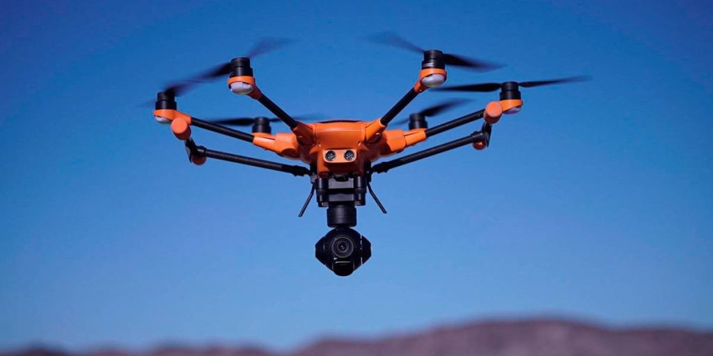
Equipped with a high-resolution 4K camera, the Yuneec H520 allows for detailed visual inspections and aerial photography. Additionally, it offers a wide range of camera settings and modes, including burst mode and time-lapse, providing flexibility in capturing the required data.
One standout feature of the Yuneec H520 is its advanced obstacle avoidance system. Utilizing ultrasonic sensors and vision sensors, it can detect and avoid obstacles in various directions, ensuring safe and efficient flight operations.
Pros:
- Hexacopter design for enhanced stability and safety.
- High-resolution 4K camera for detailed inspections and photography.
- Flexible camera settings and modes for diverse data capture.
- Advanced obstacle avoidance system for safe flight.
- Long flight time of up to 28 minutes.
- Can be equipped with a range of payloads for specialized missions.
- Easy to use and navigate with user-friendly controls.
Cons:
- Limited transmission range compared to some competitors.
- Lacks some advanced features found in other drones.
- Slightly shorter flight time compared to some alternatives.
- Maximum payload limit of 2.5 kg
Things to Consider When Buying a Public Safety Drone
Selecting the right drone for a public safety agency requires careful consideration of various factors. This section aims to highlight essential aspects to bear in mind when purchasing public safety drones.
Mission-Specific Requirements:
When selecting a drone for public safety missions, it's crucial to align the drone's capabilities with the mission's requirements. For law enforcement surveillance, opt for drones with advanced imaging like high-res and thermal cameras, favoring multi-rotor or hybrid drones for agility. Fire and rescue demand swift, confined-space navigation with thermal imaging, making multi-rotor or VTOL-capable hybrids ideal. Disaster response calls for extended flight time and range, typically met by fixed-wing or hybrid drones carrying thermal payloads. Accurate GPS and stable flight are vital for accident scene mapping, favoring fixed-wing or hybrid drones.
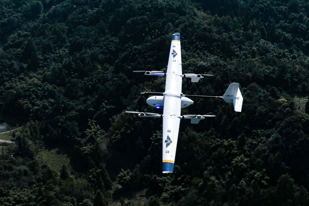
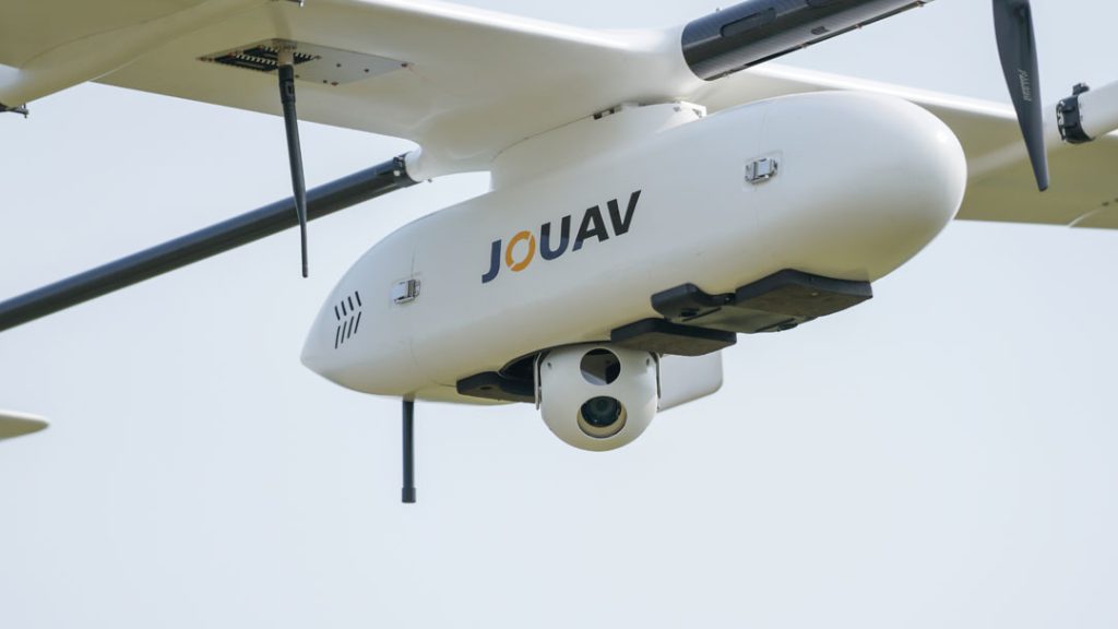
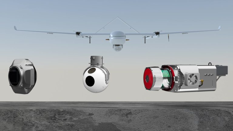
Hybrid VTOL drones like the JOUAV CW-15 stand out as versatile options that offer long endurance, the capacity to carry substantial payloads, and the ability to take off and land in challenging environments. These qualities make them a suitable choice for a wide range of public safety missions.
Flight Time and Range
The flight time and range of a public safety drone are critical considerations. It is advisable to choose a drone with flight times ranging from 30 minutes to 3 hours. This allows for extended operational periods, reducing the frequency of battery changes and maximizing mission efficiency. In terms of range, a suitable public safety drone should offer a range between 5 kilometers (3.1 miles) and 50 kilometers (12.4 miles). These long range drones provide the necessary coverage area and operational flexibility for various public safety missions.
Payload Capacity and Capabilities
Public safety drones require a payload capacity typically ranging from 0.5 kilograms (500 grams) to 5 kilograms (5000 grams) to accommodate specialized equipment such as high-resolution cameras, thermal imaging systems, sensors, and payload delivery systems.
These heavy-duty drones play a vital role in various public safety applications. High-resolution cameras are crucial for detailed imagery, while thermal imaging systems are essential for search and rescue and firefighting missions. Optical zoom capabilities are important for capturing distant details, and payload delivery systems enable the transportation of critical supplies to remote locations.
Durability and Weather Resistance
Public safety agencies often operate in challenging and unpredictable environments. Therefore, the durability and weather resistance of a drone are of utmost importance. Look for drones designed to withstand harsh conditions, including wind, rain, and extreme temperatures. Robust construction, reinforced frames, and high-quality materials contribute to a drone's ability to endure demanding operational scenarios.
Flight Stability and Maneuverability
To effectively carry out public safety missions, drones must possess stable flight characteristics and precise maneuverability. Stability is crucial for capturing clear imagery, conducting accurate inspections, and ensuring smooth video transmission. Maneuverability allows the drone to navigate tight spaces, rapidly change directions, and hover with precision. Pay attention to drones equipped with advanced flight control systems and stabilization technologies.
Data Security and Privacy
As public safety drones capture and transmit sensitive data, ensuring robust data security and privacy measures is paramount. Look for drones with built-in encryption protocols, secure data storage, and reliable transmission systems. Additionally, consider drones that allow for user-defined privacy settings, such as geofencing capabilities, to prevent inadvertent intrusions into private or restricted areas.
Training and Support
Investing in public safety drones necessitates proper training for personnel responsible for operating and maintaining the equipment. Consider the availability of comprehensive training programs provided by the drone manufacturer or authorized trainers. Additionally, assess the level of technical support and after-sales service offered to ensure seamless operations and swift resolution of any issues that may arise.
Read More
Let me tell you something that happens way too often.
A company spends $15,000 on a drone, excited about the flight time and range. They get it in the air and mount their LiDAR sensor—and the drone ba

Have you ever watched a drone hover effortlessly over a construction site, inspect a wind turbine blade, or deliver medical supplies to a remote village?
That drone was almost certainly a multirotor.

JOUAV Product News and Use Cases
Fixed-Wing VTOL Drones Insights and Industry Trends
Invitations to online demo events