Have you ever watched a drone hover effortlessly over a construction site, inspect a wind turbine blade, or deliver medical supplies to a remote village?
That drone was almost certainly a multirotor.
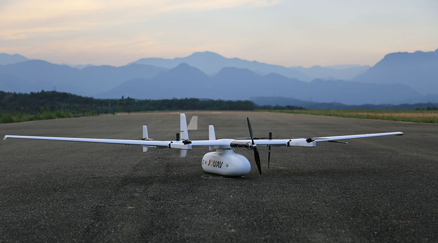
JOUAV CW-30E + MG-120E - Best Thermal Drone for Surveillance and Security
The JOUAV CW-30E + MG-120E is a top-of-the-line infrared drone designed for surveillance and security purposes. Equipped with the MG-120E gimbal camera, which combines a 30x zoom optical camera, a 640*512 infrared camera, and AI recognition and tracking capabilities, this drone provides superior image quality and tracking accuracy. It also supports dual real-time streaming with low latency, ensuring smooth and efficient data transmission.
With a VTOL fixed-wing design, this drone can vertically take off and land even in confined spaces and urban areas. It offers up to 8 hours of long endurance, a maximum cruising speed of 90km/h, and a maximum flight distance of 200km, making it suitable for large-area surveillance.
The CW-30E also features advanced flight control and navigation systems, allowing for autonomous obstacle avoidance and all-weather flight. With its cloud-based management software platform, Jocloud, you can easily manage all aspects of your drone operations and share flight data with relevant authorities for collaborative operations.
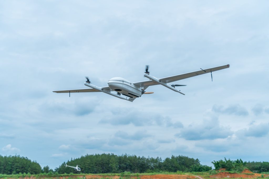
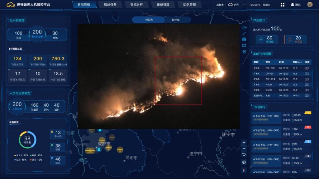
JOUAV CW-15 + MG-120E - Best Infrared Drone for Firefighting
The JOUAV CW-15 + MG-120E stands out as the ultimate infrared drone for firefighting. Its exceptional capabilities stem from the MG-120E gimbal camera, which combines a 30x zoom 1920 x 1080 optical camera with a 640*512 infrared camera. With a 3-axis gimbal and AI recognition and tracking, this drone excels in capturing critical details in thermal imaging. It showcases its versatility by effortlessly taking off and landing in confined spaces, such as cliffs, forests, and mountains.
When it comes to performance, this VTOL drone truly excels. With an impressive maximum flight time of 180 minutes and a cruising speed of 61km/h, it ensures extensive coverage and efficient firefighting operations. Its flight range extends up to 50km, allowing it to access remote areas without compromise. This drone also exhibits exceptional resilience, withstanding wind speeds of 10.8-13.8m/s.
In terms of surveillance and situational awareness, the JOUAV CW-15 offers unrivaled capabilities. It supports multi-screen monitoring, enabling simultaneous monitoring of multiple locations. Employing advanced artificial intelligence technology, it can accurately identify danger signals, such as smoke and fire, providing timely warnings. Furthermore, the drone features data encryption for secure communication, ensuring the protection of sensitive information.
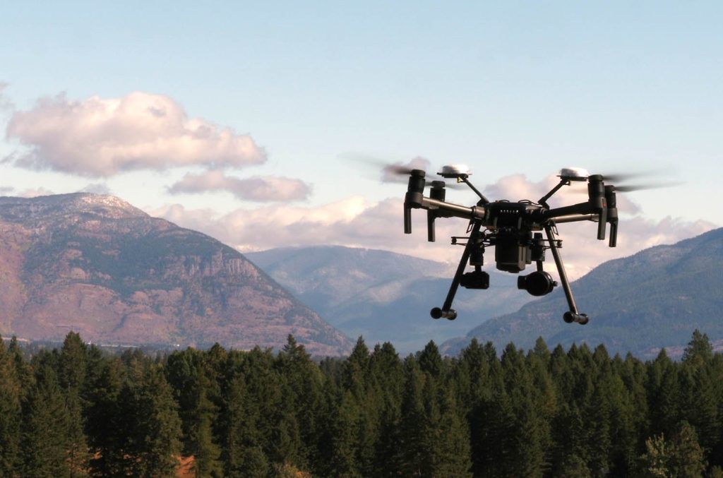
DJI Matrice 300 RTK + Zenmuse H20T - Best Thermal Drone Agriculture and Farming
The DJI Matrice 300 RTK + Zenmuse H20T is an advanced thermal drone designed specifically for agriculture and farming purposes. It features the Zenmuse H20T multi-sensor hybrid camera system, which includes a 12MP wide camera, a 20MP zoom camera with powerful zoom capabilities, a 640 x 512 px thermal sensor, and a 1200m laser rangefinder. This combination of sensors allows for accurate data collection and analysis, helping farmers identify problems caused by climate change, pests, diseases, improper irrigation, and more.

With a flight time of 55 minutes, a maximum speed of 23m/s, and a transmission range of 15km, this drone is capable of covering large areas efficiently. It also has a max payload capacity of 2.7kg, allowing for the integration of additional tools or sensors. The DJI Matrice 300 RTK is equipped with AI capabilities, enabling it to automate routine inspections and capture consistent results every time.
It has 6 directional sensing and positioning, an IP45 rating for protection against dust and water, and can operate in temperatures ranging from -20°C to 50°C. Additionally, it has a wind resistance of 12m/s, making it suitable for various weather conditions.
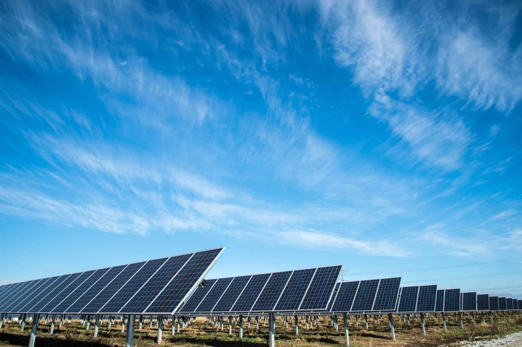
DJI Matrice 210 RTK + Zenmuse XT2 - Best Thermal Drone for Solar Panels Inspection
The DJI Matrice 210 RTK + Zenmuse XT2 is an excellent thermal drone for solar panels. It is equipped with the Zenmuse XT2 camera, which has a 25mm lens, and 30 Hz frame rate, and can capture 12MP photos and 4K videos. The camera also features a FLIR Tau 2 Sensor for thermal imaging, with a sensitivity of less than 50 mK, allowing for accurate temperature readings within ±10°C.
The drone has a maximum speed of 81 km/h and a flight time of up to 38 minutes without payload. It also has a flight range of up to 8km, making it ideal for covering large areas. The built-in RTK unit ensures centimeter-level accuracy for precise hovering. The drone is also equipped with a robust FlightAutonomy system and anti-collision beacons, ensuring safe operation even in lowlight conditions.
The IP43 rating makes it resistant to dust and water, further enhancing its durability. With its intelligent self-heating battery system, the drone can operate in temperatures ranging from -20 to 50C, allowing for versatility in various environmental conditions.
Autel EVO II Dual 640T V2 - Best Thermal Drone for Hunting
The Autel EVO II Dual 640T V2 is a professional USA-made drone designed for hunting. It has an 8k camera and a 640*512 thermal imager for high-quality imaging. The drone offers picture-in-picture mode, overlaying thermal images on camera views. It boasts a 30hz refresh rate, and 16x zoom, enabling effective prey detection and remote monitoring.
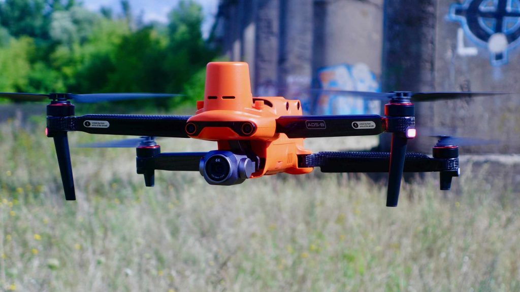
Apart from its impressive imaging, the Evo II Dual 640T drone excels in-flight performance. It has 360-degree obstacle avoidance for safe flying, up to 38 minutes of flight time, wind resistance class 8, and features like object tracking and advanced flight planning for an enhanced hunting experience.
Thermal imaging drones like the Autel EVO II Dual 640T work by capturing the heat emitted by objects, making them suitable for both day and night use. This is particularly advantageous for hunting at night, as thermal imaging allows hunters to track animals based on their heat signatures. The Evo II Dual 640T offers 10 heatmap displays for optimal image quality, further improving hunting efficiency.
Yuneec H520E + E10T - Best Thermal Drone for Search and Rescue
The Yuneec H520E + E10T is a top-tier thermal drone specifically engineered for search and rescue operations. Its standout feature is the E10T thermal camera, equipped with a stabilized 3-axis gimbal, a 320 x 256-pixel thermal resolution, and an impressive RGB resolution of 1920 x 1080. This dual video stream technology allows simultaneous streaming of thermal and residual light images to the remote control, enabling operators to overlay or view them in a picture-in-picture mode.
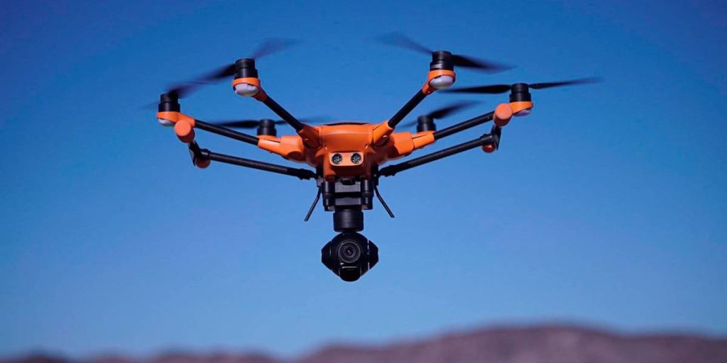
With up to 28 minutes of flight time equipped wth the E10T, the Yuneec H520E excels in long-duration missions, making it a dependable choice for critical operations. The hexacopter design, coupled with advanced obstacle avoidance, fail-safe battery, and return-to-home functions, ensures a high level of operational safety.
With a generous payload capacity of 500g, the Yuneec H520E is adaptable to various scenarios and is widely adopted by police, fire brigades, search and rescue teams, inspectors, and surveying professionals. Moreover, the optional Payload Delivery System© aids in critical missions by delivering essential supplies to hard-to-reach or communication-challenged areas.
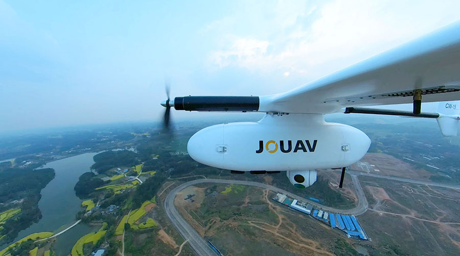
JOUAV PH-7E + PDL-1K DUAL - Best Thermal Drone for Industrial Inspection
The JOUAV PH-7E + PDL-1K DUAL is an advanced thermal drone designed specifically for industrial inspections. It features the PDL-1K thermal & visible dual gimbal camera, which combines an infrared sensor with a resolution of 1280×1024 and a 1-inch visible light sensor. This allows the drone to work in infrared thermal and visible light sensor dual-output modes, providing detection capabilities both day and night.
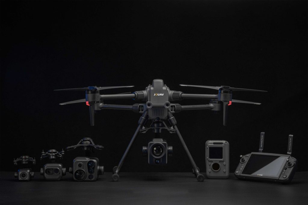
The infrared camera features various functions such as temperature measurement, 10 pseudo colors, 8X electric magnification, picture-in-picture display, and thermal & visible dual fusion. On the other hand, the visible light camera supports features like 16X digital zoom, 8K/6K photo taking, and 4K 30fps video recording. Additionally, the drone utilizes advanced three-axis stabilization technology with an accuracy of ≤ 0.01°, offering a stable and detailed view.
With a flight time of 63 minutes, a top speed of 23m/s, and a control range of 15km, the JOUAV PH-7E + PDL-1K DUAL provides excellent performance for industrial inspection tasks. It is equipped with millimeter wave radars and a visual system that work together to sense the environment omnidirectionally, allowing the drone to avoid obstacles such as cables during both day and night operations.
DJI Mavic 2 Enterprise Dual - Best Thermal Drone for Building and Roof Inspection
The DJI Mavic 2 Enterprise Dual stands out as an advanced and adaptable thermal drone meticulously crafted for the purpose of building and roof inspections. Boasting a dual-camera setup, this drone combines the capabilities of a Thermal FLIR® camera and a 4K HDR camera featuring a high-resolution 21MP Sony sensor. Notably, the drone's exceptional 32x zoom capability elevates its suitability for meticulous inspections, capturing even the minutest intricacies with remarkable precision.
A standout feature of the DJI Mavic 2 Enterprise Dual lies in its exceptional stability. Employing three-axis stabilization, the cameras remain steady and crystal clear, even when tilted at angles of +/-90°. This feature proves invaluable when scrutinizing structures from varying viewpoints or attaining a clear perspective from directly beneath.
The DJI Mavic 2 Enterprise Dual shines with a maximum transmission distance of 4km, facilitating extensive coverage over expansive areas in a single flight. Moreover, its remarkable 26-minute flight duration ensures prolonged inspection sessions, enabling uninterrupted data collection and analysis.
Parrot Anafi Thermal - Best Thermal Drone for Building and Roof Inspection
For those seeking a cost-effective yet capable thermal imaging solution, the Parrot ANAFI Thermal emerges as a standout option. With an industry-first 32x zoom, you can easily observe structures from a distance.
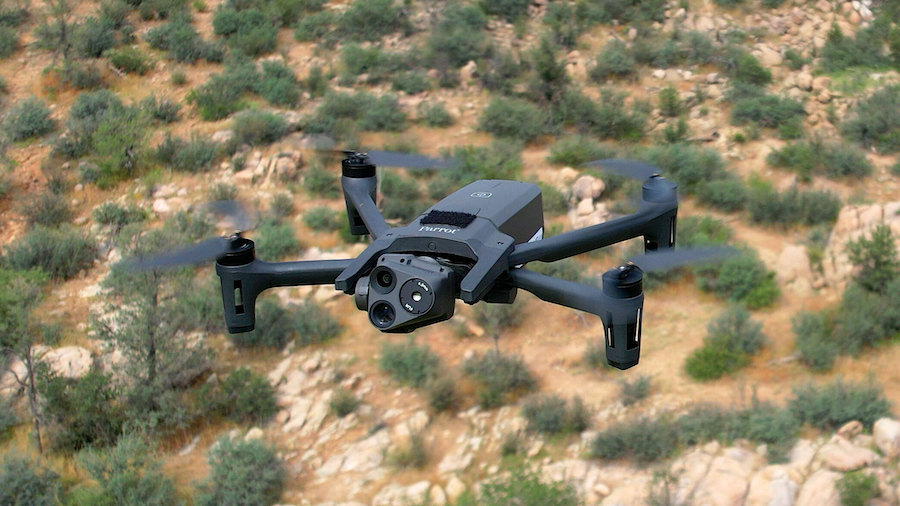
It is equipped with two cameras, a thermal FLIR® camera, and a 4K HDR camera with a 21MP Sony sensor. Both cameras are stabilized on three axes and can tilt at +/-90°, allowing you to observe right underneath structures.
The Parrot ANAFI Thermal has a maximum transmission distance of 4km with the Parrot Skycontroller 3, ensuring a reliable connection during inspections. With a maximum flight time of 26 minutes and a maximum horizontal speed of 34mph, you can cover a large area efficiently. The drone can operate in temperatures ranging from -10°C to 40°C, making it suitable for various environments.
What is a Thermal Drone and How Does it Work?
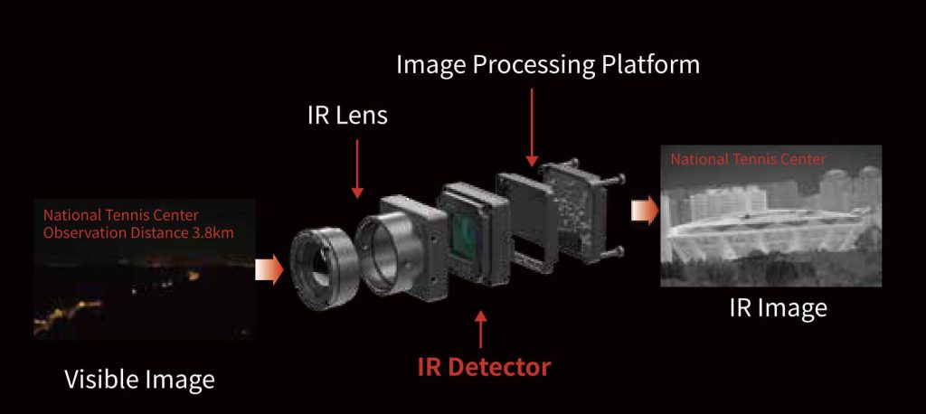
A thermal drone, also known as an infrared drone, is a type of drone equipped with a thermal camera that can detect heat signatures and create a visual representation of temperature variations in the environment. This technology can be used for a variety of applications, such as search and rescue, surveillance, and industrial inspection.
Thermal drones work by using a thermal camera to capture infrared radiation emitted from objects in the environment. Thermal cameras have a special lens that focuses the infrared radiation onto a detector array made up of many individual detector elements called microbolometers. Each microbolometer measures the temperature of the radiation that it receives and generates an electrical signal proportional to the temperature.
The signals from all the microbolometers are then processed by a computer, which converts them into a visible image. In the image, different colors or shades represent different temperatures, with the hottest areas being displayed in bright colors like red, and the coolest areas in darker colors like blue.
Source from gst-ir.net
Thermal Imaging vs. Night Version
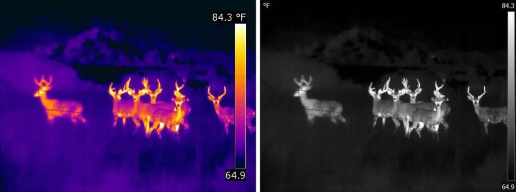
The main difference between night vision cameras and thermal imaging cameras is what they can see. Night vision cameras are like normal cameras in that they both see things in terms of reflected light, but night vision cameras need very little light or they will provide their own light. Thermal imaging cameras do not see reflected light, but thermal energy.
One disadvantage of using night vision cameras is that their images are not as clear due to poor contrast. Contrast is the difference in colors between objects that makes them stand out from each other. In the dark, everything is pretty much the same color, so it can be hard to see anything despite the magnified light. These cameras also have a shorter range because their visibility decreases the further they get from a light source.
Thermal imaging cameras don't need light to see, so poor contrast isn't a problem. In contrast, thermal imaging cameras produce high-contrast images due to their ability to detect differences in heat. Compared to night vision cameras, thermal imaging cameras are more effective because they can be used in complete darkness and harsh weather conditions.
What is a Thermal Drone Used for?
As thermal sensors become more technologically advanced and accessible, many drone applications are emerging in different industry sectors. To help you understand how this technology can help professionals around the world, we will list below the main applications of drones with thermal cameras:
Solar Farm Inspections
Thermal drone inspection detects faulty or malfunctioning solar panels by detecting variations in temperature. During an inspection, the drone's thermal camera captures images of the panels and creates a thermal map of the solar field. Any panel producing less heat than surrounding panels may indicate a problem.
The thermal images also reveal shading areas, which can reduce panel efficiency. Technicians can use this information to make necessary adjustments and maximize energy output.
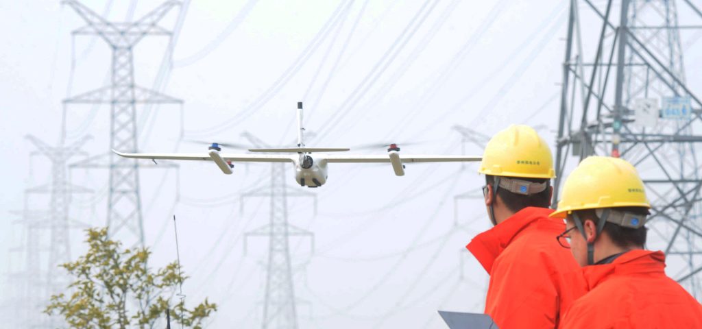
Powerline Inspections
Drones with thermal cameras are used in powerline inspections to detect potential faults and identify areas that need maintenance. By detecting abnormal heat on powerlines and related infrastructure, inspectors can take proactive measures to repair or replace damaged components, preventing potential damage and reducing the risk of outages.
Thermal drones can also be used to inspect transformers and assess the overall health of powerline infrastructure. Overall, the use of these drones in powerline inspections improves the safety and reliability of power distribution systems.
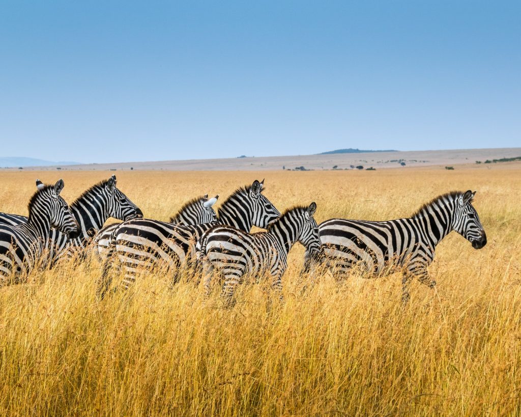
Wildlife Hunting
Commercial drones with thermal cameras are increasingly being used in hunting to locate and track animals. During a hog hunt, thermal imaging drones can be used to scan large areas of land quickly and efficiently. The thermal cameras can detect the heat signatures of hogs or deers, even in dense vegetation or low-light conditions. Once hogs are detected, hunters can use the information from the drone to move in and locate the animals.
The use of infrared drones can increase the chances of a successful hunt and maintain a safe distance while tracking the animals through challenging terrain.
Roof and Building Inspections
Drones with infrared cameras are used in roof and building inspections to detect areas of heat loss, moisture intrusion, and structural defects. The drone's thermal camera captures infrared radiation emitted by objects, which allows it to create a heat map of the building's surface.
This heat map can help identify areas where insulation is lacking, where leaks or moisture are present, and where structural defects may be causing heat loss. By detecting these issues early, thermal drones can help prevent costly repairs and improve energy efficiency in buildings.
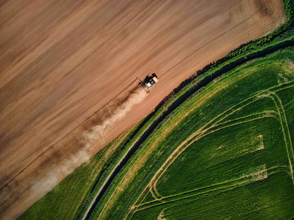
Precision Agriculture and Livestock
Unmanned aircraft are popular in precision agriculture, performing various functions from pre-planting to harvesting, such as localized fertilization and pest control. Thermal mapping drones monitor soil and plant temperature and are useful for long-term vegetation and soil monitoring. NDVI indices relate plant spectral response to the infrared and visible spectrum and are widely used in agriculture to identify plant health, water and nutritional stress, pests, and fertilization needs.
Ranchers use drones with thermal cameras to monitor pastures, grazing, and locate animals. Aerial mapping with thermal cameras is becoming more accessible, with drones being used in various applications in agriculture and livestock management.
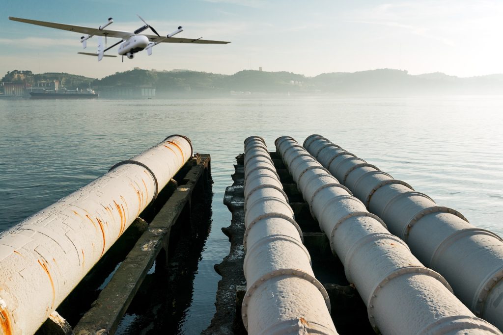
Refinery and Pipeline Inspections
Thermal drones are used in refinery and pipeline inspections to detect anomalies in equipment and infrastructure by capturing thermal images of the area. The drones can quickly cover large areas, allowing inspectors to identify potential issues such as leaks or hot spots in pipelines or tanks.
- Read more: What are refinery turnarounds and shutdowns?
This information can be used to schedule maintenance and repairs before more significant problems arise, reducing the risk of accidents and downtime.
Search and Rescue
Thermal drones are used in search and rescue to locate missing persons or survivors by detecting their body heat signatures. The drone's thermal camera can detect temperature differences and create a visual representation of the environment based on the heat emitted by objects or individuals, making it easier to locate people in low-light or obscured areas such as forests, caves, or disaster zones. Thermal camera drones can cover large areas quickly and efficiently, allowing rescue teams to prioritize their efforts and potentially save lives.
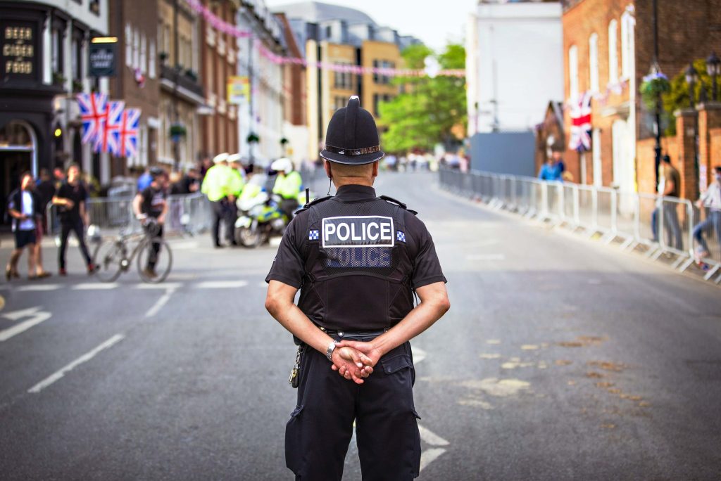
Public Safety and Security
Public security sectors have taken advantage of thermal cameras embedded in drones to identify fugitives in difficult-to-reach environments and to help people in risky situations. In addition, these security drones are powerful tools for the prevention and control of fires of any nature.
If before, large search groups had to risk themselves in dense forests and difficult-to-access environments, now, drones coupled with thermal cameras perform a complete scan of a certain area of interest, ensuring the safety of the professionals involved and generating reliable results in real time.
What Type of Drone Holds Thermal Imager?
A thermal imager can be mounted on a variety of drone types, including fixed-wing drones, multirotor drones, and hybrid drones. The type of drone used will depend on the specific application and the desired flight characteristics.
Multirotor drones, such as quadcopters, are often used for shorter flights and close-range inspections. Quadcopter drones with thermal cameras are typically more maneuverable and can hover in place, making them ideal for applications such as building inspections, firefighting, and search and rescue.
Fixed-wing drones, on the other hand, are designed for longer flights and can cover larger areas more efficiently than multirotor drones. These long-range drones are often used for applications such as agricultural mapping, pipeline inspections, and wildlife surveys.
Hybrid VTOL drones with thermal cameras combine the benefits of both fixed-wing and multirotor drones, offering long flight times and the ability to hover in place. They are typically used for applications such as aerial surveys and mapping, as well as search and rescue operations.
Read More


Every drone needs a brain.
Without it, you’re holding an expensive paperweight with spinning blades.
That brain is called a flight controller—but most people have no idea what it actually does.

Let’s be honest: the drone world loves its acronyms. UAV, UAS, drone, RPAS, UCAV, FPV–it’s an alphabet soup. And most people use them like they’re the same thing.
They’re not.
And here’s why that matt

JOUAV Product News and Use Cases
Fixed-Wing VTOL Drones Insights and Industry Trends
Invitations to online demo events