At 2:27 PM on a storm-lashed afternoon in July 2025, a small fishing boat capsized off the coast of Gulei, Zhangzhou.
Two men were thrown into violent waters. Winds howled at gale force. Waves surged
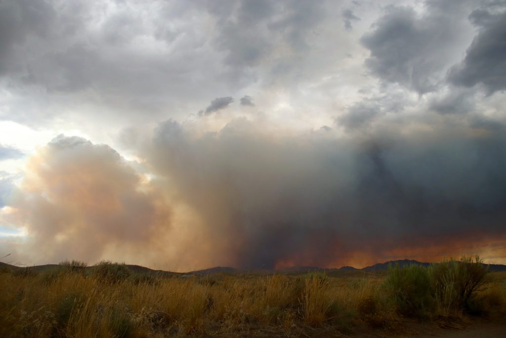
During the deep Qinghai autumn, telltale plumes of smoke rise from the grassland in the east.
Qinghai is a landlocked province in northwest China. Its eastern region is highland pastoral areas in vast and flat grasslands.
Wildfires are common in the fall and winter because of the powerful combination of dry weather and warming that produces fuel - grass, bushes, and trees. They stand where they are like matchsticks, just waiting for a spark.
In early November, Eight natives from Hualong County in eastern Qinghai held a smoke festival and set off firecrackers in an open field, but unfortunately, they ignited the hay and nearby bushes. As the fire rapidly expanded, these natives immediately called the Hualong County Forest Fire Control Department.
The local fire department rose to call quickly and organized 13 fire-fighting teams of 1,500 people. Among the teams was a UAV response team of ten people, including Joey Zhao. Upon first arriving on the scene, they were greeted with a smoking expanse of 20 acres that was spreading. To provide the incident commander with valuable real-time aerial awareness, they quickly deployed JOUAV CW-15D and CW-007 one after another.
"Using drones in firefighting efforts helps provide emergency responders with rapid situational awareness to create maps of fire-affected areas," said Joey.
Collect ortho data for incident response and post-incident recovery
Joey and his team used a CW-007 equipped with a CA-103 Aerial Camera to collect before and after pictures of the fire scene and to obtain accurate geographic locations. Using the 61 MP full-frame camera, CW-007 provides higher spatial resolution images than both satellite and most human-crewed aircraft imagery, thereby producing more accurate burn maps.

CW-007C is taking orthophotos for post-fire analysis.
"These orthoimages are able to deliver enhanced situational awareness to the incident commander. It provides a record of the disaster and helps decision-makers prioritize where to send help. Meanwhile, these drone surveying results can be used for post-fire parameter comparisons, such as burned area and burned volume. By comparing images taken at different times, the researchers can access changes over time, such as how vegetation is regrowing or elevation changes caused by erosion." said Joey.
- Read more: Learn how a China company does forest survey using CW-25E with LiDAR
Real-time wildfire monitoring
Subsequently, Joey launched the CW-15D in the air, which has a long endurance of 160 minutes and a fast flight speed of 30 m/s. CW-15D captured a full-motion, high-resolution video containing information about the wind and fire and predictive data about how the flames might spread next. Other mobile devices can also watch the live streaming of the fire scene by visiting the shared link. This enabled the incident commander to monitor the real-time video variation of fire, so as to make overall arrangements for fire rescue and maximize fire-fighting efficiency.
The CW-15D monitors the fire locates the accurate position of the fire and transmits the video footage to the ground station in real time.
"I'm impressed by the MG-120E EO/IR Gimbal Camera that CW-15D carried. This camera has a thermal module to see areas of heat through smoke, and a 30X optical video image to observe detailed fire situations in a distance," commented Joey.
To conclude
Globally, destructive wildfires, whether natural or man-made, are becoming increasingly common. They destroy property and take the lives of people and animals. Fortunately, armed with new technology, firefighters are rising to the challenge. Crews are using the innovation of drones to respond quickly, allocate resources and ultimately save lives and property.
More Use Cases


Chongqing’s Qinba Mountains are basically a giant green wall protecting the region. But there’s a problem – pine wood nematodes are eating through it. Fast.
The forestry department n

When TotalEnergies set out to build one of Southeast Asia’s largest solar and battery storage projects—spanning 12,000 hectares across the dense acacia forests of Riau, Indonesia—they faced a problem

JOUAV Product News and Use Cases
Fixed-Wing VTOL Drones Insights and Industry Trends
Invitations to online demo events