What is oblique imagery?

What is oblique imagery?

Oblique imagery is aerial photography that is captured at an angle of 40 to 45 degrees. The most popular oblique camera system in the market uses a mechanical rig with five cameras in fixed positions in a cross configuration; one that looks nadir and four sensors that view oblique under a tilt angle of 45 degrees.

Compared to traditional orthographic imagery, oblique imagery more closely resembles and has four more tilt shooting angles, thus giving you a wealth of additional information. Oblique images offer 3D information of ground objects from different views, and they can provide not only the top surface information but also the side, such as the building facade. Through advanced positioning and modeling technologies, a typical 3D city model can be generated.

Oblique imagery

Benefits of using oblique imagery

What's the benefit of using oblique imagery?

Firstly, compared to orthophotos, oblique imagery allows users to observe ground features from multiple angles, which more realistically shows the actual conditions of the features.

Secondly, by using the supporting software, you can directly measure height, length, area, angle, slope, etc. according to the resulting image, which expands the application of oblique photography technology.

Thirdly, Oblique photography can quickly acquire multi-angle and wide-range images of urban areas, thus overcoming the limitations of traditional images. In addition, oblique photography can obtain more information about ground features, especially the building facades, by tilting the camera. With the help of massively parallel computing, 3D models based on oblique images can be built quickly, effectively reducing the modeling cost of urban 3D models.

Finally, the image data obtained by oblique aerial photography is much smaller than that of 3D GIS, and its image data format can be quickly shared on the network.

How accurate is oblique photography?

How accurate is oblique photography?

Georeferencing consists of associating recognizable points with known coordinates in a predetermined reference system (UTM, Gauss-Braga, etc.) to the image.

In all measurements, there are geometric and accidental errors. The GIS software calculates the error types and applies the corrections to the image. It involves applying a deformation criterion on the final image adapted to the reference system used by the map.

Accidental errors, which depend on the movement of the drone and the morphology of the terrain, are also reduced. They can be corrected by using ground control points.

In the case of oblique photographs, a variable number of GCPs (Ground Control Points) are used on the ground. These points, with known coordinates, are located on the ground, either homogeneously, or concentrated in the areas of maximum interest.

The comparison of the values ​​obtained during data collection and the actual position of the points is called residual. The precision of each GCP is measured through a residual value (of x, y).

What are oblique photos used for?

What are oblique photos used for?

The oblique imagery can be used for a wide range of purposes, the main applications include the following:

  • Smart city: The ground feature information obtained through oblique cameras can be used to quickly build 3D models, providing urban planners with consistent, reliable data to visualize projects and evaluate the short and long-term effects of any smart city initiatives.
  • Open-pit mine management: High-resolution 3D realistic mesh models are the perfect starting point for engineering operations, construction, project planning, and communication activities. Use an accurate and fully textured 3D model of your site as a simulation planning sandbox. Model and virtually redesign all your future developments. Use the 3D model to better communicate with your stakeholders to show what you have done, what you are doing, and what you plan to do in the future.
  • Planning and design: Oblique photography can also be used for planning and design, such as the planning and design of bridges. Combining BIM technology and oblique aerial photography, you can build a 3D model of the bridge structure. Meanwhile, Also using BIM modeling technology, you can show your real-time dynamic adjustment and 3D dynamic presentation of the bridge design plan.

In addition, oblique photography technology has been widely used in land survey, rural cadastral mapping, river and lake management, real estate rights, engineering measurement, building construction, agriculture and forestry, traffic planning, BIM design, and GIS information system.

Real-world use cases of oblique imagery

Real-world use cases of oblique imagery

Equipped with oblique cameras of different tilt angles, our JOUAV VTOL drones helped lots of customers from different industries obtain more accurate spatial information of ground targets and generate large-scale 3D models quickly.

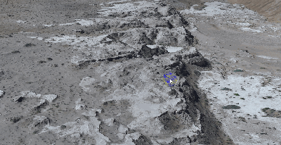
Water flow study in the Taklimakan desert

Taklimakan Desert, in Southwestern Xinjiang in Northwest China, is the largest desert in China and the second largest in the world. To study seasonal river generation in the desert, the Xinjiang Institute of Geology used CW-15 with a CA503R five-lens oblique camera to calculate the volume of sediment scoured by rivers.

 Actual flight area of Taklimakan desert

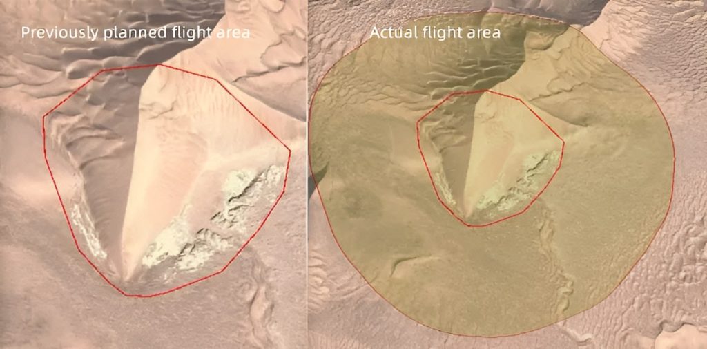
This 3D model covers 2.78km2 and was captured in a single flight.

Lily Shee, Superintendent of Technical Services at Xinjiang Institute of Geology said a ground survey on this area would take more than 3 days, but with CW-15, they only spent 70 minutes and save thousands of money.

Taklimakan desert 3D model

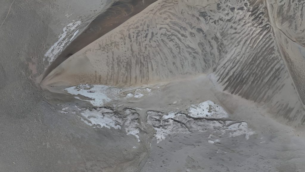
"Using professional 3D design software, we can easily make the 3D model based on oblique images. The 3D model directly shows the river image directly, which can be used to calculate the river sediment volume more accurately, and also can infer the impacts of water flow direction and intensity on the dune," said Lily.

Taklimakan desert 3D model

Weinan 3D city modeling project

The Weinan Municipal Government utilized CW-15 VTOL and PH-7E multirotor equipped with CA-503R cameras to capture high-resolution oblique imagery, generating a comprehensive 3D model with accuracies as low as 5cm for a 700 sq. km area. The 3D model aided in promoting the Weinan Snowlight Project by improving construction efficiency, project monitoring, and maintenance management.

"We were blown away by the level of detail and accuracy provided by CW-15 and PH-7E's 3D modeling drones. The ability to capture data from such a high altitude and still have a comprehensive and realistic representation of our site was truly impressive. This technology has completely transformed our approach to urban construction planning and we look forward to utilizing it for future projects", said John Guo, Project Manager from the Weinan Municipal Government.

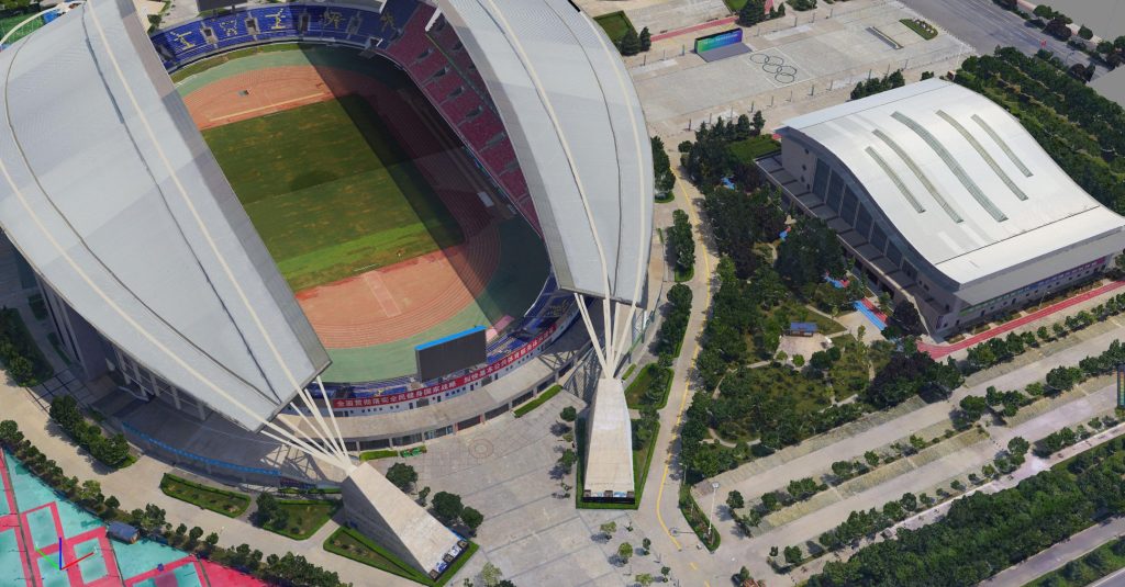
3D model details of the Weinan Gymnasium

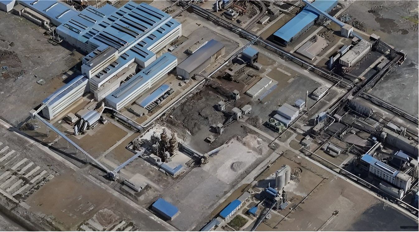
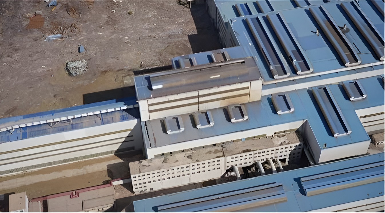
Mapping one of the chemical plants in China

Wanhua Chemical Plant, one of the largest chemical plants in China, used CW-25E equipped with a CA503 oblique camera to digitally model the chemical plant. In this way, they can conveniently and intelligently manage the traffic, volume ratio, sewage management, black water, greenery, and garbage in the area.

"It takes one to two years for the manual modeling to complete small and medium-sized city modeling work. But now with the oblique aerial photography, we can be completed the task in only three to five months, which effectively improves the efficiency of 3D model data collection," said Hermann Liu, Manager at Wanhua Chemical Plant.

grid-image
grid-image
Conclusion

Conclusion

Oblique imagery recreates the environment from the point of view of a human observer, compared to traditional drone surveying (taken straight from above). Since the angle of inclination is greater than in the nadir images, the visualization of vertical structures is improved. Consequently, the user can immerse himself in images that allow a quick and instinctive recognition of the objects present in them.

JOUAV drones for 3D mapping can be equipped with five-lens oblique cameras for high-resolution images that meet the survey accuracy in various industries. At present, JOUAV drones equipped with an oblique photography system are widely used in urban management, land resource management, smart city, emergency response, land security, geological control, power line inspection, and other fields.

Share :
Read More
thumbnail
The vast expanse of our oceans holds countless secrets, with hidden mountains, valleys, and plains veiled beneath the waves. To navigate these submerged landscapes and unlock their potential, we rely
thumbnail
Millions lost, projects delayed: Construction site theft is a costly reality. According to the National Equipment Register,a staggering $300 million to $1 billion lost annually in stolen construction
thumbnail
Have you ever wondered why Greenland appears larger than South America on a world map? This is a prime example of map distortion, a necessary consequence of transforming our spherical Earth onto a fla