At 2:27 PM on a storm-lashed afternoon in July 2025, a small fishing boat capsized off the coast of Gulei, Zhangzhou.
Two men were thrown into violent waters. Winds howled at gale force. Waves surged
China launched the third national land survey on Oct. 9, 2017. The purpose of the national survey is to thoroughly check the status of land use, collect accurate land data, and improve the mechanism of land survey and statistics.
Survey items include cataloging the use of land resources, ownership, and natural and economic conditions. Covering 9.6 million square kilometers of land in China, the main task of the survey is to investigate the land use status of each map based on the results of the second national land survey.
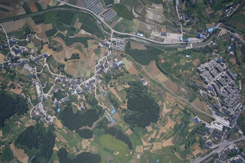
In July 2018, Liaoning Bohao Land Technology Co., one of the leading surveying companies in China, was given the challenging task to find out the current status of utilization and ownership of every piece of land within the urban and rural areas of Shuangyang District.
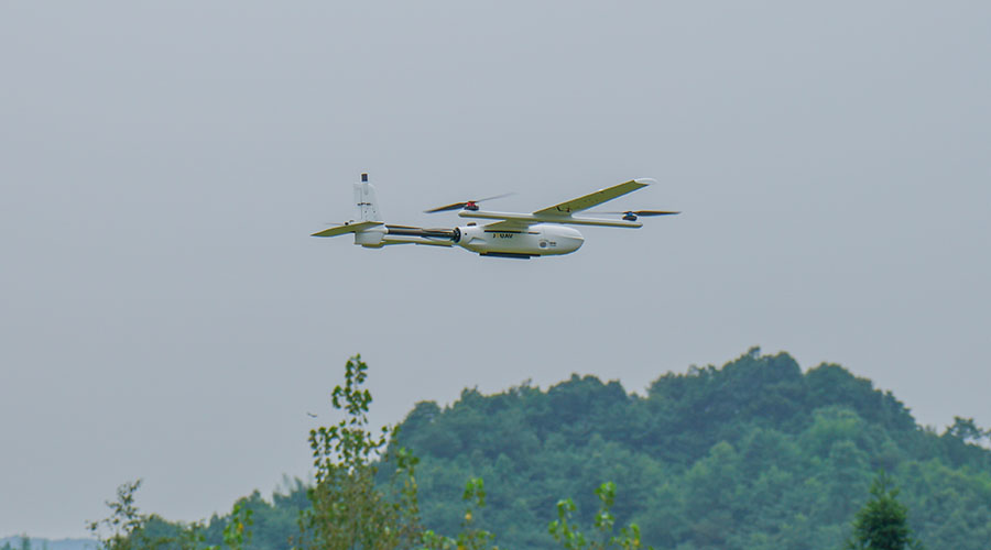
Shuangyang District, located in northeast China, is one of seven districts of the prefecture-level city of Changchun, the capital of Jilin Province. As the demonstration zone of this land survey, Shuangyang has a total area of 1,677.04 square kilometers with nearly 30,000 inconsistent map patterns. To improve the efficiency of this survey task, Liaoning Bohao Land Technology Co. used JOUAV CW-007 VTOL drone with SONY ILCE 7R to map large areas.
"CW-007 has greatly improved the efficiency of land surveying, especially in remote areas, where manual surveying is difficult and dangerous and where a lot of time is wasted on travel. It is 3 times faster than the traditional land surveying method," said Jack Ma, Chief Surveyor at Liaoning Bohao Land Technology Co.
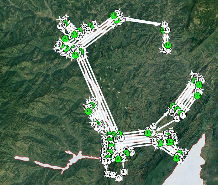
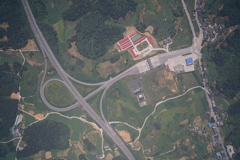
The flight plan for the third national land survey
Fast flight speed & long endurance
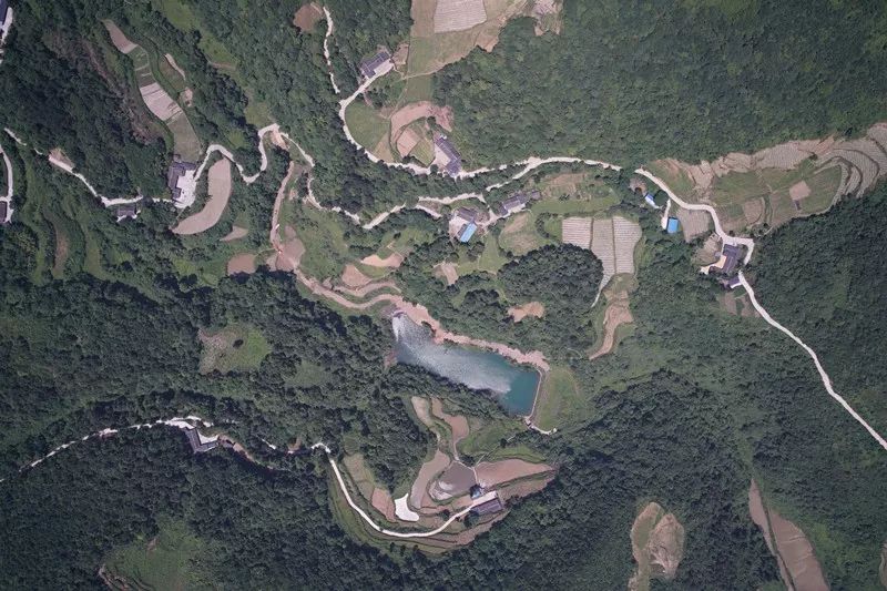
With a wide distribution and large changes in the map spot, the task of land survey in Shuangyang District can be inefficient if a muti-rotor drone is deployed. Compared with multi-rotor UAVs, CW-007 is safe and stable, with long endurance and fast flight speed. Meanwhile, CW-007 can obtain high-definition orthophotos of large areas with an image resolution of about 9cm, which fully meets the requirements of the national third land survey.
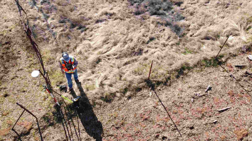
A pilot is doing the pre-flight check of the CW-007
CW-007 verified all the map spots of 36 km in just 20 minutes. Especially in mountainous areas and rivers and other areas with complicated terrain and inconvenient access for personnel, the efficiency of the drone verification of the map spots is more obvious. The photos taken by the drone are marked out on the map, and the spot photos can be seen by clicking on the icon.
“With 52 flights, 65% navigational overlap rate, and 65% side overlap rate, CW-007 completed all the data of the land survey in Shuangyang District. The submitted pilot results also passed the acceptance of the project team,” said Jack.
Fully autonomously
CW-007 has the advantages of intelligent obstacle avoidance and simple operation. Fully autonomous, the CW-007 allows a flight to be pre-planned via the intelligent FlightSurv Aerial Survey Software. With the touch of a button, the CW-007 is up in the air and automatically capturing surveying data.
"The CW-007 is very smart and easy to operate. Many times we joke that this drone makes us very uninvolved." Jack finished with a smile, "The CW-007 saves us a lot of heartache by flying with a smooth attitude and not having problems in the sky in case of emergencies."
After data aggregation, results in analysis, data results production, and map preparation are completed, Jack and his team will not only analyze the results of the secondary land survey to determine the quantity of land, distribution, and utilization structure, and its change status but also use the obtained data and information to build a region-wide integrated urban and rural land survey database and realize the interconnection and sharing of survey information.
More Use Cases


Chongqing’s Qinba Mountains are basically a giant green wall protecting the region. But there’s a problem – pine wood nematodes are eating through it. Fast.
The forestry department n

When TotalEnergies set out to build one of Southeast Asia’s largest solar and battery storage projects—spanning 12,000 hectares across the dense acacia forests of Riau, Indonesia—they faced a problem

JOUAV Product News and Use Cases
Fixed-Wing VTOL Drones Insights and Industry Trends
Invitations to online demo events