Have you ever watched a drone hover effortlessly over a construction site, inspect a wind turbine blade, or deliver medical supplies to a remote village?
That drone was almost certainly a multirotor.
What is LiDAR and How Does It Work?
LiDAR, an acronym for Light Detection and Ranging, stands at the forefront of modern remote sensing technology, playing a pivotal role in various industries such as mining, forestry, agriculture, and construction.
Though the concept of LiDAR has been in existence for several decades, recent advancements have made it compact enough to be seamlessly integrated into the payload of drones, unlocking new realms of data acquisition and analysis.
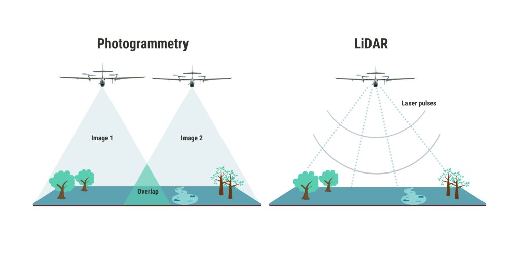
At its core, LiDAR is an active remote sensing technology that utilizes lasers to measure the distance between the LiDAR sensor and the target object.
This process involves the emission of a laser beam, which subsequently bounces off objects in its path.
By precisely measuring the time it takes for the laser pulse to return, LiDAR can determine the distance to the object with exceptional accuracy.
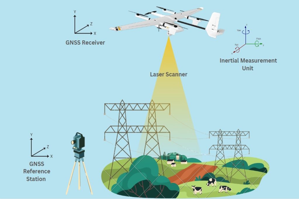
The LiDAR system doesn't work in isolation. It collaborates with other high-precision systems to create a comprehensive representation of the terrain and its topography.
Global Navigation Satellite System (GNSS) data, obtained from satellites, aids in precisely locating the LiDAR sensor.
Additionally, Inertial Measurement Units (IMUs) contribute by providing information about the sensor's orientation and motion.
This amalgamation of technologies allows LiDAR to generate a detailed and accurate 3D point cloud, capturing the shape and location of objects in its operational environment.
What is Photogrammetry and How Does It Work?
Photogrammetry, an age-old imaging technique revitalized for the digital era, is a passive measurement method that constructs 3D models by analyzing multiple photos of an object or scene.
Since its inception in the 19th century, it has evolved into a pivotal tool across diverse industries.
The process begins with the acquisition of numerous photographs capturing the target from different perspectives.
These images serve as the raw data that will be processed to construct a 3D model.
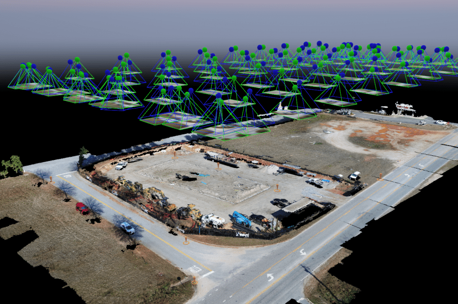
Specialized software plays a pivotal role in this intricate procedure, meticulously scrutinizing each photograph to calculate its precise position and orientation within the three-dimensional realm.
By combining this abundance of positional data, photogrammetry unfolds a detailed and accurate 3D model, offering a comprehensive view of the captured environment.
Photogrammetric surveys yield raw images, precise orthophoto maps, digital surface models (DSMs), and detailed 3D models.
Raw images capture visual data, orthophoto maps correct distortions, DSMs provide elevation insights, and 3D models offer a complete representation with texture, shape, and color.
LiDAR vs. Photogrammetry: Which is More Accuracy?
When choosing between LiDAR and photogrammetry for geospatial surveying, the debate inevitably centers around accuracy. Both methods offer reliability when executed meticulously.
To discern their comparative strengths, a closer examination of absolute and relative accuracy is essential.
Absolute (Vertical) Accuracy
Absolute accuracy gauges the precision of an object's or feature's position on the Earth's surface in mapping data. It ensures the alignment between mapped points and their real-world geographic coordinates.
Relative (Vertical) Accuracy
Relative accuracy measures the precision of the positional relationships between different objects or features in mapping data. It assesses the accuracy of the relative positions of points within the same scene, regardless of their absolute position on the Earth's surface.
LiDAR Accuracy
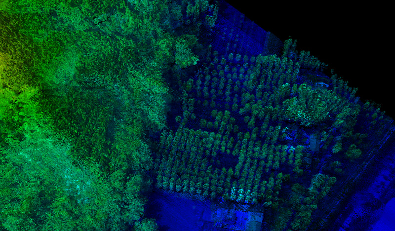
LiDAR boasts high precision, with an anticipated ranging accuracy of 0.5 to 10 millimeters relative to the sensor. Mapping accuracy reaches up to 1 centimeter horizontally (x, y) and 2 centimeters vertically (z).
Point cloud density, the number of points per unit area measured by LiDAR, is key to accuracy, with higher densities yielding more precise maps.
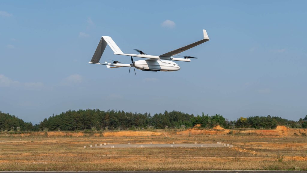
A notable example is the JOUAV CW-25E VTOL UAV equipped with PPK and RTK modules, carrying the JoLiDAR-1500.
This setup generates highly accurate, true-color point clouds with a point density ranging from 50 to 200 points/square meter, providing a typical absolute accuracy of 2-3 cm vertically.
Mounting the JoLiDAR-1500 on a multi-rotor vehicle like the PH-20 further enhances point density and resulting point cloud accuracy.
Flying at low speeds and low altitudes, this configuration achieves point densities between 70 and 500 points/square meter, enabling measurements at 1-centimeter intervals and achieving an absolute horizontal accuracy of about 1 centimeter.
LiDAR's accuracy is attributed to laser pulses directly measuring distances, eliminating errors in manual measurements.
This, coupled with integration with GNSS data, helps provide a high level of vertical accuracy for your digital terrain maps.
LiDAR excels in achieving absolute accuracy, making it an ideal solution for creating realistic models of the bare earth by accounting for elevation and vegetation. With its high data point density, surveyors can generate reliable data sets, and the laser pulse rate plays a crucial role in this.
For instance, a higher pulse rate, such as the JoLiDAR-1500's collection of 1.8 million points per second, allows for more detailed models, reducing the number of flights needed to cover a specific area.
However, it's important to note that LiDAR systems are complex, with various components each contributing to accuracy.
Ranging errors in LiDAR sensors, horizontal and vertical position errors in GNSS, roll, pitch, and heading errors in INS, and other factors need to be considered.
In conclusion, despite complexities and various factors affecting accuracy, LiDAR generally outperforms photogrammetry in producing more detailed and accurate scans. The precision and versatility of LiDAR make it a preferred choice for intricate mapping applications.
Photogrammetry Accuracy
However, this is not to say that photogrammetry is not an accurate measurement solution.
Certain UAV photogrammetry systems can deliver outputs with horizontal (x-y) accuracy as fine as 1 cm (0.4 inches) and elevation (z) accuracy within the same range.
Particularly in areas devoid of dense forest canopy, photogrammetry outshines aerial LiDAR in terms of horizontal accuracy.
Now, achieving such precision isn't a walk in the park. You need specialized payloads armed with the right image sensors and lenses to capture the nitty-gritty details. It's not just a pixel game; it's about finding that sweet spot between sensors and lenses.
Even two cameras flaunting the same megapixel count but with different-sized sensors can dish out different levels of image quality and accuracy.
Optimal accuracy also relies on meticulous mission planning and post-processing. A well-planned mission with adequate image overlap enhances precision and facilitates superior error correction.
High-end UAS, coupled with specialized mission planning and post-processing workflows, play a pivotal role in ensuring the collection of high-quality data that translates into accurate results.
Nevertheless, without the aid of ground control points or RTK- or PPK-enabled UAVs, achieving absolute accuracy in photogrammetry becomes challenging. Shadows, occlusions, and the texture of the surveyed object are additional factors that can impact photogrammetric accuracy.
When all the necessary elements align, photogrammetry excels in terms of relative accuracy.
In contrast, LiDAR stands out by not necessitating ground control points for accurate data acquisition. This stands as a distinct advantage, especially considering the time-consuming nature of setting up GCPs.
Other Differences Between LiDAR and Photogrammetry
Apart from accuracy and cost considerations, there are several other specifications to compare between LiDAR and photogrammetry, each influencing their suitability for different applications:
Resolution
LiDAR and photogrammetry, pivotal in geographic information acquisition, diverge significantly in resolution, a critical factor influencing technology selection.
LiDAR data manifests as a point cloud, its resolution contingent upon point density, quantified in points per square meter (pts/m²) or points per square foot (pts/ft²). LiDAR point densities vary considerably, ranging from 50 to 200 pts/m² (UAV-based).
In contrast, photogrammetry's relationship with point cloud density exists, but it isn't a direct indicator. Photogrammetric point densities are generally lower, particularly in the case of UAV-based systems, typically falling within the range of 5 to 20 pts/m².
In photogrammetry, the Ground Sampling Distance (GSD) serves as a critical measure, quantifying the distance between the camera sensor and the ground. A lower GSD signifies higher resolution, typically measured in centimeters per pixel.
While LiDAR lacks a direct GSD application, it can be estimated indirectly through point density, e.g., 50 pts/m² roughly corresponding to a 2 cm GSD.
Photogrammetric GSD directly derives from image resolution and flight parameters, ranging from millimeters to centimeters. In UAV projects, GSD typically hovers between 2-5 cm.
While LiDAR excels in point cloud density, photogrammetry balances this with strategically placed points and a visually rich texture that can offer a resolution surpassing that of LiDAR in certain contexts.
Coverage
LiDAR stands out for its superior coverage when compared to photogrammetry.
Fixed-wing drones, equipped with LiDAR payloads, exhibit remarkable efficiency in surveying vast ground areas, covering up to 10 square kilometers in a single flight.
This is made possible by LiDAR's capability to leverage a broader scanning angle, allowing for comprehensive data collection across horizontal and vertical dimensions.
In contrast, cameras are often limited by their narrower field of view, necessitating multiple shots and intricate stitching processes to achieve a comparable coverage area.
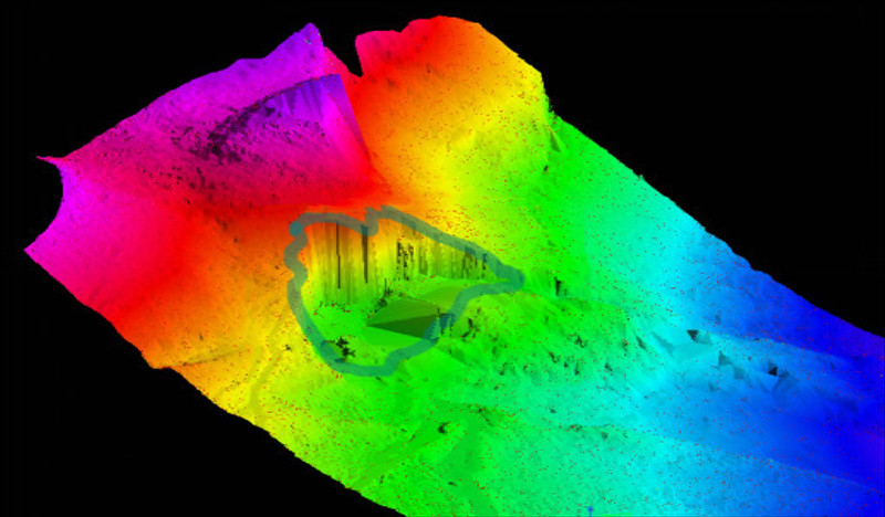
Leaf Penetration
While neither LiDAR nor photogrammetry sensors physically penetrate through the leaves, LiDAR has a unique capability to glean valuable information about the ground beneath a dense canopy.
In LiDAR, emitted laser beams are directed toward the forested area. Some of these beams penetrate through the leaves, reach the forest floor, and then bounce back up to the sensor. This unique capability allows LiDAR to effectively "see through" the gaps between leaves, providing detailed terrain information in areas with tightly woven canopies.
In contrast, photogrammetry relies on photographs. In densely wooded areas with a thick canopy, the darkness and shadows created by dense tree stands limit the amount of ground information that can be gathered. Photogrammetry is less effective in capturing terrain details under heavy canopies due to the obstructed view caused by shadows and the lack of direct light.
Data Acquisition Speed
LiDAR outpaces photogrammetry by swiftly collecting millions of points per second, making it ideal for efficiently mapping large areas.
With only 20-30% image overlap needed between flight lines, LiDAR streamlines the process, capturing detailed terrain information effectively.
In contrast, photogrammetry's reliance on multiple overlapping images, requiring 60-90% overlap, can be time-consuming, especially in larger or complex terrains.
LiDAR's speed advantage in precise terrain data collection makes it the more time-efficient choice for applications prioritizing swift data acquisition.
Data Processing Time
LiDAR data processing is typically swift. Since it involves direct distance measurements, post-processing primarily entails tasks such as noise filtering, point organization, and potential georeferencing.
These calculations are straightforward and efficiently handled by modern algorithms. The raw data requires only a brief calibration period, usually between 5 and 30 minutes, to yield final results.
In contrast, photogrammetry involves the reconstruction of 3D models from overlapping images, a process requiring intricate algorithms for feature matching, 3D coordinate calculation, and mesh generation. These computations can be computationally demanding, especially with high-resolution images or complex scenes.
Photogrammetry's data processing is time-consuming and necessitates powerful computers to handle operations on gigabytes of images. Consequently, the time spent in the field can be multiplied by 5-10 fold for the data processing phase.
3D Data Output
Both LiDAR and photogrammetry capture the real world in 3D, but they do so in different ways, leading to distinct types of outputs. Here's a breakdown of the key differences:
Point Cloud
The primary output of LiDAR is a point cloud, a vast collection of individual points representing the position and intensity of reflected laser pulses. These points accurately represent the surfaces and features they've bounced off, providing a rich dataset for analysis.
While photogrammetry doesn't directly generate point clouds, it can be used to derive them from the reconstructed 3D model through post-processing. These derived point clouds are typically less dense and accurate than pure LiDAR point clouds.
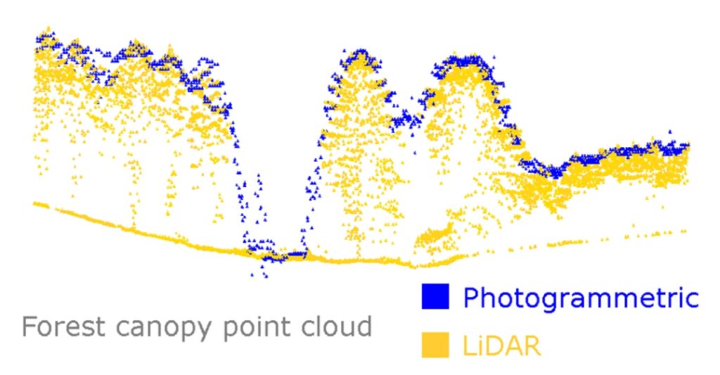
Comparison between photogrammetric and LiDAR point clouds. Source from "A Photogrammetric Workflow for the Creation of a Forest Canopy Height Model from Small Unmanned Aerial System Imagery".
Meshes
LiDAR point clouds can be further processed to generate a mesh, a collection of interconnected triangles that approximates the original surfaces. LiDAR-derived meshes are often smooth and accurate but may lack intricate details compared to photogrammetry.
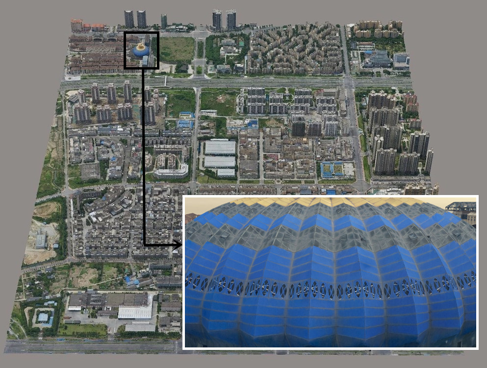
Photogrammetry directly generates 3D meshes from overlapping images. These meshes often capture fine details and textures present in the images, leading to realistic and visually appealing models. However, they may struggle with areas with poor visibility or lack of texture.
Grids
Point clouds can be interpolated to create a regular grid, where each cell value represents the elevation or other property measured by the LiDAR. This format is useful for the analysis and visualization of continuous data like terrain elevation.
Grids are not a typical output of photogrammetry, but they can be derived from the 3D model for specific applications.
Textures
LiDAR point clouds directly lack color information. Textures can be applied to LiDAR-derived meshes using other techniques like photogrammetry or image overlays.
Photogrammetry excels at capturing textures and colors from the original images. These textures can be directly applied to the generated meshes, resulting in photorealistic outputs.
Ease of Use
LiDAR systems are known for their user-friendly data acquisition process. With minimal user input, you simply set the flight path, hit a button, and the LiDAR system autonomously captures the necessary data. Unlike photogrammetry, which demands capturing overlapping images at specific angles, LiDAR effortlessly collects data points across the entire area without requiring manual adjustments.
While operating and interpreting LiDAR data may demand a good understanding of the technology, the initial steps—such as filtering noise and generating point clouds—are often automated, reducing the need for extensive manual intervention. This automation streamlines the process, even for beginners.
Photogrammetry, on the other hand, offers a more accessible option for beginner users. It can be conducted using readily available drones and cameras, tapping into the familiarity most people have with the process of taking photos. This inherent simplicity in data capture makes photogrammetry feel more intuitive for beginners.
However, it's important to note that achieving accurate results in photogrammetry requires careful planning and precise control over camera angles and overlaps. This aspect can be time-consuming and prone to errors, adding a layer of complexity to the data acquisition process.
Output File Format
When it comes to output file formats, LiDAR and photogrammetry offer distinct results, each tailored to their unique data capture methods.
LiDAR
- Point Clouds: The primary output of LiDAR is a point cloud, a vast collection of individual points typically stored in formats like LAS, E57, or PTS. Each point neatly houses its X, Y, and Z coordinates, along with additional information like intensity or reflection angle.
- Meshes: Point clouds from LiDAR can be processed to generate meshes, usually saved in formats like OBJ, STL, or PLY. These formats represent the three-dimensional surfaces derived from the original point cloud data.
- Grids: For applications such as terrain analysis, LiDAR data can be interpolated into grids. Each cell in the grid holds values like elevation or other properties, and these grids find their storage in formats like ASCII or GeoTIFF.
Photogrammetry
- 3D Models: Photogrammetry generates 3D models, commonly stored in formats like OBJ, STL, PLY, or FBX. These models, similar to LiDAR-derived meshes, often capture finer details and textures from the original images.
- Orthomosaics: Photogrammetry can also produce orthomosaics—high-resolution stitched images corrected for camera tilt and distortion. These map-like representations of the captured area are typically saved in formats like TIFF or JPEG.
- DEMs: Similar to LiDAR, photogrammetry can generate Digital Elevation Models (DEMs) representing terrain elevation. These DEMs are commonly stored in formats like ASCII or GeoTIFF, providing valuable insights into the topography.
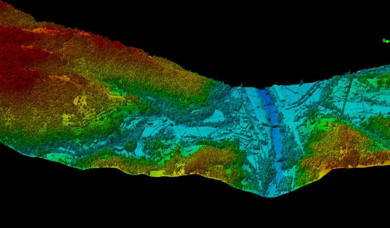
Large-Scale Topographical Maps Featuring Heavy Vegetation
Large-scale topographical maps featuring dense vegetation are most effectively acquired using LiDAR drones. A Digital Terrain Model (DTM) of the forest floor offers valuable insights for construction planning (e.g., road development) and provides detailed information on forest biomass, vegetation, and habitats.
In scenarios like these, incorporating LiDAR, at least partially, is essential for normalizing topographical data.
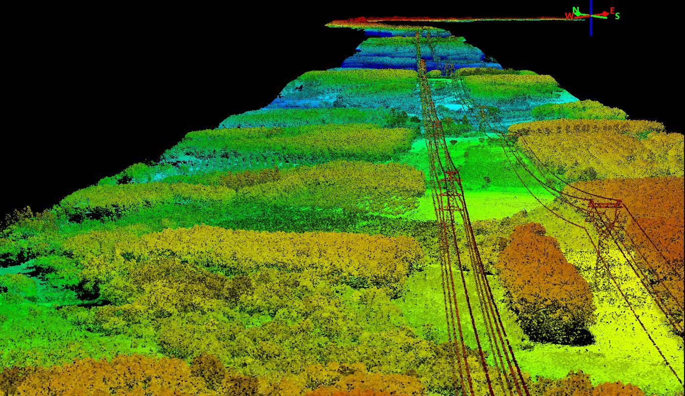
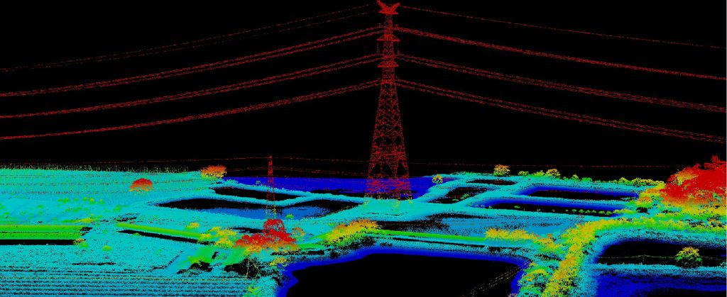
Power Line Inspection and Vegetation Management
LiDAR revolutionizes power line inspection with its ability to swiftly and accurately assess the interaction between vegetation and power lines. This technology generates point clouds and 3D maps that facilitate the measurement of distances between foliage, various vegetation, and power lines.
Grid operators leverage this information to make informed decisions, predicting potential trouble spots. Unlike large-scale clearing operations, LiDAR allows operators to focus efforts on areas posing the greatest threat to the stability of the power line network.
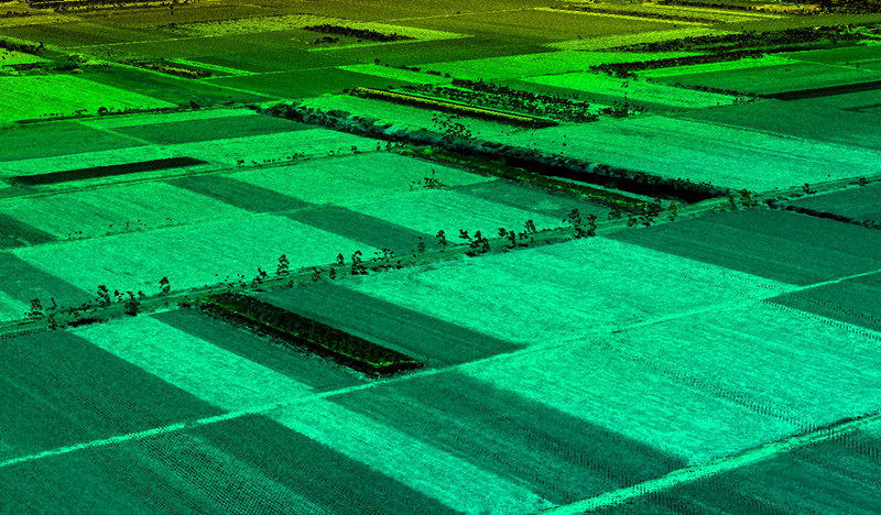
Agriculture
LiDAR's geospatial data in agriculture offers comprehensive insights. Digital soil mapping reveals topsoil quality, soil types, and drainage. Identifying water sources optimizes well placement, enhancing water management.
Understanding water-prone areas aids in precise irrigation planning, mitigating soil erosion. For large farms, LiDAR analyzes sun exposure, water drainage, and erosion for optimal crop planning. The data aids pre- and post-planting analyses, ensuring accurate yield predictions and critical information during severe weather or crop health issues.
Forestry
LiDAR drones, equipped with artificial intelligence, prove invaluable for monitoring plant health within forestry applications. These drones gather and process data on the well-being of trees, vegetation, and bushlands.
Organizations managing extensive forested areas benefit from LiDAR drones, which provide regular updates and accurate information for strategic decision-making. The fast and precise scanning capabilities of LiDAR drones facilitate the identification of potential threats, such as landslides and fire risks.
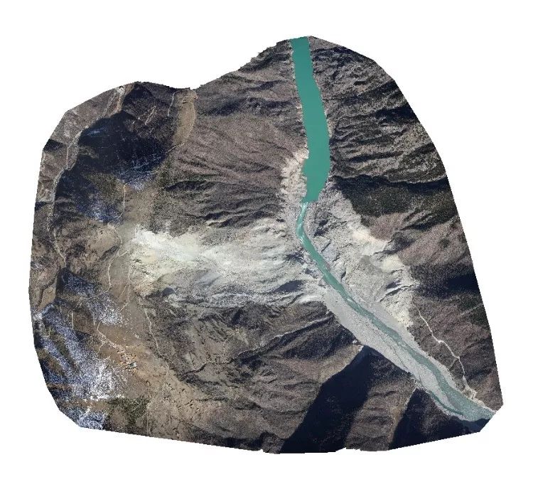
Floodplain Mapping
In flood mapping, accurate Digital Elevation Models (DEMs) are essential, impacting hydrological modeling precision. Even a 1-meter DEM error in flat floodplains can lead to a substantial 100 km2 error in flood estimates.
Drone photogrammetry provides high-resolution DEMs but may be limited by clouds or haze during floods. In contrast, LiDAR is flexible, works day or night, and penetrates vegetation effectively, making it ideal for flood-related challenges.
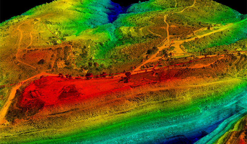
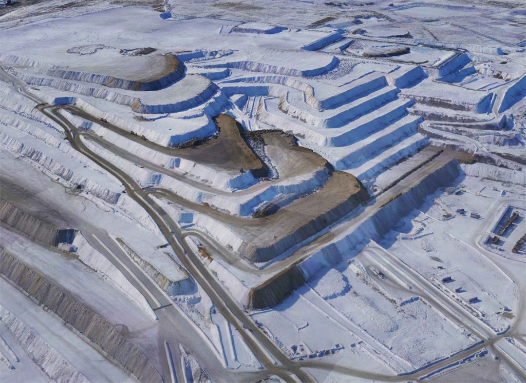
Mining and Quarrying
LiDAR optimizes mining operations by calculating volumes, modeling terrain, and monitoring surface changes. It aids in efficient stockpile management, assists in designing mine layouts and access roads, and contributes to slope stability monitoring.
For sustainable practices, LiDAR assesses and mitigates environmental impacts, identifying concerns like erosion and vegetation loss. When integrated with technologies like ground-penetrating radar, LiDAR provides insights into subsurface features, indicating potential mineral deposits.
Surveying a Cleared Site with Sparse Vegetation
Obtaining topographical maps for areas with sparse vegetation can be efficiently achieved by photogrammetry. Integrating ground survey methods ensures cost-effectiveness while maintaining high accuracy, resolution, and photorealistic outcomes provided by photogrammetry.
Comprehensive tutorials with a reasonable learning curve for this integrated approach are readily available. It facilitates the precise mapping of terrain, offering crucial data for applications such as construction, land development, and environmental monitoring.
Construction and Engineering
Drones with photogrammetry capabilities are essential for on-site tasks in construction and engineering. They capture real-time aerial imagery, geotagged with precise GPS information. This data aids in distance calculation, progress tracking, and intricate project-related calculations.
The integration of surveying and photogrammetry techniques enables the creation of accurate 3D digital models, facilitating precise measurements, modifications, and design work for various infrastructures. This streamlined approach enhances project understanding and decision-making in construction and engineering.
Archaeological Site Documentation
Photogrammetry proves invaluable in archaeology, creating detailed 3D models of artifacts and excavation sites. This not only preserves a digital record but allows for in-depth analysis without physically handling objects.
It extends to mapping archaeological sites with precision, offering a detailed representation of terrain and structures. During excavations, photogrammetry documents trenches, artifacts, and stratigraphy, preserving nuanced contexts with high-resolution imagery.
Read More


Every drone needs a brain.
Without it, you’re holding an expensive paperweight with spinning blades.
That brain is called a flight controller—but most people have no idea what it actually does.

Let’s be honest: the drone world loves its acronyms. UAV, UAS, drone, RPAS, UCAV, FPV–it’s an alphabet soup. And most people use them like they’re the same thing.
They’re not.
And here’s why that matt

JOUAV Product News and Use Cases
Fixed-Wing VTOL Drones Insights and Industry Trends
Invitations to online demo events