Every drone needs a brain.
Without it, you’re holding an expensive paperweight with spinning blades.
That brain is called a flight controller—but most people have no idea what it actually does.
What is Distortion in Geography and Why Does it Happen?
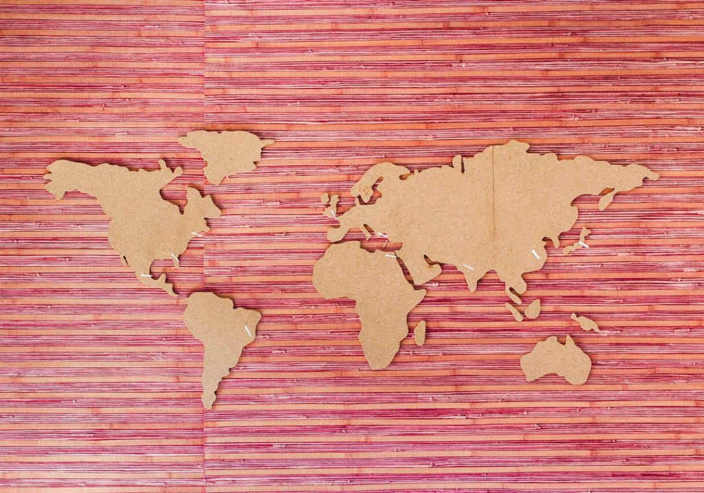
Geographical distortion is a concept that arises from the challenge of representing the Earth's curved surface on a flat map. This transformation is akin to peeling an orange and trying to lay the peel flat; it will inevitably tear or warp, creating a distorted representation of the original shape.
In the context of geography, distortion affects four primary properties of maps: shape, size (or area), distance, and direction.
- Shape: If a map preserves shape, it means that any small enough area on the map has the same shape as it does on the Earth.
- Size/Area: If a map maintains size or area, it signifies that the area covered by a particular feature on the map is proportionally the same as its actual coverage on the Earth.
- Distance: If a map retains accurate distances, it indicates that the distance between two points on the map accurately represents the true distance between those points on the Earth.
- Direction: If a map keeps accurate direction, it means that the angles measured on the map between two features are the same as the actual angles between those features on the Earth.
However, it's important to note that no map can perfectly preserve all four of these properties at once due to the Earth's curvature. Different map projections prioritize different properties based on the map's intended use.
Types of Map Projections and Distortion
A map projection is a systematic method of transferring geographical coordinates (latitude and longitude) onto a flat surface. Different projections achieve this in various ways, each with its strengths and weaknesses. Some common projections include:
- Mercator projection: Commonly used in world maps, it minimizes distance distortion along lines of longitude, making it useful for navigation. However, it severely exaggerates the size of landmasses farther from the equator.
- Robinson projection: This projection aims for a more balanced representation of the Earth, with less extreme area distortion compared to the Mercator. However, it sacrifices some accuracy in shape and distance.
- Goode's Homolosine projection: This equal-area projection minimizes area distortion, making it suitable for analyzing land use or population distribution. However, shapes and distances can be slightly distorted.
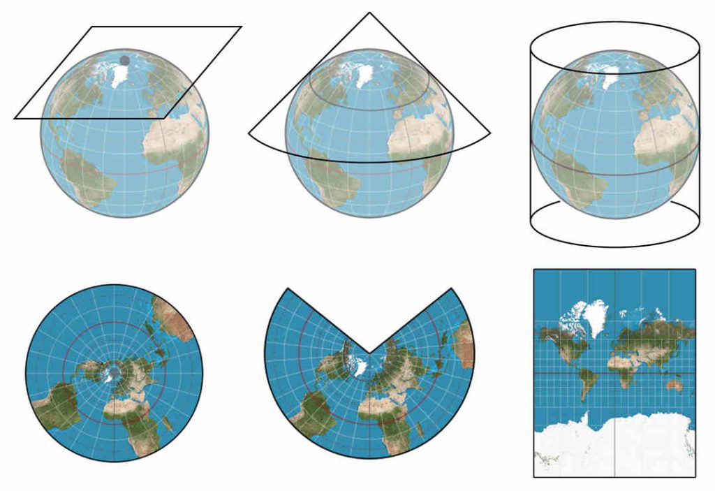
Image credit: gistbok.ucgis.org
How to Minimize Distortion in Drone Mapping?
Drone mapping has revolutionized data collection for various applications, from surveying construction sites to creating 3D models of historical landmarks. However, unlike traditional surveying methods, drone mapping can be susceptible to image distortion. This distortion can compromise the accuracy of the final 3D model, impacting measurements, analysis, and overall project outcomes.
Understanding Image Distortion
Two main types of distortion can affect drone-captured images:
- Radial Distortion: This distortion occurs due to the inherent limitations of camera lenses. It causes straight lines to appear curved, typically bowing outwards at the image edges and inwards near the center. This is most prominent with wide-angle lenses commonly used in drone photography.
- Tangential Distortion: This distortion is less common but can occur due to slight misalignment of the lens elements within the camera. It manifests as a slight shearing effect, causing straight lines to appear slightly wavy or bent.
Tips to Handle Distortion in Drone Mapping
Accurate drone mapping relies on minimizing image distortion caused by camera lenses. Here's how to achieve that:
Camera Calibration
Frequency: Calibrate your drone camera at least once every 3 months, or more frequently if you experience significant temperature variations during operation.
Software: Use reputable camera calibration software specifically designed for your drone model and camera. Several manufacturers offer dedicated calibration tools, or you can explore third-party options.
Calibration Target: Invest in a high-quality checkerboard calibration target with a clear and consistent pattern. Ensure the target is large enough to fill a significant portion of the camera frame during capture.
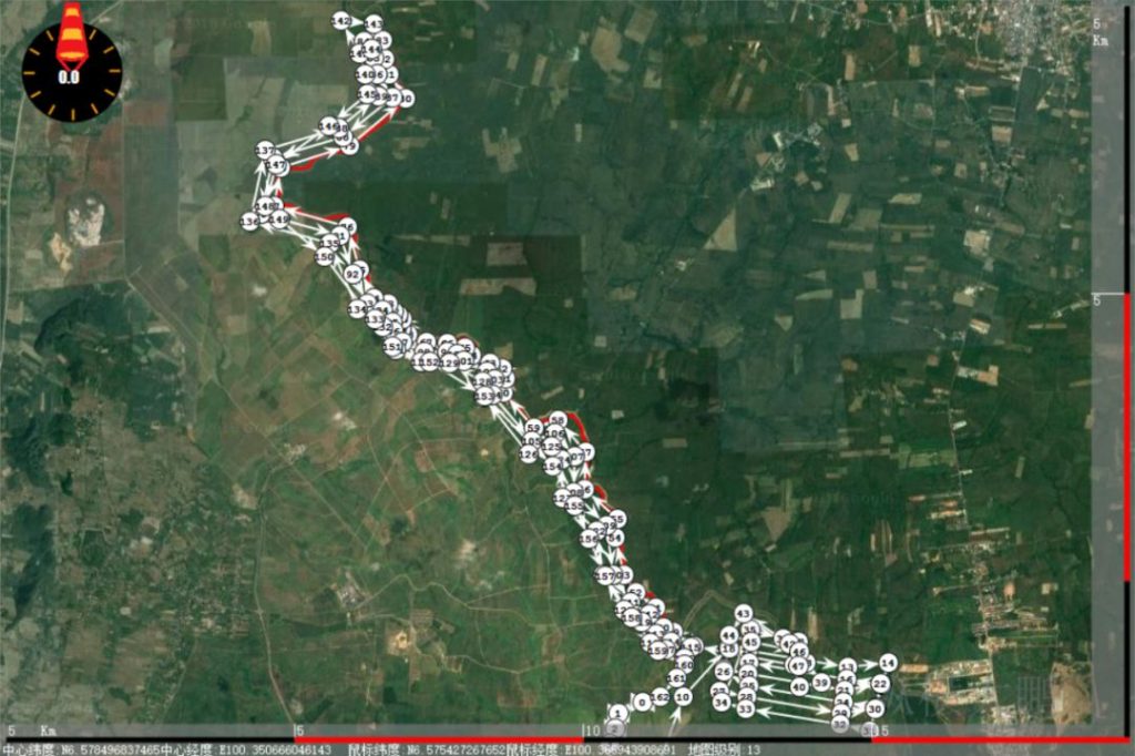
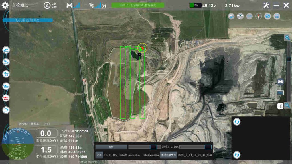
Flight Planning and Image Overlap
Image Overlap: Set your flight planning software to capture images with at least 60% overlap for both forward overlap (between consecutive images) and side overlap (between images from adjacent flight lines). Higher overlap (up to 80%) might be necessary for complex or challenging environments.
Flight Path Planning: Plan straight and parallel flight lines with consistent spacing to ensure even image coverage across the entire mapping area. Utilize automated flight modes or waypoints to maintain consistent flight speed, altitude, and camera angle throughout the mission.
Flight Parameters and Stability
Flight Speed: Maintain a consistent flight speed throughout the mission. A slower flight speed allows for more image detail capture, which can be beneficial for distortion correction during post-processing. Aim for a range of 3-5 meters per second (6.7-11.2 mph) depending on project requirements and wind conditions.
Altitude: Maintain a consistent flight altitude throughout the mission. This ensures consistent image scale and minimizes variations that could contribute to distortion. The ideal altitude depends on the desired ground resolution and project area size. A good starting point is twice the desired ground resolution (e.g., for a 5cm ground resolution, aim for a 100-meter flight altitude).
Camera Angle: Maintain a nadir (straight down) camera angle throughout the mission. Tilting the camera can introduce perspective distortion, especially for oblique captures. Utilize the camera gimbal controls or automated settings to maintain a vertical camera orientation.
Photogrammetry Software
Distortion Correction: Choose photogrammetry software with built-in distortion correction algorithms. Most modern software offers this functionality. During the processing workflow, ensure the camera calibration profile is properly applied to the project.
Software Options: Several reputable photogrammetry software options are available, including Pix4D, DroneDeploy, Metashape, and Autodesk ReCap. Consider factors like ease of use, feature set, processing speed, and cost when choosing software.
Advanced Software Features: Some advanced photogrammetry software might offer tools for identifying and correcting residual distortion in specific areas of the 3D model. These tools may involve comparing the model to ground control points ( GCPs) or using manual editing techniques. However, relying solely on manual refinement is time-consuming and requires specialized skills.
Sensor Quality
Invest in high-quality drone cameras with reputable lenses known for minimal distortion characteristics. Consult reviews and technical specifications from drone manufacturers and lens manufacturers to identify cameras with low distortion profiles.
Lighting Conditions
Plan your flights for overcast days with even lighting conditions. Harsh sunlight creates strong shadows and variations in brightness that can contribute to distortion during image processing. If flying under cloudy conditions is not possible, consider capturing images during the early morning or late afternoon when the sun angle is lower and shadows are less pronounced.
Read More


Let’s be honest: the drone world loves its acronyms. UAV, UAS, drone, RPAS, UCAV, FPV–it’s an alphabet soup. And most people use them like they’re the same thing.
They’re not.
And here’s why that matt
An airborne cargo drone is exactly what it sounds like: an unmanned aircraft built to carry stuff. Not tiny packages for a suburban backyard – real cargo. From medical supplies to industrial parts.
An

JOUAV Product News and Use Cases
Fixed-Wing VTOL Drones Insights and Industry Trends
Invitations to online demo events