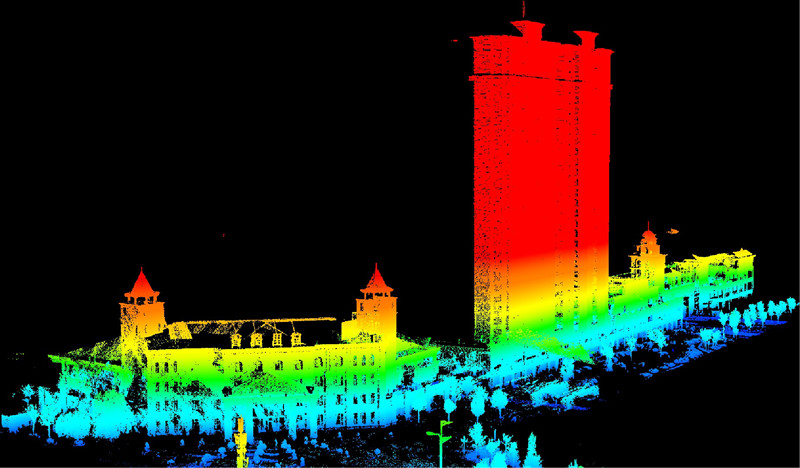
Yeah, you’ve probably seen those LiDAR maps—the ones that strip away trees to reveal ancient ruins or show cityscapes in stunning 3D detail. They’re impressive.
But here’s a question
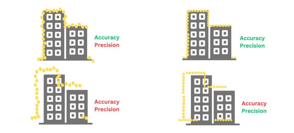
What's the Difference Between Accuracy and Precision?
Accuracy Refers to the closeness of a measurement or representation to its actual value in the real world. In simpler terms, it signifies how correct the data is.
For example, if a map claims a lake is located at a specific coordinate, the accuracy reflects how close that coordinate is to the lake's true location on Earth.
Precision presents the level of detail or reproducibility of a measurement. It essentially tells you how consistent the measurements are.
In GIS, precision often relates to the resolution of the data. High-resolution data, like aerial imagery collected by drones, allows for more precise measurements and captures finer details compared to low-resolution data.
Can Geospatial Data be Precise But Not Accurate?
Yes. It's crucial to remember that high precision doesn't guarantee high accuracy in the geospatial world. A tool might measure and record positions very precisely, but if those measurements are consistently off from the true location (e.g., always showing 10 meters north of your actual position), it's precise but not accurate.
Conversely, a tool might be generally accurate (getting you to the right street) but not precise enough to differentiate between closely spaced points (like different buildings on the street).
Is Accuracy or Precision More Important?
It's crucial to recognize that accuracy and precision are not mutually exclusive. Ideally, we strive for data that is both accurate and precise. However, depending on the specific application and its goals, one might take precedence over the other.
Accuracy is paramount when tasks require absolute truth and spatial certainty. Examples include:
Defining legal boundaries and property lines: Even slight deviations can have significant legal and financial implications.
Infrastructure planning and construction: Precise location data is essential for the accurate placement of structures and for ensuring their proper functioning.
High-precision applications: Tasks like emergency response, asset management, and environmental monitoring often rely on highly accurate data to make informed decisions.
Precision plays a vital role in applications where comparative analysis and consistency are key. Examples include:
Change detection: When analyzing changes in land cover, vegetation density, or other features over time, consistent and repeatable measurements are crucial for meaningful comparisons, even if the data may not be perfectly accurate compared to the original state.
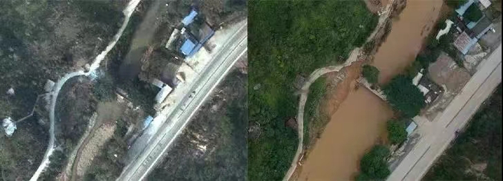
Before and after the old bridge broke after the flood.
Modeling and simulation: Precise data ensures consistency and reliability in models and simulations, even if the model itself may incorporate assumptions or simplifications.
Integration of data from various sources: When combining GIS data from different sources, having measurements with similar levels of precision facilitates seamless integration and analysis, even if the absolute accuracy of each dataset might differ.
Tips for Improving Accuracy and Precision
Achieving high levels of accuracy and precision in mapping requires careful consideration of various factors, including data acquisition techniques, data processing workflows, and data management strategies. Here are some tips to enhance accuracy and precision in mapping efforts:
Data Acquisition
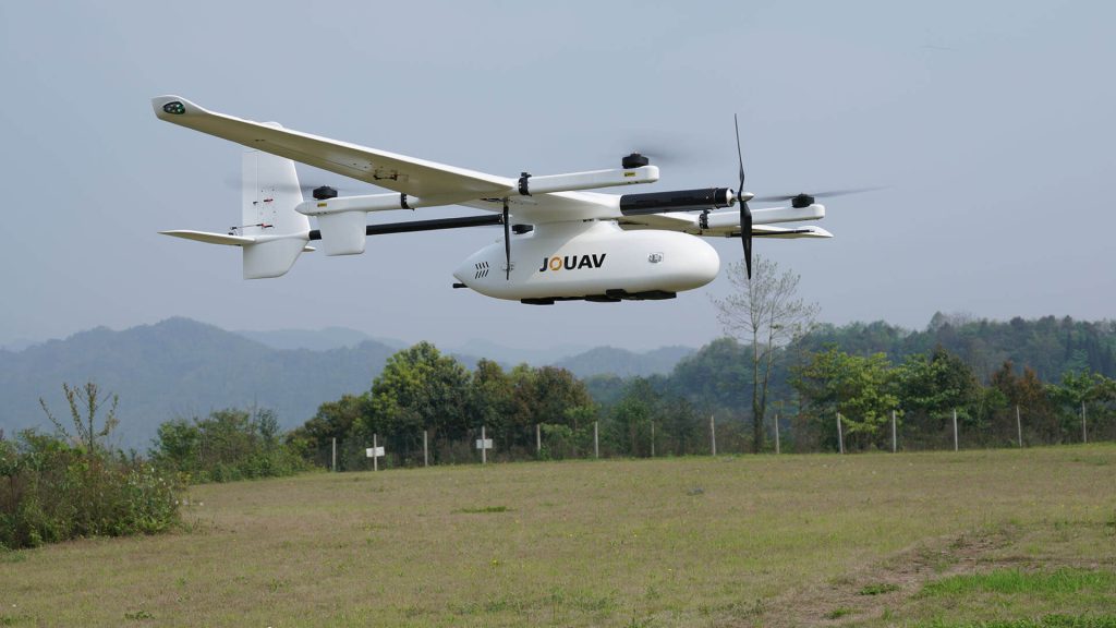
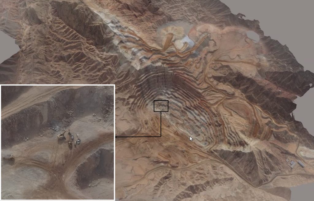
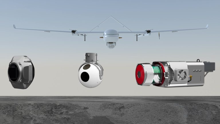
Drone-based Precision Mapping: For projects requiring exceptional precision, consider high-performance drones like the CW-15 VTOL. This advanced system integrates LiDAR, cameras, and other sensors (including hyperspectral and thermal options) for comprehensive data capture, delivering horizontal accuracy down to 1 cm. Its compatibility with RTK and PPK GNSS correction systems further bolsters positioning accuracy across diverse mapping applications.
Integration with Satellite Navigation Systems (SNS): Real-time corrections from reference stations can be delivered not only via terrestrial networks but also through satellite constellations, like Global Navigation Satellite System (GNSS) corrections received through Space-Based Augmentation Systems (SBAS).
Emerging Techniques: High-resolution satellite imagery with revisit times of less than a day is becoming increasingly available, enabling near-real-time monitoring of dynamic phenomena. Additionally, advancements in radar technology, like synthetic aperture radar (SAR), are providing new opportunities for all-weather and high-resolution data acquisition.
Data Processing
Deep Learning for Data Cleaning: Deep learning algorithms can be utilized for automated data cleaning tasks beyond error detection. For example, they can be trained to reconstruct missing or corrupted data points by learning from surrounding valid data.
Data Augmentation: Techniques like image augmentation can be employed to artificially increase the size and diversity of training datasets for machine learning models, improving their accuracy and generalization capabilities in GIS applications.
Data Management and Analysis
Security and Privacy Considerations: Cloud-based GIS platforms raise security and privacy concerns related to sensitive geospatial data. Implementing robust security protocols and adhering to data privacy regulations are crucial aspects of managing and analyzing spatial data in the cloud.
Interoperability and Open Standards: Ensuring data interoperability between different platforms and software tools is essential for seamless data exchange and collaboration in GIS. Promoting the adoption of open standards and data formats facilitates data sharing and integration across various systems.
Components of Data Quality
Data quality is crucial in GIS (Geographic Information System) as it directly impacts the reliability and validity of the results obtained from spatial analysis. Here are the key components of data quality in GIS:
Positional Accuracy: This refers to the closeness of the features' recorded locations to their actual positions on the Earth's surface. It is often measured in meters or as a percentage of the map scale. For instance, a map with a scale of 1:24,000 and a positional accuracy of 12 meters implies that features on the map could be displaced by up to 12 meters from their true locations.
Attribute Accuracy: This component ensures the correctness of the descriptive information associated with each feature in the data set. This includes verifying that the data attributes (e.g., road type, building name, population) accurately represent the real-world characteristics they describe.
Logical Consistency: This refers to the adherence of the data to established rules and relationships. It involves checking for internal consistency within the data (e.g., ensuring no dangling rivers or self-intersecting roads) and ensuring consistency with external standards or data models (e.g., following specific coding schemes for land cover classification).
Completeness: This aspect of data quality deals with the comprehensiveness of the data set. It ensures that all necessary features and their attributes are present and accounted for within the data. Incompleteness can lead to skewed results or misleading analysis if crucial information is missing.
Temporal Accuracy: This component is relevant for data that changes over time, such as land cover or population data. It refers to the accuracy of the date and time associated with the data, ensuring it reflects the intended time period it represents.
Lineage: This component documents the origin, history, and processing steps involved in creating the data. Maintaining a clear lineage trail allows users to understand the data's provenance, assess its potential biases, and determine its suitability for their specific purposes.
Read More

Let me tell you something that happens way too often.
A company spends $15,000 on a drone, excited about the flight time and range. They get it in the air and mount their LiDAR sensor—and the drone ba

Have you ever watched a drone hover effortlessly over a construction site, inspect a wind turbine blade, or deliver medical supplies to a remote village?
That drone was almost certainly a multirotor.

JOUAV Product News and Use Cases
Fixed-Wing VTOL Drones Insights and Industry Trends
Invitations to online demo events