At 2:27 PM on a storm-lashed afternoon in July 2025, a small fishing boat capsized off the coast of Gulei, Zhangzhou.
Two men were thrown into violent waters. Winds howled at gale force. Waves surged
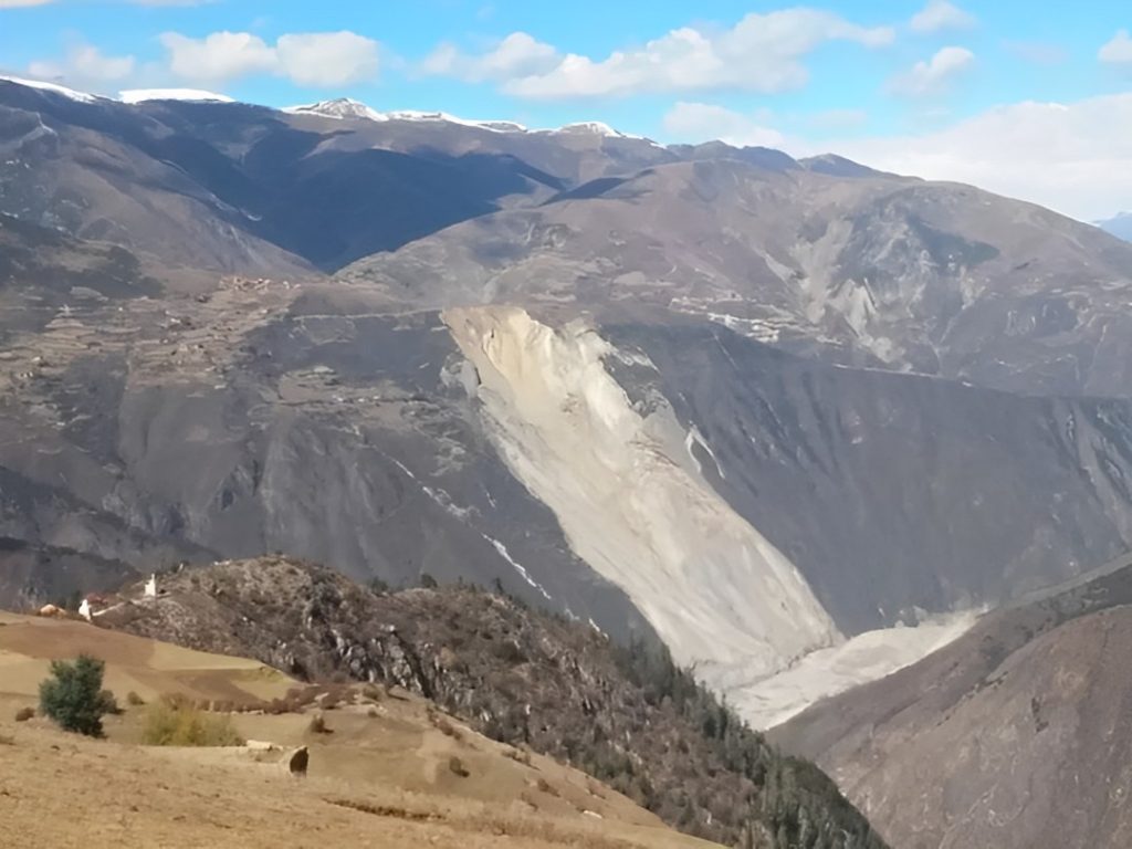
The Jinsha River, as the upper reaches of the Yangtze River, flows through four provinces including Qinghai, Tibet, Sichuan, and Yunnan in western China. On Oct. 11, 2018, a large-scale landslide occurred on the left bank of Jinsha near Baige village, temporarily blocking the valley.
This landslide event has seriously threatened the safety of people's lives and properties on both sides of the Jinsha River and raised widespread concern in society. A total of 67,449 inhabitants were affected and relocated after the occurrence of the Baige landslide.
Landslide risk mapping needs to be created
In the aftermath of a landslide, one major risk for the first responder is the broken structural integrity of the soil which might lead to further landslides. To assess any risks, multiple maps need to be created.
Challenges of landslide mapping in High altitude areas
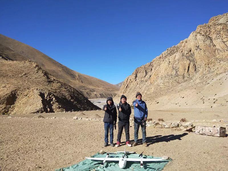
In the early hours of October 11, Kenny Shee from Sichuan Zhong Hui Xun Hang Engineering Mapping Co. answered an emergency call, he did not realize that it would be the beginning of the longest and most challenging mapping mission his team has ever faced.
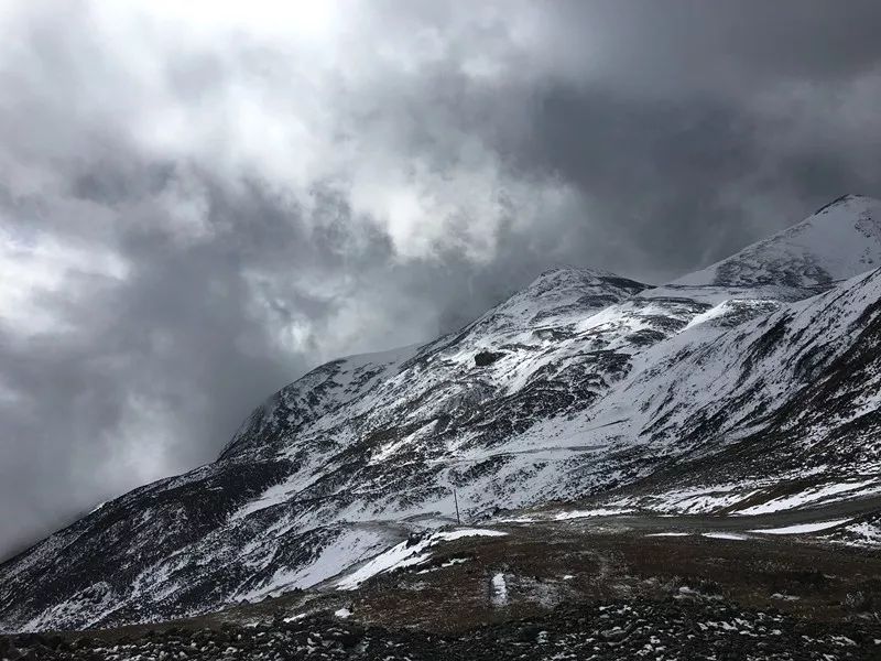
This big landslide led to a natural dam that was 25 million m3 in total volume with a height of 61 m. The average altitude of 4500 m and rugged mountainous terrain make this mapping mission a big challenge.
Using drones in landslide mapping missions
Sichuan Zhong Hui Xun Hang Engineering Mapping Co. is trained to use drone surveying to gain a detailed overview of the disaster site. The primary goals are to conduct landslide mapping, monitoring, landslide characterization, and early warning.
Helicopters were quickly dismissed because using this aircraft for mapping did not meet accuracy expectations, target costs, and allow for small data collection areas. Kenny and his colleagues decided to opt for drone mapping to meet their requirements and to accommodate the size of the project and high-altitude terrain.
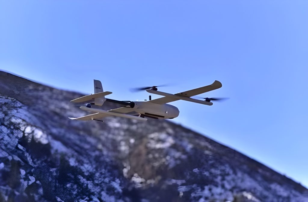
The JOUAV CW-007 allows for fast and safe vertical takeoff and landing. This is a must when you are working in an undulating plateau like Baige, where you don't need much space to fly and data collection starts quickly. On top of that, you can fly higher, faster, and longer than with a multi-rotor drone. This is the best solution for mapping large areas of devastation.
JOUAV CW-007 parameters and performances:
- Drone: CW-007
- Camera: CA-103 Camera, CA502R Oblique Camera
- Number of flights: 3 times
- Coverage: 9.7 km2
- Flight altitude: 5,163
- Results: down to 10cm GSD
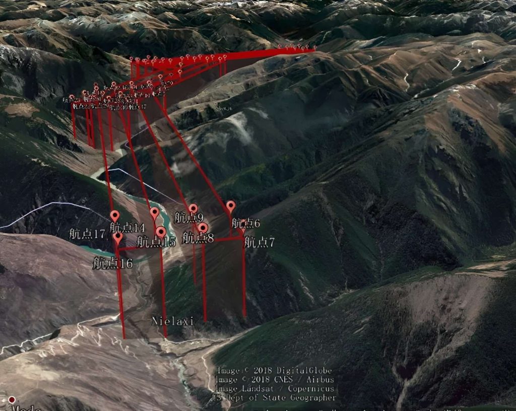
The flight plan of CW-007 in this task
"This time, CW-007 was used to fly the landslide area to observe the changes of cracks in the landslide section at different stages in advance. By monitoring data such as crack length, width, depth, and up-and-down shift, we can reduce the threat of secondary disasters." Daniel Peng said, Sichuan Zhong Hui Xun Hang Engineering Mapping Co. Analyst.
Flying stably at high altitudes
As you go to higher and higher altitudes with your drone, you might have some degree of difficulty due to lower air density at higher altitudes. CW-007 had a maximum takeoff altitude of 4850m and a maximum flight altitude of 5520m during this mission. The drone flew in gusty winds up to 14m/s (5mph) and still map large areas with high accuracy.
When CW-007 flies at high altitudes, the propellers can force enough air downward to generate lift to keep the drone hovering steadily. With improved built-in battery technology, this VTOL drone has long endurance of up to 6 hours and carries large payloads in a wide range of operating conditions.
"This measurement area is located in the canyon area with complex terrain conditions and a height difference of 1000m. This puts higher requirements on the reliability and stability of drones," Kenny Shee said, "However, CW-007 completed the entire landslide mapping mission and had no obstacles during data collection".
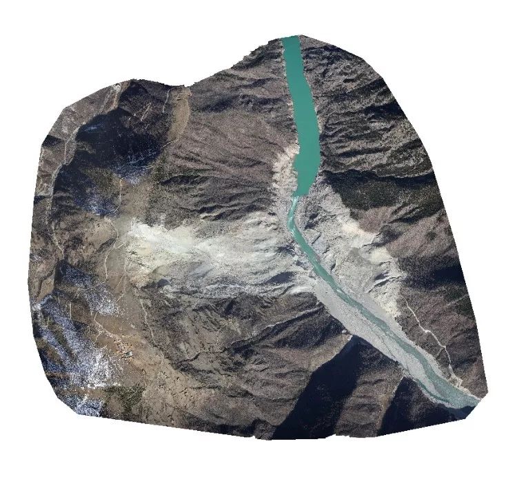
DOM of the Jinsha river landslide
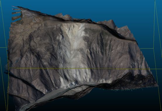
3D model of Jinsha river landslide
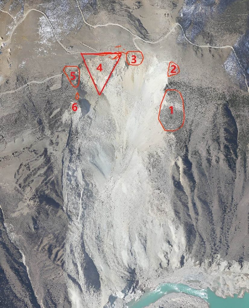
John Xu from the Institute of Crustal Stress of the China Earthquake Administration pointed out that according to the orthophotos captured by the CW-007 UAV, they could perform optical interpretation to delineate the geohazard risk areas: 1 and 2 are high-risk prone spots for geohazards which need to be focused on; other risk areas have small-scale fractures on the trailing edge which only need to be routinely inspected.
Conclusion
As one of the most frequent natural hazards, landslides are being studied extensively. One of the best ways to access landslide risk is to understand the factors that have caused landslides in the past. This means looking at old or ongoing landslide sites, but quantifying this in the field can be difficult. Landslides can be very large and by nature occur on steep, often inaccessible slopes. Traditional fieldwork to assess them can be very time-consuming and dangerous.
Using drones for emergency response and disaster relief can prove to be greatly beneficial. Drones can capture high-resolution images of landslides from a bird's view to track how landslides change over time. By comparing two orthophotos of the same location, surveyors can spot small changes, such as cracks or movement of soil. Signs like these can show how landslides move and can help mapping teams determine what is causing the landslide to change. By detecting early signs of instability, authorities can warn residents and help them evacuate before a triggering event.
More Use Cases


Chongqing’s Qinba Mountains are basically a giant green wall protecting the region. But there’s a problem – pine wood nematodes are eating through it. Fast.
The forestry department n

When TotalEnergies set out to build one of Southeast Asia’s largest solar and battery storage projects—spanning 12,000 hectares across the dense acacia forests of Riau, Indonesia—they faced a problem

JOUAV Product News and Use Cases
Fixed-Wing VTOL Drones Insights and Industry Trends
Invitations to online demo events