

Drone mapping services can produce far more than aerial photos—orthomosaics, 3D models, point clouds, and elevation data that feed directly into GIS, CAD, and BIM workflows. But ask three providers to quote the same project, and you may get three wildly different prices, timelines, and deliverable lists. The problem isn't that one is overcharging. It's that they're often selling fundamentally different services under the same name.

Some providers capture with RTK/PPK and ground control points, process with survey-grade software, and deliver CAD-ready point clouds with an RMSE report. Others fly a consumer drone, stitch images in a desktop tool, and hand over a GeoTIFF. Both call it "drone mapping." Only one may be suitable for your project.

In this guide, you'll learn how to match your project to the right mapping method, what deliverables to request, how accuracy is actually verified, why quotes vary so dramatically, and what to ask before signing a contract.

What Drone Mapping Service Do You Actually Need?

What Drone Mapping Service Do You Actually Need?

Most providers list the same services: aerial mapping, 3D modeling, LiDAR, orthomosaics. That list tells you nothing about fit. The right question isn't what they offer—it's what your project needs the data to do.

For Site Maps and Construction Progress

You need an orthomosaic, a DSM, and progress imagery suitable for measurement and comparison over time. This is the most common commercial drone mapping service, and it is almost always photogrammetry-based. The deliverables should open directly in GIS or CAD software, and they should be captured with consistent flight parameters so that progress overlays remain comparable across weeks or months.

For a construction site, the key question is not whether the drone can fly — it’s whether the data can be measured. Insist on georeferenced GeoTIFFs and a stated GSD. If your team needs to calculate cut-and-fill or stockpile volumes, request a point cloud in addition to the orthomosaic.

Drone in construction

For Topographic and Terrain Mapping

You need an orthomosaic, DSM/DTM, contour maps, and a point cloud. This is where the difference between a “drone map” and a “survey-grade deliverable” becomes critical. If your project requires engineering or surveying-level outputs, you cannot simply ask for “a drone map.” You need to specify:

  • Ground control points (GCPs) or RTK/PPK positioning — without one of these, absolute accuracy is unreliable
  • A stated RMSE for horizontal and vertical accuracy
  • File formats compatible with your CAD or GIS workflow (GeoTIFF, LAS/LAZ, DXF/DWG)

Some providers will deliver a visually impressive orthomosaic that looks accurate but has not been tied to ground control. For a topographic survey, that is not a deliverable — it’s a picture.

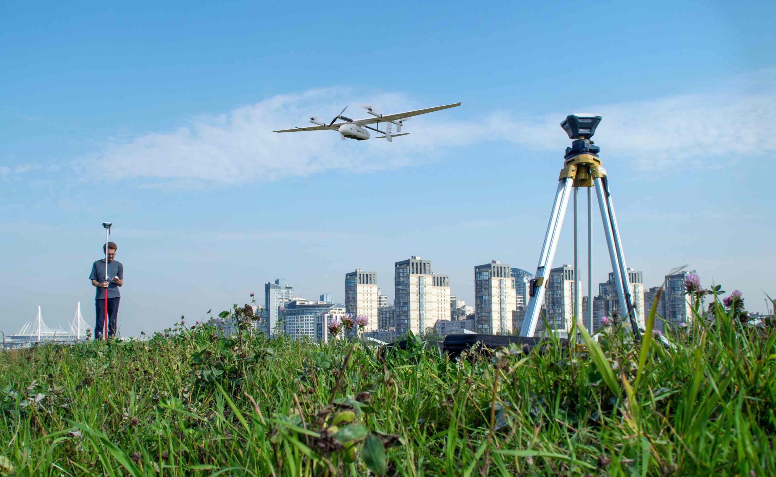
Drone for Mapping

For Large Areas and Corridors

When your project area is measured in hundreds of hectares or your asset is linear — a highway, railway, pipeline, or power line — platform choice becomes the dominant cost and efficiency variable.

Multirotor drones are limited by battery endurance and require multiple sorties to cover large areas, with each battery change introducing a new capture window and potential inconsistency in lighting and overlap.

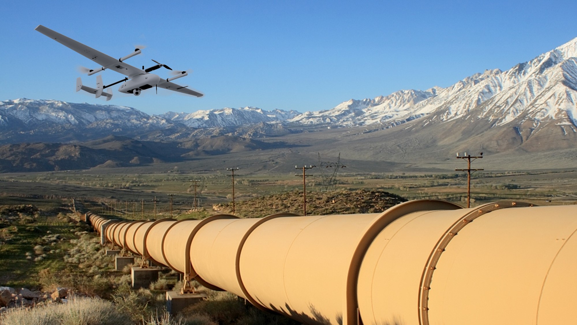
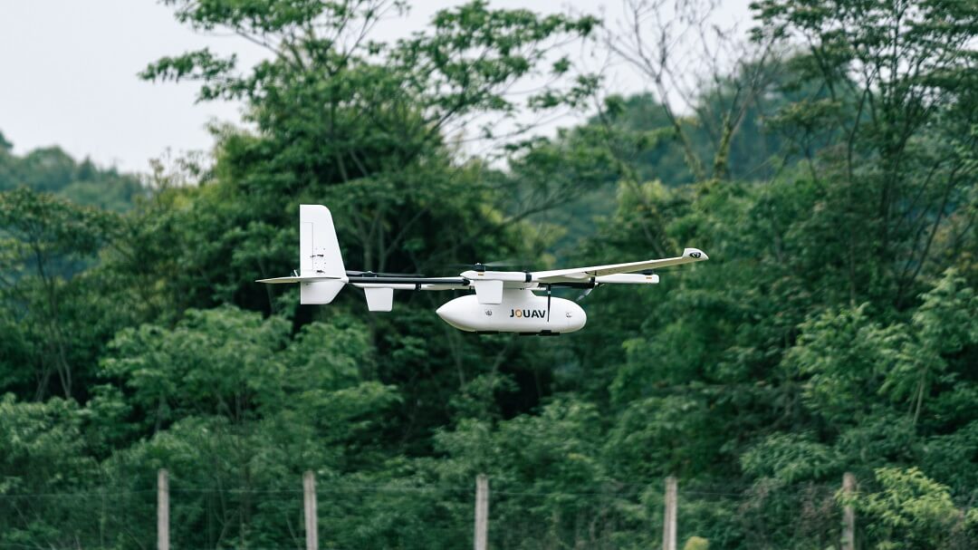
Fixed-wing VTOL platforms combine the vertical takeoff and landing flexibility of a multirotor with the aerodynamic efficiency of a fixed-wing aircraft. The JOUAV CW-15, for example, offers up to 180 minutes of flight endurance and a 50 km communication range, making it suitable for wide-area coverage and linear infrastructure projects.

CW-15 VTOL drone used for pipeline inspections

For Vegetation, Complex Terrain, or Infrastructure

This is where photogrammetry vs. LiDAR determines feasibility.

Photogrammetry relies on visible surface texture. In open terrain, it delivers excellent results at lower cost. But when vegetation covers the ground, photogrammetry only reconstructs the canopy—not the terrain beneath. LiDAR penetrates gaps in vegetation and records multiple returns, separating canopy from ground.

For infrastructure corridors through vegetated or complex terrain, LiDAR is often the only method producing usable terrain data. JOUAV's CW-15 with the JoLiDAR-1000 inspected 33.7 km of 110kV power line through karst terrain in one flight, producing 171 points/m² at tower locations—conditions where photogrammetry would fail. See the full case study: UAV LiDAR power line inspection.

Open, flat sites with color imagery needs: photogrammetry. Vegetation canopy, steep terrain, or assets needing ground beneath obstructions: LiDAR.

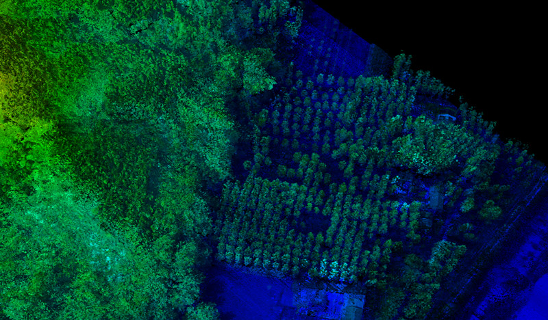
Tree Density Analysis

Decision Summary

If your project involves...What you likely needPlatform consideration
Construction progress, site documentationPhotogrammetry: orthomosaic + DSM + progress imageryMultirotor or VTOL by site size
Topographic survey, engineering-grade terrainPhotogrammetry or LiDAR + GCPs/RTK + RMSE reportMultirotor for small sites; VTOL for larger
Dense vegetation, canopy penetration, bare-earth DEMLiDARVTOL with LiDAR payload
Large-area mapping (100+ hectares)Photogrammetry or LiDARFixed-wing VTOL
Linear infrastructure (roads, rail, pipelines, power lines)Photogrammetry or LiDARFixed-wing VTOL, corridor flight planning
3D site model, digital twin, BIM coordinationPhotogrammetry with oblique captureMultirotor or VTOL by coverage area
What Should You Receive From a Drone Mapping Service?

What Should You Receive From a Drone Mapping Service?

You are paying for data, not for flight time. Before comparing quotes, make sure you know what each provider will deliver and whether those outputs fit your workflow.

Orthomosaic

An orthomosaic is a geometrically corrected aerial image created by stitching together overlapping drone photos. It is commonly used for construction progress, site documentation, agriculture, land mapping, and other applications where you need an accurate visual map of an area.

Common format: GeoTIFF

When requesting an orthomosaic, ask for the GSD (ground sample distance), file format, and coordinate system used for georeferencing.

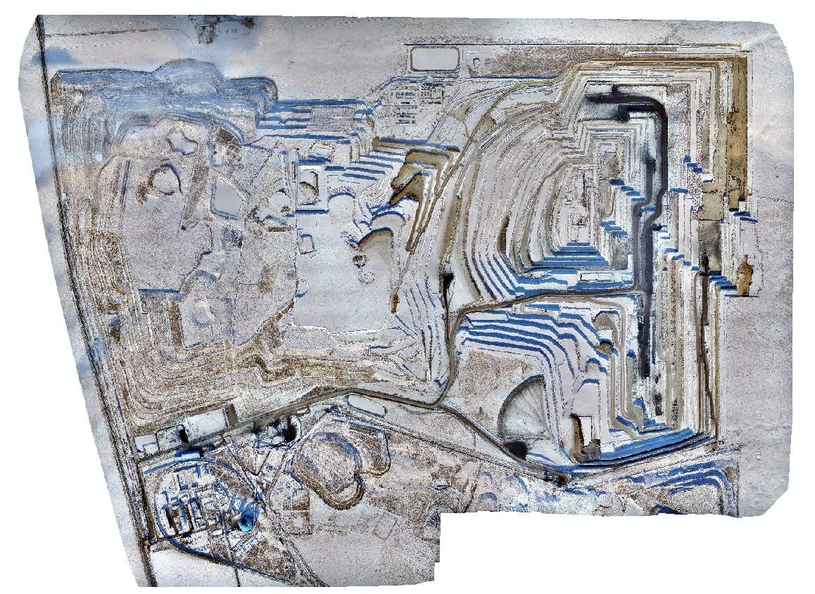
Digital orthophoto model of Baorixile open-pit mine

DSM and DTM

DSM and DTM are both elevation models, but they represent different surfaces:

  • DSM (Digital Surface Model) represents the visible surface, including buildings, vegetation, and other above-ground features.
  • DTM (Digital Terrain Model) represents the bare-earth ground surface after non-ground features have been removed.

The right product depends on your application. A DSM can be useful for surface, building, or line-of-sight analysis, while a DTM is typically used for terrain mapping and earthwork or cut-and-fill calculations.

Make sure the provider specifies which elevation model you are receiving rather than using terms such as "terrain model" without further definition.

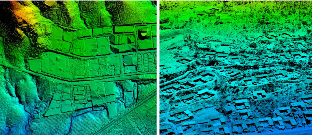
The difference between DSM, and DTM

Point Cloud

A point cloud is a collection of georeferenced 3D points representing the surveyed area. It can be used for 3D measurements, terrain analysis, volume calculations, engineering, and downstream CAD or BIM workflows.

Common formats: LAS and LAZ

If you need the point cloud for further processing, ask about point density, ground/non-ground classification, colorization, and coordinate reference system.

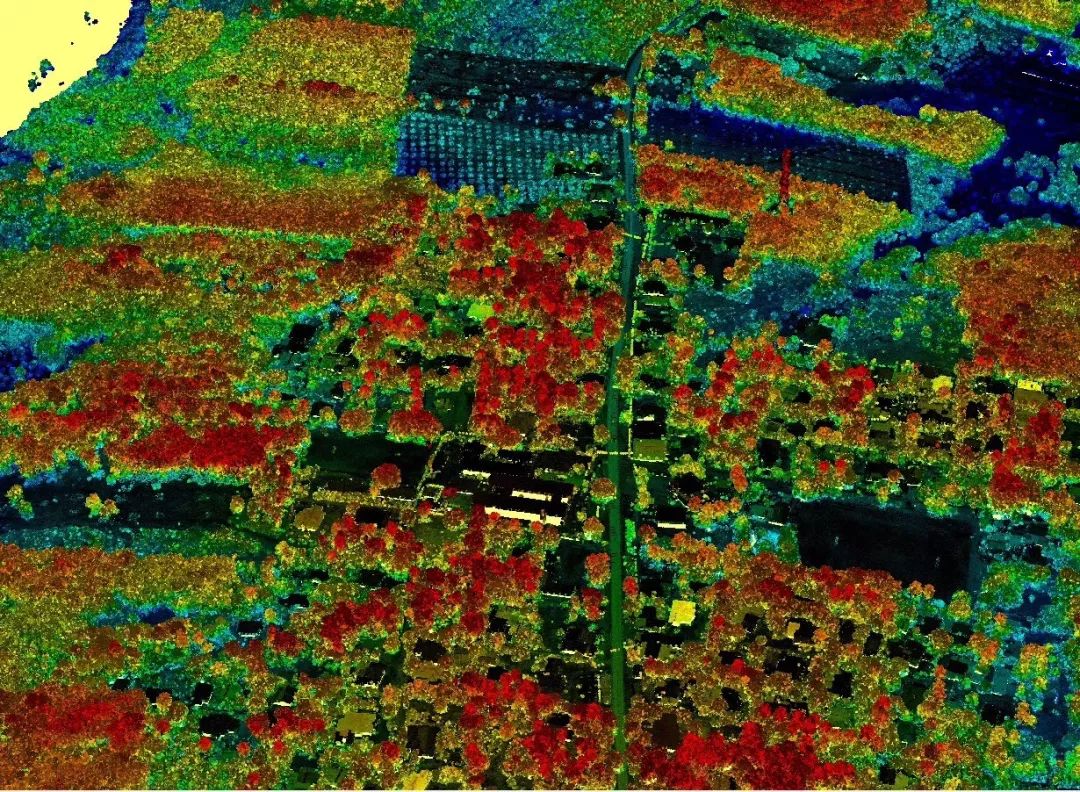
Details of 3D point cloud model

3D Models

A textured 3D model or mesh provides a three-dimensional representation of the surveyed site or structure. It can be useful for 3D visualization, remote site review, documentation, and digital-twin or BIM-related workflows.

Common formats: OBJ, GLB, and other 3D formats

A 3D model is not necessary for every mapping project. If your main goal is terrain measurement or engineering analysis, an orthomosaic, elevation model, or point cloud may be more useful.

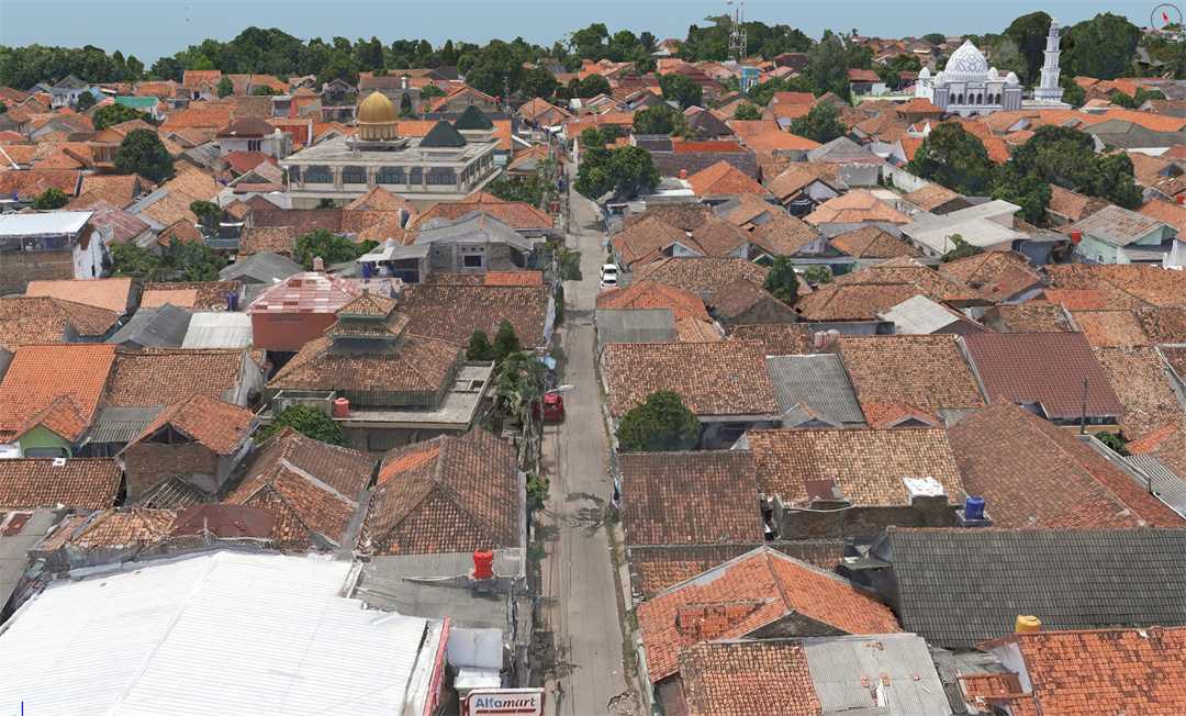
3D model details of urban mappin in indonesia

Other Deliverables

Depending on your project, you may also request:

  • Contour maps in formats such as DXF or DWG
  • Volume calculations for stockpiles and earthwork
  • CAD drawings for engineering workflows
  • Inspection imagery for roofs, facades, bridges, and other structures
  • Raw aerial images for future processing
  • Accuracy reports including RMSE and GCP or RTK/PPK information

Not every service includes these outputs by default, so confirm them before the survey begins.

What to Confirm Before You Sign

Ask the provider for a written list of deliverables that specifies:

ItemWhat to askExample answer
File formatsWhich formats will I receive?GeoTIFF + LAS + DXF
Coordinate systemProjected or geographic? Which datum?UTM Zone 50N, WGS84
ResolutionOrthomosaic GSD? Point density?3 cm GSD; 50 pts/m²
AccuracyHorizontal and vertical RMSE?3 cm H / 5 cm V
Data coverageWhich area and features are included?Full site + 50 m buffer
Raw dataAre original images and point clouds included?Yes, RAW + LAS
Processing levelFinal products only, or intermediate data too?Final + classified point cloud
PermitsAre flight authorizations or permits provided?Yes, if applicable
How Accurate Can Drone Mapping Services Be?

How Accurate Can Drone Mapping Services Be?

“Centimeter-level accuracy” is one of the most common claims in drone mapping. But the number means little without knowing how it was achieved and verified.

The same drone can produce very different results on different projects because mapping accuracy depends on the entire workflow—from image capture and positioning to ground control, processing, and quality verification.

What Affects Mapping Accuracy?

Several factors work together to determine the accuracy of a drone mapping project:

  • GSD (ground sample distance): GSD is the ground distance represented by one image pixel. A lower GSD provides more image detail, but it does not automatically mean higher absolute accuracy. For example, a 3 cm GSD dataset can still have significant positioning errors if the project is poorly controlled.
  • Positioning: RTK and PPK improve the accuracy of the drone's camera positions and can reduce the amount of ground control required. They do not, however, guarantee that the final map is accurate to the same level.
  • Ground control points: GCPs provide known ground coordinates that can anchor the mapping project to the site's coordinate system. Their distribution and measurement accuracy also affect the final result.
  • Flight planning: Flight altitude, image overlap, speed, and image quality affect how well the software can reconstruct the site. Insufficient overlap or motion blur can reduce mapping quality.
  • Terrain and site conditions: Vegetation, steep slopes, reflective surfaces, water, and areas with few recognizable features can make image matching more difficult.
  • Processing and QA/QC: Camera calibration, photogrammetric processing, control-point adjustment, and quality checks all contribute to the final accuracy.

In other words, accuracy comes from the workflow, not the drone alone.

Horizontal vs. Vertical Accuracy

Horizontal and vertical accuracy describe different types of error, and both may matter depending on your project.

Horizontal accuracy measures how well features are positioned in X and Y. It is important for mapping roads, utilities, structures, property features, and other objects on an orthomosaic.

Vertical accuracy measures elevation in the Z direction. It is particularly important for terrain models, stockpile volumes, cut-and-fill calculations, drainage analysis, and other applications that depend on elevation data.

A provider that simply says “3 cm accuracy” without specifying the direction, accuracy metric, or verification method is not giving you enough information to compare services properly.

For photogrammetric mapping, Pix4D gives a useful rule of thumb: relative horizontal accuracy is typically around 1–2 times the GSD, while relative vertical accuracy is around 1–3 times the GSD. For example, a project flown at 3 cm GSD may have relative horizontal accuracy in the range of roughly 3–6 cm and relative vertical accuracy of roughly 3–9 cm under suitable conditions. These are general expectations, not guaranteed project results.

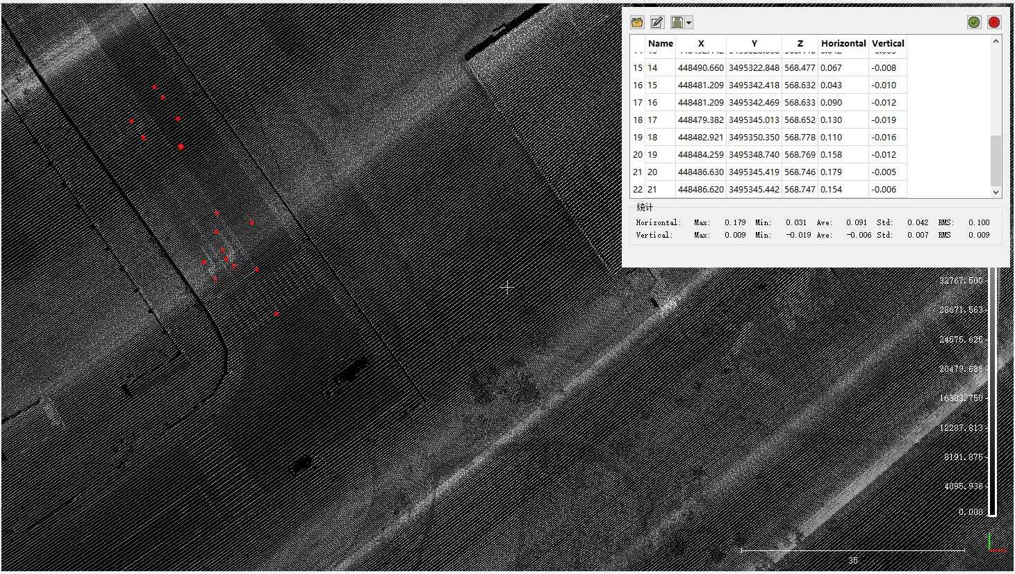
High Accuracy LiDAR Surveying

Absolute accuracy is a separate question. It depends on how well the project is tied to known ground coordinates through RTK/PPK, GCPs, checkpoints, or other surveying controls.

How to Verify a Provider's Accuracy Claims

When comparing drone mapping services, do not compare the advertised accuracy number alone. Ask how the number was measured.

A reliable provider should be able to answer:

  1. What accuracy was achieved on a comparable project?
    A result from a similar site, terrain, sensor, and mapping method is more useful than a best-case specification.
  2. How was the accuracy verified?
    Ask whether the provider used independent checkpoints or compared the results with surveyed coordinates.
  3. What accuracy metric is being reported?
    Look for values such as RMSE or accuracy at a stated confidence level rather than an unsupported “centimeter-level” claim. ASPRS accuracy standards, for example, distinguish RMSE from accuracy reported at a confidence level.
  4. Were GCPs, RTK, or PPK used?
    These approaches affect how the survey is controlled. RTK/PPK can provide highly accurate camera positioning, while GCPs provide an additional way to constrain and check the project.
  5. Does the accuracy match the intended use?
    A dataset that is suitable for construction progress monitoring may not be suitable for engineering design or a legally defined boundary survey.

The most useful question is therefore not “How accurate is your drone?” but “How accurate is the final dataset, and how did you verify it?”

What Accuracy Should You Request?

ApplicationTypical achievable accuracy (with GCPs or RTK/PPK)
Construction progress documentation3–10 cm
Topographic mapping3–5 cm horizontal / 5–10 cm vertical
Stockpile volume measurement3–5 cm vertical
LiDAR terrain mapping2–5 cm vertical
Corridor mapping (roads, rail, pipelines)5–15 cm
Boundary or legal surveyRequires licensed surveyor; accuracy depends on legal standard

These ranges assume professional-grade capture and processing. Consumer drones flown without ground control can produce errors measured in meters, even if the orthomosaic looks sharp.

The most important takeaway: accuracy is not something you buy off a spec sheet. It is something you specify, verify, and confirm against your project requirements.

How Much Do Drone Mapping Services Cost?

How Much Do Drone Mapping Services Cost?

Drone mapping services typically cost $300–$3,500 per project for standard photogrammetry, and $1,500–$15,000+ for LiDAR surveys. But these ranges are only a starting point. The more useful question is: why do two providers quote such different prices for what sounds like the same project?

The answer is almost never "one is overcharging." It is that they are quoting different scopes, different accuracy levels, and different levels of post-processing. Understanding what drives cost — and what a quote actually includes — is how you avoid paying for data you cannot use, or choosing the cheapest option and getting a deliverable that fails your project requirements.

Count the money

What Determines Drone Mapping Service Cost?

Cost is not driven by flight time alone. The variables that matter most are:

  • Project size — Larger areas require more flight sorties, more battery changes, and longer processing time. A 20-acre construction site might cost $800–$1,500; a 300-acre mining site can reach $4,000–$8,000.

  • Mapping method — LiDAR surveys cost roughly 20–40% more than standard photogrammetry due to sensor cost and more complex processing. LiDAR operators typically charge $1,500–$3,000 per day, or $10–$150 per acre, depending on terrain complexity and accuracy requirements.

  • Accuracy requirements — A documentation-grade orthophoto at 5 cm accuracy costs less than an RTK-supported survey with GCPs achieving 1–2 cm accuracy. The decisive factor is always the combination of area, accuracy, and deliverable scope.

  • Ground control — GCP placement and survey adds $300–$1,500+ depending on the number required. On larger sites requiring 10–15 GCPs, the survey component alone can cost $1,500–$4,000+ and take a full day.

  • Deliverable complexity — An orthomosaic only is cheaper than a full package including point cloud, DTM, contours, and volume calculations.

  • Site complexity and access — Steep terrain, dense vegetation, controlled airspace, and remote locations all increase cost.

  • Turnaround time — Rush delivery typically carries a premium.

How Are Drone Mapping Services Priced?

There is no single industry-standard pricing model. The four most common are:

Pricing modelTypical rangeWhen it is used
Per project$500–$2,500 (small); $2,500–$10,000 (medium); $10,000+ (large)Most common for defined-scope commercial work
Per acre$10–$30/acre (basic photogrammetry); $10–$150/acre (LiDAR)Large sites with predictable coverage
Hourly/daily$150–$400/hour; $1,500–$3,000/day (LiDAR)Undefined scope or complex access
Per model (cloud platform)$24.99–$199/modelOperators processing in-house via cloud platforms

Most providers start with an hourly rate, then move to project or per-acre pricing once they understand their market and costs. Some cloud platforms now offer per-model pricing — SkyeBrowse, for example, charges $24.99 per model for its Commercial plan and $199 per model for Public Safety & Enterprise.

The critical point: different pricing models do not mean quotes are comparable. A per-acre quote that excludes processing is not the same product as a per-project quote that includes GCPs, QA/QC, and a classified point cloud.

Why Two Providers May Quote Very Different Prices

This is the most common source of confusion in drone mapping procurement — and the most important section in this guide.

Consider two quotes for the same 100-acre construction site:

 Provider A — $1,200Provider B — $4,800
CaptureConsumer drone, autonomous GPSRTK/PPK-equipped drone
Ground controlNone10 GCPs, surveyed with GNSS
DeliverablesGeoTIFF orthomosaicOrthomosaic + classified point cloud + DTM + contours (DXF)
ProcessingBasic stitchingFull photogrammetric pipeline with QA/QC
Accuracy reportNoneRMSE reported
Turnaround5–7 days3 days

Provider A delivered exactly what the quote described. Provider B delivered a survey-grade dataset suitable for engineering design and earthwork calculations.

If your project needs a progress photo, Provider A is adequate. If your project needs cut-and-fill volumes or a design-grade terrain model, Provider A's deliverable is unusable — and you will pay twice.

As one industry analysis puts it: "If you ask for 'a drone survey of Site A,' each supplier will make different assumptions about access, flight permissions, control points, deliverables and post-processing. That makes quotes look comparable when they are not."

Do not compare the final price before comparing the scope.

What Should Be Included in a Drone Mapping Quote?

Ask for a written, itemized quote that specifies each of the following. If a provider cannot or will not provide this level of detail, that itself is useful information.

ItemWhat to confirm
Survey areaExact boundaries and acreage to be covered
Sensor and platformRGB, LiDAR, or multispectral; multirotor or fixed-wing
Positioning methodRTK/PPK, GCPs, or both
GSD and accuracyStated GSD; horizontal and vertical RMSE
GCPsHow many, who surveys them, and whether that cost is included
DeliverablesExact list with file formats (GeoTIFF, LAS/LAZ, DXF, OBJ)
ProcessingIncluded or billed separately?
TurnaroundExpected delivery date and what happens if weather delays the flight
Raw dataAre original images and point clouds included?
Travel and mobilizationAny site access, mileage, or lodging fees?
RevisionsHow many rounds of correction are included?
Licensing/permitsWho handles airspace authorizations if required?

The Hidden Costs That Inflate Drone Mapping Budgets

Industry analysis identifies five costs that most commonly catch buyers off guard:

  1. Data processing is not always included. Some vendors quote only for flight services. Processing raw imagery into orthomosaics, point clouds, and elevation models — and the software licenses and expertise required — is billed separately. On complex projects, processing costs can equal or exceed flight costs.

  2. Mobilization and travel fees. For remote sites, mobilization fees covering travel time, mileage or fuel, lodging, and equipment transport can add hundreds to thousands of dollars. Some vendors bundle this for local projects but break it out separately beyond a certain radius.

  3. GCP survey is often not included. Many buyers assume GCP placement and survey is part of the drone mapping quote. It often is not. GCP surveying requires a licensed surveyor or skilled geomatics technician with survey-grade GPS equipment. Budget separately if needed, and clarify who is responsible for GCP measurement in the contract.

  4. Re-flight costs. Wind, rain, fog, and low cloud cover can ground a planned flight. Some contracts place full re-flight costs on the client, even for weather cancellations. Others split the cost. Confirm this before signing.

  5. Specialized outputs carry premiums. Thermal orthomosaics, LiDAR point clouds, court-admissible accuracy reports, and licensed surveyor certification are add-ons that increase cost.

What Does This Mean for Your Project?

Cost is a function of scope, not a fixed rate. The cheapest quote is rarely the best value if it excludes the accuracy or deliverables your project requires. The most expensive quote is not automatically the most capable if it includes outputs you do not need.

Ask every provider for an itemized quote against a written scope. Compare the scope first, the price second. That is the only way to know what you are actually buying.

How to Choose a Reliable Drone Mapping Provider?

How to Choose a Reliable Drone Mapping Provider?

Every provider claims to be reliable. The difference between a reliable provider and a convincing one comes down to what they can document, not what they promise.

Look at Relevant Project Experience

Years of drone experience are not the same as relevant mapping experience. A team that mainly performs aerial photography or roof inspections may have extensive flight experience but limited experience with a large topographic survey or infrastructure corridor.

Look for projects similar to yours in:

  • Industry — construction, surveying, mining, utilities, agriculture, or infrastructure

  • Project scale — similar site area or corridor length

  • Terrain — flat, steep, forested, urban, or otherwise comparable conditions

  • Deliverables — orthomosaics, elevation models, point clouds, contours, CAD/GIS outputs, or 3D models

Ask to see case studies or sample deliverables from comparable projects. A useful sample is more than an attractive aerial image; it should show the type of data the provider actually delivers.

Check the Mapping Workflow, Not Just the Drone

The drone is only one part of a mapping project. What matters is how the provider turns field data into a usable final dataset.

Before hiring, ask how they handle:

  • Sensor selection — Why is RGB photogrammetry, LiDAR, multispectral, or another sensor appropriate for your site?

  • Positioning — Will the project use RTK, PPK, GCPs, or a combination?

  • Flight planning — How are altitude, overlap, coverage, terrain, and flight constraints determined?

  • Data processing — How are imagery or LiDAR data processed into the required mapping products?

  • QA/QC — What checks are performed before the final data is delivered?

  • Accuracy verification — How are the stated accuracy results measured and documented?

A professional provider should be able to explain this workflow in practical terms. The specific drone model or software name is less important than whether the overall process is appropriate for your project.

For example, saying that a project will be flown with an RTK-equipped drone does not, by itself, tell you how the final dataset will be controlled or verified. Likewise, naming a processing platform does not guarantee that the resulting data will meet your required accuracy or file specifications.

Ask for Evidence of Quality

A provider's accuracy claim is more useful when it comes with supporting evidence.

Instead of asking only, "How accurate is your mapping?", ask:

  • How was that accuracy measured?

  • Can you provide an accuracy report from a comparable project?

  • Were independent checkpoints used to verify the result?

Depending on the project, useful documentation may include accuracy reports, checkpoint results, QA/QC records, or sample datasets from comparable projects. For higher-accuracy work, ask whether reported results were checked against independent surveyed points rather than relying only on the control data used during processing.

A provider that can clearly document its workflow, deliverables, and verification process gives you more useful information than one that relies mainly on marketing statements.

Check Professional and Operational Requirements

Technical capability is only part of the evaluation. The provider also needs to operate appropriately at your project location.

Depending on the country, site, and project type, check whether the provider has:

  • Required commercial operating credentials (e.g., FAA Part 107 in the US, CAA in the UK, GCAA in the UAE, DGCA in India). For an overview of regulations, see drone flight laws.

  • Adequate insurance coverage (at least $1M general liability is standard)

  • Experience with local airspace or site-access requirements

  • Clear procedures for data storage and transfer

It is also useful to clarify who is responsible for:

  • Flight permissions or airspace coordination, where required

  • Site access and safety procedures

  • Ground control surveying

  • Data storage and transfer

  • Re-flights caused by weather or data-quality problems

The goal is to avoid discovering responsibilities or additional costs after the project has already started.

What to Ask Before Hiring a Drone Mapping Provider

CriterionWhat to look for Questions to ask
Relevant experienceSimilar projects, industries, terrain, and deliverablesCan you show a comparable project?
Technical workflowAppropriate sensor, positioning, flight planning, and processingWhy is this workflow suitable for my project?
Quality control Documented QA/QC and accuracy verificationHow do you verify the final dataset?
Project scopeClear deliverables, formats, coordinate system, and pricingWhat exactly is included in the quote?
Professional capabilityRequired operating credentials, insurance, and site proceduresWhat documentation do you provide before the project?
TurnaroundDefined schedule and clear re-flight or revision policyWhen will I receive the final deliverables?
CommunicationProvider asks detailed questions before quotingDo you understand how I plan to use the data?

A reliable drone mapping provider does not start with a standard package. It starts by understanding what the project needs the data to do. Compare what each provider is actually offering, how the data will be produced, and how the result will be verified—not just the drone model or the final price.

Can You Combine LiDAR and Photogrammetry? 

Drone Mapping Services vs. In-House Mapping

Once you understand what drone mapping involves, a practical question follows: should you hire a service provider, or build the capability in-house? The answer depends less on budget alone and more on how often you need mapping, what accuracy you require, and whether you have (or want to develop) the expertise to manage the workflow.

When Outsourcing Makes Sense

Most organizations start with a service provider. Outsourcing is the lower-risk path because:

  • No upfront capital — you pay per project rather than investing in drones, sensors, software, and training.

  • Access to specialized sensors — LiDAR, multispectral, and high-resolution cameras are expensive and require maintenance. A provider already owns and operates them.

  • Proven expertise — a good provider has refined their flight, processing, and QA/QC procedures across many projects.

  • Scalability — you can handle a large or urgent project without owning enough equipment to cover peak demand.

For occasional projects — a one-time topographic survey, an annual stockpile measurement, a single construction documentation job — outsourcing is almost always more cost-effective than building internal capacity.

When In-house Mapping May Be Justified

Organizations with recurring, standardized mapping needs often find that in-house capability pays for itself. Consider building internal capacity if:

  • You map the same sites repeatedly — weekly construction progress, monthly corridor inspection, ongoing stockpile tracking.

  • Turnaround time is critical — you cannot wait days for an external provider to schedule a flight and process data.

  • You need full control over data — sensitive sites, proprietary processes, or strict data-handling requirements.

  • You already have survey or GIS staff — the learning curve is lower when you have existing geospatial expertise.

  • You want to integrate mapping into a broader workflow — digital twin updates, BIM coordination, or automated change detection.

The trade-off is real: in-house mapping requires investment in a reliable platform, sensors, processing software, training, and ongoing maintenance. It also requires someone to manage airspace compliance, flight planning, and data quality.

Comparison at a Glance

FactorOutsourcingIn-house
Upfront investmentLowHigh (drone, sensors, software, training)
Per-project costService feeEquipment amortization + labor
Specialized sensorsAccess on demandMust purchase and maintain
Pilot expertiseProvider's responsibilityInternal training and currency
Processing workflowProvider's responsibilityInternal software and QA/QC
Scheduling flexibilityDependent on provider availabilityFull control
Data controlShared with providerFully internal
Best forOccasional or varied projectsFrequent, standardized, time-sensitive work

A Practical Middle Ground

Some organizations combine both: they outsource complex or occasional projects (LiDAR surveys, large-area mapping) while building in-house capability for routine tasks (progress orthomosaics, volume checks). This hybrid approach keeps capital investment focused on the most frequent use cases while retaining access to specialized expertise when needed.

For organizations that choose to build in-house, the platform decision matters as much as the drone. Fixed-wing VTOL platforms like the JOUAV CW series are designed for recurring, large-area, and corridor mapping — offering long endurance, vertical takeoff from confined sites, and integration with LiDAR or photogrammetry payloads. When paired with cloud-based processing software, they allow a small team to manage end-to-end mapping without a dedicated desktop workstation or external processing bureau.

JOUAV CW-15 UAV

The right choice is not "outsource or build" — it is "outsource what makes sense, and build what you will use repeatedly." Start with a clear assessment of your project frequency, accuracy requirements, and internal capacity. That will tell you which path — or which combination — fits your organization.

FAQ

FAQ

What are drone mapping services?

Drone mapping services use drones to capture aerial data and turn it into mapping products such as orthomosaics, 3D models, point clouds, DSMs, DTMs, and contour maps. Depending on the project, the service may use photogrammetry, LiDAR, RTK/PPK positioning, or a combination.

How are drone mapping services priced?

Four common models: per project (most common), per acre ($10–$30 for basic photogrammetry, up to $150 for LiDAR), hourly/daily ($150–$400/hour), and per model on cloud platforms ($24.99–$199/model). See the full breakdown in "How Much Do Drone Mapping Services Cost?" above. For broader industry pricing, see drone services cost.

Are drone mapping services reliable?

Reliability depends on the provider, not the technology. A reliable provider can document relevant project experience, explain their capture and processing workflow, provide an RMSE accuracy report, carry $1M+ liability insurance, and confirm deliverables in writing before the flight. See "How to Choose a Reliable Drone Mapping Provider" for the full evaluation checklist.

What is the difference between drone mapping and drone surveying?

Drone mapping produces georeferenced maps and models for visualization, measurement, and documentation. Drone surveying produces legally defensible boundary, topographic, or volumetric data—often requiring a licensed surveyor, GCPs, and compliance with state or national surveying regulations. Mapping can be done by a trained operator; surveying is a regulated profession in most jurisdictions.

Can drone mapping services use LiDAR?

Yes. LiDAR-equipped drones emit laser pulses that penetrate vegetation gaps and record multiple returns, producing accurate bare-earth terrain data even under dense canopy. LiDAR is typically 20–40% more expensive than photogrammetry but is the only reliable method for vegetated terrain, power line corridors, and infrastructure mapping where ground surface data is required.

Can drone mapping be used for construction and infrastructure projects?

Yes. Drone mapping is commonly used for construction site documentation, progress monitoring, earthwork and stockpile measurements, topographic mapping, and infrastructure projects such as roads, railways, utilities, and other large assets. The required mapping method and deliverables depend on the project.

Smaller sites may be efficiently mapped with a multirotor photogrammetry workflow, while large areas and long corridors may benefit from fixed-wing VTOL platforms with longer endurance and greater coverage.
Share :
Read More
thumbnail
Picking drone mapping software feels harder than it should be. Open any review site, and you will see the same ten names repeated: Pix4D, DroneDeploy, DJI Terra, Agisoft Metashape, UgCS. But the recom
thumbnail
Here’s the question every drone pilot hears: How much should I charge? And here’s the honest answer: $100 to $500 an hour, or $300 to $5,000 per project, depending on what you’re doi
thumbnail
Here’s something most people don’t think about: someone has to climb those cell towers you see along the highway. Tower climbers ascend hundreds of feet—often in wind, heat, and hazardous