At 2:27 PM on a storm-lashed afternoon in July 2025, a small fishing boat capsized off the coast of Gulei, Zhangzhou.
Two men were thrown into violent waters. Winds howled at gale force. Waves surged
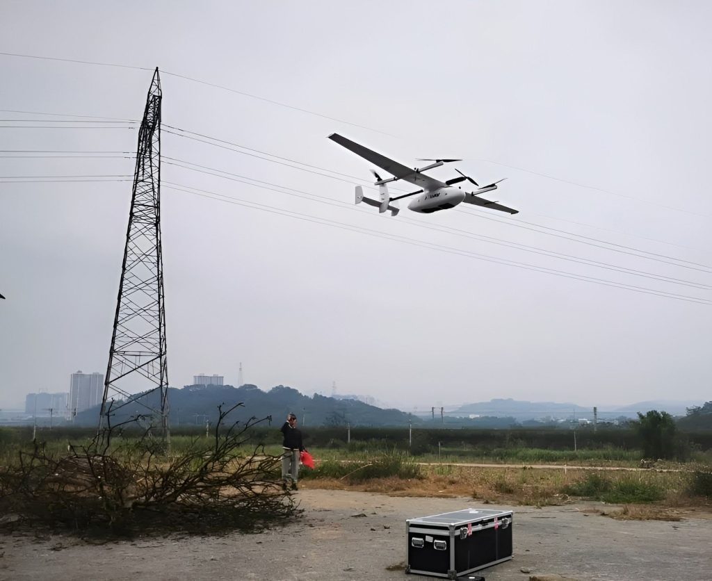
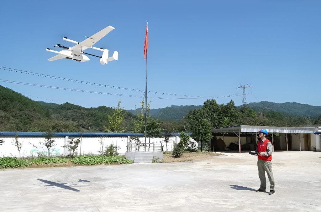
To improve the lean management system of power grid equipment and power line inspection technology, JOUAV joined hands with power grid companies around China to carry out application experiments for new LIDAR-equipped hybrid VTOL UAVs.
The experiments used the CW-15 vertical take-off and landing fixed-wing UAV with LIDAR to inspect the transmission lines of different environments, terrains, and scenes, resulting in digital grid transformation and increasingly UAV intelligent inspection application scenarios.
Guangxi Power Grid simplifies powerline vegetation management
JOUAV collaborated with Guangxi Power Grid Company and conducted application experiments in Baise City, Guangxi province (located in southwestern China). JOUAV CW-15 VTOL drone equipped with a LiDAR system inspected the 110kV Tian Ma line and 220kV Liang Hu lines.
CW-15 took off from Baise, Guangxi.
The total length of the power lines inspected this time was 20km, mainly in mountainous and hilly areas. CW-15 flew at ground altitude based on a high-precision digital 3D map and inspected two routes at the same time. The flight weather was light rain to medium rain. In such an environment, CW-15 safely and efficiently completed this flight inspection experiment, establishing 3D modeling of transmission channels based on data collected by LiDAR, tree barrier analysis, and route planning for the power company's inspection robots.
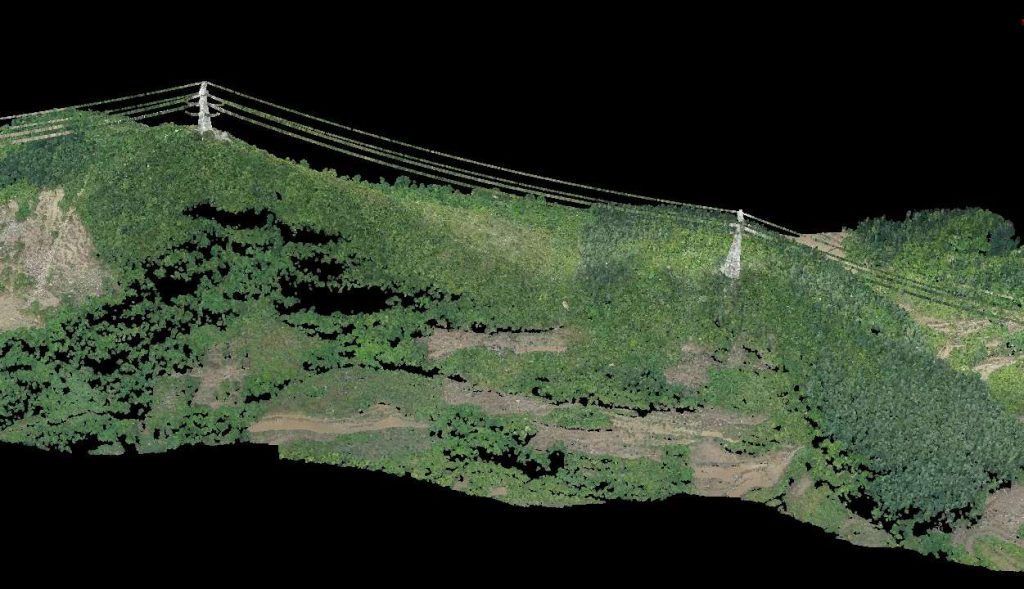
LiDAR point clouds and 3D maps allow grid operators to measure the distance between the foliage, vegetation, and power lines.
"This application experiment effectively protects the safety of the inspection staff, opens the intelligent, professional, and precise inspection", the person in charge of Guangxi power grid said, "It effectively improves the operation efficiency and data accuracy, including the real-time access to the power lines through multi-dimensional inspection".
CW-15 helps Jincheng Power Grid inspect power lines efficiently
China's State Grid Jincheng Power Supply Company (located in eastern China) experimented on a hybrid LiDAR drone in cooperation with JOUAV. The experiment is a breakthrough innovation in the research, production, and application of UAVs application by State Grid Jincheng Power Supply Company.
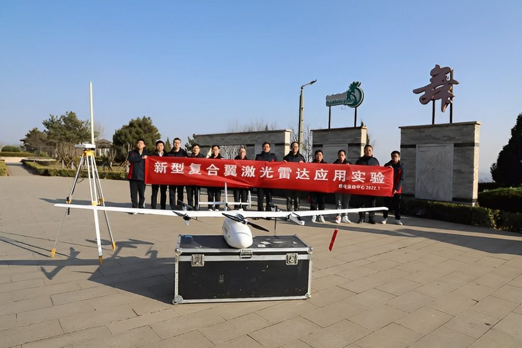
Members of Jingcheng Power Grid Company
During this joint experiment, CW-15 UAV, equipped with a LIDAR system, was used to carry out experimental inspection operations on the 110kV Tai Chun line. The total length of the inspection line is 19.6 km, all of which are mountainous and complex terrain.
The experiment was conducted at a low temperature of -4℃ in winter with strong wind gusts, and the simulated lines were affected by snowstorms and ice cover. The main purpose was to test the CW-15 UAV with a LIDAR system, UAV low-temperature endurance, the communication signal condition in complex terrain, and LIDAR data acquisition in single, dual, and triple route inspections separately.
JOUAV CW-15, inspecting 200 meters above the transmission channel for 60 minutes, safely and effectively completed the flight experimental inspection operations. After exporting the point cloud data, they obtained the specific situation of the power line affected by snowstorms and ice cover through internal software analysis, which played a decisive role in the analysis and further research of potential problems.
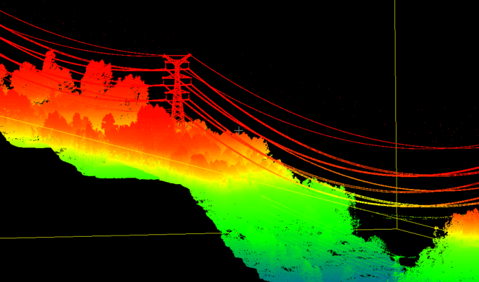
Utilizing the CW-15, the team can spot insulators, and concrete damage, and mark them for repair.
The staff of the transmission and operation inspection center claimed: "We will take the construction of drone lab as the driving force, improve the existing power grid inspection method as the core, give the application system of drone inspection an important place, and dare to try and foretaste, so as to promote drones to be a bigger role in the power gird inspection and maintenance.
The efficiency of CW-15 UAV inspection in a day is 6-10 times that of multi-rotor UAV. CW-15 can accurately and efficiently gain first-hand information on transmission lines and is widely used in the power grid industries to prevent hill fire, ice cover, external breakage of electrical facilities, and special fault patrol.
JOUAV is committed to accelerating the upgrading of intelligent inspection, continuously strengthening cooperation with the electric power industry, deeply researching the technical application of UAVs in power grid line patrol, and contributing to the construction of China's power grid.
Hubei Power Grid uses CW-15 to prevent power line fire
Hubei Electric Power Maintenance Company (located in the south of central China) made use of JOUAV CW-15D UAV to carry out a special inspection of ±500 kV Longzheng Line No. 865-964 pole tower line channel against mountain fire.
China's State Grid Xiaogan Power Supply Company applied JOUAV CW-15 to inspect power transmission channels, which ensured the safe operation of cross-province transmission channels, high-speed railway power supply lines, and new energy transmission channels in northern Xiaogan.
Only one pilot is needed to operate CW-15 drone for power line inspections.
China Southern Power Grid used the JOUAV CW-25E LiDAR system to inspect 52km of power lines in 2hrs before it was put into operation, making sure that the Yunnan-Guizhou interconnection channel project was put into operation with zero defects.
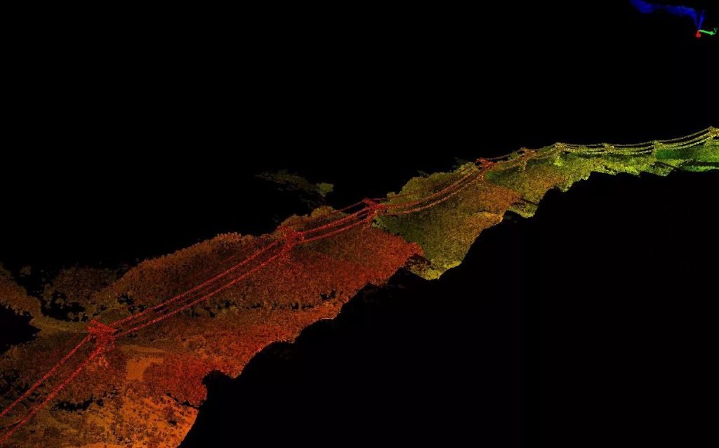
With the 3D-reconstructions of power lines from drone LiDAR point clouds, operators can quickly detect anomalies or defects, thus reducing fire hazards.
More Use Cases


Chongqing’s Qinba Mountains are basically a giant green wall protecting the region. But there’s a problem – pine wood nematodes are eating through it. Fast.
The forestry department n

When TotalEnergies set out to build one of Southeast Asia’s largest solar and battery storage projects—spanning 12,000 hectares across the dense acacia forests of Riau, Indonesia—they faced a problem

JOUAV Product News and Use Cases
Fixed-Wing VTOL Drones Insights and Industry Trends
Invitations to online demo events