Drone mapping services can produce far more than aerial photos—orthomosaics, 3D models, point clouds, and elevation data that feed directly into GIS, CAD, and BIM workflows. But ask three providers to
Picking drone mapping software feels harder than it should be.
Open any review site, and you will see the same ten names repeated: Pix4D, DroneDeploy, DJI Terra, Agisoft Metashape, UgCS. But the recommendations rarely match your actual situation. They tell you what is "best" without asking what you are mapping, what drone you are flying, what accuracy you need, or what your budget looks like.
This guide is built differently.
We are not going to list every feature in every app and call it a comparison. Instead, we walk through the full workflow—flight planning, photogrammetry, 3D reconstruction, analytics, and export—and show you which tools excel at each stage.
We also cover the practical decisions that actually affect your results: cloud versus desktop, free versus paid, DJI-only versus hardware-agnostic, and what happens when your project grows beyond 500 images.
If you already know which software you are leaning toward, the comparison table below gives you a quick answer.
If you are starting from zero, read on—we break down every major platform so you can make a confident choice.
Best Drone Mapping Software in 2026
The best drone mapping software depends on what you need to do with your data.
A surveyor looking for accurate georeferenced maps may prioritize photogrammetric processing and GCP workflows. A construction team may care more about cloud collaboration, measurements, and site progress. Meanwhile, a drone operator working with DJI enterprise hardware may prefer software that integrates closely with the DJI ecosystem.
These are some of the best drone mapping software options to consider in 2026:
Pix4D — Best for Professional Photogrammetry
Best for: Professional surveyors, engineers, and mapping specialists who need survey-grade accuracy and industry-specific tools.
Pix4D is the most widely used photogrammetry platform in professional surveying. The company offers a family of products rather than a single tool. PIX4Dmapper is the flagship desktop photogrammetry software, trusted for its mature processing engine and survey-grade outputs. PIX4Dmatic is the next-generation version optimized for larger datasets and faster processing. PIX4Dcloud provides browser-based processing and collaboration, while PIX4Dfields is purpose-built for agriculture workflows.
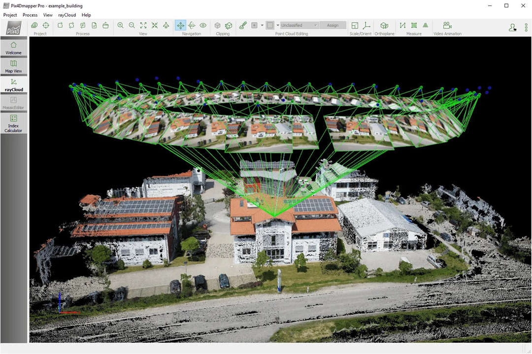
Image credit: https://drone.ua/
Key features:
Full photogrammetry pipeline: image alignment, dense point cloud, DSM/DTM, orthomosaic, 3D mesh
Comprehensive GCP and checkpoint workflow with accuracy reports
RTK/PPK integration for survey-grade georeferencing
Support for RGB, multispectral, and thermal imagery
Industry-specific editions for surveying, agriculture, and emergency response
DroneDeploy — Best for Construction & Enterprise
Best for: Construction teams, project managers, and enterprise organizations that need cloud-based collaboration and progress tracking.
DroneDeploy is a cloud-first drone mapping platform designed for teams. Unlike desktop-focused tools, DroneDeploy handles flight planning, automated image upload, cloud processing, analytics, and team sharing in one ecosystem. The platform is built around construction workflows — progress tracking, stockpile measurement, and change detection — but is also used in agriculture, mining, and inspection.
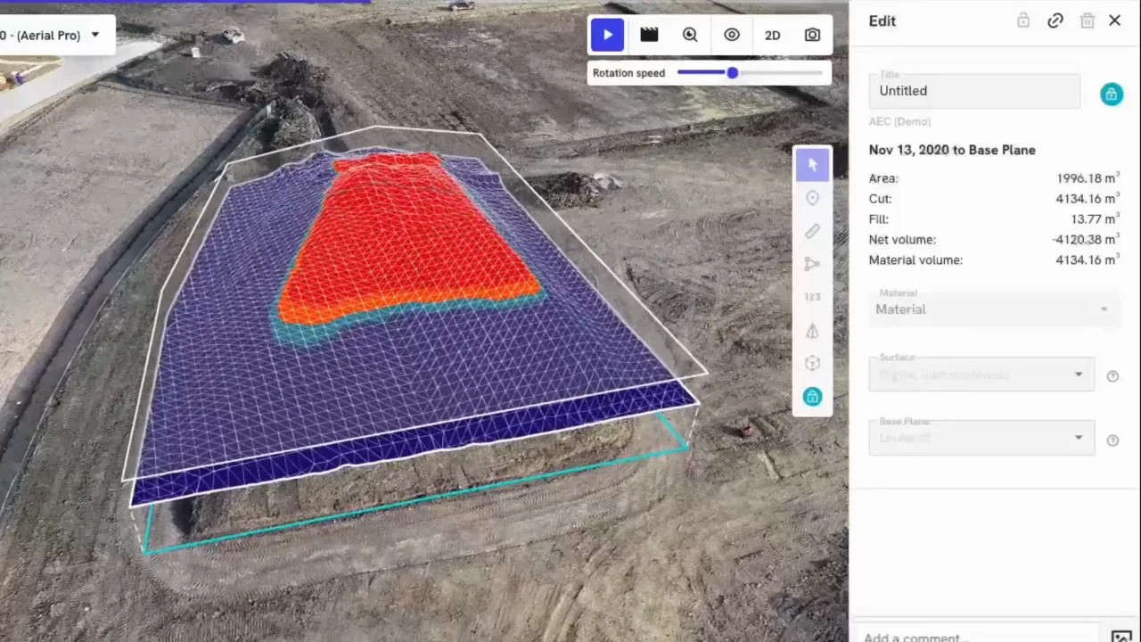
Image credit: https://www.dronedeploy.com/
Key features:
Built-in flight planning for grid and corridor missions
Automated cloud processing of orthomosaics, 3D models, and elevation maps
Construction-specific tools: progress tracking, change detection, markup
Volume measurement for stockpile and cut/fill analysis
Team collaboration with role-based access and shareable links
Integrations with Procore, Autodesk BIM 360, and other construction platforms
Pricing: Flight & Analysis plan starts at approximately $4,188/year for a single license. Custom enterprise pricing available.
Who should use it: Construction firms, project managers, and enterprise teams that need consistent, repeatable mapping across multiple sites with team collaboration and cloud access.
DJI Terra — Best for DJI Drone Mapping
Best for: Organizations standardized on DJI Enterprise drones and payloads.
DJI Terra is DJI's native mapping and photogrammetry software for their enterprise drone lineup. It integrates directly with DJI hardware, offering the fastest path from capture to processed deliverable for users of the Matrice series, Phantom 4 RTK, and DJI LiDAR payloads.
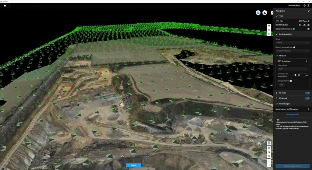
Image credit: https://www.terrestrialimaging.com/
Key features:
2D orthomosaic and 3D reconstruction from RGB images
Native LiDAR processing for DJI LiDAR payloads (Zenmuse L1, L2)
Seamless integration with DJI RTK workflows and base stations
Modern 3D visualization with support for 3D Gaussian Splatting
Flight planning built directly into the application
Pricing: Available through DJI dealers. A 1-month free trial is available with a 500-photo and 8GB LiDAR cap.
Who should use it: Teams flying DJI Enterprise drones — especially Matrice series, Phantom 4 RTK, and LiDAR payload users — who want the most integrated workflow.
JOUAV FlightSurv — Best for Integrated JOUAV VTOL Workflows
Best for: Organizations operating JOUAV VTOL drones who want an all-in-one cloud platform that covers flight planning, data processing, and team collaboration in a single ecosystem.
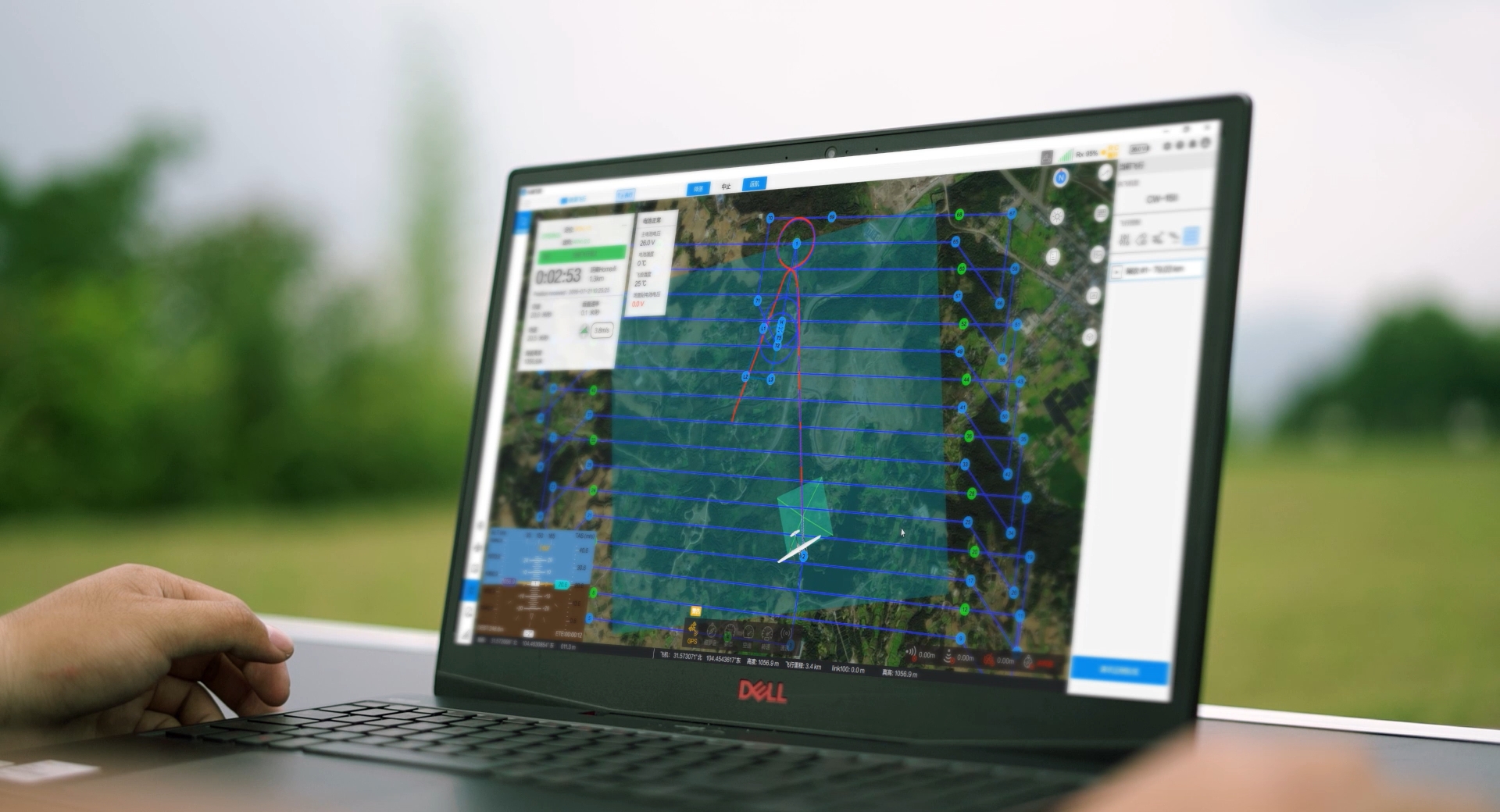
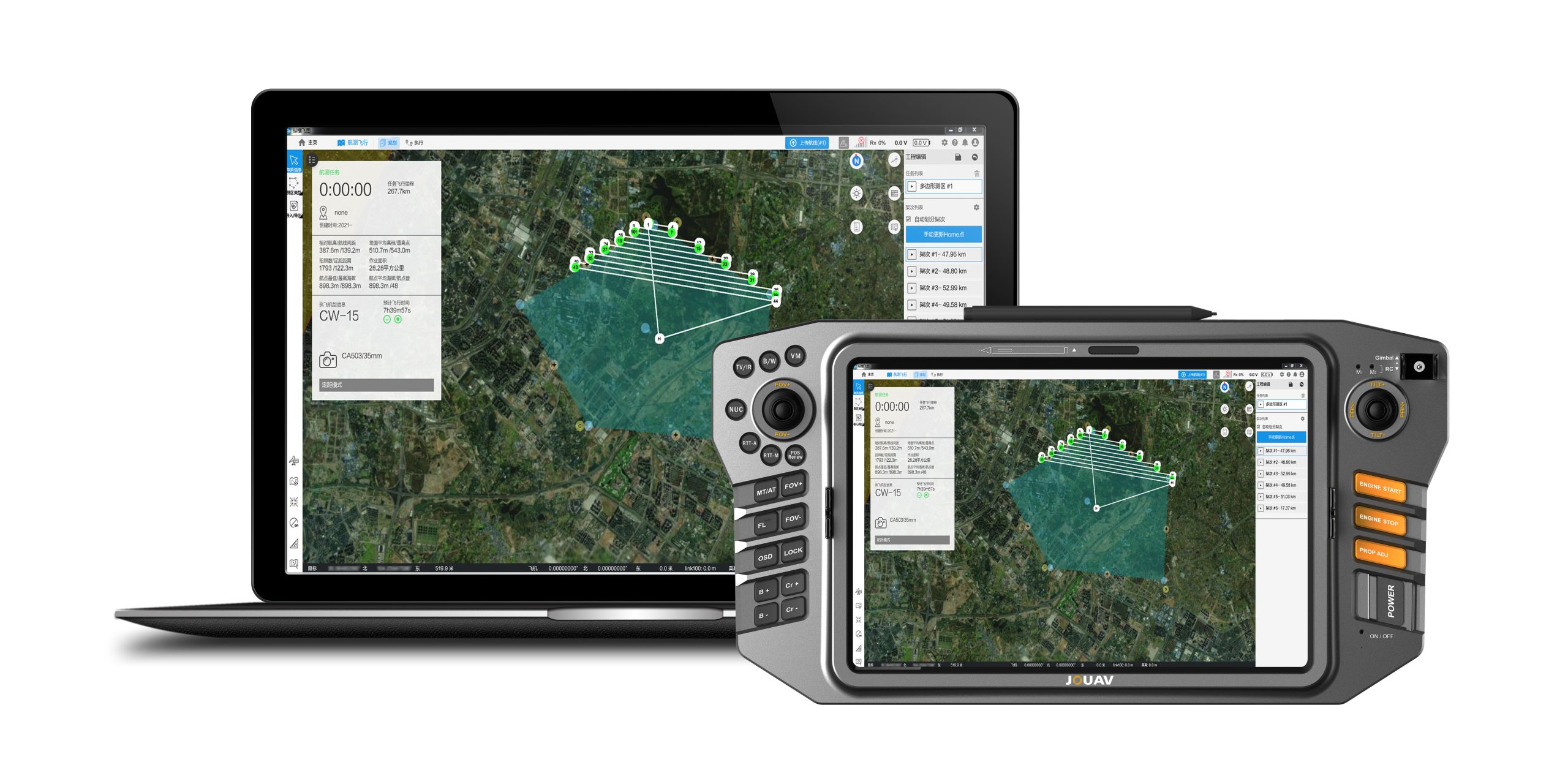
JOUAV FlightSurv is a cloud-based drone mapping software designed specifically for professional surveying, topography, and photogrammetry applications. Built around JOUAV's VTOL fixed-wing drone lineup — including the CW-15 and CW-30E — it covers the entire workflow from mission planning to deliverable generation. Unlike general-purpose mapping platforms, FlightSurv is optimized for large-area surveys where VTOL endurance and efficiency are critical.
Key features:
Cloud-based end-to-end workflow: flight planning, data collection, processing, and analysis in one platform
Automated flight planning with KML import — generates routes automatically from KML polygons and alignments, saving up to 50% of mission setup time
Multi-mission planning without landing — plan and execute multiple flight plans in a single mission without landing between plans, maximizing field efficiency
Terrain following with DEM/DSM support — automatically adjusts flight altitude in response to real-time terrain changes, essential for complex landscapes
High-speed cloud processing — processes 1,000 photos into high-precision TDOM and DSM in approximately 2 hours
Outputs: TDOM (True Digital Ortho Mosaic), DSM, dense point clouds, and 3D models
Multi-user cloud management — real-time data sharing with field teams and remote clients via mobile devices
Asset inspection tools — structured image capture for infrastructure inspection (power lines, bridges, pipelines)
Agisoft Metashape — Best for Flexible Desktop Photogrammetry
Best for: Surveyors, researchers, and organizations with mixed hardware fleets that need full control over processing.
Agisoft Metashape is the most hardware-agnostic photogrammetry software available. It accepts images from any drone, terrestrial camera, or smartphone, and runs on Windows, macOS, and Linux — the only major commercial tool with full cross-platform support.
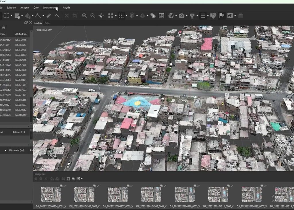
Image credit: https://www.metashape-la.com/
Key features:
Full photogrammetry pipeline: image alignment, dense point cloud, DSM/DTM, orthomosaic, 3D mesh, textured models
Comprehensive GCP and checkpoint tools with coordinate system support (EPSG)
Python API for workflow automation and batch processing
Supports RGB, multispectral, thermal, and LiDAR data
Available in Standard and Professional editions
Pricing: Standard edition ~$179 (perpetual). Professional edition ~$3,499 (perpetual). Educational discounts available. Trial available.
Who should use it: Surveyors, researchers, and organizations with mixed drone fleets who need full processing control and cross-platform support.
UgCS — Best for Advanced Flight Planning
Best for: Professional pilots and surveyors working on complex terrain, corridors, and large linear infrastructure projects.
UgCS by SPH Engineering is a professional flight planning and mission control tool. It is designed for environments where standard grid missions are insufficient — steep terrain, long corridors, and complex survey boundaries.
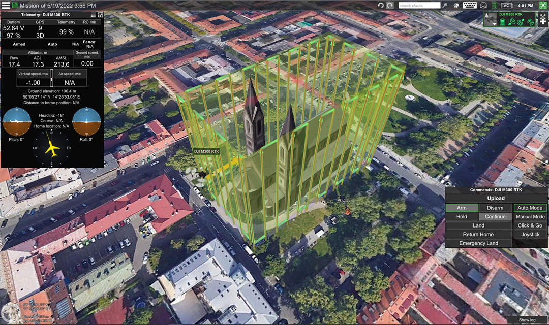
Image credit: https://www.sphengineering.com/
Key features:
Advanced terrain following using imported DEM/DSM data (GeoTIFF format)
Dedicated corridor mapping tools for pipelines, roads, and powerlines
KML and SHP import for precise boundary definition
LiDAR mission planning with custom scan patterns
Offline maps and DTM support for remote sites
Supports DJI, ArduPilot, Autel, and custom platforms
Pricing: UgCS Open (free) with limited features. Paid versions available through SPH Engineering.
Who should use it: Professional pilots and surveyors working on challenging terrain, linear infrastructure (pipelines, powerlines, roads), or large-scale projects with complex flight requirements.
WebODM / OpenDroneMap — Best Open-Source
Best for: Budget-conscious users, researchers, and technically capable teams with access to local processing hardware.
OpenDroneMap is the most capable open-source photogrammetry software available. It is a command-line tool that processes images into orthomosaics, point clouds, DSMs, DTMs, and 3D models — all at zero cost. WebODM provides a browser-based interface for users who prefer a graphical environment.
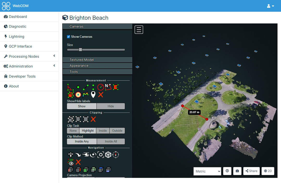
Image credit: https://webodm.org/
Key features:
Self-hosted photogrammetry processing (runs on your own hardware)
Outputs: orthomosaic, point cloud (LAS/LAZ), DSM/DTM, 3D mesh, contour lines
GCP support for georeferencing
WebODM provides a web-based GUI
Can be deployed on cloud servers for scalable processing
Active open-source community
Who should use it: Users with technical skills, access to capable hardware (32GB+ RAM), and budget constraints. Researchers, students, and organizations testing photogrammetry workflows before committing to commercial software.
ArcGIS Drone2Map — Best for GIS Workflows
Best for: Government agencies, utilities, and organizations already invested in the Esri ecosystem.
ArcGIS Drone2Map is Esri's drone mapping solution. It is designed for organizations that already use ArcGIS Pro, ArcGIS Online, and ArcGIS Enterprise, providing native integration with Esri's geospatial platform.
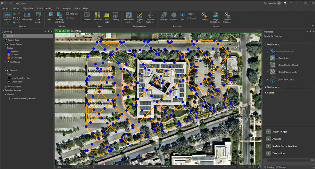
Image credit: https://www.esri.com/
Key features:
Native integration with ArcGIS Pro and ArcGIS Online
Orthomosaic, point cloud, DSM/DTM, and 3D mesh generation
Full coordinate system and projection support
RTK/PPK and GCP workflows for accuracy
Multispectral processing with vegetation indices
Direct publishing to ArcGIS Online for sharing
Pricing: Named user licensing; requires ArcGIS organizational account. Free trial available through ArcGIS Online.
Who should use it: Government agencies, utilities, and enterprise GIS teams that are already using ArcGIS and need native integration for their mapping workflows.
Propeller — Best for Construction & Earthworks
Best for: Earthworks contractors, mining operations, and construction firms that need precise volume measurements and change detection.
Propeller is a cloud-based mapping platform focused on heavy construction, earthworks, and mining. It processes drone data into survey-grade maps, stockpile volume reports, and cut/fill analyses. Unlike general-purpose mapping platforms, Propeller is built specifically for the economics of moving dirt.
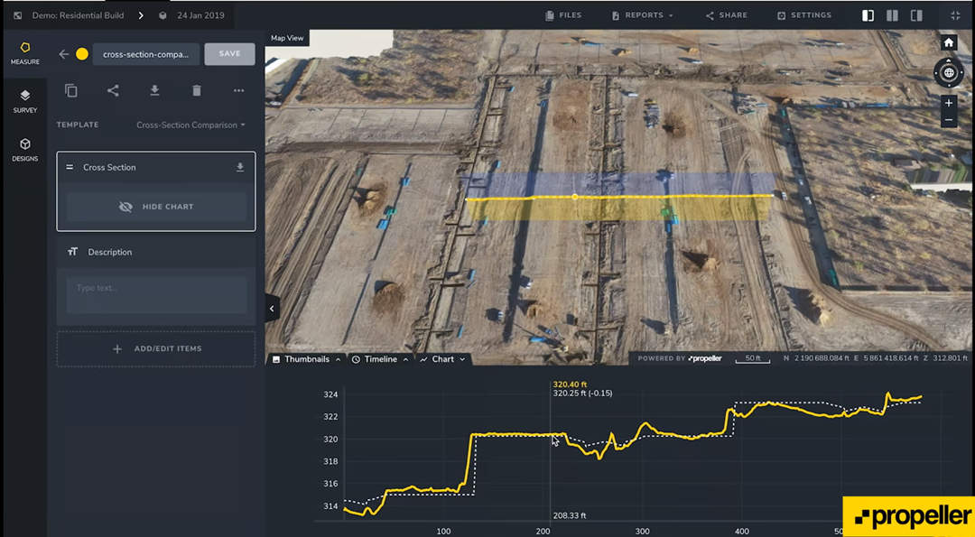
Image credit: https://www.propelleraero.com/
Key features:
Survey-grade orthomosaics and digital terrain models
Stockpile volume measurement and cut/fill analysis
Construction progress tracking with change detection
Cloud-based collaboration with site teams
Integration with Trimble, Topcon, and Leica hardware
Automated reporting and compliance documentation
Pricing: Custom pricing based on site count and team size. Contact Propeller for a quote.
Who should use it: Earthworks contractors, mining operations, and construction firms that need precise stockpile volumes, cut/fill analysis, and progress tracking on active sites.
SkyeBrowse — Best for Rapid 3D / Video-Based Mapping
Best for: Emergency responders, insurance adjusters, and users who need a 3D model quickly without pre-planned grid missions.
SkyeBrowse uses videogrammetry — processing continuous video footage (MP4/MOV) instead of a grid of overlapping photos. This approach removes the need for pre-planned missions, ground control points, or specific flight patterns. Users simply fly a simple pattern, upload the video, and receive a 3D model in minutes.
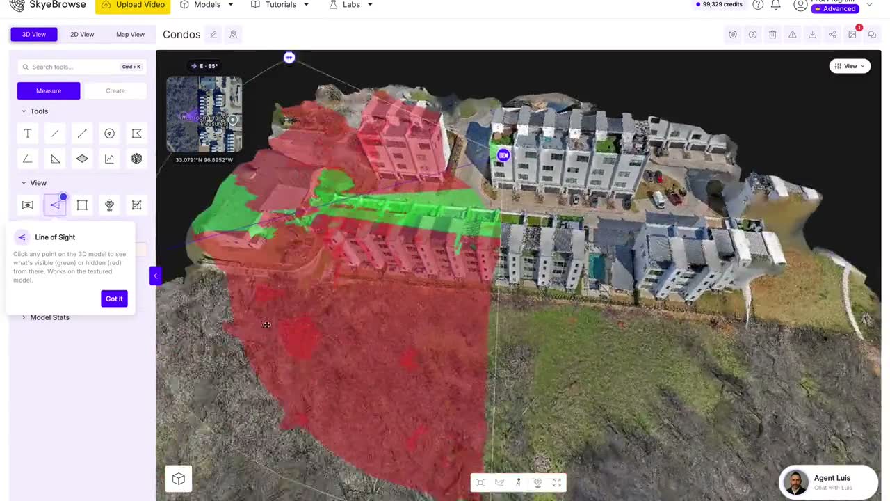
Image credit: https://www.skyebrowse.com/
Key features:
Video-based processing (videogrammetry), not traditional photogrammetry
Accepts MP4 and MOV files from any drone, smartphone, or action camera
Cloud-based processing — no local hardware required
Web browser viewer with measurement tools (distance, area)
Available in Freemium and paid tiers
How We Evaluate Drone Mapping Software?
Not all software comparisons are created equal. Many guides simply list features and declare a winner.
That approach is not useful — because the "best" tool for a surveyor mapping a 100-hectare site is almost certainly not the "best" tool for a construction manager tracking weekly progress on a single building pad.
Flight Planning Capabilities
The quality of your final map or model is determined in the field, not at the processing desk. Software with weak flight planning forces you to fly manually or compromise on overlap — and no amount of processing can fix poorly captured data.
What we look for:
Grid and polygon missions — Can you define an irregular survey boundary and generate flight lines automatically?
Corridor mapping — Does the software support linear missions for pipelines, roads, powerlines, and railways?
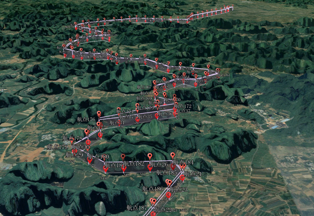
Terrain following — Can the drone maintain a constant Above Ground Level (AGL) over changing elevation? Tools that support importing custom DEM or DSM data as GeoTIFFs deliver significantly better results on steep terrain than those relying on basic terrain services.
AGL control and speed management — Does the software allow fine control over altitude, speed, and camera trigger intervals?
Multi-flight segmentation — Can you split a large mission across multiple batteries with seamless resume points?
Tools like UgCS, DJI Terra, and JOUAV FlightSurv excel in this category. Others, like Agisoft Metashape and WebODM, offer little to no flight planning — they assume you have already captured the images.
Photogrammetry and Processing Capability
This is the core engine. The software's photogrammetry pipeline determines how accurately it can reconstruct 3D geometry from 2D images.
What we look for:
Image alignment — How well does the software handle large image sets, varying lighting conditions, and difficult scenes (e.g., repetitive patterns, water, vegetation)?
Dense point cloud generation — Quality, density, and color accuracy of the point cloud.
Orthomosaic stitching — Seam quality, color balancing, and geometric accuracy.
DSM/DTM/DEM generation — Can it produce both surface and bare-earth models?
3D mesh and textured model output — Mesh quality, polygon count, texture resolution.
GCP and checkpoint workflows — Does the software support Ground Control Points for absolute accuracy, and checkpoints for quality assurance?
Academic research has compared open-source and commercial photogrammetry engines, finding that tools like OpenDroneMap produce results comparable to commercial alternatives like Agisoft Metashape — though the choice between them depends on user requirements and specific project needs. Our evaluation reflects both raw capability and practical usability.
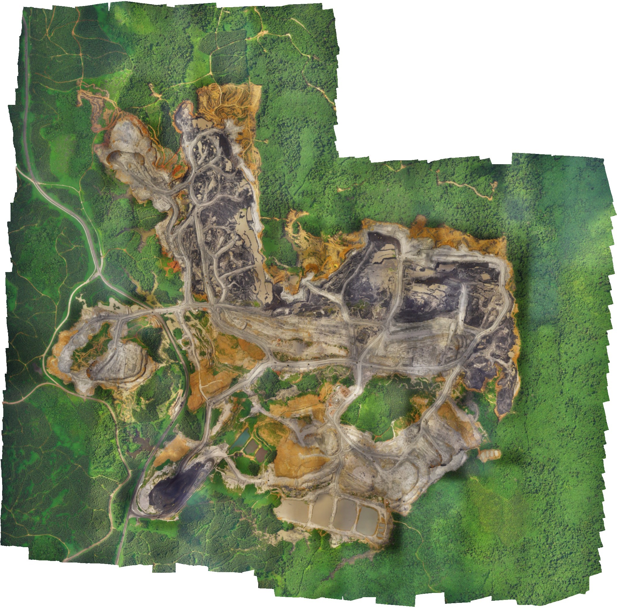
Accuracy and Georeferencing
Accuracy is not a single number. Different projects require different levels of precision, and software must support the workflows that deliver them.
What we look for:
RTK and PPK integration — Does the software support Real-Time Kinematic and Post-Processed Kinematic workflows? RTK and PPK significantly improve survey accuracy by correcting GNSS measurements, typically reducing horizontal and vertical errors to just a few centimeters.
GCP support — Can you import surveyed GCP coordinates, mark them on images, and use them to georeference the model?
Checkpoint validation — Does the software allow you to validate accuracy independently using checkpoints not used in the alignment?
Coordinate system management — Support for EPSG codes, vertical datums, and custom coordinate systems.
QA/QC reporting — Does the software generate accuracy reports showing residual errors?
A critical distinction: Ground Sampling Distance (GSD) is not the same as mapping accuracy. GSD tells you the pixel resolution on the ground. Absolute accuracy — how close your map is to real-world coordinates — depends on GCPs, RTK/PPK, and the software's georeferencing engine. Our comparison distinguishes between the two.
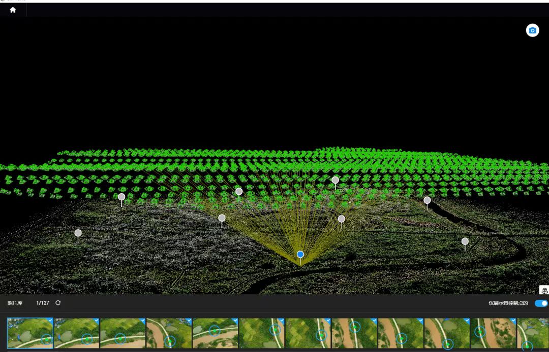
Sensor Support
Not all mapping projects use standard RGB cameras. Agriculture, inspection, and surveying workflows increasingly rely on specialized sensors.
What we look for:
RGB cameras — Support for standard visual-light cameras from DJI, Sony, and other manufacturers.
Multispectral sensors — Can the software process multispectral data for NDVI and crop health analysis?
Thermal sensors — Support for thermal imagery for inspection, search and rescue, and building diagnostics.
LiDAR — Does the software process LiDAR point clouds, or is it photogrammetry-only? Some tools, like DJI Terra, offer native LiDAR support for DJI payloads.
Some tools are hardware-agnostic (Agisoft Metashape supports images from almost any camera or sensor), while others are tightly coupled to specific ecosystems (DJI Terra is optimized for DJI hardware). Our comparison makes these tradeoffs explicit.
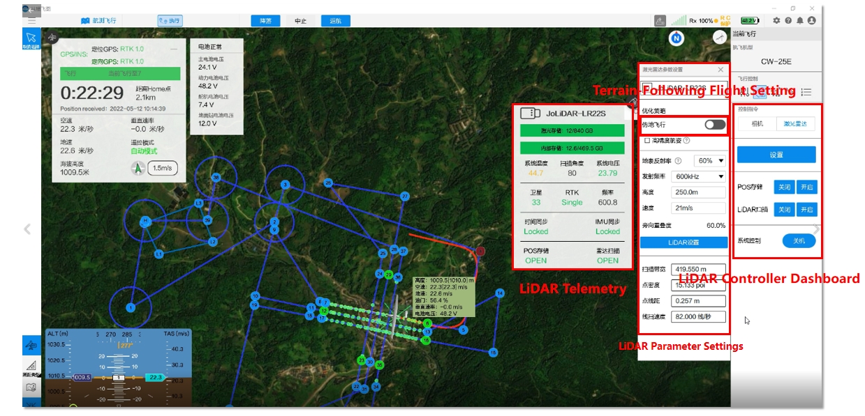
JOUAV FlightSurv provides integrated LiDAR management, enabling operators to control the LiDAR payload, monitor sensor status, and set up LiDAR parameters directly within the flight planning and mission control interface.
Cloud, Desktop, and Offline Deployment
How and where you process data matters as much as what you process.
What we look for:
Cloud processing — Upload images to the vendor's servers; processing happens remotely. Accessible from anywhere, no powerful local hardware required, but with recurring costs and internet dependence.
Desktop processing — Processing happens on your own workstation. One-time cost (or subscription), faster on high-end hardware, requires local compute and storage.
Hybrid — Some tools offer both (e.g., Pix4D offers desktop and cloud options).
Offline capability — Can the software operate without an internet connection? Critical for remote sites, military and government work, and sensitive data.
Some tools are cloud-first (DroneDeploy, SkyeBrowse), others are desktop-first (Agisoft Metashape, WebODM), and a few offer both (Pix4D, DJI Terra, JOUAV FlightSurv). The right choice depends on your hardware, connectivity, and data security requirements.
Scalability and Large-Dataset Handling
A tool that works well for a 200-image construction site may fall apart on a 2,000-image mining survey.
What we look for:
Image count limits — Does the software cap the number of images per project?
Dataset size handling — How does performance scale with image count and resolution?
Multi-flight project management — Can you combine data from multiple flights into a single project?
Processing speed — How long does it take to process 500, 1,000, or 2,000 images?
Hardware requirements — What CPU, RAM, and GPU are recommended for large projects?
Professional photogrammetry is computationally intensive. A typical 400-image construction site survey takes 2.5–3 hours of processing time on a capable workstation. Large-area surveys with 1,000+ images require 64GB+ RAM and a powerful GPU. Our comparison notes where each tool hits its limits.
Pricing and Licensing
Cost is not just the sticker price. The total cost of ownership includes hardware, processing time, training, and the cost of re-flights if the software fails to deliver.
What we look for:
Pricing model — Free, freemium, subscription, perpetual, or pay-as-you-go?
Free options — Is there a genuinely free tier, or just a time-limited trial?
Entry price — What does it cost to get started?
Enterprise pricing — How does pricing scale with team size and usage?
Hidden costs — Are there additional costs for cloud processing credits, exports, or add-on modules?
Pricing models vary widely — from WebODM at $0 (self-hosted) to DroneDeploy at approximately $4,188/year for a single license. Our comparison includes both the advertised price and the real-world cost for typical use cases.
Drone Mapping Software Pricing in 2026
Drone mapping software pricing is more complicated than a single number. Understanding the different pricing models — and what you actually get for your money — is essential to making a cost-effective choice.
This section breaks down the pricing landscape: free vs. paid, subscription vs. perpetual, what each tool actually costs, and the hidden costs that often surprise buyers.

Free vs. Free Trial vs. Freemium vs. Open Source
Not all "free" options are the same. The distinction between genuinely free tools and time-limited trials is one of the most common sources of confusion — and wasted time.
Common Drone Mapping Software Mistakes
Even experienced operators make these mistakes. The good news is they are all avoidable—and fixing them costs nothing but a few minutes of planning.
Choosing Software Based Only on Price
The cheapest software is rarely the cheapest solution.
Here is why that fails: a $0 tool that crashes halfway through processing a 500-image dataset, or produces an orthomosaic with visible seam lines, will cost you more than a paid license ever would. You will spend hours re-flying the site, days troubleshooting failed exports, or worse—deliver a subpar product to a client who expects professional results.
The real cost of software is not the license fee. It is the combination of:
Your time learning and troubleshooting
Processing time waiting for results
Re-flight time when outputs fail quality checks
Lost clients when deliverables are late or inaccurate
Before you choose a tool based solely on its price tag, ask yourself: What is my time worth on a 500-acre survey?

Confusing GSD With Accuracy
Ground Sampling Distance—the size of one pixel on the ground—is a measure of resolution, not accuracy.
A GSD of 1 cm per pixel tells you how much detail the camera can resolve. It does not tell you how close that pixel's location is to its true geographic position. You can have a 1 cm GSD and still be 2 meters off in absolute position if you have not placed Ground Control Points or used RTK/PPK.
Here is the rule: Resolution is what you see. Accuracy is where it is.
To achieve survey-grade absolute accuracy, you need georeferencing—GCPs, RTK, or PPK. The software can generate a gorgeous, sharp orthomosaic, but without ground control, it is floating in its own relative coordinate system. That might be fine for a visual inspection. It is not fine for a boundary survey or a cut-fill calculation.
Skipping Ground Control Points and Checkpoints
This is the most common shortcut—and the most expensive one.
GCPs are surveyed markers placed on the ground and identified in your imagery. They anchor your model to real-world coordinates. Checkpoints are similar but used exclusively for quality assurance—you do not use them to align the model, only to verify how accurate the alignment actually is.
Some operators skip GCPs because they trust their drone's onboard GNSS or RTK. Here is the reality: even with a DJI Matrice 350 RTK, uncrewed aerial vehicles typically produce vertical accuracies of about 3–5 times the GSD without ground control. That translates to 0.05–0.15 meters vertical accuracy under ideal conditions. With GCPs, you can achieve 0.01–0.03 meters after network adjustment.
Without GCPs, you have no independent way to validate your output. The software will tell you it aligned successfully—it cannot tell you if it aligned correctly.
The rule: GCPs are not optional for survey-grade work. Checkpoints are not optional if you need to prove your accuracy to a client or regulator.
Choosing Cloud Software for Offline Environments
This mistake is usually discovered on the morning of a remote site deployment.
You arrive at a mining site, forestry block, or agricultural field with no cellular coverage. You open your cloud-based mapping app. It asks for an internet connection to load maps, process data, or sync flights. You have none. The day is wasted.
Cloud software is excellent—for offices, sites with reliable connectivity, and teams that collaborate across locations. But if you regularly work in remote areas, offline capability is not a nice-to-have. It is a requirement.
Look for software that allows you to:
Pre-load base maps and digital elevation models before you leave the office
Plan and save missions entirely offline
Collect data without phoning home
Process data locally or queue it for upload when you are back on the network
UgCS, DJI Pilot 2, and Agisoft Metashape all support offline workflows. Some cloud-first platforms offer limited offline modes, but they are not the same as being fully functional without an internet connection.
Ignoring Dataset Size and Processing Time
A 50-hectare site captured at 80% overlap generates roughly 400–500 images. That processes comfortably on a laptop with 16GB of RAM.
A 1,500-hectare site captured with a fixed-wing drone generates 3,000–8,000 images. That will fail on the same laptop—or take three days to process.
This mistake has two flavors:
Flavor one: Buying software without checking its dataset limits. Some platforms cap image counts on lower-priced tiers. DroneDeploy's mid-tier plans, for example, limit maps to a certain number of images or area. DJI Terra's free trial caps processing at 500 images. Exceeding those limits means upgrading, splitting your project, or paying per-credit fees.
Flavor two: Underestimating the hardware required. Photogrammetry is computationally brutal. Processing 5,000 images at high quality requires 64GB of RAM at minimum, and preferably 128GB. A fast NVMe SSD and a powerful GPU (NVIDIA RTX 4070 or better) significantly reduce processing time. Cheaping out on hardware turns a 4-hour process into a 24-hour process.
Do this before you buy: Check the software's maximum image count per project. Confirm its hardware recommendations. Then double your RAM estimate.
Choosing Software Before Defining the Final Deliverable
This is the mistake that underpins all the others.
You pick a tool because it is popular, or because a colleague recommended it. Then you figure out what you actually need to produce—and discover the tool does not support it.
Need an orthomosaic? Every photogrammetry tool does that.
Need a CAD-ready DXF with breaklines and contours? Not every tool exports that.
Need a classified point cloud (ground, vegetation, buildings)? That requires specific software or add-ons.
Need a digital twin that integrates with BIM software? That is a different set of export requirements.
The list goes on. The only way to avoid this mistake is to work backwards:
What is the final deliverable? (Orthomosaic? Point cloud? 3D mesh? Contour map? Volume report? CAD file? GIS layer?)
What accuracy standard does it require? (Sub-centimeter? Sub-foot? Relative only?)
What formats do your clients or downstream tools need? (GeoTIFF, LAS, OBJ, DXF, Shapefile, KML?)
Then choose the software that delivers exactly that.
Start with the output. The software is just the means to get there.
Read More
Here’s the question every drone pilot hears: How much should I charge?
And here’s the honest answer: $100 to $500 an hour, or $300 to $5,000 per project, depending on what you’re doi
Here’s something most people don’t think about: someone has to climb those cell towers you see along the highway.
Tower climbers ascend hundreds of feet—often in wind, heat, and hazardous

JOUAV Product News and Use Cases
Fixed-Wing VTOL Drones Insights and Industry Trends
Invitations to online demo events
 English
 中文
中文