Picking drone mapping software feels harder than it should be.
Open any review site, and you will see the same ten names repeated: Pix4D, DroneDeploy, DJI Terra, Agisoft Metashape, UgCS. But the recom
Here's something most people don't think about: someone has to climb those cell towers you see along the highway.
Tower climbers ascend hundreds of feet—often in wind, heat, and hazardous conditions—just to check if bolts are tight and cables are secure. It's one of the most dangerous jobs in America.
But what if you could do the same inspection from the ground?
Drones can circle a 300-foot tower in minutes, capturing high‑resolution images and thermal data that reveal issues no human eye could spot. Faster. Safer. More thorough.
The market is growing fast, from $500 million in 2025 to a projected $4.5 billion by 2036. 5G, aging infrastructure, and regulatory pressure are all driving demand.
This guide covers everything you need to know: the best drones for tower inspections, cost per tower, software that turns images into 3D models, and FAA regulations.
Let's get started.
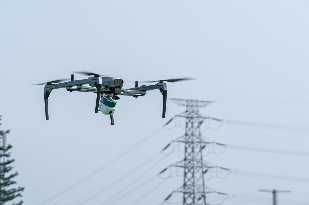
Why Drones for Tower Inspection?
Before we dive into the technical details, let's answer the obvious question: why use drones at all?
The short answer is that drones do what tower climbers do—but faster, safer, cheaper, and more thoroughly. Let's break down each of these four pillars.
Safety—The #1 Reason
Tower climbing is one of the most dangerous jobs in America. The tower industry has one of the highest fatality rates of any occupation. Falls, electrocution, and structural collapse are constant risks.
Drones keep people on the ground. They eliminate most height-related safety risks while providing faster, more comprehensive inspections. Industrial studies show that drone operations can cut risk exposure by more than 70%. You're not just saving money—you're saving lives.
The math is simple: if a drone crashes, you lose equipment. If a climber falls, you lose a person.
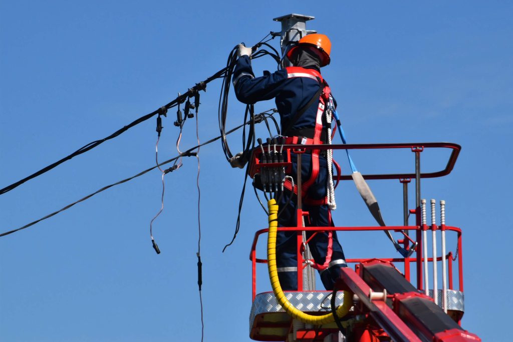
Speed—Faster Than Climbing
A drone can survey a tower in minutes, not hours.
A climber has to ascend slowly, stop at each level, inspect components, take photos (often one-handed while hanging on), and descend. A drone circles the tower, captures images from every angle, and lands—all while the pilot stays safely on the ground.
Faster inspections mean fewer labor hours, lower travel costs, and the ability to inspect more thoroughly and more frequently. Network operators adopting automated inspection can inspect more often without growing their workforce.
And here's the real benefit: the ability to conduct more frequent inspections prevents minor issues from escalating into major, costly repairs.
Thoroughness—Better Data, Better Decisions
Here's something that surprises people: drones often do a better job than climbers.
A climber can only see what's directly in front of them. They might miss something on the other side of the tower. A drone captures images from every angle—top, bottom, sides, and inside tight spaces that a person can't reach.
Industrial studies have verified that fault detection reaches 95% accuracy when inspection imagery is analyzed through GIS and analytics platforms. Drones capture detailed, repeatable data that helps track wear, spot vegetation issues, and plan maintenance more effectively.
When you can compare this year's inspection against last year's, you can spot degradation before it becomes a failure. That's not just thorough—it's predictive.
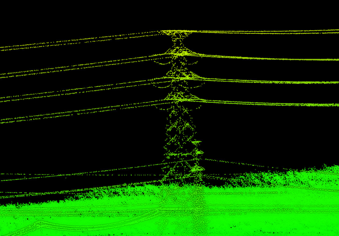
Cost—Cheaper Than You Think
Traditional tower inspection is expensive. Liability insurance is costly. So is the personnel cost associated with training climbers and the hours required for manual inspections.
Drones reduce both.
Industrial studies have verified the same trend: inspection-related costs lowered by 60% through drone operations. A single drone pilot can replace a climbing crew, dramatically reducing labor costs.
Quick comparison:
Best Drones for Tower Inspection (A Complete Comparison)
Not every drone is built for tower inspection. You need more than just a good camera—you need zoom, obstacle avoidance, flight time, and the ability to handle wind and electromagnetic interference.
Here's a breakdown of the top options in 2026, what they're good for, and who should buy them.
What Makes a Good Tower Inspection Drone?
Not every drone is built for tower inspection. You need more than just a good camera—you need zoom, obstacle avoidance, flight time, and the ability to handle wind and electromagnetic interference.
Here's a breakdown of the top options in 2026, what they're good for, and who should buy them.
Stable Flight and Control
Towers are tall and often in exposed locations. Wind at 300 feet is stronger and more turbulent than at ground level. A good tower inspection drone holds its position tightly in strong winds and at high altitudes—without drifting into the tower or its guy wires. That stability isn't just about image quality; it's about safety.
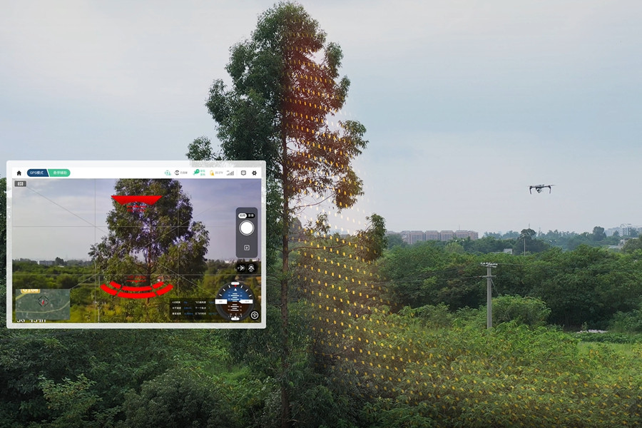
Advanced Obstacle Avoidance
Towers are packed with obstacles: thin metal bars, guy wires, antennas, cables, and mounting brackets. Many of these are thin and hard for standard obstacle avoidance systems to detect. A good drone uses multi-directional sensors—and ideally, algorithms trained to detect thin, linear objects—to help you navigate safely around these hazards. But remember: obstacle avoidance is a safety net, not a license to fly carelessly.
High-Zoom Optical Camera
This is non-negotiable. You need to capture sharp, detailed 4K images from a safe distance. A good optical zoom (30x or more) lets you inspect components like bolts, antennas, and cable connections without getting close enough to risk a collision or interfere with sensitive equipment. A digital zoom alone won't cut it — you need optical zoom for real detail.
Reliable Signal Transmission
Towers are made of steel. Steel blocks signals. Guy wires and antennas create electromagnetic interference. A good tower inspection drone maintains a clear, stable video link even when flying behind heavy steel structures or around sources of interference. Without reliable transmission, you lose control, lose video, and lose the ability to inspect safely.
Top 9 Drone Models for Tower Inspection (2026)
Not every drone is built for tower inspection. You need more than just a good camera — you need a platform that can handle the unique challenges of inspecting tall, complex, and often exposed structures.
Here's what actually matters.
JOUAV PH-007
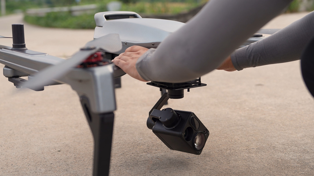
The PH-007 is a portable quadcopter for commercial inspection work. It folds in under a minute and packs into a hiking backpack—ideal for reaching remote tower sites. With a 2.5 kg payload capacity, it carries 4K cameras, thermal sensors, or LiDAR for detailed inspections.
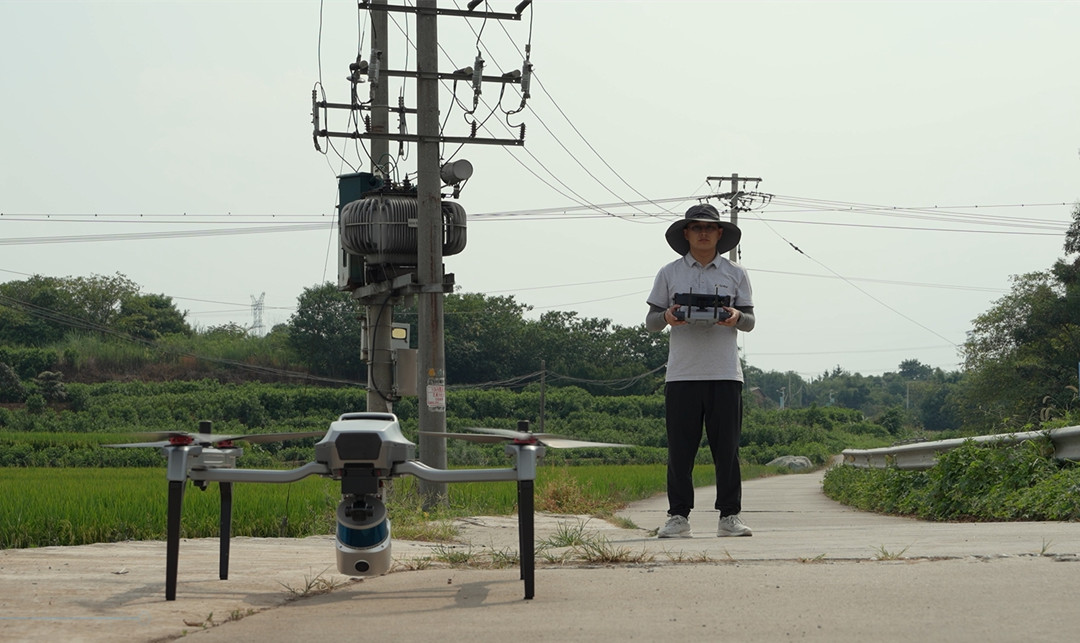
Flight endurance is a key advantage. The long-endurance version delivers 85 minutes (75 minutes standard), meaning fewer battery changes and more towers per day. The modular payload interface lets you swap sensors quickly, adapting to different missions on the fly.
For tower work, obstacle detection matters. The PH-007 provides front, bottom, left, and right coverage to help spot guy wires and cables before they become a problem. It handles Level 6 winds, light rain, and temperatures from –20°C to +55°C—covering most field conditions. With a 10 km transmission range and triple GNSS positioning, it keeps you connected and on target. A practical choice for inspectors who need endurance, precision, and reliability.
JOUAV JOS-P200
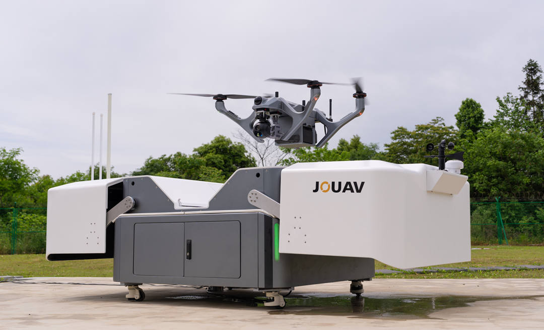
The JOS-P200 is a fully automated "drone-in-a-box" solution for continuous tower inspection. It combines a PH-10H multirotor with a weatherized docking station, enabling 24/7 operation with automatic battery swapping and deployment in under 1.5 minutes.
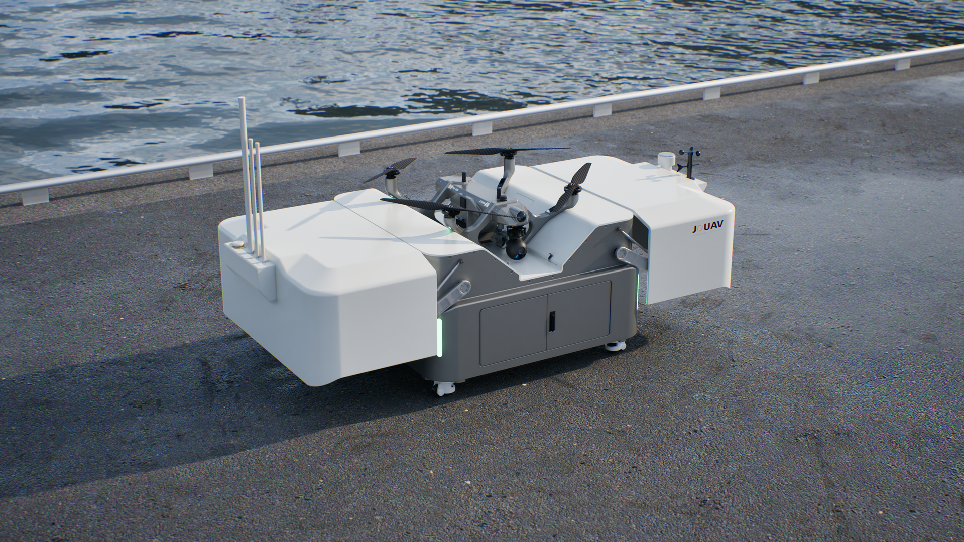
The system supports 43 minutes of endurance at full payload and accommodates up to four payload modules simultaneously—cameras, LiDAR, speakers, or searchlights. This automation eliminates the logistical overhead of manual deployment for large tower portfolios.
For tower owners managing hundreds of sites, the JOS-P200 transforms inspection from a resource-intensive manual process into an automated, data-driven operation. It can be deployed at fixed sites or vehicle-mounted for mobile operations, offering flexibility for remote or distributed tower networks.
DJI Mavic 3 Enterprise
The Mavic 3 Enterprise is the most accessible entry point for professional tower inspection, balancing capability, and portability. Its 56× hybrid zoom allows inspectors to examine tower components from a safe distance, eliminating the need to fly close to guy wires or energized equipment.
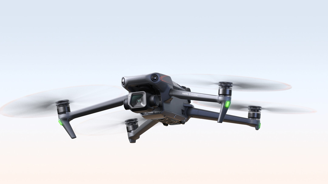
With 45 minutes of flight time and a 32 km transmission range, it can cover multiple towers per sortie. The optional RTK module provides centimeter-level accuracy for repeat inspections and change detection.
At its price point, the Mavic 3 Enterprise offers the best value for visual tower inspection without compromising on professional-grade features. It integrates with DJI Terra for 2D maps and 3D models, turning inspection imagery into actionable engineering data.
DJI Matrice 4T Thermal
The Matrice 4T is engineered for tower inspections requiring both visual and thermal data. Its integrated payload combines a 48 MP camera, 112× hybrid zoom, and a 640×512 thermal sensor (up to 1280×1024 in High-Res Mode) to detect overheating components, loose connections, and insulation failures invisible to standard cameras.
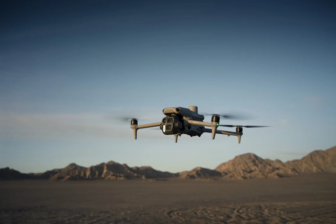
With 49 minutes of flight time and a compact 1,219 g weight, it is highly portable while delivering enterprise-grade inspection performance. The laser rangefinder measures up to 1,800 meters, and the NIR auxiliary light supports low-light operations.
The RTK module provides the precision needed for accurate geotagging and repeat inspections. For teams that need to identify electrical and thermal anomalies alongside structural defects, the Matrice 4T is the most capable compact solution available.
DJI Mini 4 Pro
The Mini 4 Pro is the lightest option at under 249 g, ideal for operations with strict weight restrictions or as a portable backup platform. It is the first mini-series drone with omnidirectional obstacle sensing—a critical safety feature when navigating complex tower structures.
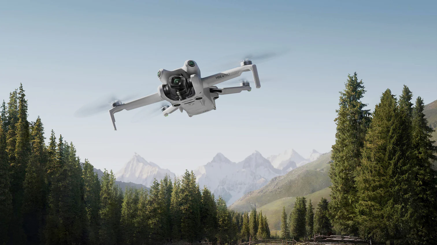
Flight time is 34 minutes with the standard battery and 45 minutes with the Plus battery. O4 video transmission provides a range of up to 12.4 miles, allowing inspectors to maintain a safe operating position.
However, the Mini 4 Pro lacks optical zoom and thermal capabilities. It is best suited for basic visual inspections, site reconnaissance, and as a lightweight backup. For operators in weight-restricted environments or those needing a simple drone for preliminary assessments, it offers an accessible entry point.
DJI Matrice 350 RTK
The Matrice 350 RTK is the flagship industrial drone for serious tower inspection operations. With a 2.7 kg payload capacity, it can carry up to three payloads simultaneously—visual, thermal, and LiDAR—for comprehensive tower assessment in a single flight.
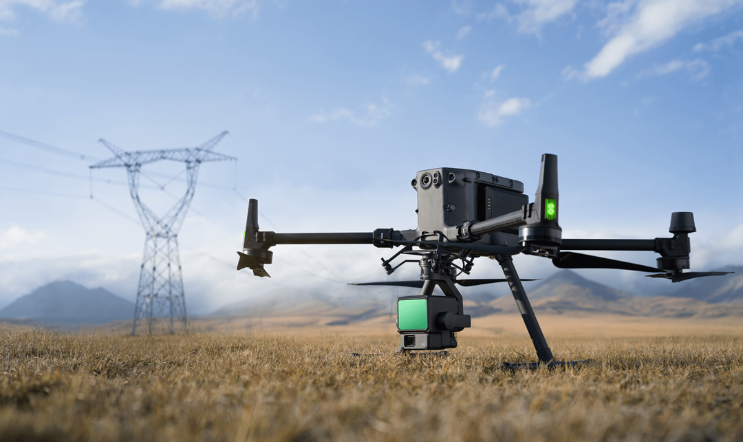
Flight performance is outstanding: 55 minutes of endurance, 23 m/s max speed, and a 7,000 m service ceiling. IP55 protection and an operating range of –20°C to 50°C ensure reliable operation in harsh, high-altitude conditions.
Its robust design, proven reliability, and extensive payload ecosystem make the Matrice 350 RTK the platform of choice for large-scale tower inspection programs. For enterprise teams needing a workhorse capable of handling the toughest missions, it delivers the performance and durability serious operations demand.
Autel EVO II Pro
The EVO II Pro features a 1-inch CMOS 20MP sensor with adjustable aperture (f/2.8–f/11) for high-quality tower inspection imagery. 6K video and 16× digital zoom allow both wide-area context and close-up detail capture.
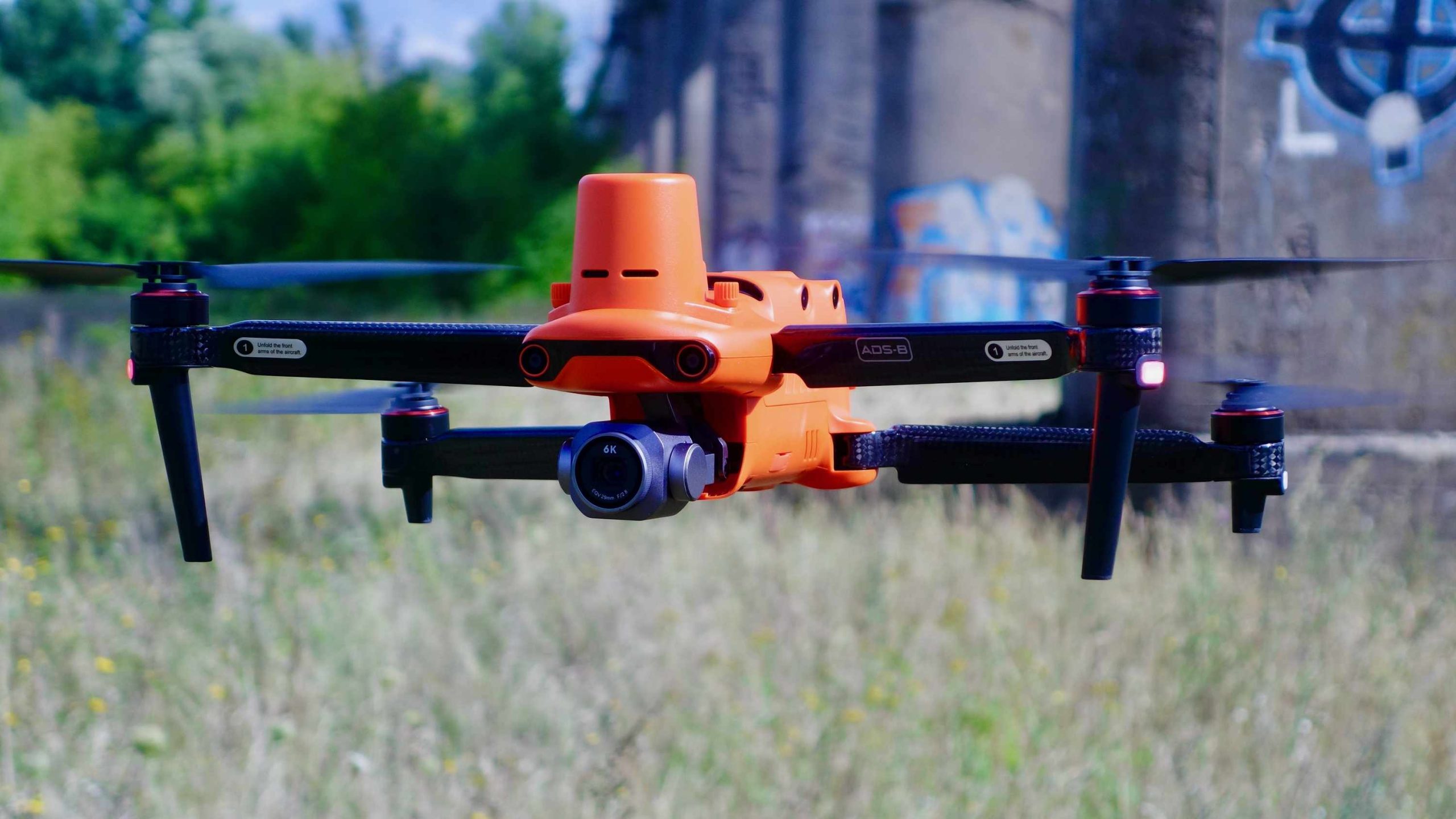
With 40 minutes of flight time and 5.5-mile (9 km) transmission range, it can cover multiple towers per sortie. Level 8 wind resistance makes it suitable for windy tower sites.
The optional RTK module provides accuracy for repeat inspections. However, the EVO II Pro lacks integrated thermal, high-zoom optical, and advanced obstacle avoidance features increasingly standard on enterprise platforms. It remains a solid option for operators already in the Autel ecosystem or those needing a capable visual inspection drone.
Skydio X10
The Skydio X10 is built around Skydio Autonomy — an AI-driven system enabling real-time obstacle avoidance and 360° awareness. This is critical for tower inspection, where guy wires, antennas, and cables create a dense obstacle field that challenges conventional drones. The X10 can operate without GPS and in zero-light conditions.
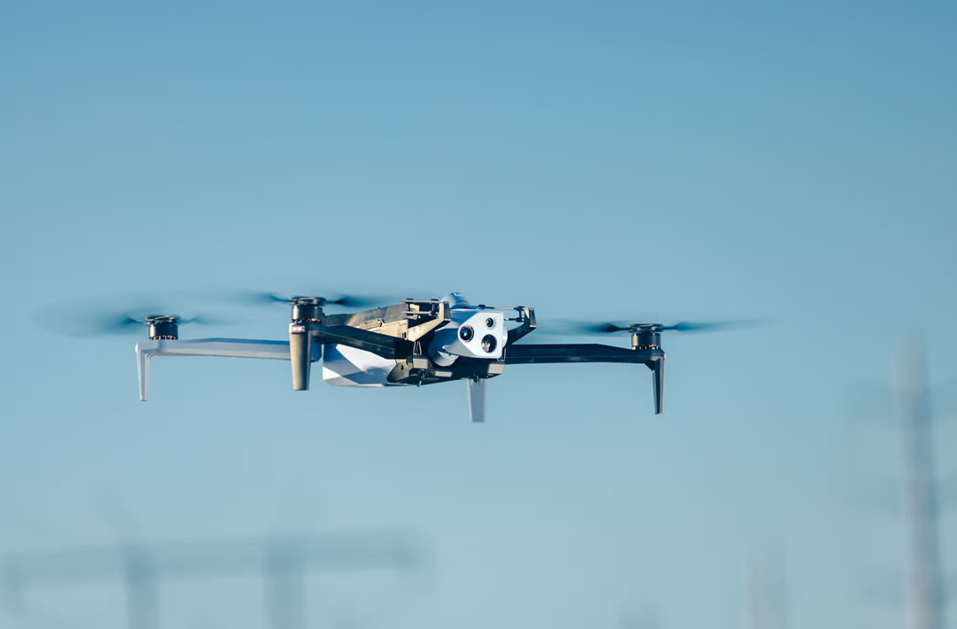
The VT300-Z sensor package includes a 64 MP narrow camera and 48 MP telephoto, with a 50 MP wide camera also available. Thermal sensitivity goes down to ≤30mK. Onboard processing enables real-time 2D orthomosaic and 3D modeling without external processing.
With 40 minutes of flight time, IP55 protection, and EMI resistance, the X10 is built for critical infrastructure inspection. For operators prioritizing autonomous flight and US-made, NDAA‑compliant platforms, it offers a sophisticated, AI-driven alternative.
Voliro T
The Voliro T is fundamentally different from any other drone on this list. Its tiltable rotor design enables 360° omnidirectional mobility—allowing it to inspect vertical walls, horizontal ceilings, and the underside of complex tower geometries that conventional drones cannot reach.
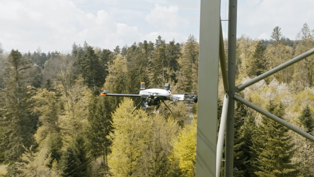
It can apply up to 30 N of force, enabling contact-based non-destructive testing (NDT)—ultrasonic thickness measurements, EMAT, and dry film thickness gauging. This goes far beyond visual inspection, allowing inspectors to measure material integrity, detect corrosion, and assess structural health at the component level.
With swappable payloads for UT, EMAT, DFT, and gas sensors, the Voliro T delivers consistent, repeatable results even in GPS‑denied or windy conditions. For tower inspection teams that need quantitative measurements—not just photos—the Voliro T offers capabilities no conventional drone can match.
For example, communication towers are generally easier and faster to inspect because they usually have standardized structures. A telecom tower inspection may only require high-resolution images to check antenna systems, cables, mounting brackets, and visible corrosion. In this case, a professional drone with an RGB zoom camera is usually sufficient, and the cost may range from $100 to $500 per tower.
Power transmission towers typically require more detailed inspections because operators need to identify issues such as damaged insulators, overheating components, corrosion, loose hardware, and vegetation interference. These inspections often involve thermal cameras, higher-resolution imaging, and more detailed reporting. As a result, costs are usually higher, ranging from $200 to $1,500 per tower.
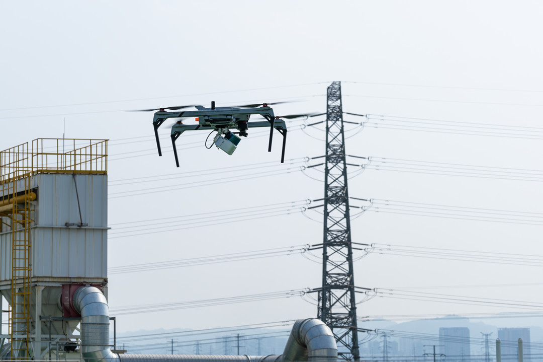
Wind turbine inspections are among the most complex because of their height, size, and safety requirements. A complete inspection may include the tower structure, blades, nacelle, and electrical systems. Advanced sensors and specialized workflows can increase the cost to $500–$3,000 or more per turbine.
Inspection Scope Has a Major Impact on Pricing
Not every drone inspection requires the same level of detail.
A basic visual inspection is mainly used for routine monitoring. The drone captures images and videos that allow operators to identify obvious issues such as damaged components, missing parts, or visible corrosion. These inspections require less flight time and minimal data processing, making them the most affordable option.
A professional inspection requires much more detailed information. Operators may use drones equipped with optical zoom cameras, RTK positioning, and automated flight paths to capture consistent images of every section of the tower. The final deliverables may include organized inspection photos, defect locations, and maintenance recommendations.
For critical infrastructure, companies often require advanced inspections. These may combine RGB cameras, thermal sensors, LiDAR scanners, and AI-based analysis. The result is not just a collection of images but a complete digital record of the asset, including 3D models and detailed defect analysis.
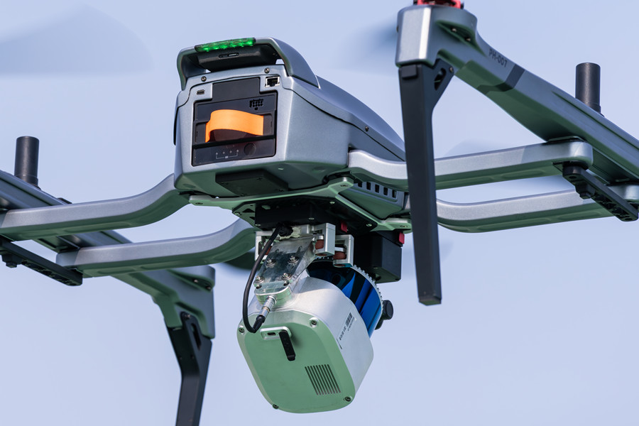
The more detailed the inspection data needs to be, the higher the cost.
Drone Equipment and Sensor Selection Affect Inspection Cost
The drone platform itself also influences the final price.
A basic consumer drone may cost only a few thousand dollars, but it is usually not designed for professional tower inspection. These drones often have limitations in wind resistance, zoom capability, positioning accuracy, and data management.
Professional inspection drones usually include enterprise-grade features such as RTK positioning, high-resolution zoom cameras, thermal payloads, obstacle avoidance, and industrial communication systems. These systems typically cost between $5,000 and $30,000+, depending on configuration.
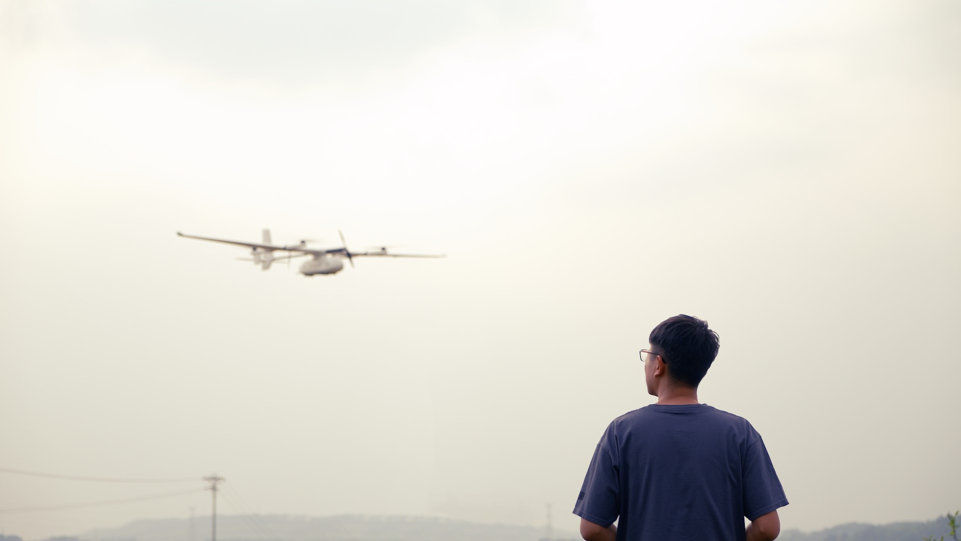
For large-scale infrastructure inspection, companies may choose fixed-wing VTOL drones. Compared with multirotor drones, VTOL platforms provide much longer endurance and can cover large areas efficiently. They are especially suitable for inspecting remote transmission networks or hundreds of towers distributed across large regions. However, the initial investment can exceed $50,000 or even $100,000 for advanced systems.
Drone Inspection vs. Traditional Tower Inspection Cost
One of the biggest reasons companies adopt drones is cost reduction compared with traditional manual inspections.
Traditional tower inspections often require trained climbers, safety equipment, transportation, and sometimes temporary shutdowns. A technician must physically climb the structure to capture inspection data, which increases both labor costs and safety risks.
Depending on the tower type, traditional inspection can cost:
Drone inspections significantly reduce the need for climbing and allow inspections to be completed faster. In many cases, companies can reduce inspection costs by 30–70%, especially when inspecting large numbers of towers.
For example, a telecom operator inspecting 1,000 towers annually may spend around $1 million using traditional methods at $1,000 per tower. With drone inspection, the cost could potentially drop to around $300,000–$500,000 depending on requirements.
Drone Inspection Service vs. Buying Your Own Drone
Companies also need to decide whether to hire a drone inspection service provider or purchase their own equipment.
For organizations that only inspect a small number of towers each year, outsourcing is usually more economical. There is no need to invest in expensive equipment, train pilots, or maintain drones.
However, for companies inspecting hundreds or thousands of towers annually, owning a drone system may provide a lower long-term cost.
For example, a professional inspection drone package may require an initial investment of $15,000–$30,000. If the system is used to inspect several hundred towers each year, the equipment cost per tower becomes much lower over time.
Want to see how these numbers break down? Check out our complete 2026 drone services pricing guide for inspection rates, cost benchmarks, and ROI calculations.
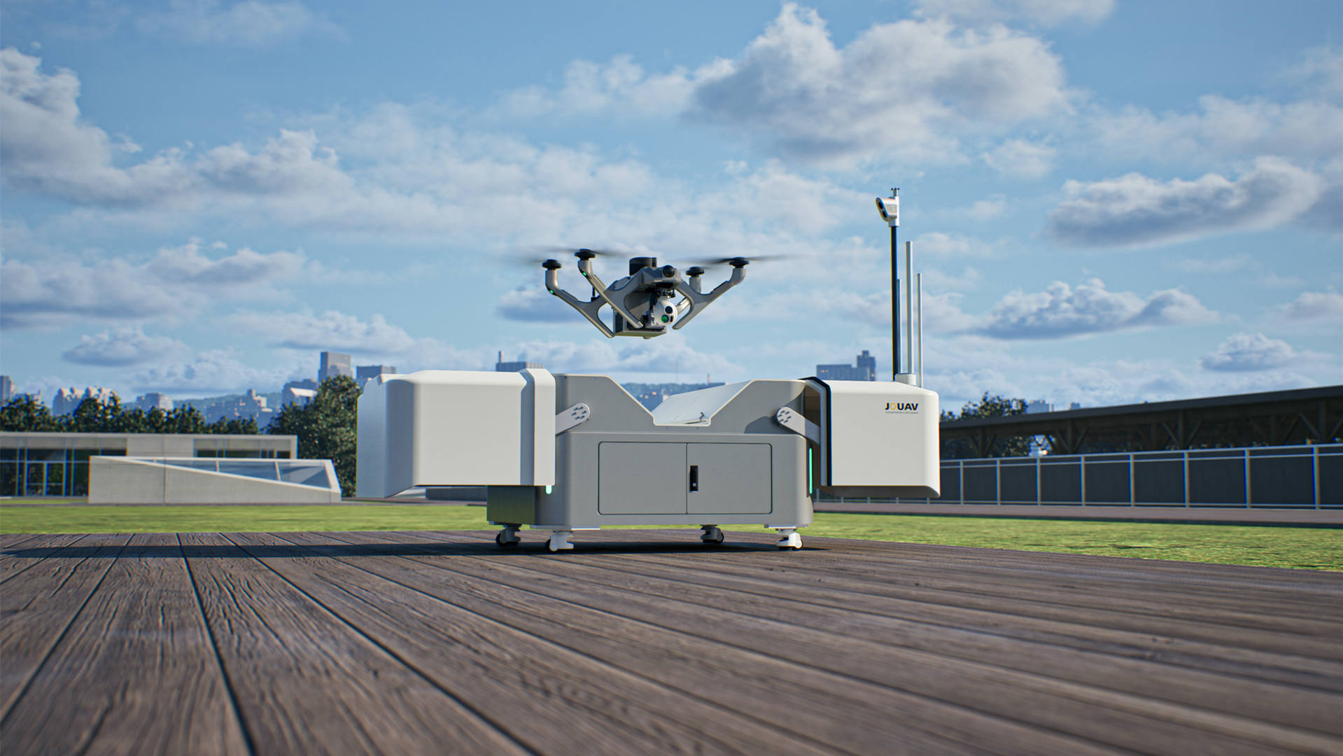
Large infrastructure operators may go one step further by adopting automated drone stations, often called drone-in-a-box solutions like JOS-P200. These systems allow scheduled inspections, remote operation, automatic charging, and continuous monitoring, making them suitable for large telecom or energy networks.
How Can Companies Reduce Drone Tower Inspection Costs?
Although drone inspection is already more cost-effective than traditional climbing inspections, companies can further reduce the cost per tower by improving operational efficiency, optimizing equipment selection, and adopting automation.
Standardize Inspections with Automated Flight Missions
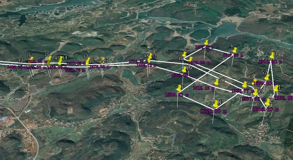
Manual drone flights often depend heavily on pilot experience, which can lead to inconsistent data collection and longer inspection times. By using automated waypoint missions, companies can create repeatable inspection workflows that allow drones to follow the same routes, capture images from consistent angles, and reduce pilot workload.
For telecom operators and utility companies managing large numbers of towers, standardized flight missions improve inspection efficiency and reduce the average cost per tower.
Optimize Mission Planning and Inspect Multiple Towers Efficiently
A large portion of inspection costs comes from transportation, site preparation, and personnel deployment rather than actual flight time.
Companies can lower costs by grouping nearby towers into the same inspection mission, optimizing travel routes, and maximizing daily inspection capacity. This is especially valuable for large-scale projects involving hundreds or thousands of towers.
Choose the Right Payload for Each Application
Advanced sensors can improve inspection accuracy, but using unnecessary equipment increases costs.
For routine telecom tower inspections, high-resolution RGB cameras with optical zoom are often sufficient. Thermal cameras are more suitable for detecting electrical issues, while LiDAR is valuable for 3D reconstruction and structural analysis.
Selecting the right drone payload ensures companies achieve the required inspection quality without overspending.
Deploy Automated Drone-in-a-Box Solutions for Large-Scale Networks
For mission-critical infrastructure requiring frequent inspections, emergency response, or continuous monitoring, automated drone-in-a-box solutions can significantly reduce long-term operating costs.
Systems such as the JOUAV JOS-P200 autonomous drone solution combine industrial UAVs with automated docking stations, remote operation, intelligent battery management, and cloud-based mission control. These systems reduce the need for on-site pilots, minimize travel costs, and enable scheduled inspections or rapid post-storm assessments.
By moving from periodic manual inspections to automated monitoring, companies can improve efficiency and reduce operational expenses across large infrastructure networks.
Improve Data Processing with Cloud and AI Tools
Inspection costs are not only related to flight operations. Reviewing thousands of images and generating reports can also require significant labor.
Cloud-based inspection platforms and AI analysis tools can automate image management, defect detection, and reporting, allowing maintenance teams to identify issues faster and make better decisions.
OpenTower iQ—The Telecom Specialist
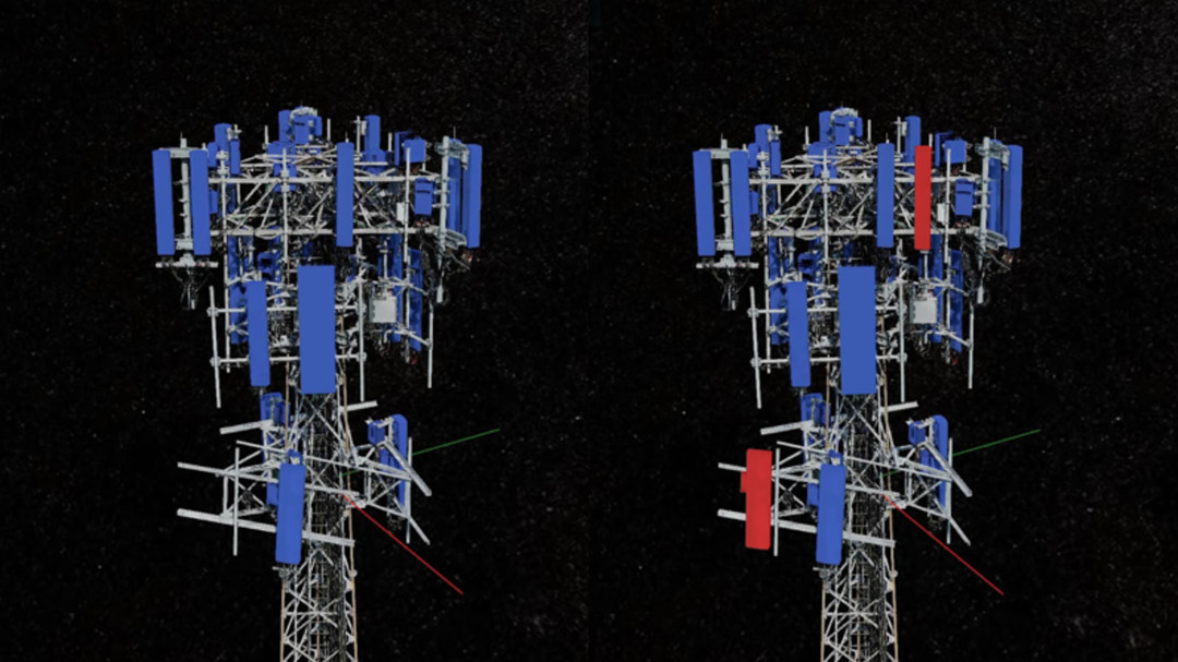
OpenTower iQ, built by Bentley Systems, is purpose-built for telecom tower management. It automatically transforms drone-captured data into a 3D model of the tower, generates engineering-grade DWG drawings, produces reports, and helps predict maintenance needs.
Key capabilities:
- Automated defect detection inside the model
- Asset condition tracking with geotagged images
- AI-powered identification of tower components
- Integration with popular CAD platforms, including Autodesk
- Reduces operational and maintenance costs to an average of $2,200 per tower per year
Best for: Tower owners and operators who need engineering-grade deliverables—drawings, inventories, and maintenance predictions.
vHive—Autonomous Fleet Operations
vHive is an enterprise-grade software platform for autonomous drone data collection and digital twin creation for complex assets like cell towers. It allows tower owners to digitise large portfolios using off-the-shelf drones.
Key capabilities:
- Autonomous drone flights with minimal manual piloting
- AI-powered 3D modelling and photogrammetry
- Automated analytics for condition assessment and equipment verification
- Cloud-based administration for large telecom portfolios
- Industry-first RF interference resiliency—solves the interference challenge that has long been the Achilles' heel of telecom tower drone surveys
Best for: Operators managing thousands of assets across multiple regions who need to scale inspections without scaling pilots.
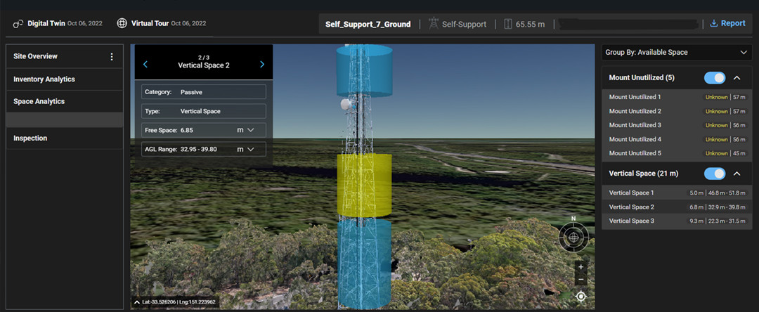
DroneDeploy — Workflow Automation
Programmed, a leading maintenance services provider, adopted DroneDeploy to streamline asset inspections. The results are compelling:
- Cut tower inspection time by 70%—from 16 hours to 5 hours per tower
- $30,000 saved per project by replacing manual quantity surveying
- Double surveyor efficiency through automated measurement tools
- Eliminated the need for workers to climb telecom towers—reducing high-risk site exposure
Key capabilities:
- Asset inspection flight type for transmission towers and substations
- Change detection over time
- Vertical facade inspections for tower structures
- Automated thermal and visual inspection workflows
Best for: Inspection teams who need to streamline operations, reduce costs, and eliminate manual climbing.
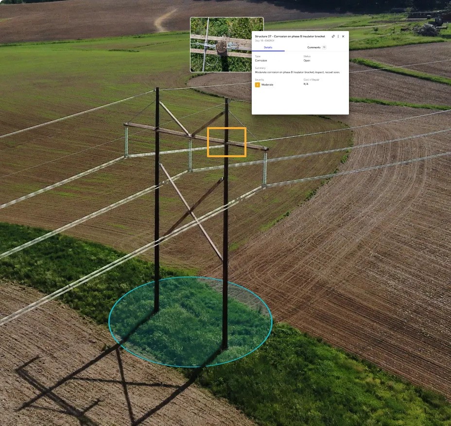
Skyfish—Precision 3D Models
Skyfish creates cell tower 3D models that are measurable and accurate up to 1/32 of an inch. Within the model, teams can make focused, precise measurements—like measuring steel thickness—identify maintenance needs, generate reports, and export to CAD.
Key capabilities:
- End-to-end hardware and software platform
- Fully autonomous complex inspection patterns
- Advanced object detection and avoidance algorithms
- Engineering-grade 3D models for structural assessment
Best for: Teams that need millimeter-accurate measurements for engineering analysis and CAD exports.
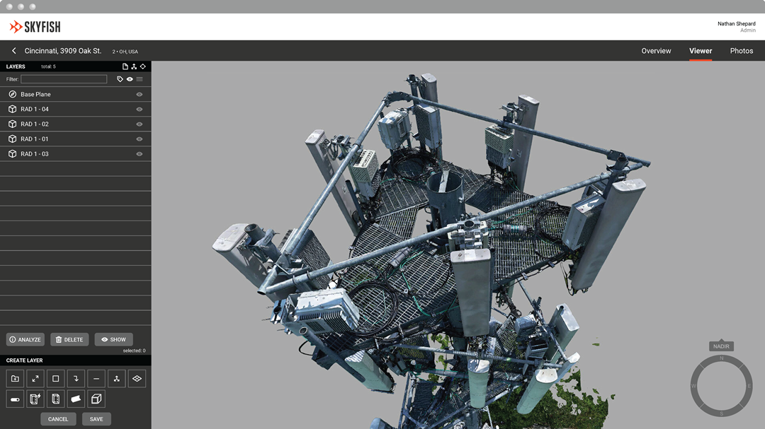
Optelos—AI-Powered Visual Intelligence
Optelos provides an AI-powered visual inspection platform that transforms visual data into actionable insights. It offers flexible deployment options—fully managed cloud, hybrid with customer-owned storage, or on-premise—to meet regulatory and data governance requirements.
Key capabilities:
- Per-project pricing—no costly upfront subscriptions
- Pre-built AI models for rapid deployment
- Bring your own model or build custom solutions
- Telecom: Drone-enabled inspections detect equipment misalignments, performance issues, and structural conditions
Best for: Organizations with specific data governance requirements who need flexible deployment options.
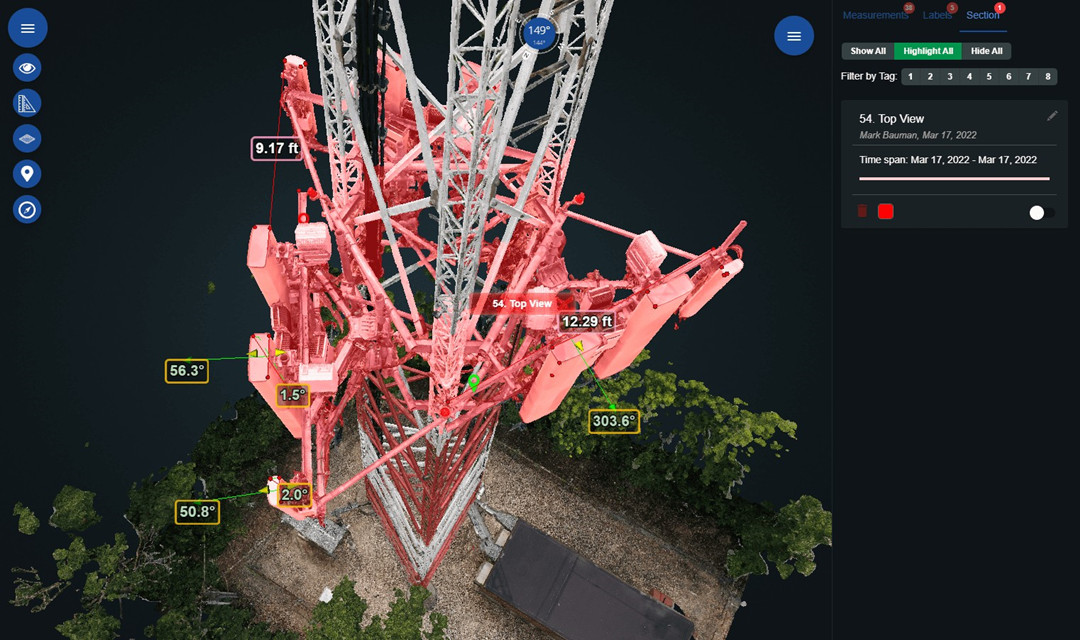
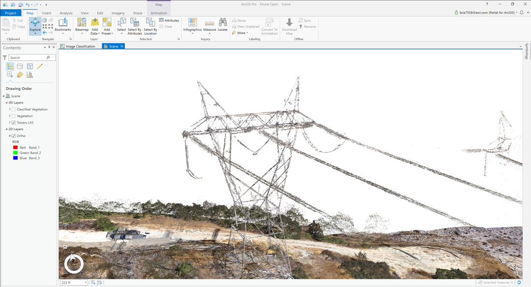
ArcGIS Drone2Map—GIS Integration
ArcGIS Drone2Map allows inspectors to review drone imagery and find potential problems or areas that require maintenance. It integrates directly with the ArcGIS ecosystem, enabling seamless sharing of inspection results through reports and your ArcGIS organization.
Key capabilities:
- Create inspection projects from drone imagery
- Import and modify inspection schemas
- Identify assets needing repair
- Share findings through reports or ArcGIS organization
Best for: Teams already using ArcGIS who need seamless GIS integration.
Challenges of Drone Tower Inspection
Let's be honest: drone tower inspection isn't always smooth sailing. For all the benefits—safety, speed, cost—there are real challenges that operators face every day.
Here's what you're up against.
Technical and Operational Challenges
Obstacle avoidance and collision risk
Towers are dense with obstacles: guy wires, antennas, brackets, cables, and cross-bracing. Many of these are thin and difficult for standard obstacle avoidance systems to detect. Flying close enough to capture detailed images means flying close enough to hit something.
The challenge is compounded by the size, weight, and power (SWaP) constraints of inspection drones. It's often impractical to deploy heavy LiDAR or computation-intensive sensors on smaller platforms.
Electromagnetic interference (RFI)
This is the "Achilles' heel" of drone tower inspection. Telecom towers generate significant radio-frequency interference that can disrupt drone signals, causing GPS drift, magnetic interference, or temporary signal loss. The steel structure itself blocks signals, and guy wires and antennas create a complex electromagnetic environment that can interfere with drone navigation and data transmission.
Some software providers like vHive have developed RF interference-resilient systems to address this, but it remains a significant operational hurdle.
GPS and signal loss
Towers are steel. Steel blocks signals. Flying close to or behind tower structures can cause GPS dropout or loss of control link. Even minor issues like GPS drift or temporary signal loss can escalate quickly.
Line-of-sight restrictions
Maintaining visual line of sight (VLOS) is an FAA requirement for most operations. But towers are tall, and pilots often need to position themselves at awkward angles to maintain sight of the drone. Terrain, vegetation, and the tower structure itself can create non-line-of-sight (NLoS) conditions that weaken signal quality.
Weather dependence
Drones have weather limits. Wind speeds above 20–25 mph can cause instability, making it difficult to maintain a safe standoff distance. Rain, ice, and extreme temperatures can ground operations entirely. Towers are often in exposed locations where weather is more severe.
Data and Software Challenges
Data volume
The explosion of visual data from drone inspections can create unexpected challenges. A single tower inspection can generate thousands of images. A 250-mile transmission corridor with 2,600 towers can produce over 120,000 images.
Without a unified operations platform, this data often hits a dead end. Utilities and inspection teams end up with fragmented data in multiple formats, creating gaps in visibility and coordination.
Data processing and analysis
Manual review of inspection imagery is time-consuming. One drone flight can take nearly 1,000 seconds to review manually. Without AI-powered analytics, inspection teams face delays, fragmented data, and missed anomalies, leading to higher maintenance costs and slower decision-making.
Training data scarcity
AI models for defect detection require large, labeled datasets. But there's a lack of freely available training data for tower inspection, and collecting it is difficult. This limits the effectiveness of AI-powered inspection systems.
Photogrammetry challenges
Conducting photogrammetry-based inspections of towers is a challenging exercise. Pilots need to plan carefully to maintain sufficient overlap between continuous image frames and adjacent flight legs. Non-metric cameras introduce instabilities that become major impediments to achieving high-accuracy measurements.
Regulatory and Compliance Challenges
FAA Part 107 and BVLOS
All commercial drone operations require FAA Part 107 certification. BVLOS (beyond visual line of sight) operations currently require FAA waivers, which are often limited to specific areas. For long transmission corridors spanning thousands of miles across easements and public rights-of-way, this is a significant constraint.
Standardization gaps
The FAA has identified a need for standardization of sUAS operations for vertical structure inspections, but this is still evolving. Part 108 — the FAA's forthcoming regulation for BVLOS — will change this by creating a standardized framework for certificated operators.
DroneZone submission requirements
All requests for vertical structure inspections should be submitted through DroneZone, even for LAANC-enabled facilities. This adds administrative overhead to operations.
No standardized pilot certification for tower inspection
Unlike tower climbers who hold valid rescue training certifications, no drone operator certification exists at a comparable regulatory level for tower inspection. This creates a compliance gap.
Environmental and Site Challenges
Remote locations
Towers are often in hard-to-reach places: swamps, steep slopes, dense vegetation, or mountains. Getting equipment and personnel to site adds time and cost. Remote areas also have limited network coverage, making real-time data transmission difficult.
Vegetation encroachment
Vegetation growing near tower sites and power line corridors is a persistent challenge. It can obstruct flight paths, create collision hazards, and cause power outages.
Complex tower geometries
Pylon structures vary widely in design. Complex trajectory design due to diverse pylon structures makes automated inspection difficult. Each tower type may require a different flight plan.
People and Skills Challenges
Pilot skill requirements
A detailed aerial inspection of a cell tower requires a highly skilled UAV operator who can safely and competently generate sensor data for the relevant parts of the cell tower. Not every drone pilot has the skills for complex tower inspection.
Training gaps
Drone training courses often lack context-fitting considerations for specific industries. There's a lack of specialized courses for construction and infrastructure inspection activities.
Standardized training and assessment
There is no standardized training, assessment, or implementation plan for statewide or industry-wide adoption of drone tower inspection. This creates inconsistency in quality and safety.
Drone Tower Inspection Workflow — Step by Step
A successful tower inspection isn't just about flying a drone and taking pictures. It's a structured process with clear phases — and skipping any of them usually means re-flying the job.
A drone-based tower inspection typically follows four main steps:
- Preparation — Site review, equipment checks, and flight planning
- Capture — The actual flight and data collection
- Processing — Turning raw images into usable data
- Analysis and Reporting — Identifying issues and delivering findings
Let's walk through each phase.
Step 1 — Pre-Flight Preparation
This phase sets you up for success. Cut corners here, and you'll be re-flying towers.
Site assessment
Before you leave the office, review the tower location, height, access, and airspace. Check for any potential hazards — guy wires, vegetation, nearby structures. Verify airspace restrictions and submit any required FAA authorizations through DroneZone. A standard preparation workflow includes site review, flight plans, and FAA waivers.
Equipment check
Inspect your drone, batteries, camera, and all accessories. Ensure firmware is up to date. Confirm you have enough batteries for the number of towers you plan to inspect. Check that your payload — whether it's a high-zoom camera, thermal sensor, or LiDAR — is properly mounted and calibrated.
Permissions and access
Confirm access to the site. Be prepared for locked gates, wrong codes, and alarm issues. If the site is remote, factor in travel time and vehicle access. For large portfolios, use software like DroneDeploy to create Locations for each asset before you arrive.
Flight planning
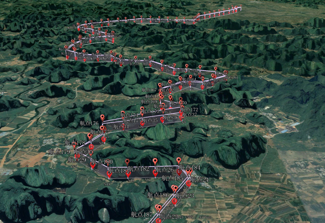
Plan your flight path based on the tower type. For a simple monopole, a basic orbit might suffice. For a complex lattice tower with guy wires, you'll need a more detailed route that captures all structural elements. Use flight planning software—JOUAV FlightSurv, vHive, or DroneDeploy—to pre-plan automated flight paths. The objective is to achieve very high-resolution photos (ideally ≤ 1 mm/px) with around 80% image overlap.
Safety briefing
Review emergency procedures, no-fly zones, and communication protocols. Ensure everyone on site knows their role and understands the flight plan.
Step 2 — Data Capture (The Flight)
This is where the drone does its work. A single pilot can scan up to six miles in a day or perform dozens of pole inspections with detailed visuals.
Takeoff and systems check
Perform a pre-flight check of all systems—GPS lock, battery levels, camera settings, and control link. Take off and hover briefly to confirm everything is working as expected.
Flight pattern
Use a combination of autonomous and manual flight. Common patterns for tower inspection include:
- Orbit paths: Circle the tower at multiple heights to capture 360° coverage
- Ladder paths: Fly up and down the tower, capturing images at regular intervals
- Vertical inspection modes: Maintain a precise, fixed "stand-off" distance from the tower face, capturing high-resolution "flat" imagery that can be processed into specialized vertical orthomosaics
Data capture
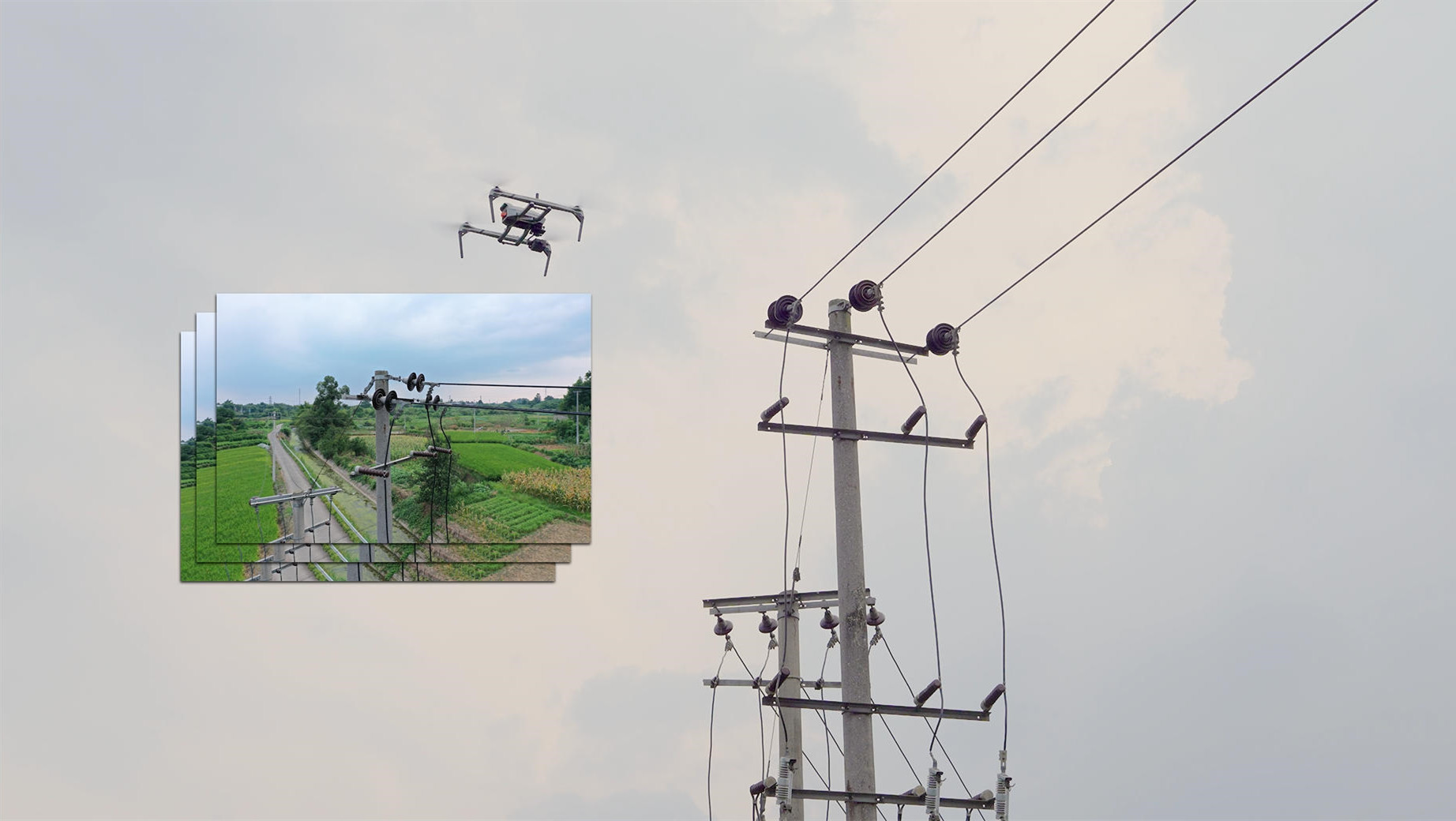
Capture high-resolution images from multiple angles and heights. A typical site inspection yields hundreds of photos—sometimes over 1,000 for a complex tower. Use zoom to capture detailed images of specific components: antennas, mounts, cables, guy wires, lighting, corrosion, and vegetation encroachment. Tower inspections that once took half a day now take under two hours.
Thermal inspection
If equipped with a thermal camera, capture thermal data to identify overheating components, loose connections, and insulation failures. Thermal imaging can detect problems invisible to the naked eye.
Obstacle awareness
Towers are dense with obstacles — guy wires, antennas, brackets, cables. Maintain situational awareness at all times. Use obstacle avoidance systems as a safety net, not a license to fly carelessly.
Landing and post-flight check
Land safely and perform a post-flight inspection of the drone. Check for any damage, battery levels, and confirm all data has been captured.
Step 3 — Data Processing
The flight is only half the job. The real value comes from processing and analyzing the data.
Image upload
Upload images and data to your processing platform — OpenTower iQ, vHive, DroneDeploy, Pix4D, or ArcGIS Drone2Map. In a typical workflow, the team uploads and enters all collected data upon returning to the office.
3D modeling and photogrammetry
Process images into 3D models using photogrammetry software. vHive, for example, uses AI-powered photogrammetry to create digital twins of telecom towers. OpenTower iQ automatically transforms drone-captured data into a 3D model of the tower.
Point cloud creation (LiDAR)
If LiDAR data was collected, process it into point clouds. The workflow typically includes point cloud creation, data cleaning, stitching, and QA/QC.
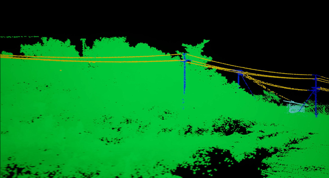
Image adjustment
Some software packages require adjusting images after import. ArcGIS Drone2Map, for example, uses an "Adjust Images" processing step to apply photogrammetric corrections before inspection.
Step 4 — Analysis and Reporting
This is where the data becomes actionable.
Inspection creation
Use software to review the imagery and identify potential problems or areas requiring maintenance. In ArcGIS Drone2Map, you create an inspection project, import an inspection schema, and create inspection features to identify assets that need repair.
AI-powered analysis
AI tools can dramatically speed up analysis. The vHive platform uses AI and computer vision to identify installed equipment, measure sector alignment, detect damage or corrosion, flag unauthorized modifications, and produce engineering-ready reports. FlyPix AI can review one drone flight in three seconds — compared to nearly 17 minutes manually.
Change detection
Compare current inspection data against previous inspections. Systems like the University of Waterloo's platform enable pixel-wise alignment of images from different time windows to detect changes and anomalies — even detecting bolt loosening in telecom towers.
Report generation
Generate inspection reports that document findings, identify issues, and recommend maintenance actions. Deliverables may include:
- Annotated photos with geotags
- 3D models and digital twins
- Engineering-grade drawings (DWG format)
- Point clouds (LAS, DEM, DTM formats)
- Inspection reports (DOCX, KMZ formats)
Share findings
Share results with tower owners and operators through reports, cloud platforms, or GIS integration. Captured data is automatically transferred into the asset-management and compliance systems operators already use.
Common Pitfalls — And How to Avoid Them
Incomplete or low-quality imagery
If inspectors uncover gaps, inconsistencies, or low-quality imagery (e.g., dark photos or missing angles) during reporting, some or all steps must be repeated — significantly increasing time and cost.
Fix: Plan your flight path carefully. Use automated flight modes for consistency. Check image quality during the flight, not after.
Data fragmentation
Without a unified platform, data often hits a dead end. Utilities and inspection teams end up with fragmented data in multiple formats, creating gaps in visibility and coordination.
Fix: Use an end-to-end platform like vHive, DroneDeploy, or OpenTower iQ that handles capture, processing, and reporting in one workflow.
Manual review bottlenecks
Manual review of inspection imagery is time-consuming. One drone flight can take nearly 1,000 seconds to review manually.
Fix: Use AI-powered analytics tools to automate defect detection and speed up review.
Read More
Here’s the question every drone pilot hears: How much should I charge?
And here’s the honest answer: $100 to $500 an hour, or $300 to $5,000 per project, depending on what you’re doi
Yeah, you’ve probably seen those LiDAR maps—the ones that strip away trees to reveal ancient ruins or show cityscapes in stunning 3D detail. They’re impressive.
But here’s a question

JOUAV Product News and Use Cases
Fixed-Wing VTOL Drones Insights and Industry Trends
Invitations to online demo events
 English
 中文
中文