Hainan is the tropical resort destination known as China’s Hawaii. In June 2020, the Chinese government announced a plan to transform the island province of Hainan into the world’s largest
What are the benefits of drone survey?
Even the most novice user knows that drones can be used for photography. The availability of unmanned aerial photography has led to its use in many sectors and produced incredible images. But is it good enough for your next mapping or surveying job? Let's take a look at some of the advantages of using drones for mapping and surveying.

Save time and money
The economic advantage of drone land surveying comes primarily from its low operating costs compared to its main competitors, airplanes, and helicopters, which are up to 10 times more expensive than drone topography. Besides, recent studies show drone surveying is up to five times faster than traditional land-based methods.

Provide high data accuracy
Drones have extremely high accuracy, with aerial mapping reaching centimeter-level accuracy and mapping accuracy generally reaching 1:1000. In addition, aerial mapping also has a wealth of 3D geographic information, which can capture the data of large-scale terrain.

Map inaccessible places safer
Drone topographic survey allows us to obtain extensive and reliable data from inaccessible locations, unsafe steep slopes, or hazardous terrain. This means that surveyors can create a 3D computer model of the object under study and take a series of measurements in the office, without necessarily needing to be in the field or in a hazardous area to obtain data.
What is the best drone for land surveying?
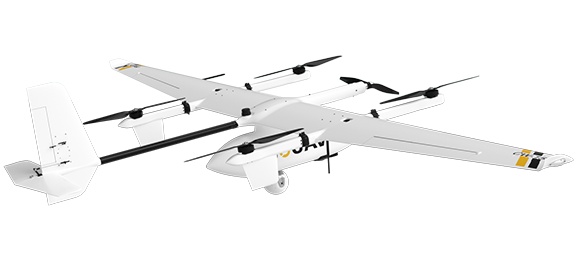
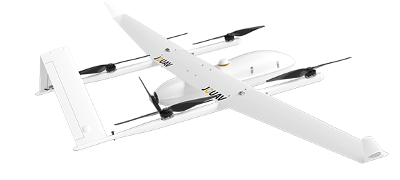
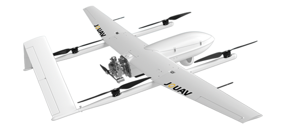
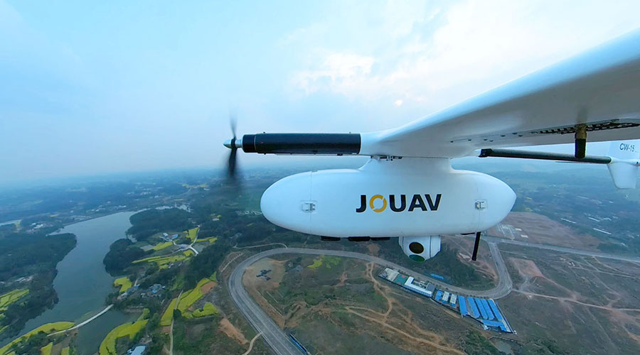
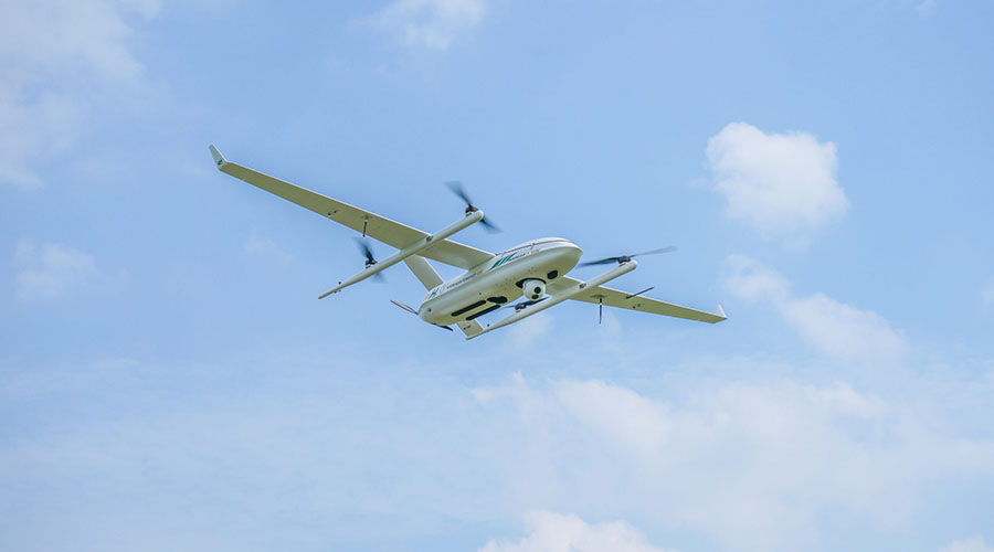
As the best drones for land surveying, JOUAV CW Series VTOL drones provide a comprehensive drone surveying solution, which has released drones that can carry different functions according to the different needs of users.
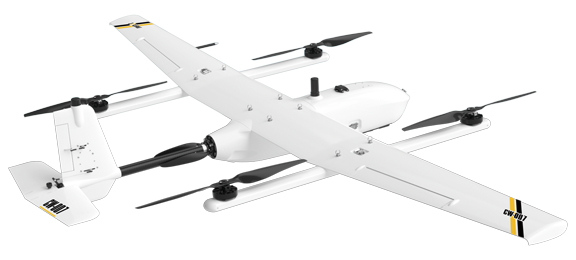
CW-007
A portable, integrated UAV platform that delivers exceptional reliability to our customers.
Vertical take-off and landing (VTOL)
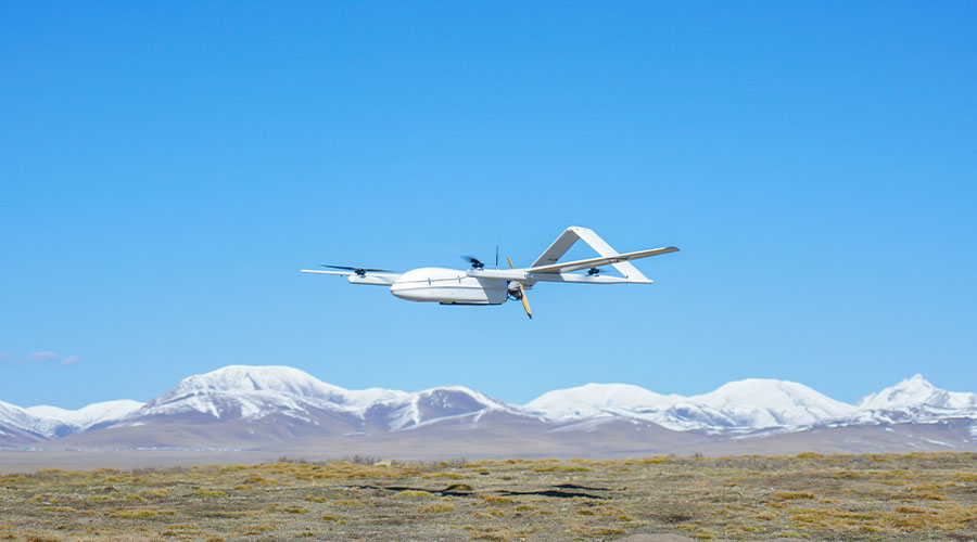
JOUAV VTOL drones (Vertical Takeoff and Landing) represent a hybrid approach that combines elements of quad-rotor and fixed-wing designs. They take off and land vertically like quadcopters, which means JOUAV drones can take off and land smoothly in narrow areas such as cliffsides, woods, or mountainous areas. Meanwhile, drones have the advantages of long endurance and fast flight speed of a fixed-wing drone, making them suitable for mapping large areas.

Up to 10 hours endurance/maximum load of 25kg
Through various methods such as aerodynamic optimization, power system optimization, and customized high energy density batteries, the JOUAV drone with longest flight time is 5 times longer than its competitors and can reach a maximum 10h flight time under heavy load conditions.
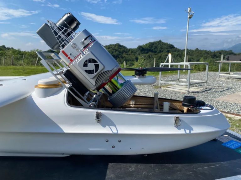
JOUAV drones can take orthophoto cameras, multi-cameras, gimbal cameras, hyperspectral cameras, multispectral cameras, atmospheric sensors, aeromagnetic and other mission equipment, and supports secondary development. The heavy lift drone can carry a weight from 0.8 to 25kg.
Down to 1cm (0.4 in) absolute accuracy
The JOUAV UAV uses both RTK and PPK modes. RTK is primarily used for precise centimeter-level autonomous vertical landings, and PPK is primarily used to output high-precision POS data to ensure a large reduction in image control points. The JOUAV RTK drone provides best-in-class absolute accuracy with vertical positioning accuracy down to 3 cm and horizontal positioning accuracy down to 1 cm, which allows the JOUAV UAV from high altitude to fly over and still provide low GSD images.
Flying in harsh environments
Through continuous power system optimization analysis and testing, the JOUAV UAV can fly efficiently at an altitude of 4,500 meters despite the thinner air. The drone is waterproof, ensuring that the aircraft can fly in light rain and snow. They can safely fly and collect data in winds of up to 12 m/s (28 mph).
The easiest and autonomous drones to fly
After pressing the take-off button, the drone takes off autonomously on a planned course, captures images, and then lands where it started. The operator does not need to do anything else during this process.
JOUAV drones also support a Terrain Following Mode based on a high-precision digital 3D map. With this feature, they can automatically generate a variable height route based on the measurement area and maintain a consistent ground resolution for better data results.
The safest drone to fly
JOUAV drones' forward and backward sensors have a detection range of up to 240m and a wide field of view. So you can be sure it will catch all obstacles in its path and avoid them effectively, guaranteeing a safe flight. The downward sensors allow a measurement range of 50m that can be performed to avoid dangerous landing sites.

STEP 1
Check regulations and weather. Before flying a drone, you need to check local regulations to ensure that the drone is allowed to fly in the location you want to survey. Also, make sure there is no rain, fog, snowfall, or strong winds on the day you plan to fly.
STEP 2
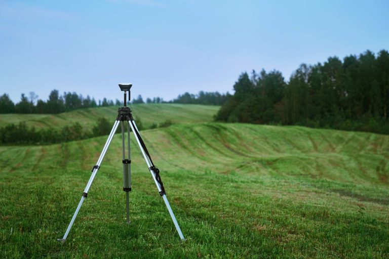
Set up ground control points. When setting up ground control points, we need to consider the quantity, quality, and distribution. For a drone like the JOUAV CW series, which has an RTK module, we recommend that 5 checkpoints be set for each project, as the drone already has the ability to georeference the photos it takes with better than 1cm accuracy.
STEP 3
Set up overlap and flight mode. For most drone aerial surveys, the photo overlap should be set to 75/75 and the flight mode should be "lawnmower mode" or a sweeping flight path back and forth over the entire site.
STEP 4
Create survey flight plans with FlightSurv. You just need to click and drag points around the area you want to survey or import a KML file. When setting up, you'll need to set the flight altitude based on the accuracy you want and be aware of objects up to the height, and differences in altitude.
STEP 5
Fly and collect data. Now you need to unpack and assemble the drone, follow the interactive checklist and check each parameter one by one. After pressing the take-off button, the drone takes off autonomously and captures images without the pilot doing anything.
STEP 6
Post-analysis. After a few flights, you need to upload the images to a post-processing software that generates a 3D map or an orthomosaic map. Based on the images provided, you can focus on finding volume, geographic location, altitude, or damage.
Real-world case studies of drone mapping and surveying
Survey professionals from all industries are using JOUAV CW Series drones for better and faster mapping. Below, we've selected a few real-world cases to help you understand how drones are helping to change aerial surveying.
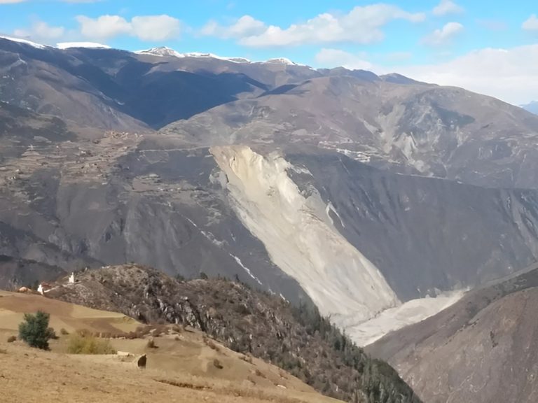
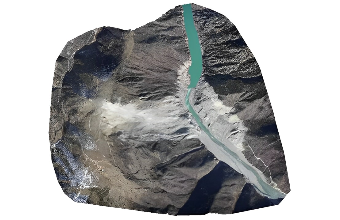
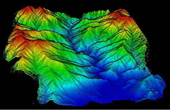
The Jinsha River, as the upper reaches of the Yangtze River, flows through four provinces including Qinghai, Tibet, Sichuan, and Yunnan in western China. On Oct. 11, 2018, a large-scale landslide occu
Aeromagnetic surveys are always a challenging task. They have traditionally involved the use of manned aircraft with a variety of heavy and expensive equipment in inhospitable and dangerous areas.
UA
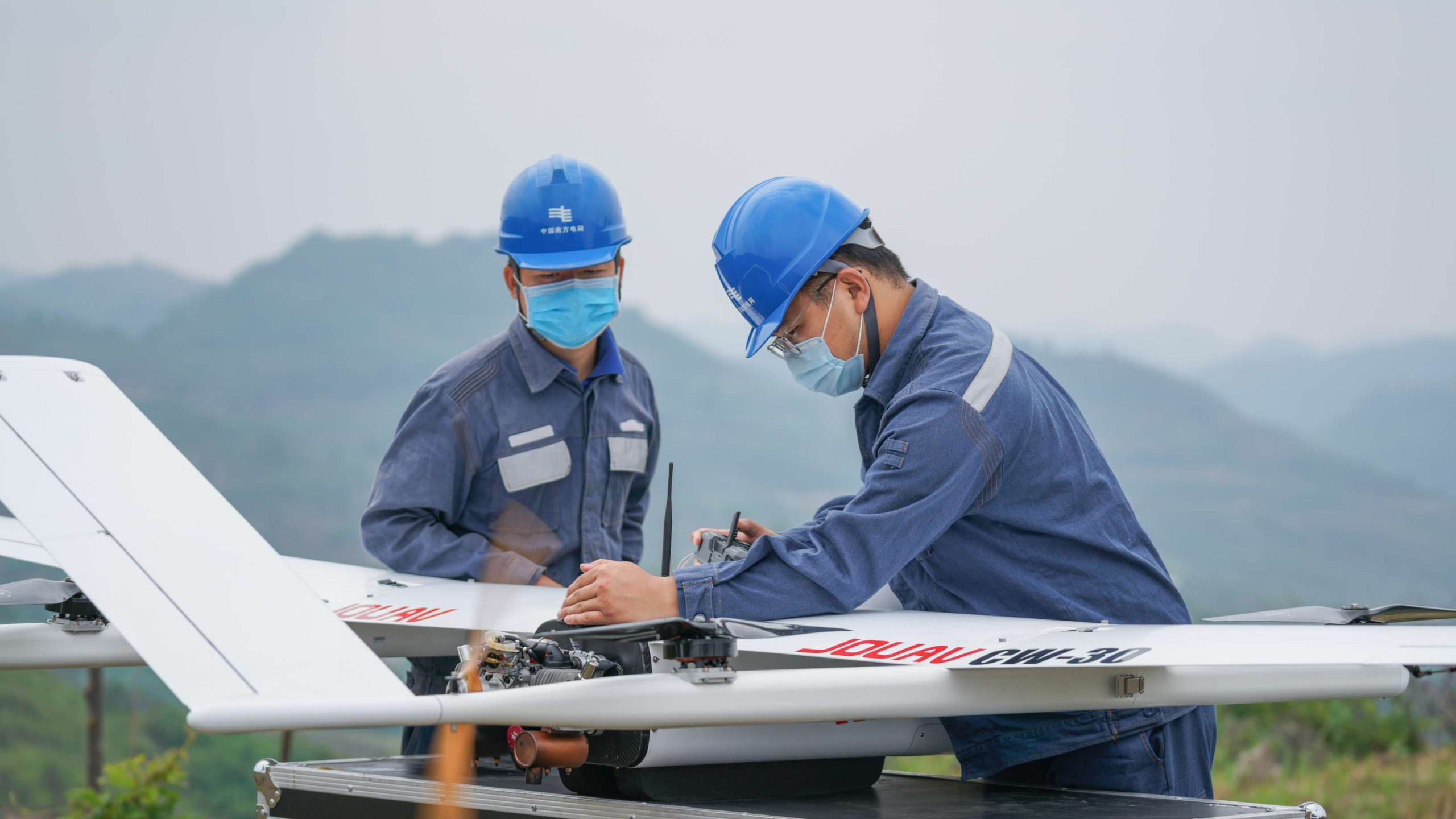
Guangdong Power Grid Company invests in, constructs, and operates power grids in the southern provinces of Guangdong. This company manages 19 municipal power supply bureaus, a multitude of production
China launched the third national land survey on Oct. 9, 2017. The purpose of the national survey is to thoroughly check the status of land use, collect accurate land data, and improve the mechanism o
The Yunnan Bureau of Nonferrous Geology used CW-25E to collect laser point cloud and orthophoto data of 950km² of forest in Yunnan Province, China, in just 8 hours. The captured 3D point cloud data he
Many industries require surveyors to provide maps of land areas. From determining the overall grade of an area to creating detailed maps of each square foot, drone mapping makes the surveyor's job easier, faster, and safer. Among the many industries that use drones for GIS surveying, some of the most important include:
Topographic Surveying
Drones greatly reduce the human cost of topographic surveys, making them more efficient and accurate. Survey drones can produce high-resolution orthophotos and detailed 3D models. Even in complex or difficult-to-access environments, they can still produce high-precision maps quickly. Surveyors can use these maps, combined with expertise, to produce extremely accurate maps for their clients.
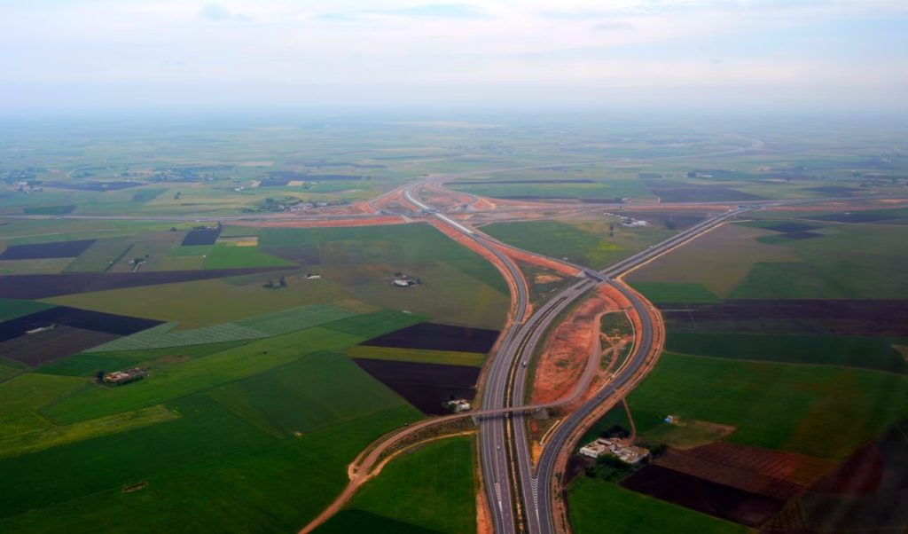
Road construction surveying
A drone in construction helps councils, transport agencies, and civil engineering companies create accurate, large-area linear maps quickly and accurately. By carrying LiDAR, it can measure earthwork and soil precisely.
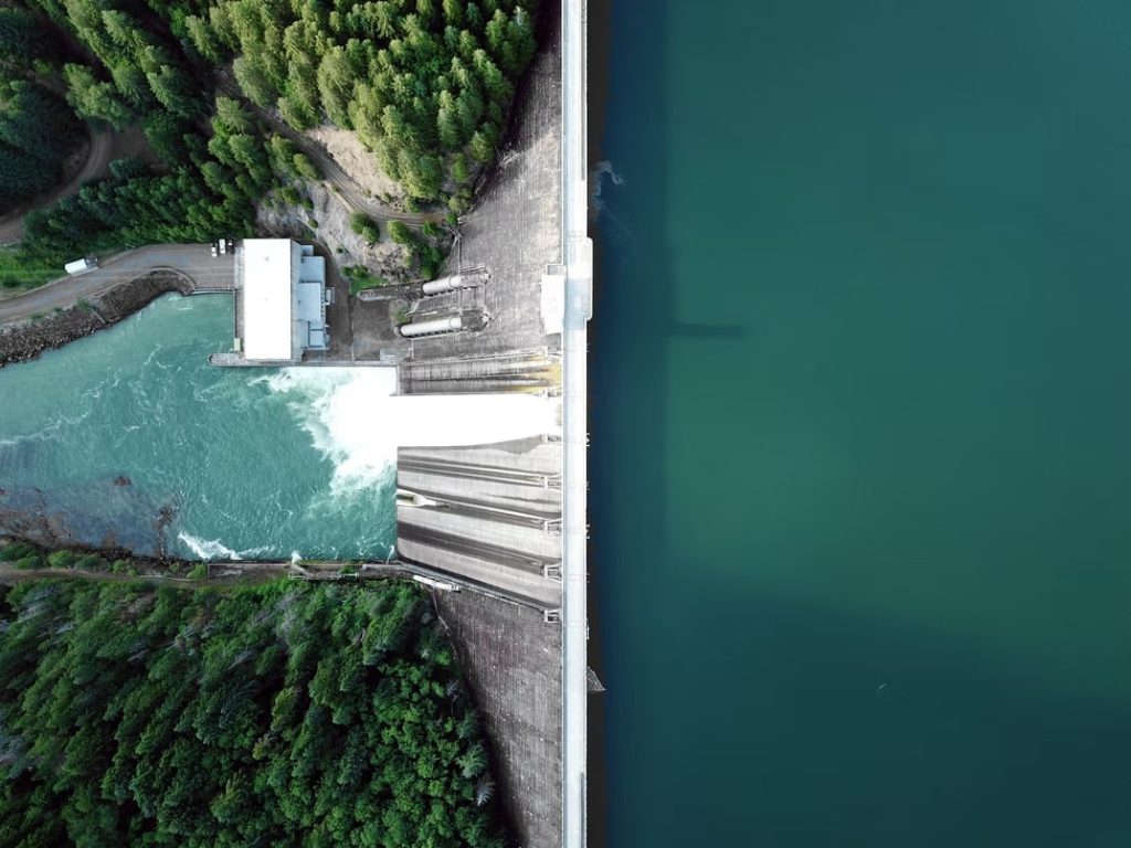
Dam surveying
The measurement of dams and other large structures can be a challenging task due to varying static water levels and hard-to-reach areas. Combining advanced sensor equipment, flexible communication systems, and compact designs, UAVs can be successfully applied to dam surveys and visual assessments of large structures and hard-to-reach areas.
Urban planning
Drone for a smart city is being tested and deployed to rapidly collect, aggregate, analyze and provide highly accurate topographic maps of urban areas, the foundation of a smart city. This data facilitates applications that improve operations, engage residents and support communities.
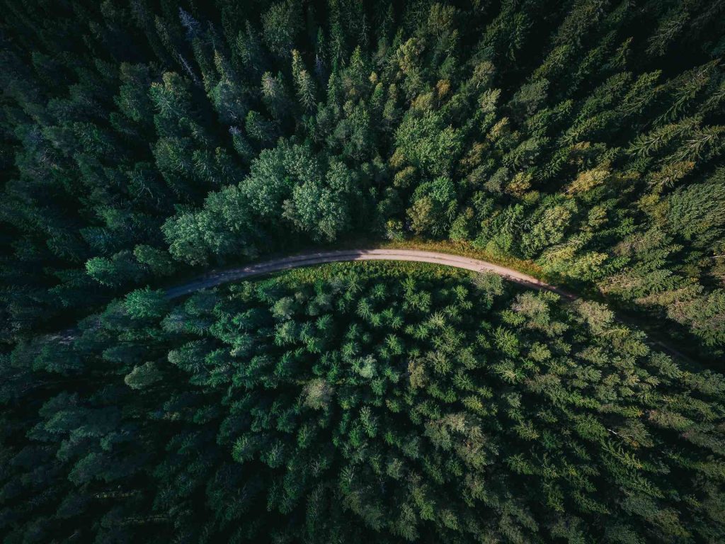
Forestry management & monitoring
The sheer size of natural forest lands makes forest management and monitoring very labor-intensive, resulting in time-consuming, tedious, and often dangerous work for the staff. A LiDAR drone is equipped with LiDAR and imaging sensors to accurately reproduce the forestry environment in 3D format (e.g. photogrammetry and point clouds). Through powerful analysis software, inspectors can extract metrics such as tree height, diameter, volume, and number.
Geological hazard monitoring
In the event of a geological disaster, technical workers can use drone mapping technology to take panoramic photos of the geological disaster area in the shortest possible time, and image into the system to achieve 3D visualization, greatly reducing the difficulty of rescue.
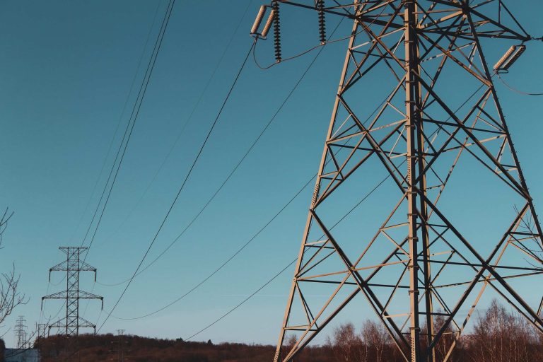
Power grid inspection
Drones can be used to inspect power lines and power towers for lightning strikes, rust/corrosion, and damaged bolts. The power line inspection solution provides detailed and accurate data on all parts of the grid, automating inspection, enabling timely repairs, and reducing downtime.
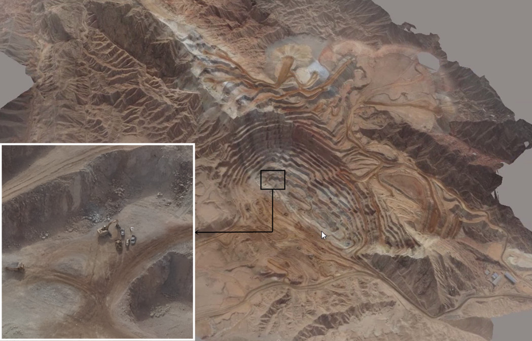
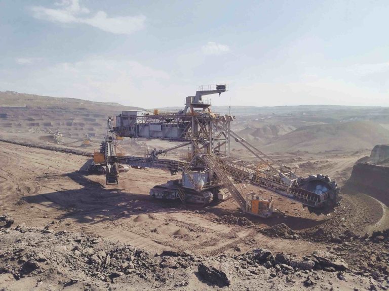
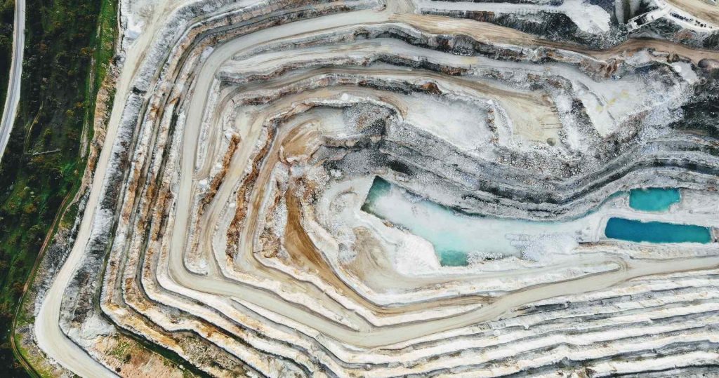
Mining mapping
Drones in mining enable professionals to obtain specific aerial data on mining sites to improve productivity, planning, safety, inventory management, and more. In the mining industry, drone mining surveys include drones equipped with RGB cameras that take photos of the site from different angles.
Orthomosaic maps
A drone image that has been corrected for lens distortion, camera tilt, perspective, and topographic relief (i.e., elevation changes on the Earth's surface) and stitched together in post-processing to create a large map-quality image with a high level of detail and resolution.
3D point cloud
3D point cloud data, each point contains three-dimensional coordinate information, i.e., X, Y, and Z elements. Sometimes it also contains color information, reflection intensity information, echo count information, etc.
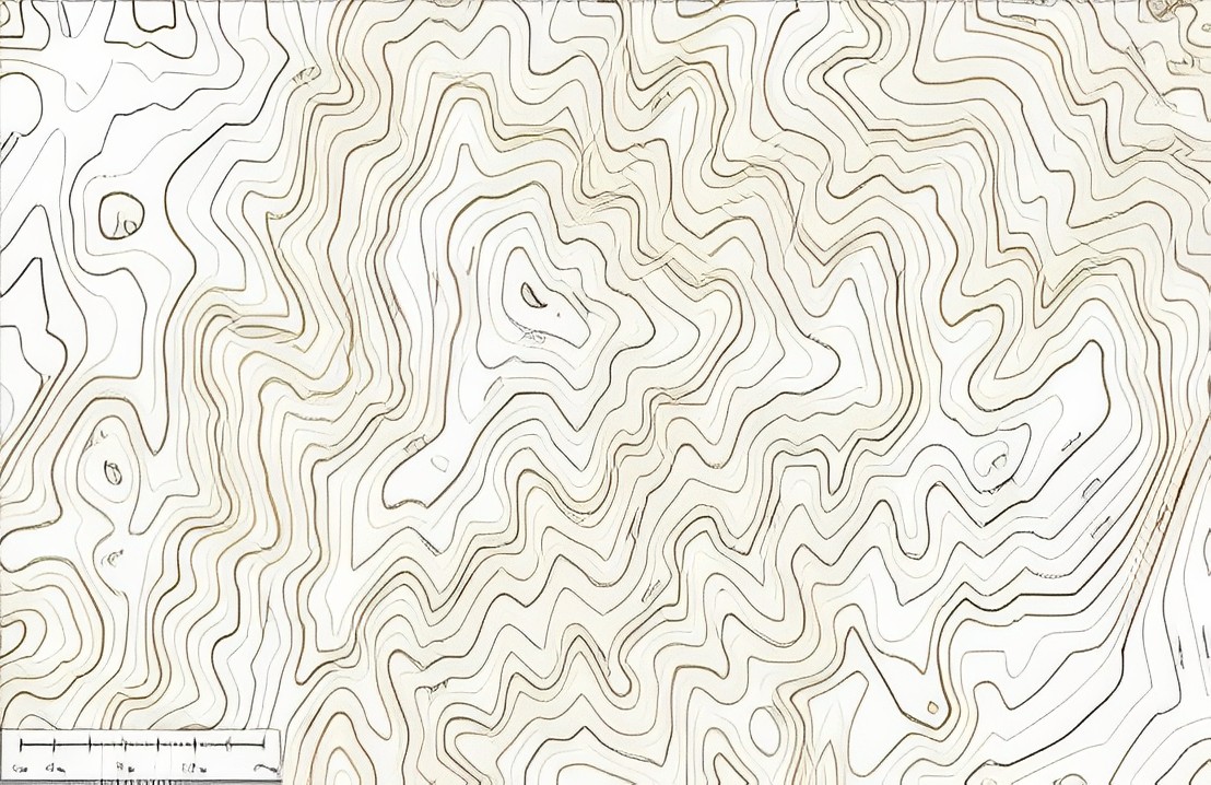
Digital line graph (DLG)
A digital line map (DLG) is a map feature represented as a digital vector. A DLG depicts information about the geographic features of the terrain. In addition, it includes administrative, hydrography, transportation, and man-made features.
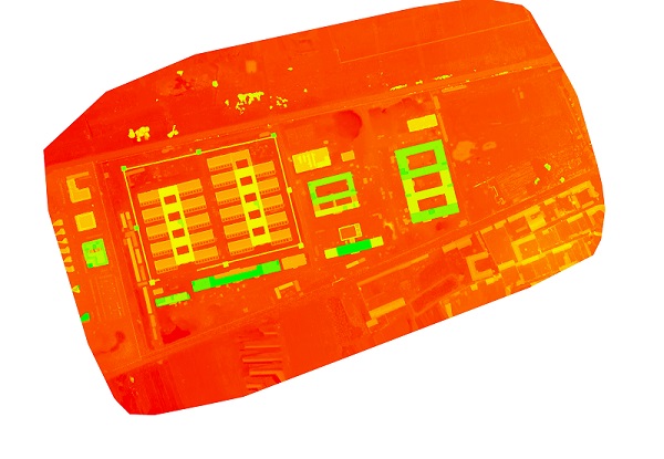
Digital surface models (DSM)
A digital surface model is a ground elevation model that includes the height of surface buildings, bridges, trees, etc.
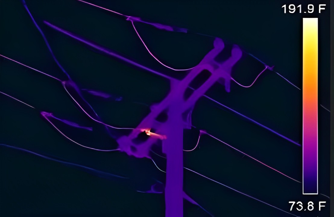
Thermal map
A thermal drone surveys with a thermal camera and quickly identifies targets with abnormal heat signatures.
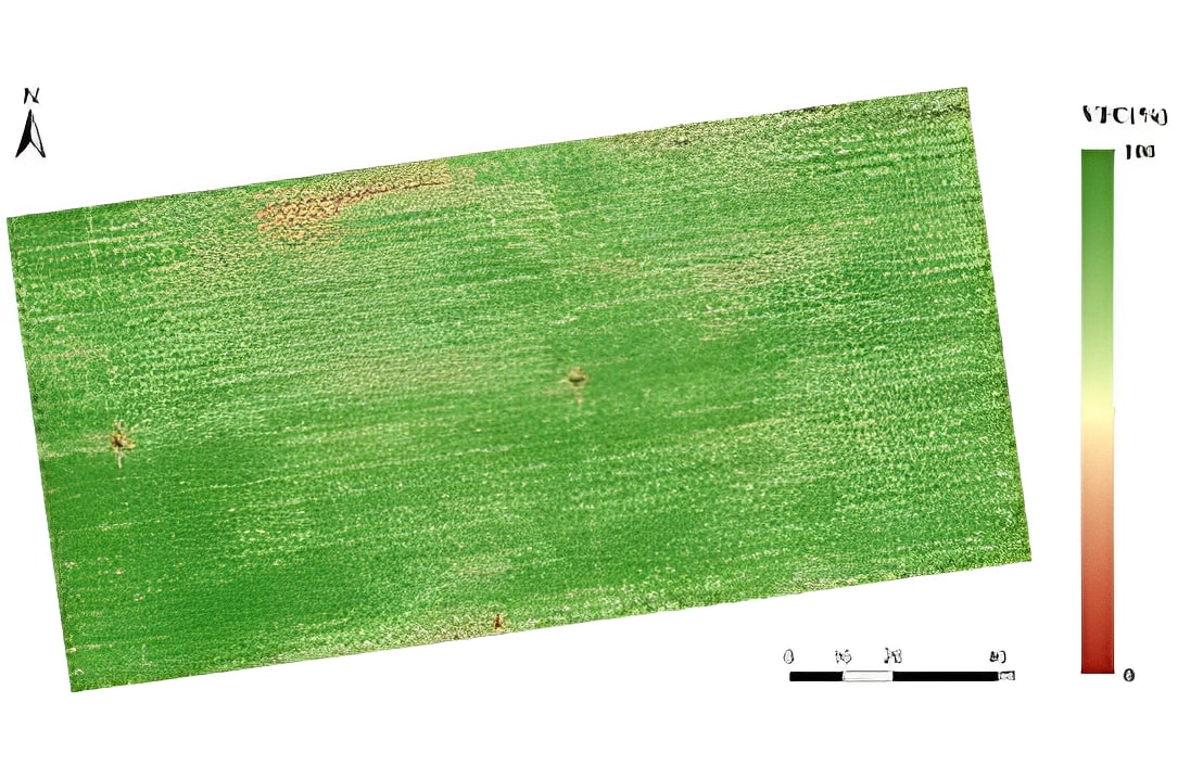
Multispectral map
Multispectral images are a very effective tool for assessing soil productivity and analyzing plant health.
More information about JOUAV and our drones
Provide the suitable solution for your needs
Help for your project promotion
Get a product quote