At 2:27 PM on a storm-lashed afternoon in July 2025, a small fishing boat capsized off the coast of Gulei, Zhangzhou.
Two men were thrown into violent waters. Winds howled at gale force. Waves surged
Hainan is the tropical resort destination known as China's Hawaii. In June 2020, the Chinese government announced a plan to transform the island province of Hainan into the world's largest free trade port. In the past two years, Hainan is promoting its construction of expressways and ports to improve its connectivity with the rest of the country and the whole world.
Every year, new skyscrapers and attractions pop up along its skyline. To help surveyors and other professionals create a base plan for construction sites and track developments, one of the best surveying firms in China, Hainan Trunyun Space Information Technology Co., Ltd, has been turning to drones since 2018.
Not all drone surveys are equal
They began mapping with DJI multi-rotor drones, and over the next few years, they had a large fleet. "So DJI was a nice experience because it can fly at a low altitude and collect high-resolution data", said Eric Chow, Technical Manager at Trunyun. "At the time it was good."
As the reform of the Hainan Free Trade Zone proceeds, the demand for local construction surveying increases. But DJI multi-rotors can only fly up to 15-30 minutes which has low efficiency. So in 2018, the company purchased a VTOL drone from a Chinese firm. But it didn't meet the requirements of high image quality and accuracy.
"The best 3D oblique imagery we got with this VTOL drone was 15cm GSD while the mapping scale was 1:2000. This causes the 3D model to be blurred when zoomed in, and the acquired side textures of the building are not rich in detail," said Eric.
Considering the demand for long endurance and high accuracy, The Trunyun has recently upgraded to verticle take-off and landing (VTOL) technology by investing in two CW-30 drones.
"So we had big problems with the previous drones we tried, and we knew we needed other equipment and that's when we saw the JOUAV CW-30," said Eric.
High efficient and high-quality drone solution
Last week, the Trunyun measured 7.5km2 by deploying CW-30 equipped with a 100-megapixel PhaseOne iXU-RS 1000 and a 70mm focal length lens. Flying at an altitude of more than 200 meters to the ground, the drone obtained high-resolution oblique photos with a ground sample distance of better than 2cm.
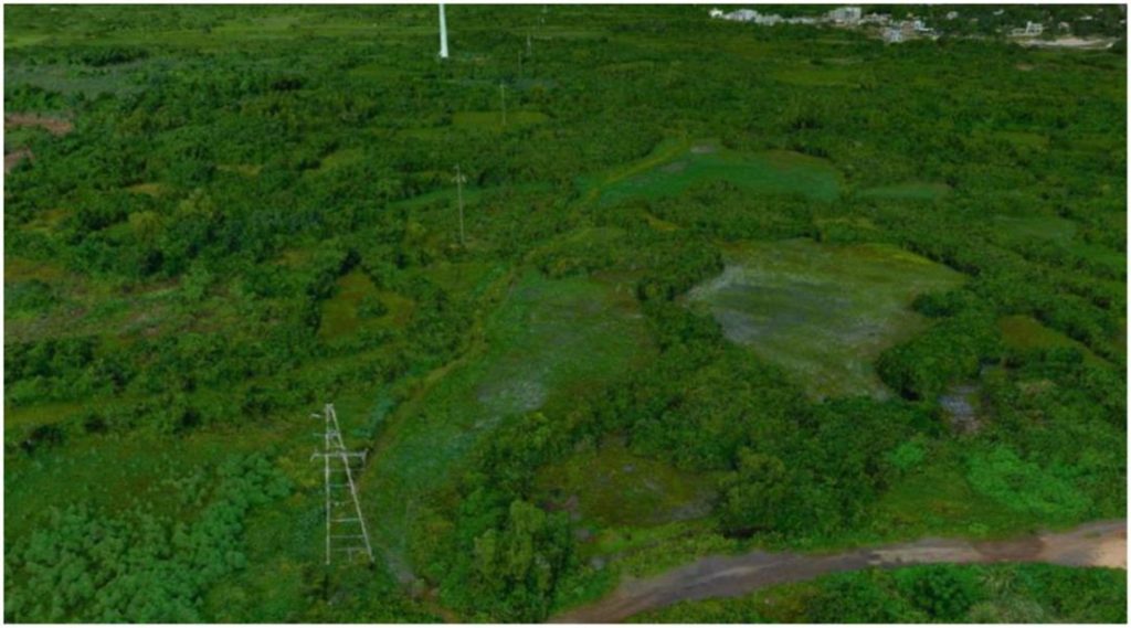
The measurement area includes the coast, mudflats, woodlands, farmlands, villages, and roads. The terrain is basically flat, without hills, and the height difference is within 35cm.
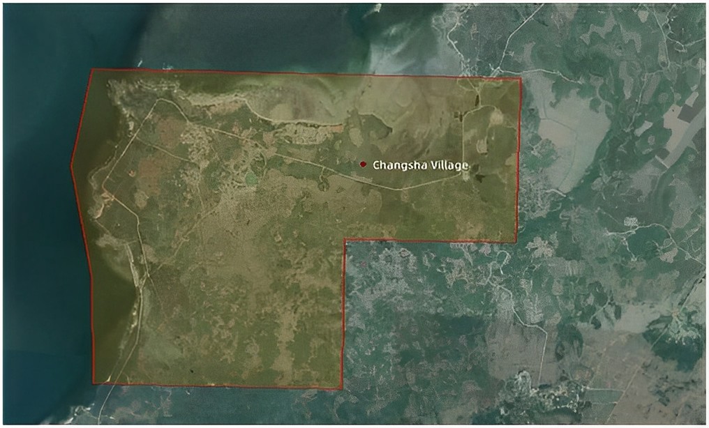
The measured area
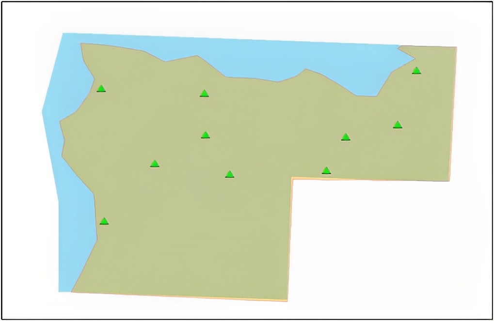
Distribution of ground control points
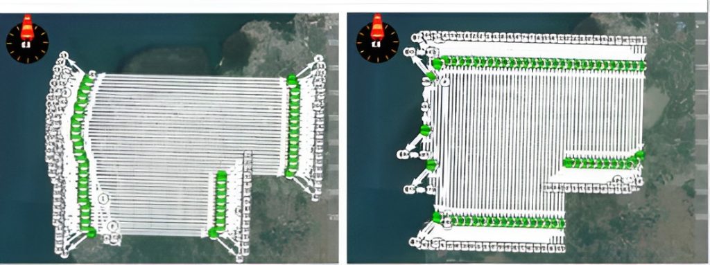
The flight path of CW-30
The results were surprising. "A multi-rotor often takes about 21 days to cover the measurement of 7.5km2 area. And the quality of the data was 7 times better than a fixed-wing drone. This one is such a plus, and it works well for us. We can then come down and process all of the data at a go." said John Shee, Unit Survey Manager, Hainan Trunyun Space Information Technology Co., Ltd.
Results show that horizontal accuracy and verticle accuracy at the 60% confidence level was 10cm and 5cm respectively. "After establishing a 3D model using these oblique images, we saw the real scene of the surrounding environments of the drone surveying area, and obtain the accurate spatial position, geometric shape, and geological characteristics of this area, which can provide important parameters for road construction and urban planning," commented John.
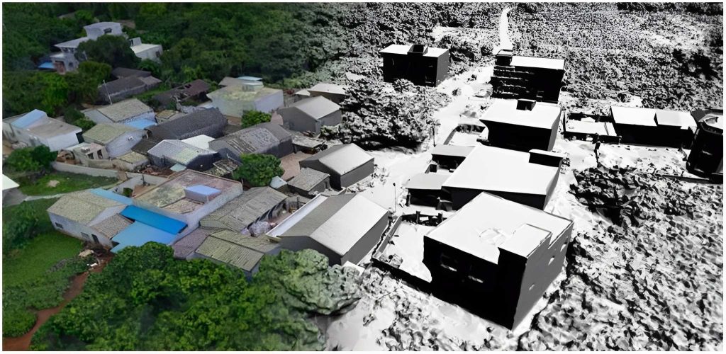
The 3D model with clear texture and sharp edges
3D model: The morphology of pole-like features such as electric poles and traffic signs is basically complete.
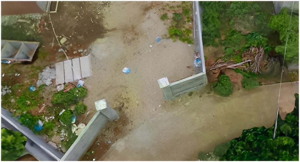
3D model (fence detail) with uniform fence thickness
More Use Cases


Chongqing’s Qinba Mountains are basically a giant green wall protecting the region. But there’s a problem – pine wood nematodes are eating through it. Fast.
The forestry department n

When TotalEnergies set out to build one of Southeast Asia’s largest solar and battery storage projects—spanning 12,000 hectares across the dense acacia forests of Riau, Indonesia—they faced a problem

JOUAV Product News and Use Cases
Fixed-Wing VTOL Drones Insights and Industry Trends
Invitations to online demo events