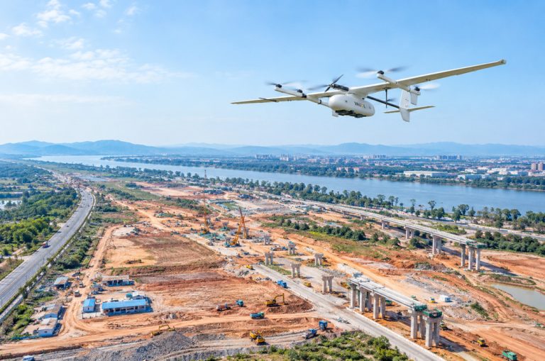
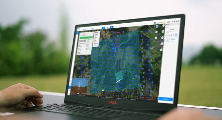
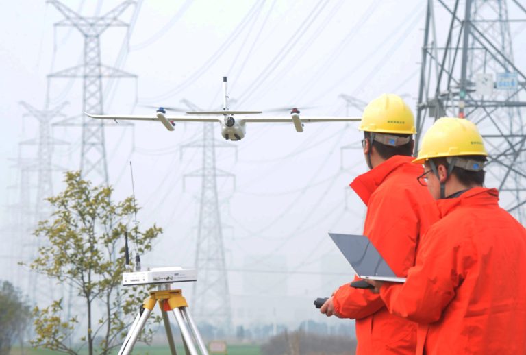
Yeah, you've probably seen those LiDAR maps—the ones that strip away trees to reveal ancient ruins or show cityscapes in stunning 3D detail. They're impressive.

But here's a question most people don't think to ask: Can LiDAR see underwater?

The short answer is yes — but not the kind of LiDAR you're used to. That standard near-infrared laser you see on survey drones? It hits the water and bounces straight back. Doesn't penetrate at all.

But a green-wavelength laser—532 nm—sits right in water's "optical window." It passes through the surface, travels down, reflects off the seafloor, and returns to the sensor. That's bathymetric LiDAR.

In this guide, we'll walk you through how it actually works, how deep it can go, how it stacks up against sonar and radar, and where it's being used right now—from coastal mapping to underwater infrastructure inspection.

We'll also cover costs, limitations, and what LiDAR simply cannot detect underwater.

Let's dive in.
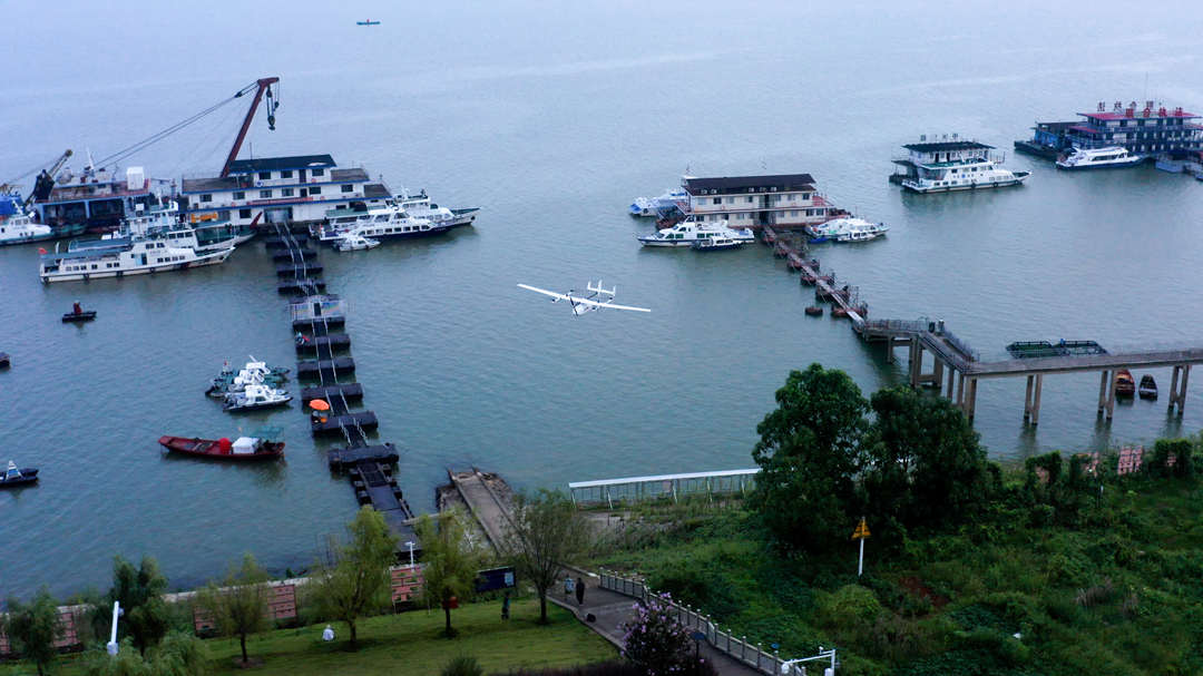
CW-25E takes off from beach

Does LiDAR Work Underwater?

Does LiDAR Work Underwater?

Yes—but not the kind you're probably thinking of.

Standard LiDAR systems use a near-infrared laser at 1064 nm. That wavelength works great for mapping forests, buildings, and terrain. But point it at water, and it reflects straight off the surface. The water absorbs it. You get nothing from the bottom.

Bathymetric LiDAR, on the other hand, uses a green laser at 532 nm. That wavelength sits right in the "optical window" of water—the range where water absorbs the least light. Instead of bouncing off the surface, the green pulse passes through the water column, reflects off the seafloor or riverbed, and makes its way back to the sensor.

Most bathymetric systems actually use two lasers simultaneously:

  • An infrared laser (1064nm) that reflects off the water surface—this gives you the surface height reference
  • A green laser (532nm) that penetrates the water and reflects off the bottom—this gives you the seafloor height

Subtract one from the other, and you get water depth.

The catch: How deep the green laser can penetrate depends entirely on water clarity. In crystal-clear water, it can reach 40–50 meters or more. In turbid, sediment-filled water, it might only penetrate a few meters. The rule of thumb is that bathymetric LiDAR can typically measure depths up to two to three times the Secchi depth—a standard measure of water transparency.

So the short answer is yes, LiDAR works underwater—but only with the right wavelength, the right system design, and clear enough water.

How Does Bathymetric LiDAR Work?

How Does Bathymetric LiDAR Work?

Bathymetric LiDAR works on the same basic principle as any LiDAR system: measure the time it takes for a laser pulse to travel to a target and back, then calculate distance. But water adds a layer of complexity.

Let's walk through exactly how it works—from the laser to the data.

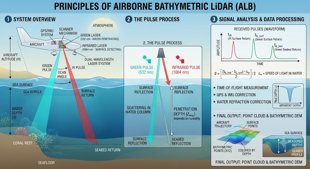
Step 1 — Emission. The laser fires a short, powerful green pulse — typically 5–10 nanoseconds long — from an airborne platform (fixed-wing aircraft, helicopter, or UAV).

Step 2 — Surface interaction. When the pulse hits the water surface, two things happen:

  • Reflection: A portion reflects directly off the surface and returns to the sensor. This is the "surface return."
  • Refraction: The rest bends as it enters the water. Water is optically denser than air, so the beam changes direction. This must be accounted for in post-processing.

Step 3 — Travel through water. Inside the water column, the laser light encounters:

  • Absorption: Some light is absorbed by the water itself
  • Scattering: Particles scatter the light in different directions
  • Volume backscatter: Some light scatters back toward the sensor from the water column itself

Step 4 — Bottom reflection. If the water is clear enough and the depth is within range, some light reaches the bottom and reflects. The strength of this return depends on the bottom material—bright sand reflects well; dark mud absorbs most of the light.

Step 5 — Return to sensor. After the return trip through the water column and atmosphere, the system records the round‑trip time.
How does bathymetric LiDAR work

The Full Waveform

A bathymetric LiDAR system doesn't just record a single return. It records a full waveform — a continuous record of the returning light over time.

A typical green laser waveform consists of three distinct parts:

Waveform ComponentWhat It Represents
Air/Water Interface ReturnThe initial spike from the green laser reflecting off the water surface
Volume BackscatterLight scattered back from particles in the water column
Bottom ReturnThe final spike when the laser reflects off the seafloor

The system measures the time difference between the surface return and the bottom return to calculate water depth. The waveform also reveals information about water clarity and bottom type.

Scanning, GNSS, and IMU

The laser doesn't fire straight down. It scans. Most systems use a scanning mirror that directs the laser pulses in a pattern across the survey area, creating a swath of points. The beams are typically fired at a forward angle of 15–20 degrees from vertical — this limits surface scattering and improves penetration.

Accurate bathymetric mapping also requires the following:

  • GNSS: Precisely georeferences the sensor platform to within a few centimeters
  • IMU: Continuously monitors the aircraft's attitude—roll, pitch, and yaw—to compensate for movement

Together, these components achieve vertical precision within 10 cm for both topographic and bathymetric data points.

How Deep Can LiDAR Penetrate Water?

How Deep Can LiDAR Penetrate Water?

The short answer: anywhere from 0.5 meters to over 50 meters — depending almost entirely on water clarity.

There's no single number. In crystal-clear tropical waters, you can reach 40–50 meters. In turbid, sediment-filled rivers, you might only get a few meters — sometimes less than one.

The Secchi Depth Rule

The most practical way to estimate LiDAR penetration is the Secchi depth — a simple measure of water transparency. Lower a black-and-white disk into the water until you can't see it anymore. That depth is your Secchi depth.

The rule of thumb: Bathymetric LiDAR can typically penetrate two to three times the Secchi depth.

System TypeTypical Penetration (× Secchi Depth)
Shallow-water sensors~1.5× Secchi depth
Standard bathymetric systems~2–3× Secchi depth
Advanced systems (e.g., HE4X)~3× Secchi depth
Photon-counting systemsUp to 5× Secchi depth

If Secchi depth is 5 meters, a standard system can map to about 10–15 meters. If it's 10 meters, you might reach 20–30 meters. If it's less than 1 meter, you're probably not getting any useful data.

Depth by Water Type

Water TypeTypical PenetrationExample Locations
Crystal-clear (oligotrophic)40–50m+Open ocean, Caribbean, Mediterranean
Clear coastal waters20–30mProductive coastal zones
Moderately turbid7–10mNearshore, estuaries
Very turbid3–5mMuddy rivers, harbors
Extremely turbid0.5–1.5mSilty rivers, high-sediment areas

Real-world examples:

  • The NOAA HE4X system captures data from 0 to 50 meters in clear conditions.
  • The CZMIL SuperNova mapped lakebed to a maximum depth of 31 meters in the Great Lakes.
  • NASA's ICESat-2 photon-counting LiDAR reaches depths of up to 40 meters in clear water.
  • The YellowScan Navigator, a UAV-mounted system, is optimized for 0–3 meters but reaches 18 meters in clear conditions. In real-world surveys with moderate turbidity, it achieves 5–6 meters.

What Limits Penetration Depth?

Water clarity (turbidity) is the single biggest factor. Suspended particles—sediment, plankton, and algae—scatter and absorb the laser pulse. More particles = shallower penetration.

Bottom reflectivity also matters. Light-colored sand reflects well and is easy to detect. Dark mud or submerged vegetation absorbs most of the light and is much harder to see.

Surface conditions affect performance, too. Rough water — waves, whitecaps — scatters the laser before it enters the water.

System design makes a difference. Higher-power lasers penetrate deeper but are heavier and more expensive. Receiver sensitivity, optical element size, and scanning angle all affect depth performance.

The Takeaway

You can't predict LiDAR penetration depth from a spec sheet alone. It depends on where you're flying, when you're flying, and what's in the water. The Secchi depth rule gives you a rough estimate—but the only way to know for sure is to fly a test line and see what comes back.

LiDAR vs Sonar vs Radar

LiDAR vs Sonar vs Radar — Which Is Best for Underwater Mapping?

Here's the short version: LiDAR and sonar both work underwater. Radar doesn't.

But which one is "best" depends entirely on what you're trying to map, how deep it is, and how clear the water is.

Let's break down each technology—what it is, where it works, and where it falls short.

The Core Difference

All three technologies work on the same basic principle: send out a signal, measure how long it takes to bounce back, and calculate distance. The difference is what kind of signal they use.

TechnologySignal TypePenetrates Water?Best Environment
LiDARLight (laser)Yes — green wavelength onlyClear, shallow water
SonarSound (acoustic)YesAny water, any depth
RadarRadio wavesNoAir and space only

LiDAR — Resolution King in Clear Water

Bathymetric LiDAR uses a green laser (532 nm) that penetrates the water column and reflects off the seafloor. It's an optical technology, which means it's fundamentally limited by water clarity.

Strengths:

  • Exceptional resolution—LiDAR can produce point clouds with centimeter- or even millimeter-level accuracy. It captures fine-scale structural details that sonar simply cannot match.
  • Speed — Airborne LiDAR covers large areas much faster than ship-based sonar surveys.
  • Seamless land-water transition—LiDAR can map both the shoreline and the submerged terrain in a single survey, something sonar struggles with.
  • Cost-effective for shallow areas—For mapping coral reefs, coastal zones, and other shallow-water environments (<50 m), LiDAR is often more cost-effective than multibeam sonar.

Weaknesses:

  • Limited depth—Typically 1.5–50m, depending on water clarity. In turbid water, penetration drops to just a few meters.
  • Water clarity dependent—Suspended sediment, plankton, and algae scatter the laser pulse. If the water isn't clear, LiDAR doesn't work.
  • Expensive — Systems cost $100,000–300,000+.

Best for: Coastal mapping, river surveys, coral reef monitoring, and any project in clear, shallow water where high resolution matters.

Sonar — The Deep-Water Workhorse

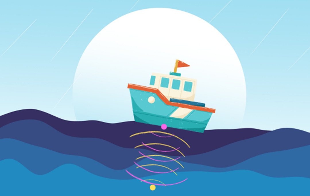
Sonar uses sound waves instead of light. Sound travels well through water — much better than light or radio waves. That's why sonar is the standard tool for underwater mapping.
Sonar technology

Strengths:

  • Unlimited depth — Sonar can map the deepest ocean trenches (11,000m+).
  • Works in turbid water — Sediment and plankton don't stop sound the way they stop light.
  • Cost-effective for deep water — Much cheaper than LiDAR for deep-water surveys.
  • Bottom coverage — Multibeam sonar provides complete bottom coverage in navigable depths.

Weaknesses:

  • Lower resolution than LiDAR—Sonar resolution is limited by the wavelength of sound. Shorter wavelengths give better resolution but shorter range; longer wavelengths give greater range but lower resolution.
  • Slower— Ship-based sonar surveys take much longer than airborne LiDAR surveys.
  • Requires vessel — Most sonar systems need to be deployed from a boat or underwater vehicle.

Best for: Deep-water mapping, turbid conditions, and any project where depth or water clarity rules out LiDAR.

Multibeam vs. Side-Scan Sonar:

  • Multibeam sonar—Provides full bathymetric coverage of the seafloor. Used for depth mapping and navigation.
  • Side-scan sonar—Provides imagery of the seafloor surface. Used for detecting objects, identifying bottom types, and finding shipwrecks.

Radar — Doesn't Work Underwater

Radar uses radio waves. And radio waves don't penetrate water.

The reason is simple: water absorbs radio waves. A radar signal hits the surface and reflects back. It never reaches the bottom.

Can radar be used for underwater mapping at all? Only indirectly. Satellite radar altimeters can measure sea surface height with extreme precision. By analyzing variations in sea surface height, scientists can infer underwater topography — but this gives a resolution of about 5–8 kilometers per pixel. That's not mapping; that's guessing.

Best for: Not underwater mapping.

Comparison Table — LiDAR vs Sonar vs Radar

FactorLiDAR (Green)SonarRadar
SignalLight (laser)Sound (acoustic)Radio waves
Penetrates waterYes—in clear waterYesNo
Depth range1.5–50m (clear water)Unlimited (0–11,000m+)Surface only
ResolutionVery high (cm–mm)Low–moderateVery low (km-scale)
SpeedFast (airborne)Slow (ship-based)Fast (satellite)
Turbidity tolerancePoorExcellentN/A
CostHigh ($100k–300k+)Moderate–High ($50k–200k+)Low–Moderate
Best forShallow, clear waterAll depths, turbid waterSurface altimetry only

Which One Should You Choose?

Here's a simple decision framework:

Choose LiDAR if:

  • You're mapping clear, shallow water (<50m)
  • You need high resolution
  • You need to cover large areas quickly
  • You need seamless land-to-water elevation data

Choose Sonar if:

  • You're mapping deep water (>50 m)
  • The water is turbid
  • You need bathymetric data at any depth
  • You're working from a vessel

Choose both if:

  • You have a coastal zone with varying depths and clarity
  • You need comprehensive coverage from shoreline to deep water
  • You can afford the combined approach

The industry best practice is often a combined approach: LiDAR for shallow, clear areas (0–20 m) and multibeam sonar for deeper areas (20–200 m+).

Applications of Bathymetric LiDAR

Applications of Bathymetric LiDAR — What Is It Used For?

Bathymetric LiDAR isn't just a niche technology for oceanographers. It's being used across a surprisingly wide range of industries—from coastal management to underwater archaeology to pipeline inspection.

Here's a breakdown of the most common applications, with real-world examples.

Coastal and Marine Mapping

This is the original and still the biggest application. Bathymetric LiDAR provides seamless elevation data that connects the shoreline to the shallow seafloor—something no other technology does as efficiently.

What it's used for:

  • Charting and navigation: NOAA uses bathymetric LiDAR for updating nautical charts and identifying navigational hazards.
  • Coastal erosion monitoring: Tracking shoreline changes, sediment movement, and beach loss over time.
  • Nearshore habitat research: Mapping coral reefs, seagrass beds, and other benthic habitats.
  • Coastal zone management: Planning infrastructure projects while preserving ecological balance.

Real-world example: NASA's ICESat-2 satellite uses spaceborne LiDAR to fill near-shore data gaps, providing bathymetric data for coastal science, marine navigation, and engineering applications.
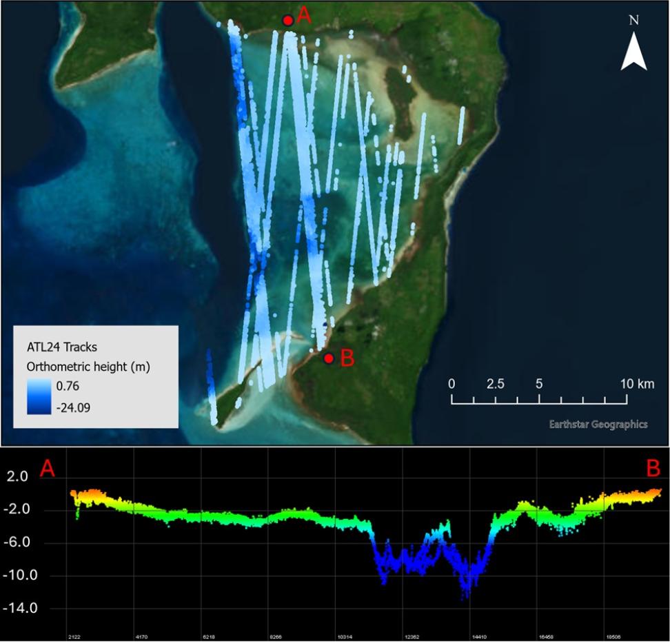
The true-color image of Kiriwina Island in Papua New Guinea

 ATL24 data observed for Kiriwina Island, Papua New Guinea. Credit: Chris Parrish

River, Lake, and Floodplain Mapping

Bathymetric LiDAR is increasingly used for inland water surveys — especially in rivers and lakes where traditional sonar surveys are slow or logistically difficult.

What it's used for:

  • Riverbed mapping: High-resolution surveys of river channels, tracking erosion and sediment movement across seasons.
  • Flood risk assessment: Creating accurate flood inundation maps by combining bathymetric and topographic data.
  • Water resource management: Mapping river channels, floodplains, and watershed boundaries.
  • Dam and reservoir management: Informing decisions about dam operations and water releases.

Real-world example: The USGS used topo-bathymetric LiDAR to map the Santiam River's underwater topography for fish habitat and water flow management. The USACE used the same data to update flood models in the Willamette Valley.
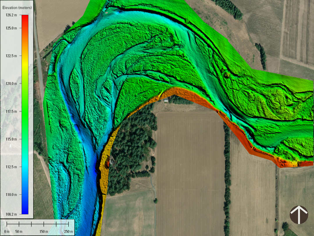
The digital elevation model of the Santiam River

Santiam 3D Topobathymetric Digital Elevation Model. Credit: U.S. Geological Survey, USGS

A study on the River Feshie in Scotland demonstrated that UAV-mounted topo-bathymetric LiDAR could survey a 1 km river reach and produce meter-resolution digital terrain models for flood inundation mapping.

Underwater Infrastructure Inspection

This is one of the fastest-growing applications. Bathymetric LiDAR can inspect submerged infrastructure without sending divers into dangerous conditions.

What it's used for:

  • Pipeline and cable inspection: Detecting damage, deformation, or sediment buildup along subsea pipelines.
  • Bridge footing inspection: Identifying scour, undermining, and structural issues around bridge piers.
  • Dam wall inspection: Detecting cracks and sediment accumulation in submerged dam structures.
  • Offshore structure inspection: Surveying platform support structures and other offshore infrastructure.

Real-world example: Fraunhofer IPM's Underwater LiDAR system (ULi) maps underwater infrastructure with millimeter precision using pulsed time-of-flight technology. The Airborne Bathymetric Laser Scanner (ABS) enables high-resolution bathymetric measurements from the air.

Environmental Monitoring and Habitat Mapping

Bathymetric LiDAR is a non-destructive tool for studying fragile ecosystems.

What it's used for:

  • Coral reef mapping: Creating high-resolution 3D maps of reef structure and health.
  • Seagrass bed monitoring: Tracking seagrass distribution and density.
  • Sediment and erosion tracking: Monitoring soil movement in rivers and coastal areas.
  • Water quality assessment: Analyzing water clarity and suspended sediment from waveform data.

Real-world example: The Florida Seafloor Mapping Initiative uses airborne LiDAR to map coral reefs and seagrass beds across Florida's coast. Researchers at Oregon State University use topo-bathymetric LiDAR specifically for mapping benthic habitats, including coral reefs and seagrass.
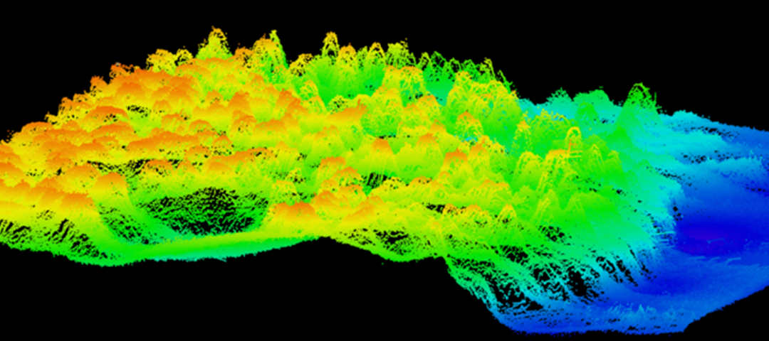
Coral reefs across Florida's coast

Previously unknown mesophotic coral reefs are located more than 50 kilometers offshore of Pensacola, Florida. Credit: FLDEP (Florida Department of Environmental Protection).

Underwater Archaeology and Cultural Heritage

Bathymetric LiDAR is helping archaeologists discover and document submerged sites—often without ever getting wet.

What it's used for:

  • Shipwreck detection: Identifying and mapping sunken vessels.
  • Submerged settlements: Finding ancient structures and settlements now underwater.
  • Cultural heritage documentation: Creating detailed 3D records of underwater heritage sites.

Real-world example: Airborne bathymetric LiDAR has been used to study shipwrecks around Dongsha Atoll in the South China Sea. Machine learning models are now being developed to automatically detect shipwrecks in bathymetric LiDAR data over large geographic areas. Studies have shown that bathymetric LiDAR can identify shipwrecks at depths up to 160 meters.

Oceanographic Research and Climate Science

Scientists use bathymetric LiDAR to advance our understanding of ocean processes and climate change.

What it's used for:

  • Seafloor mapping: Creating high-resolution maps of underwater geological features.
  • Sediment transport studies: Tracking how sediment moves through coastal and river systems.
  • Sea-level rise modeling: Providing baseline data for coastal vulnerability assessments.

Real-world example: Researchers from Germany and Indonesia tested bathymetric LiDAR systems in Indonesian waters to improve underwater measurement capabilities. The Fraunhofer ABS system has been deployed for ecological applications like monitoring water depth in shallow lakes and ocean coastlines.

The JOUAV Perspective

At JOUAV, we work with bathymetric LiDAR payloads for UAV-based surveys. Our platforms can carry systems such as the YellowScan Navigator and the RIEGL VQ-840-G for shallow-water mapping. But we're the first to admit that LiDAR isn't always the answer.

If you're mapping a clear coastal zone or a river with good visibility, LiDAR is fast, efficient, and produces incredible detail. If you're mapping deep water or turbid conditions, sonar is the only practical option.
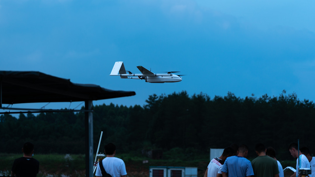
CW-30E flying at night

Bathymetric LiDAR Cost

Bathymetric LiDAR Cost — How Much Does It Cost?

Let's talk money.

Bathymetric LiDAR isn't cheap. But neither is sending a boat out for weeks with multibeam sonar. The cost question isn't "is it expensive?" — it's "is it worth it for my project?"

Here's the reality: Bathymetric LiDAR systems range from under $250 for basic underwater sensors to over $2 million for full-scale airborne systems. Most professional UAV-mounted systems fall somewhere in the $100,000–300,000 range.

But the cost structure is more nuanced than a single number.

Let's break it down by system type, service options, and total cost of ownership.

System Costs — What You Actually Pay

Bathymetric LiDAR systems span a massive price range depending on platform, capability, and precision. Here's how they break down:

System TypePrice RangeExamples
Compact underwater LiDAR sensors$64–250Benewake VLS-H5 ($244), single-line scanning sensors
UAV topographic LiDAR$100,000–200,000YellowScan Surveyor Ultra
UAV bathymetric LiDAR$150,000–250,000Leica Chiroptera 4X (dual-wavelength)
Manned aircraft systems$500,000–1,000,000+RIEGL VQ-840-G
High-end full-waveform systems$1,000,000–2,000,000Teledyne Optech CZMIL, Leica ALS80

The YellowScan Navigator is a UAV-mounted bathymetric LiDAR system optimized for shallow-water surveys (0–3m, up to 18m in clear water). While its exact price isn't publicly listed, YellowScan's topographic systems in the $100,000–200,000 range suggest the Navigator sits in a similar bracket.
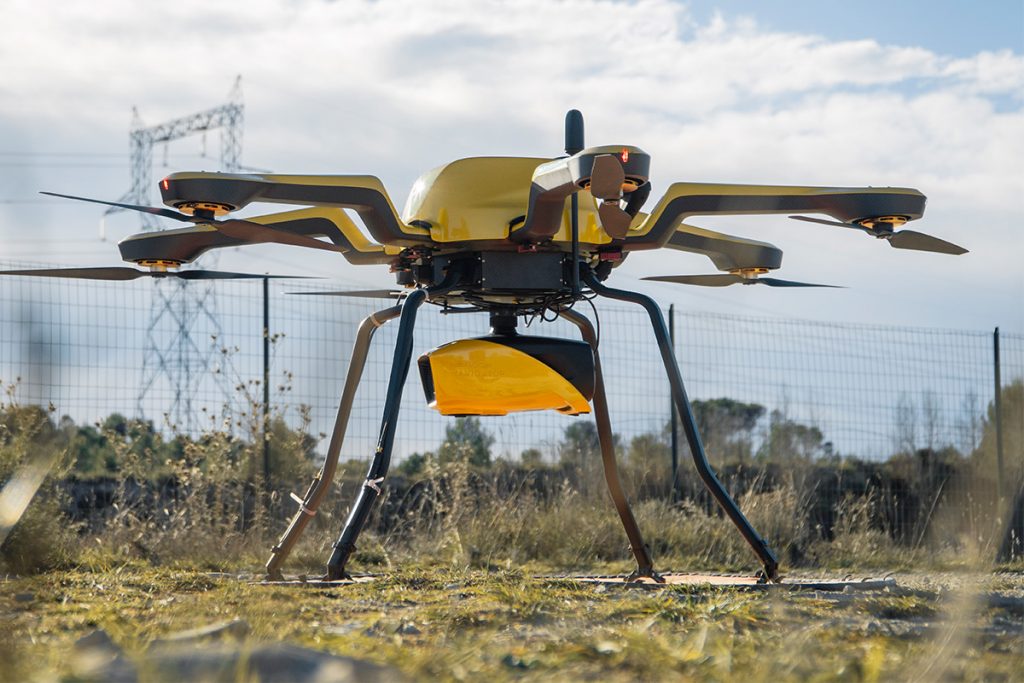
YellowScan Navigator bathymetric LiDAR

The Fraunhofer ABS (Airborne Bathymetric Scanner) is a lightweight system weighing just 3.3 kg — about the size of a shoebox. Fraunhofer describes it as "lightweight and comparatively inexpensive", though it's not a consumer product — it's a research-grade system that requires integration and typically isn't sold off-the-shelf.

Underwater sensors for ROVs are a different category entirely. The Benewake VLS-H5 is a compact underwater 360° scanning LiDAR priced at $244, designed for underwater robots and pool inspections. At the other end, custom underwater LiDAR systems for deep-sea ROVs can cost tens or hundreds of thousands of dollars.

Service Costs — When You Don't Buy the System

Not everyone needs to own a bathymetric LiDAR system. For many projects, hiring a service provider makes more sense.

Service TypeCost RangeNotes
LiDAR data acquisition (per km²)$300–800 per km²Raw data collection only
Small drone survey (LiDAR)$150–500 per acreTopographic surveys under 5 acres
Large drone survey$1,500–30,000+ per projectComplex or large-scale sites
Large-scale airborne contract$450,000–600,000+ per projectRegional-scale mapping

Palm Beach County, Florida, acquired QL1 LiDAR data for $607,500 (reduced to $451,978 through a partnership)

  • The Florida Department of Environmental Protection awarded a $13 million contract for bathymetric LiDAR data collection under the Florida Seafloor Mapping Initiative
  • The US Army awarded Woolpert a $49.9 million contract to support coastal mapping with airborne LiDAR bathymetry

The efficiency argument: Airborne bathymetric LiDAR can actually be more cost-effective per square kilometer than acoustic methods in nearshore, optically-suitable waters. A manned aircraft can cover in hours what would take days or weeks from a boat.

Total Cost of Ownership — What You're Really Paying For

If you're buying a system, the purchase price is just the beginning.

Hardware costs:

  • The LiDAR sensor itself ($100k–2M+)
  • GNSS/IMU integration ($10k–50k+)
  • Mounting hardware and cables ($5k–20k)
  • Spare parts and batteries ($5k–10k+)

Software costs:

  • Data processing software ($10k–50k+ per license)
  • Point cloud classification and analysis tools
  • Ongoing software updates and maintenance

Operational costs:

  • Training for operators ($5k–20k per person)
  • Platform integration (UAV, aircraft, or vessel)
  • Insurance and certifications
  • Maintenance and calibration (annual)
  • Data storage and processing infrastructure

The hidden cost: The Fraunhofer IPM notes that "lightweight and comparatively inexpensive bathymetry systems delivering high-resolution measurement data are not available on the market today". What you save on hardware, you often spend on integration, processing, and operational complexity.

Bathymetric LiDAR Limitations

Limitations — What Can LiDAR Not Detect Underwater?

Bathymetric LiDAR is a powerful tool, but it has very real limits. Understanding what it can't do is just as important as knowing what it can — especially when you're planning a survey that depends on getting usable data.

Let's be direct about where this technology falls short.

The Physical Limits — Why LiDAR Stops at the Surface

Bathymetric LiDAR relies on light. And light, no matter how carefully tuned, is still light.

Turbid water is the enemy. Suspended sediment, plankton, algae — anything that makes water murky — scatters and absorbs the laser pulse. In clear water, you might reach 40–50 meters. In turbid water, you might only get 0.5–2 meters. Sometimes not even that.

This isn't a technology problem — it's physics. The laser has to pass through the water column twice (down and back). Each pass loses energy to scattering and absorption. If the water is too murky, there's simply not enough light returning to the sensor to detect a bottom return.

The rule of thumb: If you can't see the bottom with your eyes, LiDAR probably can't either.

Shallow water is also challenging. In water less than 1 meter deep, the surface return and bottom return overlap. The timing difference between the two is too small to resolve clearly, which means LiDAR struggles to measure depths in extremely shallow water.

What LiDAR Simply Cannot See

Here's a straightforward list of what LiDAR cannot detect underwater:

Objects deeper than the penetration limit. This sounds obvious, but it's worth repeating. If the water is 60 meters deep and your system can only penetrate 40 meters, the bottom is invisible. Period.

Objects hidden behind or under vegetation. LiDAR is line-of-sight. If a pipeline is buried under sediment or hidden behind a kelp forest, the laser can't reach it. It detects surfaces, not what's behind them.

Dark or absorbent bottoms. Bright sand reflects light well and returns a strong signal. Dark mud, organic material, or submerged vegetation absorbs most of the light and returns very little. In some cases, there's not enough return signal to detect a bottom at all — even if the water is clear and the depth is shallow.

Very small objects at depth. The laser footprint on the bottom can be 1–2 meters wide. A small object—a pipeline fitting, a small wreck — might fall between the points or be too small to resolve.

Objects at the water surface. Strong surface reflections (glint) can mask objects just below the surface. The sensor can't easily distinguish between a surface reflection and a shallow submerged object.

Operational and Environmental Limitations

Even when the water is clear and the depth is within range, LiDAR surveys face practical challenges.

Weather and daylight matter. Bathymetric LiDAR works best in low-glare conditions — overcast days, early morning, or late afternoon. Strong sunlight creates surface glint that can overwhelm the sensor. Heavy rain, fog, or cloud cover can also degrade performance.

Wave action and whitecaps. Rough water scatters the laser before it enters the water. Whitecaps reflect light almost like a mirror. Both reduce penetration and create noisy data.

Flight altitude and speed. Higher altitudes reduce the signal-to-noise ratio. Higher speeds increase the spacing between laser points. Survey planning needs to balance coverage efficiency with data quality.

Time of year. Water clarity can vary significantly by season. Algal blooms in summer and sediment runoff after storms can make LiDAR unusable — even in areas that are clear the rest of the year. Plan your survey window carefully.

What About Ground or Sand Penetration?

LiDAR does not penetrate ground or sand to any meaningful depth.

It reflects strongly off sand surfaces but stops at the surface. Wet sand absorbs even more light. You might get a few centimeters of penetration in dry, loose soil — but that's it. If you need to see what's beneath the surface, you're looking at ground-penetrating radar (GPR) or other subsurface detection methods, not LiDAR.

Can LiDAR penetrate sand? Only the surface layer. Think of it as a highly precise tape measure for surfaces — not an X-ray machine.

Share :
Read More
thumbnail
Let me tell you something that happens way too often. A company spends $15,000 on a drone, excited about the flight time and range. They get it in the air and mount their LiDAR sensor—and the drone ba
thumbnail
Have you ever watched a drone hover effortlessly over a construction site, inspect a wind turbine blade, or deliver medical supplies to a remote village? That drone was almost certainly a multirotor.
thumbnail
Every drone needs a brain. Without it, you’re holding an expensive paperweight with spinning blades. That brain is called a flight controller—but most people have no idea what it actually does.