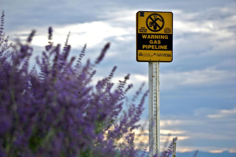
As of December 2020, the Global Energy Monitor identified 2,381 operational oil and gas pipelines spanning 162 countries, totaling over 1.18 million km in length. This extensive network presents uniqu
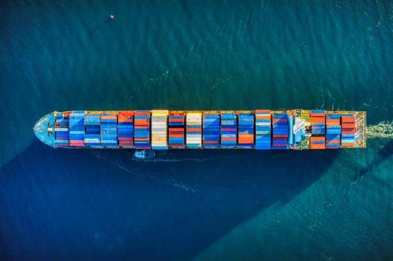
The maritime industry, with roots reaching deep into history, fuels the global economy by handling a staggering 90% of world trade.However, as this industry grows, it encounters a new wave of challeng
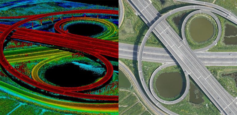
This in-depth guide breaks down LiDAR vs. photogrammetry, comparing accuracy, cost, applications, and more.
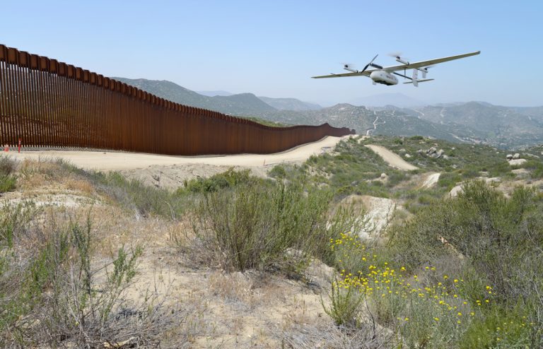
The evolution of border patrol drones traces back to the early 2000s, notably with the emergence of models like the Predator B around 2005, transforming surveillance along the U.S.-Mexico border.By 20
Heavy lift drones boast a distinctive airborne capability, allowing them to effortlessly carry hefty payloads beyond the reach of conventional drones.These ultra-large drones, with a weight capacity o
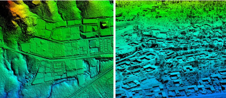
Elevation data has become a linchpin in infrastructure and AEC projects, revolutionizing how we perceive and plan for the earth's surface.Among the key players in this digital transformation are digit
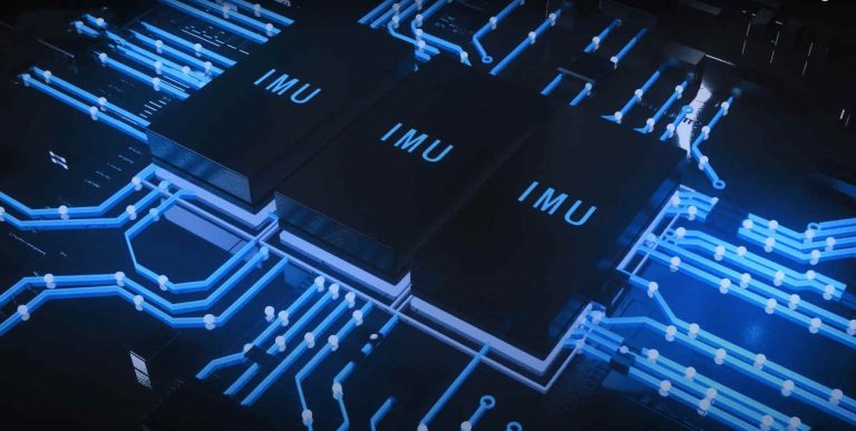
An Inertial Measurement Unit (IMU) is a sophisticated device that plays a pivotal role in tracking and measuring an object's orientation, velocity, and gravitational forces.From space launches to the
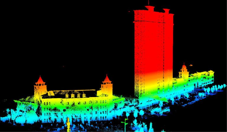
In the early 1960s, as lasers debuted, LiDAR emerged - a fusion of "light" and "radar." Initially mapping small water bodies, LiDAR soared in the 1980s with GPS integration, revolutionizing geospatial data collection.
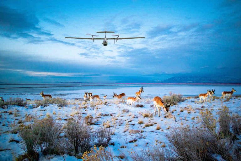
Wildlife drones, empowered by Artificial Intelligence, Machine Learning, and Predictive Analytics, are reshaping the way we monitor, track, patrol, and gather vital data for conservation efforts. In this article, we'll introduce you to some of the top choices in the world of wildlife drones and provide insights into the drone policies governing national wildlife refuges in various countries.

JOUAV Product News and Use Cases
Fixed-Wing VTOL Drones Insights and Industry Trends
Invitations to online demo events