Every drone needs a brain.
Without it, you’re holding an expensive paperweight with spinning blades.
That brain is called a flight controller—but most people have no idea what it actually does.
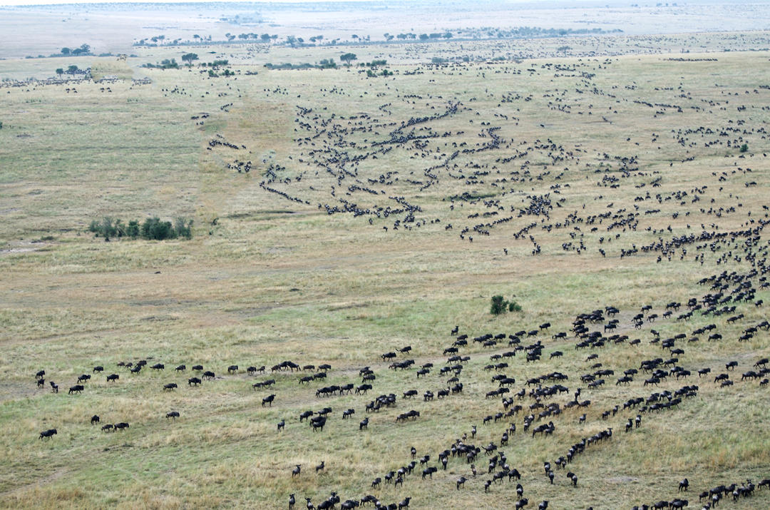
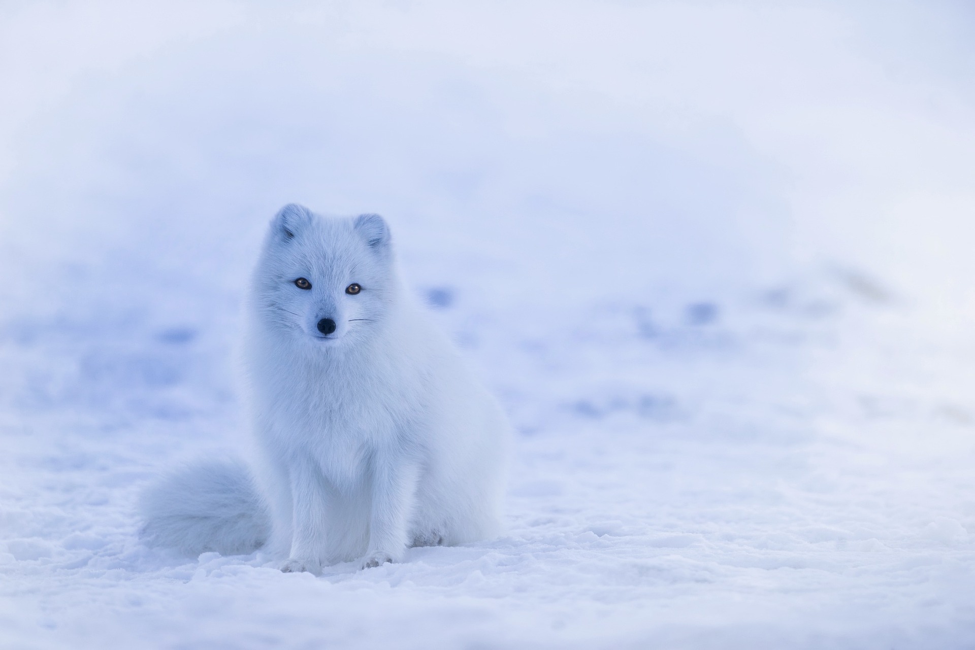
Since the 1950s, wildlife ecologists have employed radio telemetry, affixing radio tags to animals and manually tracking their emitted signals. However, this method presented its fair share of challenges.
Traversing natural terrains with tracking antennas was labor-intensive, limited the number of animals that could be effectively monitored, and often distressed the very creatures we aim to protect. In remote and rugged terrains, it even posed risks to field researchers.
The good news is that governments and green organizations around the globe are embracing innovative solutions, and at the forefront of this revolution are drones, or Unmanned Aerial Vehicles (UAVs).
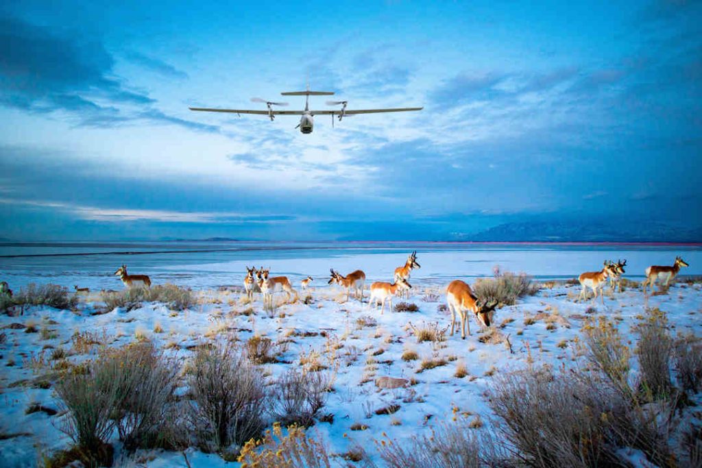
These aerial marvels, equipped with thermal cameras, offer a safer, cost-effective, and highly efficient alternative. They provide precise data and high-resolution imagery while ensuring minimal disturbance to wildlife.
But that's not all. These wildlife drones, empowered by Artificial Intelligence, Machine Learning, and Predictive Analytics, are reshaping the way we monitor, track, patrol, and gather vital data for conservation efforts.
In this article, we'll introduce you to some of the top choices in the world of wildlife drones and provide insights into the drone policies governing national wildlife refuges in various countries.
What Are Wildlife Drones and How Do They Work?
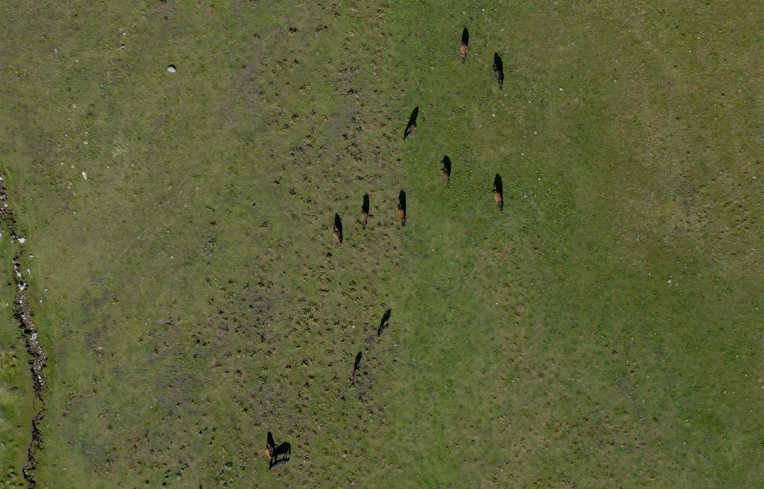
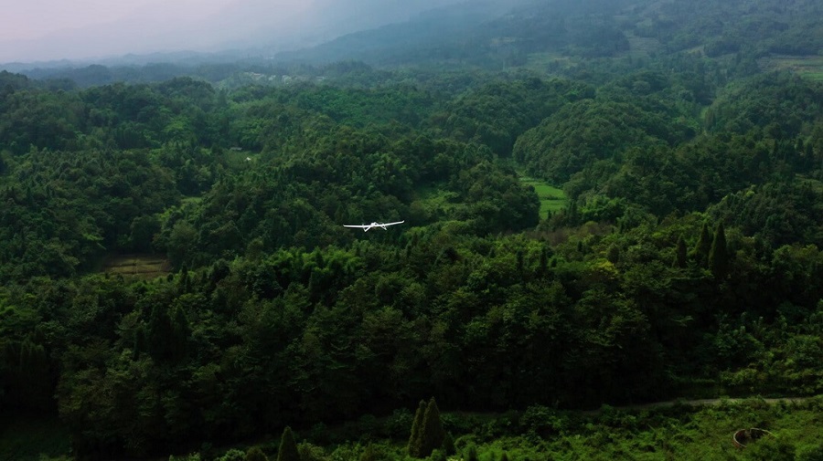
Wildlife drones are unmanned aerial vehicles designed to monitor, track, survey, and protect wildlife and their habitats. They come equipped with advanced technology, including cameras, sensors, and even artificial intelligence, to gather crucial data while minimizing human disturbance. These drones are engineered to navigate diverse terrains, from dense forests to open savannas and challenging landscapes.
The global market for wildlife drones is experiencing an incredible surge. In 2022 alone, it raked in a whopping $3.70 billion, and the excitement doesn't stop there. Experts are predicting a steady annual growth rate of 4.90% from 2023 to 2026. This soaring demand underscores the pivotal role wildlife drones play in preserving our planet's diverse and endangered species.
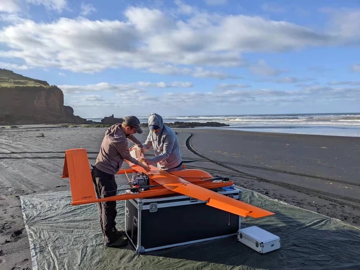
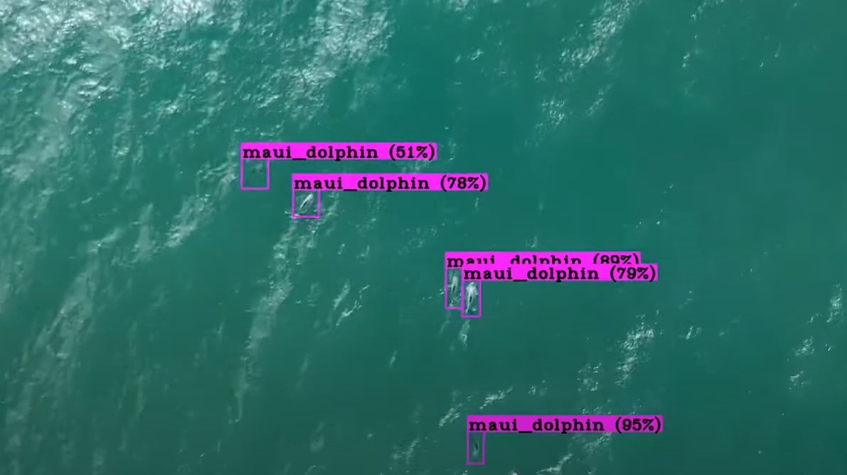
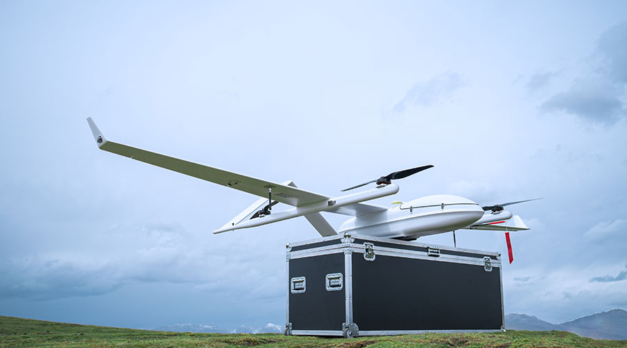
MAUI163 team, a New Zealand based not-for-profit, was using the JOUAV CW-25 VTOL drone to track Māui dolphins. Source from maui63.org
Wildlife drones operate on the principles of aerial surveillance and data collection. These remarkable devices are equipped with an array of specialized tools, each tailored to serve a unique purpose in the field of wildlife conservation:
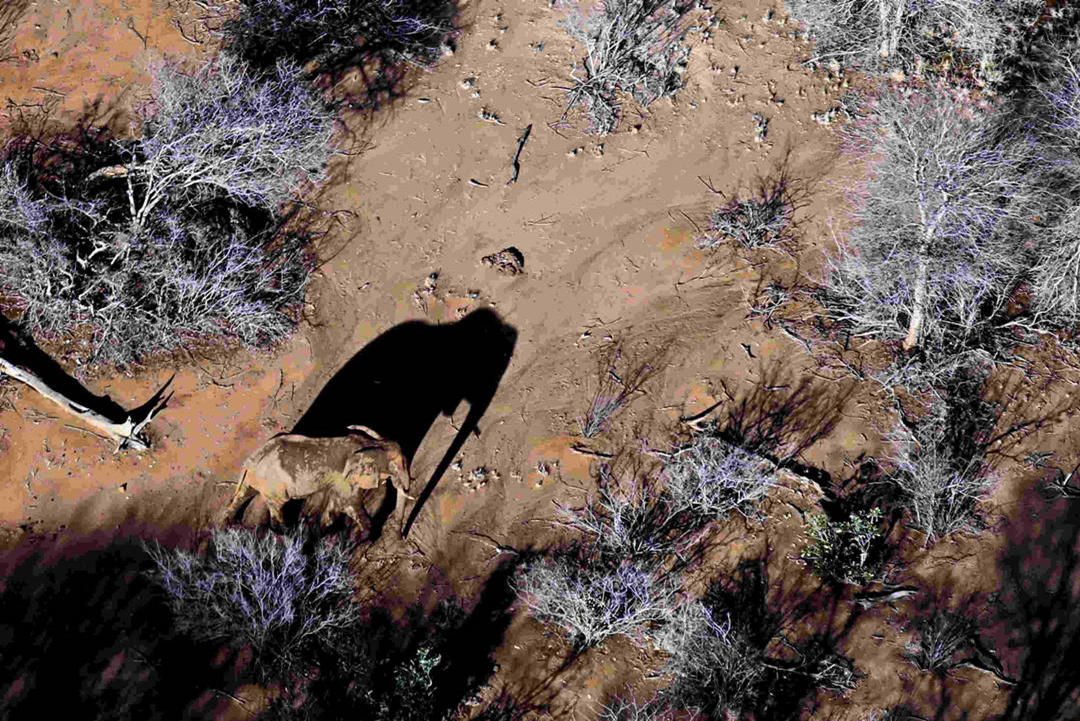
- Thermal Cameras: Wildlife drones often have advanced thermal cameras. These cameras can detect and capture heat signatures, enabling researchers to identify and track wildlife even in the cover of darkness or dense foliage. Whether it's a hidden animal or an injured one needing help, thermal cameras play a crucial role.
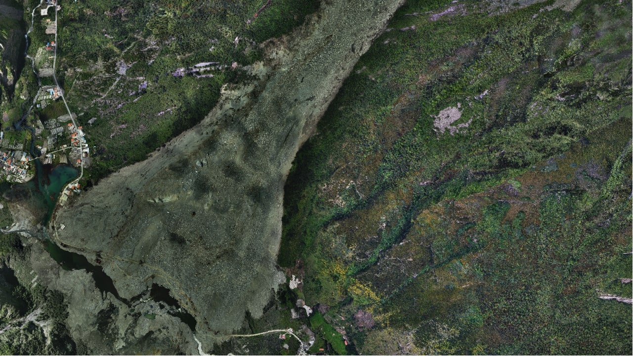
- Remote Sensing Technology: Drones equipped with GPS and environmental sensors collect vital data on habitat fragmentation, weather patterns, and other ecological factors. This information helps assess ecosystem health and animal well-being.
- Artificial Intelligence and Machine Learning: Many wildlife drones incorporate AI and machine learning algorithms. These cutting-edge technologies enable drones to analyze the data they collect in real-time, assisting in the identification of species, and animal behavior, and even early detection of threats like poachers.
Types of Wildlife Drones and Their Specialized Features
There are several types of drones used for different wildlife research and conservation needs. Here is a comprehensive overview of the types of wildlife drones:
Fixed-Wing Drones
Fixed-wing drones are designed to resemble traditional airplanes with wings that provide lift and propulsion.
These drones are known for their efficiency in covering large areas and conducting surveys over extensive wildlife habitats.
Researchers and conservationists often use fixed-wing drones for tasks such as aerial surveys of large animal populations, mapping and monitoring vast landscapes and tracking migratory patterns of birds and marine animals.
Their ability to cover long distances efficiently makes them a valuable tool for wildlife research over extensive regions.
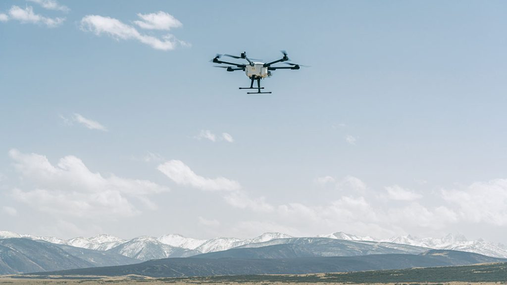
Multirotor Drones
Multirotor drones, including quadcopters and hexacopters, feature multiple rotors that enable vertical takeoff and landing.
These drones can hover in place, making them well-suited for capturing detailed images and videos in confined spaces or at low altitudes.
Researchers use multirotor drones for close-range wildlife monitoring and observation, especially in dense forests or urban environments.
They are ideal for behavioral studies of animals, including nesting and mating behaviors, and are also employed for rapid response to wildlife emergencies, such as monitoring injured animals or assessing disaster-stricken areas.
Hybrid Drones
Hybrid VTOL drones combine features of both fixed-wing and multirotor drones, offering the flexibility of vertical takeoff and landing as well as efficient, long-range exploration.
Researchers use hybrid drones for wildlife tracking in challenging terrains, such as mountains or dense jungles.
These drones are valuable for conducting extended-range surveys of both terrestrial and aquatic ecosystems.
They are often used for environmental monitoring, including assessing the impact of climate change on wildlife habitats.
Reduced Disturbance to Wildlife
Traditional methods of tracking and monitoring wildlife often require researchers to physically enter natural habitats. This approach, while well-intentioned, could cause significant stress to the animals and disrupt their natural behaviors.
With wildlife drones, the game changes dramatically. These drones can fly at safe distances, capturing essential data without physically intruding on the wildlife. They provide an unobtrusive vantage point from above, allowing us to monitor animals in their natural state without causing any unnecessary stress.
Enhanced Data Collection
Consider the challenge of monitoring the behavior and populations of animals in a vast, remote, or difficult-to-access area. Traditional ground surveys can be time-consuming, and the data collected may lack detail due to the limitations of human observation.
Wildlife drones, on the other hand, soar above these obstacles. They capture high-resolution imagery and videos, allowing us to gather extensive and precise data. These visuals offer insights into animal behavior, population dynamics, and habitat conditions that we might never have obtained otherwise.
Cost-Effectiveness
Traditional wildlife monitoring methods often require extensive fieldwork, which can be labor-intensive and expensive. Ground surveys, helicopter flights, and manpower can consume significant resources.
Wildlife drones offer a cost-effective alternative. They cover larger areas in less time, eliminating the need for expensive helicopter operations and reducing labor costs. This efficiency ensures that limited conservation budgets are used efficiently, stretching resources further and maximizing conservation impact.

Improved Safety for Researchers
Field researchers often operate in remote and challenging terrains, exposing themselves to various risks. Dangerous animals, rough landscapes, and extreme weather conditions are just a few of the hazards they may encounter.
Drones mitigate these risks by providing remote access to these areas. Researchers can monitor and collect data from a safe distance, eliminating the need to venture into potentially perilous environments. This enhances the safety of field researchers, ensuring they can focus on their work without compromising their well-being.
Wildlife Monitoring and Conservation
Equipped with specialized cameras, including infrared and thermal imaging, these flying agents offer insights that were once unattainable. They capture high-resolution images and real-time data, enabling ecologists to decipher animal behavior, migration patterns, and population dynamics with unmatched precision. This invaluable data forms the backbone of conservation efforts, equipping us to make informed decisions aimed at protecting endangered species and preserving biodiversity.
Combatting Wildlife Crime
The battle against wildlife crime, which encompasses poaching and the illegal trade of wildlife, is a constant challenge in conservation. Drones armed with advanced surveillance technology play a pivotal role in detecting and deterring these nefarious activities. By patrolling protected areas and wildlife reserves, these vigilant airborne guardians assist law enforcement agencies in tracking down poachers and protecting vulnerable animals, contributing to the preservation of species on the brink.
Efficient Surveys and Research
Traditional wildlife surveys often demand extensive time, labor, and resources. Drones redefine the equation. They can cover vast areas swiftly, conduct detailed habitat assessments, and collect vital biological data. From population counts to habitat mapping, drones amplify the efficiency of research endeavors, allowing scientists to concentrate on data analysis and the formulation of conservation strategies.
Disaster Response and Wildlife Rescue
Drones equipped with thermal cameras shine brightly in disaster-stricken regions. They come to the aid of wildlife affected by natural calamities such as wildfires or floods. Rapid response teams can deploy drones to identify stranded animals, assess their condition, and plan effective rescue operations. In moments of crisis, these airborne heroes ensure the survival of vulnerable species, embodying the essence of compassionate conservation.
JOUAV Drone Solution for Wildlife Management
Elevate your wildlife management initiatives with JOUAV's cutting-edge drone solution - a harmonious blend of specialized technology, autonomous capabilities, and advanced data analytics for a more effective and ethical approach to wildlife conservation.

Specialized Drones
These are drones designed for wildlife conservation, equipped with features such as long flight times, thermal or infrared cameras, high-resolution cameras, and low noise profiles to minimize disturbance.

Autonomous Flight and Navigation
GPS and advanced navigation systems for precise positioning and autonomous flight planning. Obstacle avoidance technology to prevent collisions during flights, ensuring the safety of both the drone and wildlife.

Customized Sensor Payloads
High-quality drones equipped with specialized sensors such as high-resolution cameras, thermal imaging cameras, LiDAR, and multispectral cameras. These sensors enable detailed data collection, habitat mapping, and wildlife monitoring.

Cloud-Based Drone Management Software
Manage your drone fleet effortlessly with our cloud-based web application. Offering comprehensive features such as fleet management, real-time performance monitoring, mission planning, and post-flight AI analytics.

Data Analysis and AI Integration
AI algorithms for species identification, animal counting, and behavior analysis, allowing for efficient processing of collected data. Predictive analytics for trend analysis and forecasting based on historical wildlife data.

Real-time Data Transmission
Instantaneous data transmission to a centralized database or research facility ensures that data is available for immediate analysis and informed decision-making, empowering conservation efforts.

Route Planning with Eagle Map
The JOUAV drone solution begins with meticulous route planning using the advanced Eagle Map. This intuitive flight planning tool allows operators to chart the drone's course with precision, considering factors such as terrain, wildlife habitats, and research objectives.
Autonomous Video Acquisition
Once the route is defined, the drone autonomously takes flight, equipped with a dual gimbal camea. This advanced sensor captures video data, combining the benefits of visible light and thermal imaging for comprehensive and detailed observations.
Real-time Video Transmission
The drone captures high-quality video data throughout its mission, instantly shared via the Jocloud platform. This enables agencies and researchers to access real-time footage with low latency, ensuring swift and effective situational awareness.
Recommended Drones for Wildlife Conservation
Selecting the best drone for wildlife conservation involves considering various factors, including camera capabilities, flight time, portability, and durability. Below we will recommend 3 of the best drone options tailored for wildlife conservation:
JOUAV CW-15 VTOL Drone - Best Drone for Wildlife Crime Surveillance
The JOUAV CW-15 VTOL Drone is an exemplary choice for wildlife ecologists who require a versatile, long-lasting, and quiet solution to their research needs, ensuring minimal disturbance to the very creatures they aim to protect.
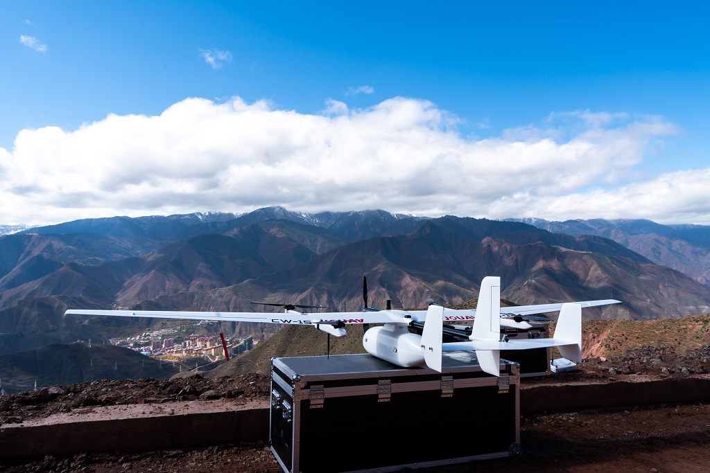
- VTOL Fixed-Wing Design: The vertical takeoff and landing capabilities allow this drone to access confined spaces like cliffs, forests, and mountains, making it an ideal choice for wildlife crime surveillance in challenging terrains.
- Silent Operation: The VTOL design enables quiet flight at altitudes of 300 meters, resulting in minimal ground noise during operation. This silent operation is essential to avoid disturbing wildlife and illegal activities.
- Extended Flight Time: With a remarkable maximum flight time of 180 minutes, this drone can cover extensive areas, making it suitable for surveilling vast regions of African savanna and bodies of water.
- Payload Capacity: The CW-15 boasts a payload capacity of 3kg, accommodating various accessories. It can be equipped with searchlights and megaphones to deter poachers, as well as 61MP RGB cameras for wildlife photography and LiDAR sensors for habitat mapping.
- Impressive Flight Range: This drone offers a flight range of 50km, ensuring that wildlife conservation efforts can extend over considerable distances.
- Open Architecture and SDK Support: The open architecture and support for Software Development Kits (SDKs) enable users to develop custom applications, enhancing their adaptability for specific research and conservation needs.
- Robust Design: Designed to operate in challenging conditions, the CW-15 can withstand high altitudes, high humidity, low temperatures, and light rain. It also features self-heating technology in its airspeed pitot tube.
- Obstacle Avoidance: The CW-15 is equipped with advanced obstacle avoidance capabilities, automatically adapting to various terrains and avoiding dangerous landing points, such as roofs and cliffs.
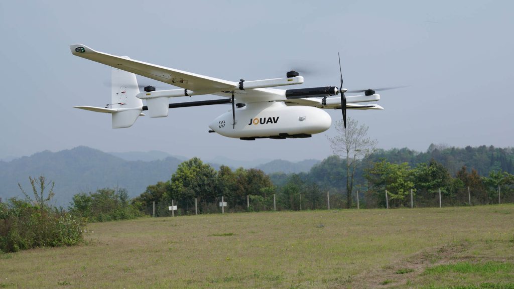
JOUAV CW-25E VTOL Drone - Best Drone for Wildlife Monitoring
The JOUAV CW-25E VTOL Drone offers advanced capabilities, extended flight time, and remarkable payload capacity, making it an excellent choice for wildlife researchers who need to cover vast areas and tackle complex research challenges with precision.
- Comprehensive Camera System: The MG-120E gimbal camera combines a 30x zoom 1920 x 1080 optical camera, a 640*512 infrared camera, a 3-axis gimbal, and AI recognition and tracking, ensuring precise monitoring of wildlife.
- VTOL Design: The vertical takeoff and landing capabilities, whether in confined spaces or on moving vehicles and ships, provide versatility for wildlife monitoring in diverse environments.
- Silent Operation: With virtually no discernible sound or vibration, even at altitudes of 500 meters, this drone ensures an undisturbed experience on the ground during high-altitude flights.
- Extended Flight Time: The CW-25E offers an impressive maximum flight time of 240 minutes, allowing for extensive coverage of African savanna and water bodies.
- High Payload Capacity: Boasting a payload capacity of 6kg, it can accommodate 61MP RGB cameras for wildlife photography and LiDAR sensors for habitat mapping, providing comprehensive data for wildlife monitoring.
- Long Flight Range: This drone offers a substantial flight range of 200km, making it suitable for extensive monitoring projects.
- Resilience to Environmental Conditions: The CW-25E is capable of flying in challenging environmental conditions, including high altitudes, high humidity, low temperatures, and light rain, thanks to its self-heating airspeed pitot tube.
- Quick Disassembly: Utilizing quick connection structures, the drone can be easily disassembled into 10 parts, making it convenient for transportation in SUV-type vehicles.
JOUAV PH-7E Quadcopter - Best Drone for Wildlife Photography
The JOUAV PH-7E Quadcopter offers precision, control, and adaptability to field researchers who require versatility and maneuverability for their wildlife research needs. While it may have a different noise profile and flight altitude compared to VTOL drones, it excels in providing close-up and detailed observations, making it suitable for specific research scenarios.
- High-Performance Camera: The PDL-1K thermal and visible dual gimbal camera combines an infrared sensor with a resolution of 1280×1024 and a 1-inch visible light sensor, offering versatile day and night detection capabilities.
- Precision and Control: This quadcopter's ability to maneuver in closely spaced transects or grid patterns provides researchers with enhanced control, facilitating thorough surveys of elusive or partially obscured species, aiding in the study of cryptic wildlife.
- Infrared and Visible Light Modes: This camera operates in both infrared thermal and visible light sensor dual-output modes, providing flexibility for wildlife photography under varying lighting conditions.
- Stabilization Technology: The three-axis stabilization technology offers a stable view with exceptional accuracy.
- Extended Flight Time: With a flight time of 63 minutes and a top speed of 23m/s, this quadcopter provides flexibility and control for wildlife photography projects.
- Payload Capacity: The PH-7E has a payload capacity of 3kg, accommodating 61MP RGB cameras for wildlife photography, LiDAR sensors for habitat mapping, and other accessories.
Control Range: Offering a control range of 15km, it ensures a robust connection during wildlife photography missions. - Obstacle Avoidance System: The inclusion of millimeter-wave radars and a visual system enables the quadcopter to sense its environment omnidirectionally, avoiding obstacles such as cables both during the day and at night, ensuring safe flight operations.
- Lightweight and Portable: Its lightweight construction and foldable design enable easy portability, allowing researchers to carry the quadcopter in a backpack. This portability ensures swift deployment and maneuverability in the field.
Policies and Regulations for Wildlife Drones
General drone regulations and guidelines serve as the foundation for responsible drone operation. These regulations are typically set by aviation authorities and are crucial to ensure safety and adherence to the law. Some common regulations include:
Registration: Many countries require the registration of drones with appropriate aviation authorities. This process helps in tracking ownership and ensuring accountability for drone operators.
Altitude Restrictions: Regulations often include altitude restrictions to prevent drones from interfering with manned aircraft and to protect airspace safety.
No-Fly Zones: Certain areas, such as airports, military bases, and sensitive government facilities, are designated as no-fly zones. Drones are prohibited from flying in these areas to ensure national security and public safety.
Line-of-Sight Operation: Some regulations mandate that operators maintain visual line of sight with their drones during flights. This is to ensure that operators can see and avoid other aircraft or obstacles.
Licensing and Certification: Commercial drone operators are typically required to obtain licenses or certifications, such as the Part 107 in the United States, which ensures they have a certain level of knowledge and skill.
Maintenance and Safety Checks: Drones should undergo regular maintenance and safety checks to ensure they are in good working condition, reducing the risk of accidents.
Privacy and Data Protection: Drone operators must respect privacy laws and data protection regulations when capturing images or data, especially when collecting information on private property or individuals.
Read More


Let’s be honest: the drone world loves its acronyms. UAV, UAS, drone, RPAS, UCAV, FPV–it’s an alphabet soup. And most people use them like they’re the same thing.
They’re not.
And here’s why that matt
An airborne cargo drone is exactly what it sounds like: an unmanned aircraft built to carry stuff. Not tiny packages for a suburban backyard – real cargo. From medical supplies to industrial parts.
An

JOUAV Product News and Use Cases
Fixed-Wing VTOL Drones Insights and Industry Trends
Invitations to online demo events