At 2:27 PM on a storm-lashed afternoon in July 2025, a small fishing boat capsized off the coast of Gulei, Zhangzhou.
Two men were thrown into violent waters. Winds howled at gale force. Waves surged
Berlin, Germany, October 12, 2023 – JOUAV is taking center stage at the InterGEO 2023 Annual Conference in Berlin, Germany, from October 10 to 12, demonstrating groundbreaking advancements in the drone industry. The company is showcasing its latest line of VTOL (vertical take-off and landing) drones and an array of advanced LiDAR payloads. Moreover, JOUAV has unveiled the world's first VTOL drone hangar system, heralding a new era in industry automation.
JOUAV's participation in the exhibition has garnered widespread attention, underscoring the remarkable potential of VTOL drones and LiDAR technology in the fields of surveying, geographic information, and automation. By introducing cutting-edge technologies and innovative hangar systems, JOUAV is paving the way for the future of drone applications, unlocking new possibilities for a multitude of industries.
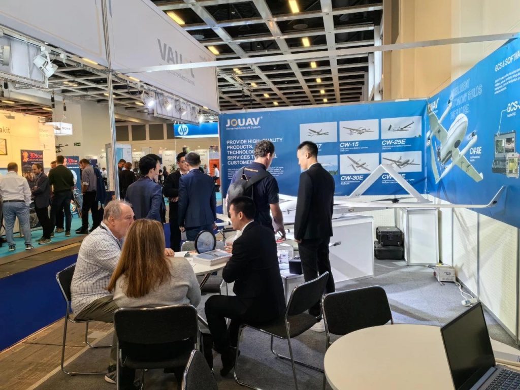
Cutting-Edge VTOL Drones
JOUAV's CW Series VTOL UAV, featuring the CW-15 and CW-25E models, stole the spotlight at the conference. Designed specifically for large-scale surveying and mapping tasks, these drones offer unparalleled capabilities.
With an impressive flight time of up to 240 minutes, a cruising speed of 72 km/h, and a flight distance of 200 km, they ensure extended operational periods and increased coverage. The absolute accuracy of 1 cm ensures the collection of highly precise data, meeting the demands of various industries.
"We believe our VTOL drones are a game-changer for professionals requiring high-precision surveying. The extended flight time and exceptional accuracy empower users to accomplish tasks that were previously challenging," explained Eric Lee, Solution Engineer at JOUAV.

Advanced LiDAR Payloads
JOUAV's LiDAR technology showcased at InterGEO 2023 set a new standard for data collection. The JoLiDAR-LR22S, JoLiDAR-1000, and JoLiDAR-1500 models integrate LiDAR and orthoimagers seamlessly, offering a scanning range of up to 1,845 meters.
This integration allows users to capture point clouds and orthophotos simultaneously, facilitating the rapid generation of high-density, true-color point cloud models. The vertical accuracy of less than 3 centimeters and horizontal accuracy of better than 5 centimeters guarantee precise surveying and mapping data for a wide array of applications.
"These LiDAR payloads are engineered to provide accurate and reliable data. The ability to capture detailed point clouds and orthophotos simultaneously enhances efficiency and ensures the delivery of high-quality results," stated Eric.
The First VTOL Drone Hangar System
A groundbreaking moment came with JOUAV's unveiling of the first VTOL drone hangar system. This innovative solution redefines automation standards by offering a flight duration of up to 100 minutes and a flight radius of 30 kilometers. The system can also carry high-quality LiDAR payloads, opening limitless possibilities for various industries.
"With our VTOL drone hangar system, we are ushering in a new era of automation. Its capabilities extend beyond conventional drone docking stations, making it a versatile and valuable tool for industries requiring automated aerial solutions," said Eric.
More Use Cases


Chongqing’s Qinba Mountains are basically a giant green wall protecting the region. But there’s a problem – pine wood nematodes are eating through it. Fast.
The forestry department n

When TotalEnergies set out to build one of Southeast Asia’s largest solar and battery storage projects—spanning 12,000 hectares across the dense acacia forests of Riau, Indonesia—they faced a problem

JOUAV Product News and Use Cases
Fixed-Wing VTOL Drones Insights and Industry Trends
Invitations to online demo events