At 2:27 PM on a storm-lashed afternoon in July 2025, a small fishing boat capsized off the coast of Gulei, Zhangzhou.
Two men were thrown into violent waters. Winds howled at gale force. Waves surged
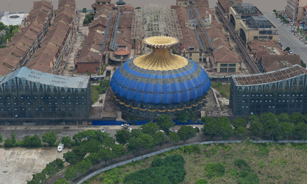
In a groundbreaking collaboration between JOUAV and Rainpoo Technology, a series of flight demonstrations were recently conducted in Chinese cities using the CW-25E VTOL UAV equipped with the DG10 oblique camera.
This case study aims to showcase the exceptional mapping efficiency and high accuracy achieved with the CW-25E+DG10 camera combination. By analyzing detailed flight data, we will unveil the revolutionary changes in work efficiency, data quality, and decision-making capabilities brought about by this cutting-edge solution.
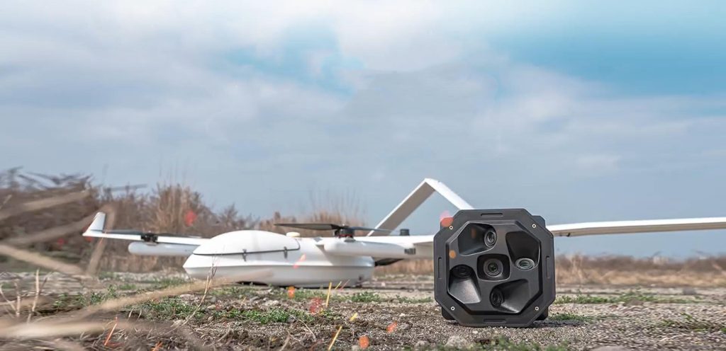
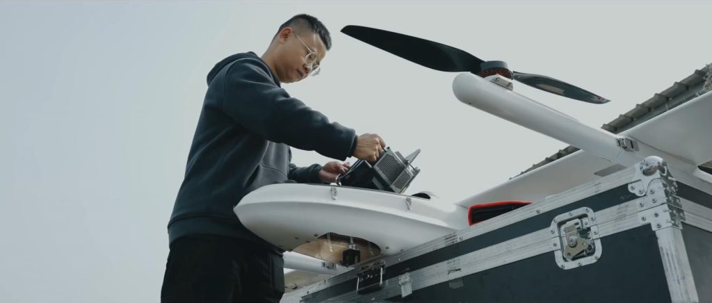
CW-25E VTOL Drone
The CW-25E vertical take-off and landing fixed-wing UAV is a remarkable creation by JOUAV. The combination of VTOL capability and fixed-wing efficiency offers several advantages for large-scale city modeling. With an impressive effective range of 240 minutes and a cruising speed of 72 km/h, this 3D modeling drone can cover flight distances of up to 200 km.
Its unique design enables it to navigate and operate within narrow urban areas, opening up new possibilities for urban mapping. Furthermore, the stability and reliability of the CW-25E ensure accurate data collection and reduce the risk of disruptions or errors during flights, contributing to high-quality 3D city models.
DG10 Oblique Camera
DG10 oblique camera is a medium-format aerial camera that has revolutionized the industry. With a total of 510 million pixels distributed across five lenses, each boasting 102 million pixels, the DG10 ensures exceptional image quality. The camera's parallel lens layout and featherweight design, weighing only 2900 grams, make it highly suitable for 3D modeling of expansive cities.
With the ability to achieve a ground resolution of 5 cm at flight altitudes over 600 m, the DG10 camera offers higher resolution and broader aerial coverage, thus propelling the mapping industry to new frontiers.
Unmatched Performance of CW-25E+DG10
To assess the performance of the CW-25E UAV with DG10 camera, the following flight parameters were utilized during the project:
Ground resolution | 3cm |
Flight altitude | 368m |
Overlap rate | 83% front/75% side |
Cruising speed | 22m/s |
Number of flights | 3 |
Mapping area | 30km2 |
Slant range | 300m |
Number of photos per sortie | 11400 |
Over 35 Times More Efficient Than Multi-rotor Drones
To demonstrate the mapping efficiency of the CW-25E UAV with the DG10 camera, a comparison was made with a multi-rotor drone with the same ground resolution of 3cm. The results clearly showcased the superiority of the CW-25E UAV with the DG10 camera in terms of efficiency.
In a single flight, the multi-rotor UAV covered only 0.28 square kilometers, while the CW-25E UAV with a DG10 camera covered an impressive area of 10 square kilometers. This stark contrast signifies that the CW-25E UAV with DG10 camera is over 35 times more efficient than the multi-rotor UAV.
High-Resolution 3D Model Results
In addition to its exceptional mapping efficiency, the CW-25E with DG10 camera produces highly accurate and detailed 3D models of the surveyed areas. One notable aspect of the project was the DG10 oblique camera's ability to capture high-definition oblique images even at an altitude of 368 meters, eliminating the need for ground control points (GCPs).
Mounted on the CW-25E UAV, the DG10 oblique camera captures a rich collection of oblique images from multiple angles, ensuring comprehensive coverage of the project area. Despite the high altitude, the DG10 camera's advanced imaging capabilities deliver crisp and clear oblique images, capturing intricate details of buildings, terrain, and other features.
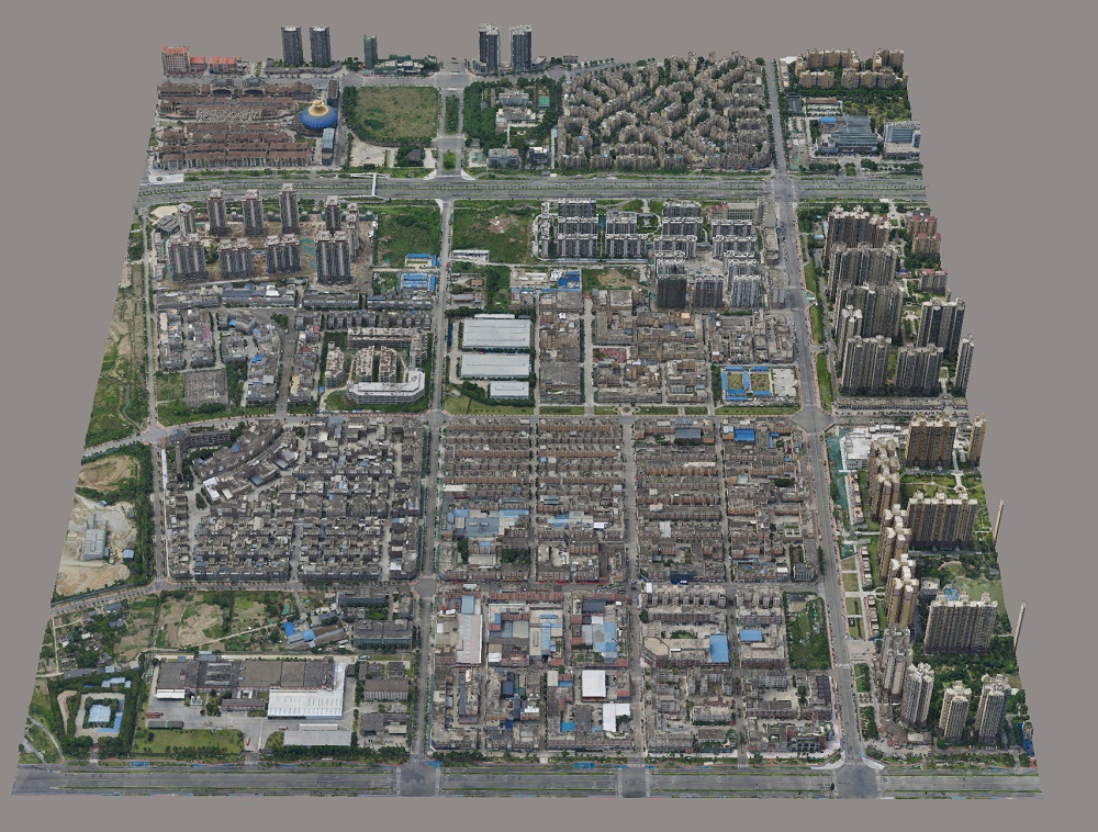
3D model results generated from oblique images acquired by CW-25E with DG10
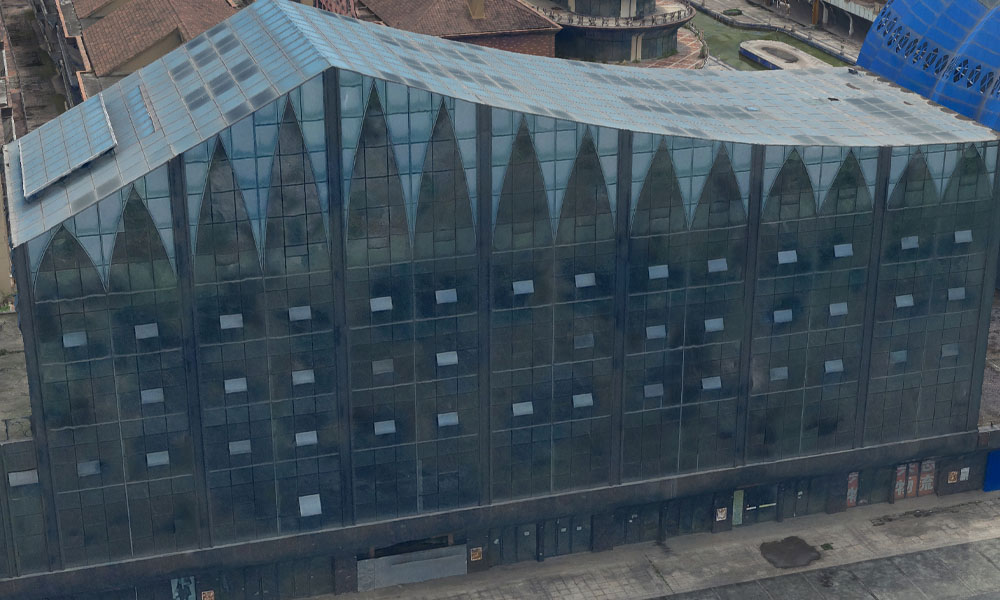
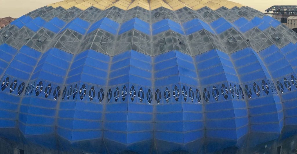
The 3D model has a high level of detail from the high-resolution images captured by the CW-25E+DG10. It accurately represents small features and objects, preserving rich colors and textures for a photorealistic result.
More Use Cases


Chongqing’s Qinba Mountains are basically a giant green wall protecting the region. But there’s a problem – pine wood nematodes are eating through it. Fast.
The forestry department n

When TotalEnergies set out to build one of Southeast Asia’s largest solar and battery storage projects—spanning 12,000 hectares across the dense acacia forests of Riau, Indonesia—they faced a problem

JOUAV Product News and Use Cases
Fixed-Wing VTOL Drones Insights and Industry Trends
Invitations to online demo events