Benefits and Features

One-click Data Export
One-click aerial photo export with ease and speed.

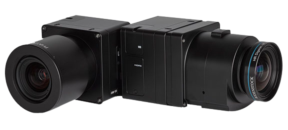
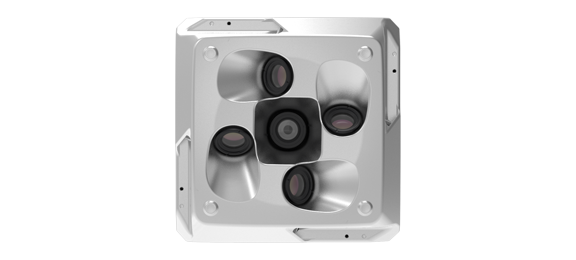
Higher Precision
New self-developed optical lens, realizing higher precision, more stable and reliable;

Multi-parameter Adjustment
Multi-parameter adjustment, remote control WeChat applet multi-device adjustment, fearless of weather variation.

Support A Wide Range of Drones
Convenient detachable switching interface, supporting a variety of drones.

Multiple Fast Memory Cards
Multiple all-in-one fast memories that allow for quick memory card changes without flight delays.

Substantial Cost Savings
High compatibility, high efficiency and substantial cost savings.
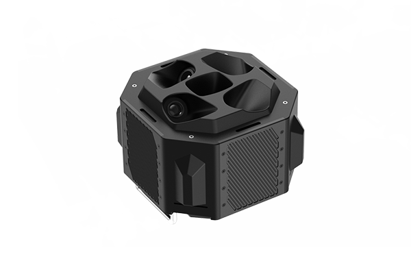
Data Results
DG10 Medium Format Oblique Camera can meet the needs of high-precision, large-area, urban-level live-view 3D construction data collection, providing core technical support and foundation for live-view 3D data collection.
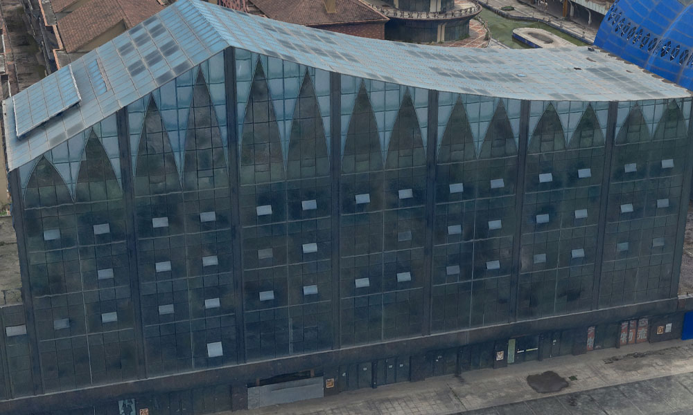
3D Model
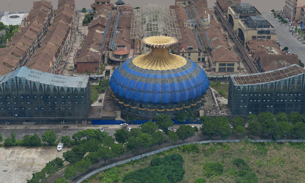
3D Model
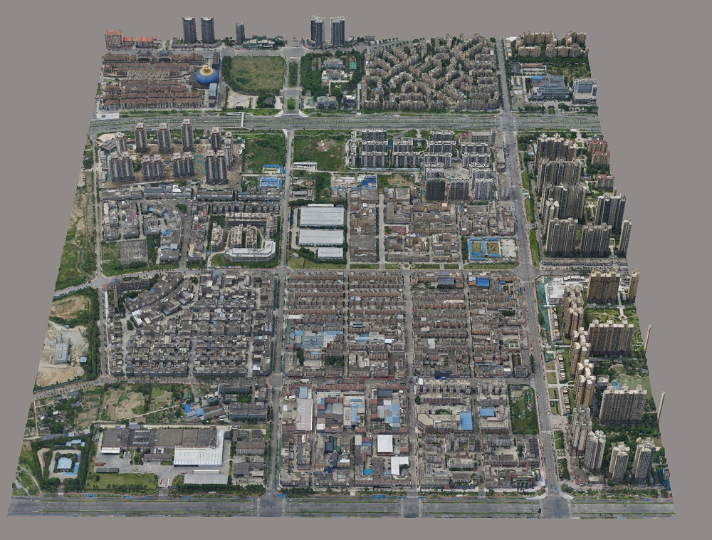
3D Model
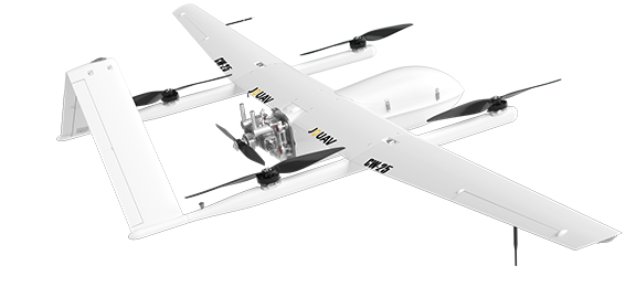
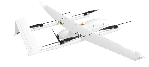
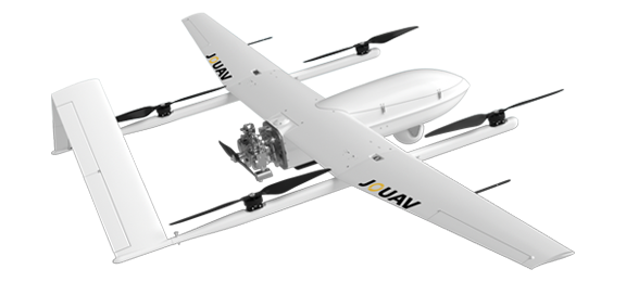
Compatible Drones
Light and small, DG10 oblique camera adopt modular design, which can be compatible with most of JOUAV aerial survey fixed-wing UAVs.
Other Payloads
JOUAV is constantly updating its cameras and enriching its product lineups to provide a better data results and to meet customers' needs.
PhaseOne iXM Series Camera
High-resolution medium format cameras for mapping and surveying
CA50XR Series Oblique Camera
High-precision half-frame/full-frame oblique cameras for 3D city modeling and urban planning

More information about JOUAV and our drones
Provide the suitable solution for your needs
Help for your project promotion
Get a product quote