At 2:27 PM on a storm-lashed afternoon in July 2025, a small fishing boat capsized off the coast of Gulei, Zhangzhou.
Two men were thrown into violent waters. Winds howled at gale force. Waves surged
Facing Multiple Challenges
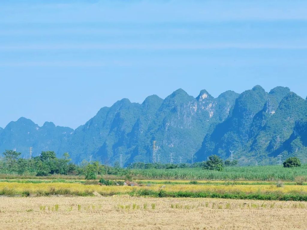
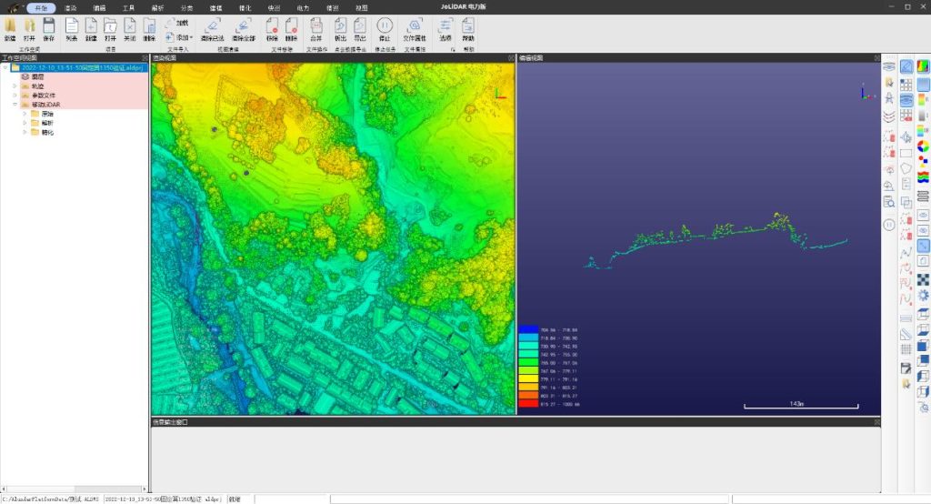
This power line inspection encountered several challenges. The terrain was an intricate karstic landscape with crested depressions, steep slopes, and localized height variations.
The route, being narrow and involving ridge crossings and tight passages, demanded meticulous flight path planning. Moreover, the long, winding power lines necessitated increased point density for precision.
These challenges required the CW-15 UAS to operate efficiently and safely in complex terrain, maintaining high accuracy during data collection.
Smart Route Planning
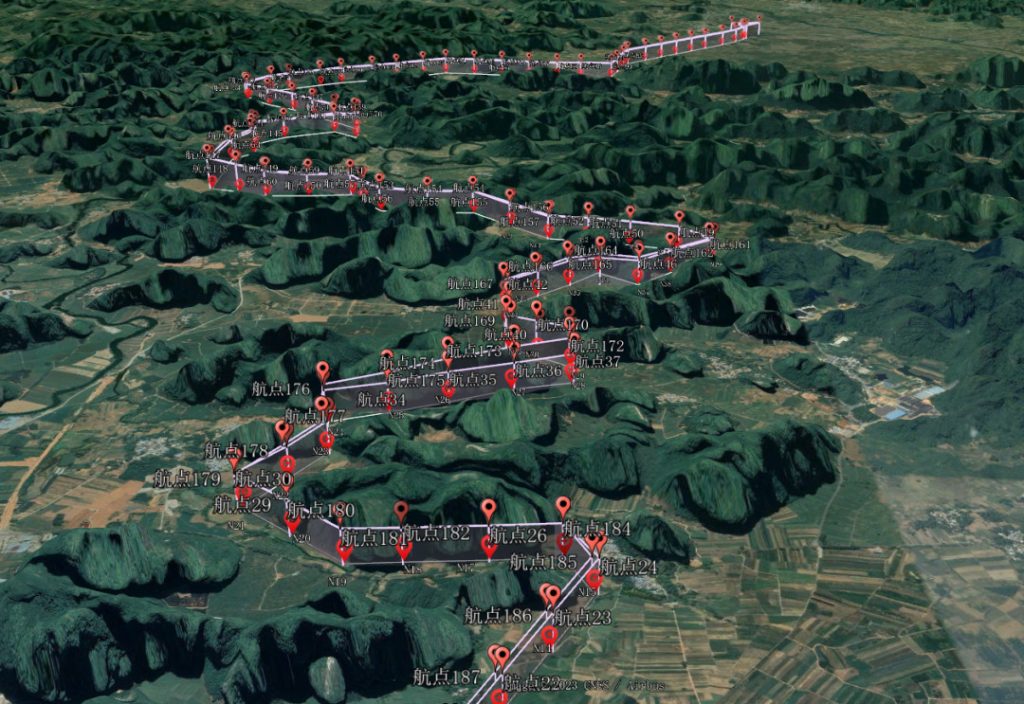
The JOUAV team used FlightSurv for flight planning. To manage a height difference of up to 200 meters, they adeptly employed the terrain-following flight function, automatically adjusting the flight altitude to 220 meters.
This functionality empowered the UAV to dynamically adapt its route in response to real-time changes in terrain height during flight, ensuring secure navigation through intricate landscapes.
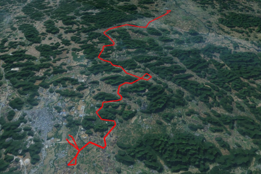
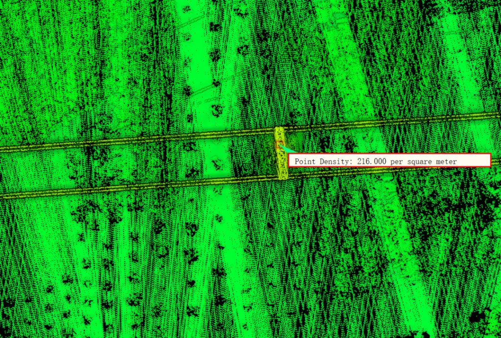
The total route spanned 83.63 km, surpassing the actual length of the power line, to accommodate unforeseen terrain challenges and guarantee comprehensive coverage of the inspection area.
Aligning precisely with the power line at 33.7 km, the scanning line length facilitated meticulous scanning and recording of every vital inspection area.
Efficient Data Acquisition
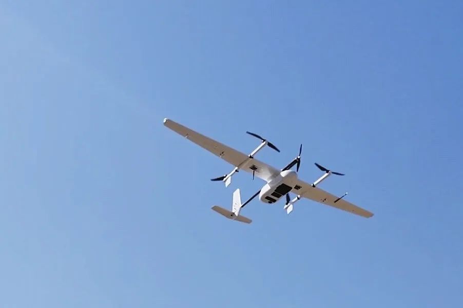
During the power line inspection, the CW-15 featuring JoLiDAR-1000 demonstrated its intelligent terrain following flight capability, providing a reliable solution for UAV inspection in challenging terrain.
The CW-15's navigation system, utilizing high-precision digital 3D maps, enabled global path search, planning, and collision detection algorithms for intelligent point-to-point flights in diverse terrain.
This autonomy allowed the UAV to adapt intelligently, ensuring a stable and safe flight.
Equipped with forward-looking and downward-looking millimeter-wave radar and binocular vision obstacle avoidance systems, the CW-15 navigated challenging terrain seamlessly.
In tough terrains, the systems on the UAV worked well together. They sensed the surroundings in real-time, helping the UAV smartly dodge obstacles, making the flight stable and safe, and boosting the success of data collection.
JoLiDAR-1000, as a payload LiDAR, integrated a mid-range laser scanner, high-resolution RGB camera, and inertial guidance system for superior multi-functionality in data acquisition.
The mid-range laser scanner ensured efficient scanning in complex terrain, the high-resolution RGB camera captured clear color information, and the inertial guidance system ensured spatial accuracy.
With a 1,000-meter scanning range, a laser pulse frequency of up to 1,000 KHz, and a measurement accuracy of 5 mm, JoLiDAR-1000 guarantees detailed and reliable data acquisition with high efficiency.
Data Processing Excellence
The success of power line inspection was boosted by JoLiDAR software's robust processing capabilities.
Known for its diverse power application modules, the software excels in one-click cut file classification, simplifying data management and analysis, and enhancing power tower identification and management through its tower informationization module.
JoLiDAR software provides professional support for power channel tree barrier analysis, cross-span assessment, arc droop detection, tree dumping analysis, fine inspection, and platform docking.
In particular, its advanced algorithms swiftly and accurately identify potential risk factors, offering a solid reference for power line maintenance, especially in identifying power channel tree obstacles and conducting tree tipping analysis.
Moreover, JoLiDAR software facilitates seamless platform docking, effortlessly integrating into other power industry information platforms.
This integration enhances the efficiency of sharing and managing inspection data, providing the power industry with effective tools for integrated management data.
Impressive Results
In just one hour, the JOUAV team efficiently completed a 33.7km power line inspection, showcasing not only speed but also exceptional detail and data accuracy.
The acquired power line dataset is crucial, providing true-color information for each point, and enhancing the overall model's realism.
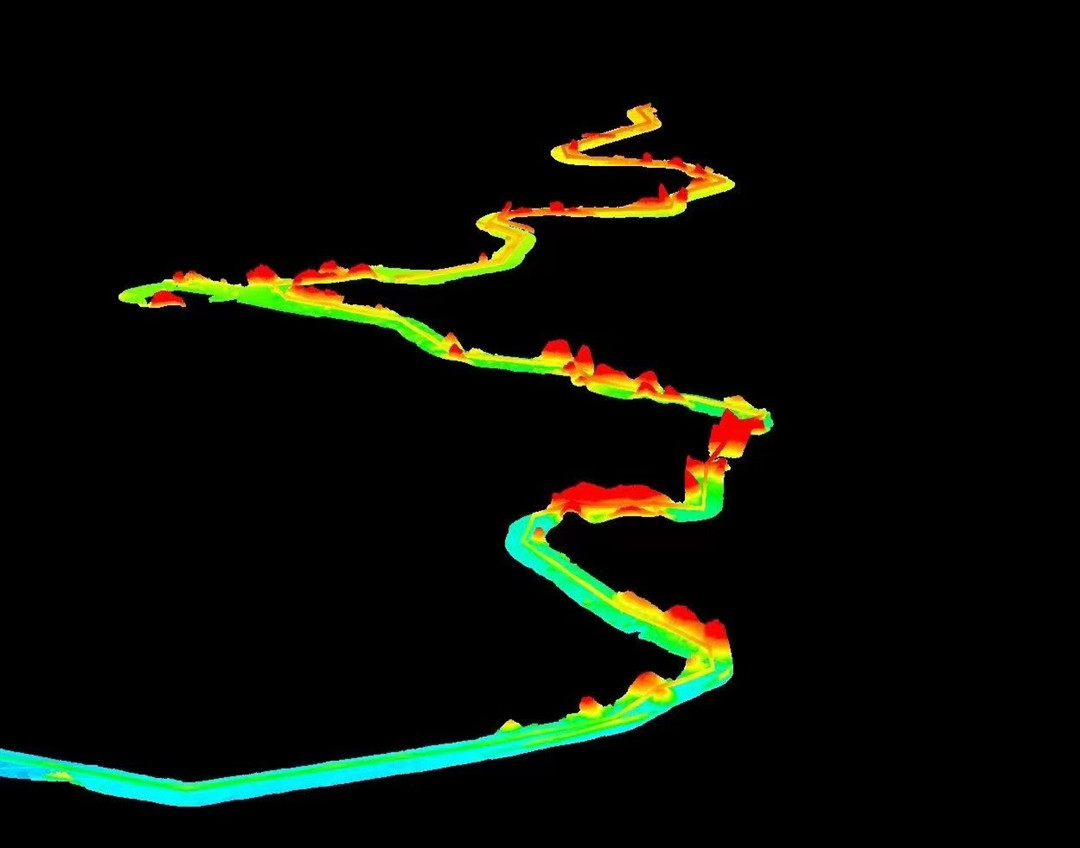
The point cloud view of the power line shows the detailed structure of the tower and line, including clear outlines, support structures, and connection points.
This high-precision display allows us to get a close-up look at the form of each tower, the layout of the support structures, and the complexity of the line's connection points.
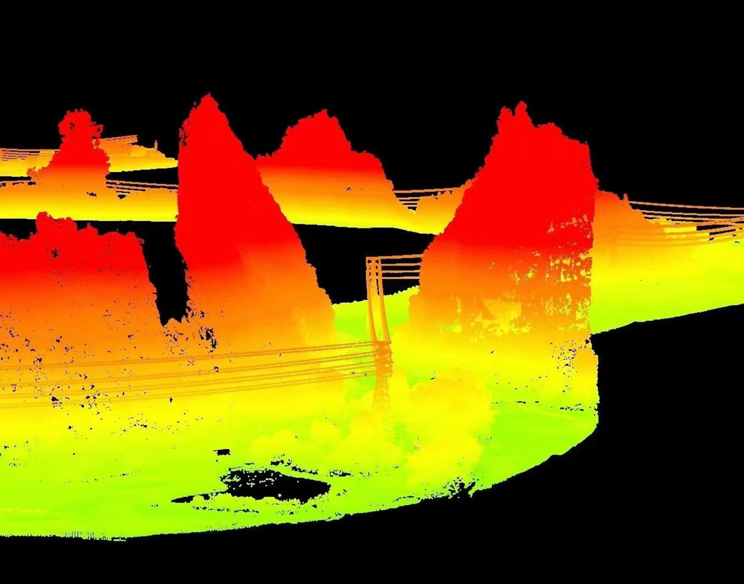
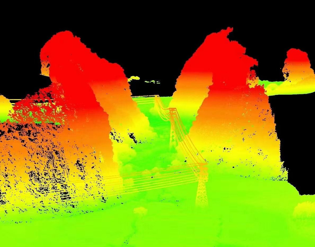
The accurate determination of the power line's profile width at 0.45 meters establishes a substantive foundation for future planning and maintenance decisions.

Within the point cloud data, tower density reached 171 points per square meter, with conductor points' density at a significant 111 points per square meter.
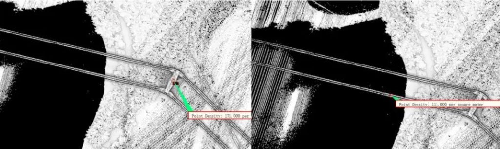
This comprehensive density information offers a clear view of the power line structure, unveiling the condition, location, and surroundings of each component.
The high-quality data application extends beyond basic inspection tasks, serving as a foundation for intelligent decision-making.
It empowers operations teams to accurately assess facility status, promptly identify potential issues, and take necessary maintenance actions.
The precise power channel information derived from profile width data enhances future project planning, ensuring more reliable line adjustments and optimization planning.
Read More


Chongqing’s Qinba Mountains are basically a giant green wall protecting the region. But there’s a problem – pine wood nematodes are eating through it. Fast.
The forestry department n

When TotalEnergies set out to build one of Southeast Asia’s largest solar and battery storage projects—spanning 12,000 hectares across the dense acacia forests of Riau, Indonesia—they faced a problem

JOUAV Product News and Use Cases
Fixed-Wing VTOL Drones Insights and Industry Trends
Invitations to online demo events