At 2:27 PM on a storm-lashed afternoon in July 2025, a small fishing boat capsized off the coast of Gulei, Zhangzhou.
Two men were thrown into violent waters. Winds howled at gale force. Waves surged
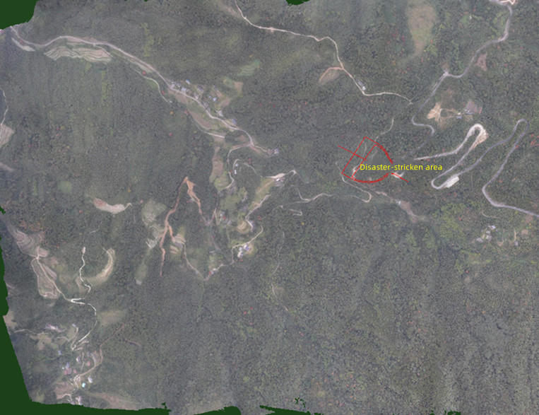
Nighttime deployment of the JOUAV VTOL Hangar System at Liangping High-Tech Zone, flying 20 km to the landslide site to begin operations.
Sustained Eyes on the Evolving Crisis
Once on station, the CW-15V vertical take-off and landing fixed-wing UAV began a relentless seven-day monitoring mission. Its unique design provided the endurance for wide-area coverage and the flexibility for precise, persistent observation.
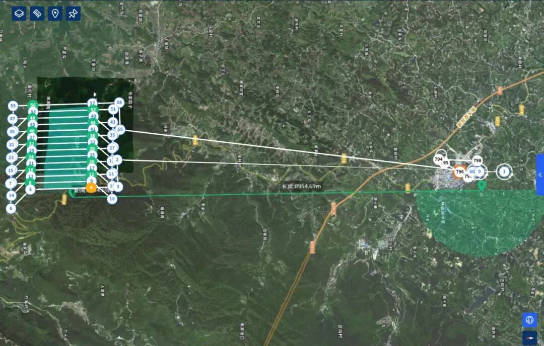
Mission flight route map.
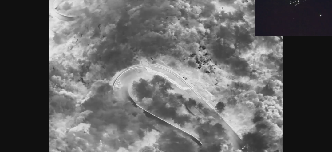
Night patrol to check for passing vehicles and pedestrians in the affected area.
Equipped with a suite of professional payloads—from high-resolution oblique cameras for 3D modeling to real-time electro-optical gimbals for live video—the system constructed a comprehensive, dynamic digital twin of the entire affected area.
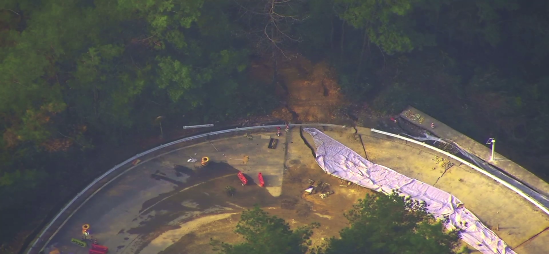
Overview of the Wanchanggou landslide disaster site.
This continuous data stream was transformed into actionable intelligence through JOUAV's analytical platform. Experts could detect subtle ground deformation invisible to the eye, calculate precise landslide volume for removal planning, and model risk trends.
This clear, scientific picture empowered a critical decision: to safely restore limited emergency traffic while implementing a protocol for long-term monitoring and mitigation.
Real-time on-site imagery captured by the CW-15V UAV.
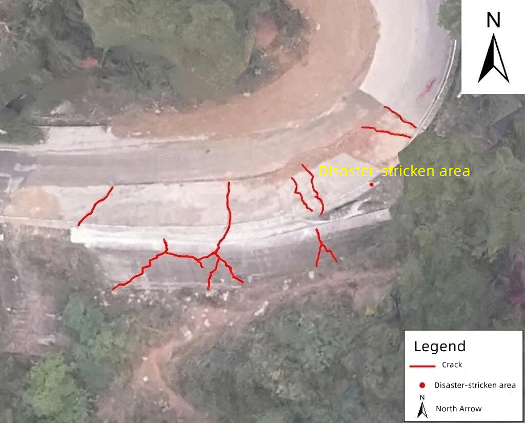
Detailed surface features and deformation at the landslide site.
From Emergency Assessment to Safeguarding Recovery
The mission’s role extended beyond the initial crisis. In January 2026, the same unmanned system was redeployed to oversee the emergency road diversion construction along G318.
It provided project managers with regular, detailed surveys to track progress and, more importantly, served as a vigilant guardian—continuously verifying slope stability to ensure construction activities did not inadvertently trigger secondary slides, thereby protecting the workers and machinery below.
More Use Cases


Chongqing’s Qinba Mountains are basically a giant green wall protecting the region. But there’s a problem – pine wood nematodes are eating through it. Fast.
The forestry department n

When TotalEnergies set out to build one of Southeast Asia’s largest solar and battery storage projects—spanning 12,000 hectares across the dense acacia forests of Riau, Indonesia—they faced a problem

JOUAV Product News and Use Cases
Fixed-Wing VTOL Drones Insights and Industry Trends
Invitations to online demo events