At 2:27 PM on a storm-lashed afternoon in July 2025, a small fishing boat capsized off the coast of Gulei, Zhangzhou.
Two men were thrown into violent waters. Winds howled at gale force. Waves surged
Thailand is the world’s leading producer of natural rubber, and its vast plantations are crucial for this status. However, a silent threat has been putting the industry at risk for years: Rubber Leaf Fall Disease. This disease, caused by aggressive fungal pathogens, leads to severe defoliation. It slashes latex yields by 20 to 45 percent and threatens the livelihoods of many farming communities.
For the Rubber Authority of Thailand (RAOT), controlling this disease was a monumental challenge. Using traditional ground teams to monitor the extensive plantations in Narathiwat Province, across all six districts, proved to be slow and inefficient. Satellite imagery didn't have the detail needed to spot early signs of stress. They needed a way to identify problems before leaves fell and yields dropped.
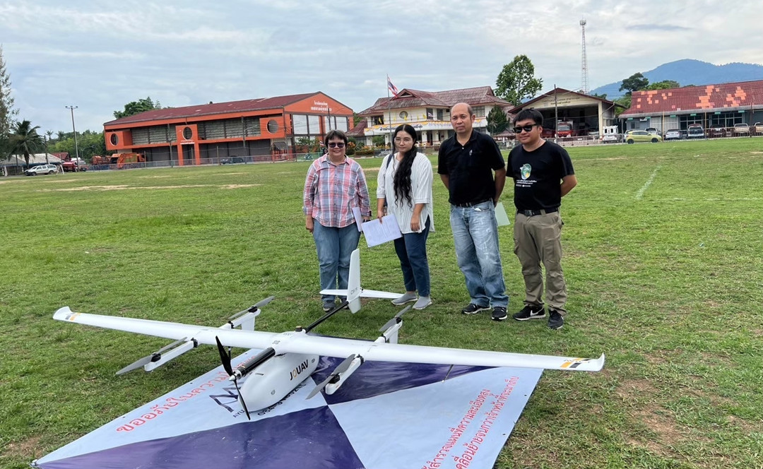
A solution emerged through a partnership with Systronics Co., Ltd. They deployed the JOUAV CW-15 VTOL drone, which comes equipped with a professional multispectral imaging system.
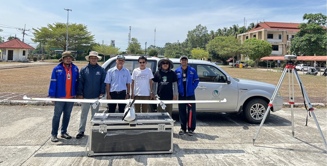
Systronics and Rubber Authority of Thailand team members pose with the JOUAV CW-15 VTOL drone during field operations in Narathiwat Province.
From Impossible Coverage to Unprecedented Detail
The operational change was immediate. The CW-15 launched vertically from narrow plantation paths, combining the coverage of a fixed-wing aircraft with the access of a helicopter.
“The first mission was a revelation,” said a Systronics project lead. “We covered over 240 km² in a single flight, and the 100-plus minutes of flight time provided a level of data we couldn’t achieve before.”
The VTOL feature was essential, as it removed the need for runways and allowed safe operations in uneven and tight areas. However, the real breakthrough was in the data collected by the drone’s five-band multispectral sensor (Red, Green, Blue, Near-Infrared, and RedEdge).
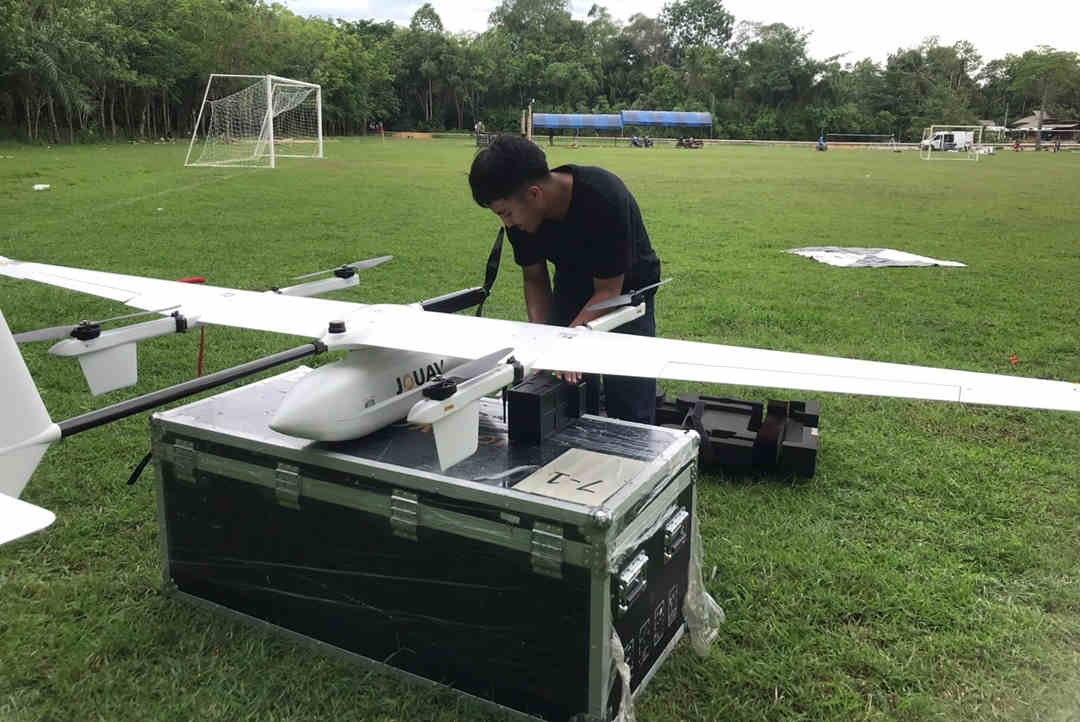
A Systronics technician assembles the JOUAV CW-15 VTOL, preparing the aircraft for a long-range multispectral inspection mission over the rubber plantations.
This technology captures details beyond human vision. By calculating indices like NDVI (Normalized Difference Vegetation Index), the system shows the physiological stress of rubber trees long before visible signs, such as yellowing or leaf loss, appear.
“The multispectral maps were like putting on glasses for the first time,” explained an RAOT agronomist. “We could see clear patches of stress that were completely invisible from the ground. It changed how we understood the outbreak’s scale.”
These multispectral maps generated by the CW-15 allow agronomists to track disease progression over time.
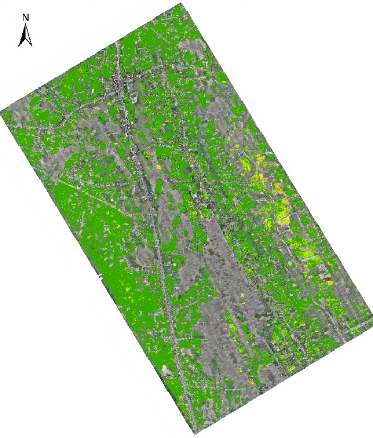
Healthy Phase: The map shows dominant green hues, indicating high chlorophyll content and healthy rubber trees.
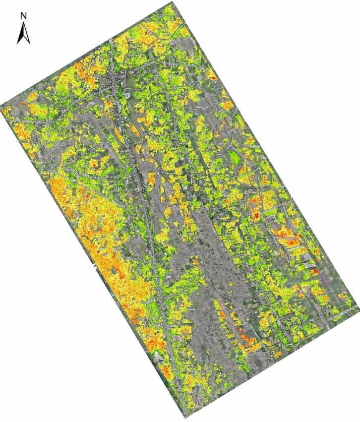
Early Warning Phase: The emergence of yellow and scattered red zones reveals trees under stress. This data allows RAOT to identify an outbreak weeks before physical symptoms like leaf shedding occur.
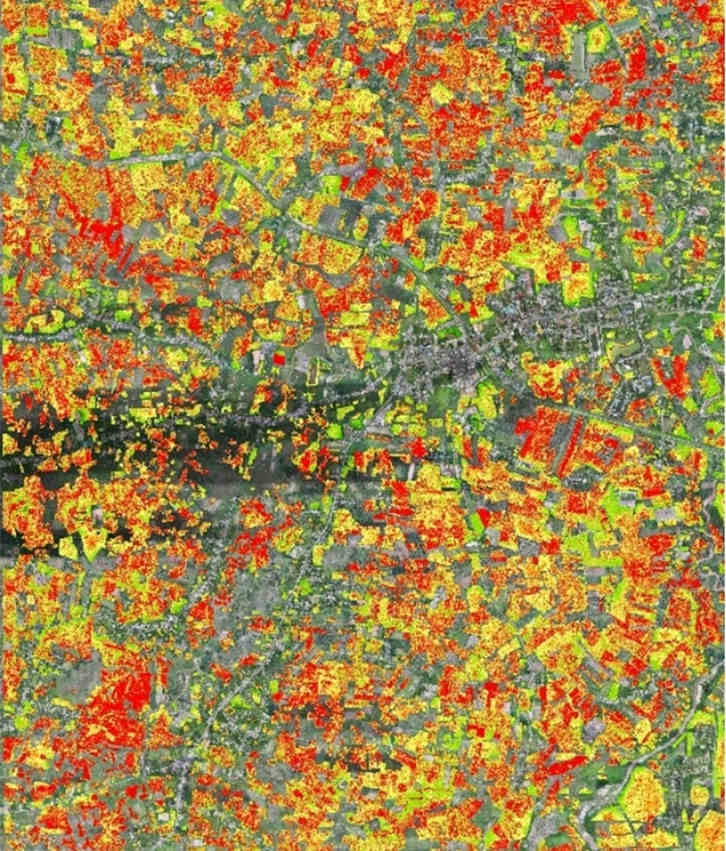
High Priority / Red Zone: A district showing severe stress (red/orange), alerting authorities to deploy immediate fungicide treatment and containment measures.
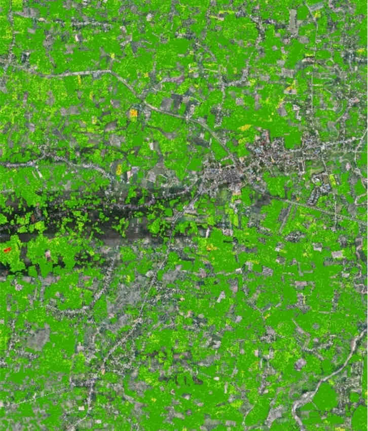
Low Priority / Green Zone: A healthy plantation area that requires continued monitoring but no immediate intervention.
Building a Sustainable Defense with Drone Intelligence
The success of this project comes from a strong combination of scale, precision, and consistency.
- The JOUAV CW-15 gave the endurance and reliability for repeatable, province-wide surveys.
- Multispectral Imaging provided critical early-detection data.
- Integrated Data Analytics turned raw images into clear, actionable risk assessments.
- The Accessible Platform empowered end-users with timely and reliable insights.
“This became the foundational layer for our entire early warning strategy,” concluded a senior RAOT officer. “It’s not just a drone project; it’s how we now protect this industry.”
Specialists from the Rubber Authority of Thailand utilize the JOUAV CW-15 to gain previously impossible insights into crop health, transforming their response strategy.
Read More


Chongqing’s Qinba Mountains are basically a giant green wall protecting the region. But there’s a problem – pine wood nematodes are eating through it. Fast.
The forestry department n

When TotalEnergies set out to build one of Southeast Asia’s largest solar and battery storage projects—spanning 12,000 hectares across the dense acacia forests of Riau, Indonesia—they faced a problem

JOUAV Product News and Use Cases
Fixed-Wing VTOL Drones Insights and Industry Trends
Invitations to online demo events