At 2:27 PM on a storm-lashed afternoon in July 2025, a small fishing boat capsized off the coast of Gulei, Zhangzhou.
Two men were thrown into violent waters. Winds howled at gale force. Waves surged
Chongqing's Qinba Mountains are basically a giant green wall protecting the region. But there's a problem - pine wood nematodes are eating through it. Fast.
The forestry department needed to find every infected cluster across 13,000 square kilometers of dense, mountainous terrain. That's bigger than Qatar. And if you've ever tried to hike through the Qinba range, you know ground patrols would take years. Maybe decades.
So they called us.
Why This Couldn't Be a Normal Drone Job
Here's the thing about the Qinba Mountains - they're shaped like "two mountains squeezing a river." One minute you're at 300 meters of elevation. Next, you're at 1,000. That vertical mess creates two headaches:
First, there's nowhere flat to land. Normal fixed-wing drones need runways or catapults. In Qinba, your only "runway" options are narrow ridges or forest trails. Good luck.
Second, the weather is straight-up unpredictable. A local saying goes something like "ten feet higher, different weather" - and they're not kidding. Fog rolls in out of nowhere. Mountain winds kick up to 12 m/s without warning. Whatever drone you fly needs to handle its most vulnerable moments - takeoff and landing - in conditions that change by the minute.
That's why we went with our CW Series drones. They take off like helicopters, fly like planes, and don't need a runway to come home.
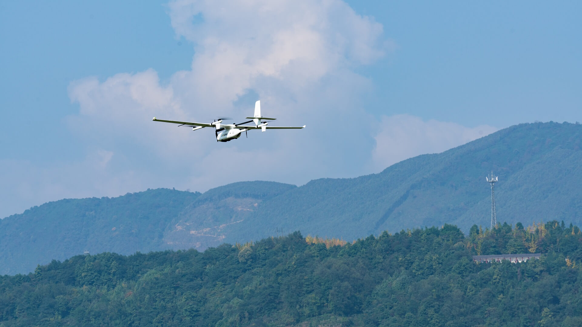
CW-15 flying over mountainous terrain.
How We Actually Pulled it off
Mapping 13,000 km² in two months isn't a flying problem. It's a logistics problem.
We broke it into grids across five counties: Chengkou, Wuxi, Wushan, Fengjie, and Yunyang. Our customer service center's technical service department coordinated more than ten JOUAV CW Series VTOL fixed-wing drones—each one assigned to a small, mobile team. No massive central launch site. Just teams scattered across the region, launching from ridges and forest clearings.
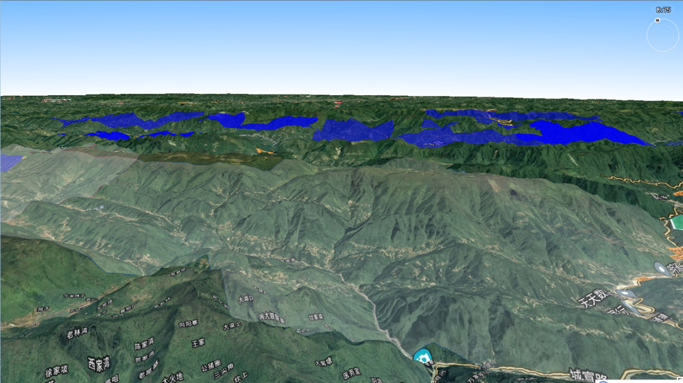
Operation area map (five counties: Chengkou, Wuxi, Wushan, Fengjie, Yunyang)
And crucially, we standardized the data formats from day one. So while one Dapeng was still in the air, the previous mission's images were already being stitched into maps back at base.
Parallel processing. No waiting around.
The "Chase the Sun" Trick
The project ran in the autumn. Which means rain, fog, and plenty of days where nothing flies.
Instead of sitting on our hands, we watched weather models across all five counties like day traders watch stock tickers. Fogged in at Chengkou? Clear window at Fengjie? Pack up and move.
Sometimes we only have two-hour windows. But two hours of flying beats zero hours of waiting. We called it "chasing the sun" - dumb name, but it worked.
And when those mountain winds hit 12 m/s? The CW Series VTOL drones held steady at a 5-7 cm ground sample distance. That's sharp enough for foresters to zoom in and spot a single sick pine tree by its slightly off color.
What Came out the Other Side
300 flights. 750 hours in the air. Zero major equipment failures.
We delivered high-res maps for all 13,000 km². Now the forestry bureau doesn't send crews on blind hikes through the mountains. They pull up our maps, find the GPS coordinates of infected clusters, and walk straight to them.
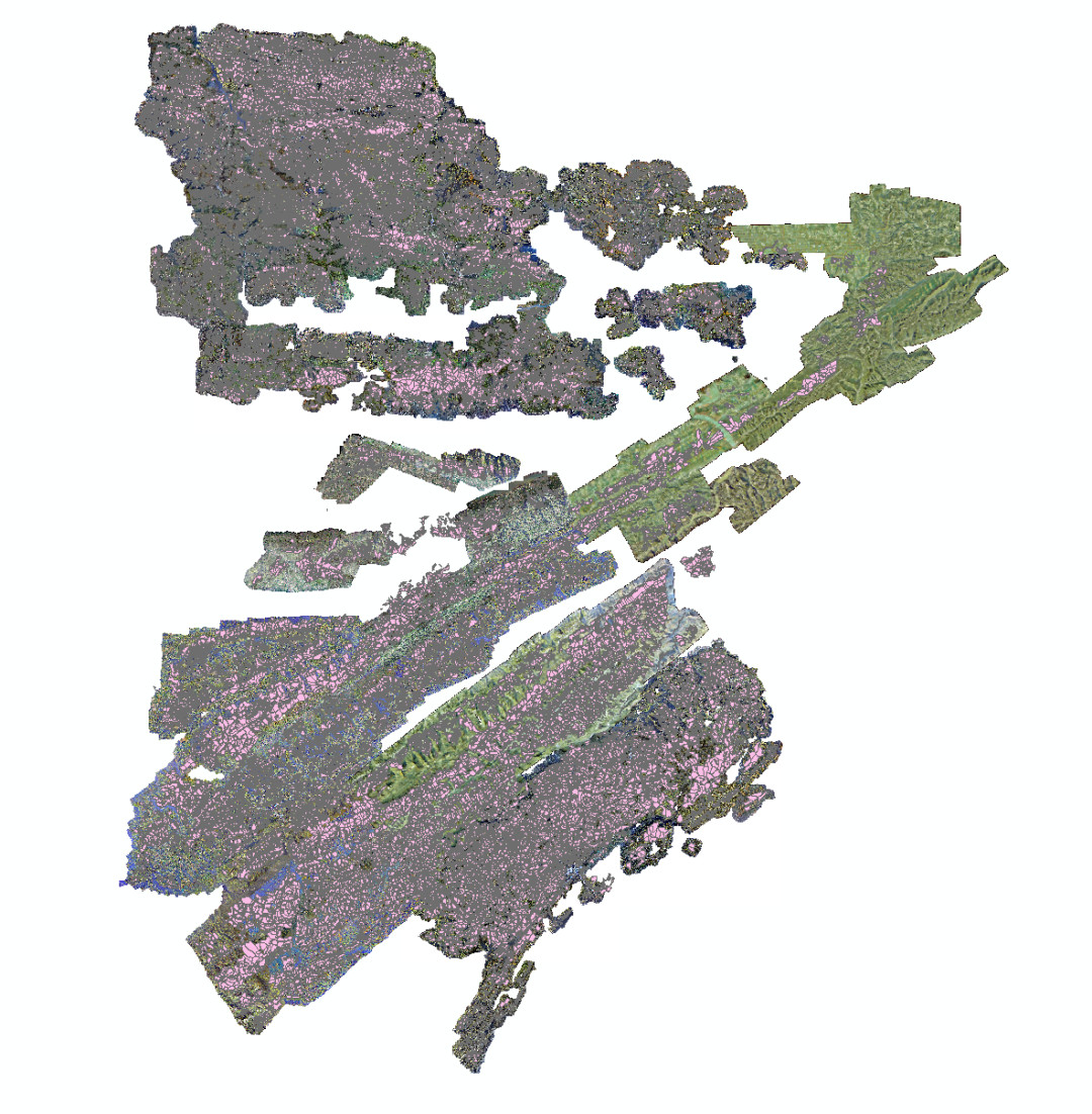
Orthomosaic result of Fengjie County.
Response times went from years to months.
The takeaway? When the terrain is brutal, and the clock is ticking, flight time matters less than landing capability, logistics discipline, and a team that knows when to pack up and chase better weather.
More Use Cases


When TotalEnergies set out to build one of Southeast Asia’s largest solar and battery storage projects—spanning 12,000 hectares across the dense acacia forests of Riau, Indonesia—they faced a problem
In the early hours of December 3, 2025, a landslide tore through Qixing Town in Chongqing, violently displacing roads and buckling the ground beneath a critical section of National Highway G318.
As th

JOUAV Product News and Use Cases
Fixed-Wing VTOL Drones Insights and Industry Trends
Invitations to online demo events