At 2:27 PM on a storm-lashed afternoon in July 2025, a small fishing boat capsized off the coast of Gulei, Zhangzhou.
Two men were thrown into violent waters. Winds howled at gale force. Waves surged
Sichuan Province in China has dense forests and often causes large wildfires due to dry weather. According to statistics, in 2019 and 2020, many large forest fires occurred in Sichuan, and 50 firefighters died while battling forest fires.
The large area and complex terrain make it difficult for inspectors to find hot spots and take effective measures when a wildfire happens. And it's time-consuming and dangerous for daily wildfire patrol on foot.
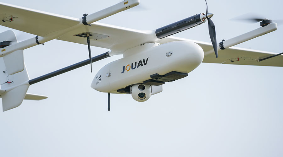
Fighting forest fire with CW-15D drones
To avoid large forest fires and human casualties again, Sichuan Mapping and Geographic Information Bureau deployed CW-15D drones equipped with visible and infrared gimbal cameras. The drone flew at low and medium altitudes and monitor the key forest prevention areas. The video footage collected by the drone will be transmitted back to the ground center in real time for data analysis and decision-making.
"We use the CW-15D VTOL drone to monitor the spread of fires and identify hot spots. With this data, firefighters can better plan how to control the fire and safeguard human survival," said Jake Shee, Technical Manager at Sichuan Mapping and Geographic Information Bureau.
Making wildfire surveillance more efficient
From March to May of 2021, crews of the fire service and forestry department were dispatched as well as six CW-15D drones to high-risk areas in Xichang, Muli, Yangyuan, and Coronation. With more than 100 flights and over 6,000 square kilometers, the teams successfully obtained optical and infrared videos of high-risk areas.
"It's stunning really. 2-hour flight times while taking a 2kg payload and 72km patrol range per hour meant that the CW-15D can cover an entire forest area by flying only 5 flights per day. This is 18 times faster than Multi-rotors and hundreds of times faster than wildfire detection on foot." said Jake.
JOUAV CW-15D vs. a multi-rotor on a 72 km forest patrol
JOUAV CW-15D | Multi-rotor | |
Number of flights | 1 | 36 |
Flight time | 1 hour | 18 hours |
During the process, a total of 15 hot spots were detected by drones and reported to the emergency response team in time, so they can take effective measures to successfully avoid another outbreak of large areas of mountain fires. Up to now, no large forest fires had occurred in Sichuan Province in 2021 and no firefighter was killed.
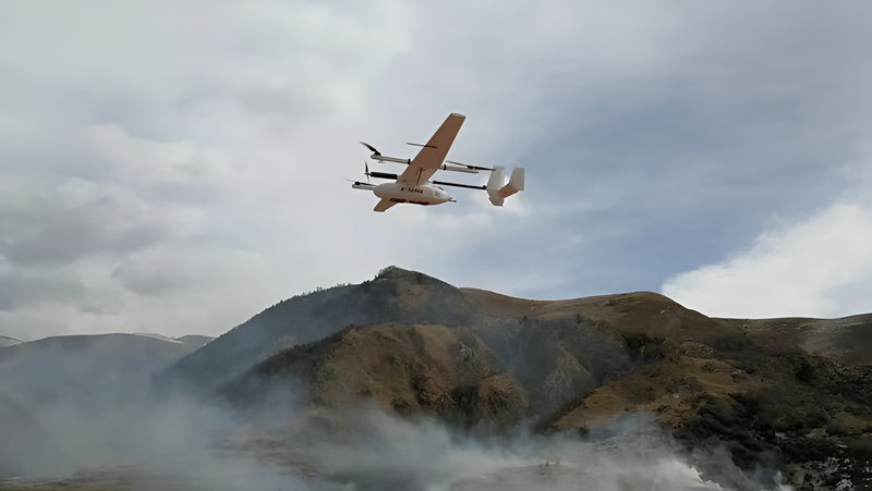
Performing well in mountain areas and in windy weather
In this mission, CW-15D flew up to 4500 meters despite the thinner air and still captured high-end videos with a 50X optical camera, so the emergency response team could see absolutely amazing details from objects that were very far away.
"CW-15D takes off and lands vertically like a multirotor which means it can be used in complex terrains such as mountains, hills, and jungles. The drone flew more smoothly in high windy conditions than the average drones," said Jake.
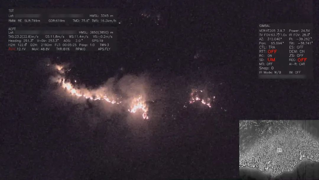
Conducting 24/7 real-time surveillance
CW-15D provides continuous aerial surveillance 24 hours a day, 7 days a week. Accurately assessing the wildfire at night is not an easy task, especially in the case of dense shrub cover. CW-15D is equipped with a visible and infrared gimbal camera. This camera has the ability to detect abnormal heat sources at night. The drone transmits the video footage back to the command center in real time, saving a lot of time for the spread of wildfire.
"We can also apply daily drone surveillance of the forest. When the weather allowed, we fly the drone at least one flight every day to monitor the forest and prevent wildfire," commented Jake.
Mapping pre-disaster and post-disaster site
In addition to real-time monitoring in the air, CW-15D can also carry professional aerial cameras to map large forestry sites and collect pre-disaster and post-disaster site orthophotography with high-precision geographic information. Geological experts compare the collected data before and after the disaster, analyze the affected area and distribution, and damage, assess the loss, and provide data support for disaster processing.
- Read more: Learn how a China company does forest survey using CW-25E with LiDAR
More Use Cases


Chongqing’s Qinba Mountains are basically a giant green wall protecting the region. But there’s a problem – pine wood nematodes are eating through it. Fast.
The forestry department n

When TotalEnergies set out to build one of Southeast Asia’s largest solar and battery storage projects—spanning 12,000 hectares across the dense acacia forests of Riau, Indonesia—they faced a problem

JOUAV Product News and Use Cases
Fixed-Wing VTOL Drones Insights and Industry Trends
Invitations to online demo events