Have you ever watched a drone hover effortlessly over a construction site, inspect a wind turbine blade, or deliver medical supplies to a remote village?
That drone was almost certainly a multirotor.
What is an environmental monitoring drone?
Drone for environmental monitoring can easily and quickly monitor air quality, water quality, animal and plant ecological environment, and pollutant emissions by carrying different equipment on the drone.
What are the uses of environmental protection monitoring drones?
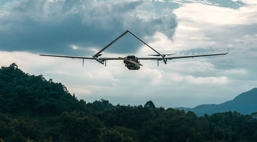
Most environmental protection monitoring drones are industrial-grade drones, mainly used in daily ecological protection law enforcement, pollutant data collection, and other aspects. You can pay attention to JOUAV, JOUAV CW Series UAS equipped with an MG-120E Gimbal Camera. Combined with an advanced 30x optical zoom camera and infrared thermal image sensor, MG-120E performs day and night reconnaissance and surveillance tasks on the target area.
- Check out this case study: How are VTOL drones used in Sanjiangyuan environmental monitoring?
What are the roles of environmental protection drones in environmental monitoring?
1. After a sudden environmental smoke pollution incident occurs, the environmental protection department can also quickly dispatch drones for positioning and monitoring to make accurate and timely emergency response decisions for the emergency.

2. Compared to traditional flue gas monitoring equipment, silent drones can be launched from a distance, quietly performing pollution discharge monitoring. This limits fraudulent practices by enterprises and makes the work of environmental inspectors easier.
3. The source of flue gas emission can be traced across provinces. It is difficult to determine the responsibility of flue gas emissions across areas, and there are many interference factors. You can try to use the multi-directional quantitative analysis data of multiple drones to determine the accountability of pollution source emissions.
4. UAVs can understand the distribution characteristics of air pollutants in detail on a three-dimensional scale and use this to clarify the mechanism of their occurrence and provide adequate data support and feedback on treatment effects for urban air pollution control.
The JOUAV CW series VTOL drone system can be widely used in engineering surveying, geographic and national conditions monitoring, agricultural foundation right confirmation, natural disaster assessment, water conservancy engineering, urban planning, fishery law enforcement, public safety, forest fire prevention, and other fields.
What are the advantages of environmental protection drones in atmospheric environment monitoring applications?
Environmental protection drones are equipped with high-definition aerial probes, thermal infrared imagers, high-definition cameras, air pollutant composite sensors, and other equipment to show their skills in environmental monitoring, environmental quality monitoring, pollution source monitoring, ecological remote sensing, and other fields. "Straw burning" and other undesirable phenomena have been effectively curbed and have become a "weapon" for environmental law enforcement by environmental protection agencies. The drone cruises silently over the pollutant-discharging company. The air quality data and real-time pictures have a panoramic view, making the illegal activities of the pollutant-discharging company nowhere to hide.
Compared with traditional monitoring methods, the advantages of environmental protection drones are shown in the following points:
1. High flexibility. The UAV does not require a driver, takes off at any time, and is less restricted by space;
2. Strong mobility. In response to environmental emergencies, drones can immediately perform real-time panoramic monitoring of the accident area;
3. Wide applicability. It can be used in various environments and occasions such as the field and the city
4. The image is clear and the data is accurate. UAVs are mostly low-altitude shooting or sensing data, which can generate multi-spectral and hyper-spectral images, which can be intuitive and comprehensive.
5. It can go deep into the high-risk environment to avoid the risk of monitoring and sampling personnel.
Read More


Every drone needs a brain.
Without it, you’re holding an expensive paperweight with spinning blades.
That brain is called a flight controller—but most people have no idea what it actually does.

Let’s be honest: the drone world loves its acronyms. UAV, UAS, drone, RPAS, UCAV, FPV–it’s an alphabet soup. And most people use them like they’re the same thing.
They’re not.
And here’s why that matt

JOUAV Product News and Use Cases
Fixed-Wing VTOL Drones Insights and Industry Trends
Invitations to online demo events