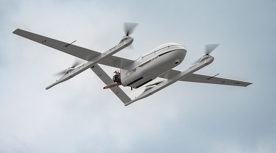
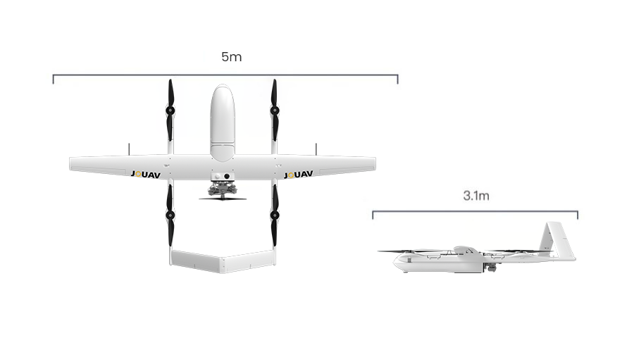
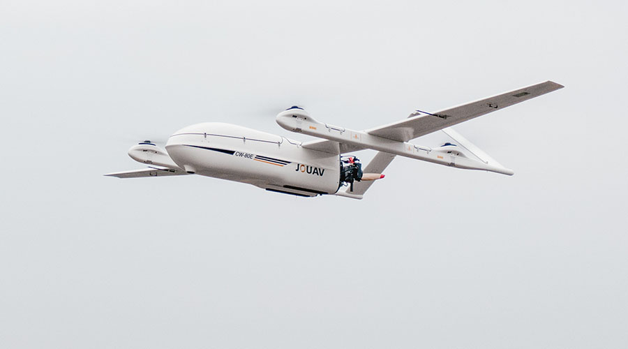
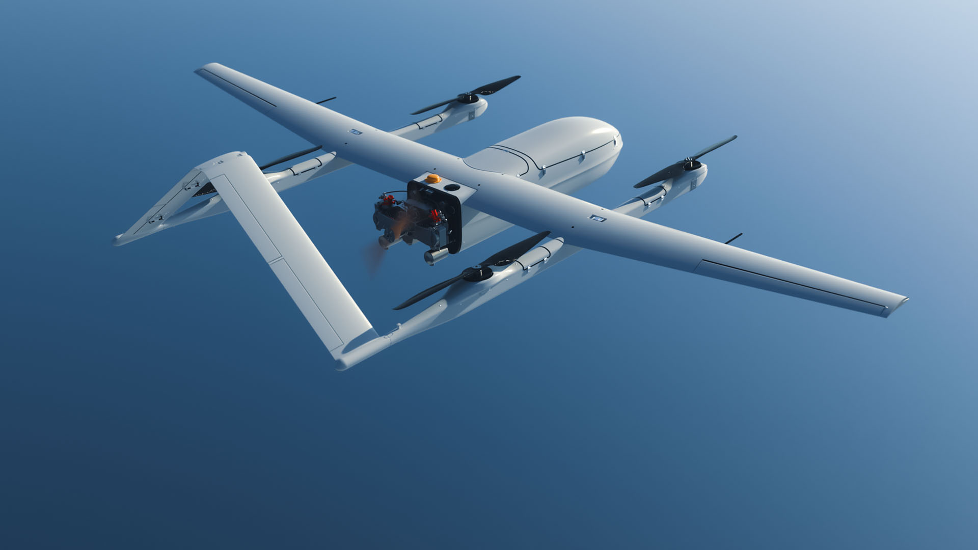
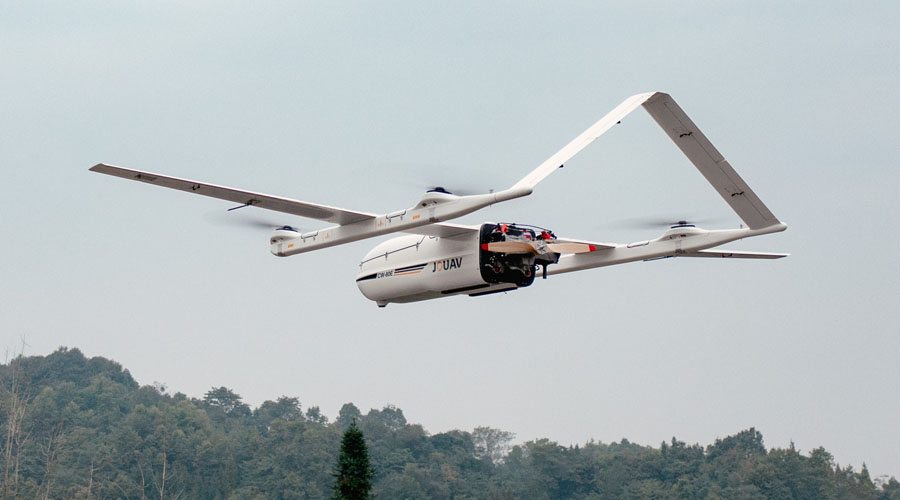
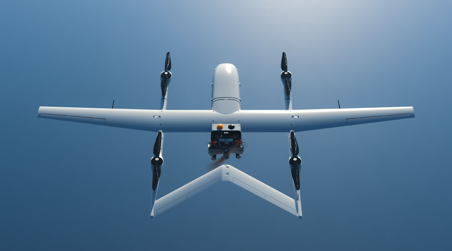
Designed for the toughest challenges, the CW-80E drone offers unmatched performance with a 25kg payload capacity, up to 10 hours of flight time, and exceptional long-range capabilities. This extra-large drone is perfect for large-scale operations like mapping, surveillance, and emergency response.


Wide Coverage and Extended Range
The CW-80E offers industry-leading coverage with up to 11 hours of flight time when unloaded, and up to 10 hours with the MG-200E gimbal camera and 200km video link. The drone supports 100km or 200km video transmission, ensuring uninterrupted communication during long-range operations. Whether monitoring large areas or conducting remote inspections, the CW-80E provides reliable, long-distance connectivity.

Built-in Safety Features
The CW-80E is designed with an anti-jamming GPS to resist complex electromagnetic environments, making it ideal for electric power inspections, urban applications, etc. Its multi-sensor redundancy technology ensures safety with systems like triple IMU configuration, dual GNSS, differential antennas, and more, automatically activating in critical situations (e.g., low battery or loss of communication) to ensure a safe return.


Data Security with Advanced Encryption
The CW-80E ensures the security of your mission with AES-128 or AES-256 encryption for real-time data transmission and flight control communication. This level of encryption protects sensitive flight data and video feeds, preventing tampering and data theft to ensure safe and secure operations.
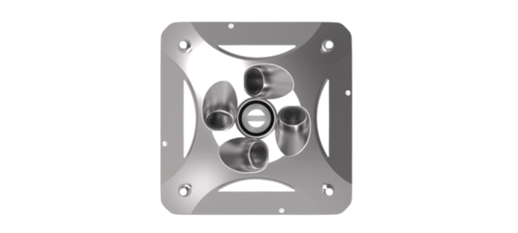
CA-503R Oblique Camera
- Full-frame five-lens system
- 220-megapixel total pixels, 36x24mm sensor size
- Straight 40mm/ Oblique 56mm focal length
- Dual 640GB onboard SSD with real-time photo streaming
- Supports real-time 3D modeling >>Learn More
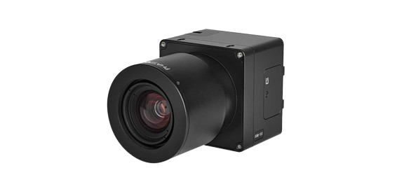
iXM-100 RGB Camera
- Medium-format sensor
- 100MP resolution (11664x8750)
- 83dB dynamic range
- 3.76µm pixel size
- 3 frames per second capture rate >>Learn More
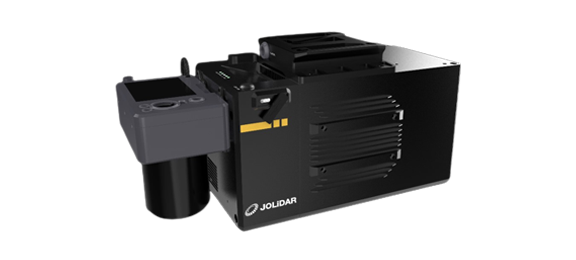
JoLiDAR-1500
- Up to 1500m of detection range
- Laser pulse repetition rate: 50-2000 KHz
- Integrated with 61MP full-frame RGB camera
- Capture synchronized point clouds and orthophotos
- Relative accuracy:1.5cm, absolute accuracy: 5cm@300m >>Learn More
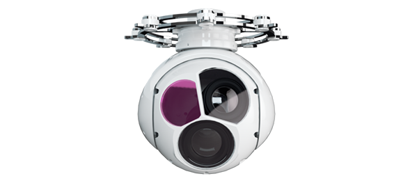
MG-150E Gimbal Camera
- Visible Light Camera: 1080p resolution, 30x optical zoom
- Infrared Camera: 640x512 resolution, 50mm focal length
- Laser Rangefinder: 4,000m range, 2m accuracy
- Target Tracking: Continuous identification and tracking >>Learn More
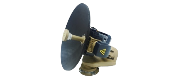
SS-10 Airborne Satellite Communication
- Operating Frequency: Supports Ka or Ku bands
- Satellite Acquisition Time: ≤2 minutes; 360° unlimited azimuth with continuous rotation
- Elevation Range: -8° to +100° with continuous automatic tracking; Roll range: +20°
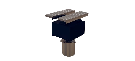
miniSAR
- Frequency: Ku-band
- Resolution: 0.3m
- Range: 6km
- Swath Width: 500m - 3000m
- Modes: Polarization, Interferometry, GMTI


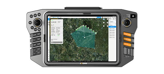
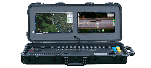
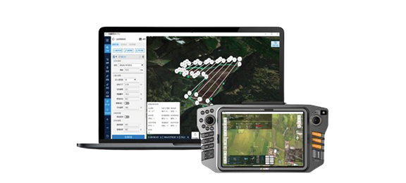
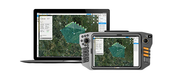
JOUAV offers handheld, portable and modular vehicle ground control station. You can choose different control devices according to the different environment and task.
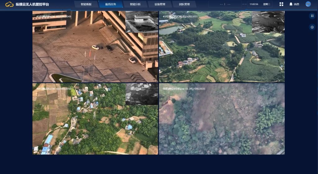
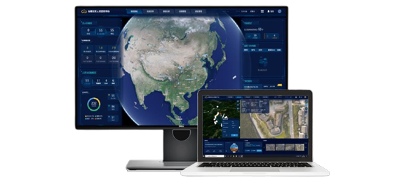
JOUAV provides one-stop UAV products, including the supporting software needed for the task. You can use these software to plan a flight path, control and manage the drone, track and identify targets, and see video and geo-data information from the drone in real time.
We are committed to ensuring that every customer can get timely and professional technical support. Engineers can provide customers with remote product installation guidance, software updates, and UAV flight technical support; they can also arrive at the scene to provide services.