At 2:27 PM on a storm-lashed afternoon in July 2025, a small fishing boat capsized off the coast of Gulei, Zhangzhou.
Two men were thrown into violent waters. Winds howled at gale force. Waves surged
China, the largest producer of marine fisheries in the world, has a long coastline and a huge marine fishing fleet. China has always attached great importance to the conservation and sustainable use of marine fishery resources. Since 1999, the Chinese government has imposed the annual summer fishing ban as a precautionary approach for the long-term sustainability of aquatic lives.
With a vast ocean and an abundance of fish, Zhejiang has been known as the land of "fish and rice" for more than 1000 years, which is the key region of this annual fishing ban. Every year, the fishing ban is implemented from April to August, an important period for fish breeding and juvenile growth.
Challenges of combating illegal fishing
The four-month ban needs the local government to protect their maritime area against illegal fishing. But this is a challenging task to manage and monitor large expanses of water.
"What we relied on patrol vessels that you can count on the fingers of one or two hands", Johnny Luo, from Zhejiang Marine and Fisheries Bureau, "There may also be aircraft, one or two aircraft, that can do reconnaissance flights or surveillance flights and that's it".
"But those methods of policing are costly, often dangerous, and inefficient due to the expense and logistical challenges of policing huge areas of the ocean", Johnny added.
Drones offer extra eyes in the illegal fishing battle
"Drones for the purpose of monitoring illegal fisheries are being deployed in many places around the world and we wanted to see its effectiveness in our context," said Johnny. But which drone should you choose for fishery surveillance?
The need for drones for fishery surveillance is driven by several key factors. First, vast ocean means that drones must have long cruise times and fast flight speeds. Second, to respond to suspected activities, the drone data can be transmitted in real-time. Third, the hot, salty, and humid environment requires high-quality drones.
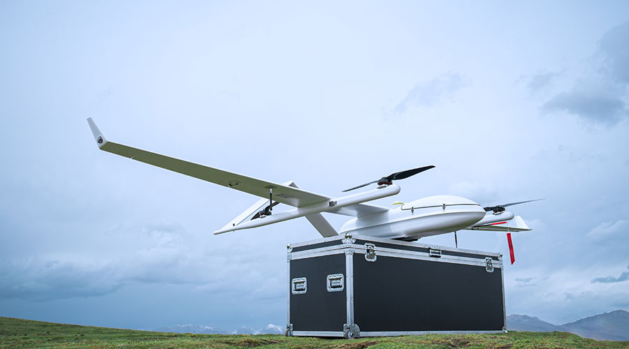
Finally, the Zhejiang Marine and Fisheries Bureau announced the acquisition of JOUAV CW-25E to conduct fisheries surveillance near Dai Quyang Fish Spawning Ground.
Increased efficiency of fishery surveillance
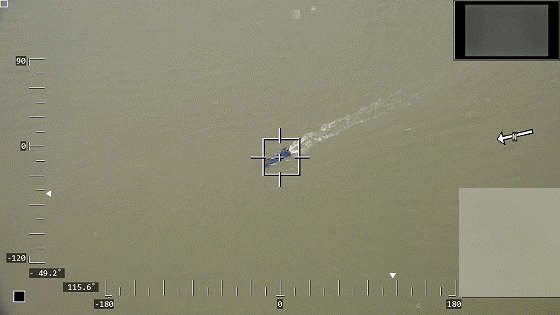
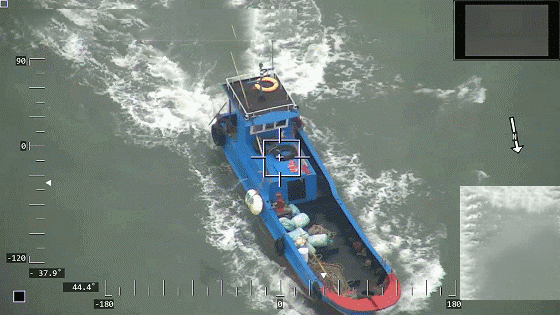
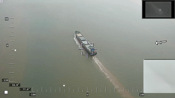
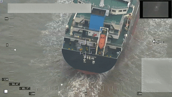
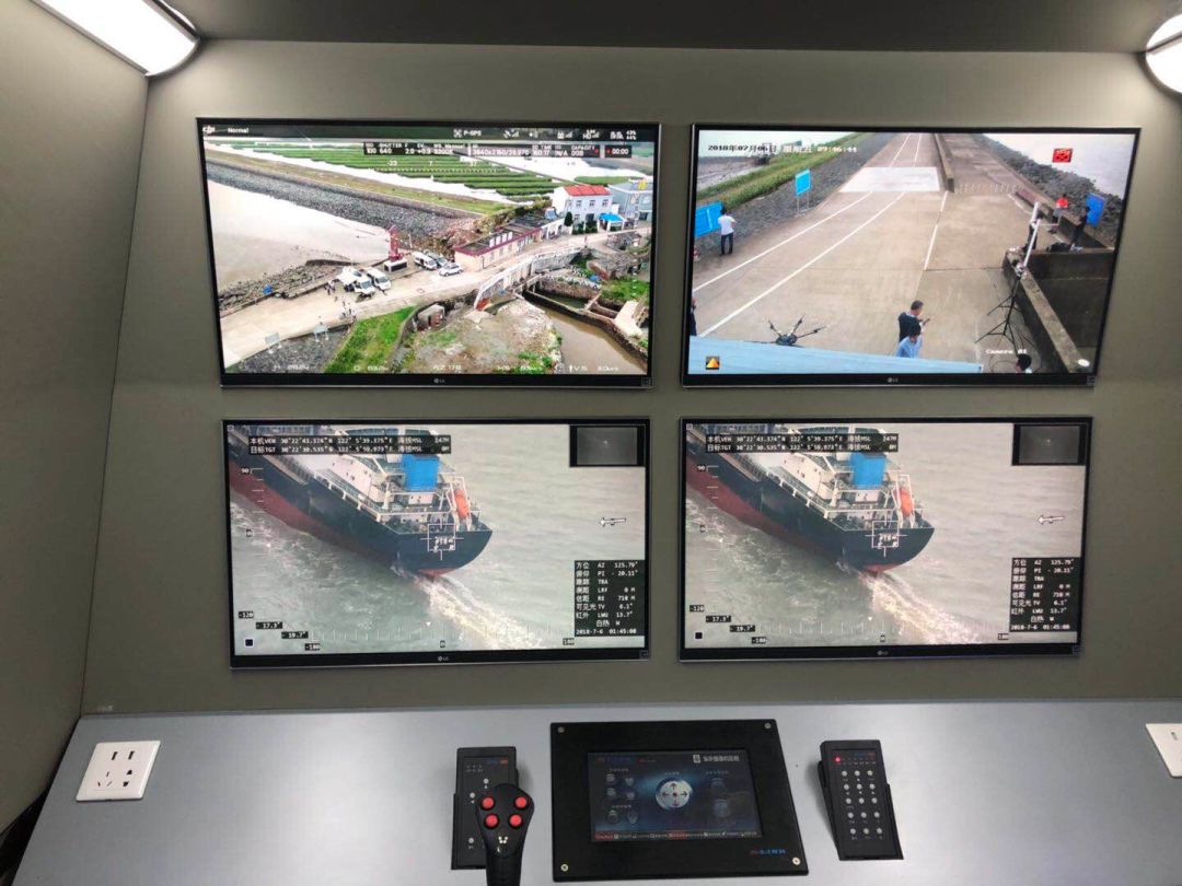
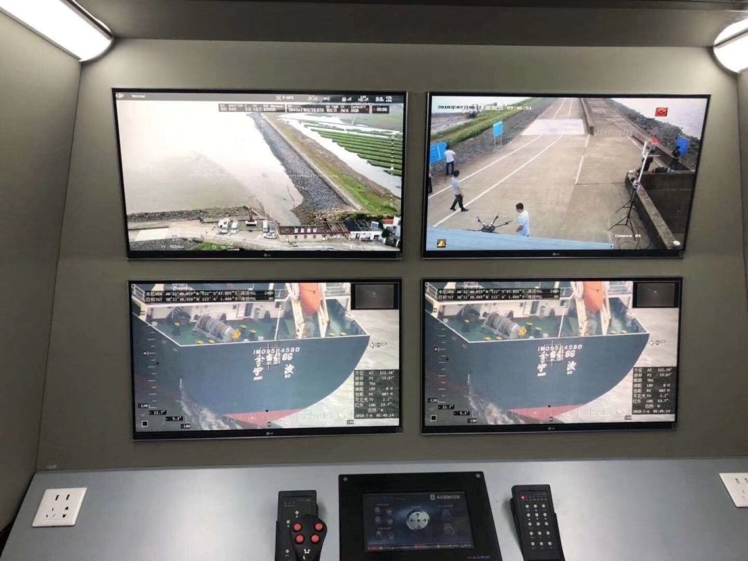
CW-25E equipped with an MG-150E gimbal camera can be very effective and fast in those tedious and repetitive tasks of monitoring large areas, inspecting hard-to-reach sites, and collecting evidence of illegal fishing to warrant a conviction.
More Use Cases


Chongqing’s Qinba Mountains are basically a giant green wall protecting the region. But there’s a problem – pine wood nematodes are eating through it. Fast.
The forestry department n

When TotalEnergies set out to build one of Southeast Asia’s largest solar and battery storage projects—spanning 12,000 hectares across the dense acacia forests of Riau, Indonesia—they faced a problem

JOUAV Product News and Use Cases
Fixed-Wing VTOL Drones Insights and Industry Trends
Invitations to online demo events