Benefits and Features
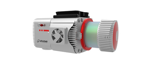
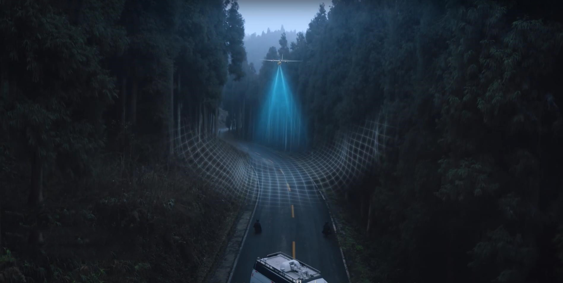
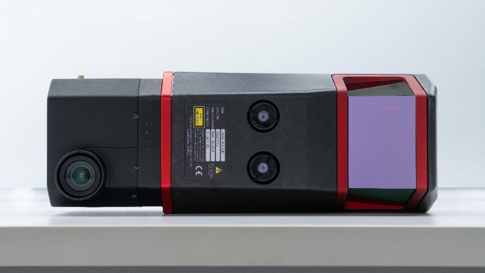
The JoLiDAR-120 is an advanced geospatial solution featuring Nadir-Forward-Backward (NFB) Scanning LiDAR, a high-accuracy Inertial Measurement Unit (IMU), and a 26MP RGB camera. With a wide 100-degree field of view and an exceptional pulse repetition rate of up to 2400 MHz, it excels in high point density corridor mapping applications. 
product-detail
NFB Scanning
Provides detailed point cloud representation for accurate mapping.
product-detail
High Precision
Accuracy of 10mm and precision of 5mm for detailed mapping.
product-detail
Exceptional Efficiency
Up to 18km² coverage per flight (with 50% overlap) on JOUAV CW-15 drone.
product-detail
32 Returns
Captures ground points under dense foliage for comprehensive data.
product-detail
Long Range
Covers up to 1430m at 80% target remission for extensive mapping.
product-detail
IMU/GNSS Integration
Ensures precise positioning and orientation data for accurate georeferencing.
product-detail
Seamless Operation
Fully integrated with JOUAV's flight control system and GCS for simplified workflows.
product-detail
1TB Internal Storage
Offers ample space for storing large datasets from surveys.
Innovative LiDAR Scanner

Exceptional Accuracy and Repeatability

The system boasts a measuring accuracy of 10mm and repeatability of 5mm, ensuring highly precise measurements and reliable data analysis. This remarkable consistency enhances data reliability and facilitates change detection analysis.

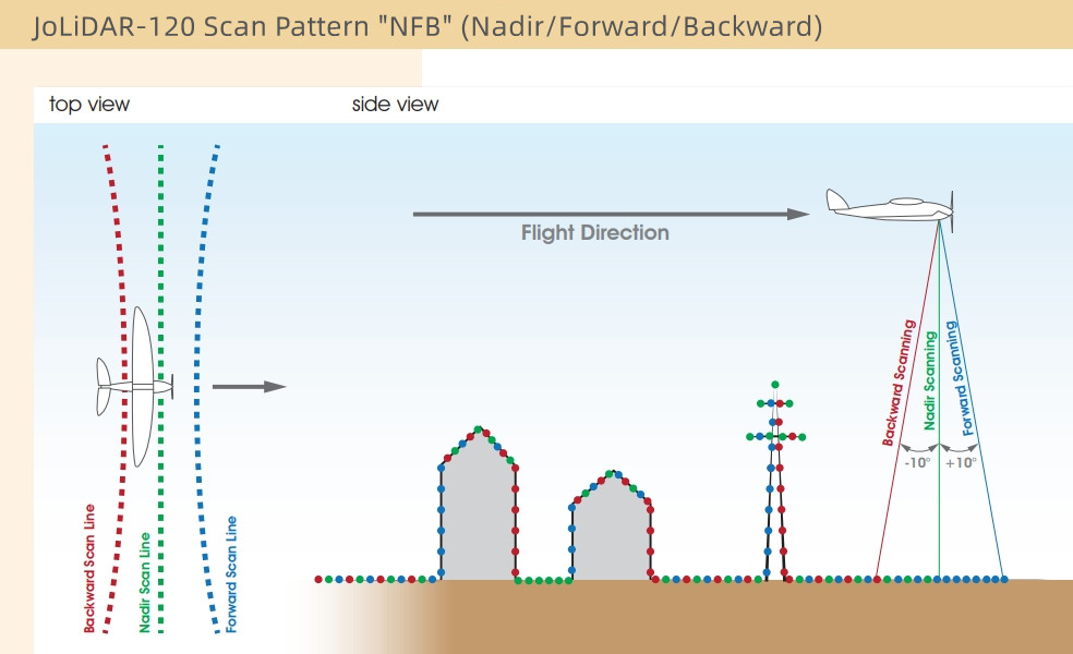
Nadir/Forward/Backward Scanning

The JoLiDAR-120 utilizes a sophisticated scan pattern alternating between strict nadir and ±10 degrees forward and backward scanning angles. This ensures comprehensive 3D data capture, accurately sampling vertical surfaces and enabling reliable data acquisition in narrow canyons.

img
img

Effective Measurement Rate Up to 2 Million pts/s

JoLiDAR-120's capacity to generate 2 million points per second surpasses traditional LiDAR systems, enabling it to capture richer, more detailed point clouds in less time. This high-resolution data is ideal for applications such as 3D mapping, object detection, and terrain analysis.

Scan Speed Up to 400 Lines/Sec

The JoLiDAR-120 offers rapid scanning speed, allowing for the quick coverage of large areas while maintaining high data density. This increases efficiency and productivity, particularly beneficial for applications requiring extensive data collection such as topographic mapping and corridor inspection.

1,430m Scanning Range

The JoLiDAR-120 boasts a maximum scanning range of 1,430 meters, allowing it to effectively operate at an operational range of up to 720 meters (2,350 feet). This extended range makes it particularly suitable for fixed-wing UAVs, enabling efficient surveying of vast areas from greater distances.

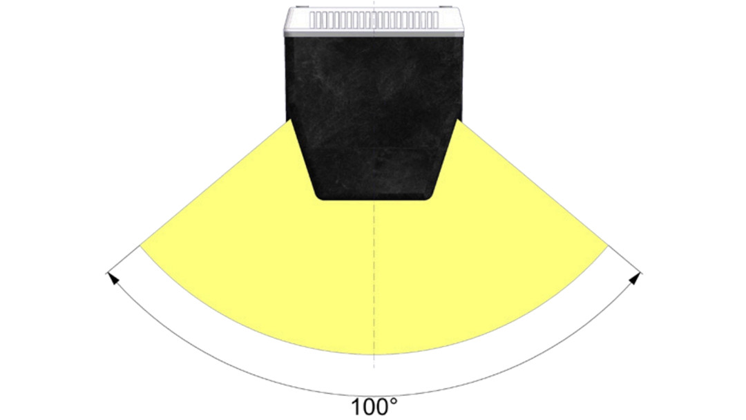
100° Field of View (FOV)

Featuring a field of view of up to 100°, the JoLiDAR-120 captures a broad swath of data in a single scan, minimizing the need for overlapping scans and maximizing efficiency. This expansive coverage is particularly beneficial for applications requiring rapid and comprehensive data collection.

img
High-Precision Inertial Measurement Unit (IMU)

Equipped with a high-precision inertial measurement unit (IMU), the JoLiDAR-120 ensures accurate orientation and positioning data. This enhances the quality of LiDAR point clouds and enables reliable geospatial analysis, even in dynamic environments. 

  • Roll, Pitch: 0.005°
  • Heading: 0.010°
  • Maximum Data Update Rate: 600Hz
High-Resolution RGB Camera

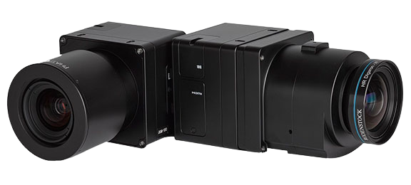
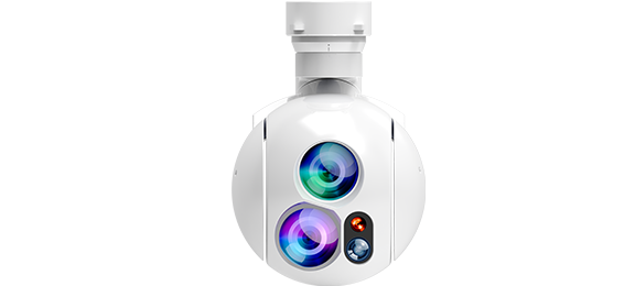
In addition to LiDAR data, the JoLiDAR-120 comes equipped with a high-resolution RGB camera that captures detailed visual information. This enables enhanced visualization, feature identification, and texture mapping for 3D models.

  • 26 million effective pixels
  • 23.5mm×15.7mm sensor size
  • 6252×4168 image resolution
  • 16mm lens focal length
img
Compatible Drones
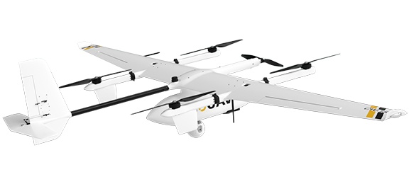
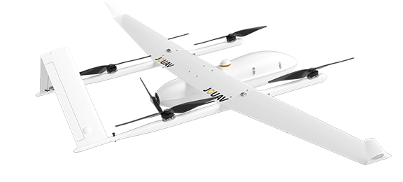
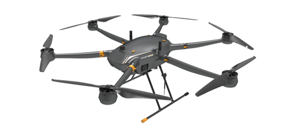
Pairing the JoLiDAR—120 scanner with a drone makes LiDAR more accessible, and allows surveyors and other professionals to collect precise data quickly and easily. Let's see the compatible drones of JoLiDAR—120.
CW-15
Multi-purpose and battery-operated intelligent VTOL drone
CW-25E
Long Endurance Electric Fixed-wing VTOL Drone
PH-20
Heavy Payload Multi-Rotor Drone
Industry Applications
JoLiDAR-120 provides highly detailed, accurate data, which can be used for large area mapping, power line inspection, road construction and other purposes.
Aerial Mapping & Surveying
Are you looking to add drones to your surveying services? Here is everything that you need to know about drone surveying.
Mining & Aggregates
Find out how mines and quarries use mine drones to increase productivity, maintain safety standards, and reduce operational costs.
Power Line Inspection
Drones are an attractive alternative for power line inspection. but what are the benefits, outputs, and applications? Let's explore more.
Other Payloads
JOUAV is constantly updating its cameras and enriching its product lineups to provide a better data results and to meet customers' needs.
PhaseOne iXM Series Camera
High-resolution medium format cameras for mapping and surveying
MG-120E EO/IR Gimbal Camera
Lightweight 3-axis gimbal camera with 30X optical zoom and thermal sensors
JoLiDAR-LR22
JoLiDAR-LR22 is a lightweight and long-range laser scanner for UAV surveying.
Technical Specifications
Laser Scanner
Laser sensors
Mechanical three-line (vertical downward and ±10° multi-directional scanning)
Safety classification
Class 1
Measurement accuracy
10mm
Repetition accuracy
5mm
Scanning Range
1430m@80%
Laser FOV
100°
Laser pulse frequency
150~2400 KHz
Angular resolution
0.001°
Max. line scanning
50~400 lines/sec
Max. echo quantity
32
IMU System
Post POS attitude accuracy
0.005°
Post POS head accuracy
0.010°
Max. data update frequency
600Hz
GNSS
GPS, GLONASS, GALILEO, BEIDOU
RGB Camera
Pixel
26MP
Size
23.5mm×15.7mm
Resolution
6252×4168
Focal length
16mm
Whole LiDAR System
Relative Accuracy
1.5cm
Absolute accuracy
5cm@300m
Weight
2.9 kg(Without camera)
Size
252mm×137mm×135mm
Power consumption
<55W
Working temperature
-20℃ ~ 55℃
* All performance data in the foregoing pages are theoretical values obtained by JOUAV® internal laboratories through tests carried out under particular conditions. For more information on the specific testing conditions, refer to the aforementioned product details. Actual performance may vary owing to differences in individual product configuration, software versions, application conditions, and environmental factors. All data is subject to actual usage.