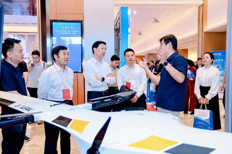
TIANJIN, China, June 12, 2026 – JOUAV participated in the 2026 China Oil & Gas Pipeline Unmanned Technology Exchange Conference, held in Tianjin from June 11–12, where the company showcased its au
JOUAV recently announces the release of its innovative drone solutions, CW-15LiDAR and JOUAV Unattended System, which can carry out inspection missions more efficiently and fully automatically.
Drone inspections are now being conducted by many industries that require visual inspections as part of their maintenance procedures. Using drones to collect visual data on the condition of assets helps inspectors increase efficiency and avoid putting themselves in harm's way. To provide users with a more convenient and efficient operating experience, JOUAV unveils a brand-new LiDAR drone system and autonomous drone station for automatic inspections.
CW-15 LiDAR system with 1430m detection range
JOUAV's CW-15 LiDAR system has broken through the technical difficulty of carrying a long-range LiDAR system on a 15kg payload electric UAV. The LiDAR is deeply integrated with the drone system and has been successfully applied to digital mines, energy inspection, smart city, rail transportation, and other professional fields, providing users with a more convenient and efficient operating experience.
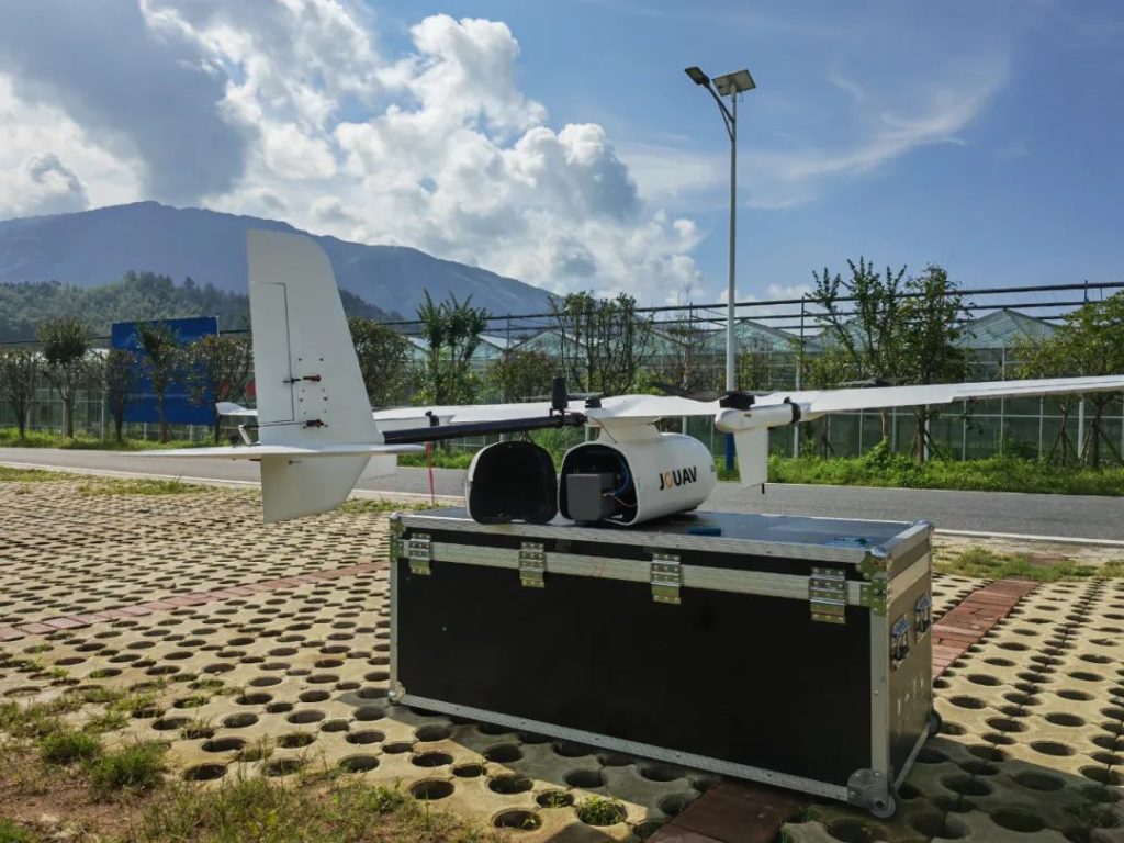
With a weight of only 2.7kg (including the camera) and a maximum range of 1430m, the JoLiDAR-120 LIDAR system offers an ultra-wide field of view of 100° and an ultra-high data acquisition rate of up to 1.8 million points/second. It combines laser point cloud data and visible light images to generate a high-density true color point cloud with a vertical accuracy better than 2cm without GCP.
The measurement beam can be scanned continuously from front to back in three different directions: forward +10°, vertical downward, and backward -10°, effectively improving the integrity of the data. The CW-15 equipped with JoLiDAR-120 LIDAR has an effective operating time of up to 100 minutes, which is suitable for large areas and high-precision data acquisition.
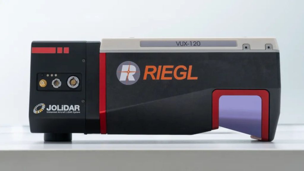
JoLiDAR-120
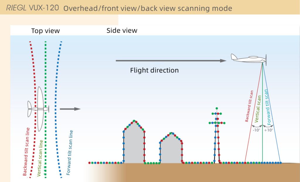
Diagram of JoLiDAR-120 LiDAR system operation
The LiDAR system is deeply integrated with the flight control system, and the protocols are interoperable. The LiDAR parameter setting can be completed through the JOUAV FlightSurv ground station software, without the need to open the scanning on the ground in advance.
The drone automatically starts data acquisition before entering the survey area, reducing data redundancy in non-operational aspects such as ground preparation, takeoff and climb, heading to the survey area and returning to land, improving the efficiency of internal data processing and extending the service life of the LiDAR.
During the flight, the working status of LIDAR temperature, GNSS, inertial guidance, data storage, etc. can be monitored in real-time to ensure the safe and effective operation of the LIDAR system.
Real application of CW-15LiDAR in Fengxin County
Fengxin County, a county located in the northwestern part of China's Jiangxi Province, has a forest coverage rate of 64.46%. This area is particularly suitable for wind farm construction because of its rich wind resources, stable wind direction and windward slope, small seasonal changes, and no extreme weather. Guohong New Energy Co. used CW-15LiDAR to collect 1:2000 point cloud results from the wind farm site in Fengxin County.
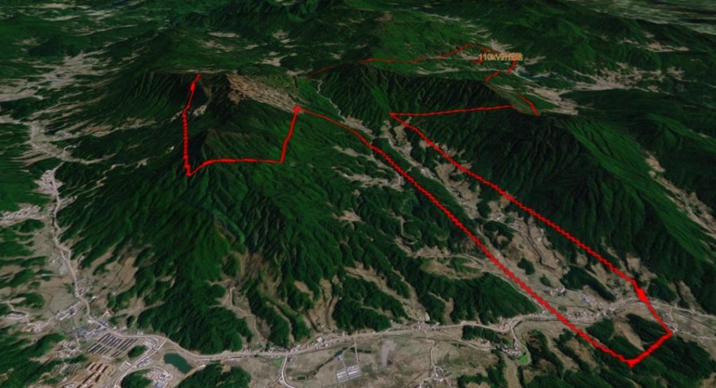
The survey area of CW-15LiDAR
"The survey area is mostly mountainous, with great height differences of more than 1200 meters, dense vegetation cover, and windy weather all year round, leading to a significant increase in both risk and data collection difficulties," said Evan Wang, an engineer at the Fengxin wind farm project.
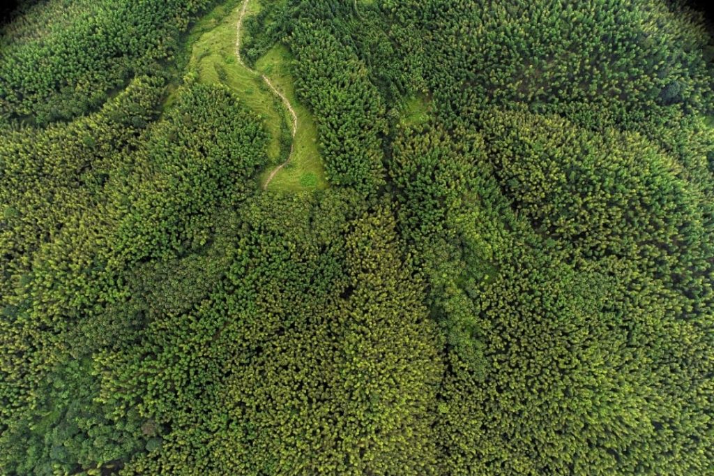
Top view of the survey area in Fengxi County
In this mapping project, they divided the survey area into three areas, low, medium, and high, according to the altitude. CW-15LiDAR flew 6 flights, including 2 flights in the high area, 3 flights in the middle area, and 1 flight in the low spot.
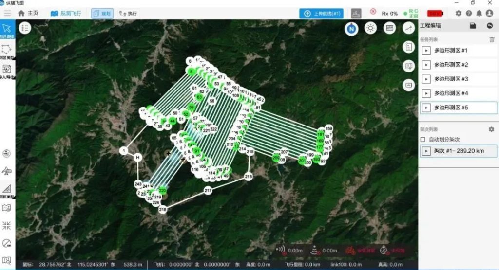
The flight plan of CW-15LiDAR
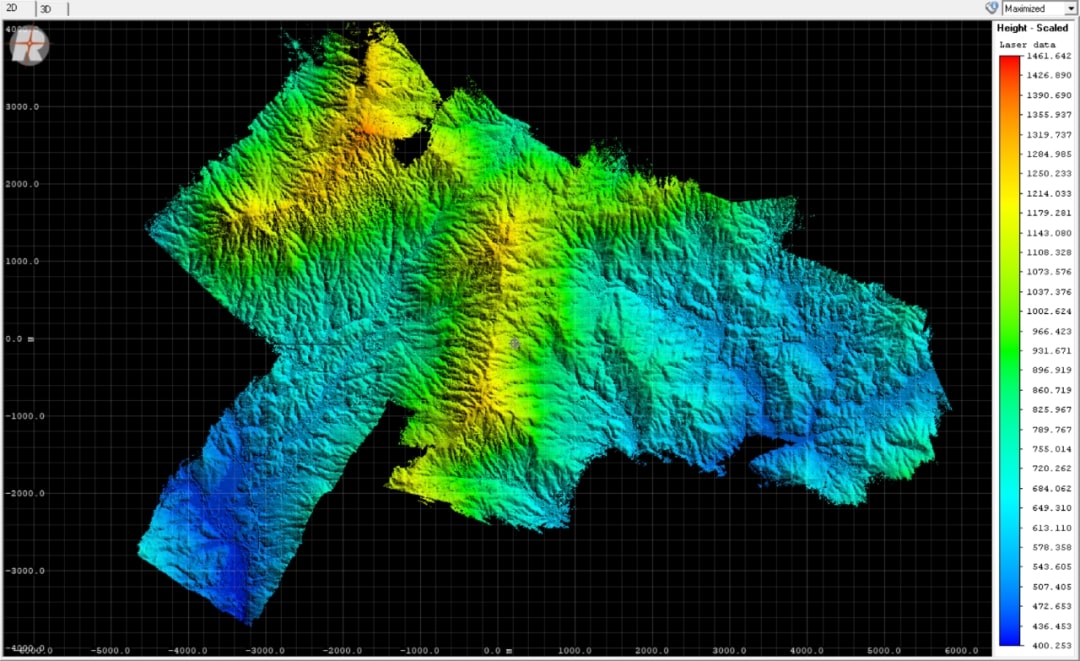
"Using the CW-15LiDAR, the entire data collection workflow itself took only 5 hours - a process that could easily have taken several days with traditional surveying methods. Under the large altitude difference conditions in the survey area, our engineers obtained an elevation mean error was only 10.4cm," commented Evan.
Point cloud displayed by elevation (400~1461 m)
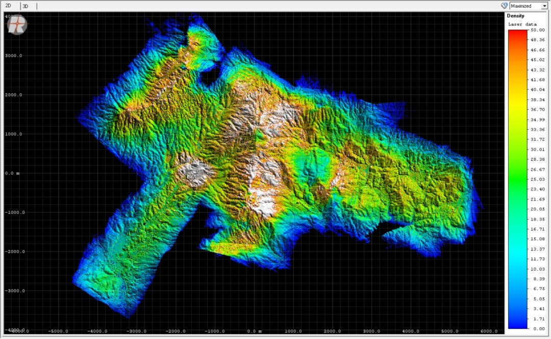
Point density display (average point density in the survey area is about 30)
JOUAV Unattended System
JOUAV Unattended System is a vertical takeoff and landing (VTOL) fixed-wing UAV automatic station with built-in functions of automatic inspection of UAV, automatic charging, off-site deployment, remote planning and command, automatic data back transmission, and more.
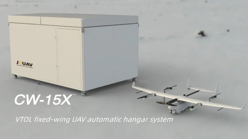
The station's fuselage is designed with high-strength stainless steel and magnesium-aluminum alloy frame structure and IP54 level rain and dustproof standard, which can provide safe and comfortable charging, storage, data exchange, and other basic services for drones in the field environment.
Specifications of JOS-C2000 station:
| Capability descriptions | Items | Features |
| Low deployment site requirements | Ground requirements <3.5×2.5m | <3.5×2.5m |
| Mass | ≤1.4T (including UPS-powered batteries) | |
| Product operating environment | Suitable for more than 90% of the altitude in China | |
| Industrial-grade wide operating temperature range | ||
| Power supply and UAV energy supplementation | Hangar power supply | Municipal electricity |
| Drone energy supplement | Support fast automatic charge/change | |
| Intelligent operations and maintenance | UAV storage environment maintenance | The hangar environment is automatically adjusted for long-term preservation |
| Hangar manned maintenance frequency | ≥ half year/time Cloud platform intelligent operation and maintenance tips | |
| Intelligent communication | Communication methods | Wired communication, fiber optic communication, wireless communication |
| Communication relay | Integrated all-in-one communication relay | |
| Intelligent Release | One-click operation on the cloud platform, intelligent sensing of takeoff and landing environment, video surveillance inside and outside the hangar | |
Specifications of CW-15X VTOL fixed-wing:
| Items | Characteristics |
| Fuselage length/wingspan | 1.9m/2.6m |
| Endurance | 2h |
| Cruising speed | 64≤S≤110km/h |
| Maximum take-off altitude and the protection level | Suitable for more than 90% of the altitude in China |
| Protection level | Millimeter-level dust control and operation under light rain |
| Precise landing | RTK + Visual Guidance |
| Landing accuracy | ≤±30cm |
| Inspection radius | >30km |
CW-15X VTOL drone can support a variety of payload replacements and can carry three major types of application payloads: LiDAR, gimbal cameras, and visible light cameras to complete rapid power line inspection, LiDAR scanning, visible light image acquisition, etc.
More JOUAV News
KUNMING, June 11, 2026 – JOUAV, a leading global provider of industrial drone solutions, today announced its participation in the 10th China-South Asia Expo (CSAE), held in Kunming Dianchi Internation
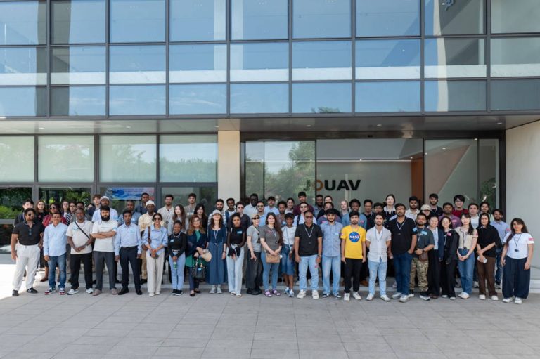
CHENGDU, June 4, 2026 – JOUAV, a leading global provider of industrial drone solutions, welcomed a group of international students and faculty to the company’s JOUAV Tech Park for an enterprise study

JOUAV Product News and Use Cases
Fixed-Wing VTOL Drones Insights and Industry Trends
Invitations to online demo events