Benefits and Features
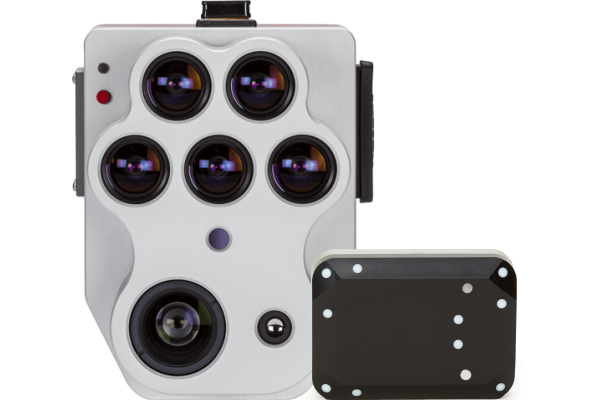
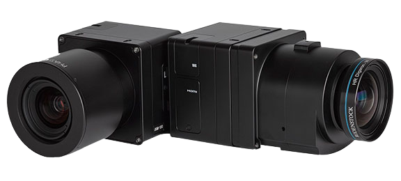
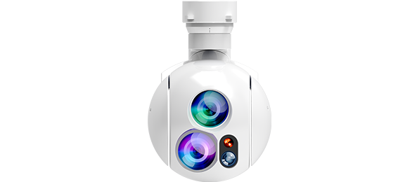
Altum-PT incorporates dedicated optics, industry-leading industrial imaging sensors, and narrow band scientific grade filters. In addition, it has undergone a rigorous factory calibration process, creating a high quality, calibrated and robust tool for high quality output.

Synchronized Thermal and Multispectral Imagery
Let you capture distortion-free RGB, NDVI, and advanced vegetation index layers in a single flight

Ultra-high Resolution
Up to 1.2cm (0.47in) full colour sharpened ground resolution at 60m (200ft) for advanced vegetation research

Several APIs
With several APIs, the camera can be compatible with multiple processiong platforms

Increased CFexpress Removable Storage
Allow for two captures per second for maximum speeds and the shortest turnaround time

DLS 2 Light Sensor with Embedded GPS
Ensure your data is highly calibrated for enhanced accuracy and reliability

Upgraded 320 x 256 Thermal Sensor
Deliver twice the ground resolution of the previous Altum for heat maps - 17 cm from a flight height of 60 m.
Data Results
With Altum-PT, you can capture synchronized multispectral, thermal, and panchromatic data for plant health indices and RGB outputs at leaf-level resolutions.
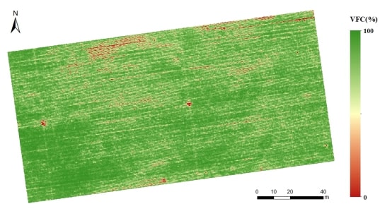
NDVI
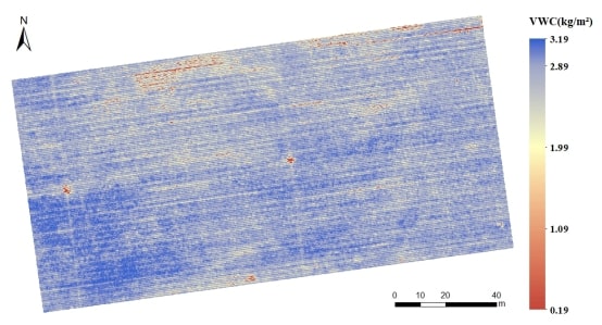
NDRE
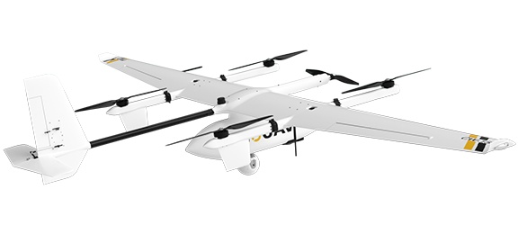
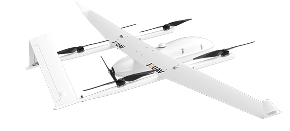
Compatible Drones
This sensor kit comes ready to integrate with JOUAV drones (CW-007, CW-10, CW-15, CW-25E, CW-100). Integration with these drones has been proven, so we can ensure compatibility.
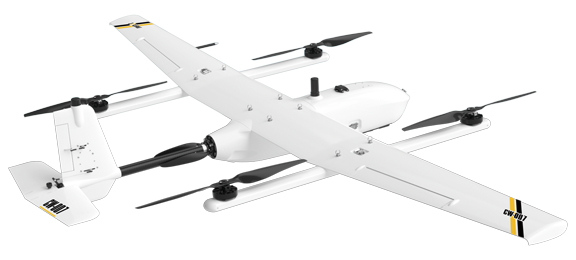
CW-007
A portable, integrated UAV platform that delivers exceptional reliability to our customers.
Other Payloads
JOUAV is constantly updating its cameras and enriching its product lineups to provide a better data results and to meet customers' needs.
PhaseOne iXM Series Camera
High-resolution medium format cameras for mapping and surveying
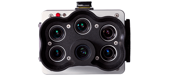
MicaSense RedEdge-P Multispectral Camera
The ultimate solution for high-resolution RGB and multispectral data.
MG-120E EO/IR/LR Gimbal Camera
Lightweight 3-axis 30X optical zoom and thermal imaging with laser rangefinder

More information about JOUAV and our drones
Provide the suitable solution for your needs
Help for your project promotion
Get a product quote