Jieyang Power Supply Bureau of Guangdong Power Grid deployed JOUAV's VTOL Hangar System for remote power line inspections, integrating the JOS-C700 docking station, CW-15V VTOL fixed-wing UAV and JoCloud AI Command Center. During its first two months of operation, the system completed 966.74 km of LiDAR-based transmission line corridor inspections, with a longest single-sortie flight distance of 104.46 km.
Yuecheng District in Shaoxing, Zhejiang Province, China, is expanding the use of unmanned aerial systems (UAS) to improve public services and urban management. As part of this initiative, the district has extended its original rural road inspection program to a wider network of transportation and urban management applications.
JOUAV is supporting this effort with autonomous drone hangar systems, aerial mapping, and a digital platform that connects inspection data with daily management workflows. By combining long-range VTOL operations with flexible multirotor inspections and AI-assisted analysis, the solution helps local authorities monitor road conditions, identify potential hazards, and coordinate follow-up actions across urban and rural areas.
The Challenge: Improving Road Inspection Across a Distributed Network
Road inspection across a large district presents several operational challenges. Rural roads extend across varied terrain, while urban roads, tunnels, and other transportation infrastructure require different inspection approaches. Manual inspections can be time-consuming and labor-intensive, making frequent coverage and timely responses difficult to maintain.
Fragmented data and separate departmental workflows can create additional challenges. When inspection records are managed independently, sharing information and coordinating responses to reported issues can take extra time.
Yuecheng needed a more coordinated approach that could connect aerial data collection with routine inspections, provide a consistent view of road conditions and help relevant departments respond more efficiently to potential hazards.
The JOUAV Solution: Automated Drone Inspection and Digital Management
1. Building a Shared Digital Base for Road Inspection
A reliable geospatial foundation helps authorities maintain a consistent view of road networks and organize inspection information.
As part of the Yuecheng project, a low-altitude data center was established, and 1:500-scale digital orthophoto imagery was collected across 311.7 km² of the district. JOUAV's low-altitude smart service platform supports the management of mapping data and inspection workflows.
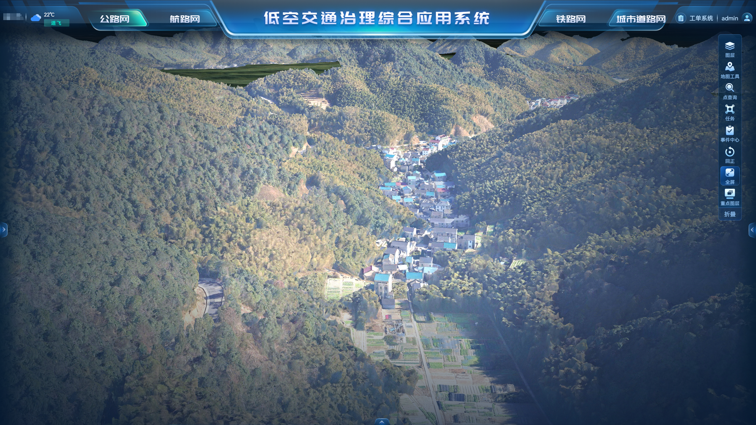
This digital base provides a geographic reference for road networks and inspection operations. By bringing aerial mapping data and inspection workflows into a shared digital environment, the platform helps reduce data fragmentation and supports more coordinated management.
2. Deploying Drone Hangars for Different Inspection Scenarios
Different road environments require different aircraft capabilities. JOUAV deployed JOS Series drone-in-a-box systems to support large-area aerial surveys, long-distance road inspection and more localized monitoring tasks.
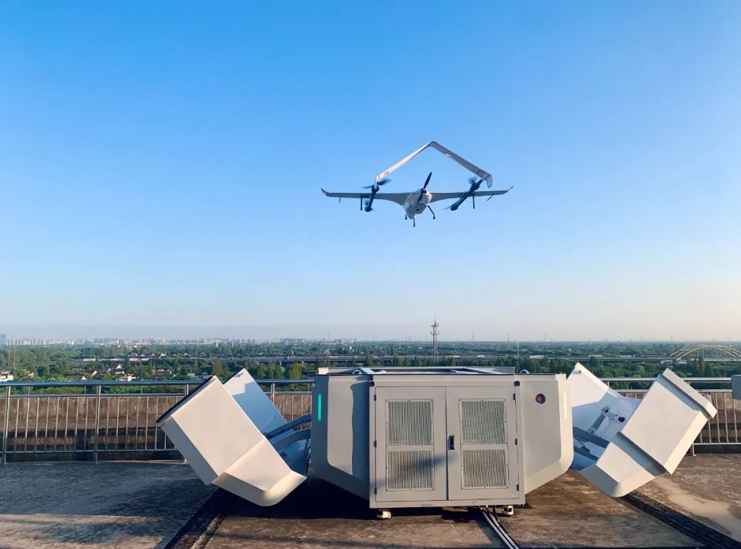
JOS-C700 VTOL Hangar System for Long-Distance Road Surveys
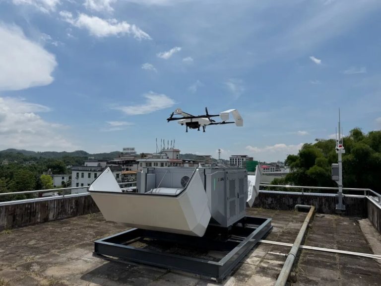
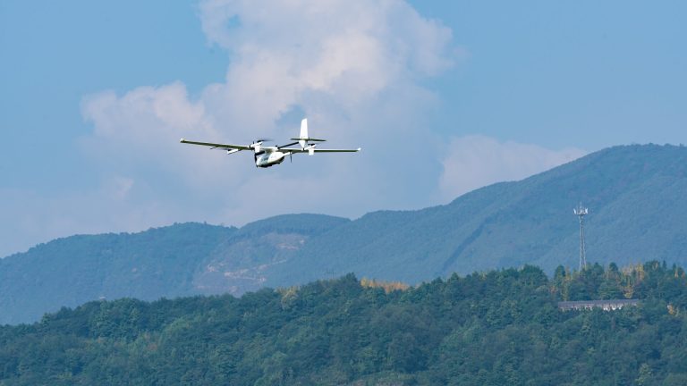
The JOS-C700 VTOL Hangar System is designed for missions covering extended routes and larger areas. Its VTOL aircraft supports aerial data collection along road corridors and across rural and mountainous terrain, making it suitable for inspection tasks that extend beyond individual urban blocks.
JOS-P200 Multirotor Hangar System for Localized Inspections
The JOS-P200 Multirotor Hangar System provides greater maneuverability for localized inspection tasks, including urban roads, tunnel entrances, and areas requiring closer observation. It supports targeted monitoring where detailed observation or a timely response to specific events is needed.
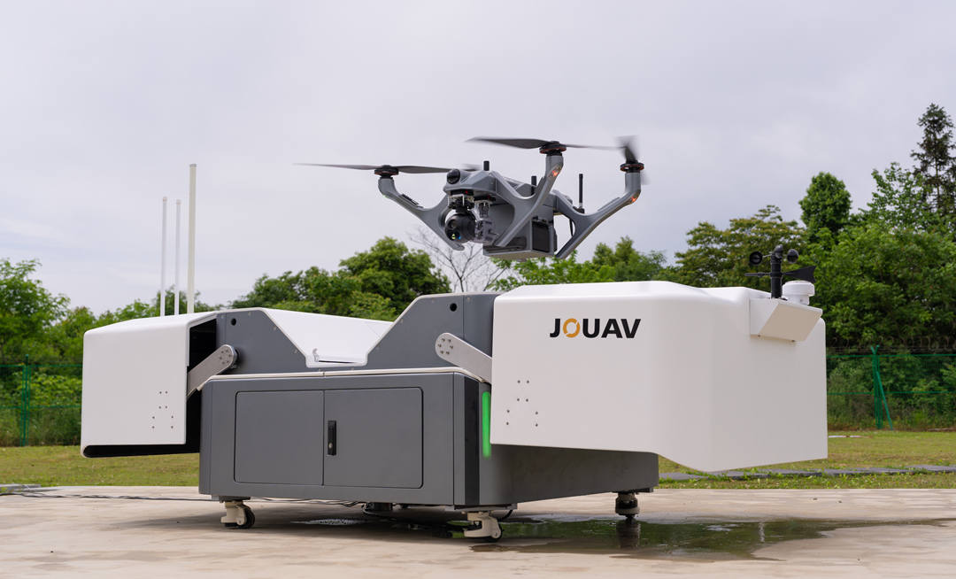
Together, the two systems provide complementary capabilities for different inspection environments.
With drone-in-a-box systems installed at key locations, operators can schedule missions remotely. The aircraft can take off, complete assigned flights, and return to the docking station for recharging, reducing the need for personnel to be physically present at every launch site.
This automated workflow supports repeat inspections and provides greater flexibility when additional monitoring is needed before or after severe weather events, including typhoons, heavy rain and snow.
3. Connecting AI-Assisted Detection with Coordinated Response
Aerial imagery becomes more useful when potential problems can be identified, located, and passed to the teams responsible for handling them.
In Yuecheng, AI-assisted analysis helps identify common hazards and urban management issues in aerial inspection data. The digital platform provides a shared view of inspection results, while relevant alerts and records can be forwarded to the appropriate authorities for follow-up.
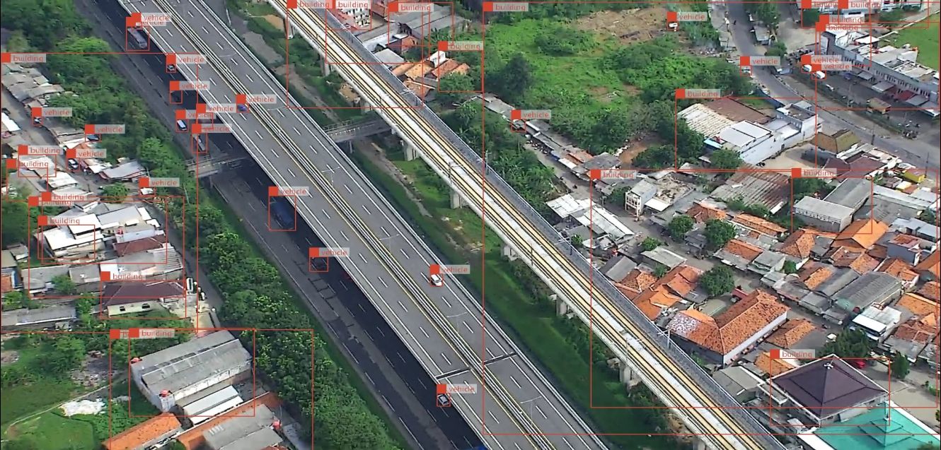
This workflow connects aerial monitoring with daily management operations, helping teams move from identifying a potential issue to reviewing and addressing it.
How Drone Inspection Is Applied in Yuecheng
1. Tunnel Safety Monitoring at Didang Lake Tunnel
At the entrance to Didang Lake Tunnel, a JOS-P200 multirotor drone system supports around-the-clock monitoring of restricted areas.
When pedestrians or non-motorized vehicles enter these areas, AI can detect and record the incident. A drone can then be dispatched to the location to deliver a remote voice warning through its onboard speaker.
This approach adds an aerial response option to tunnel safety monitoring. Rather than relying solely on fixed monitoring equipment, authorities can use the drone to provide a voice warning at the location of a detected incident.
2. Mountain Road Patrols and Incident Response in Fusheng Town
Fusheng Town was selected for a mountain-road inspection pilot covering more than 26 km across three road sections: S309 Yinkaixian, X101 Xishangxian, and X006 Zanxuxian.
The winding roads and varied terrain make regular monitoring important. At Wangyuetai in the Wufengling area, gatherings of motorcyclists are particularly common on weekends and holidays, creating additional demands for traffic monitoring and incident response.
Regular drone patrols help authorities observe road conditions and identify unusual gatherings or traffic accidents. When such events are detected, the system can capture imagery and send alerts. It can also broadcast voice warnings, while inspection records and work orders can be forwarded to traffic police for follow-up.
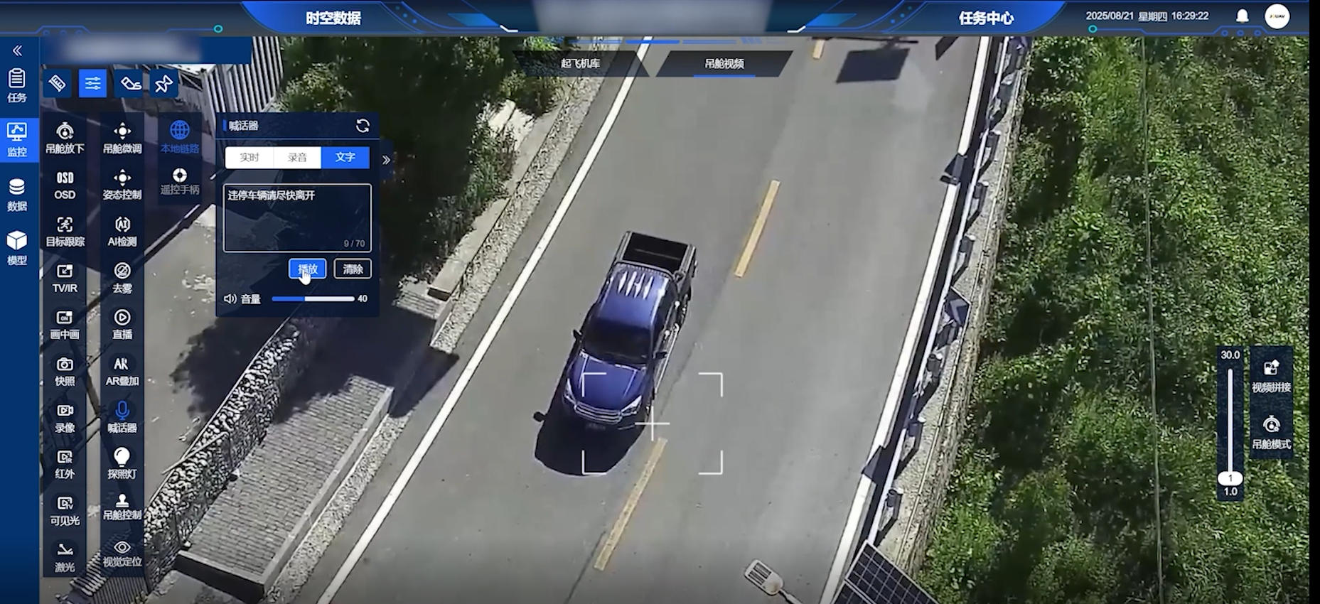
Drone-based monitoring and illegal parking warning on mountain roads.
By combining aerial observation with recorded evidence and task coordination, the system gives local authorities another way to monitor mountain roads and respond to incidents beyond the reach of routine ground patrols.
3. AI-Assisted Urban Inspection Across Yuecheng
JOUAV-supported aerial inspection also contributes to day-to-day urban management across Yuecheng. Drones launch from their docking stations and follow predefined routes over major roads and commercial areas, collecting imagery for AI-assisted analysis.
The system can identify more than 20 types of common municipal issues, including unauthorized sidewalk vending, improperly parked shared bikes, damaged advertising structures, litter in green belts, and illegal dumping of construction waste.
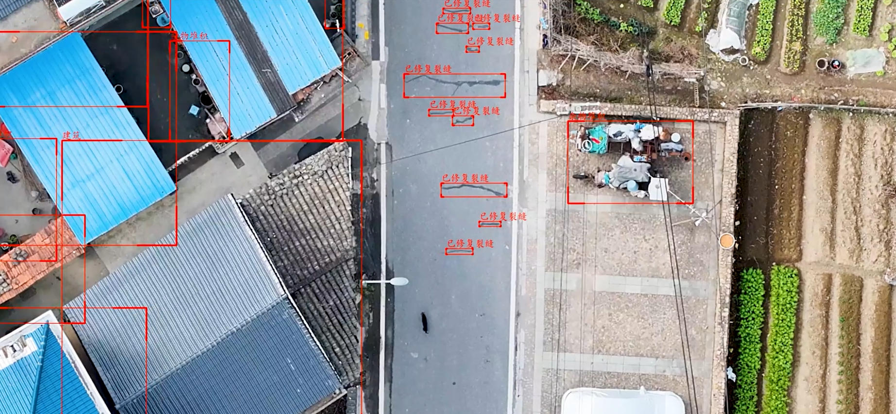
AI-assisted urban inspection identifying municipal issues.
Detected issues are marked on a digital urban inspection map, giving management teams a location-specific record for review and follow-up. The records can be used to identify recurring problem areas and help relevant departments determine where intervention is needed.
This application extends drone operations beyond road-surface observation, using aerial imagery to support a broader range of urban inspection and enforcement tasks.
Project Results: Mapping Roads and Supporting More Efficient Inspections
Road Imagery Collection
For the road-inspection component, the project collected aerial imagery across 121.33 km of national, provincial and county roads in the maintenance area.
Combined with the district-wide digital orthophoto imagery, these data provide a consistent geographic reference for reviewing road networks and organizing inspection information.
Wider Project-Level Performance
Beyond road inspection, Yuecheng's broader low-altitude government services project reported improvements in inspection efficiency, labor costs and incident handling:
More than 5× higher inspection efficiency across the four transportation networks covered by the wider project.
Over 70% lower labor costs for the reported inspection activities.
More than 90% of common hazards automatically identified by AI, according to project-reported figures.
Over 95% inspection coverage in key areas, including the urban road network.
A 100% hazard closure rate, with average handling time reduced by more than 30%.
The wider project also reduced the time required to identify problems from days to hours.
These figures reflect the broader low-altitude government services project rather than the road-inspection component alone.
What Road Operators Can Learn from the Yuecheng Project
The Yuecheng project illustrates three practical ways autonomous drone systems can support road and urban management: long-distance aerial surveys across distributed road networks, localized monitoring at specific safety-sensitive locations, and AI-assisted identification of common municipal issues.
The value lies not only in collecting aerial imagery, but also in connecting that imagery with location-based records, alerts and follow-up workflows. For transportation authorities and infrastructure operators, this provides a practical model for integrating drone operations into routine inspection and incident management.
Explore Autonomous Drone Inspection with JOUAV
Every road network has different inspection priorities, terrain conditions and operational requirements. JOUAV's drone hangar systems can be configured to support different monitoring tasks, from extended road corridors to localized inspections.
Contact JOUAV to discuss a drone-based inspection solution tailored to your road network and operational needs.
More Use Cases
At 2:27 PM on a storm-lashed afternoon in July 2025, a small fishing boat capsized off the coast of Gulei, Zhangzhou.
Two men were thrown into violent waters. Winds howled at gale force. Waves surged
Chongqing’s Qinba Mountains are basically a giant green wall protecting the region. But there’s a problem – pine wood nematodes are eating through it. Fast.
The forestry department n

JOUAV Product News and Use Cases
Fixed-Wing VTOL Drones Insights and Industry Trends
Invitations to online demo events
 English
 中文
中文