Overview
MSK-8 industrial grade multispectral aerial camera has one RGB channel and five multispectral monochrome channels built-in, with 24 million effective pixels in a single band and 140 million pixels in total, providing a total of 81 selectable bands in the 400-940nm spectral range, providing users with an efficient multispectral data acquisition solution.
MSK-8 multispectral camera
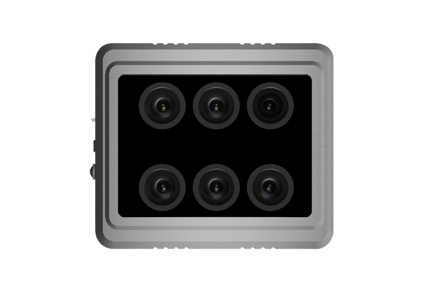
Benefits and Features
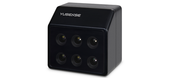
MSK-8 is a multispectral camera with the advantages of large image area, low missed shot rate and adaptable to multiple terrains.
product-detail
Large image area
Single image acquisition area is more than 20 times larger than that of small surface array.
product-detail
Low missed shot rate
High aerial survey efficiency, low overlap rate, low flight attitude requirements, and low missed shot rate.
product-detail
Adaptable to multiple terrains
Long focal length, low height difference requirement for measurement area, suitable for many kinds of area flight.
product-detail
Excellent image results
Large luminous flux, high signal-to-noise ratio; high shutter speed, small image shift, and high image sharpness.
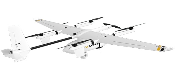
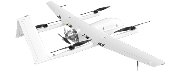
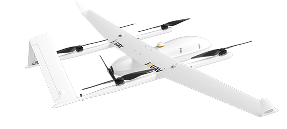
Compatible Drones
MSK-8 is compatible with a wide array of JOUAV drones, ranging from CW-15 to CW-80E. 
CW-15
Multi-purpose and battery-operated intelligent VTOL drone
CW-25
Long Endurance Hybrid VTOL drone
CW-25E
Long Endurance Electric Fixed-wing VTOL Drone
Industry Applications
MSK-8 industrial grade multispectral camera can be widely used in precision agriculture, water resources, environmental protection and other industries.
Environment
The UAV remote sensing system has the advantages of low cost, high safety, high maneuverability, high precision, and diversified payloads, which makes its application in the field of environmental protection unique advantages.
Water Resources
"Smart water resources" needs to rely on modern technical means to establish a basic water resources information perception system, improve the support system, promote the fine management of integrated water resources.
Aerial Mapping & Surveying
Are you looking to add drones to your surveying services? Here is everything that you need to know about drone surveying.
Technical Specifications
Specifications
Size
190mm×160mm×86mm
Weight
1.4kg
Resolution
6000×4000 pixels
Total Pixels
140 million pixels
Minimal exposure interval
ls
Sensor types
Exmor APS H CMOS
Sensor size
23.5×15.6mm
Lens focal length
25mm
Field of View
50°×35°
Observable range
8-band
Image Resolution
Up to 1 cm
Central wavelength transmittance
>85%
Cut-off wavelength transmittance
<0.1%
Rated voltage
7.4VDC
Max. instantaneous power
40W
Shutter speed
1/1250s
Operating temperature
-10℃~40℃
* All performance data in the foregoing pages are theoretical values obtained by JOUAV® internal laboratories through tests carried out under particular conditions. For more information on the specific testing conditions, refer to the aforementioned product details. Actual performance may vary owing to differences in individual product configuration, software versions, application conditions, and environmental factors. All data is subject to actual usage.
Other Payloads
JOUAV is constantly updating its cameras and enriching its product lineups to provide a better data results and to meet customers' needs.
MS600 V2 Multispectral Camera
6-channel high-resolution multispectral camera