TIANJIN, China, June 12, 2026 – JOUAV participated in the 2026 China Oil & Gas Pipeline Unmanned Technology Exchange Conference, held in Tianjin from June 11–12, where the company showcased its au
At 12:52 pm local time on 5 September 2022, a 6.8 magnitude earthquake struck Luding County, Sichuan Province, China, at a depth of 16km. So far, 74 people have died, 259 have been injured and 26 are still missing. and some infrastructure such as water, electricity, transportation, and communication were damaged. This is the largest earthquake to hit the province since 2017.
In response to the disaster, JOUAV set up an emergency rescue team and dispatched three teams to the disaster area.
The JOUAV emergency rescue team deployed three unmanned aerial systems, including mapping, surveillance, and communication support, to the earthquake-hit areas.
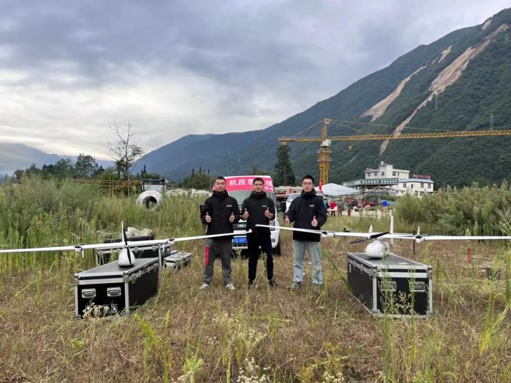
The rescue team set off from Chengdu at 8 pm on 5 September and arrived at the Luding command center at 1 am to discuss the rescue plan with the command center.
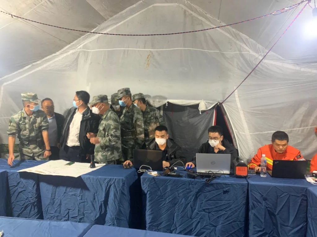
At 7 am on 6 September, the team members followed the unified deployment of the command center and used the CW-15 surveying drone to fly for 60 minutes, taking a total of more than 300 photos and successfully completing the acquisition of 1:1000 orthophoto maps for the target area of 7 square kilometers.
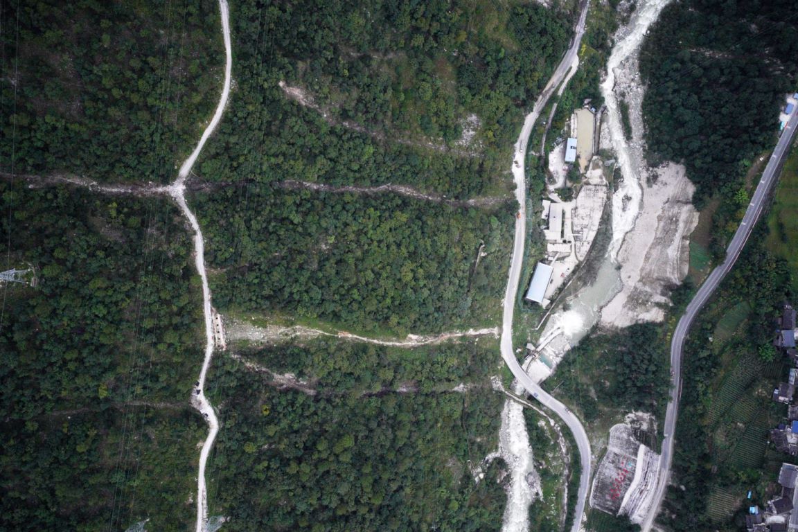
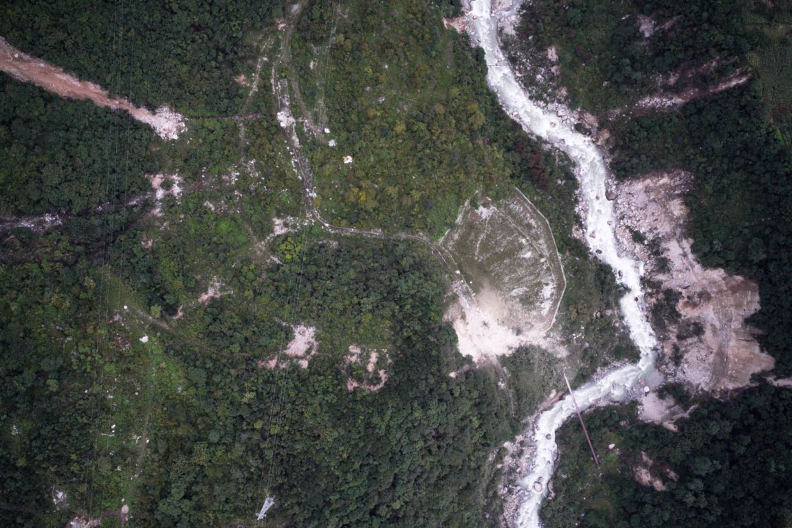
Orthophoto captured by CW-15 survey drone during the Luding earthquake, Sichuan Province, China, 6 September 2022.
At 7:30 a.m. on September 7, the emergency rescue team had two flights with the CW-15 surveying drone to obtain digital orthophoto and video real-time data from the town of Moxi, Luding County, the epicenter of the earthquake, to help rescue and relief work in Luding.
- The CW-15 surveying drone, with a flight time of 70 minutes, an operational area of 9 square kilometers, a resolution of 7cm, and 670 photographs collected, successfully acquired high-definition digital images of the affected area and quickly produced orthophoto maps to understand the overall situation promptly.
- The CW-15 surveillance drone with an EO/IR gimbal camera closely monitored the situation in the affected area and transmit video data back to the command center in real-time, providing an important basis for grasping changes in the disaster situation and formulating response strategies.
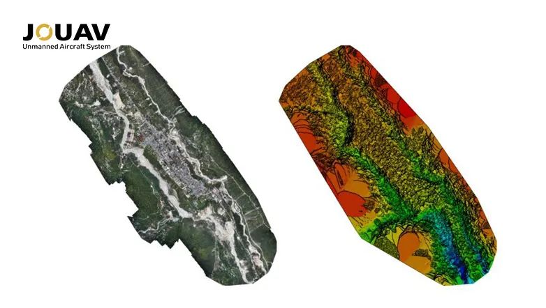
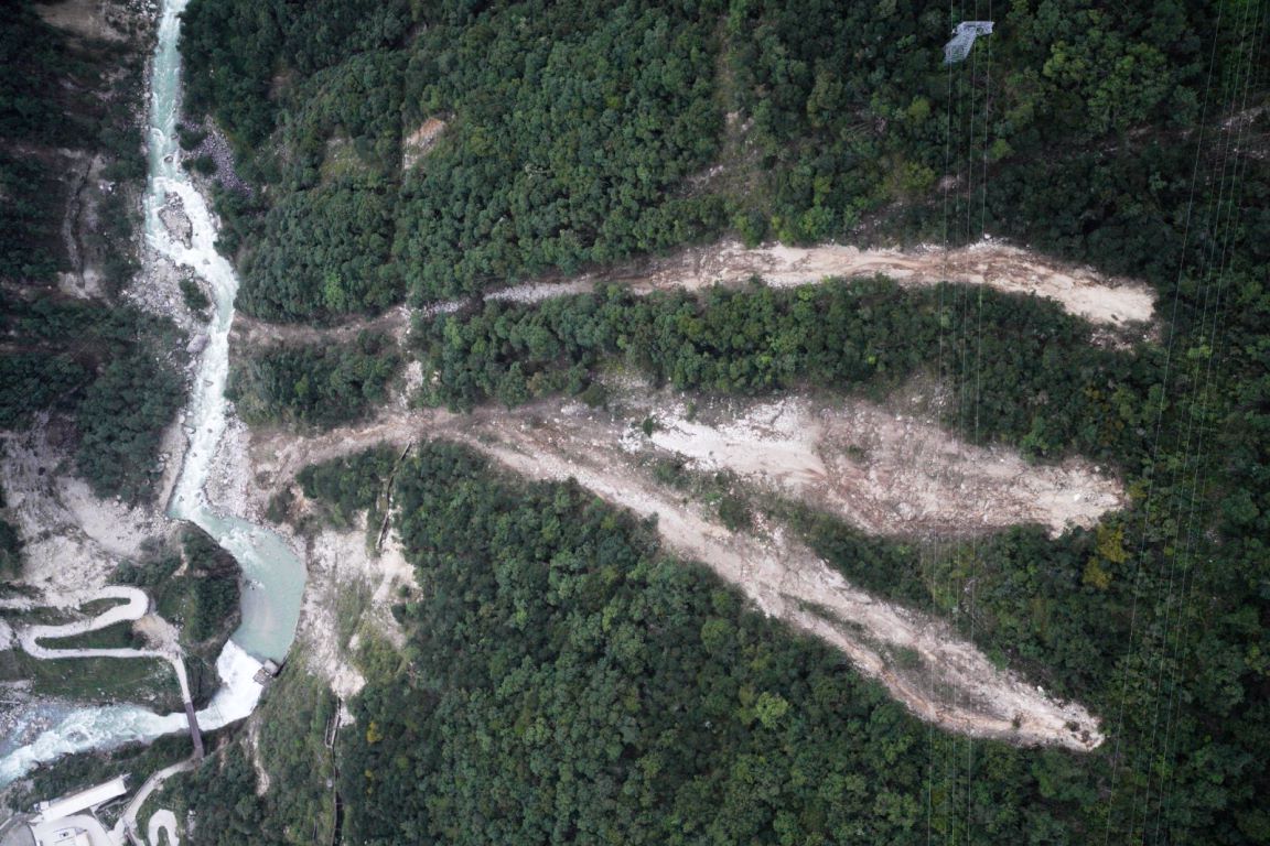
The orthophoto map that stitched together with orthophoto images collected by the CW-15 mapping drone.
The rescue lasted for three days, and JOUAV is close to the hearts of the people in the disaster area. After today, the JOUAV rescue team will be on standby for the next mission.
More JOUAV News


KUNMING, June 11, 2026 – JOUAV, a leading global provider of industrial drone solutions, today announced its participation in the 10th China-South Asia Expo (CSAE), held in Kunming Dianchi Internation
CHENGDU, June 4, 2026 – JOUAV, a leading global provider of industrial drone solutions, welcomed a group of international students and faculty to the company’s JOUAV Tech Park for an enterprise study

JOUAV Product News and Use Cases
Fixed-Wing VTOL Drones Insights and Industry Trends
Invitations to online demo events